headwaters of the Middle Fork of the Kaweah River
Sequoia National Park was established in 1890. This park includes Mt Whitney, the highest point in the lower 48 states at 14,505 feet above sea level, as well as 5 of the 10 largest giant sequoia trees. General Grant National Park was also established in 1890 to feature and protect giant sequoias, including the General Grant Tree. In 1940, in an effort to protect more of the unique resources of the area – the 14,000-foot peaks of the Sierra Nevada, Kings Canyon 10,000 feet below, as well as old-growth forests and other large groves of giant sequoia trees – the Kings Canyon National Park was created, incorporating General Grant National Park. Since 1943, the 2 national parks comprising nearly 1 million acres have been adminstered together as Sequoia & Kings Canyon National Parks.
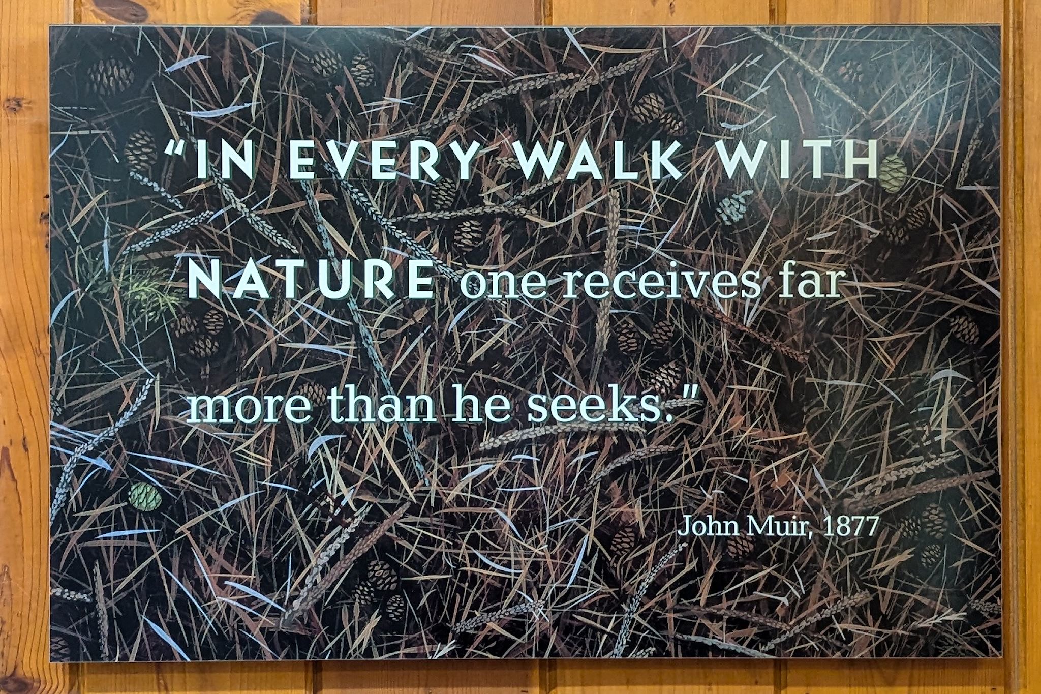
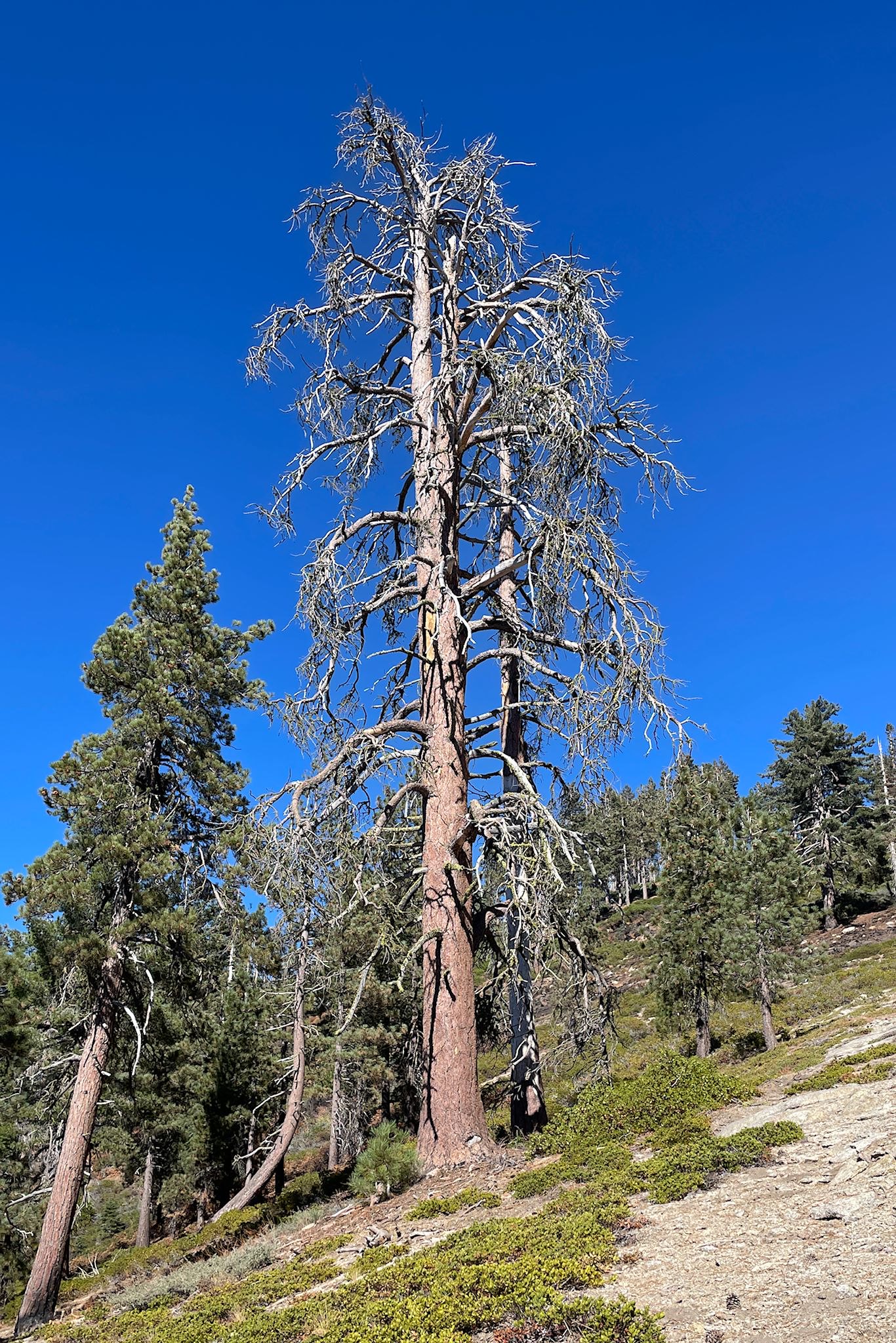
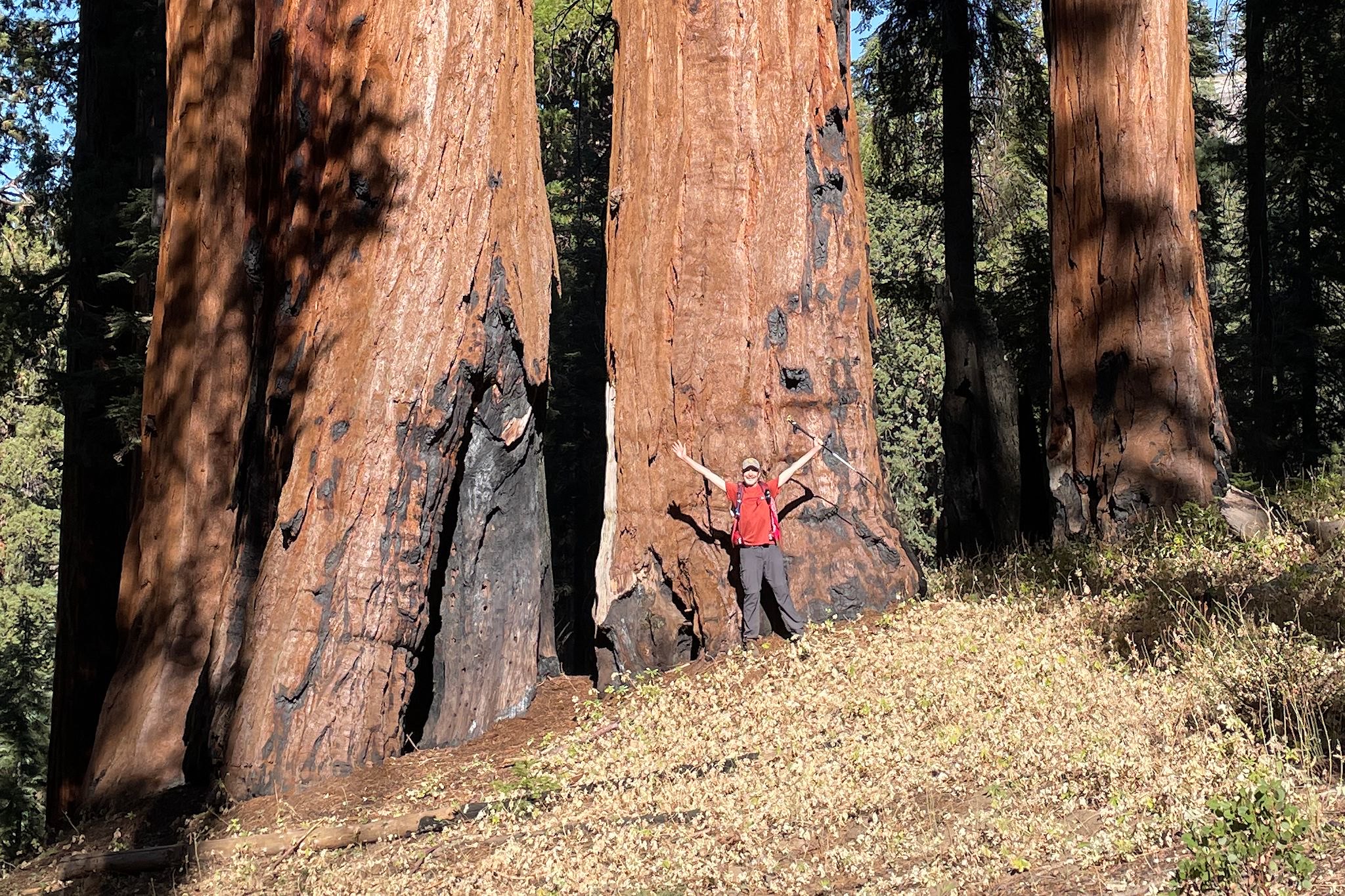
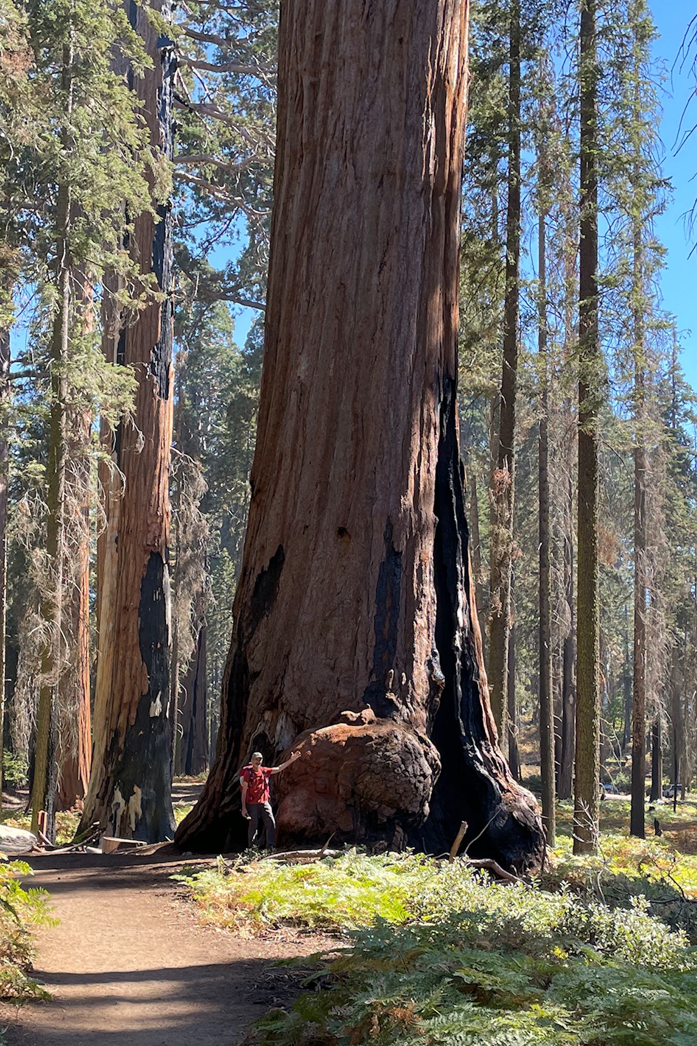
Giant sequoias are majestic yet fussy trees. They only grow naturally in one place on earth, a narrow band of the western slope of the Sierra Nevada mountain range, between 5000 and 7500 feet in moist – not wet – soil. All of the natural giant sequoias in the world are in approximately 75 groves in Sequoia & Kings Canyon National Parks. Although not the world’s tallest, widest, nor longest-living trees, giant sequoias are the most massive by volume – their trunks taper very slowly toward their tops. And they do live a long time – some sequoias have been documented to live more than 3,000 years.
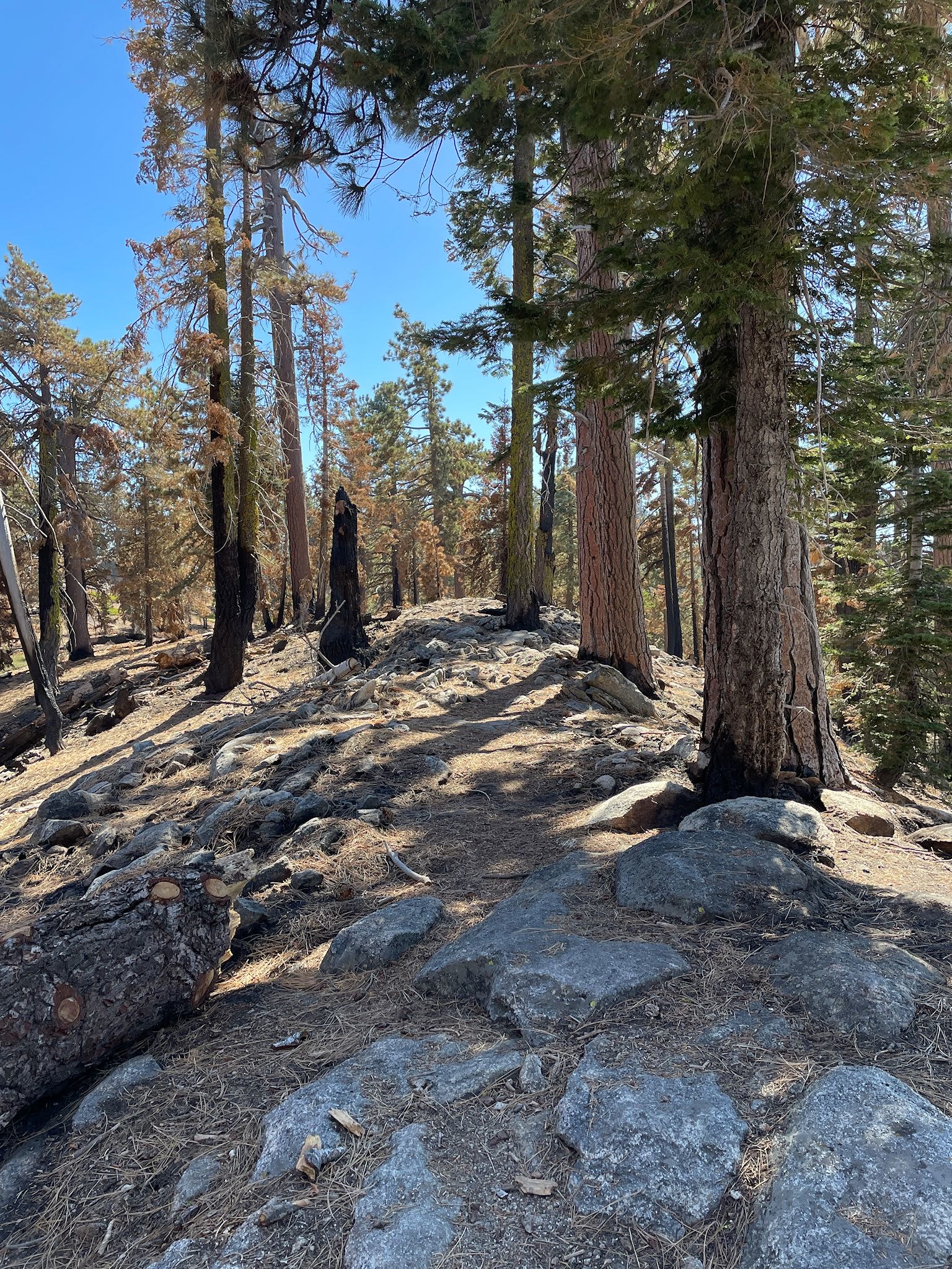
It is ironic that, following the creation of the parks, the giant sequoias were protected nearly to their destruction. How did this happen? In order to celebrate and protect the giant sequoias, the park service built roads and facilities into the forests so citizens could enjoy them, and they worked hard to eliminate forest fires which they believed would damage and destroy the trees. It took about 100 years to realize that the forests were dying, not despite these efforts but because of them! The new infrastructure, roads and pathways, vehicles, and foot traffic all around the trees were disturbing and compacting the soil, making it difficult for seedlings to germinate. Undergrowth that would have been cleared out by occasional, naturally occurring fires was allowed to build up by the fastidious fire prevention efforts. This dense, low vegetation competed with and stifled the growth of new sequoia seedlings. More research eventually determined that sequoias (and many other conifers) only propagate when their seeds, contained in pinecones which have fallen to the ground, are heated by fire – in other words, wildfires are a critical and necessary part of the life cycle of these trees. Furthermore, when fires inevitably did break out in the overgrown, protected forests, the excessively dense undergrowth resulted in more intense fires that often did kill the giant trees, though they would have survived a lesser burn. Park Service forest management methods have changed radically since the 1960’s, and the Park’s focus on deconstruction, forest restoration and fire management, including frequent prescribed burns, is having an impact and the sequoia groves are seeing new growth. Disaster averted (for now…)!
Grant Grove hike (Grant Grove section of park)
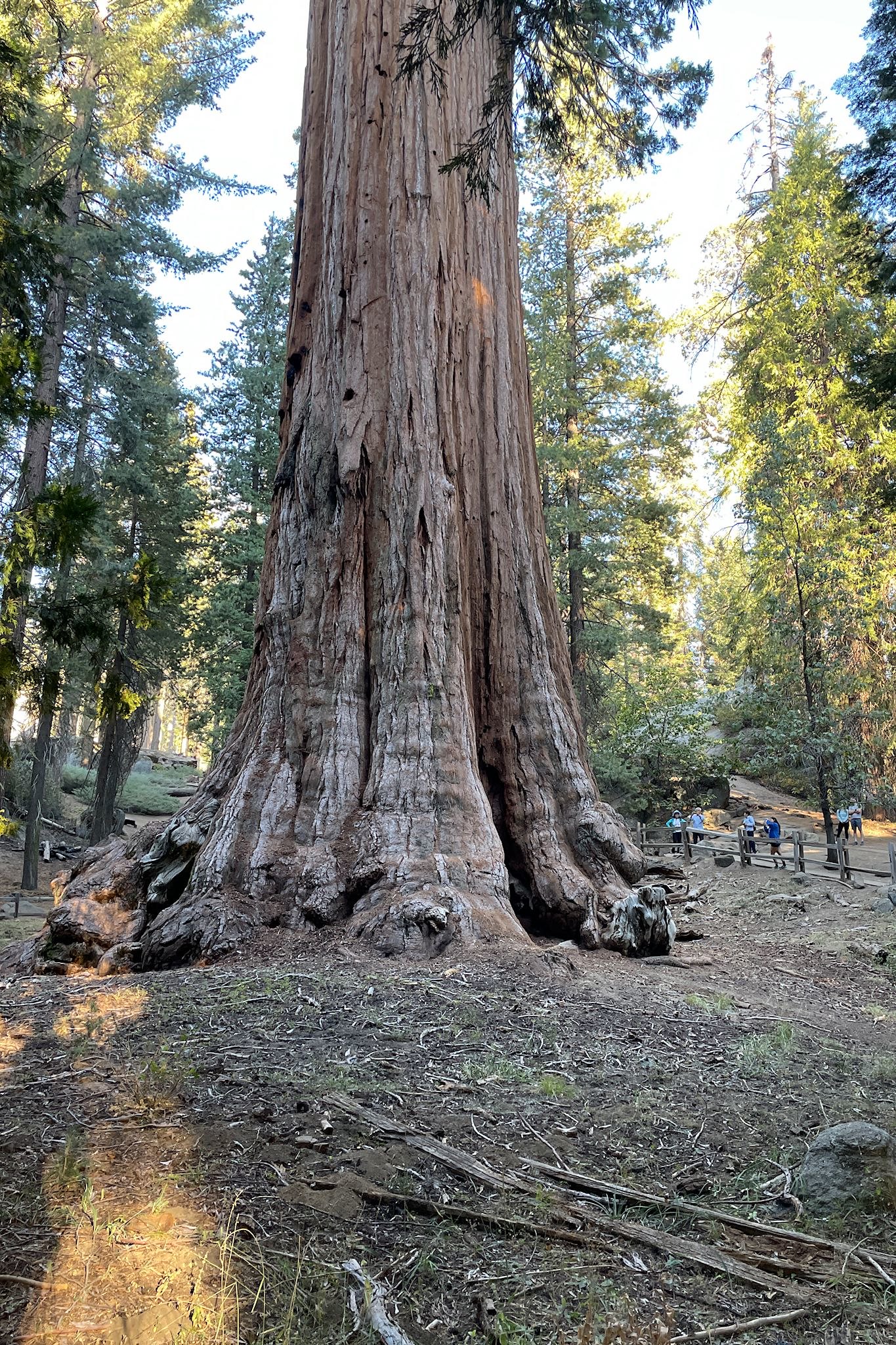
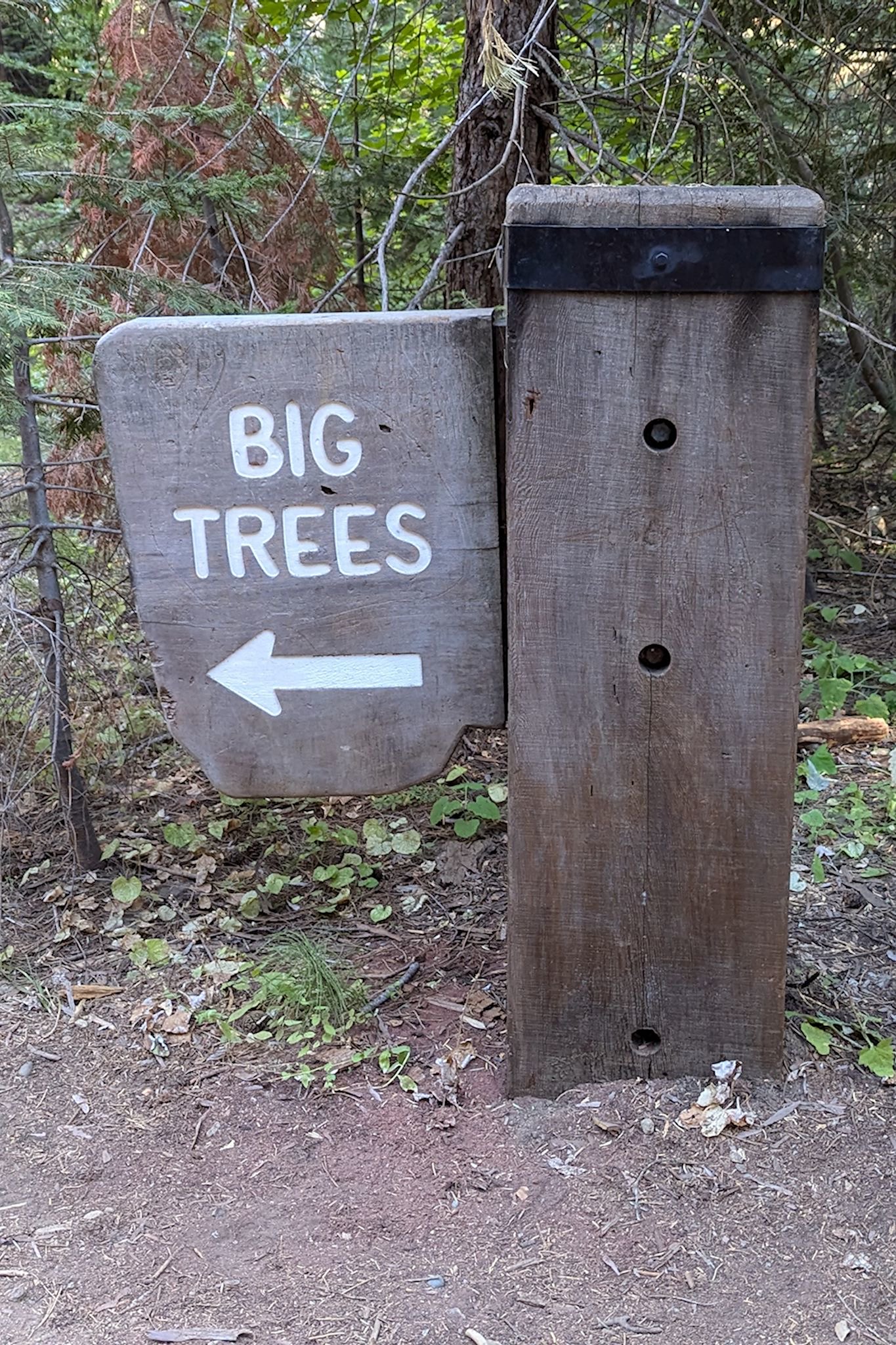
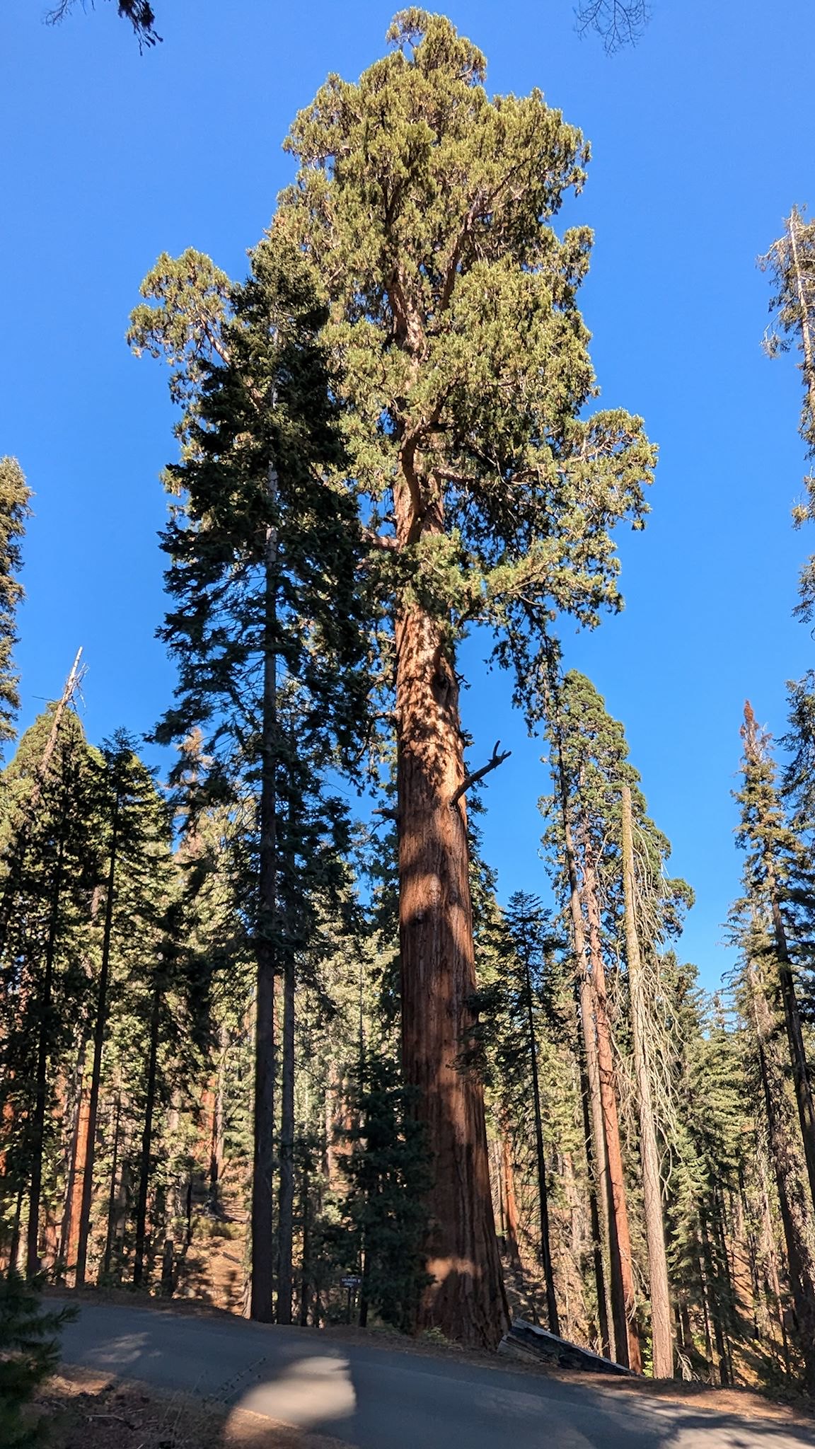
We arrived at our campsite in the Azalea Campground to find that one of the largest giant sequoias in the park was right nearby. We had to check out the General Grant Tree – 268 feet tall, 40 feet in diameter at its base, and 1,700 years old! The 3rd largest tree in the world by volume, it’s also the widest known sequoia. The trails to and around this majestic tree are well done, allowing many visitors to gawk at, photograph and contemplate its sheer size sitting on a bench, well situated behind a protective wooden fence. Other lesser giant sequoias were featured along the trail, too. This is the first national park where we’ve needed the wide angle setting for both landscape and portrait photos!
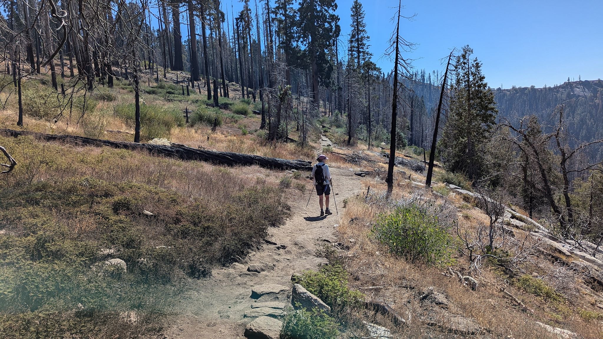
Manzanita/Park Ridge hike (Grant Grove)
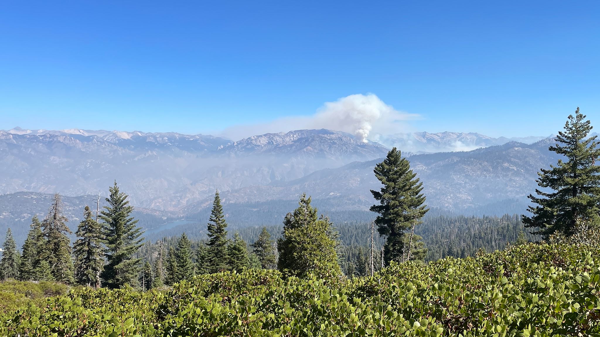
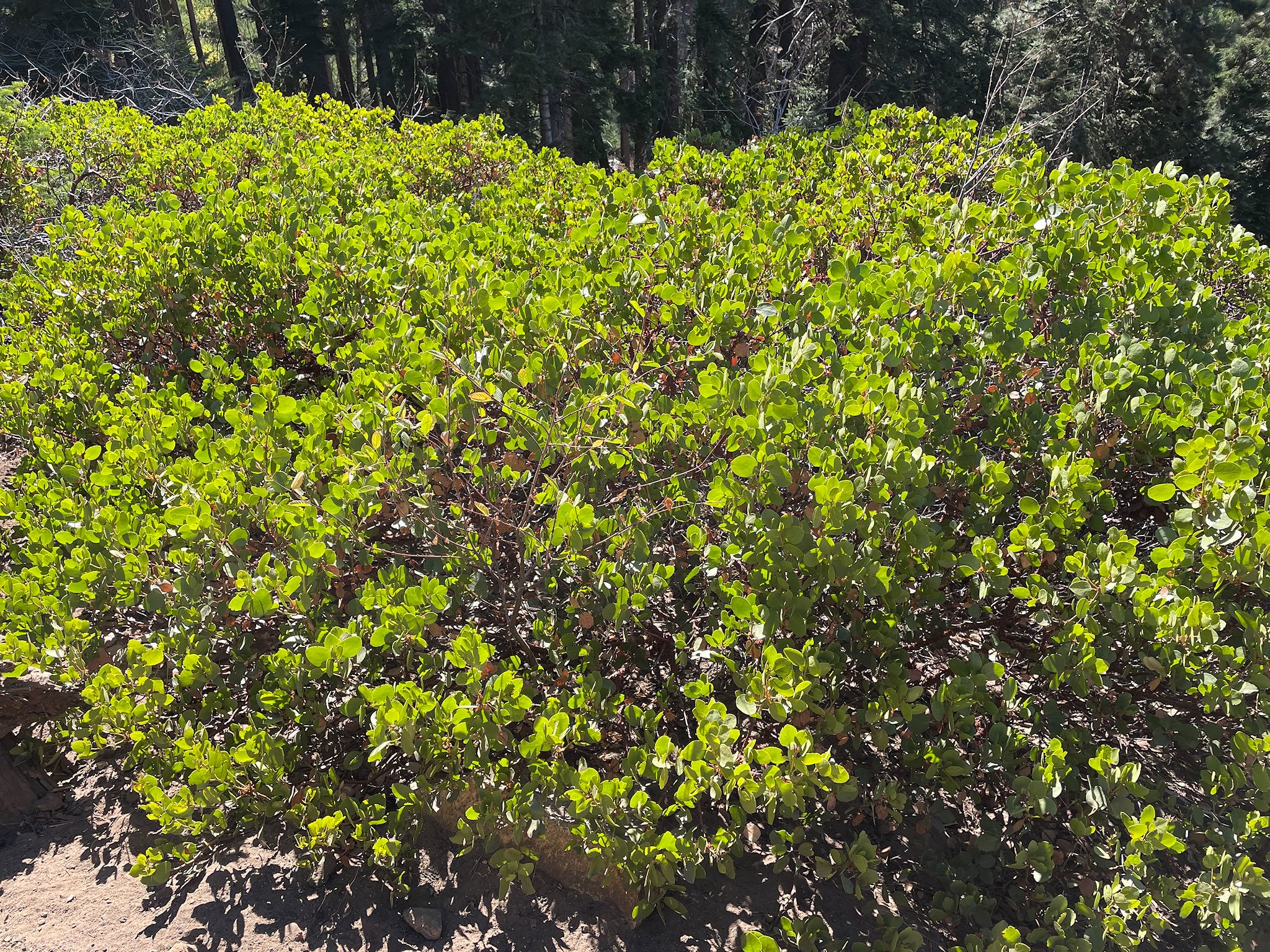
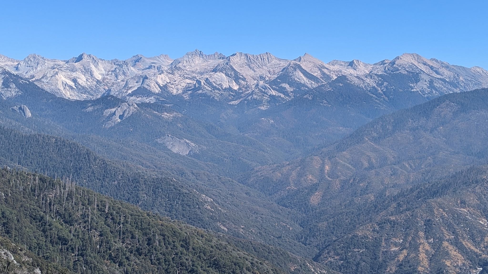
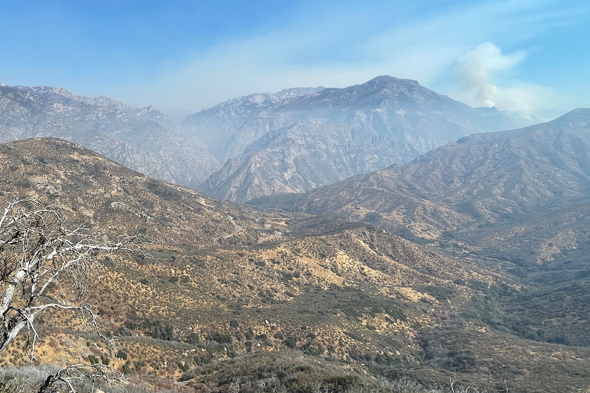
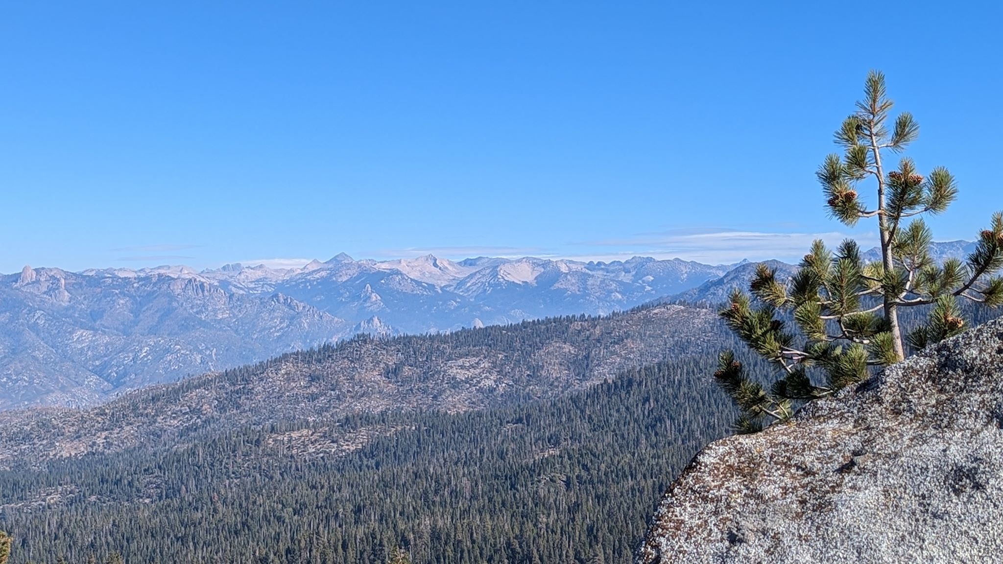
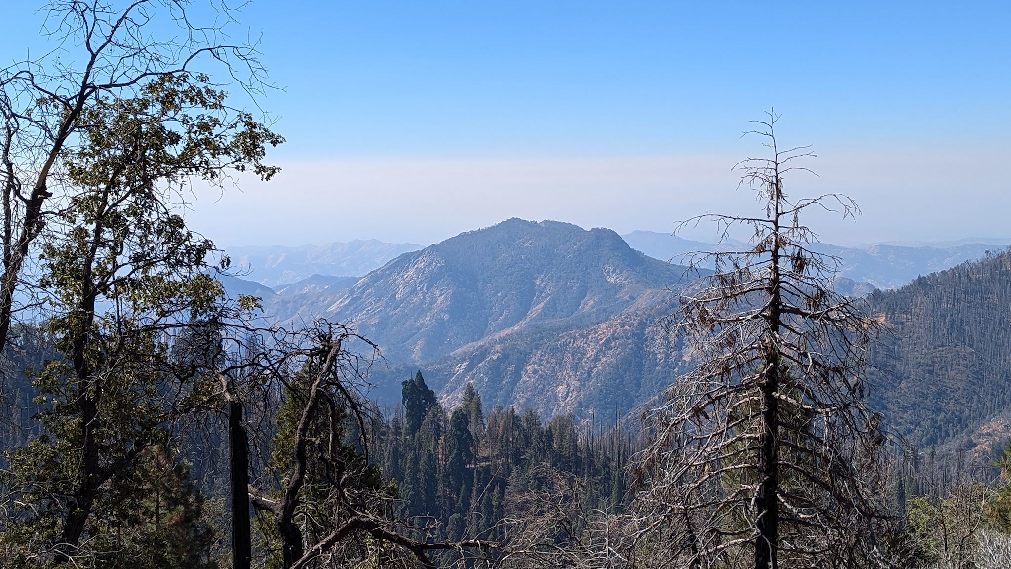
It was hard to resist a hike that included Panoramic Point and Park Ridge Lookout in the description and started at our campground – so we didn’t. The lower Manzanita Trail started with a bang – a short steep incline through the Sequoia forest to a shoulder dotted with manzanita. After a brief reprieve and a stroll through the Round Meadow, the trail followed 4 huge switchbacks up a boulder-strewn hillside. The grade abated as we approached the summit and the big views from Panoramic Point. Looking across the horizon at Kings Canyon, we could see some of the highest peaks in the Sierra Nevada as well as smoke billowing from the Happy Fire, which had been burning since a mid-July lightning strike and was the primary source of the haze in the air. (We were unable to find out why the fire has that name.)
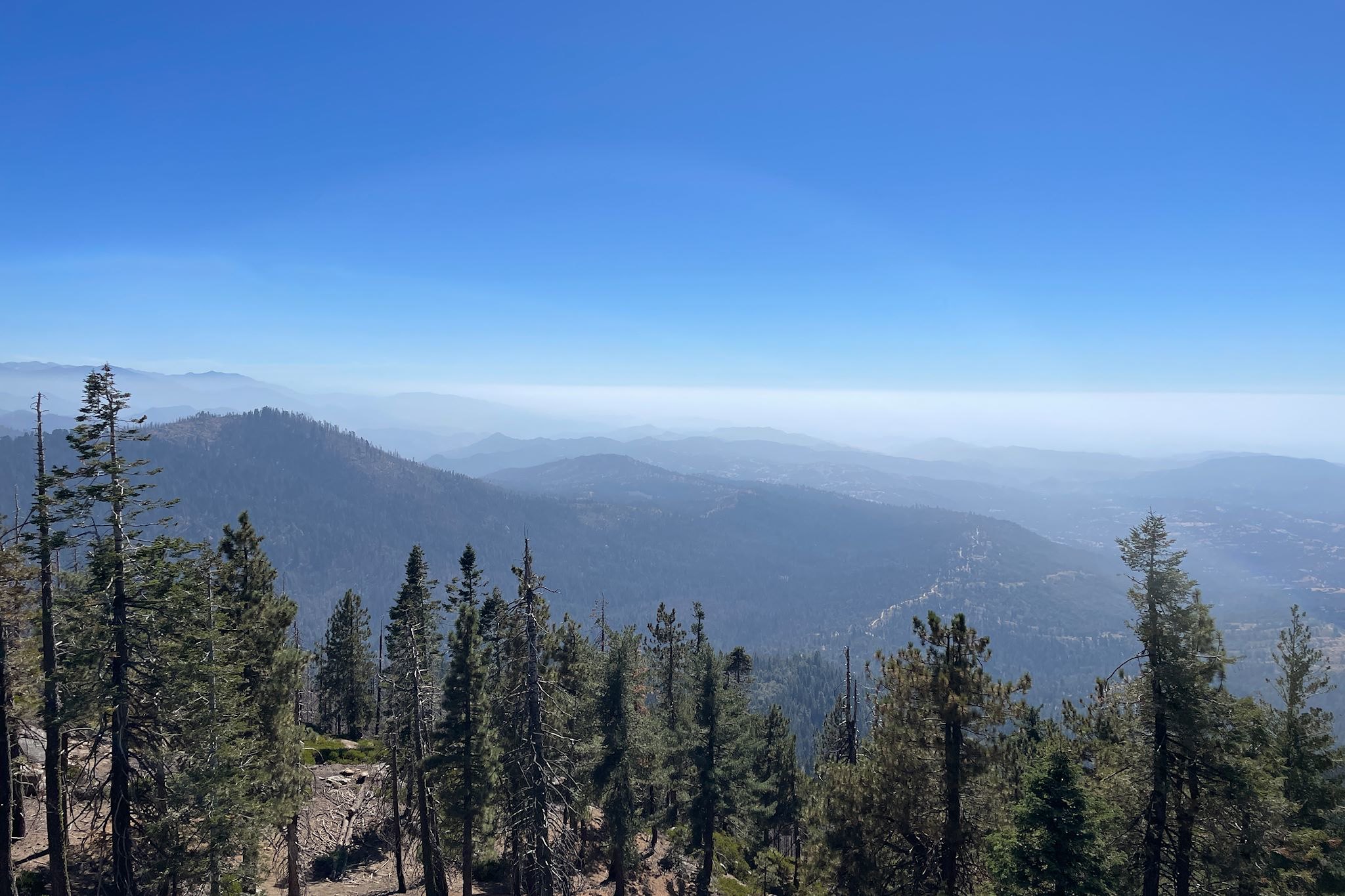
From Panoramic Point, we traversed the Park Ridge on the aptly named Park Ridge Trail. It was a lovely walk along and among trees, shrubs, big rock slabs, and small meadows, all with signs of past wildfires or control burns, and with hints of views of the high peaks on the eastern edge of the park. The Park Ridge Lookout had a 270-degree view to the east, south and west. It was a bit hazy when we were there, however we learned from the fire-spotter that on a clear day, free from pollution and wildfire smoke, we’d be able to make out the Coastal Range, 100 miles away.
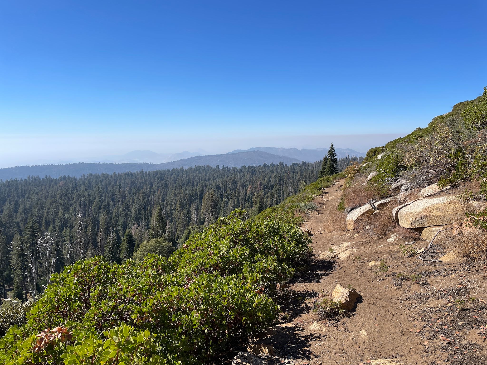
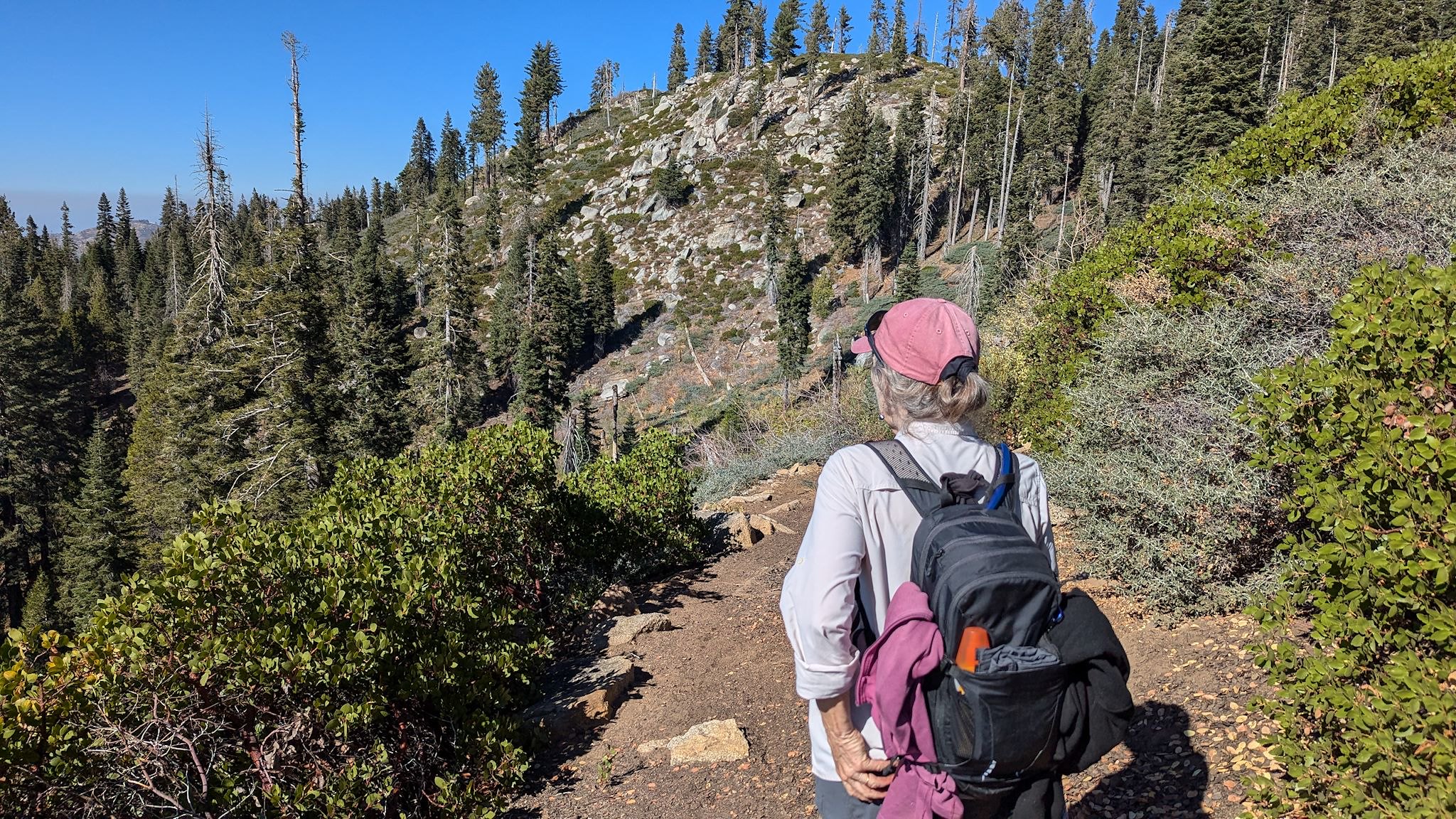
The prettiest part of day was on the upper Manzanita Trail which mostly hugged and circumnavigated the side of a mountain. Sequoias are majestic, indeed, however they do block the view! This section of the trail traversed across 45-degree meadows with grasses, shrubs and (of course) manzanita, with an unobstructed 180+ degree view to the west and the foothills of the park.
Kings Canyon Scenic Byway drive (Cedar Grove)
We snagged a reservation for the Sentinel campground at the bottom of Kings Canyon for the last 3 nights it was open this season, and we had picked out 3 hikes that would let us explore different parts of the canyon. The Universe had other plans for us. We were advised by park rangers that there was a wildfire – the aforementioned Happy Fire – just north of King’s Canyon and, although it was safe to be in King’s Canyon, the smoke could vary from barely noticeable to surrounded-by-campfires to too-dense-to-see based on time of day and wind direction. The smoke would likely be most dense in the morning, less so by mid-afternoon. We decided to check it out…
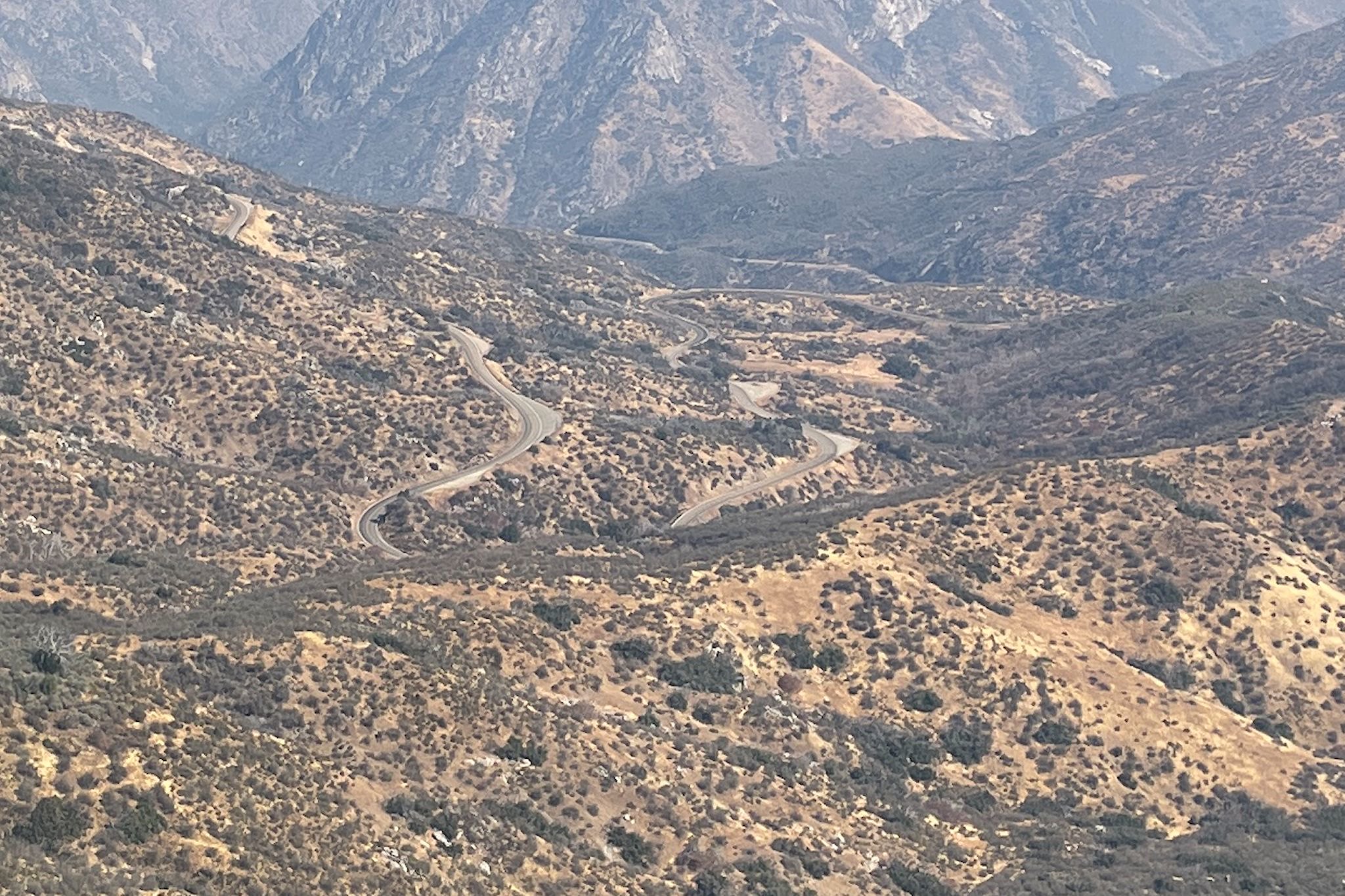
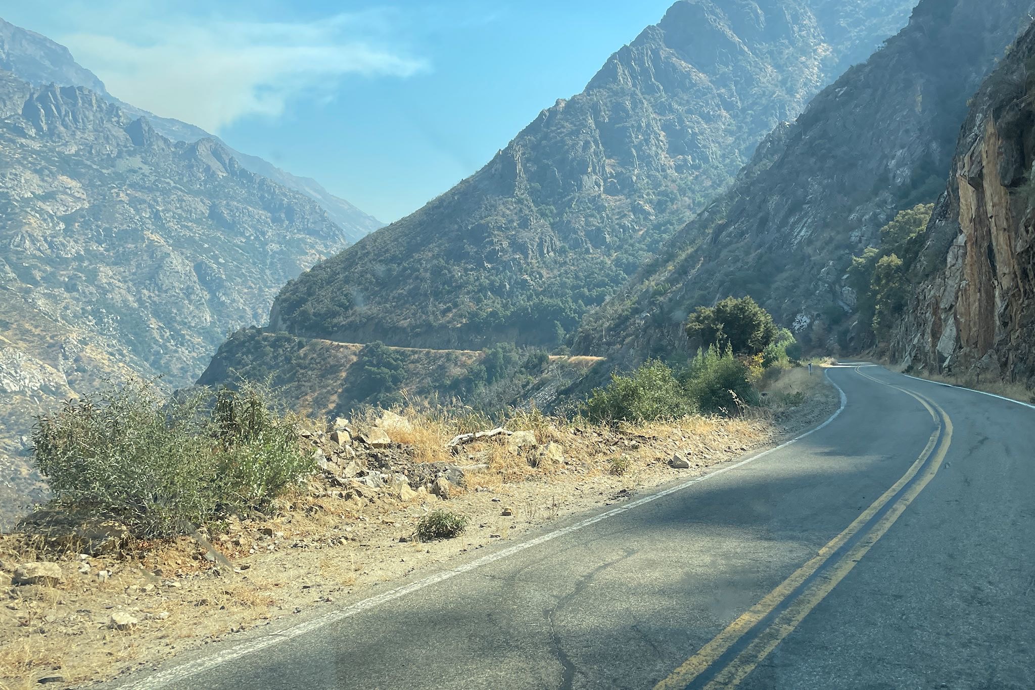
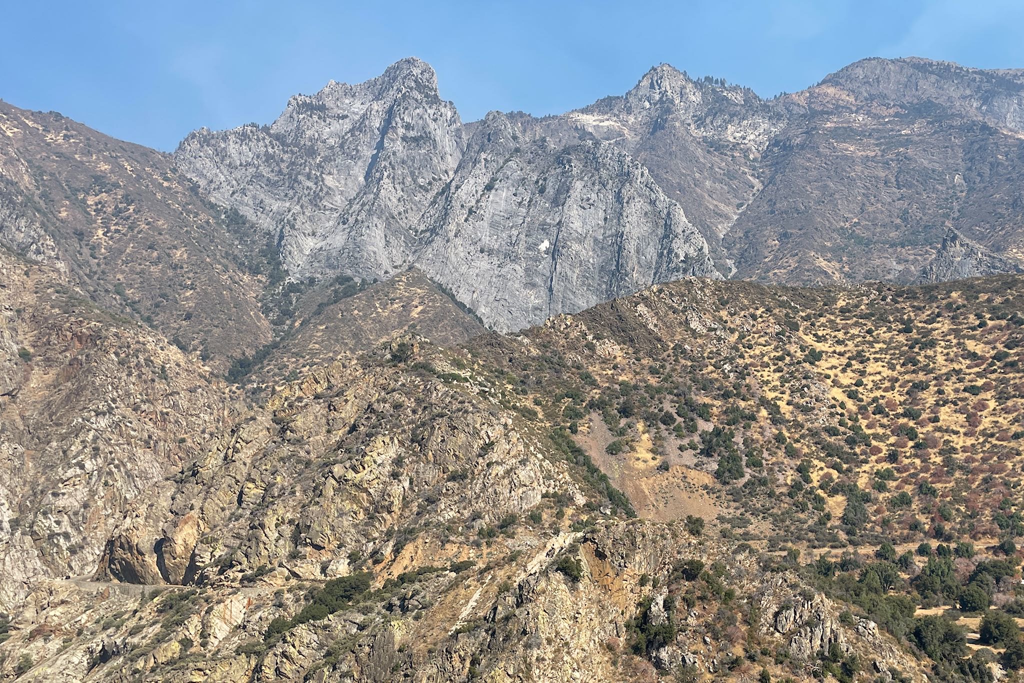
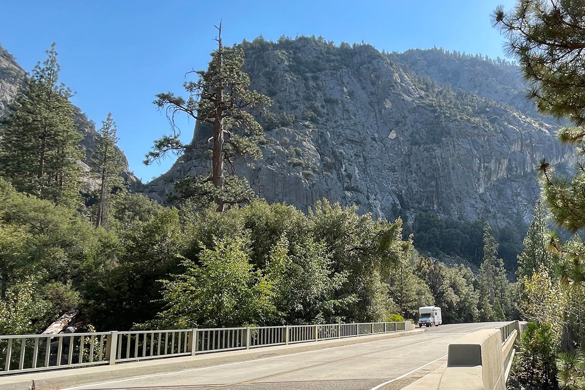
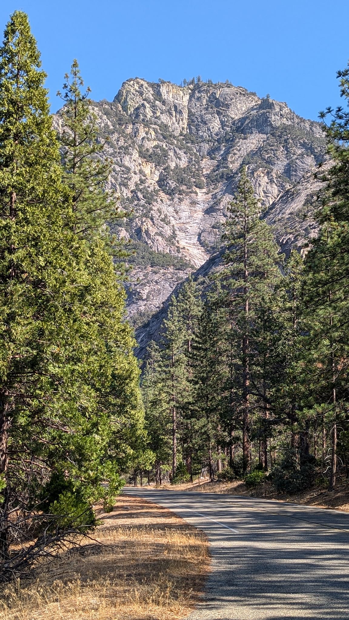
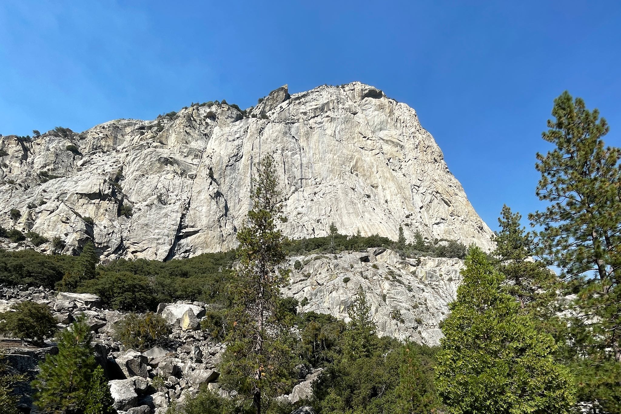
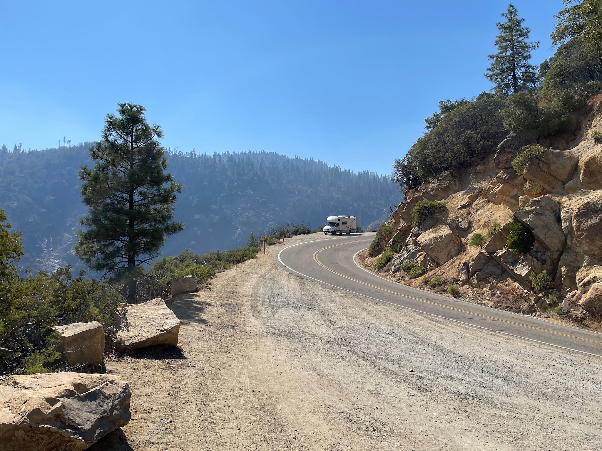
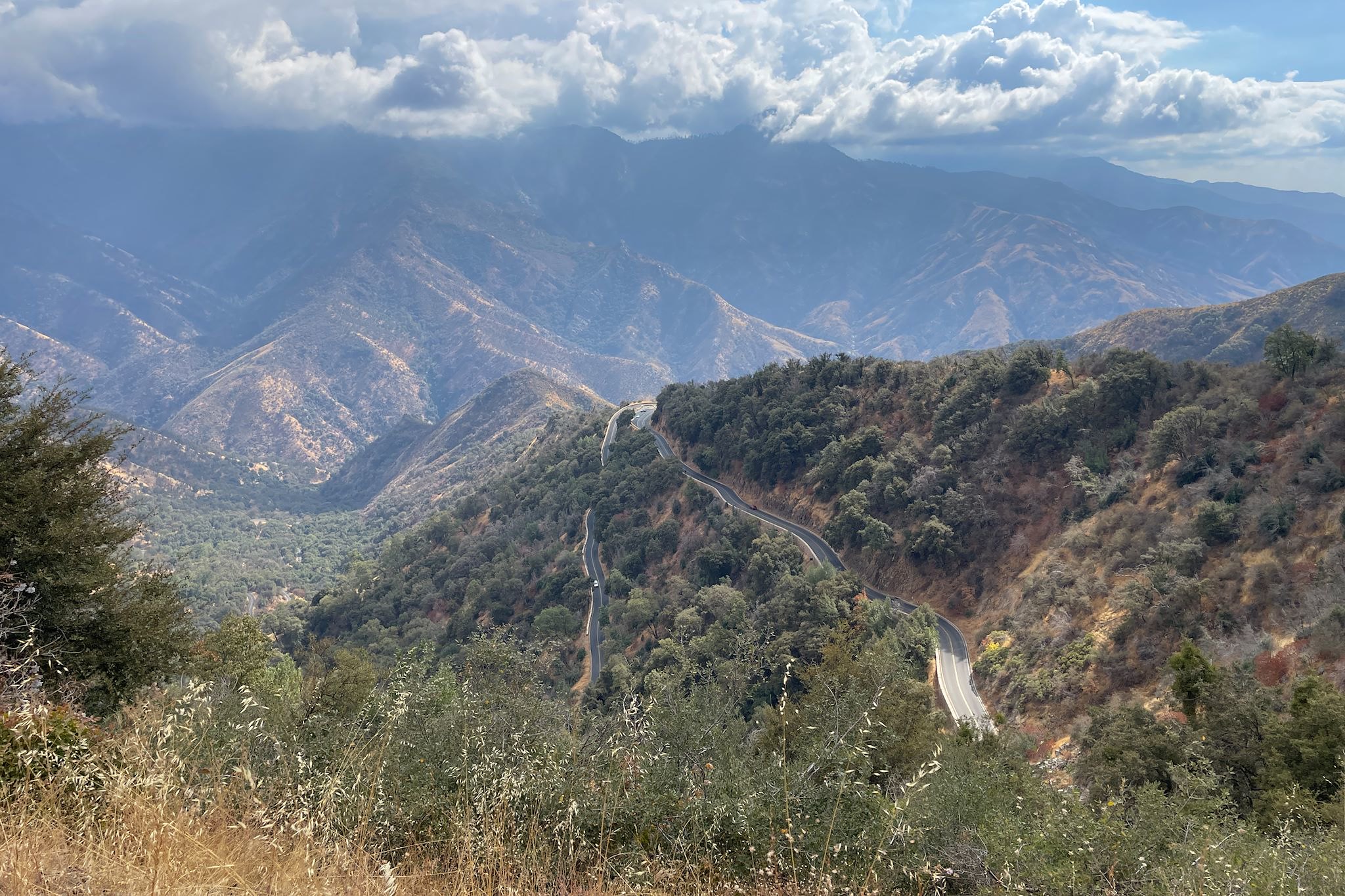
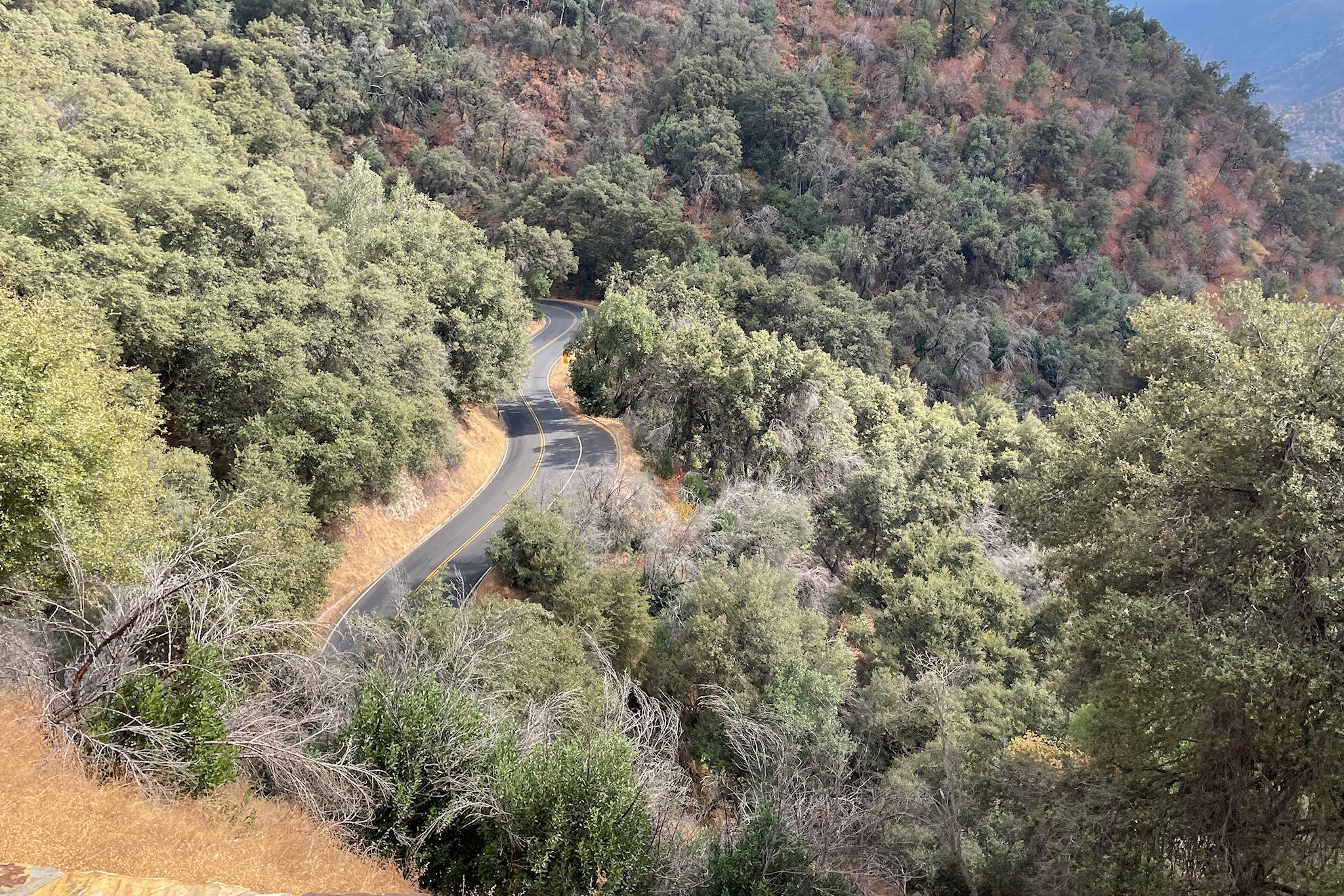
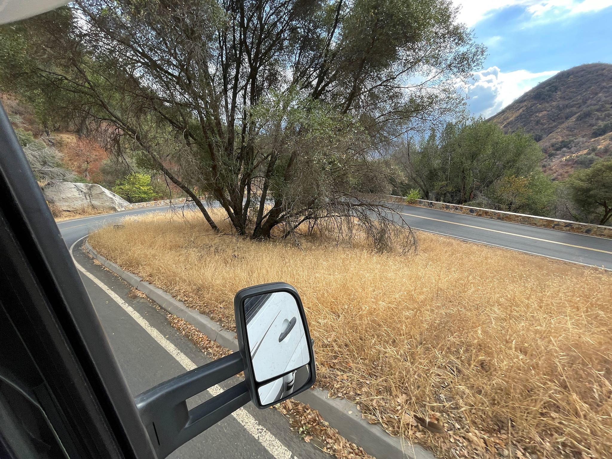
The drive through the canyon was amazing! Whoever thought of building roads over, around and between these mountains!?! In 1900! With 1900-era road building tools! Sections of the road included switchbacks that folded over each other like ribbon candy, while other sections were L-shaped notches blasted into the sides of the mountains, leaving a rocky wall along one side of the road and a sheer cliff down to the South Fork Kings River at the bottom of the canyon on the other. It is one of the deepest canyons in the world, deeper than the Grand Canyon, and it was formed primarily by glaciers, rather than erosion by a river, which created its distinguishing U-shape bottom that is especially prominent in the upper sections. Once down to the canyon floor, the road follows along the river, past the tall, steep cliffs. Eyes were drawn upward the whole time.
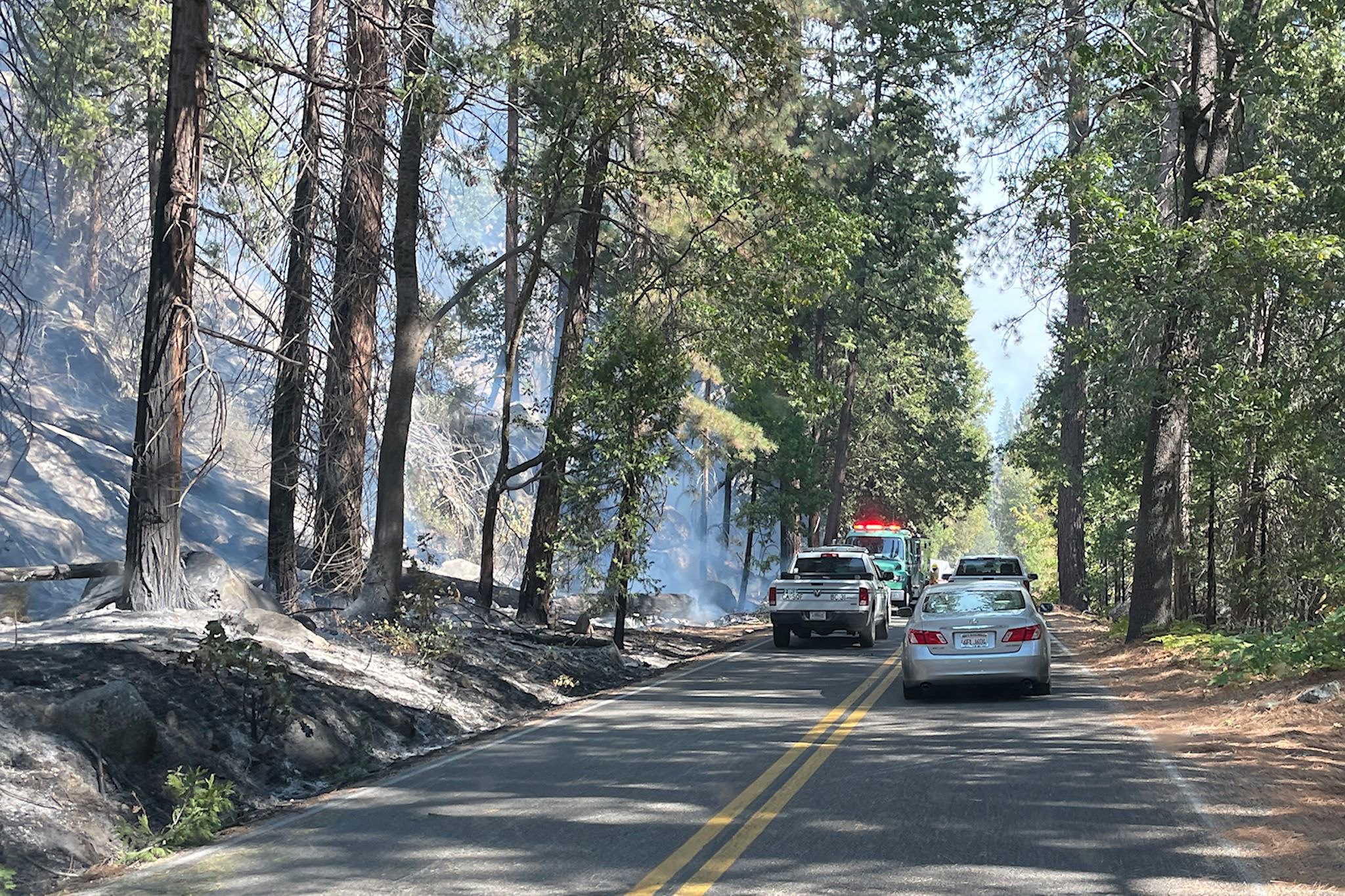
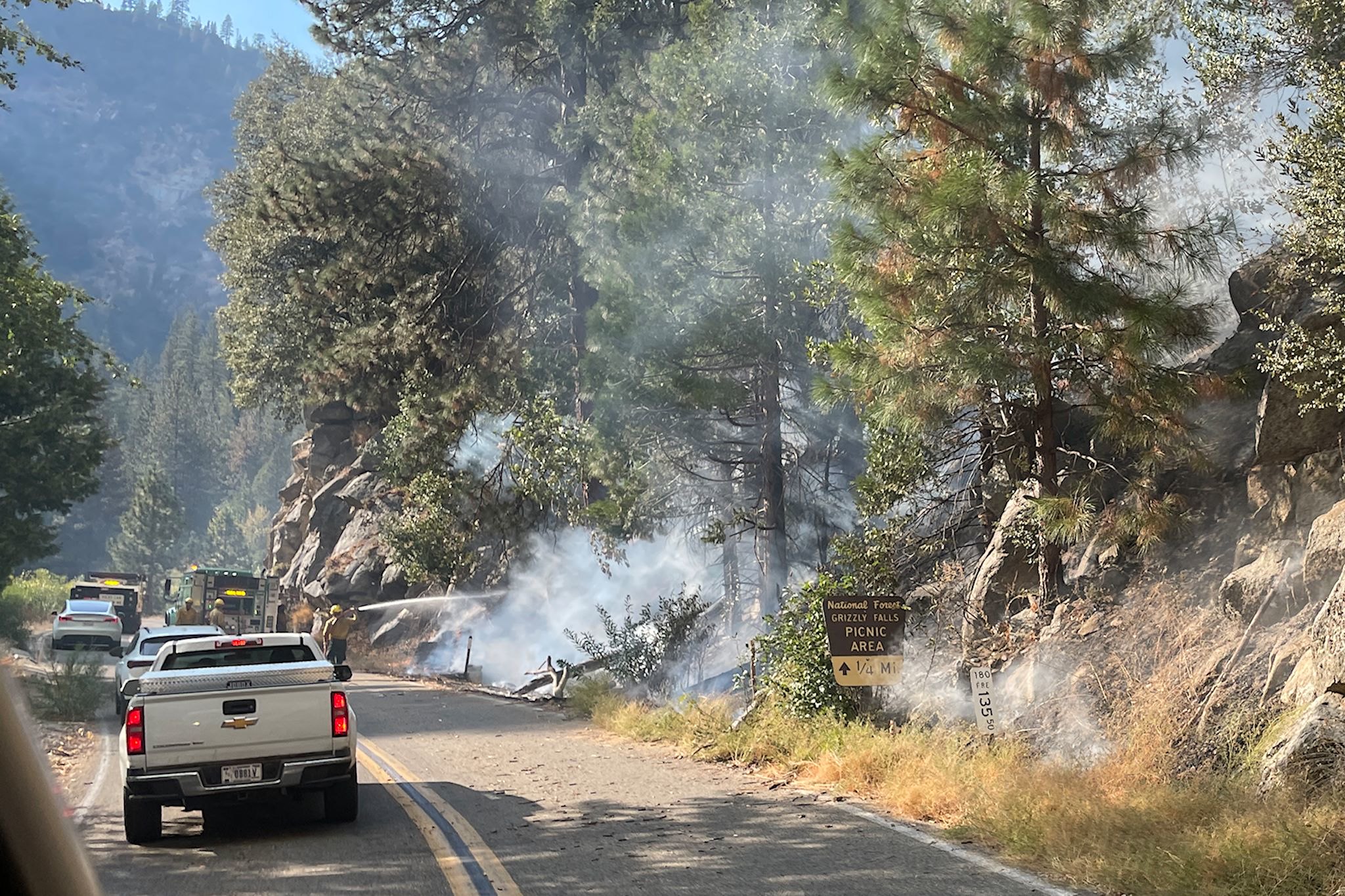
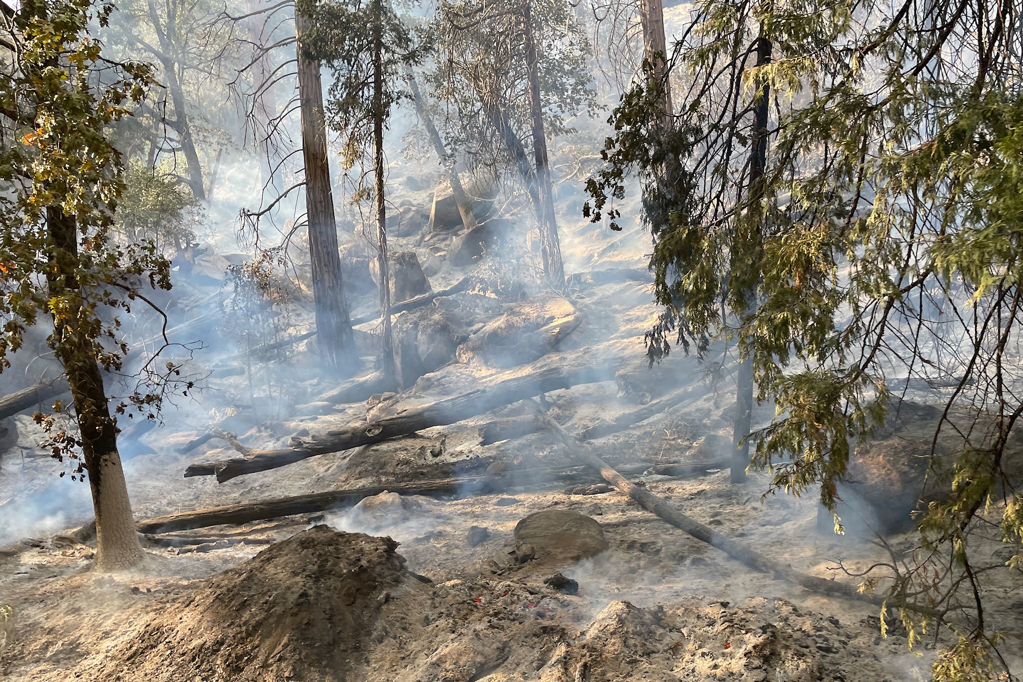
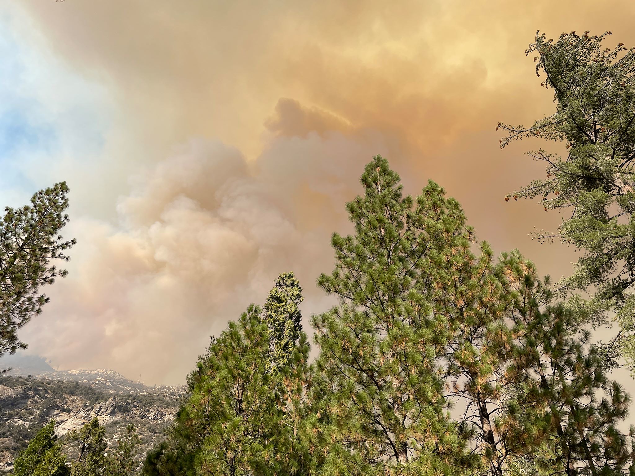
Along the canyon floor, emergency fire crews were conducting controlled burns in sections of the canyon walls. The Happy Fire was getting close to the summit between the 2 canyons. Should it reach the summit, the controlled burns would theoretically eliminate fuel for the fire and slow the spread over to the Kings Canyon side. Our thanks to the good work of these fire crews!
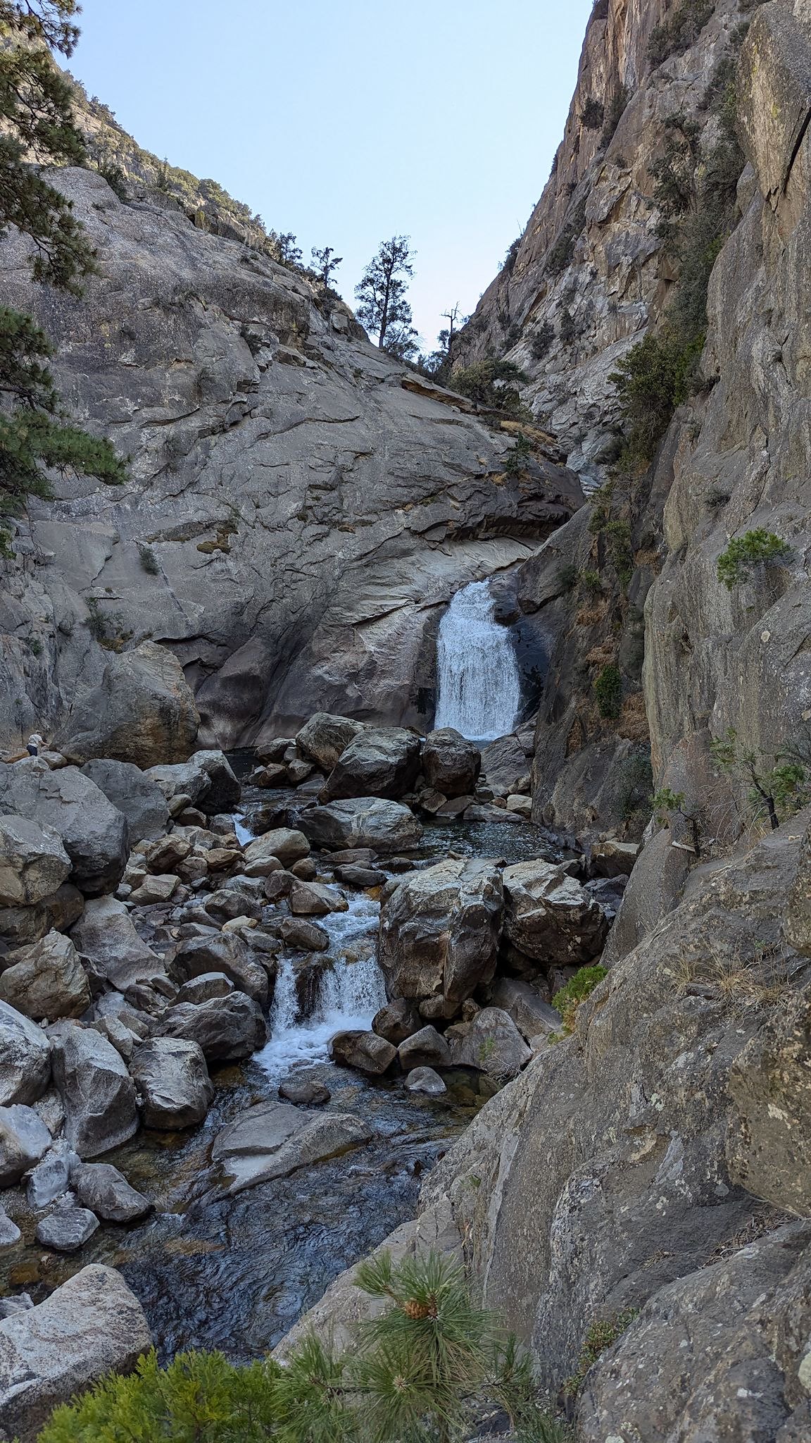
Once we reached our campground, we settled in for lunch. Although the visibility was pretty good, air quality was less so. We would not be able to hike, and likely not sleep well if we chose to spend the night. We decided to drive the remainder of the Byway through canyon to Road’s End, check it out, and possibly seek another area of the park for the remainder of our stay. A short and pleasant-but-smoky hike to a waterfall mid-afternoon finalized our decision to cut short our stay in the canyon.
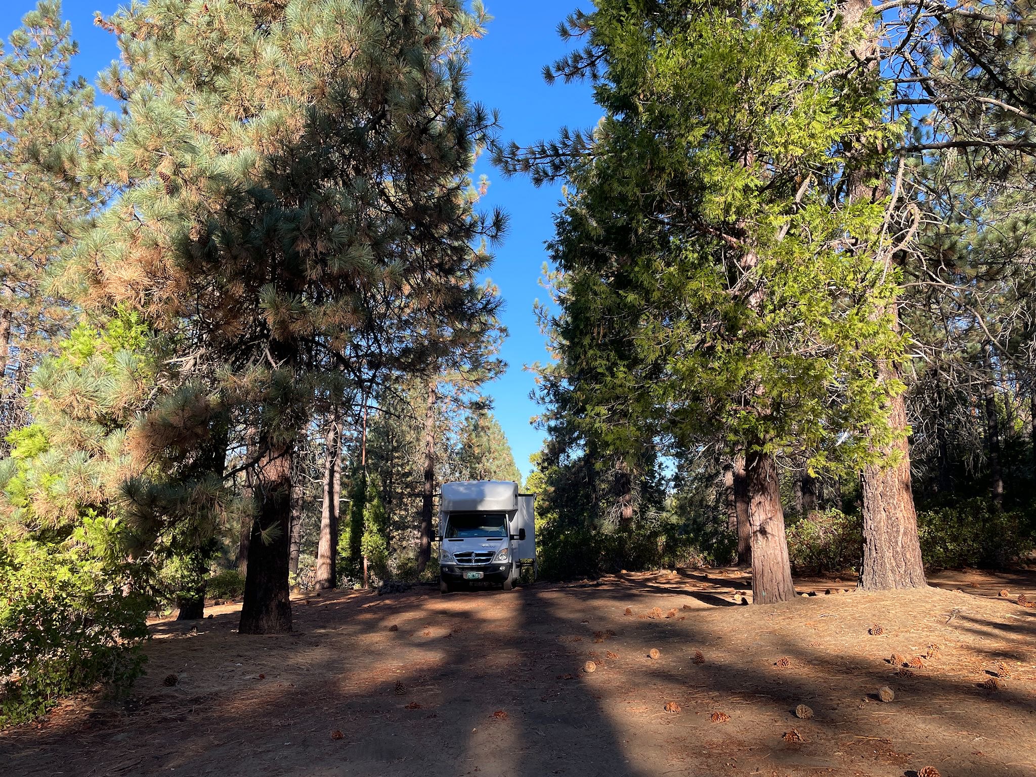
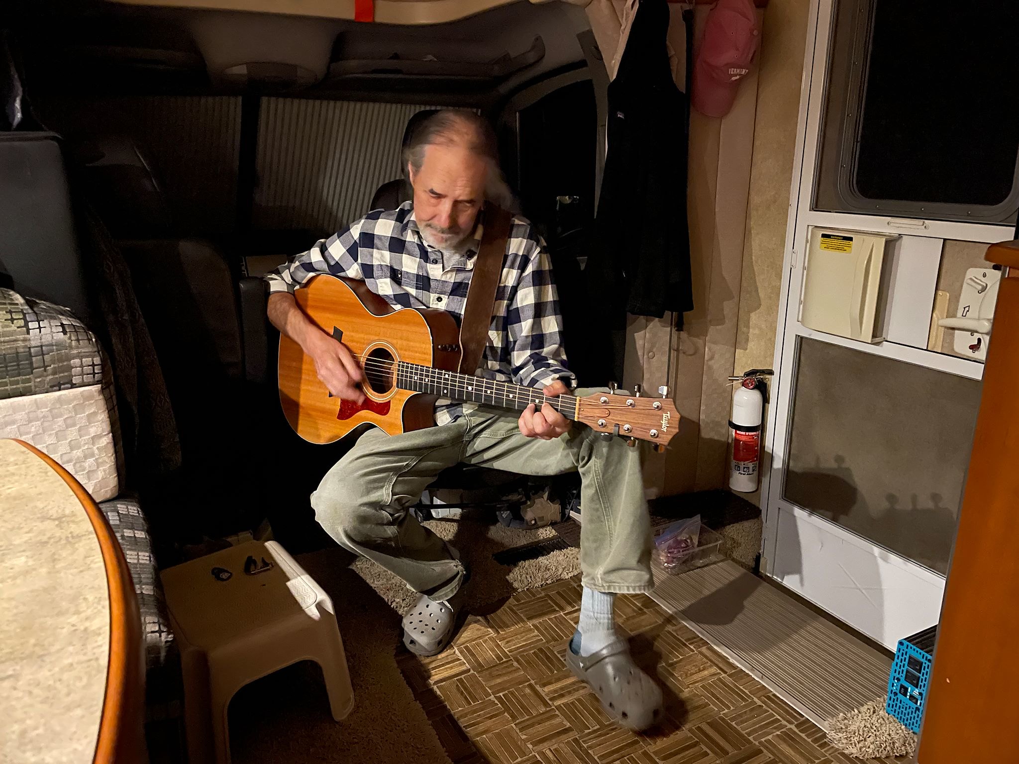
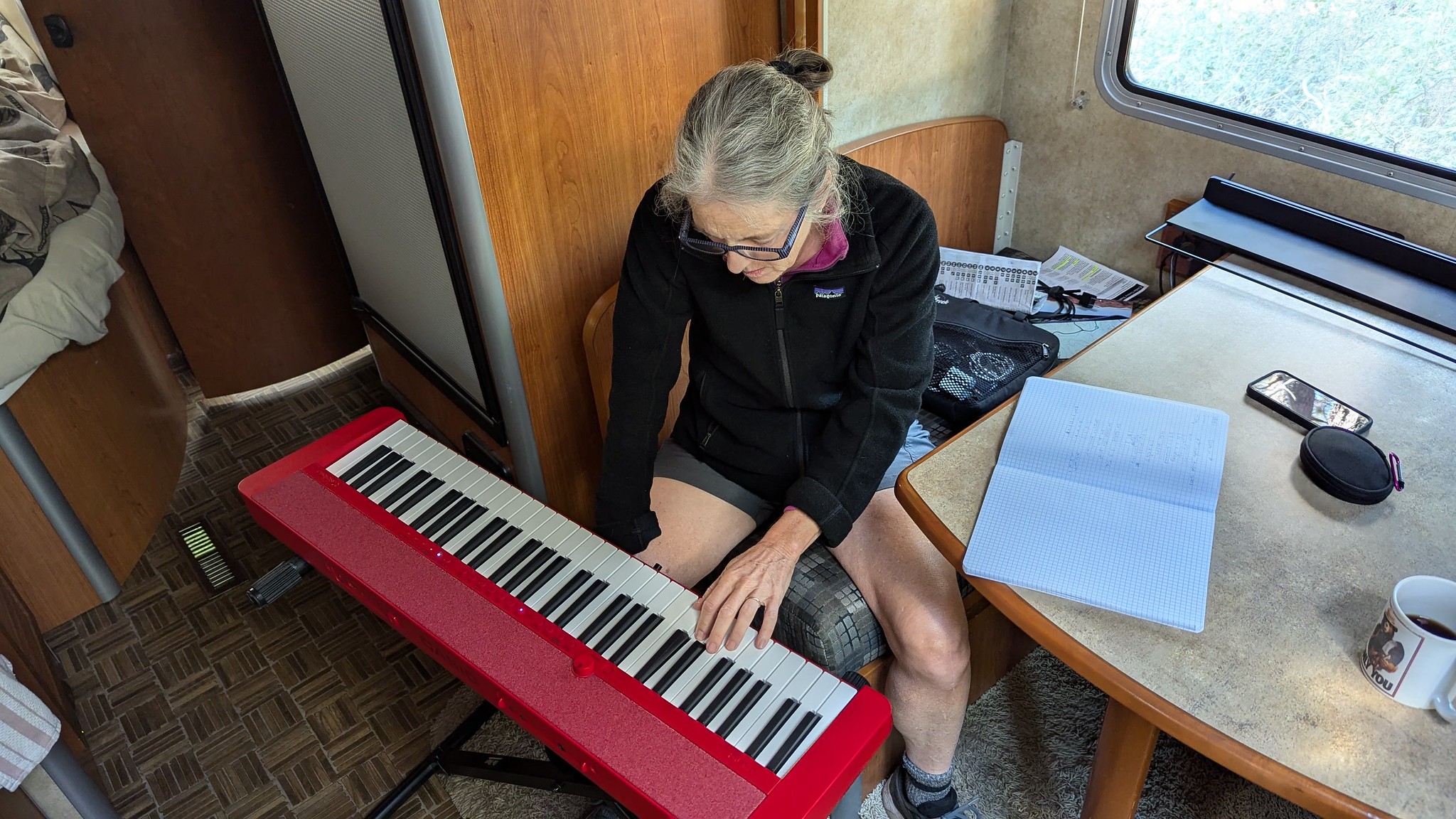
The drive up out of the canyon was just as beautiful as the way in, albeit a bit more smoky. Of course, without reservations in the national park campgrounds, we were now on our own for the next 3 nights. (Even though it’s late in the season and visits to the parks are quickly dwindling, the campgrounds are being closed at least as fast, so competition for the few remaining open campsites is fierce.) Ah, but with some hints and info from a park ranger at the Grant Grove visitor center, we’d found a beautiful boondocking spot outside the park on National Forest Service land, along the Tenmile Road. There we parked, completely internet free, playing music, reading books, and even doing some minor upkeep and repairs on the RV, all while surrounded by more majestic trees.
Buena Vista hike (Generals Highway)
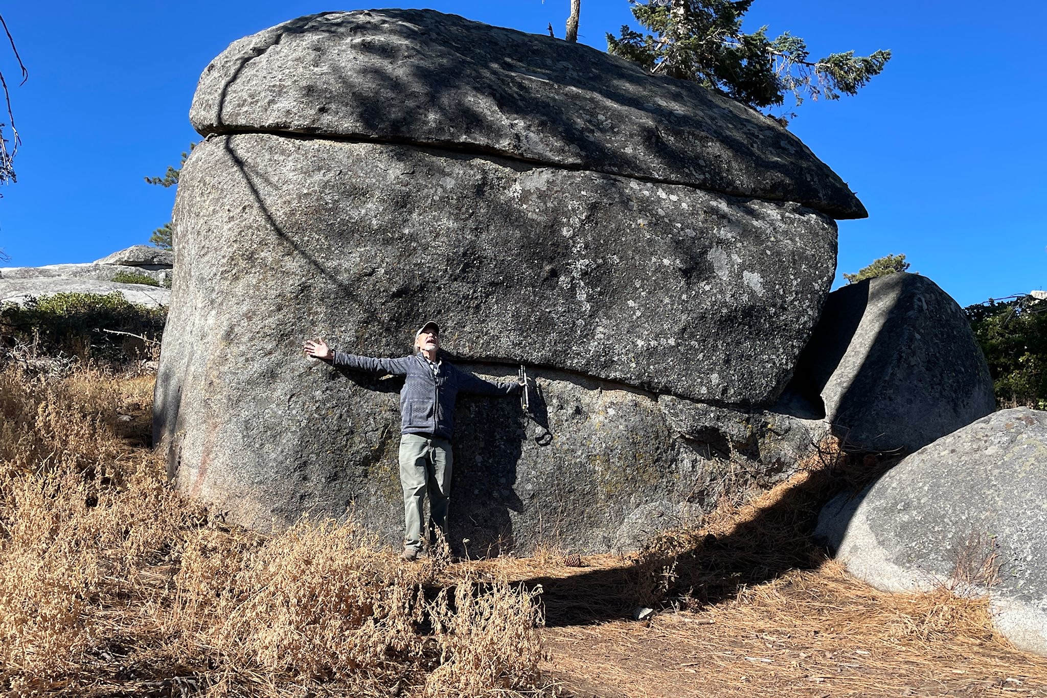
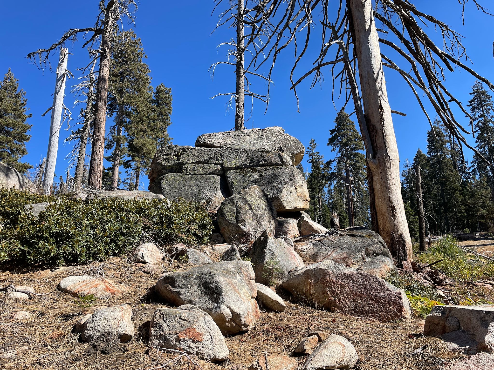
Outside of the canyon, we could add another hike. We chose Buena Vista Trail, a short hike to a summit with 330-degree views. Although views promised by the trail name did not disappoint, I really think it should be called Big Rock Candy Mountain Trail. There were giant boulders everywhere, and the trail quite purposefully meandered right up close to the largest ones. Giant rocks and a few giant sequoias made for a fun hike!
Moro Rock/Soldiers hike (Giant Forest)
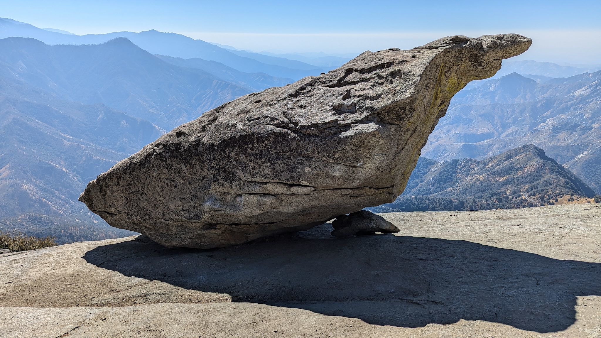
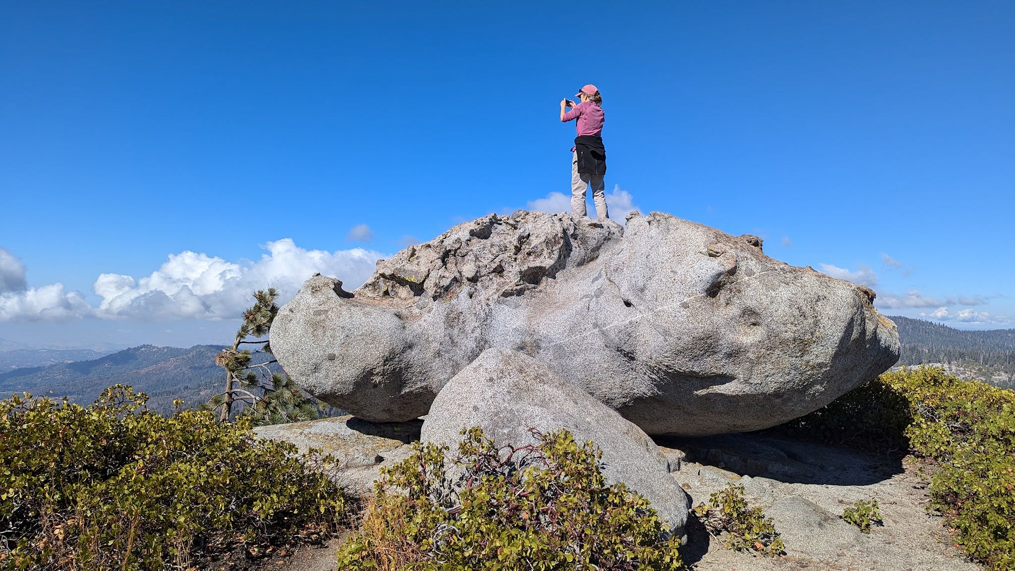
Just outside the Giant Forest Museum, the Moro Rock Trail started gently along the shoulder of the Giant Forest Plateau with open and slightly smoky views over the lower, southwest hills of the park. Before long, we arrived at the first highlight of this trail – Hanging Rock – a giant rock balanced on the side of a long wide slab of granite. We were fascinated by the rock, at least until we stepped around it. Then, the view opened to the full, narrow valley where Generals Highway winds and twists and switchbacks on itself down from the mountains to the south entrance of the park. (We mention the twists and turns because, contrary to the Park’s ‘max length’ recommendation, this is how we eventually exited the park with our allegedly too-large motorhome. Totally glad we did!)
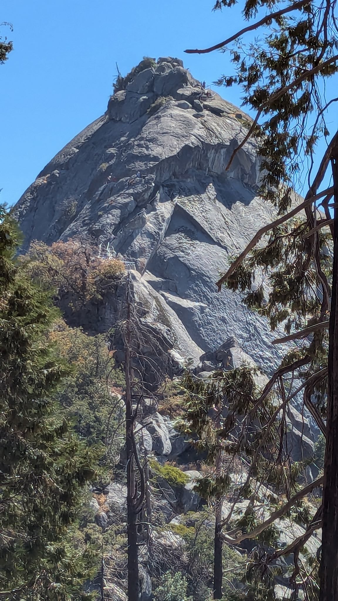
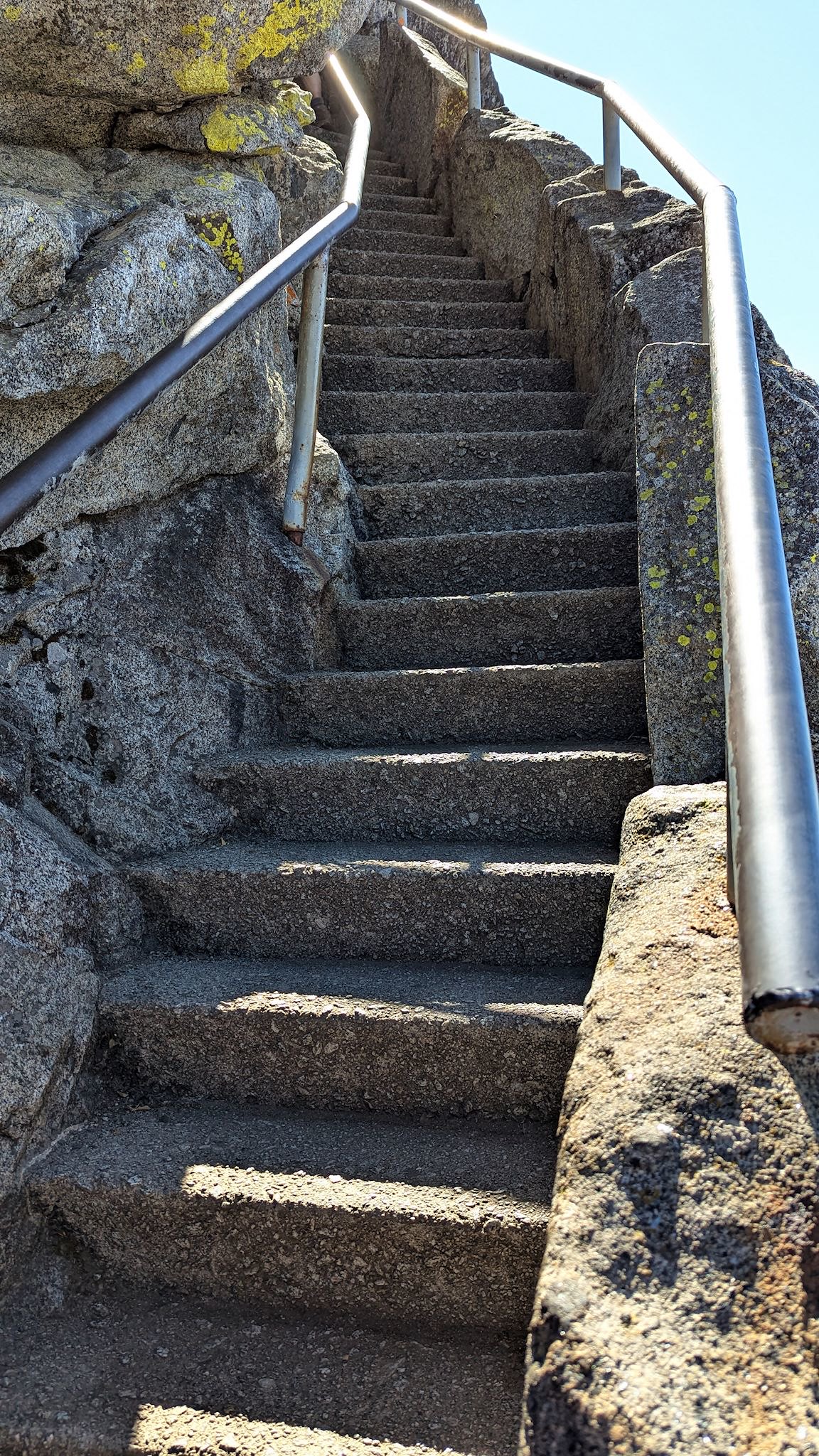
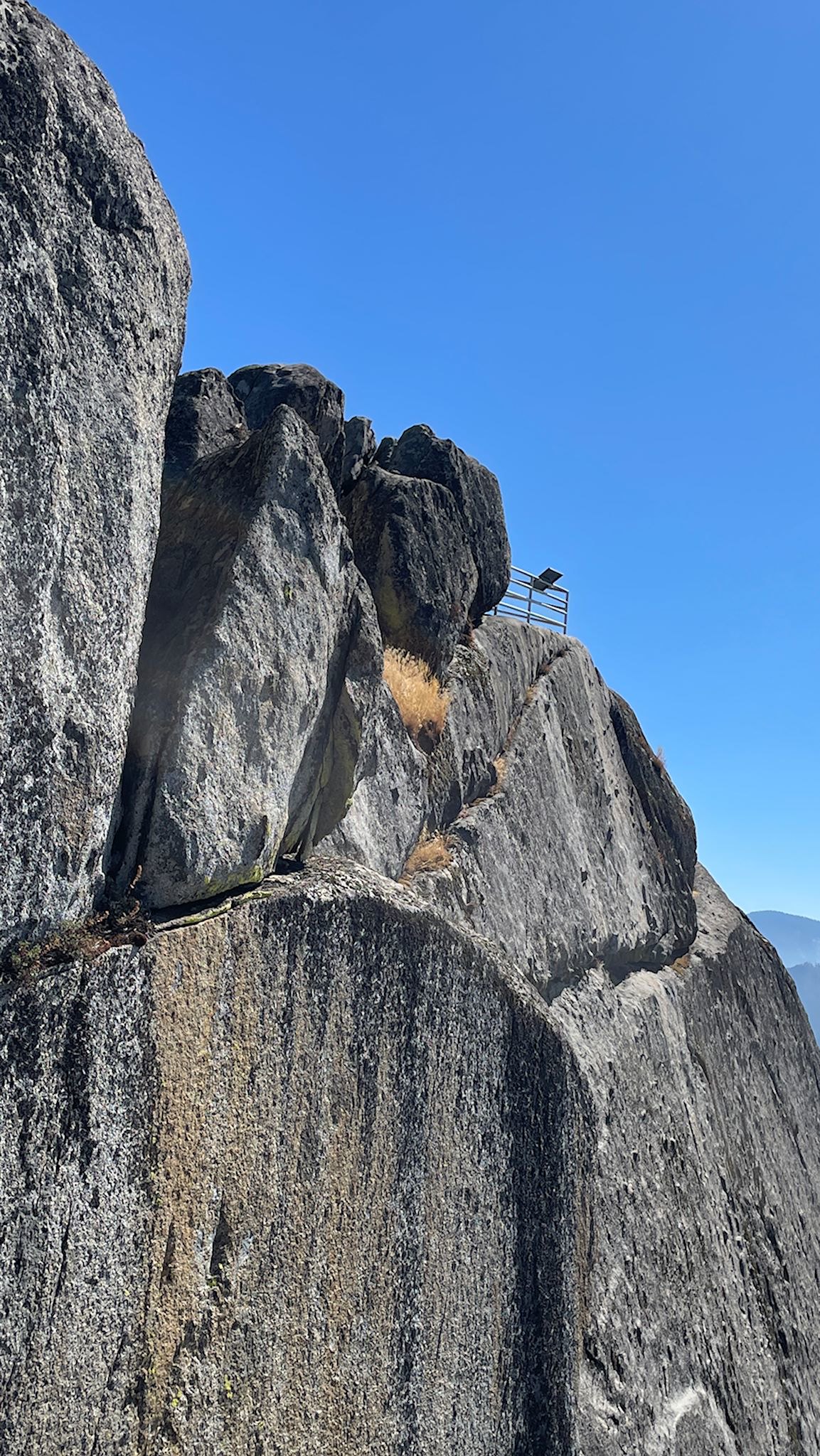
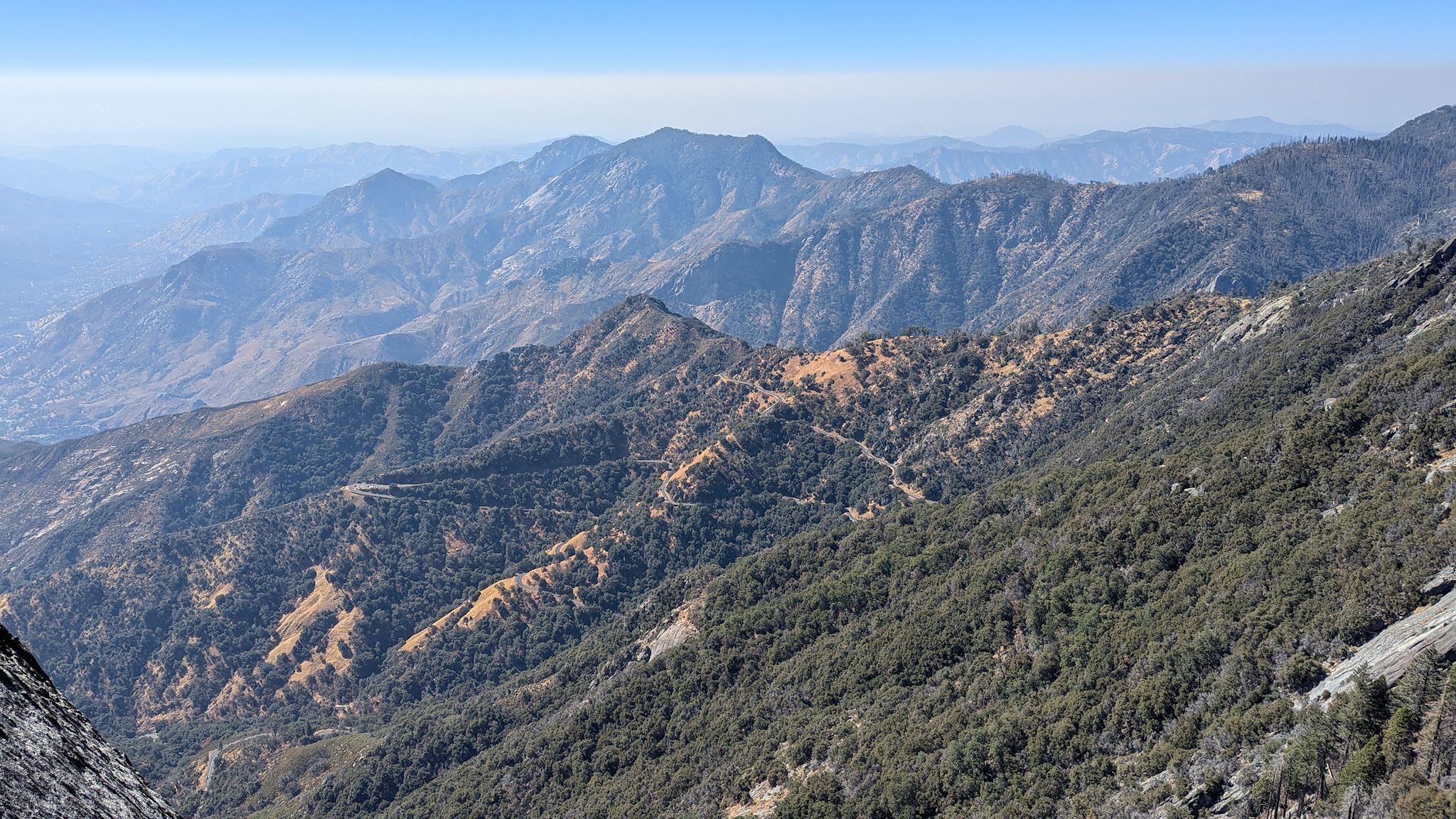
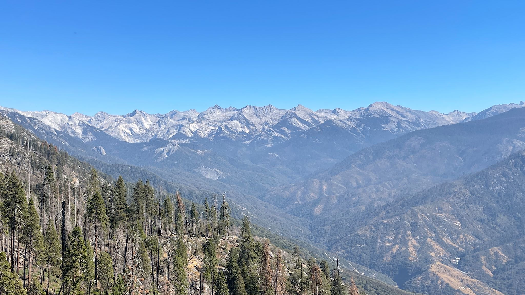
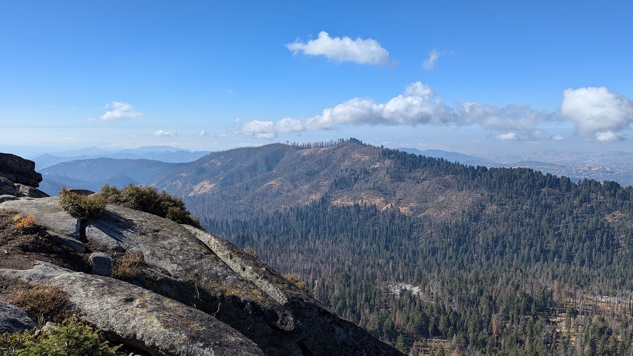
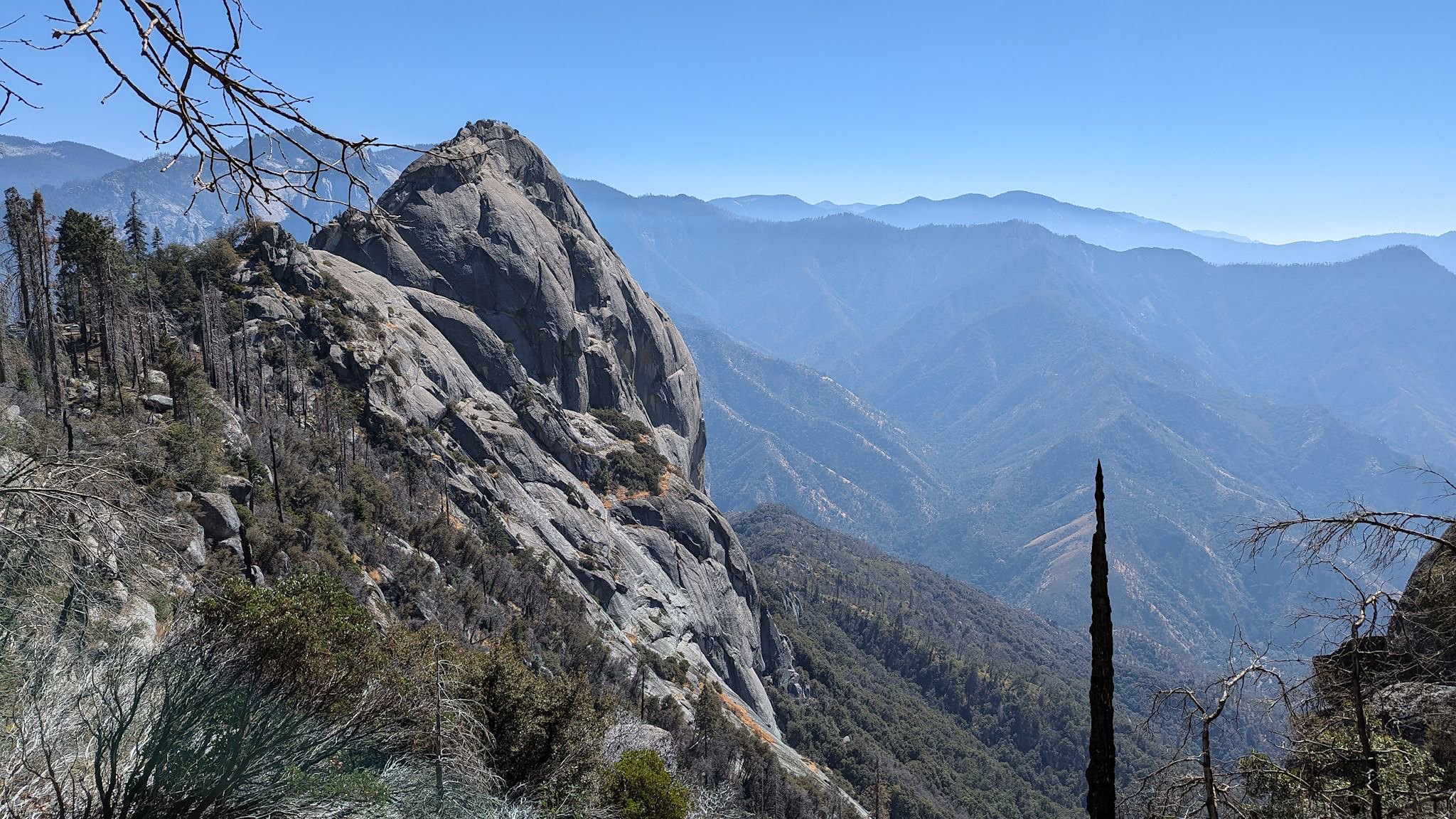
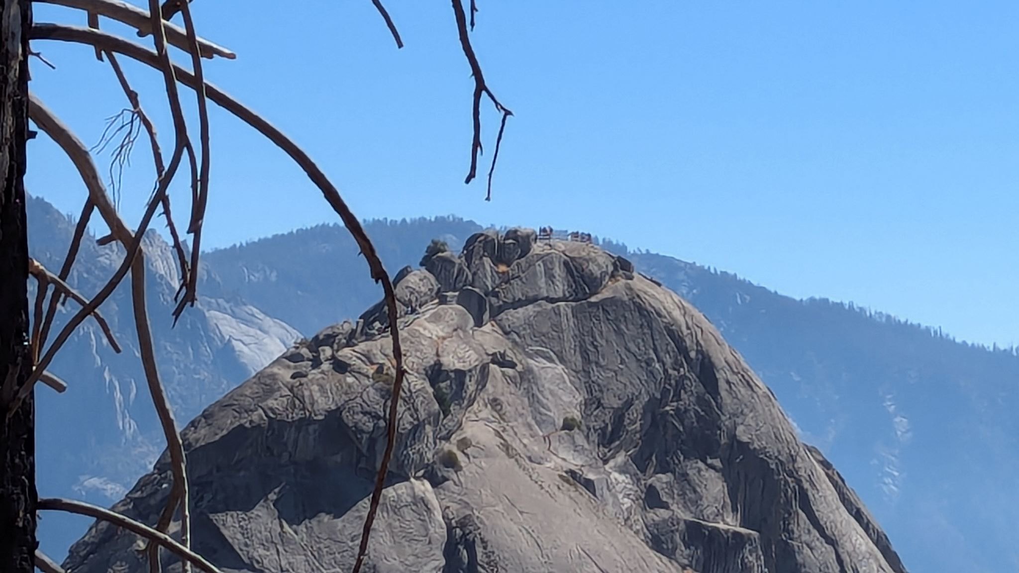
Turning around from Hanging Rock, we could see what had to be Moro Rock – a tall, granite monolith that appeared to have a line of short, dark hair on the top, like an old-school crewcut. The hair was actually a bunch of people standing in the observation space at the top of the rock. It was a short hike to the base of Moro Rock from where we were. There, we found a parking lot (of course) from which ascended a stairway carved into the rock – 300 steps and 300 vertical feet to the summit. OMG what a view! To the west was a smoky yet unobstructed view of the switchbacked road through the foothills and the San Joaquin Valley. On a clear day, the Coastal Range would be visible. The peaks of the Great Western Divide in the High Sierras and the full Middle Fork of the Kaweah River Valley were stunning as we looked out, eliciting a continuous chorus of WOWs from us and our fellow stair climbers.
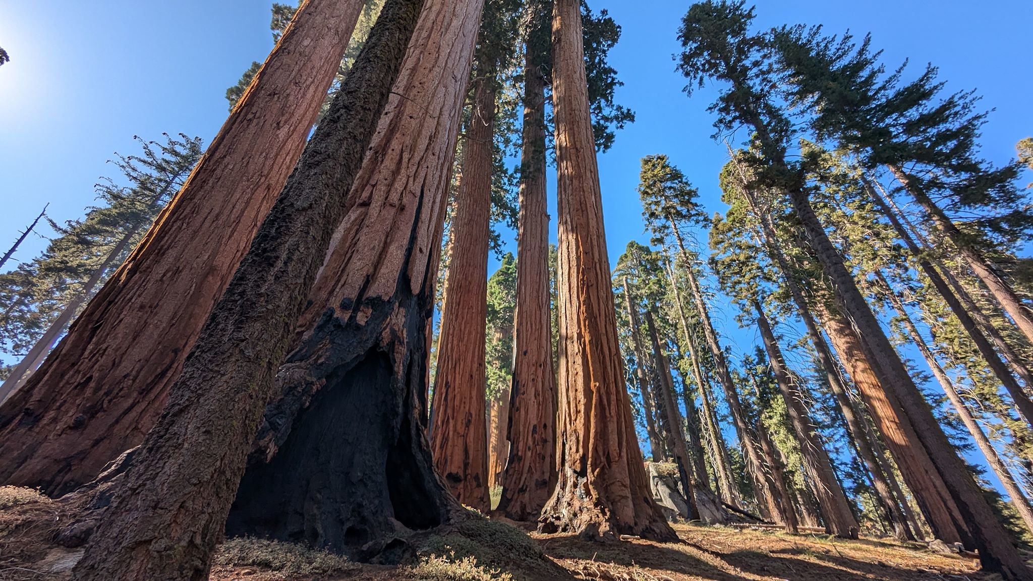
We returned to our starting point via the Soldiers Trail. Although the trail description referred to a history of soldiers living in camps to patrol the park in the early 1900’s, we missed any signs of that activity or history. What we did find was scads of non-giant sequoias (and ok, we passed a few giants as well) in a more natural setting (i.e., without signs, fences, or great numbers of visitors) as the trail meandered over gentle ridges and descended back to the Giant Forest Museum where we started. It wasn’t until we checked out a different map in the museum that we found out that our hike was entirely within the Giant Forest Sequoia Grove, the largest sequoia grove in the world.
Having thoroughly enjoyed exploring each section of these 2 large national parks, we descended Generals Highway out of the mountains, marveling again at 1900’s road construction as we navigated its 123 switchbacks. And with that, we finished our exploration of the Sequoia & Kings Canyon National Parks.
For anyone who’s interested, more Climb to the park, Grant Grove hike, Manzanite/Park Ridge hike, Moro Rock/Soldiers hike, Kings Canyon Scenic Byway, Tenmile camp, Buena Vista hike and Climb down from the park pix…