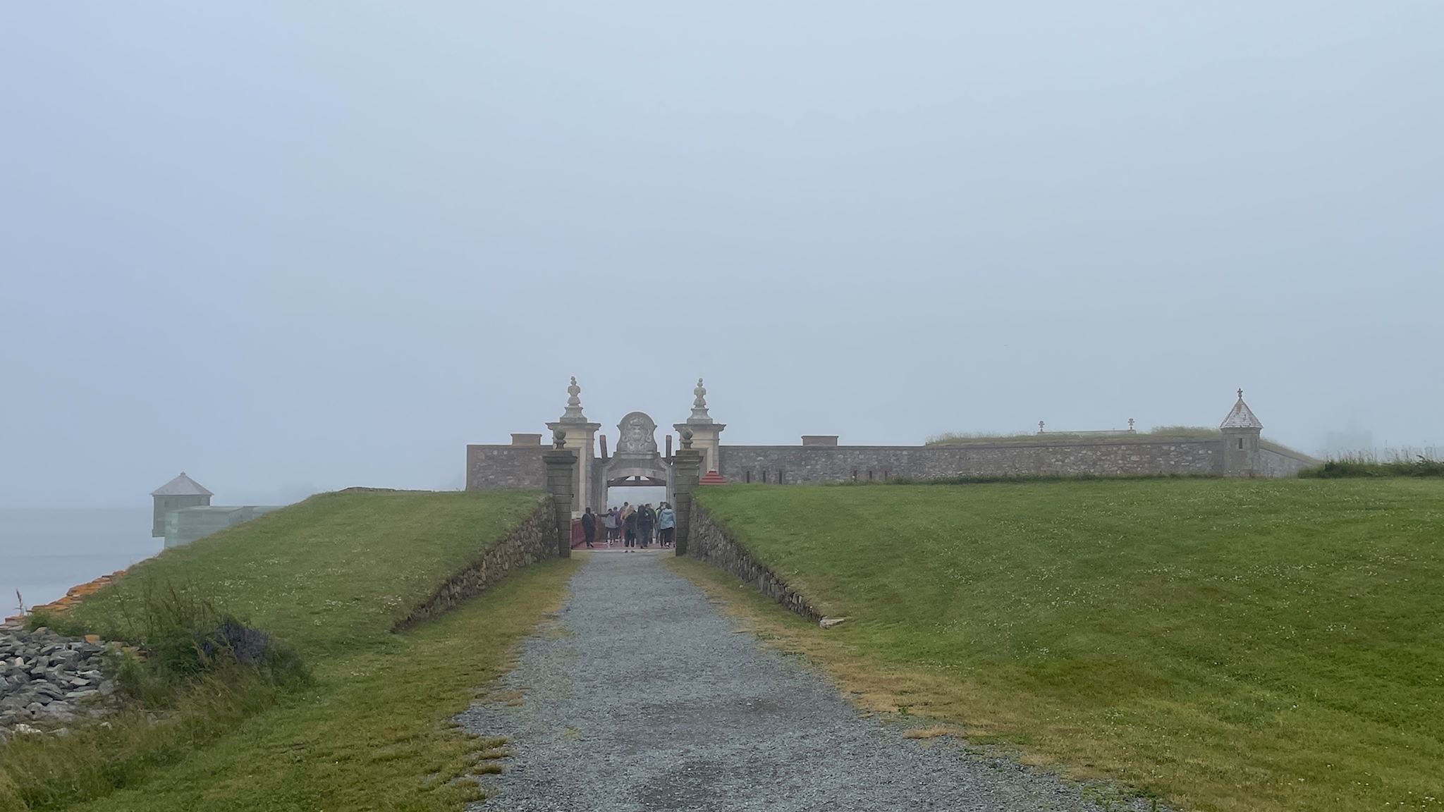
Home!

During the final two days of the trip, we tried to determine what it is that we both were experiencing – a now-familiar feeling we’ve had at the end of each of our trips. We’re happy to be coming home, yet there’s a sadness to ending our adventurous life on the road. We concluded that it’s primarily a feeling of wistfulness (yearning or longing) with a touch of bittersweet (contrasting emotions of sadness and pleasure). And overall, it leaves us with a sense of satisfaction with the adventure just concluded.

Continue reading “Home!”

Quebec City, partie 3 – fermer le cercle

The first night of this trip, on June 10, was spent in Quebec City. After 100 days on the road covering 11,000 km/7,000 miles and 5 provinces, we’ve come full circle back to Quebec City. We’re quite proud of that circle! And now, the adventure portion of this trip is behind us. Ha! Not without one more quick visit to the city… ‘Je me souviens!’

Continue reading “Quebec City, partie 3 – fermer le cercle”

Gaspesie National Park

Mont de la Table/Tabletop Mountain

Parc National de la Gaspésie/Gaspesie National Park was created in April 1937 in order to permanently protect the Gaspésie caribou and the natural beauty and resources of the Chic Choc and McGerrigle Mountains, as well as the Rivière Sainte-Anne/Saint Anne River and its salmon. Part of the Applachian Mountains, the Chic Choc and McGerrigle ranges include the highest peaks in southern Quebec. The park is a mecca for hiking and is legendary for back country skiing.

What a surprise to learn that the Chic Chocs are also known as the Shick Shock Mountains…

Continue reading “Gaspesie National Park”

Forillon National Park

Gaspe Lighthouse

The Gaspe Peninsula is that long, thin blob of Quebec that extends along the southern shore of the St Lawrence River, to the north and east of Maine. This is funny – I knew it was on the St Lawrence, yet never noticed the south side of this peninsula before. The south side is along the Baie des Chaleurs (Bay of Warmth). I was surprised by the many similarities to the Cape Breton peninsula, though this makes sense given that the same geological events formed them both and both subsequently received similar shaping from the glaciers. The east side of Cape Breton/south side of Gaspe have a gentle slope to the sea/bay/ocean while the west/north sides are seemingly endless series of sharp cliffs plunging into the river/sea/gulf. And both have Parcs Canada national parks spanning the width of the peninsula. The road along the south side of Gaspe is dominated by beachy resort towns while the road along the St Lawrence passes through what appear to be mostly fishing towns with a few tourist offerings. There’s a 70-km/40-mi stretch where the road is sort of cantilevered into the St Lawrence at the base of the cliffs. The views are amazing! And as a bonus for the one who’s not driving (thanks Doug!), there are happy seals to be spotted sunning themselves on rocks all along the road.

Continue reading “Forillon National Park”

Caraquet, NB

I’ve been hearing about Caraquet, New Brunswick, my whole life. My mom’s family (ok, the men in my mom’s family) made their living fishing in the Caraquet area for 8 generations. During the Great Depression, jobs dried up and people, including my ancestors, were struggling to find work. My grandfather Ferdinand (‘Fred’) Murray moved his wife, Marie-Louise (Godin) and the first 7 of their kids (of the eventual 13) to Berlin, New Hampshire, where the paper mill was hiring. The rest is history…

Continue reading “Caraquet, NB”

Kouchibouguac National Park

The Kouichibouguac National Park was designated in 1969 to preserve and protect a unique piece of New Brunswick’s Coastal Plain Ecosystem. The park has barrier islands that change with the tide and the wind, short sand dunes that are equally dynamic, lagoons, estuaries, salt marshes and tidal rivers that host aquatic and sea bird populations, ancient bogs and fields, and forests regenerating from past timber harvests. Its name is hard to spell, and pronouncing it is difficult enough that we needed coaching – fortunately, this was available from the helpful park staff.

Continue reading “Kouchibouguac National Park”

Cape Breton Highlands National Park

The Cape Breton Highlands comprise a tall, slightly rounded, mountainous plateau on the northeastern end of Nova Scotia. It was formed by the same collision of continents that created the unique mountains in Gros Morne National Park as well as the Appalachian Mountains, back in the really old days. Although not insanely tall at the highest point on White Hill (533 metres/1750 feet), the plateau drops dramatically from the edges – about 350 metres/1150 feet – to the ocean below.

Continue reading “Cape Breton Highlands National Park”

The Best Laid Plans…

Greetings from a rainy day in Cape Breton Highlands National Park!

We set out to visit the Maritimes this summer, and it appears we’re gonna fail. When we started planning, we’d thought that all of island provinces in eastern Canada were considered the Maritimes. As you probably know already, that assumption was incorrect. Newfoundland and Labrador are not considered Maritime provinces – they’re eastern or Atlantic Canada. We stand corrected!

Continue reading “The Best Laid Plans…”

Farewell Newfoundland

We had no expectations about traveling on the island of Newfoundland. According to google maps, the primary roads create a funky ‘H’ across the province – 1 north south road on the west side, another on the east side, and one road connecting the two across the middle. Many side roads lead to (mostly) small communities along the coast. We’d heard varying reports of the quality of the roads on ‘The Rock,’ but even the most foreboding of these led us to believe we’d seen worse. (And the roads were fine!)

Continue reading “Farewell Newfoundland”