
Parc National de la Gaspésie/Gaspesie National Park was created in April 1937 in order to permanently protect the Gaspésie caribou and the natural beauty and resources of the Chic Choc and McGerrigle Mountains, as well as the Rivière Sainte-Anne/Saint Anne River and its salmon. Part of the Applachian Mountains, the Chic Choc and McGerrigle ranges include the highest peaks in southern Quebec. The park is a mecca for hiking and is legendary for back country skiing.
What a surprise to learn that the Chic Chocs are also known as the Shick Shock Mountains…
The layout of the park and its mountain ranges were interesting to see on a map. And even more interesting to experience.

The Chic Chocs on the west side of the park run east/west. They were created by underwater volcanic activity and sedimentary rock that was uplifted by movement of the earth’s crust about 600 million years ago. Yup, the mountains were previously the ocean floor. The McGerrigles run north/south on the east side of the park. They were formed 380 million years ago when molten rock (magma) flowed to the surface through weak spots in the earth’s crust, the heat and pressure creating metamorphic rock. Glaciers, wind and rain carved away the softer surface materials, leaving the weather resistant granite. Together, these two ranges create an elevated ‘T’ shape that rises from the Gaspe peninsula, divided by the Saint Anne River at the junction. From a distance, they all look like majestic mountains. Until you get up close. Which, of course, we did.


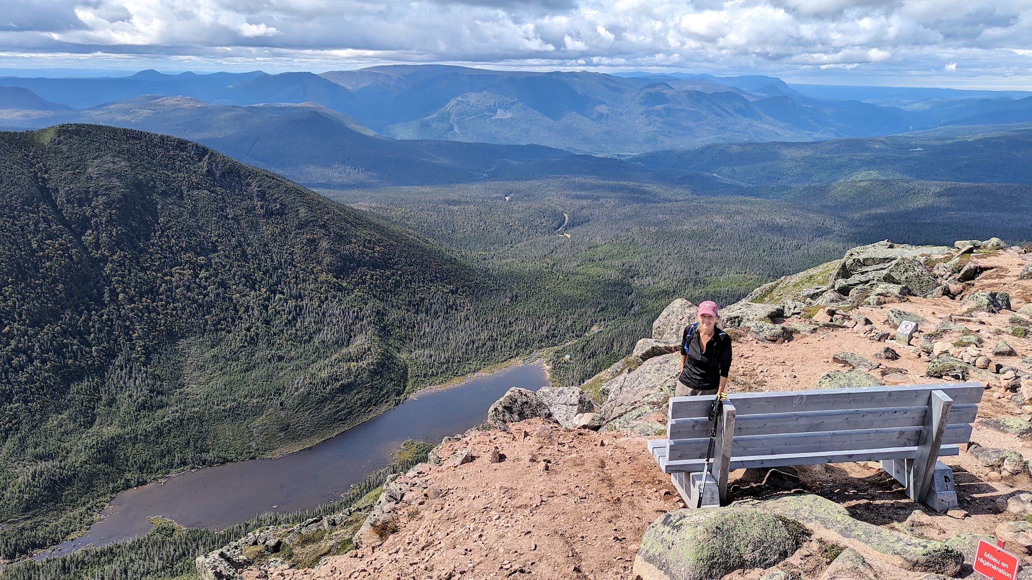
We didn’t waste any time. Up early our first day in the park and seeing lots of sunshine, we headed up Mont Jacques Cartier, the highest peak in the park at 1270 m/4167 feet. The 45 minute drive to the trailhead on the east side gave us an opportunity to see some of the more remote parts of the park. It also provided us with some elevation gain – the trail to the highest peak was also the shortest, so it seemed like a good place to start. (Although we’ve been hiking all summer, we are suddenly back in ‘real’ mountains and doing hikes with over 1000 m/3300 feet of elevation gain for the first time in a few years…)
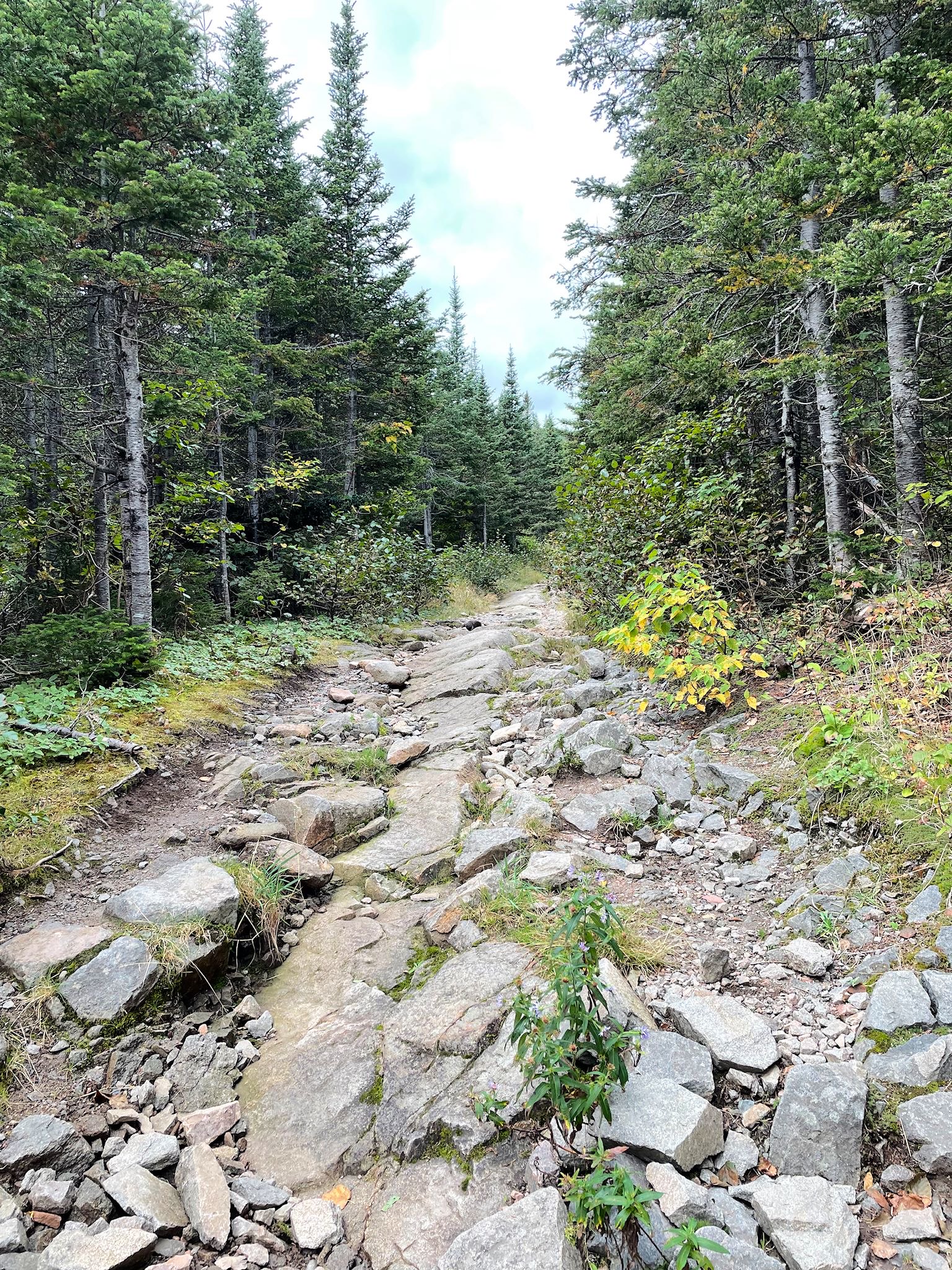
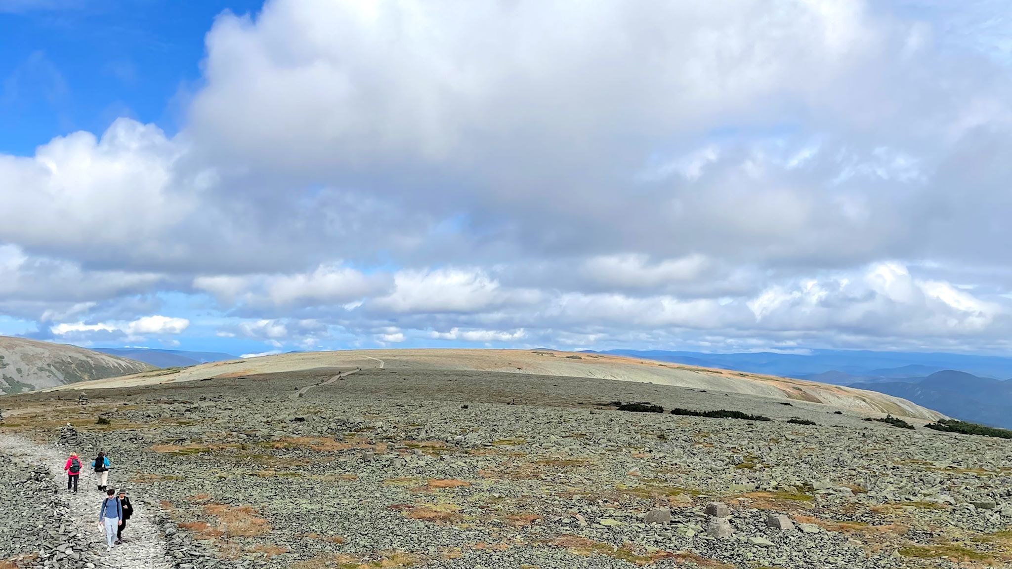
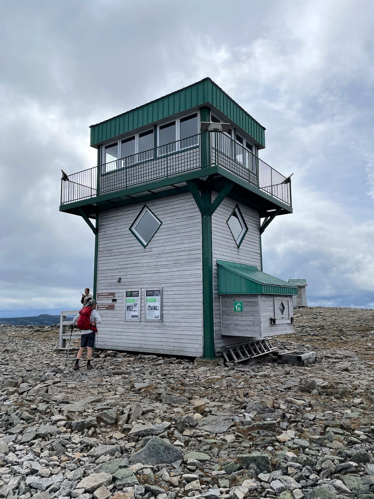
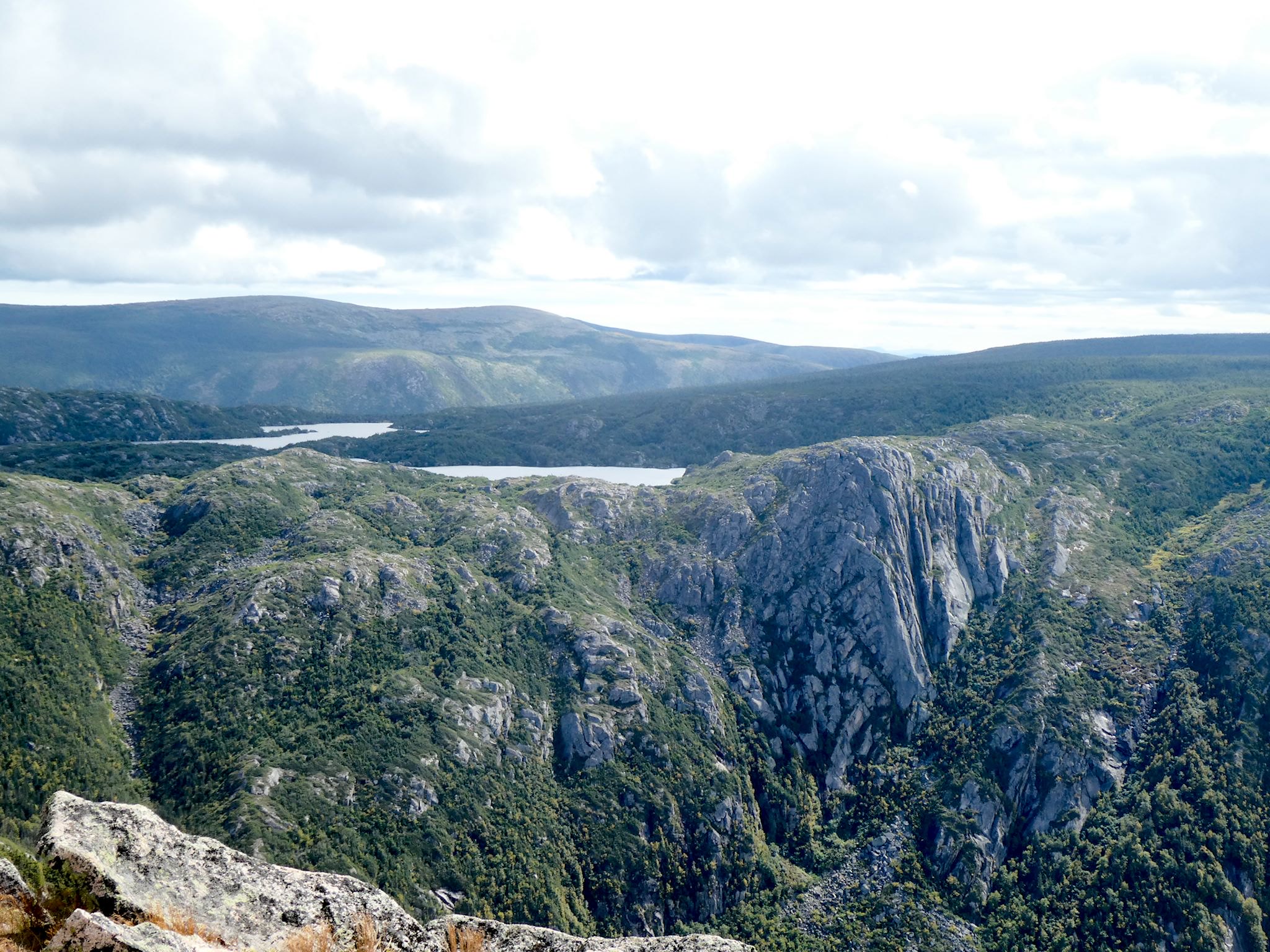
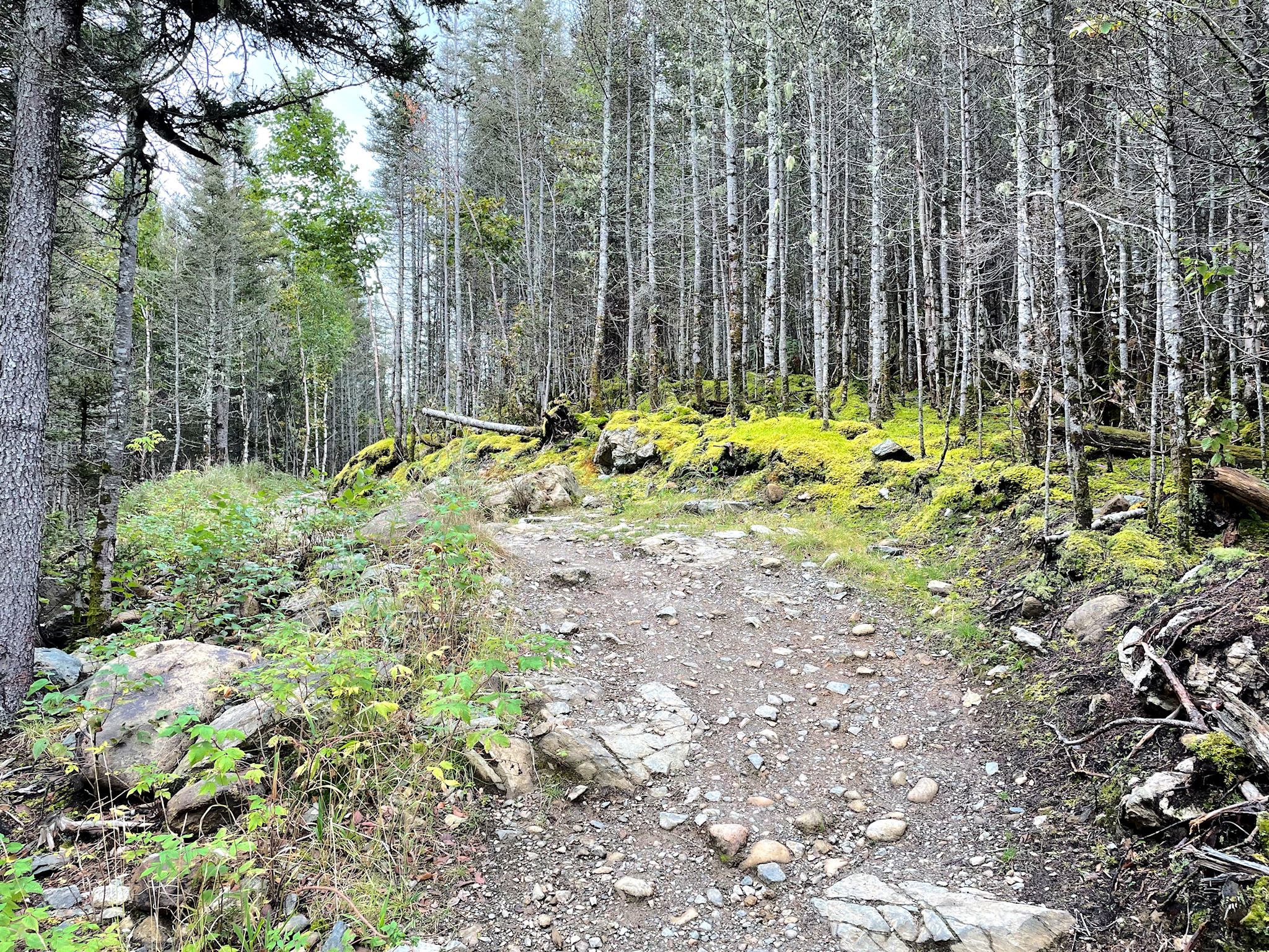
The trail started with a gentle slope through a mixed forest, and quickly turned to a delightfully rocky path through the familiar shortish pine trees of a high boreal forest. We were hiking a valley alongside Mont de la Passe/Pass Mountain. About half way to the summit, the trail popped out above the tree line onto a barren rock field with a view of a tiny tower on the horizon – the summit – and the McGerrigle Mountains. It made it kinda distracting to hike. The summit indeed featured a tower which provided 360 degrees of jaw droppingness. Looking back at the trail, we could tell we’d climbed over a shorter, long, rounded mountain before reaching Jacques Cartier – appropriately named Dos du Baleine/Whaleback. And in the distance, we could pick out a peak we planned to hike later – Mont Xalibu.
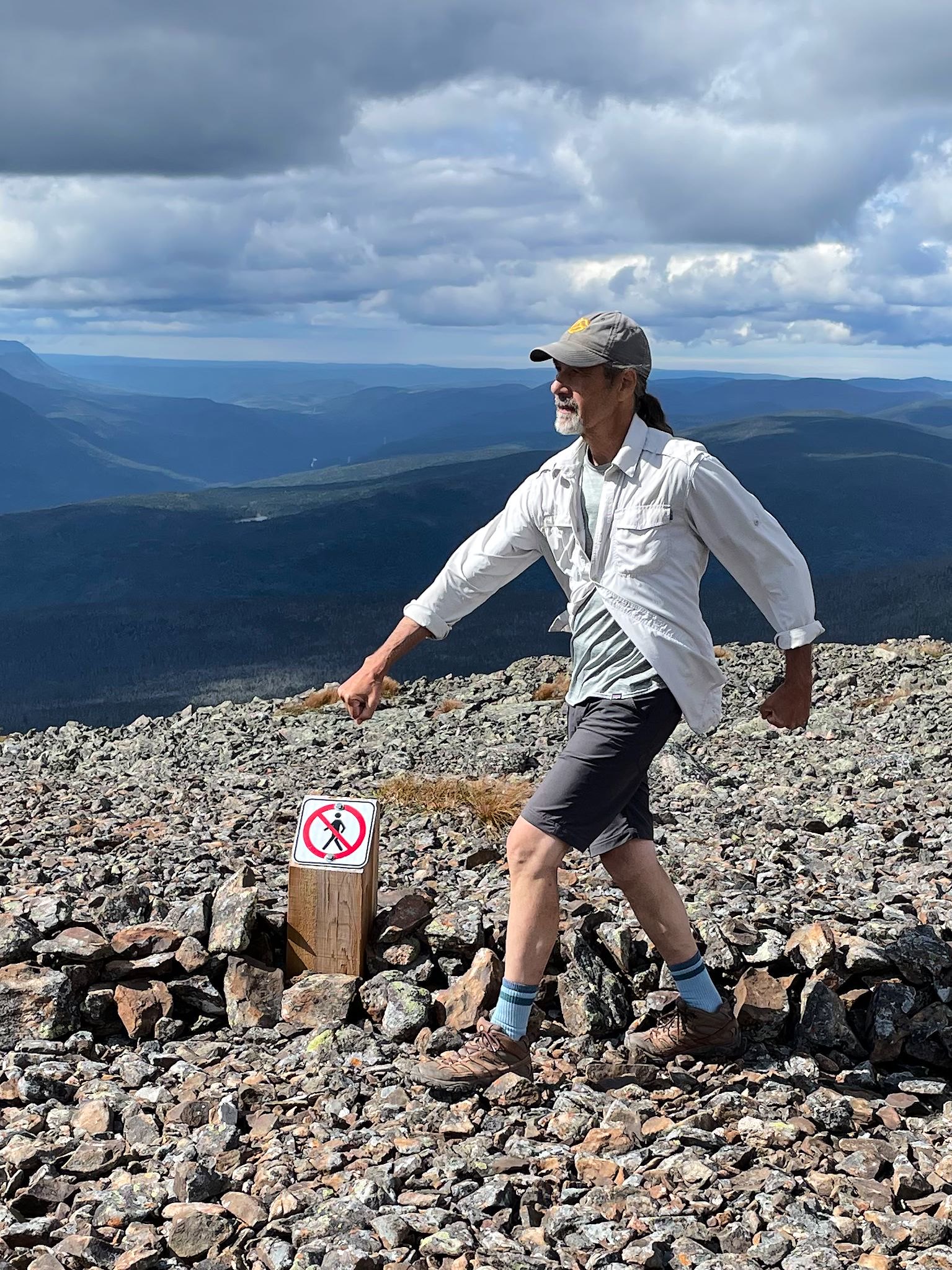
National parks manage access into protected areas as part of their mission. Gaspesie brings managing access to a whole new level, particularly with respect for the endangered caribou. There’s a caribou herd that is resident on Mont Jacques Cartier. The hiking trail and parts of the mountain are open for limited hours of the day to provide privacy and quiet time for the caribou to move about their preferred feeding grounds. Caribou behavior is predictable and the interpretive signs and staff let hikers know where and when to best get views of the caribou. One ranger stationed at the tower had an almost Hubble-sized telescope and was pointing out the herd to anyone interested, and letting us know where to go for best viewing. From a distance. On the trail.
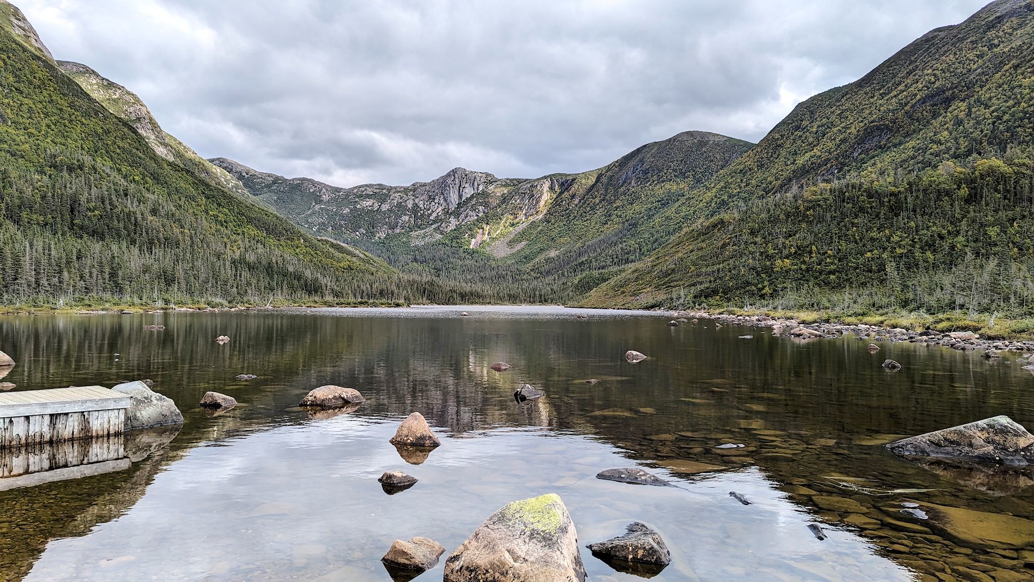


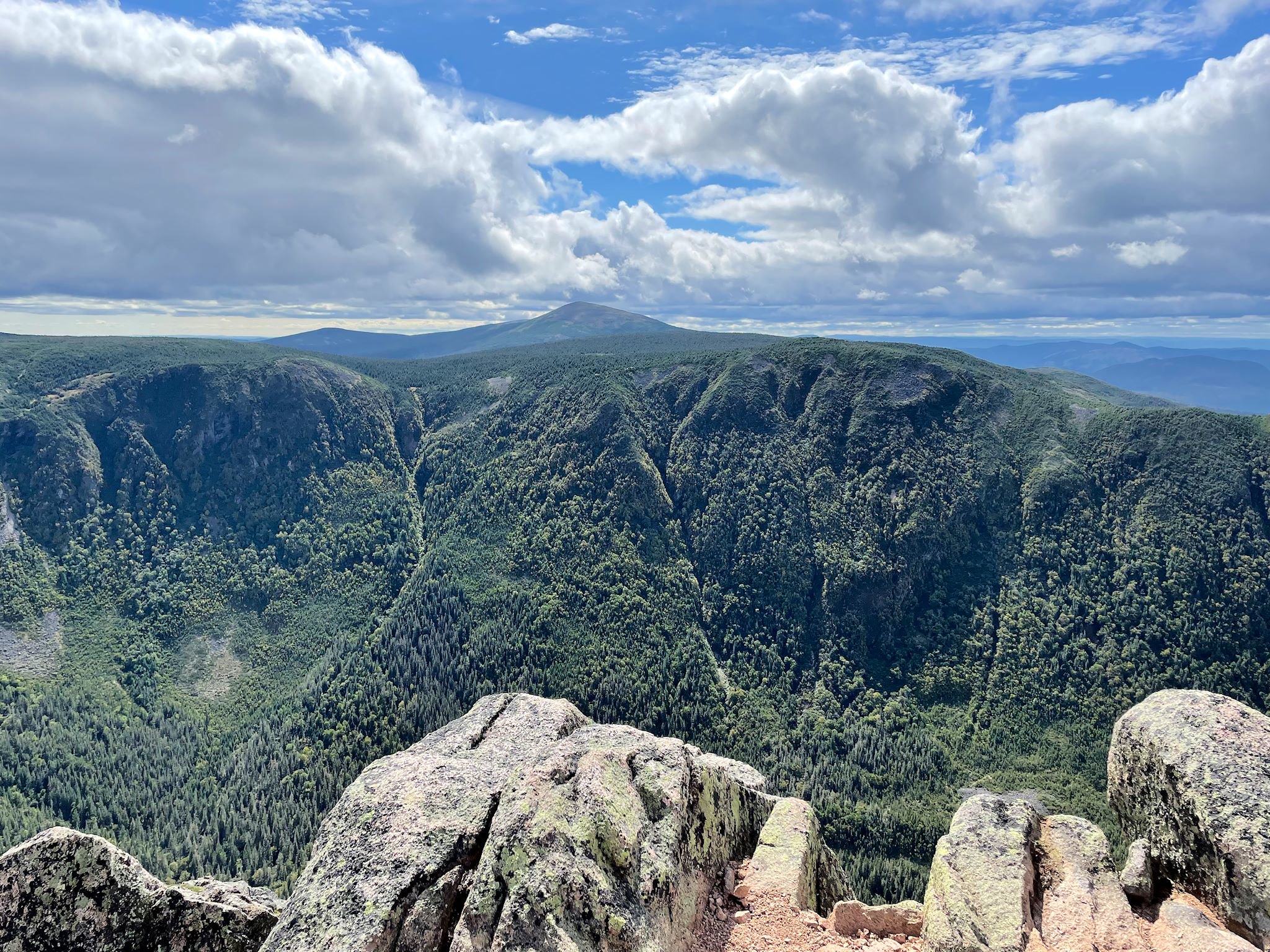

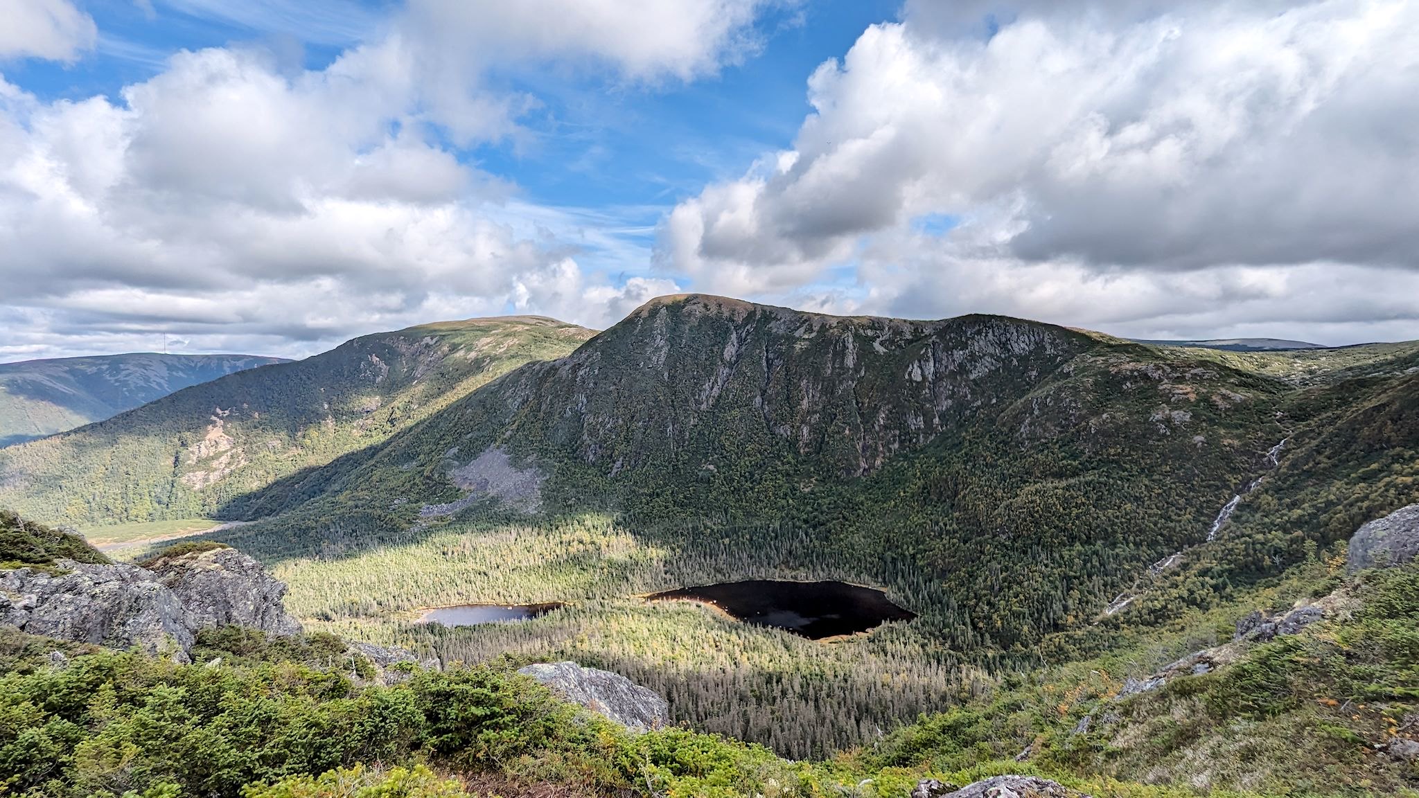
Next up was Xalibu. This is where the Doug Shick Shock really hit us hit us. The trail started with a relatively flat gravel path to Lac aux Americains/Lake of the Americans, named after scientists from the US who camped here while doing botanical research in 1906. Less than 1 km/half a mile into the hike, we were gawking at a glacial cirque with a lake at the base of nearly 300 m/1000 foot cliffs. Wow! About a km/half a mile later, we’d climbed along the shoulder of the mountain to a lookout point where we could see Mont Albert, the signature mountain in the park with a deep basin carved into its side. More wow. Still climbing along the shoulder, we broke through the forest onto a wide open cliffside view of Mont Xalibu, a nearly 250 m/900 foot waterfall, Mont de la Table/Tabletop Mountain and its cliffs dropping into another glacial lake. Squeal!
We hiked more above treeline to a side trail that took us to an overlook, which of course we had to check out. It looked like an infinity edge as we approached. When we finally peeked over the edge, there it was – Lake of the Americans! We were peering over the side of the cirque, the lake directly below us and the cliffs at eye level across the gap. This called for at least 104 photos and a leisurely lunch. Back on the main trail, we summited Xalibu where a dozen others were taking in the views of most of the McGerrigle Mountains from an array of little rock wall wind blocks built into the rocky (and windy) summit for shelter. From the summit of Xalibu, we could pick out Mont Jacques Cartier as well at Mont Albert, and everything in between. Back at the info center near camp, we were able to find out what Xalibu mountain was named after – it’s the Mi’gmac name for Caribou.
(To that sailboat couple from Virginia and New Hampshire whom we met on the Mont Alban trail in Forillon National Park in the dense, dense fog: if you happen upon our blog, thanks so much for recommending the Mount Xalibu hike!)
As always we took advantage of a couple of rain days and caught up with chores, reading and some music.

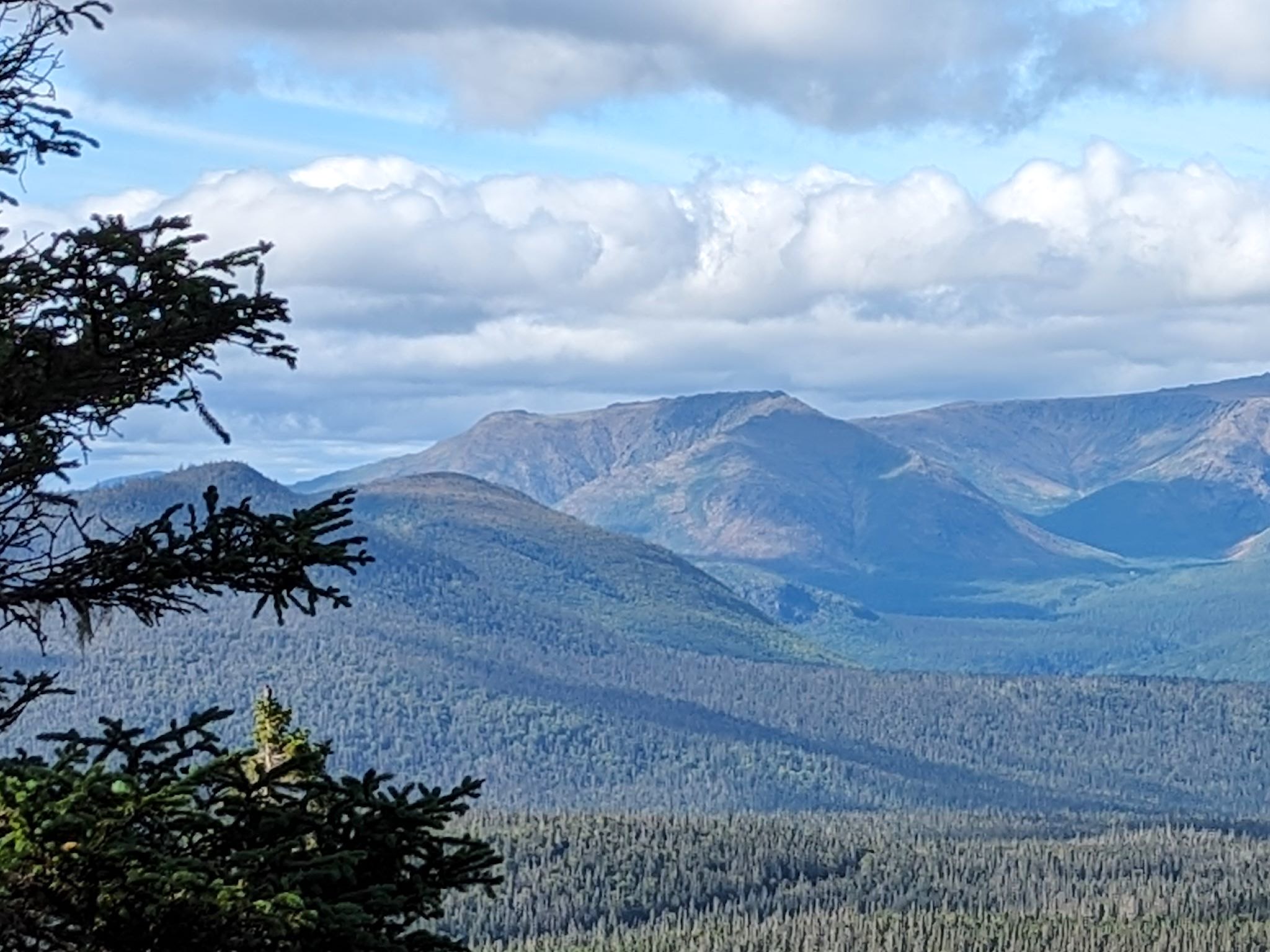
From the Xalibu hike, we saw that Mont Albert had a flat, C-shaped summit wrapping around a basin like a shawl. From the map, we could see that there were several basins and the Ruisseau du Diable/Devil Creek ran through it.
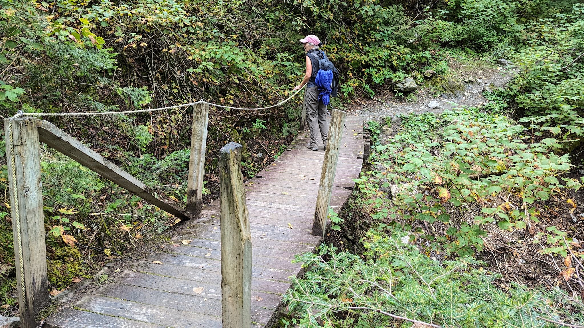
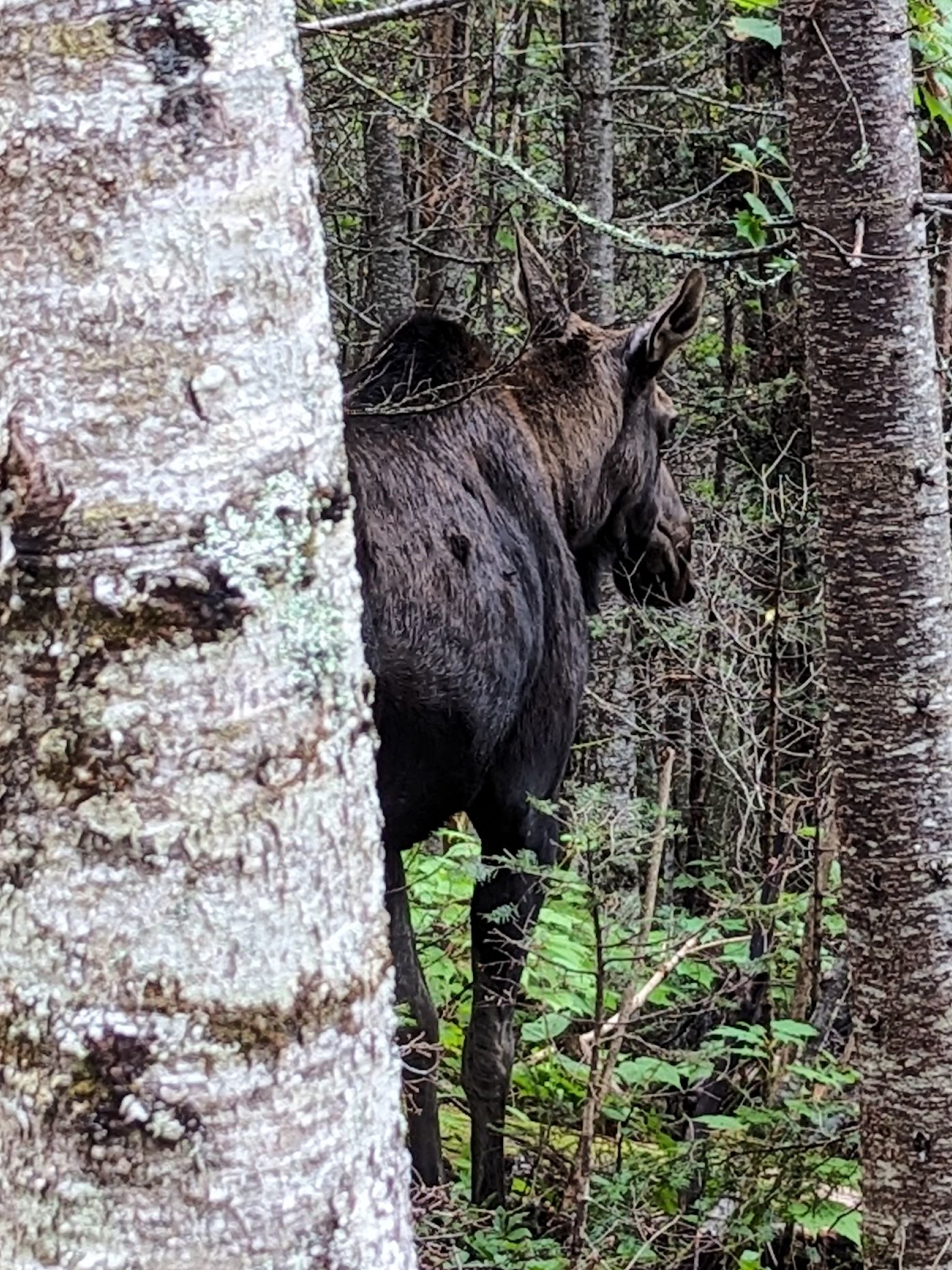
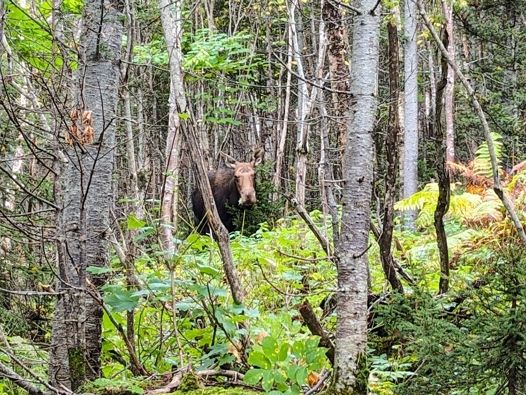
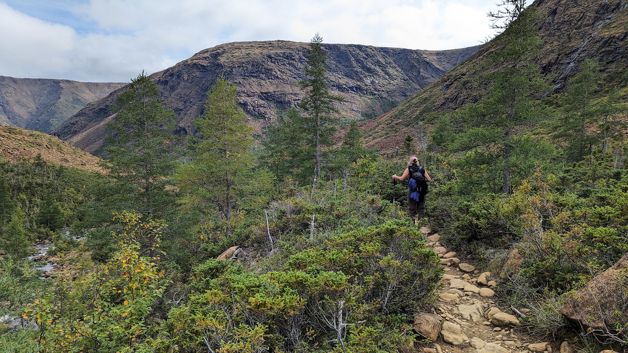
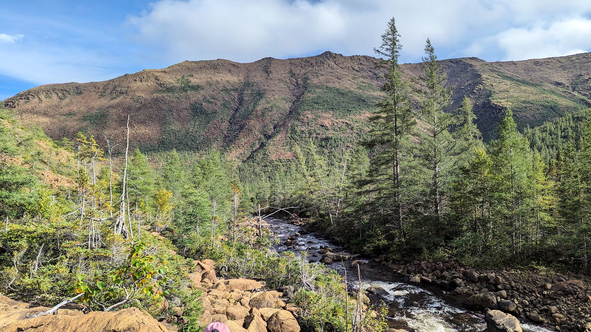
We could reach the trail from our campground, crossing the main road through the park and then a footbridge across the Saint Anne River. After, oh, maybe 17 steps along the river, the trail took a sharp left and then rose, moderately and consistently, for about 6 km/4 miles. At one point, we saw several people stopped in the trail, whispering and waving excitedly. Turns out it was a moose jam! Yup, a giant creature eating leaves from the middle of the trail. Another was a bit more secluded in the trees watching us carefully. Given their size and known skittishness, all we could do was wait until they were done. And take some photos.
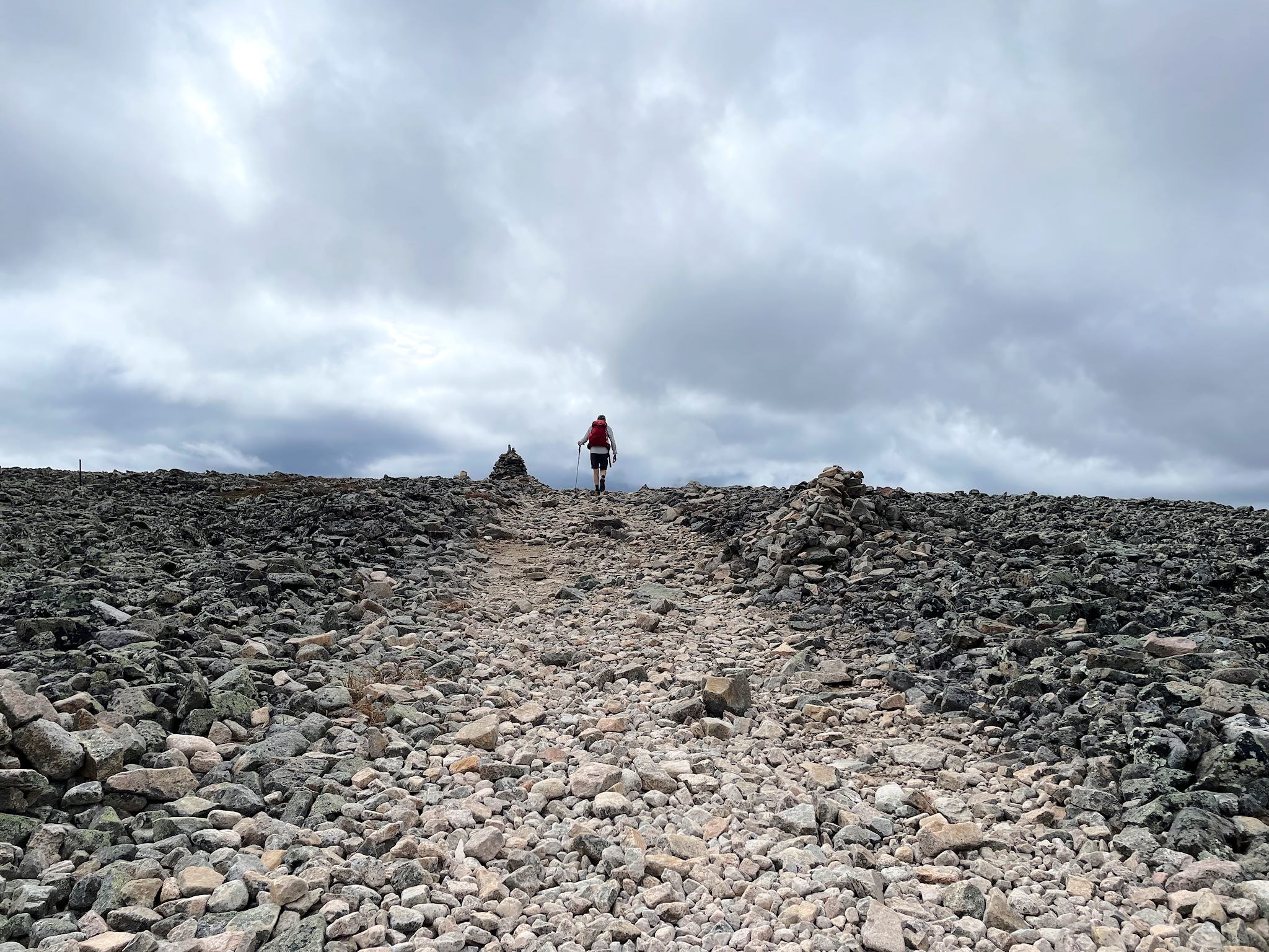
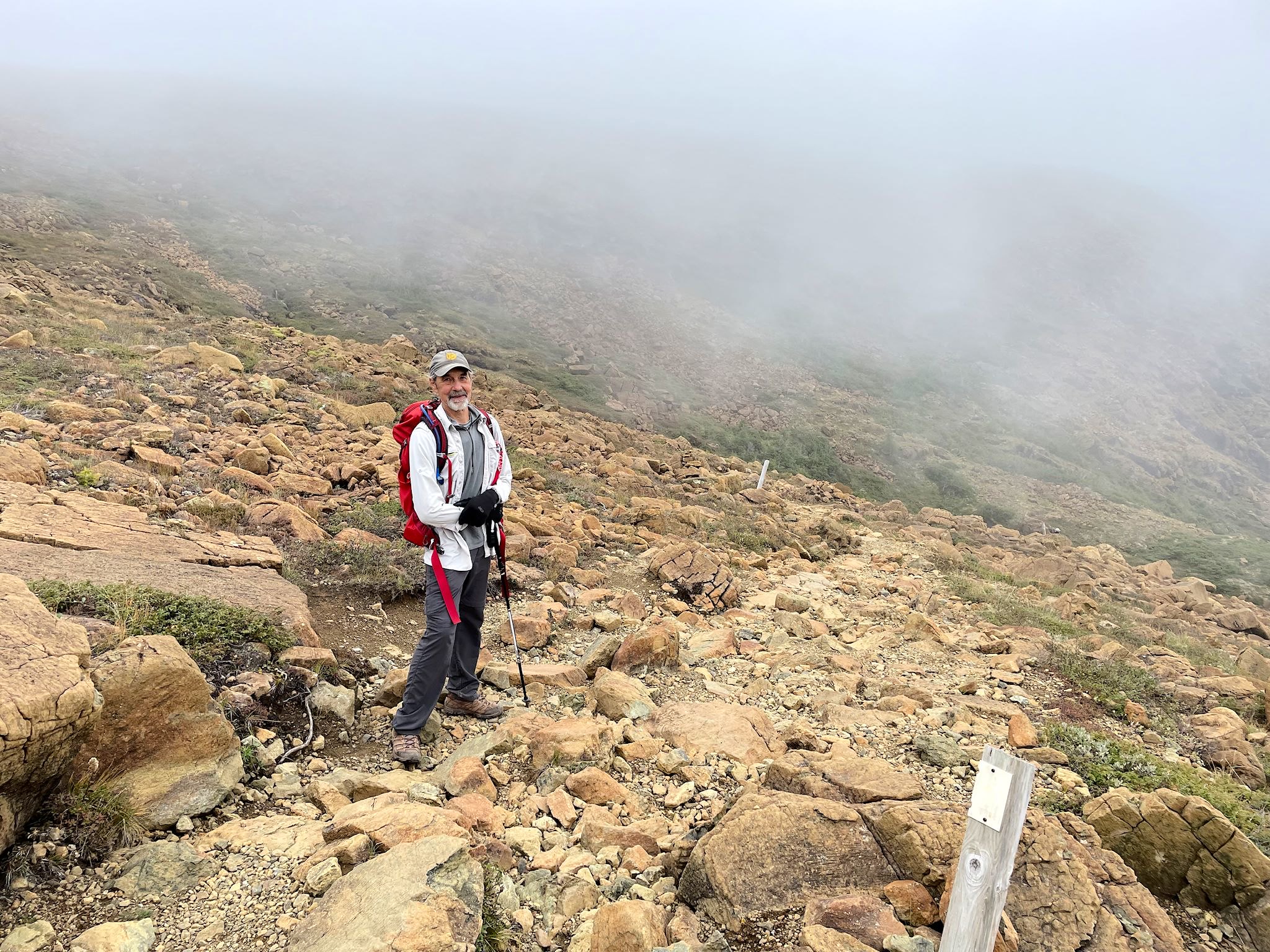
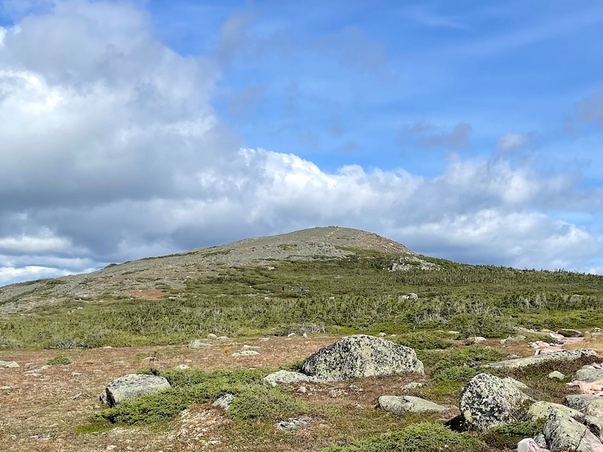
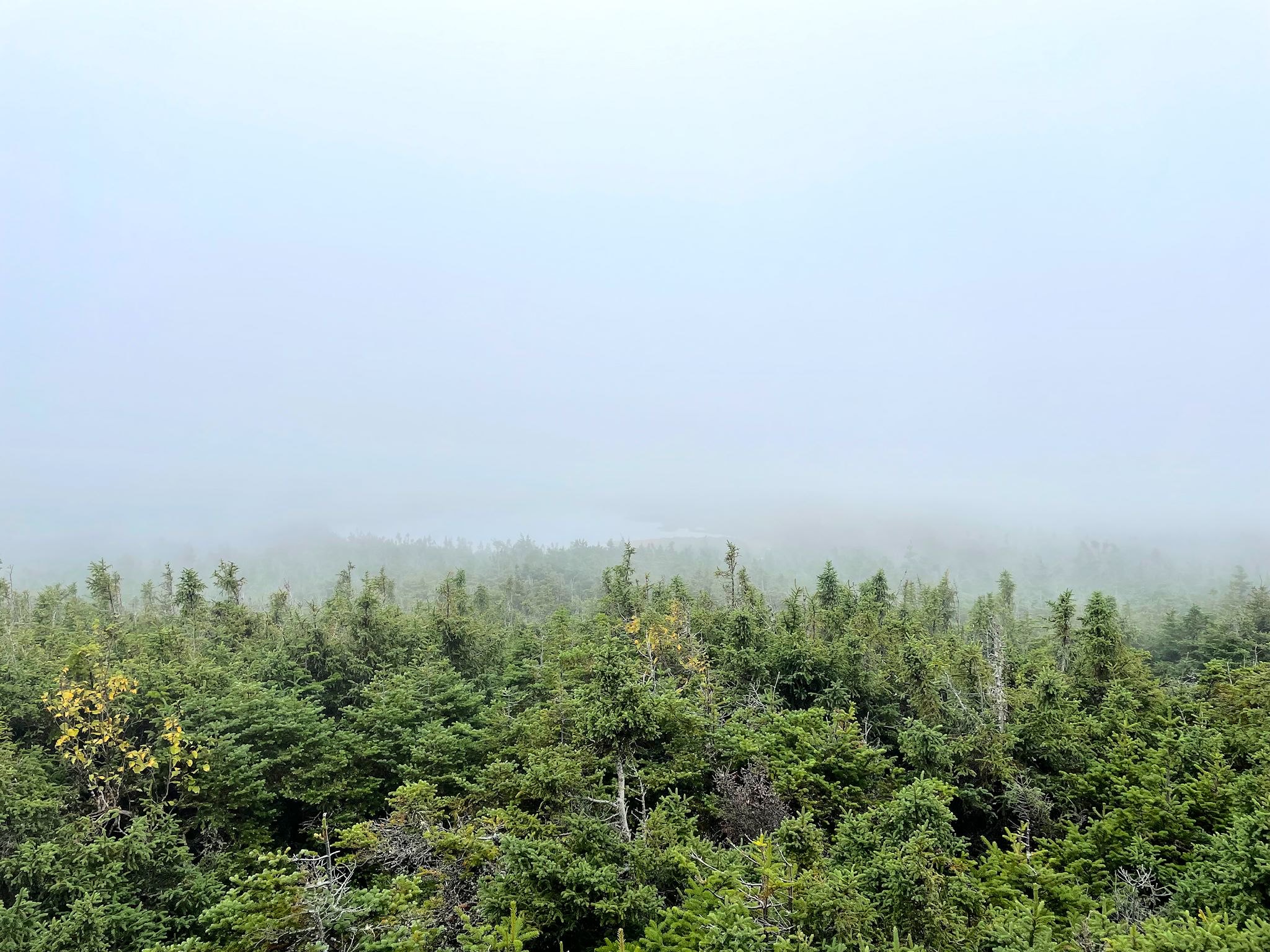
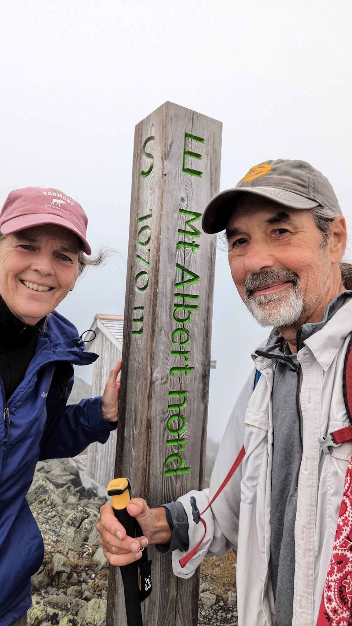
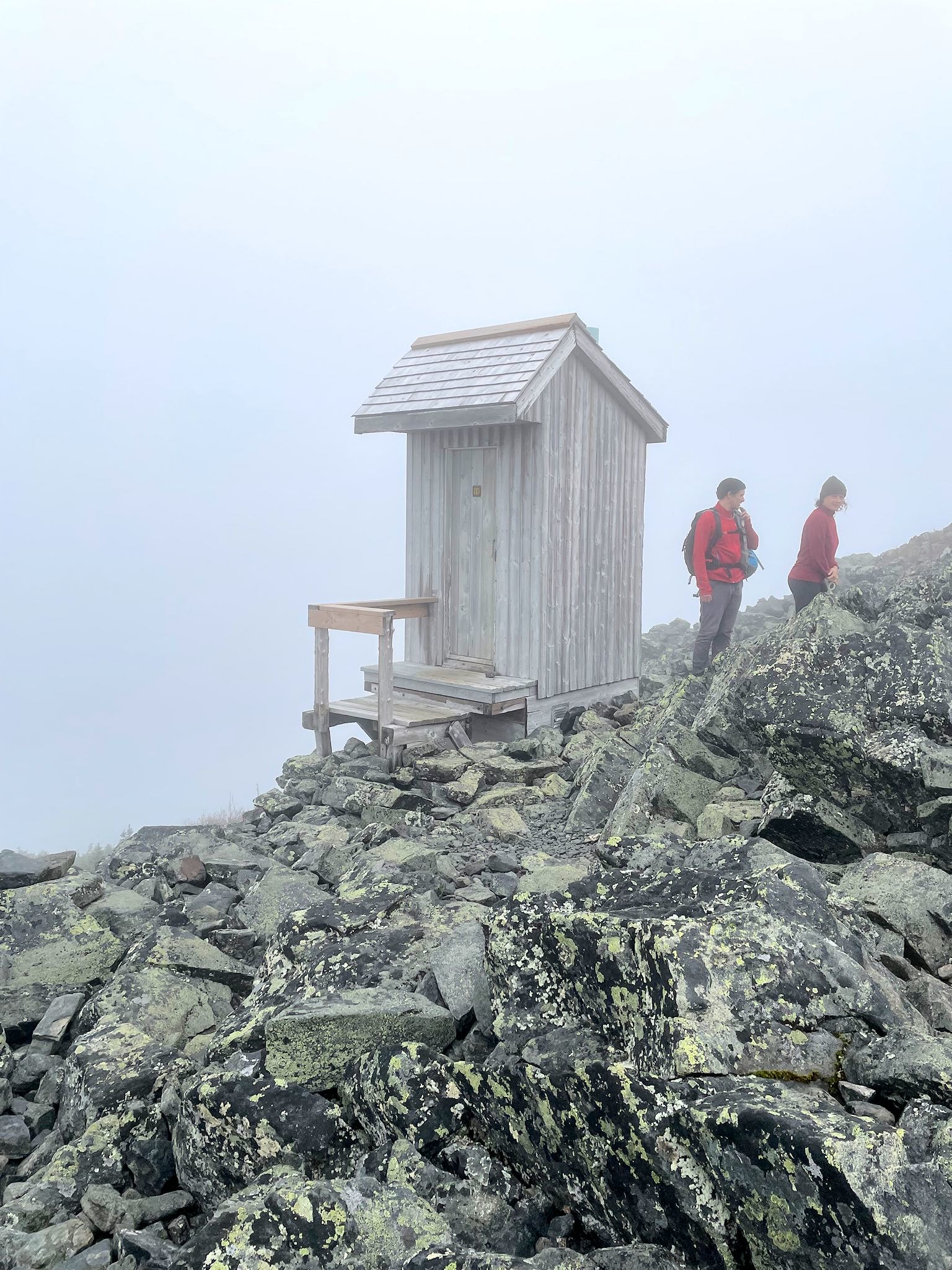
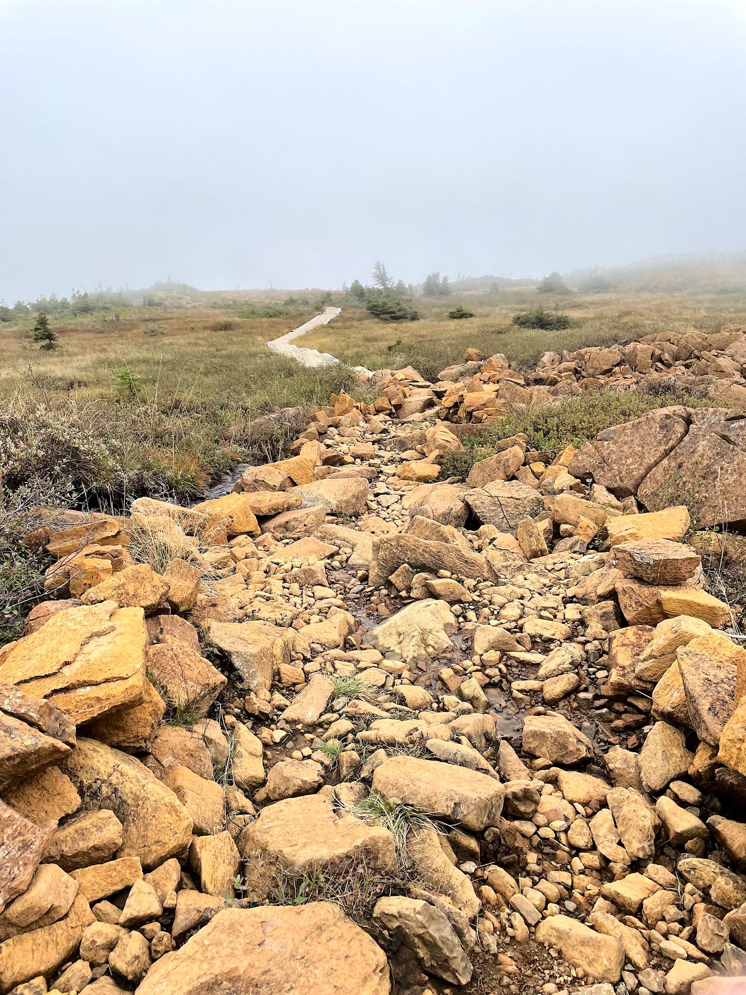
The grade then became a bit more steep and trail a bit more rocky. And the rocks were orange! (Kinda like those in Gros Morne…) And, we could now see a bit of fog hovering just above us on the trail… We soon reached the summit of the North Peak of Mont Albert in a dense fog and a brisk wind. Above the sign naming all of the prominent peaks that could theoretically be seen in the distance was a wall of white. SIGH. It was still a thrill to be on this summit, along with about a dozen others who love the mountains.
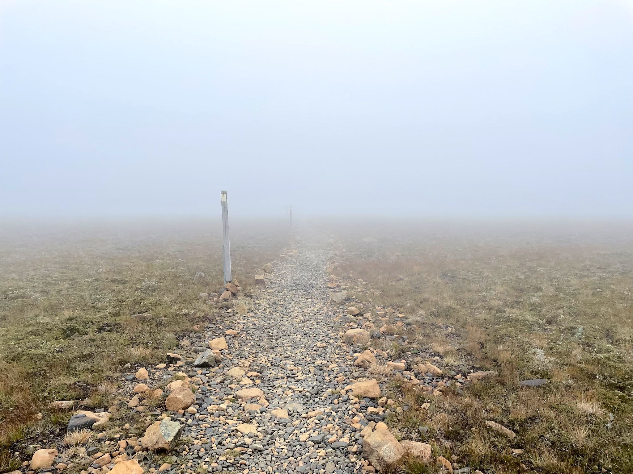
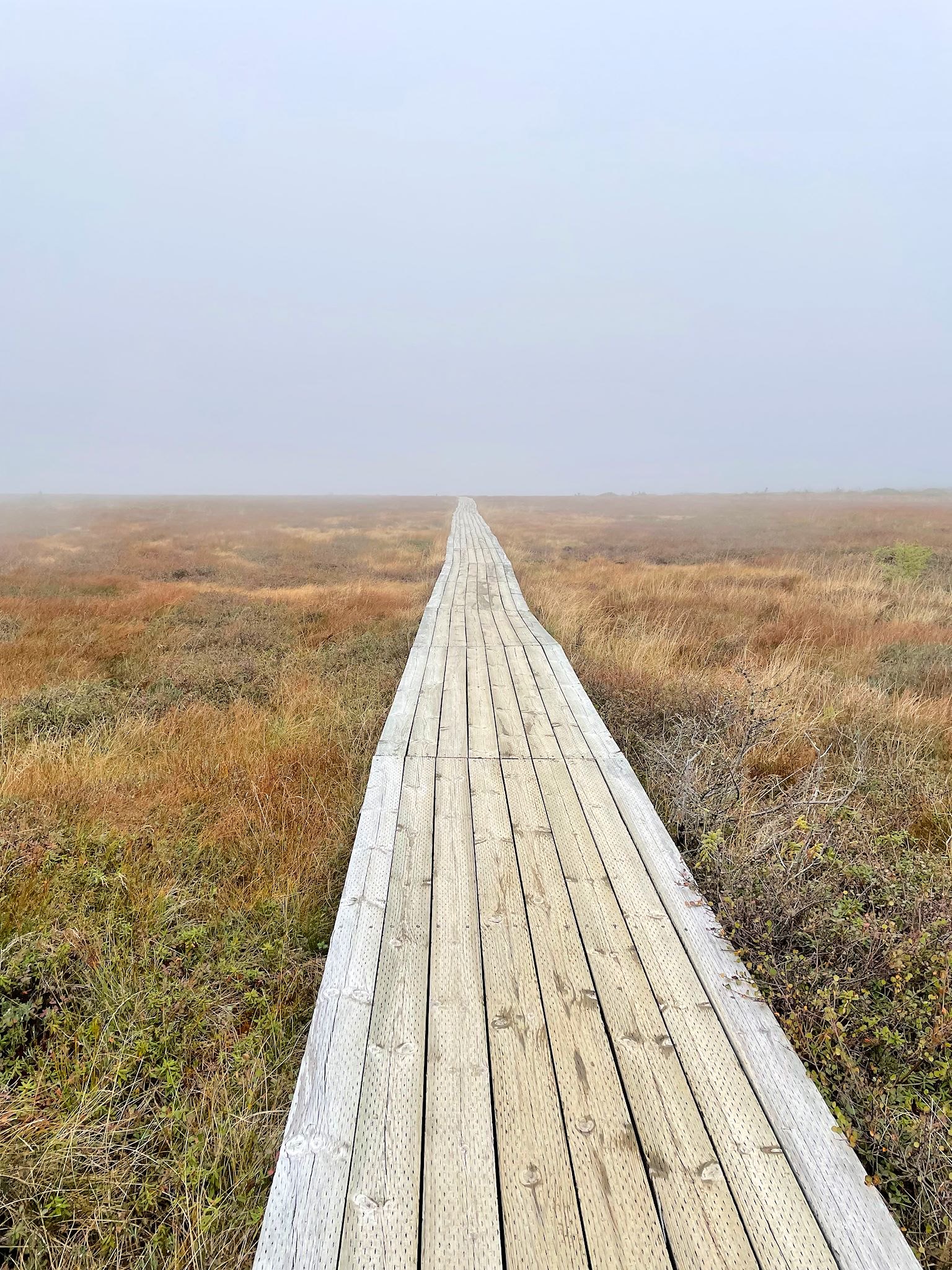


There were two ways down: the short way, back down the way we came, or the long way, about twice as far, as well as rockier and more open than the way up. We opted for the scenic descent. Leaving the summit, we followed a series of fog reflectors (ok, so this weather is not that unusual) over boardwalks and rock bridges that would have seemed otherworldly even without the fog across the mostly flat top of the mountain. We were surrounded by orange rocks of all shapes and sizes interrupted by sparse, stunted greenery. At a lookout platform, we could make out the basin below us through the haze, realizing we’d soon break through the fog on the way down. Yay!
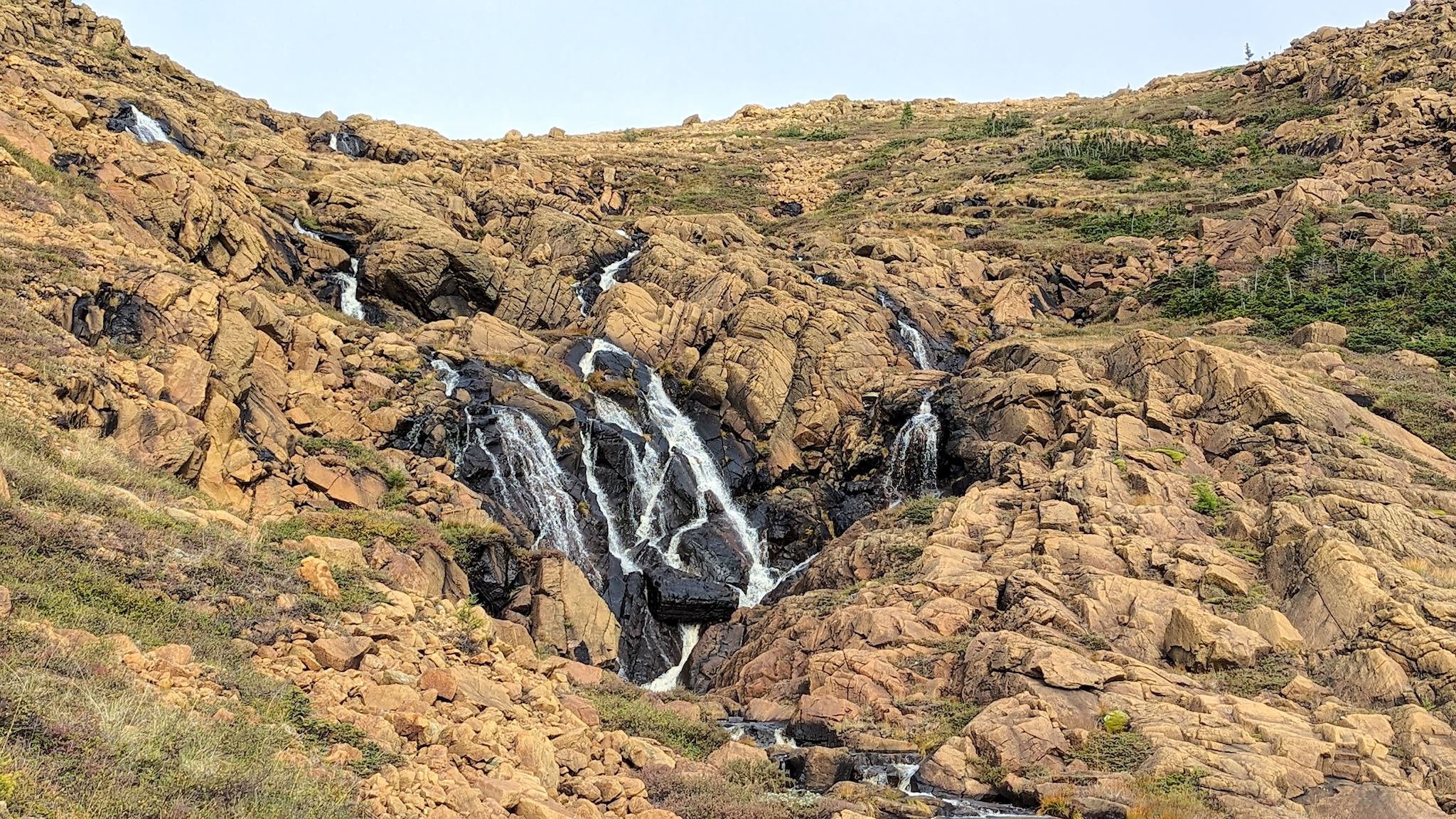
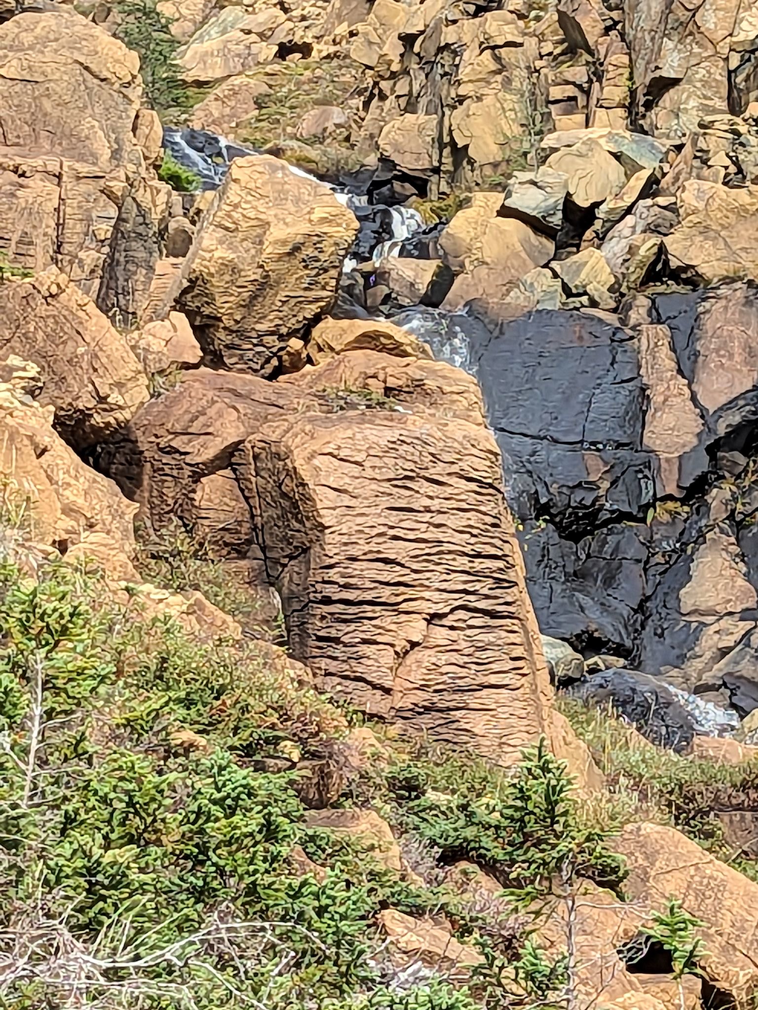
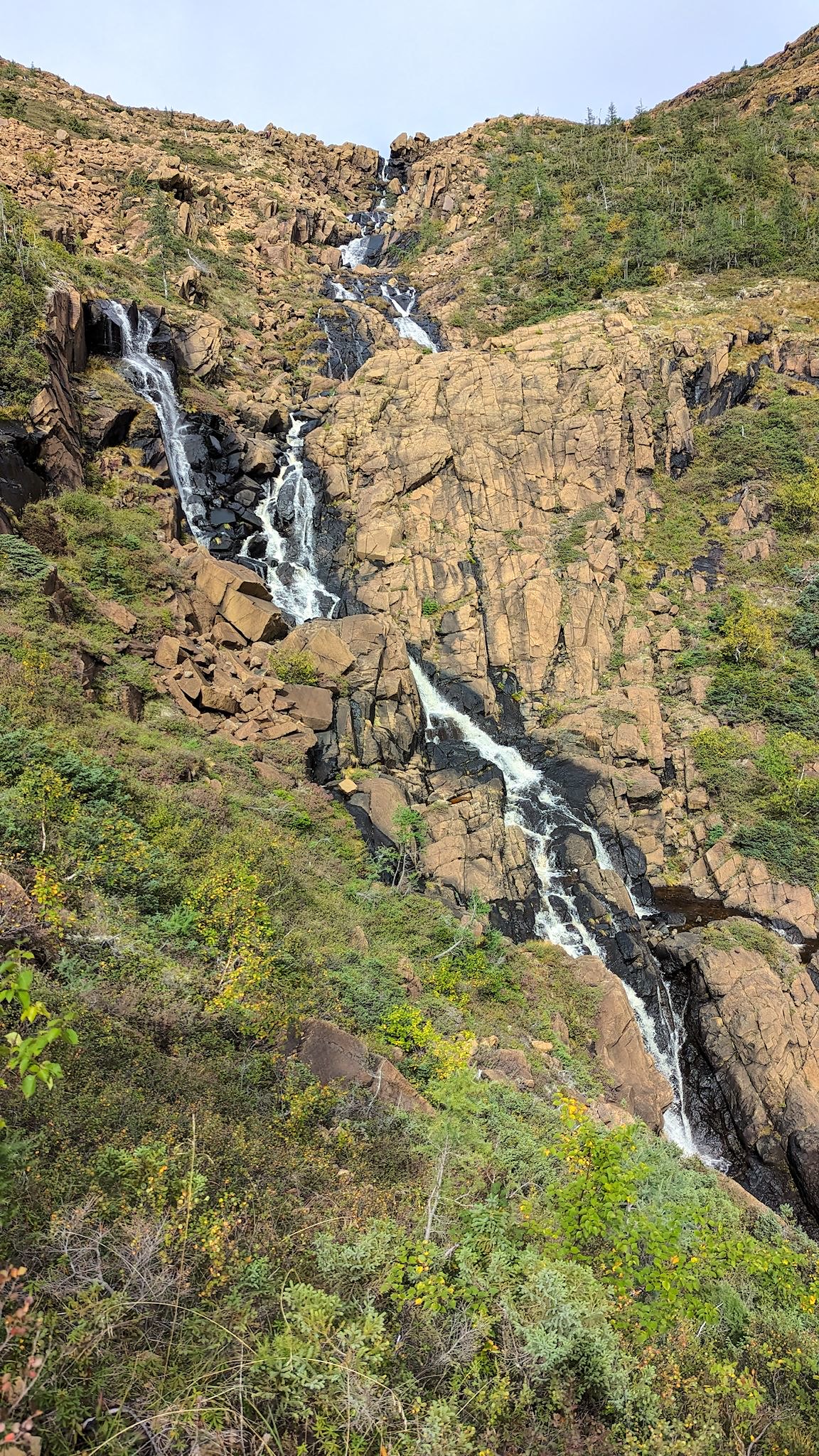
Devil Creek starts with a hundred of so tiny channels of water from the flat summit and braids them into a beautifully complex waterfall over the headwall portion of the basin. We followed the trail alongside these braids until we reached the floor of the basin. We were surrounded, wrapped by the shawl-shaped rim of Mont Albert. Everywhere we looked was a tall ridge with cliffs and hundreds of little waterfalls heading for the basin. And blue sky. It was a magical moment. Doug Shick Shock.
When surrounded by mountains, there’s generally only one way out – follow the water. The remainder of the hike was a slow and steady descent alongside what was now a raging river – made even slower and steadier by the views and gawking and photos and lotsa orange rocks. We arrived back at camp totally thrilled with our day’s adventure.
We also realized this would likely be our last hike of the trip. We were grateful to have spend this quality time in Gaspesie National Park, in the mountains that we love so much.
For anyone who’s interested, more Mont Jacques Cartier, Xalibu and Mont Albert pix…
Now you need to go back to ski them!!!
Yes, that is an exciting idea for the next step – you in?
Wow! Gorgeous! I just put those hikes on our list.
Yes, Kim! Put them on your list. We spent a week at Gaspesie. Easily coulda spent two…
Looks like a beautiful place to hike in spite of the fog. And the orange rocks do indeed look like the mantle at Gros Morne.
Hi Linda! I suspect you and Mark would really enjoyed Gaspesie National Park. We’ve heard it’s cloudy much of the time, however, the great hiking and variety of views make it a special place.