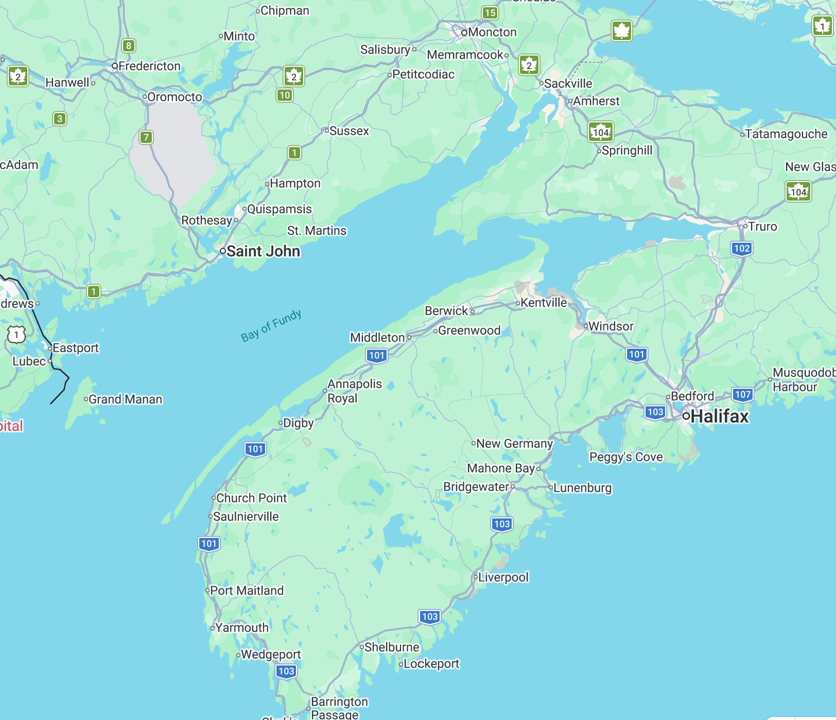
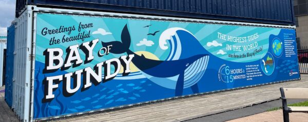
We noticed a large clump of e-pushpins surrounding the easternmost portion of the Bay of Fundy. Ha! We noticed two themes… about half of the places are related to the Bay of Fundy’s extraordinary tides, and the other half deal with the significant history of Acadians before and after Le Grand Dérangement/ Deportation of 1755. I think we can visit them all! Shall we? Allons-y!
I’ve always had a fascination with travel and for the past 20 or 30 years (give or take a few) whenever Doug or I learned of an interesting place to visit we put a pushpin on an electronic map. (It actually started with a little silver bucket with small pieces of paper and a pen on the bookshelf in our living room – our ‘Bucket List’ bucket – evolving from bookshelf to computer to The Cloud, but the concept still holds.) (We also keep track of the source of each so that friends who made the recommendations receive proper attribution.) Anyhow, as we got close to retiring those e-pushpins were nearly out of control. We’ve now spent a good part of the last 12 years reining things in, tracking and checking off the locations, marking some for a possible revisit, thanking the folks who sent us somewhere, and learning effective strategies to navigate our pushpin map.
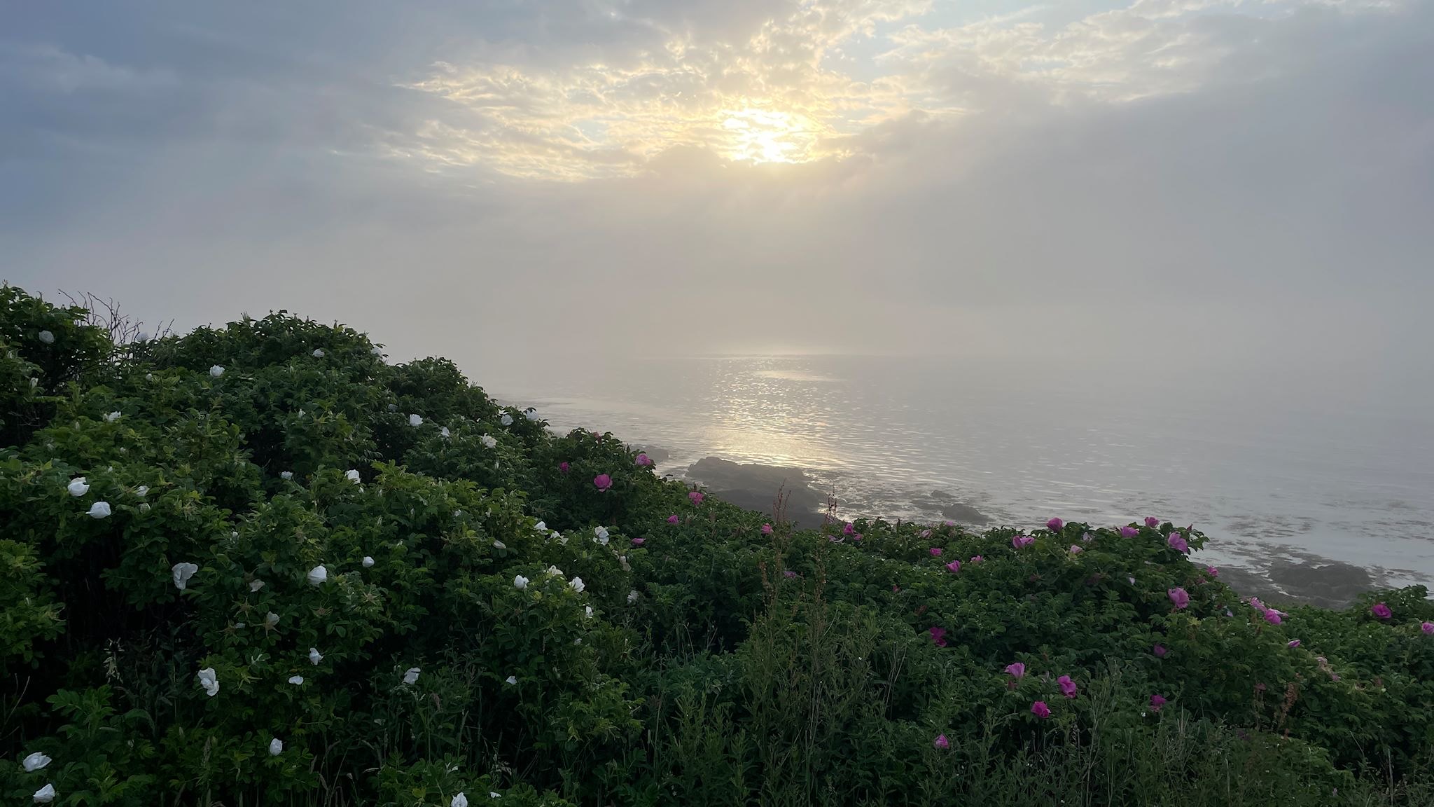
Saint John, NB (not to be confused with Saint John’s, NL), is the oldest incorporated city in Canada, and the 2nd largest city in New Brunswick. Its location where the Saint John River meets the Bay of Fundy made it the perfect spot for heavy industry and shipping. The city now boasts of reinventing itself as it modernizes and expands into more high-tech industry, tourism (it’s now a major stop for cruises on the east coast) and the arts.
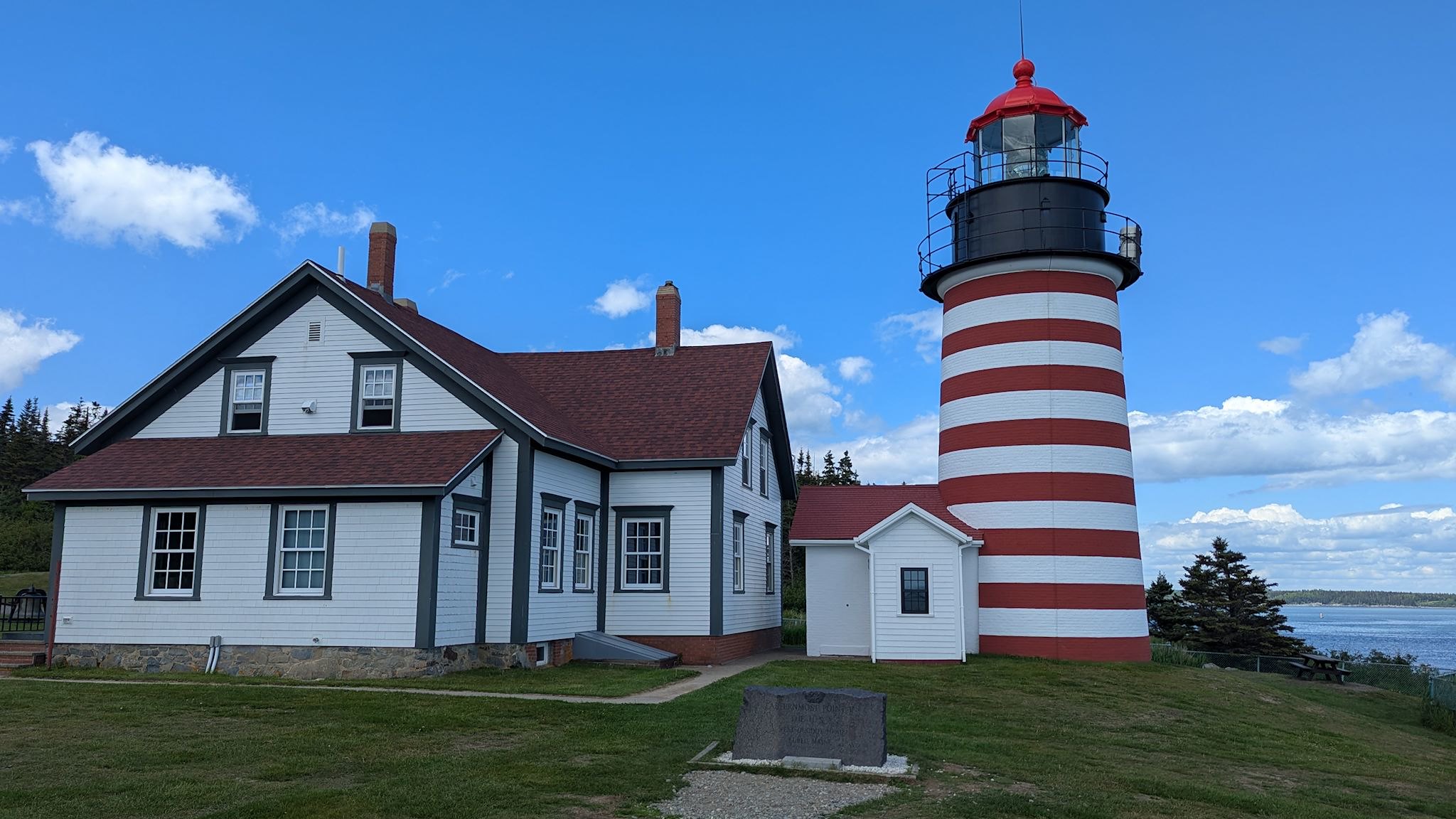
There are several places we could have chosen to cross into Canada from Maine. As superlatives nerds, we chose Lubec, ME because it’s the easternmost town in the continental US. OK, it’s also a cute little coastal city with shops, restaurants and a great hardware store. Also the easternmost campground, Sunset Point RV Park, which happens to be a great place to spend a couple days of R&R after the reunion festivities. Just outside of town is the West Quoddy Lighthouse, the easternmost point in the continental US.
We really wanted to visit Joshua Tree National Park as we head east. We didn’t know what to expect with the government shut down, and in this case we were pleasantly surprised. With the help of many volunteers and paid staff from the Joshua Tree National Park Association, a non-profit partner that provides support to JTNP to meet all of its goals, and a skeleton crew of National Park Service staff, the entire park was open and almost fully operational. We made sure to thank all of the volunteers and staff for their time and effort so that we could visit this wonderful place. Several thanked us back for having come despite the shutdown.
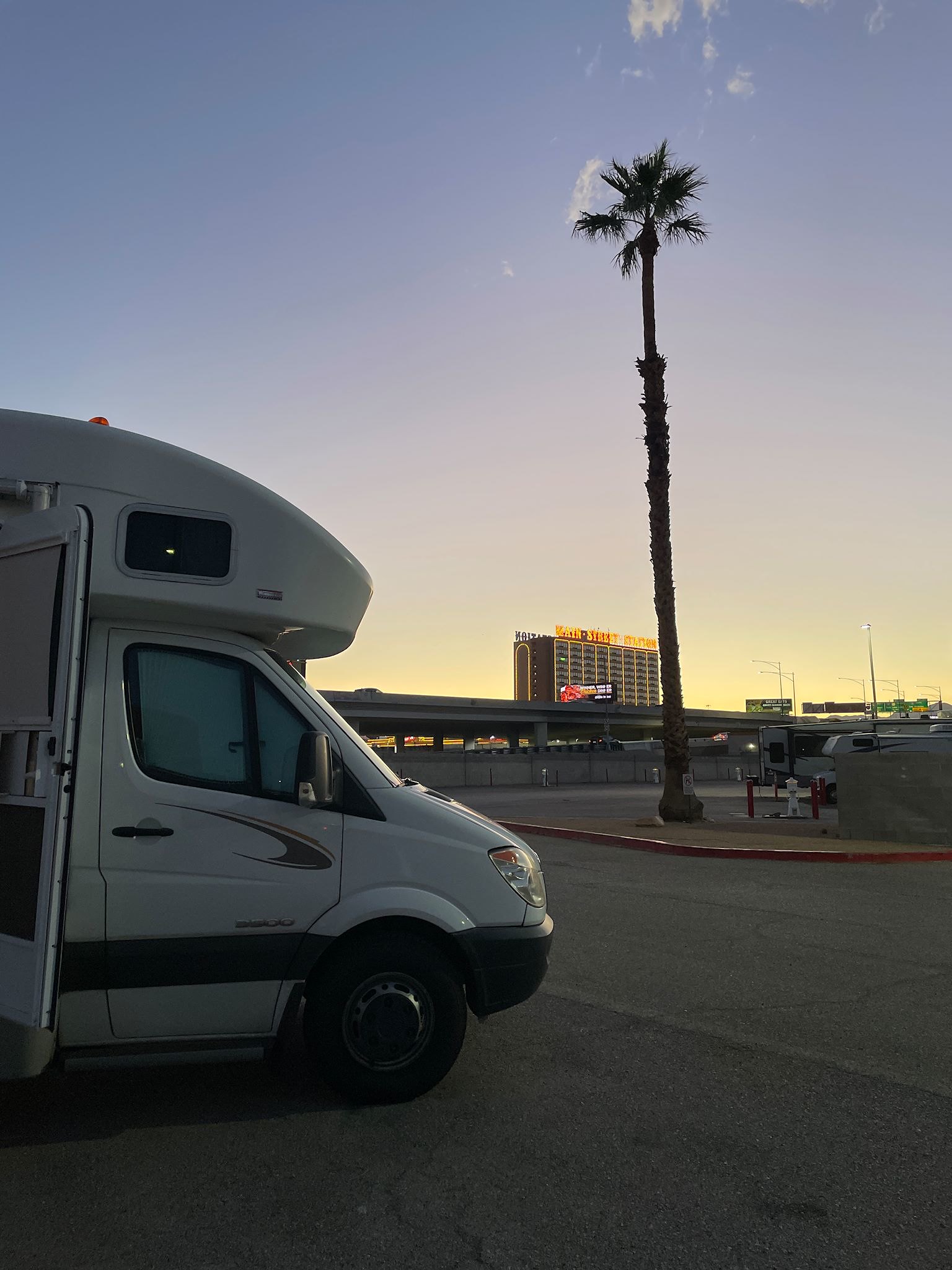
Much of our past travels have involved going places on back roads, avoiding highways and interstates. We just like poking around different places. However, there are occasions when we just need a repositioning – to get ourselves somewhere to then do some major poking around. Like, if we wanted to visit Alaska using only back roads then by the time we got there we’d have no time left to do much before we had to turn around and head back home. We were in a similar situation with Southern California. So we’re visiting friends and making stops along the way as always, however we’ve been jumping on the Interstates in between.
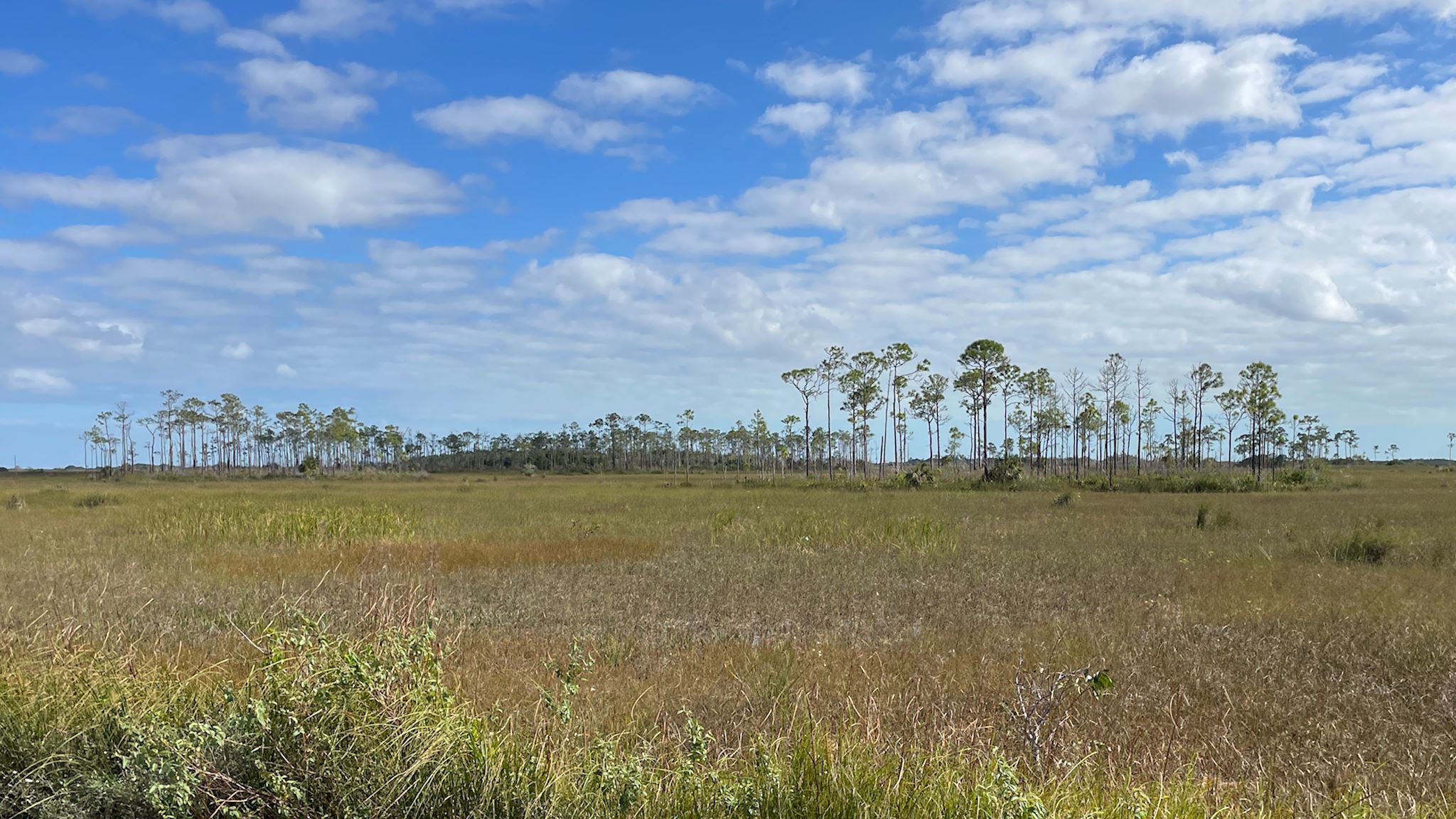
Slash pine ridges along the saw grass prairie of the Shark River Slough
Although we were glad to help my mom through her first-ever experience with surgery (at age 91!), we had to defer the latter 2/3rds of our planned southwest adventure. By the time my mom was stable (which happened very quickly, given the possibilities), there was no longer enough time to get back to any of those southwest plans. But we didn’t really need to rush home. Could we find a different adventure? What if we had planned a trip to the southeast… Is there something we would explore in Florida that we haven’t yet visited on our many family visits to Melbourne? This was a no-brainer – Everglades National Park!
When we moved to Connecticut in 1990, I worked on a team at The Travelers that was lead by Dwight. A firm believer in team-building, he and his wife Colleen hosted several team dinners at their home in Essex, CT, and we got to know Colleen as well. For the next few years, I thoroughly enjoyed the ground-breaking work we did in managed care. and I learned so much – about the healthcare/health insurance business, business politics, project management, people management, team-building – all skills that served me well when I later started my own business. Thank you, Dwight!
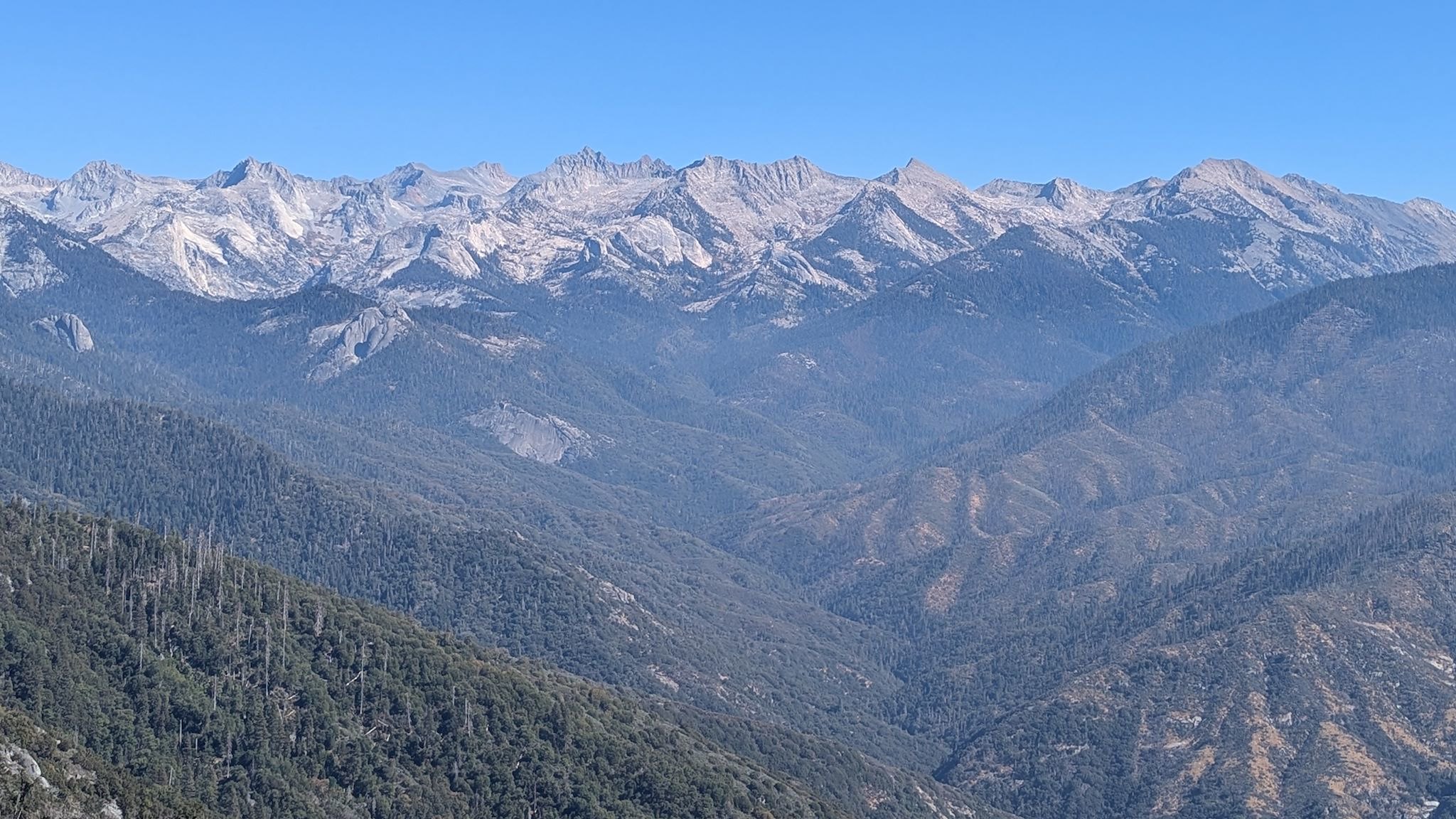
The Great Western Divide of the Sierra Nevada and headwaters of the Middle Fork of the Kaweah River
Sequoia National Park was established in 1890. This park includes Mt Whitney, the highest point in the lower 48 states at 14,505 feet above sea level, as well as 5 of the 10 largest giant sequoia trees. General Grant National Park was also established in 1890 to feature and protect giant sequoias, including the General Grant Tree. In 1940, in an effort to protect more of the unique resources of the area – the 14,000-foot peaks of the Sierra Nevada, Kings Canyon 10,000 feet below, as well as old-growth forests and other large groves of giant sequoia trees – the Kings Canyon National Park was created, incorporating General Grant National Park. Since 1943, the 2 national parks comprising nearly 1 million acres have been adminstered together as Sequoia & Kings Canyon National Parks.