

You might be thinking by now that we have a perverse infatuation with dead-end roads to out-of-the-way places. Ok, maybe we do a little – and we’ve been to some outrageously cool end-of-the-road spots – and sometimes there’s more to it than that. While at the Folk on the Rocks Festival last year in Yellowknife, we chatted with some folks living there who came originally from Inuvik. They loved the town, and they also told us that the Mackenzie Delta was the most beautiful place on earth. That was certainly enough for us to put it on our list.
So, who’s ready to hear about another 1600-km (1000-mile) road trip on a mostly great dirt road that totally rocked? It’s actually quite different from the last one. True, Alaska’s Dalton Highway – which we drove in June – and the Yukon/Northwest Territories’ Dempster Highway both provide overland access north of the Arctic Circle. They both involve about 1600 km (1000 mi) of unpaved roads through the wilderness with spectacular wildlife, and they are both the northernmost roads in their respective countries as well as the first (Dalton) and second (Dempster) northernmost roads in North America. They’re both legendary for broken windshields, flat tires and, oh, yes, you could die. Other than that, everything was different.
The Dempster Highway follows the route of an old dog sled trail to Fort McPherson, then a Hudson Bay Company trading post on the Peel River. Construction of the year-round road to connect northern communities with the rest of Canada began in 1959 in fits and starts related to potentially exciting, but ultimately disappointing, discoveries of oil. The dirt and gravel roadway was completed to the McKenzie River delta town of Inuvik in 1979, 185 km (115 mi) north of Fort McPherson. After years of petitioning the Canadian government, the Inuvik-Tuktoyaktuk Highway opened in November 2017 spanning the final 150 km (95 mi) to the Arctic Ocean, providing year-round access to goods and services and essentially opening the small town of Tuktoyaktuk for tourism in June 2018. A travel guide on the Dempster Highway starts with WELCOME! COME VISIT OUR VIBRANT REMOTE COMMUNITIES IN THE WILDERNESS UP NORTH! Only in the fine print on the back page is the stuff about dangerous roads, flat tires, and potential death. Spin at its finest!
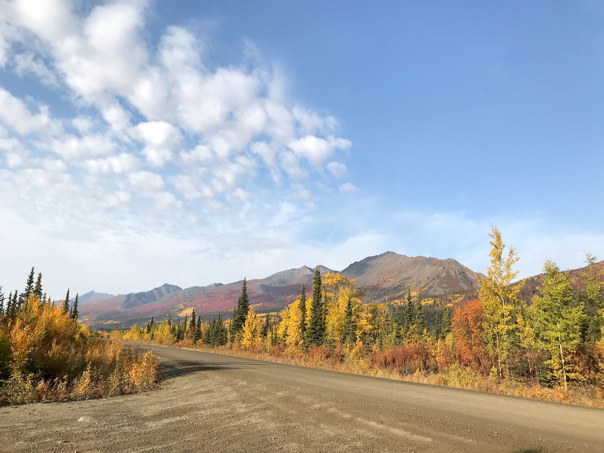
The Dempster starts just outside of Dawson City, Yukon. It quickly climbs over North Fork Pass, the highest point on the Highway, situated within Tombstone Territorial Park in the Ogilvie Mountains. On the 25 km (15 mi) drive through the park the environment transitioned from dark green boreal forest to rainbow colored arctic tundra to the dramatic tall, rugged alpine peaks of the Tombstone Range. This early in the drive, we’d learned that in this severe northern environment, small changes in latitude or altitude make a huge change in what grows, and subsequently which critters eat there and what color the area will display during the fall foliage. And we were already squealing.
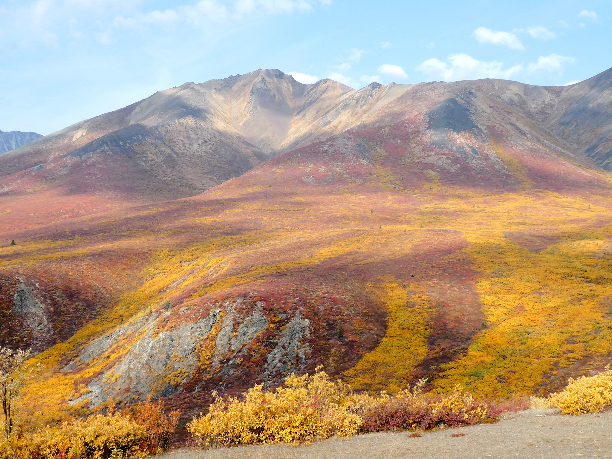
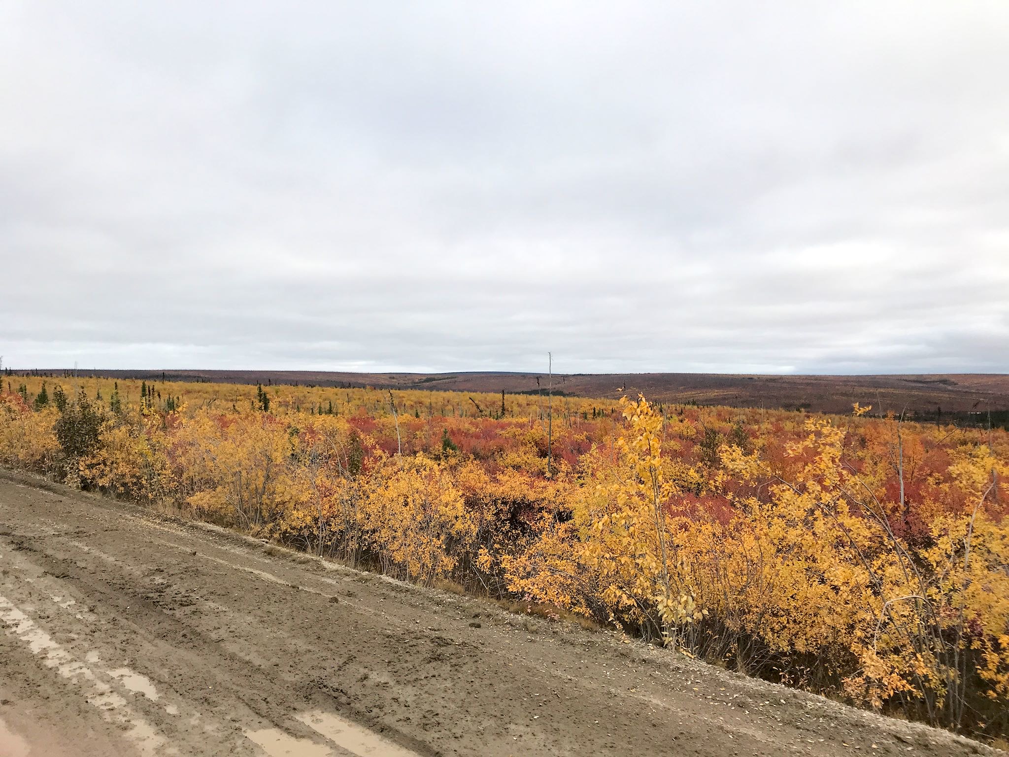
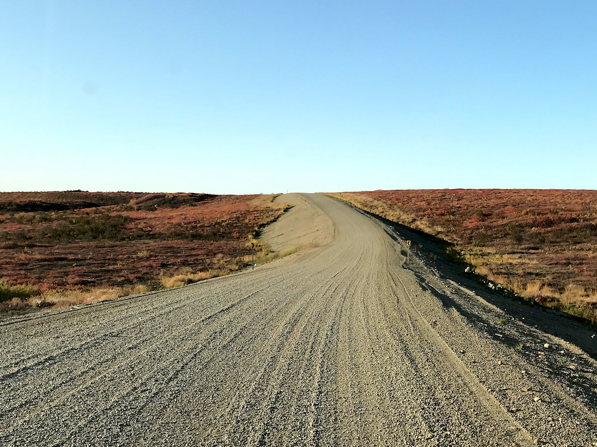
Immediately north are the North Ogilvie Mountains which bear no resemblance to any mountains we’ve seen before, including the Ogilvie range we’d just traversed, although they were closest to areas of Utah. These mountains were never sculpted by glaciers. Instead, the raised ridges were carved by water and ice, creating rock spires and cornices and long straight slopes of rubble with occasional deep V-shaped valleys. These mountains, in various shades of black and gray, support very little plant growth. Combined with the grayishness of the dirt road and cloudy skies, we felt like we were driving through a black and white photograph with splotches of yellow where willow branches or dwarf birch dared to root.
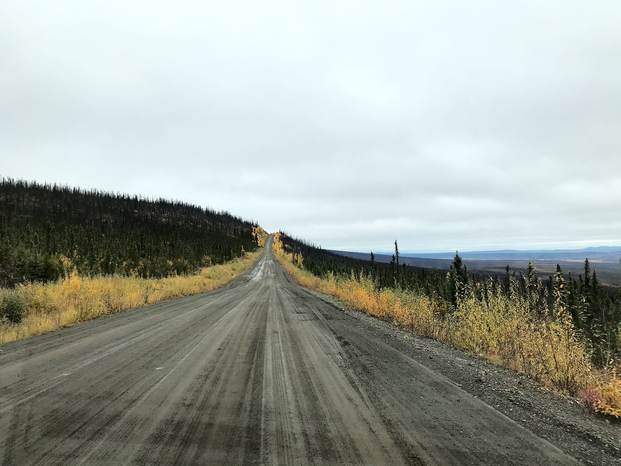
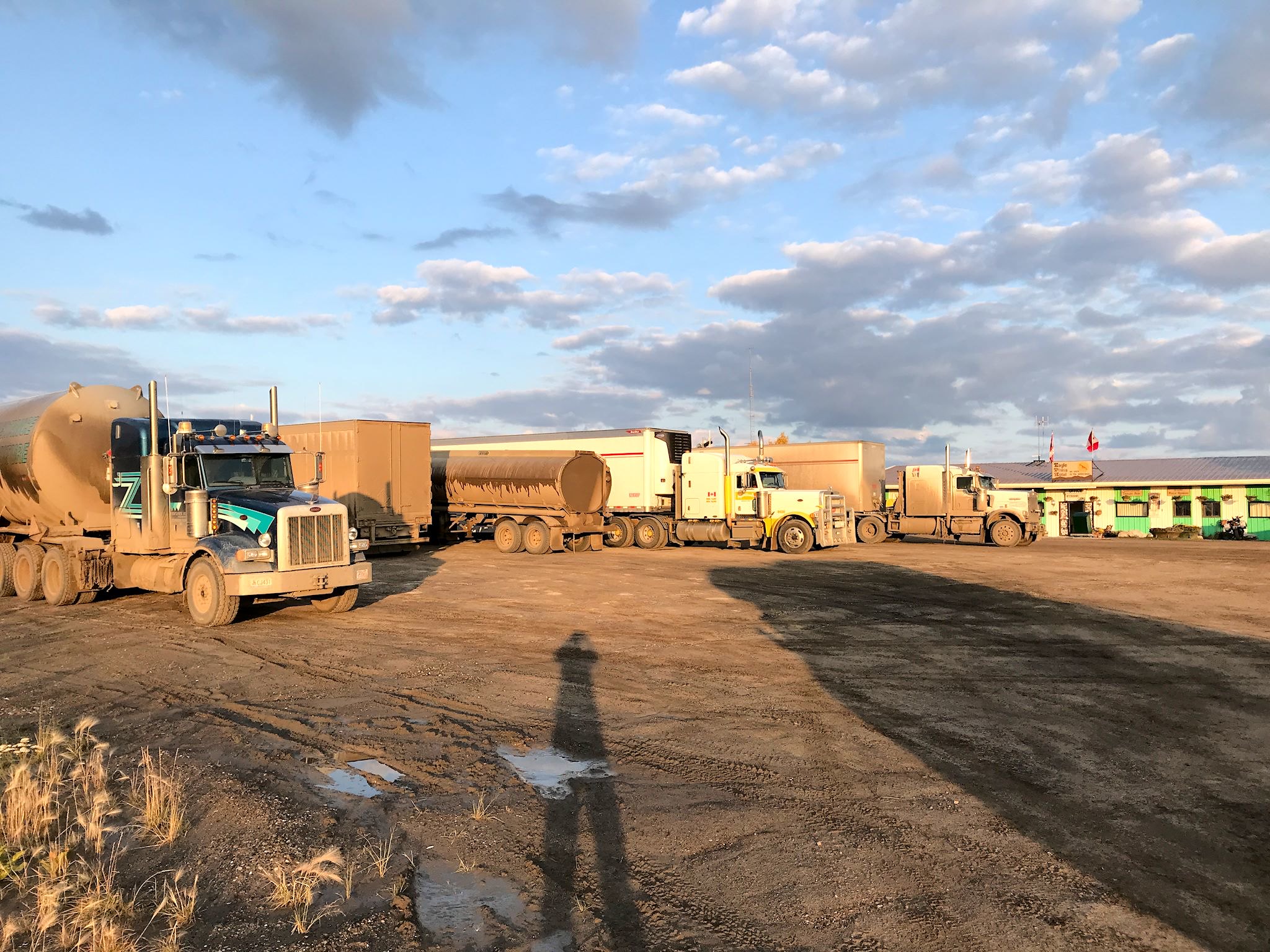
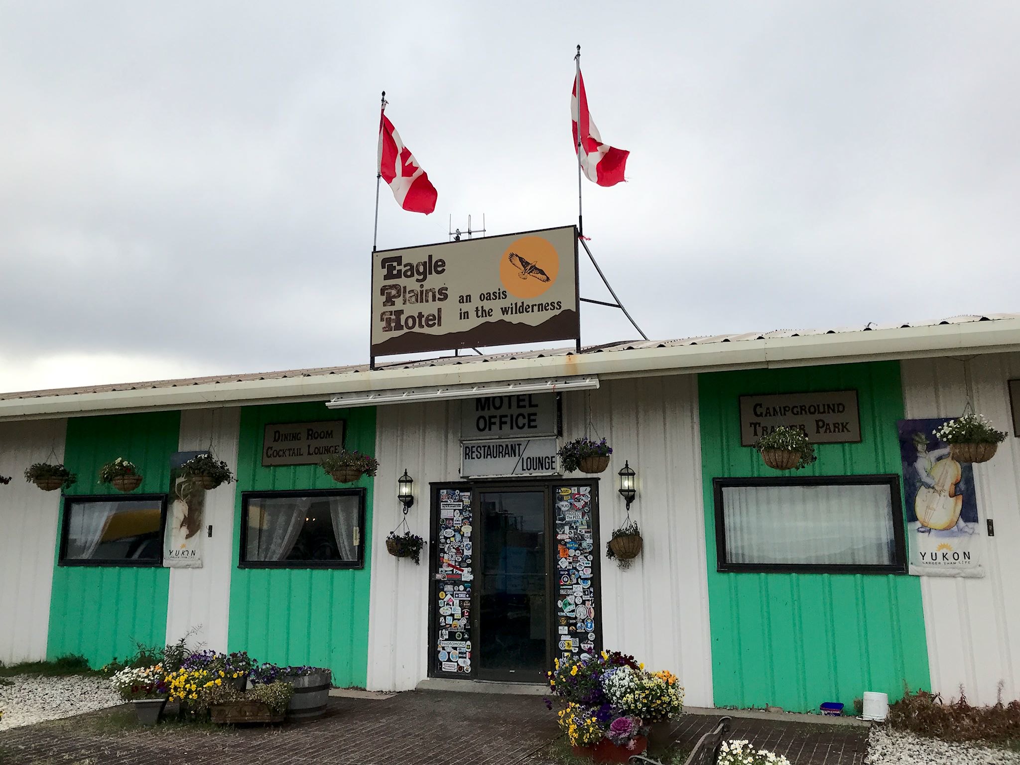
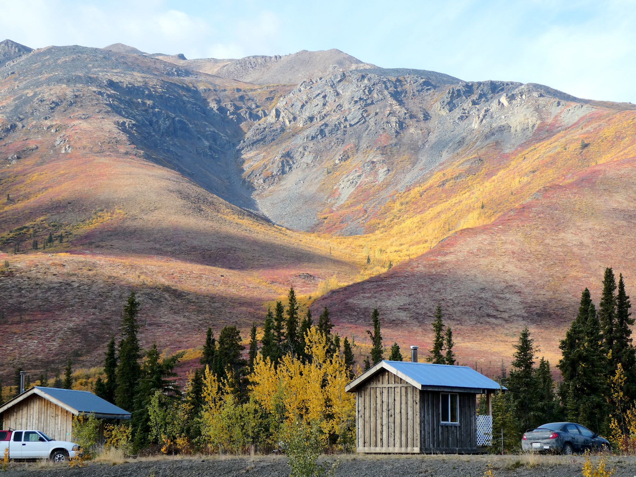
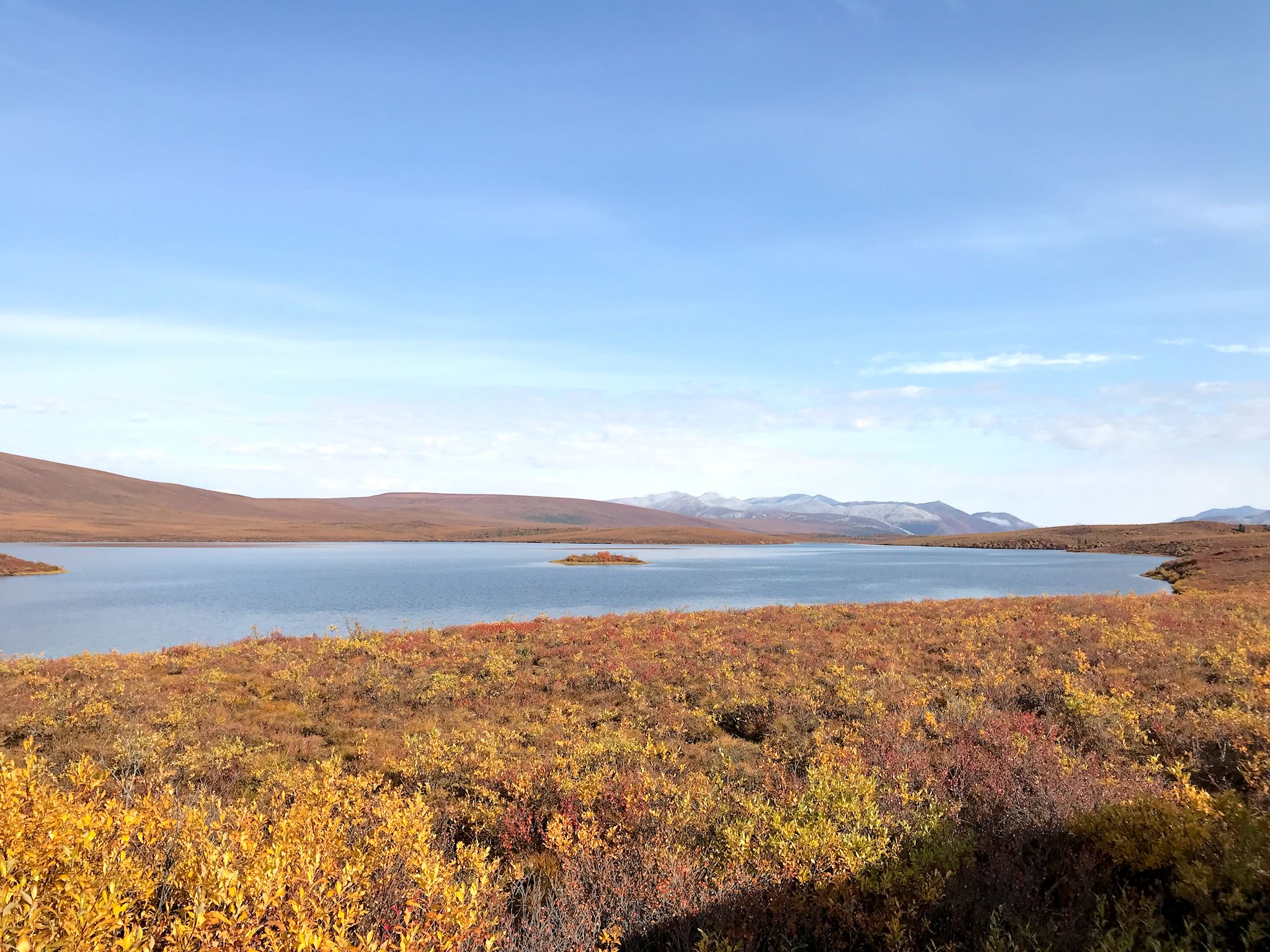
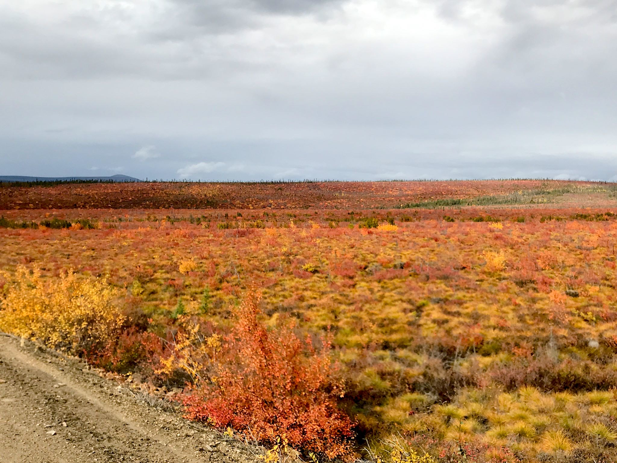
Just as we thought we were coming out of the mountains, we started to climb again, this time through peaks in the alpine tundra covered with different short bushes and brush, giving the treeless peaks a bright, patchwork quilt kind of look. Beyond Windy Pass, the terrain turned to more rolling tundra with long, long views into the colorful distance. Eventually we were ascending again, this time Seven Mile Hill, up and around an escarpment to the Eagle Plain Plateau, allowing for views of the Ogilvie and Peel River Valleys, and more fall foliage. High on the plateau is the settlement of Eagle River (pop. 9) with a hotel-restaurant-gift-fuel-tire-repair-camping establishment. A great spot to spend the night.
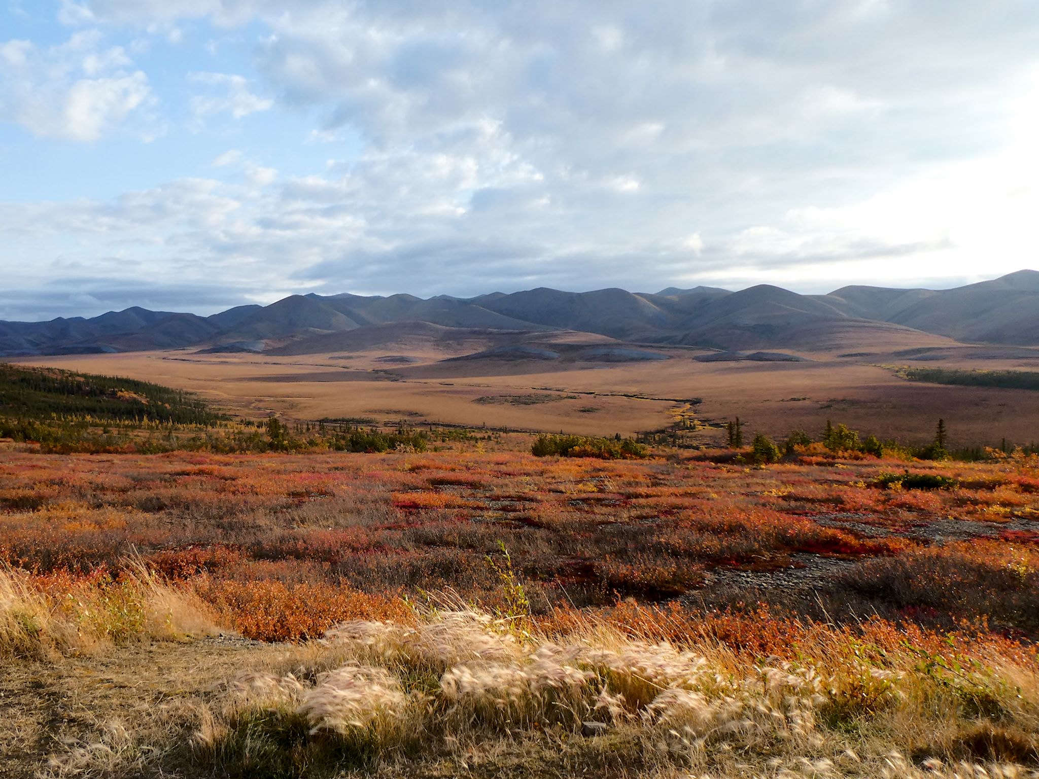
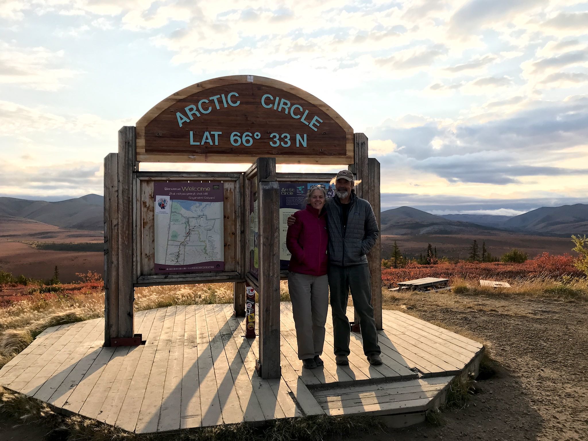
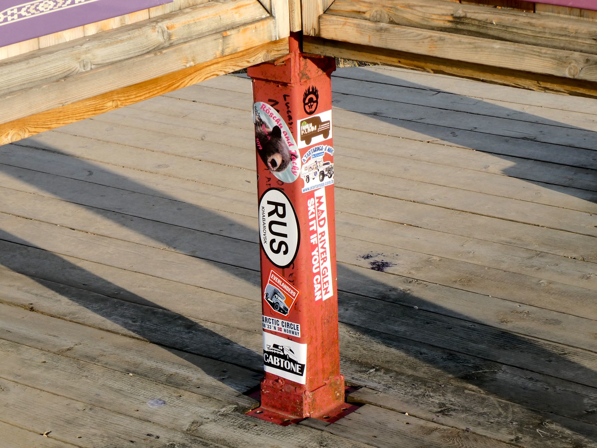
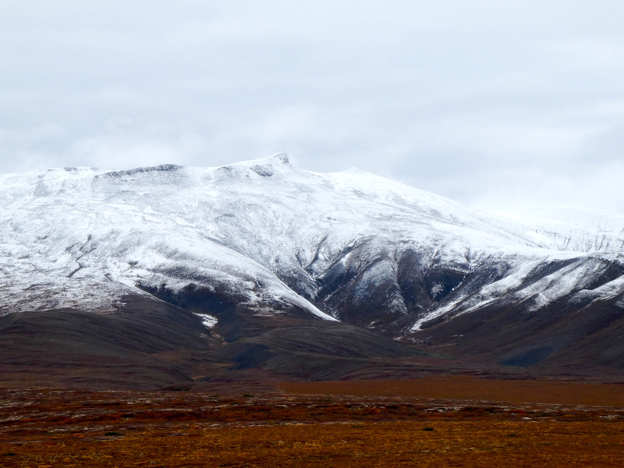
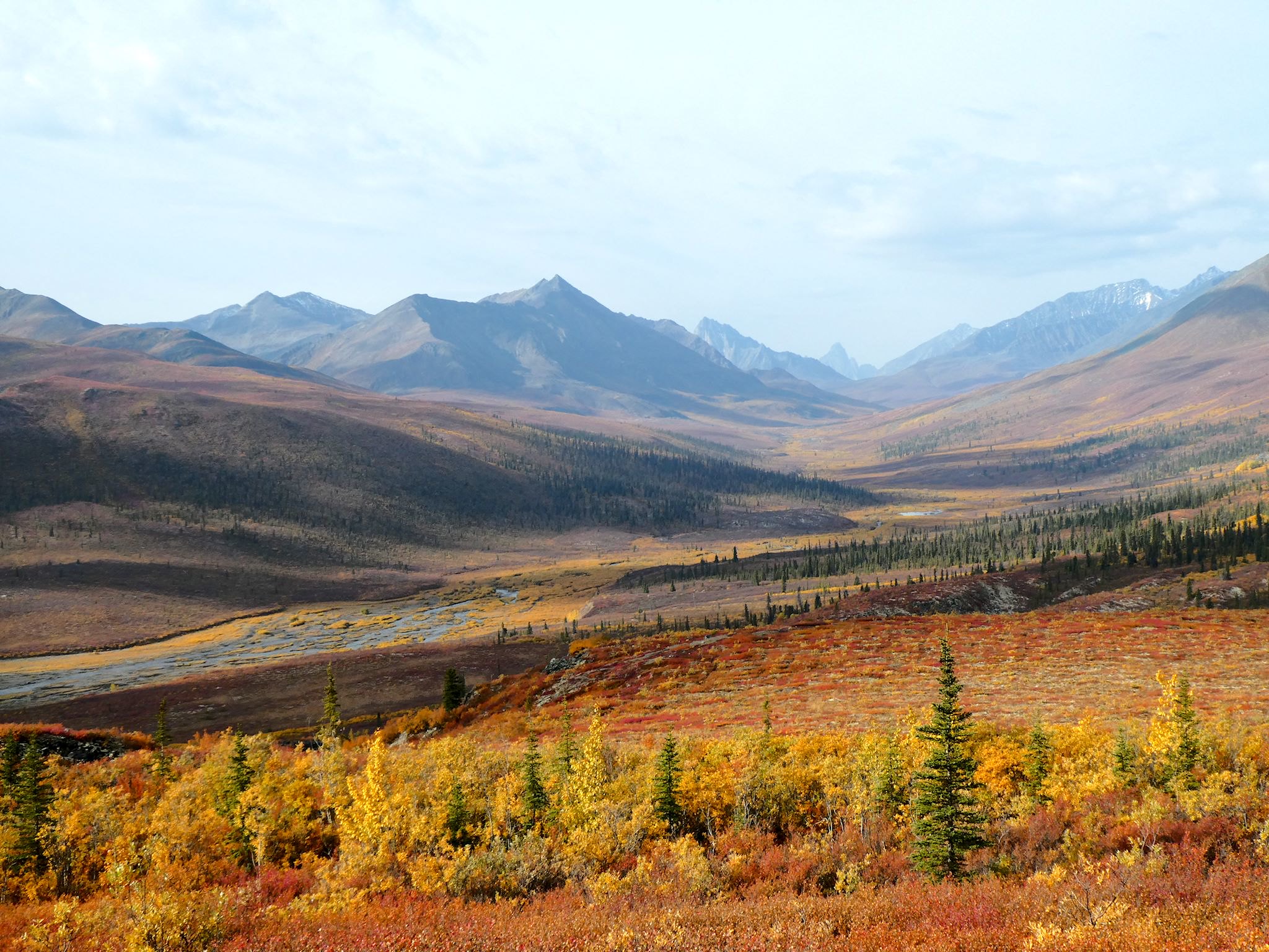
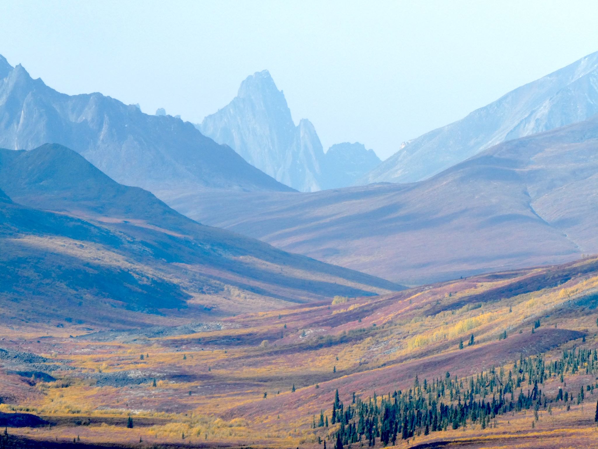
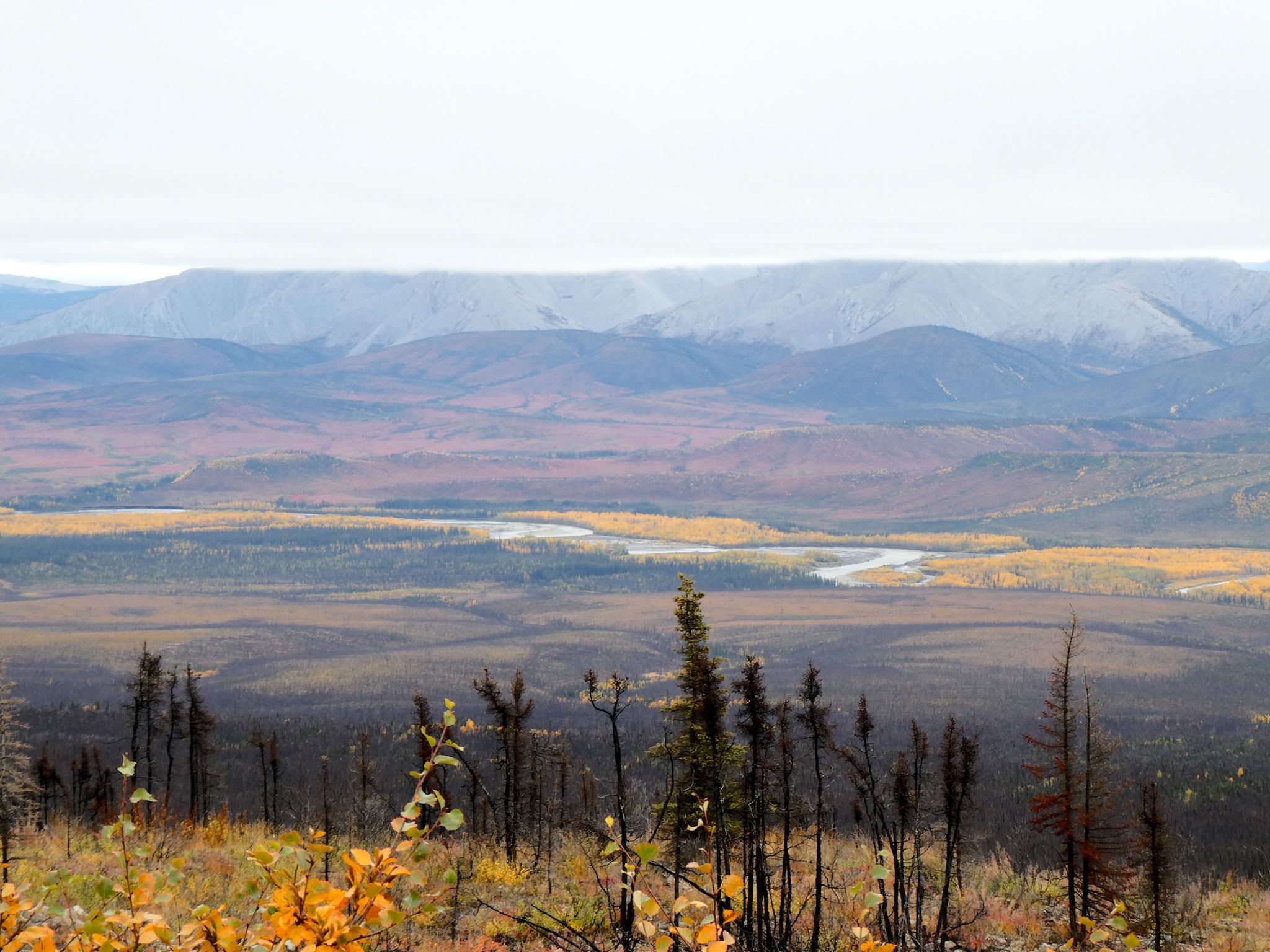
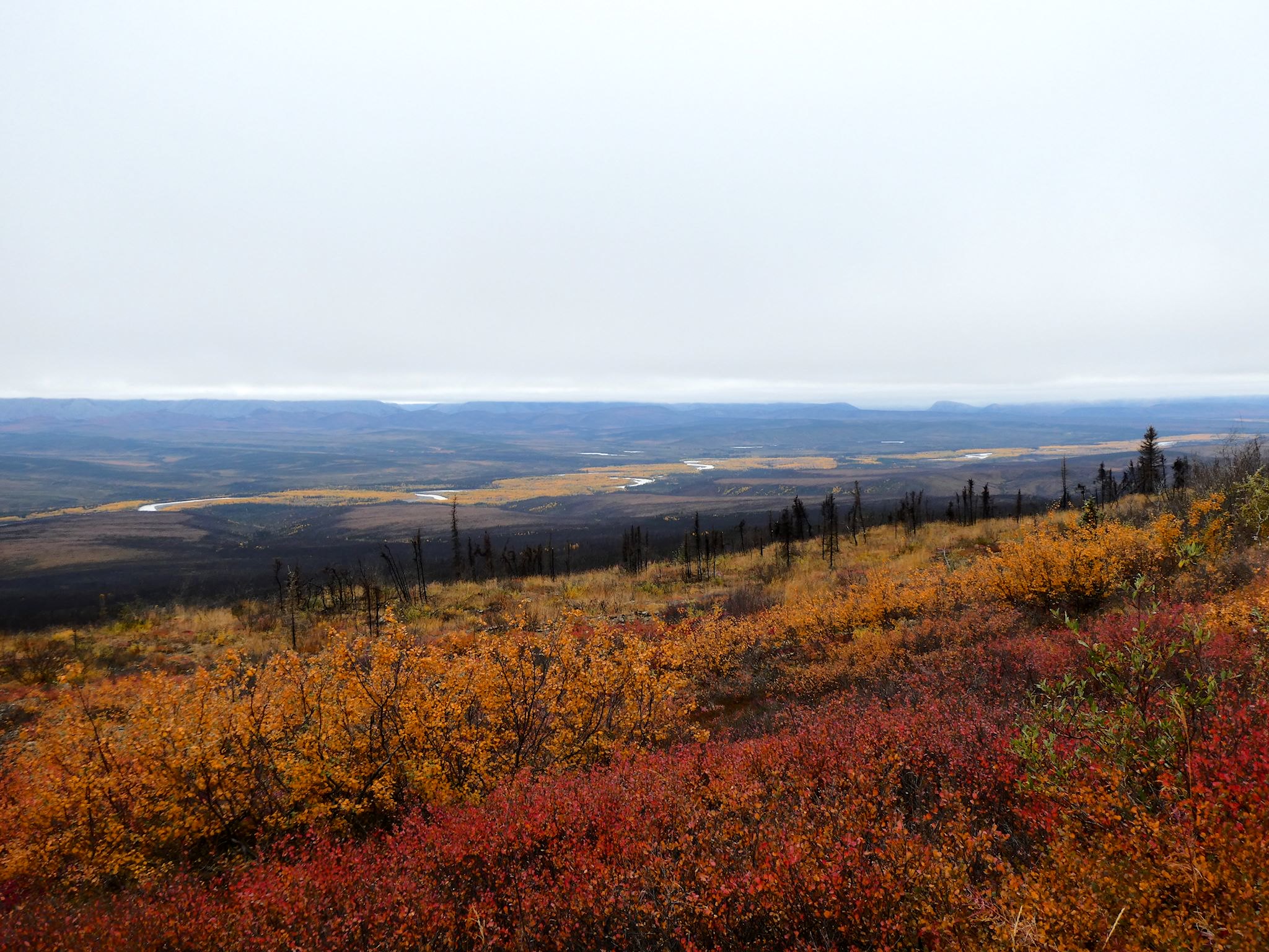
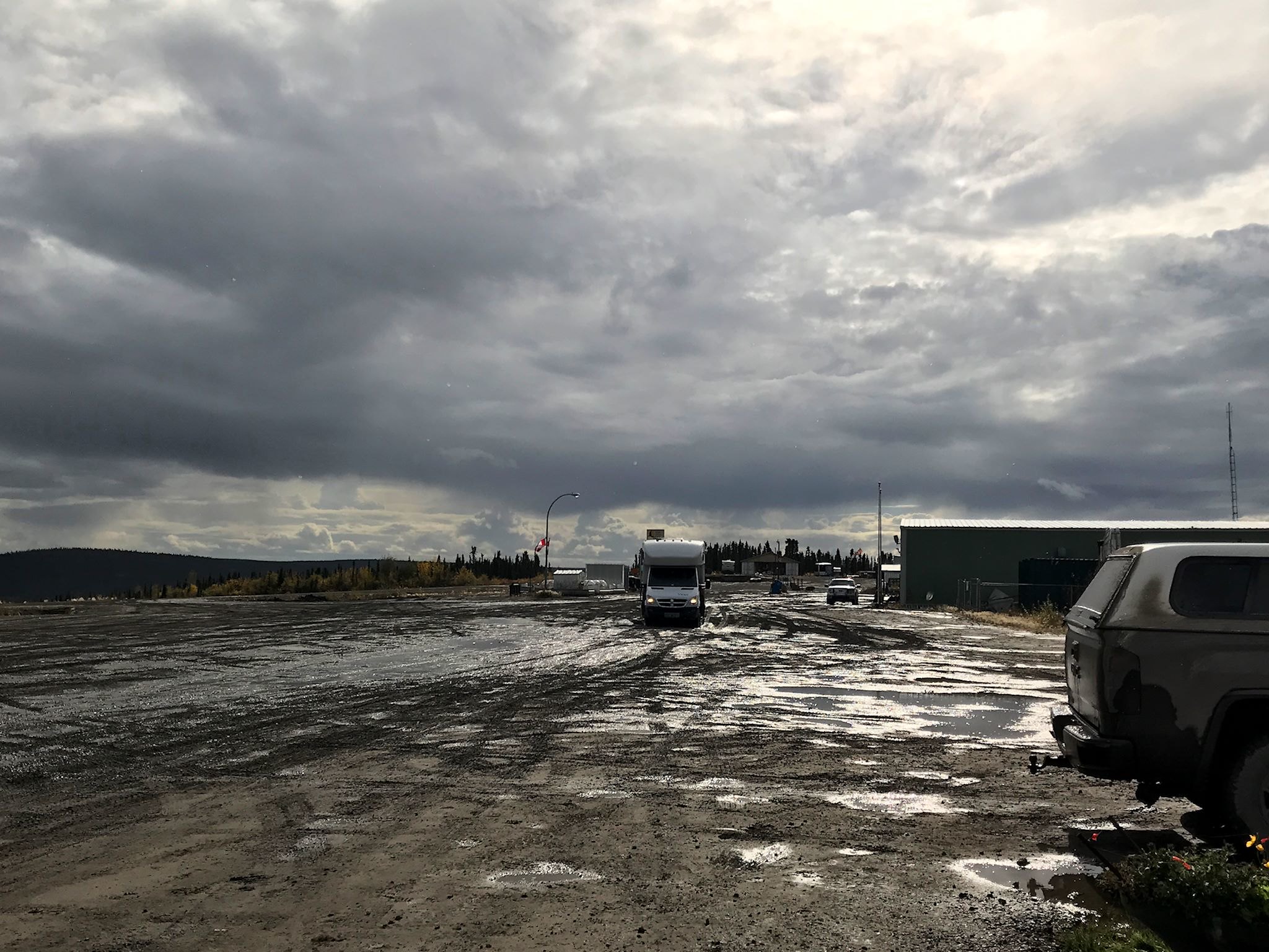
Early in the morning, it was a short drive to the Arctic Circle where we once again found a marker for the imaginary line where the sun doesn’t set below the horizon for at least one day each summer – and a sticker collection. Obviously lacking one notable sticker, we ceremoniously remedied the situation and are happy to report Mad River Glen is now represented on the Arctic Circle in Canada. The long, rolling colorful tundra views continued until we reached the freshly snow-covered Richardson Mountains. We followed Wright Pass through the mountains to reach the summit and paused at the Yukon/Northwest Territories border.
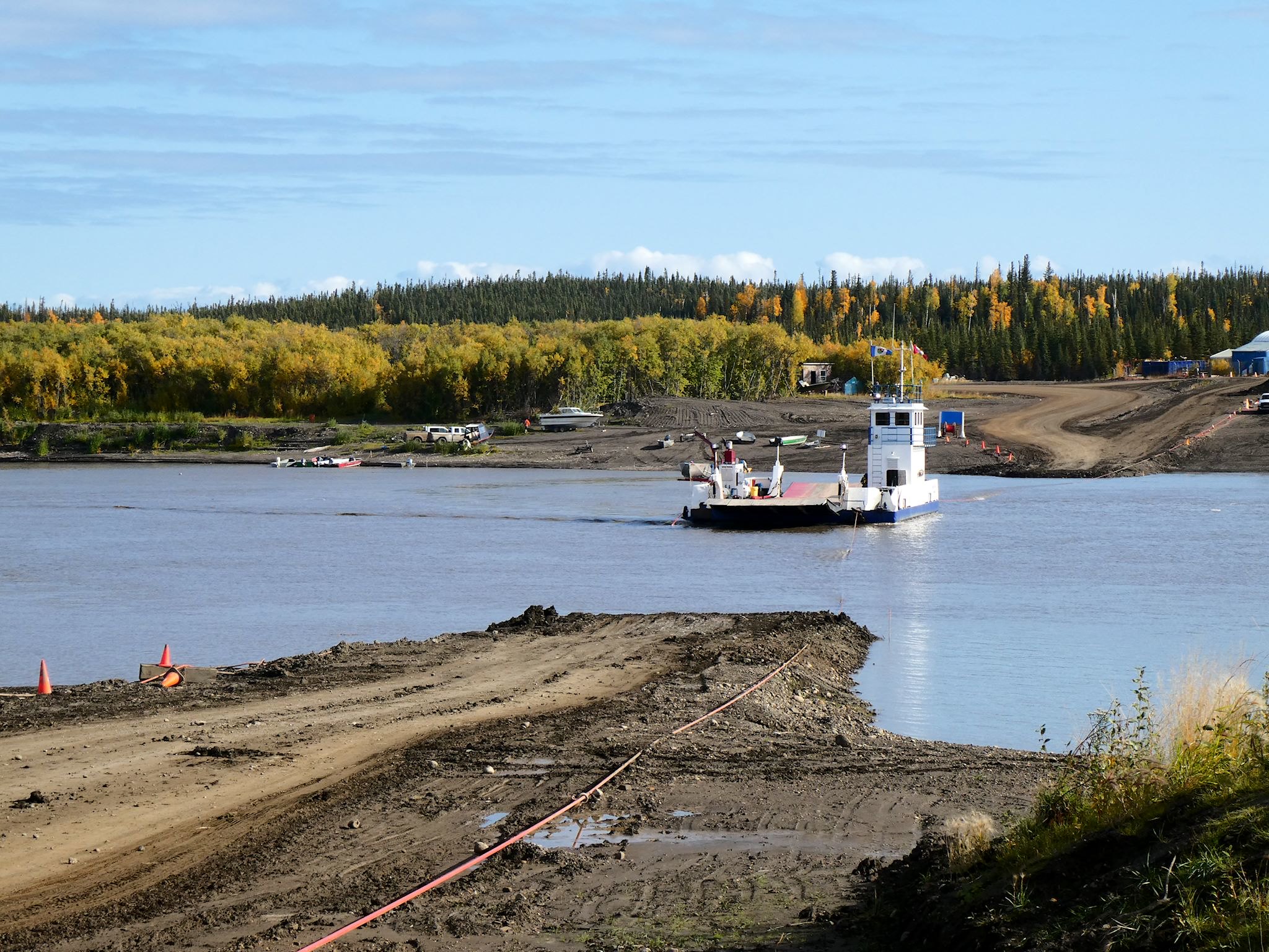
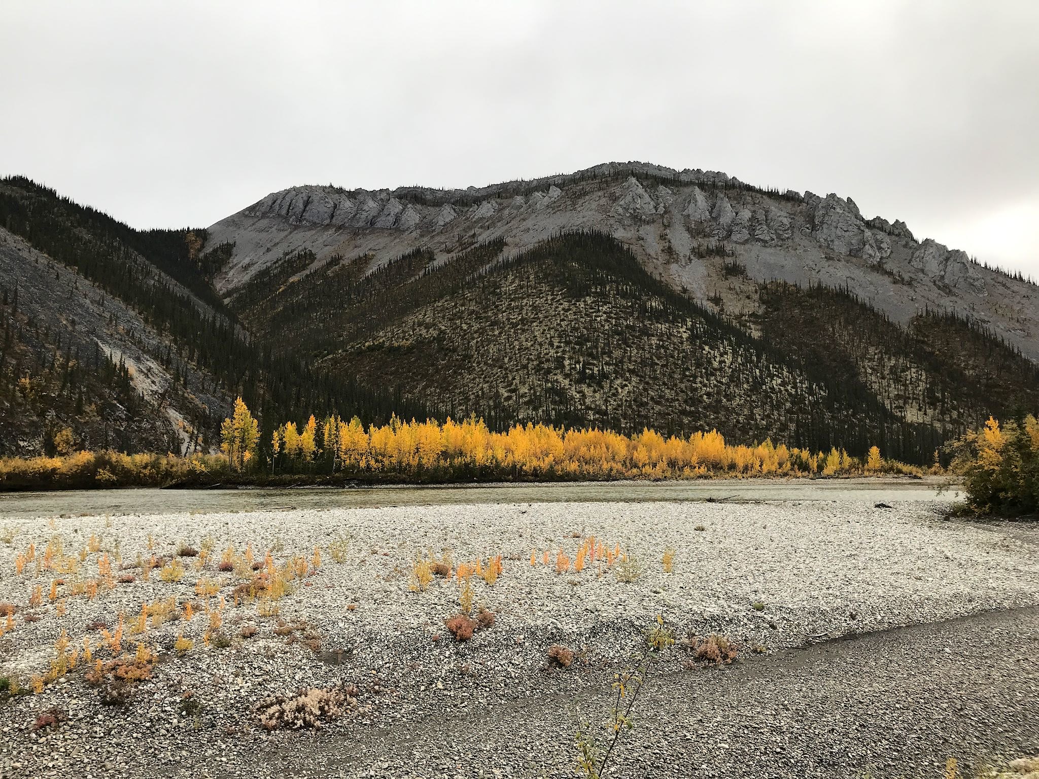
And that’s where everything changed… As we descended, the tundra turned golden red, rust, and burgundy as we made our way out of the mountains to the first ferry crossing at the Peel River. The tundra continued to roll through the second ferry to get across the Mackenzie River (the second longest river in North America, after the Mississippi) and on to the city of Inuvik. This marks the end of the Dempster Highway and, until quite recently, the literal end of the road.
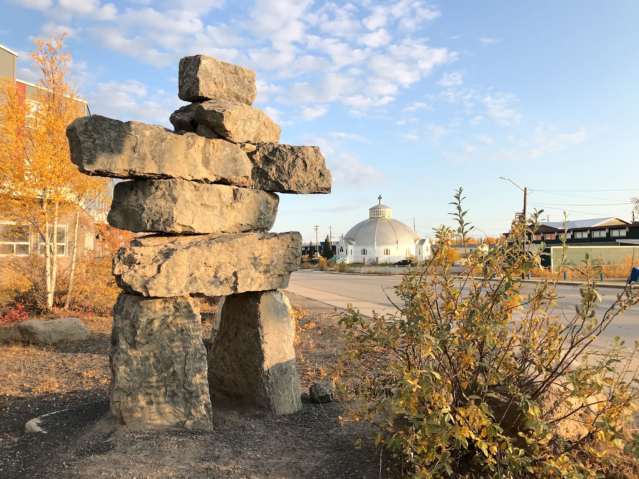
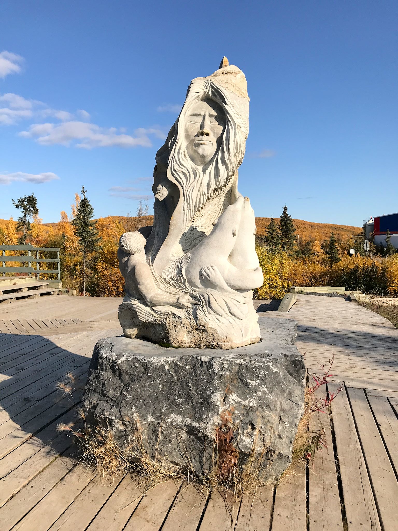
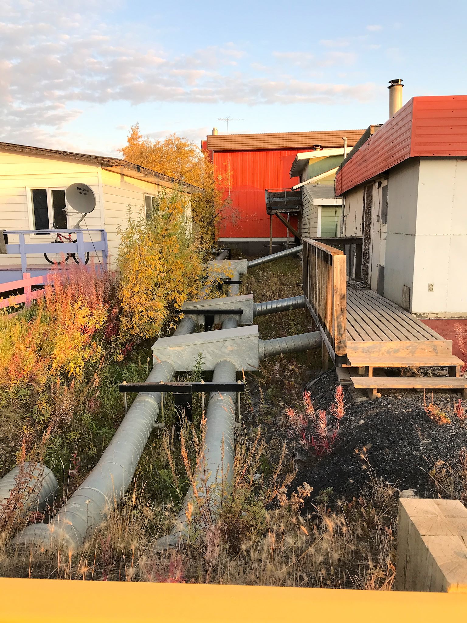
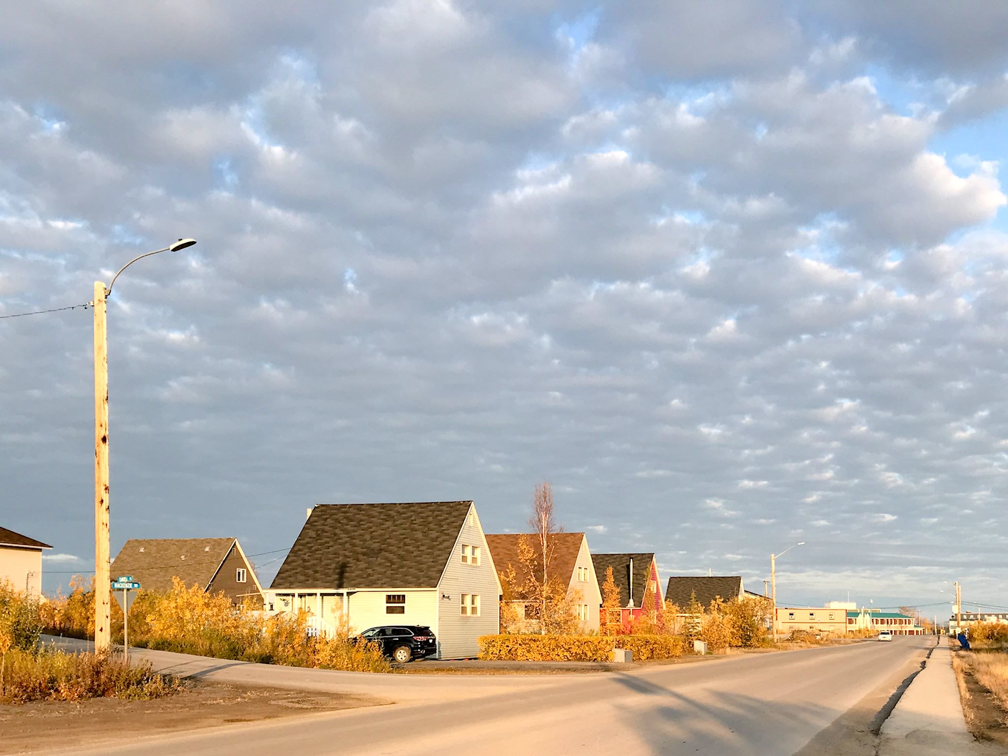
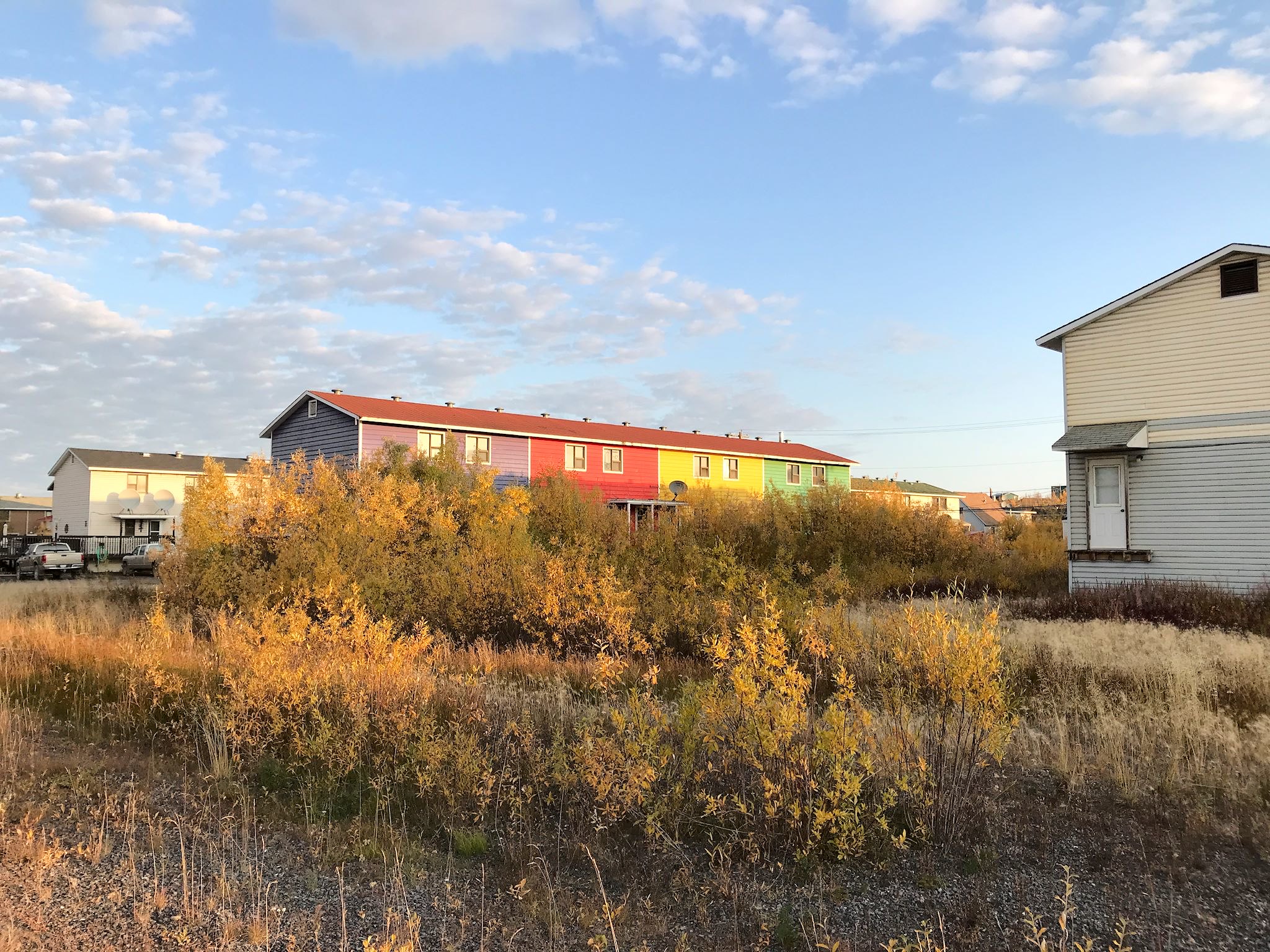
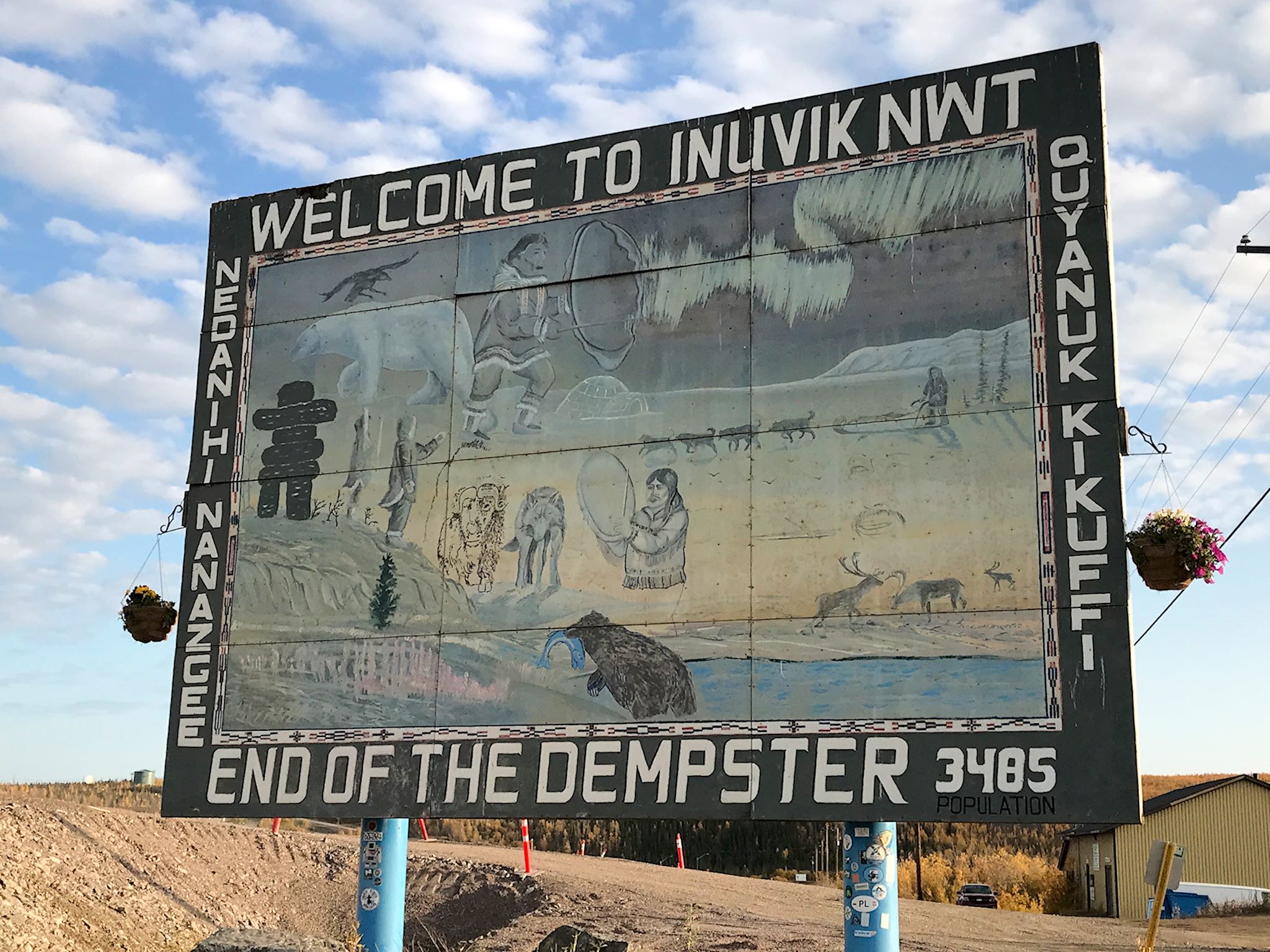
Inuvik (pop 3200) is the largest Canadian town north of the Arctic Circle and the territorial administrative center in the arctic. Aklavik, the original administrative center, flooded every year. The Canadian Government, working with the locals, built a new town in 1955 and most of the residents moved to Inuvik. Primarily an indigenous community, it’s a planned and totally modern town. It’s well known for its festivals, colorful homes, an igloo-shaped church, and for pioneering innovative water systems and permafrost construction techniques for extremely cold temperatures.
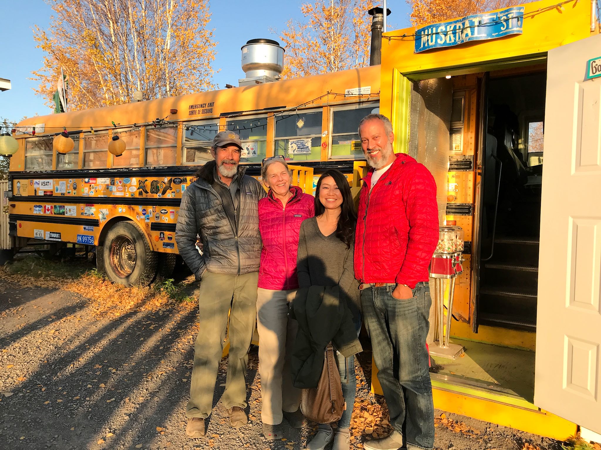

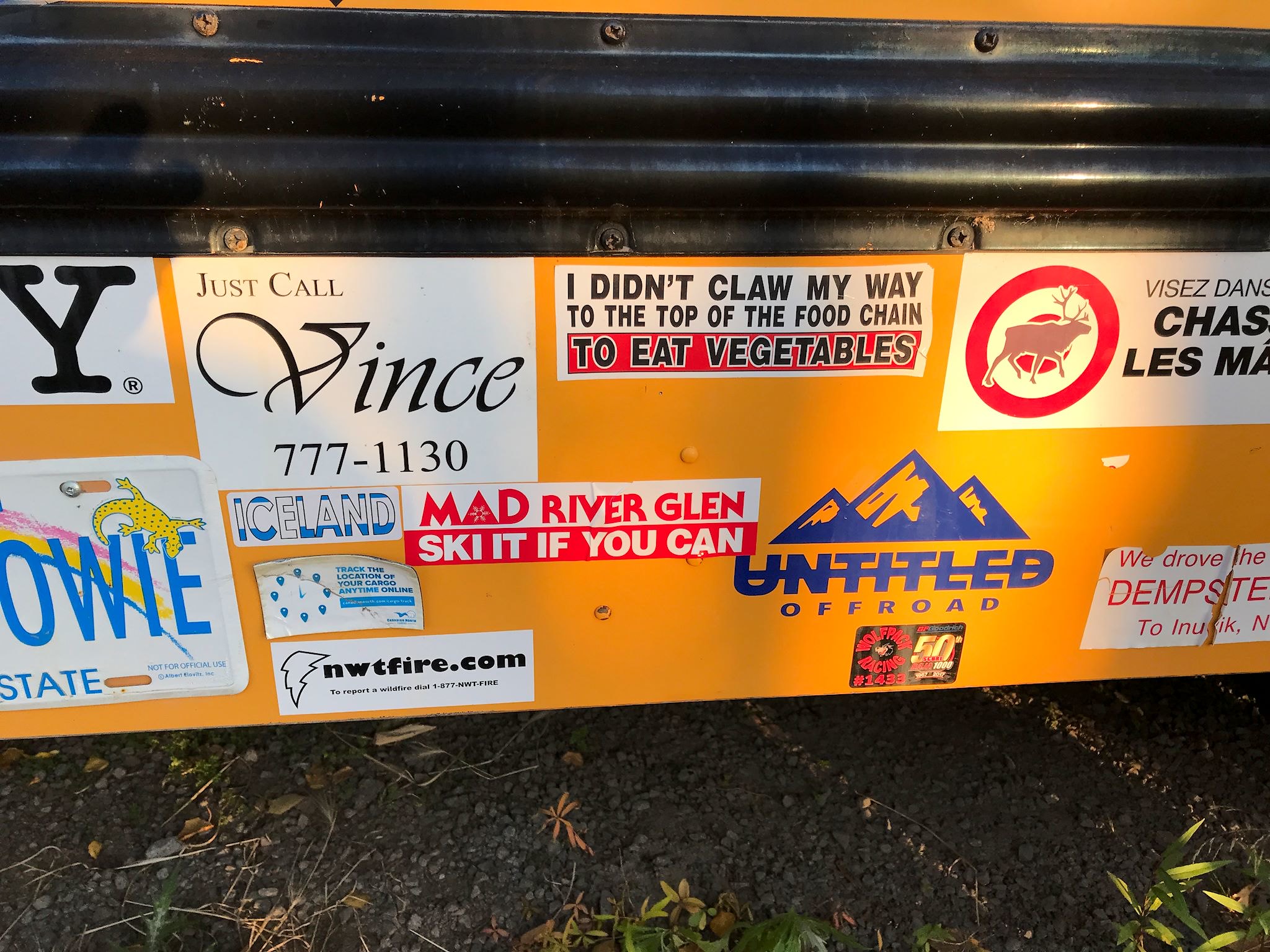
We’d met and leapfrogged with Tony and Hiroko, from Oregon, in Dawson and again on the Dempster. They’re on a 2-year North American adventure in their RV with their 2 french bulldogs (Matsuhiro and Porco), after which they plan to head off to Japan for 2 years. Crossing paths in Inuvik, we got together for dinner out on the town. Alestine’s, where dinner is prepared in a remodeled school bus, served a delightful local meal (‘the whitefish was swimming this morning’). It is the only restaurant with an outside eating deck north of the Arctic Circle, and… it has a sticker wall on the side of the bus. Mad River Glen makes it to Inuvik!
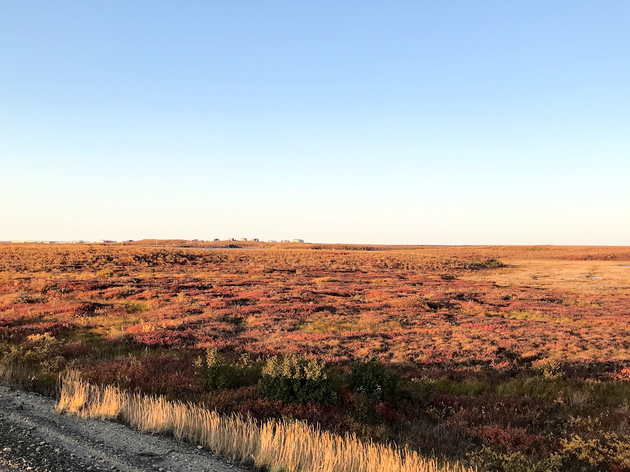

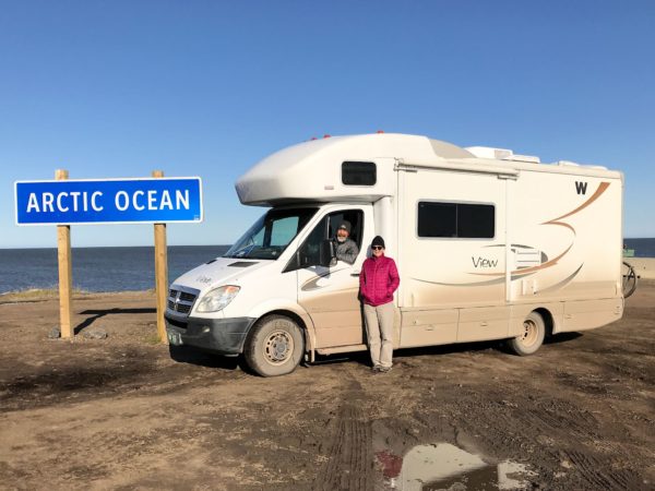
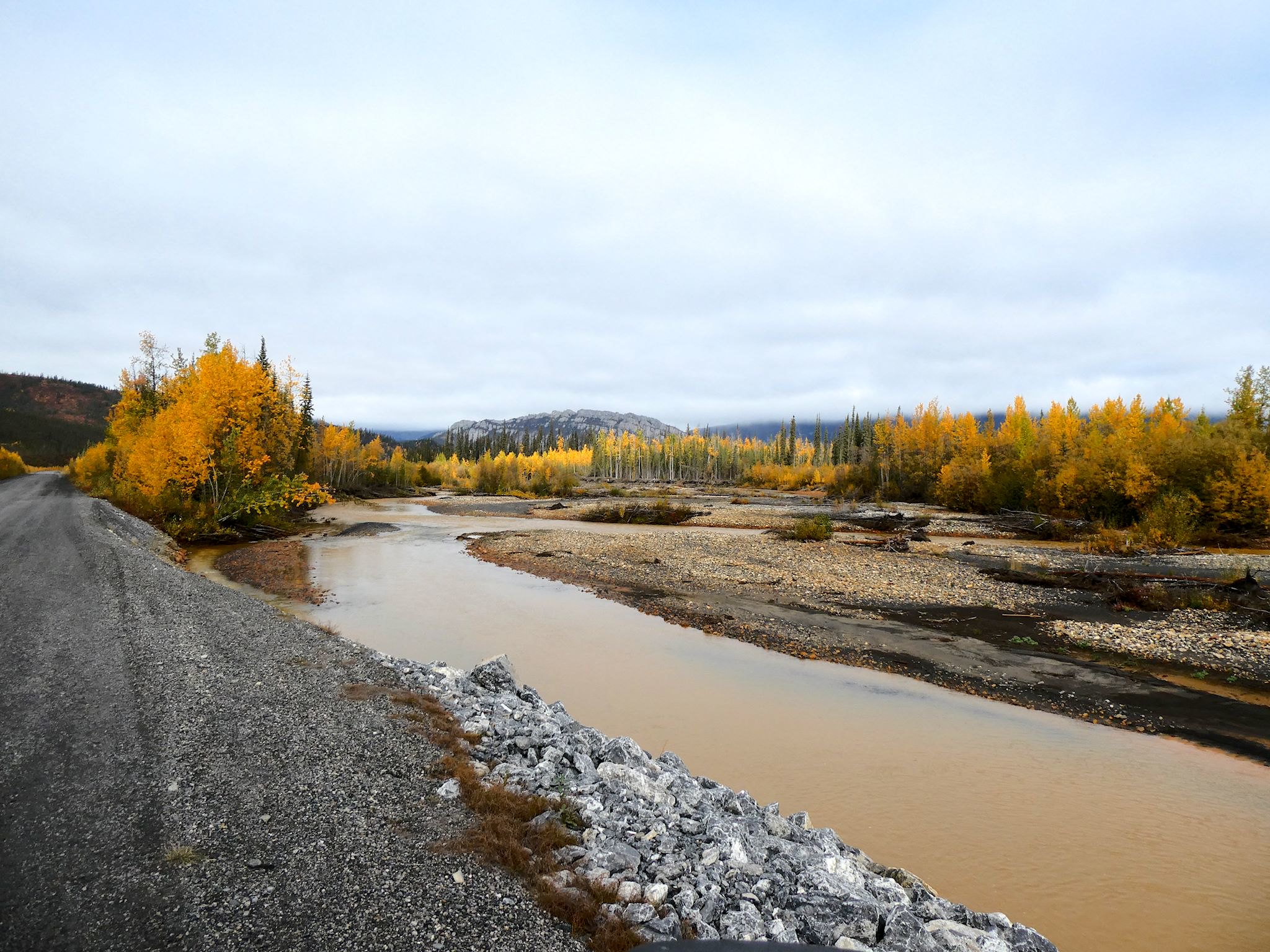
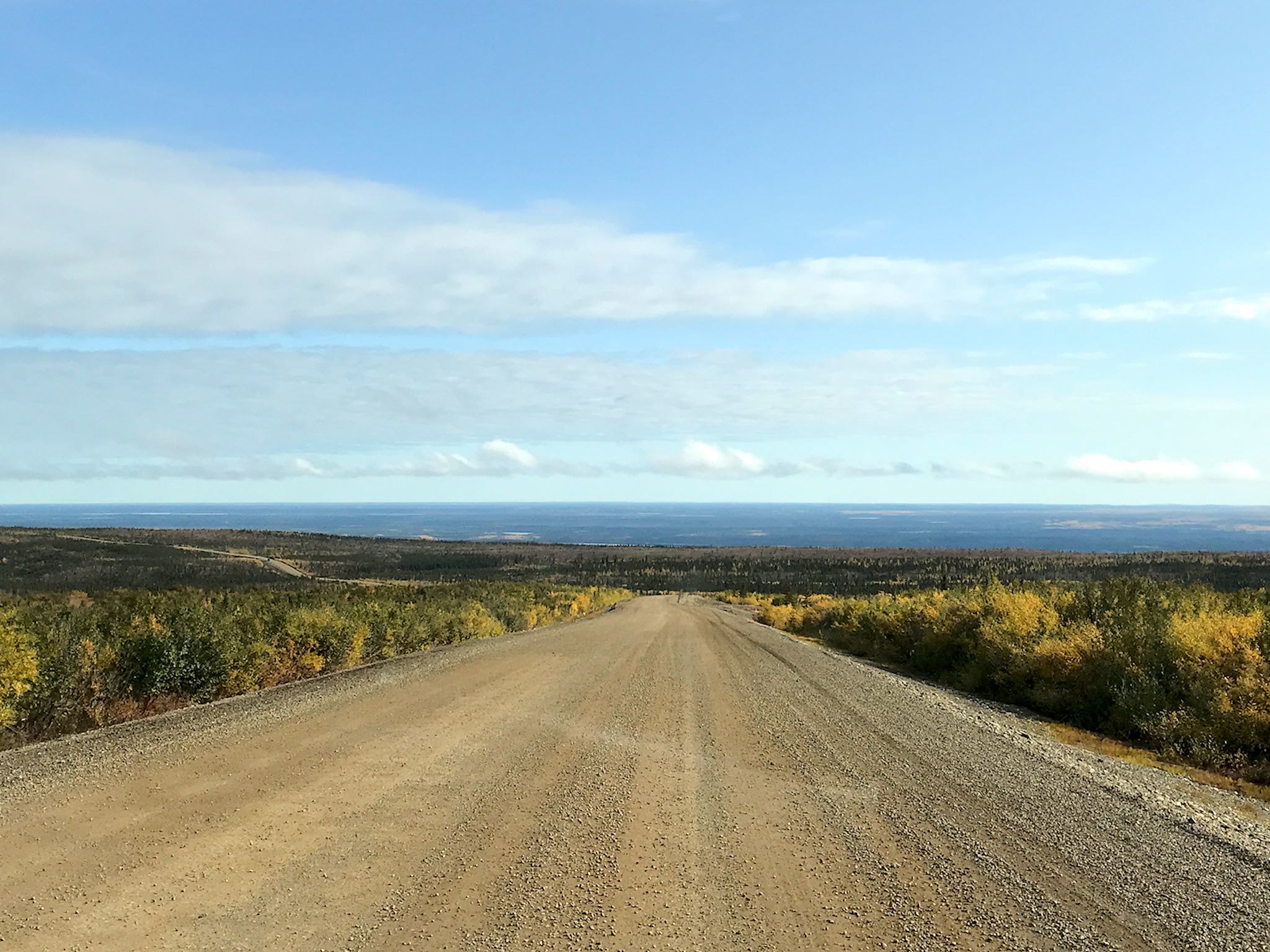
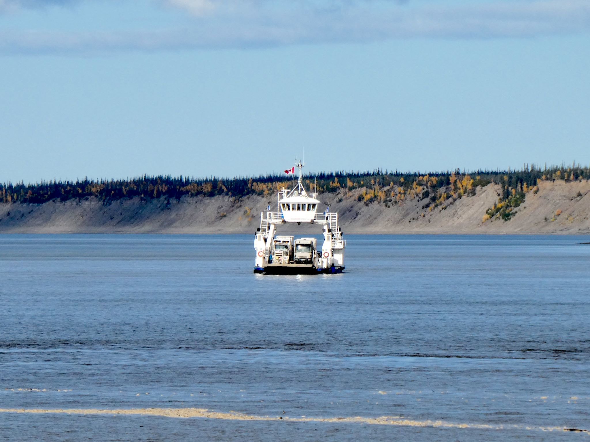
The Inuvik-Tuktoyaktuk Highway is a two-hour drive through an amazingly beautiful area known as the Mackenzie Delta. The screaming burgundy-ish gold and to gold-ish burgundy gently rolling tundra was dotted with bright blue boreal lakes everywhere! The new end of the road is on a rocky spit out into the Arctic Ocean in the town of Tuktoyaktuk, complete with an Arctic Ocean sign begging to be photographed. The town’s new campground is right there at the end of the road…
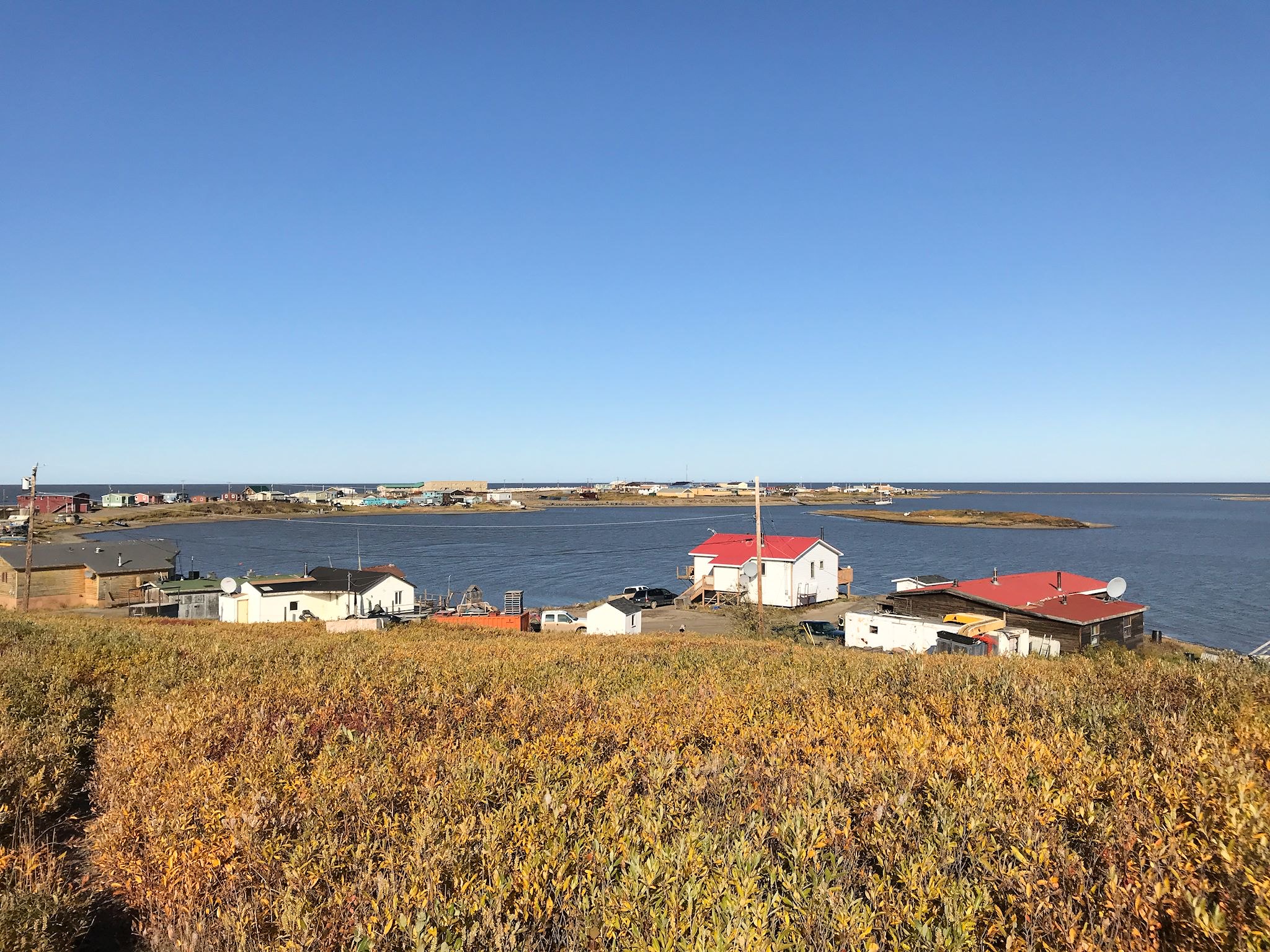
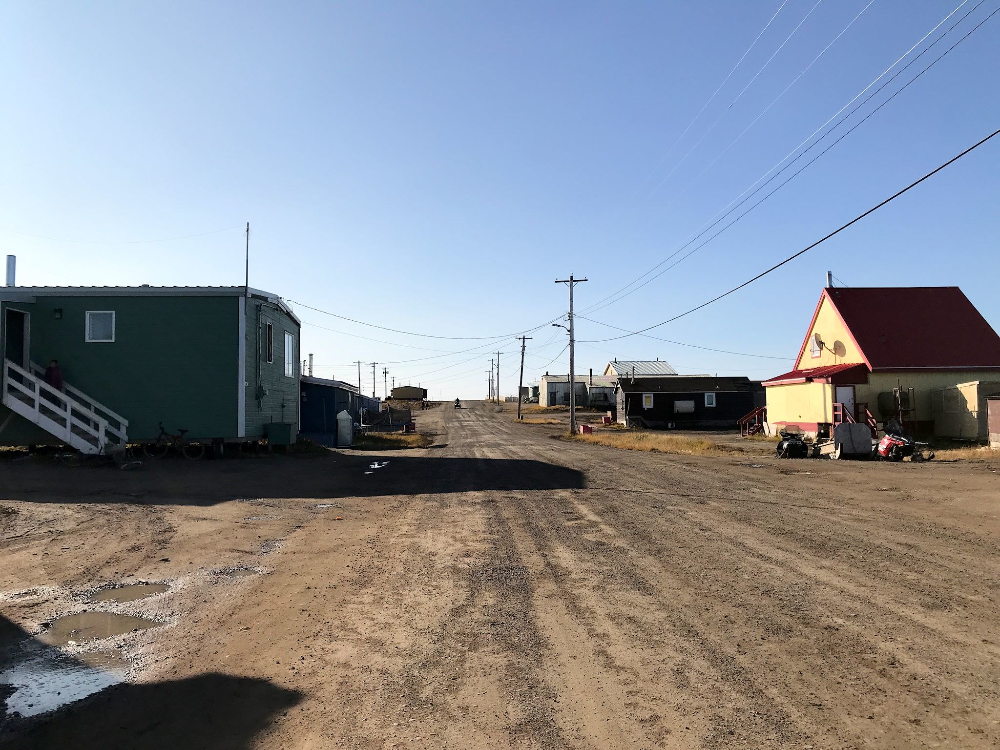
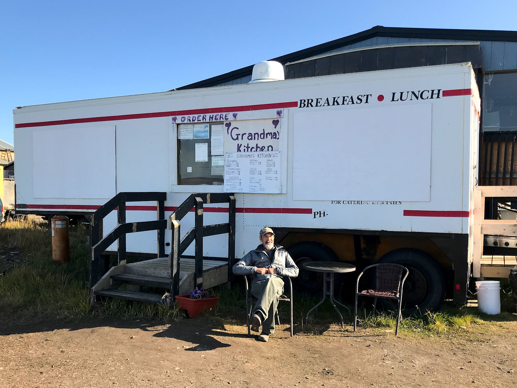
Tuktoyaktuk, or simply Tuk (pop 1000), is a traditional Inuit community. It was the first place in Canada to revert back to its traditional indigenous name. It’s now the only Inuit community connected to the rest of Canada via overland road. Although some residents work for wages for the government and oil companies, others continue to live a subsistence lifestyle, hunting, fishing and whaling. Lots of small, mostly colorful homes dot the shore surrounded by the current tools of the trade – 4 wheelers, snowmobiles and boats. We had lunch at Grandma’s Kitchen, where Joanne (Grandma) cooks up traditional foods – including muktuk (whale), bison, whitefish – along with tourists’ faves like burger, hotdogs and fries.
Tourism is new to Tuk. Previously accessible only by plane or ice-road, the town is working to build and provide infrastructure and services to meet the burgeoning needs of tourists who suddenly started arriving on the new highway. Though it’s not for everyone, we would encourage everyone who can to see this beautiful place.
Time to head south! Not much choice, really…
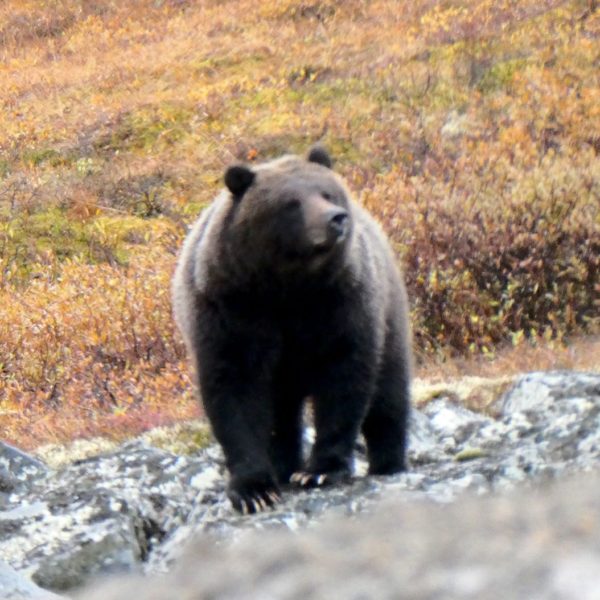
Our five-day excursion to the Canadian Arctic was epic! We were immersed in peak foliage the whole time and only drove through rain for a morning. Wildlife sightings were plentiful. Using Denali tour bus driver Wendy‘s trick, when we saw a grizzly bear walking alongside the highway ahead of us we stopped carefully a distance away, making no sudden moves or noises, and watched as the big grizzly calmly walked right past us, occasionally pausing for perfect grizzly bear poses.

After accumulating about 4800 km (3000 miles), so far, on dirt/gravel roads through Alaska, Yukon and the Northwest Territories this summer, we’ve started to see signs of epic shake, rattle and roll… The fridge hinge has been mended with superglue, the microwave bracing was removed, repaired and reinstalled, clamps were replaced and supports added to hold the tailpipe in place, broken waste tank heater wiring underneath the truck along with a crack in the windshield can wait ’til we’re back in VT, and a shattered fog light lens will also eventually be replaced. Finally, after the Dempster (as we did after the Dalton), we washed a few hundred pounds of mud off the rig and the bikes.
Epic!
For anyone who’s interested, more Dempster Highway south, Dempster Highway north, Inuvik-Tuktoyaktuk Highway, Eagle Plains, Inuvik, Tuktoyaktuk, Tithegeh Chii Vitaii hike, mud pix…
Just pulled up a map…OMG. Carpe diem. M&P
LOL. Etiam!
” 800-km (1000-mile) ”
Oh yeah? Which is it?
HAHAHA!!
Thanks, Pete! We need you to proofread all of our posts! Fixed…
Well you fixed the first one!! Awesome! But read down a few lines…
HAHAHAHA!!
Thanks again, Pete! Think we corrected them all… Keep it up!