
We’d really wanted to see Death Valley National Park on this trip – that was right up at the top of our list of reasons for undertaking this repeat visit across the country. Once again, due to the government shutdown we didn’t quite know what to expect, and up-to-date information was hard to find. However, given our recent experience at Joshua Tree, and considering that from Bakersfield we were less than 3 hours from the park, we headed over to check it out. And once again, we were pleasantly surprised! The Death Valley Natural History Association is a non-profit that supports all of the goals of DVNP. They are funding park staff salaries during the shutdown, and the park was nearly fully open! And most of the closures were due to planned improvements or repairs to flood-damaged roads, unrelated to the current budget issues. Our heartfelt thanks to the DVNHA and all of the staff we met in the visitor center and campground for enabling us to have an amazing visit in Death Valley
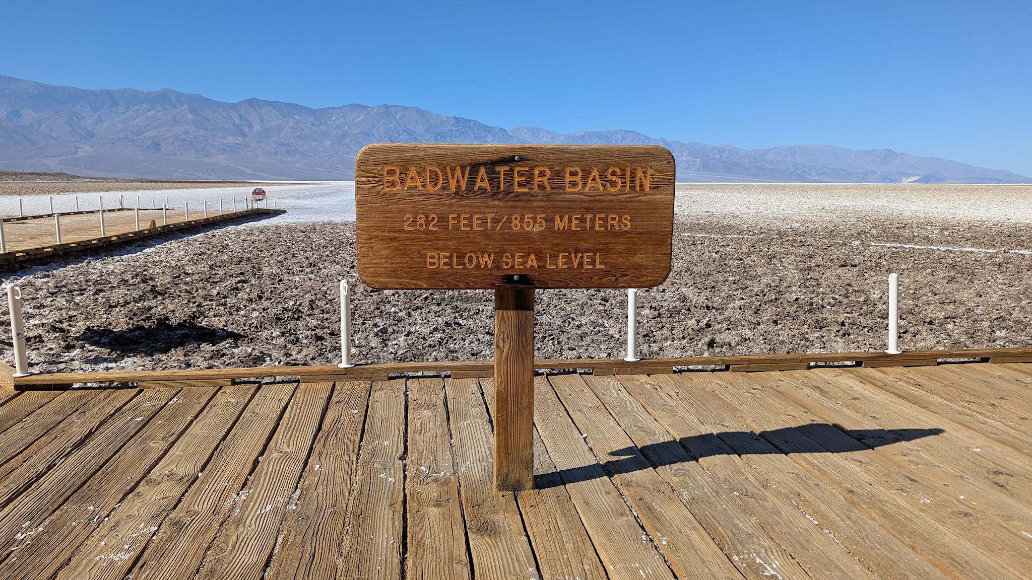
Death Valley is the hottest place on Earth. The official highest temperature recorded on earth (so far) was 134 °F on July 10, 1913, at Furnace Creek Ranch near the current Visitor Center and campground at Furnace Creek. The park also includes the lowest point in North America, 282 feet below sea level at Badwater Basin.
At least a thousand years ago, the area’s earliest indigenous residents were migrated seasonally to the small oases in Death Valley in the winters, moving back up into the mountains during the summers. More recently, miners looking to strike it rich in the California gold rush of the late 1800’s gave the valley its name. A few tried mining in Death Valley. The only profitable mines were those producing Borax – remember those 20-mule teams in the ads? – and those fizzled in the 1920’s. The mine owners then tried to build tourism in the valley by establishing small resorts near the oases. The growing popularity of the area laid the ground work for establishing Death Valley as a National Monument in 1933 and a National Park in 1994.
Panamint Springs
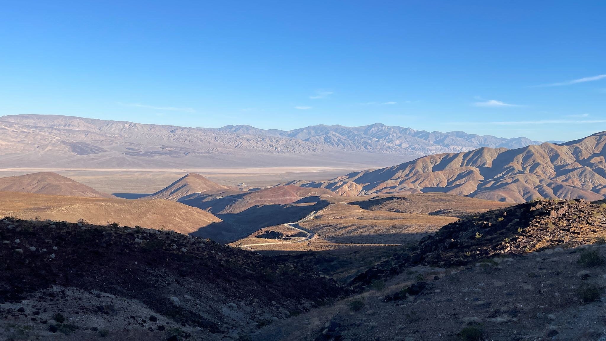
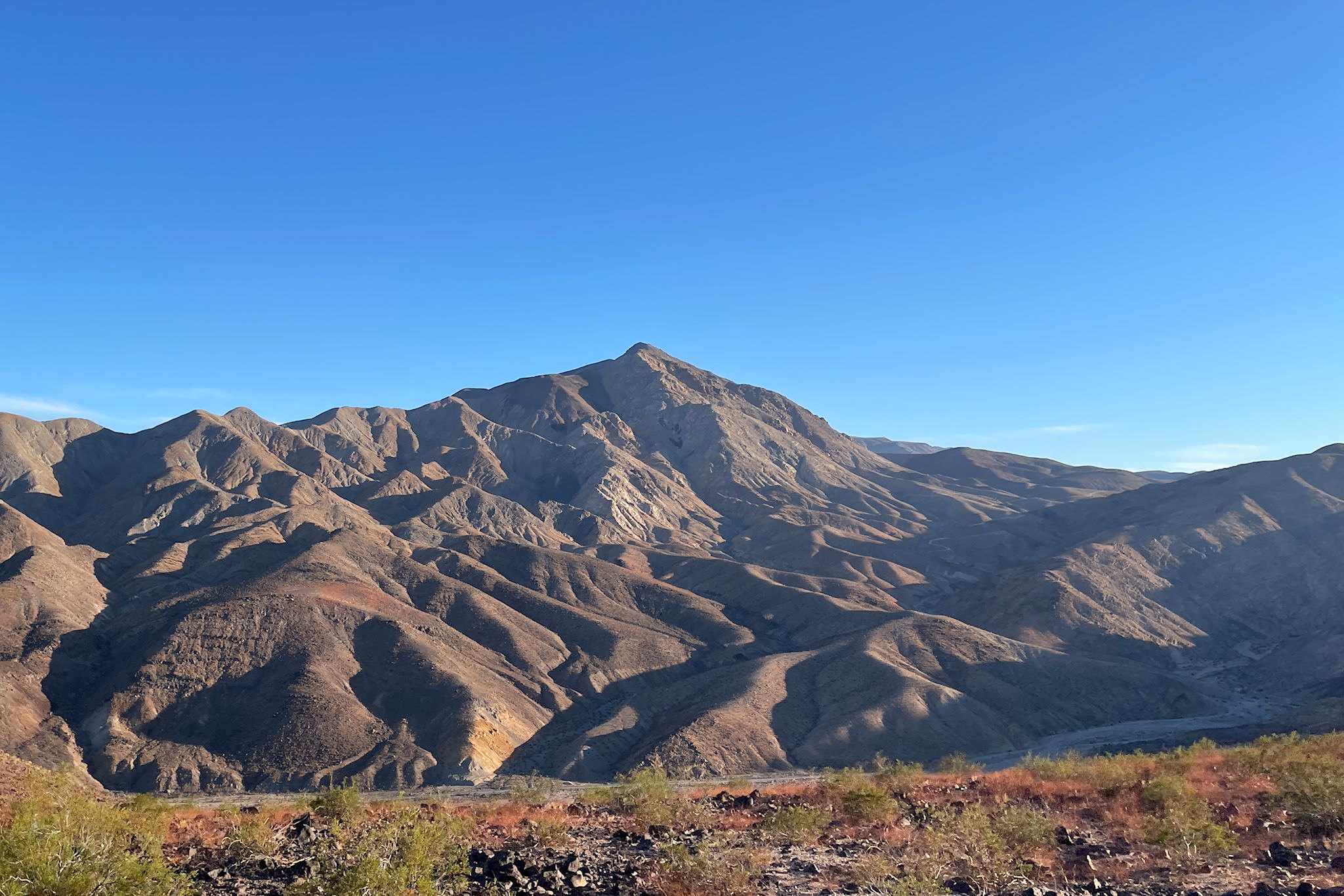
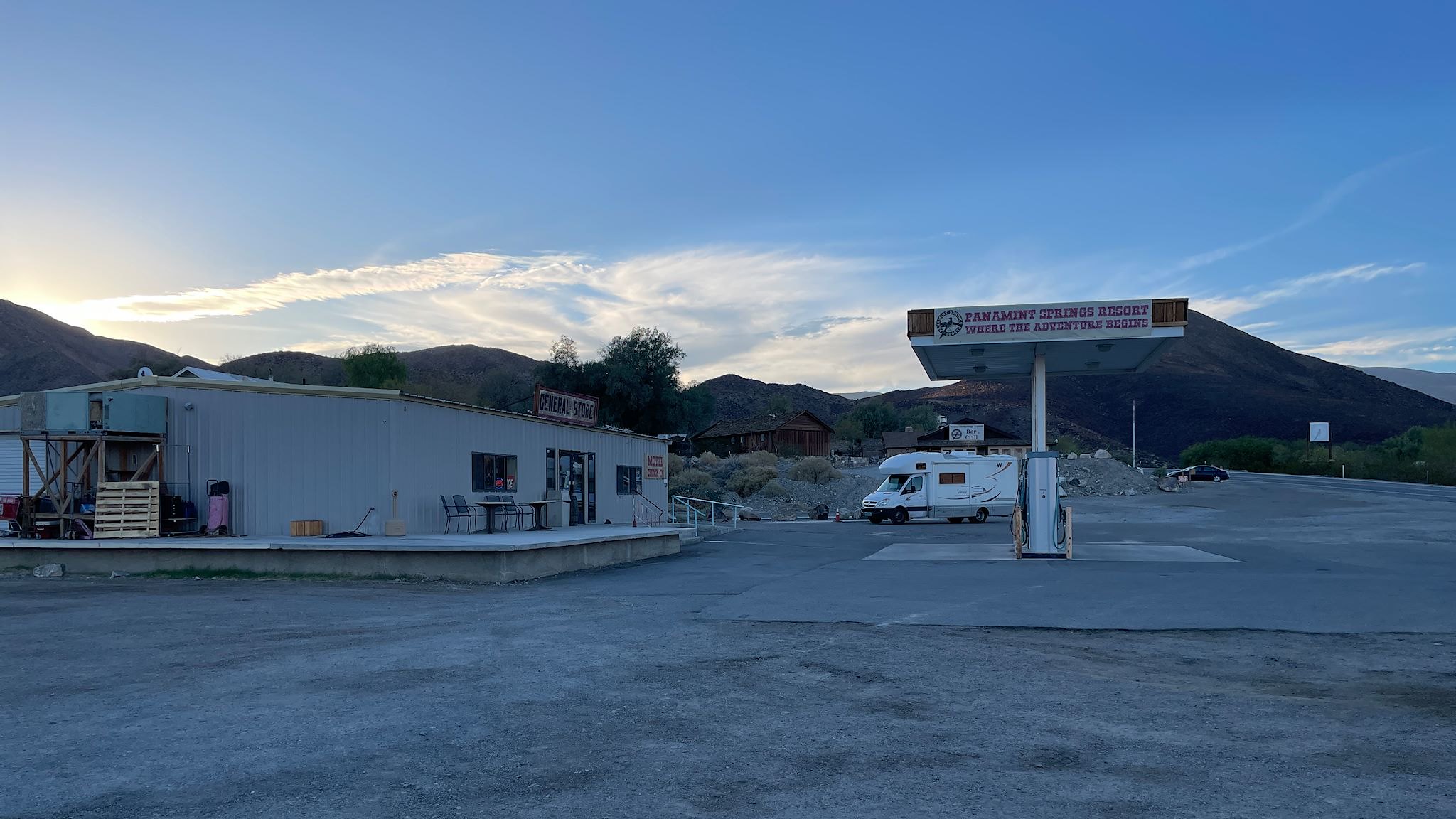
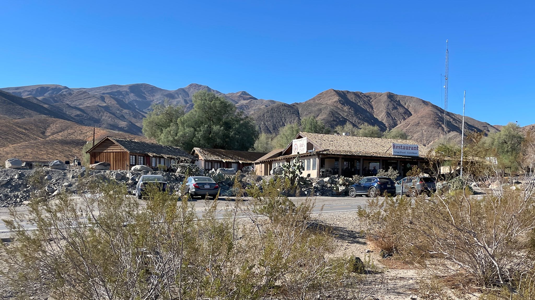
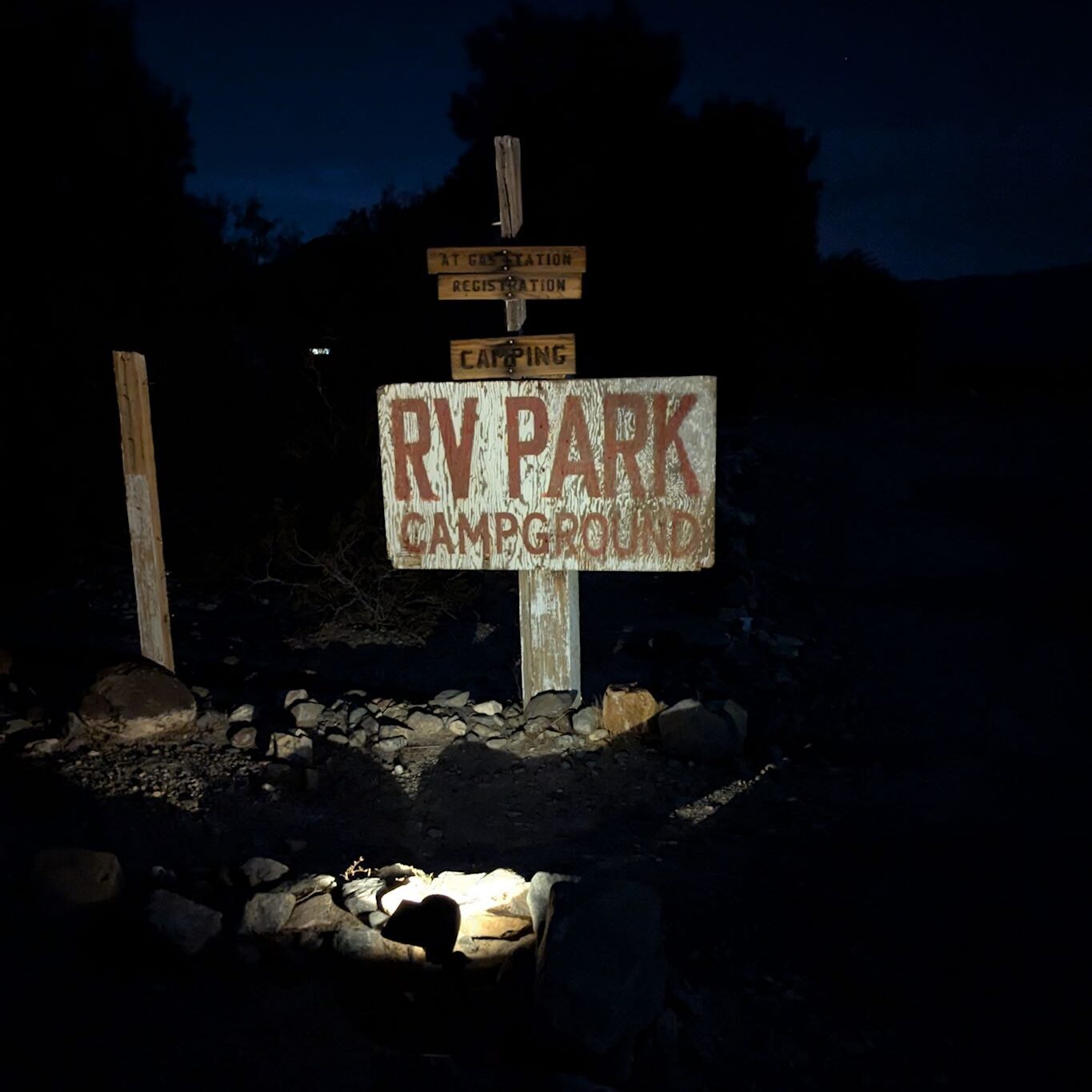
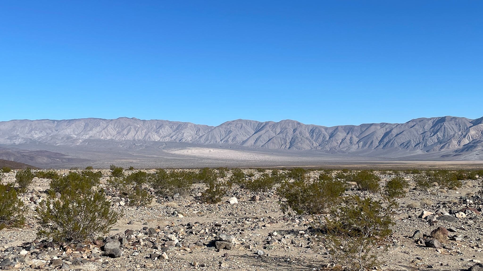
Leaving relatively late in the day (because we jammed all morning!), we set off for the Panamint Springs camp near the far west entrance to DVNP. Since we’re heading toward the lowest elevation in North America, we assumed we’d descend enroute to the park. Ha! The descent was a joy ride of switchbacks with endless views across the Panamint Valley. GPS said we’d arrive at our destination in 2 minutes. What!? There’s nothing here! Around the last switchback, there it was – Panamint Springs Resort. The resort/town is privately owned and includes a gas station, general store, rooms, cabins, campground with RV sites, and a restaurant. Camp was rustic with a beautiful view of the Panamint Range and the Panamint Dunes.
Furnace Creek
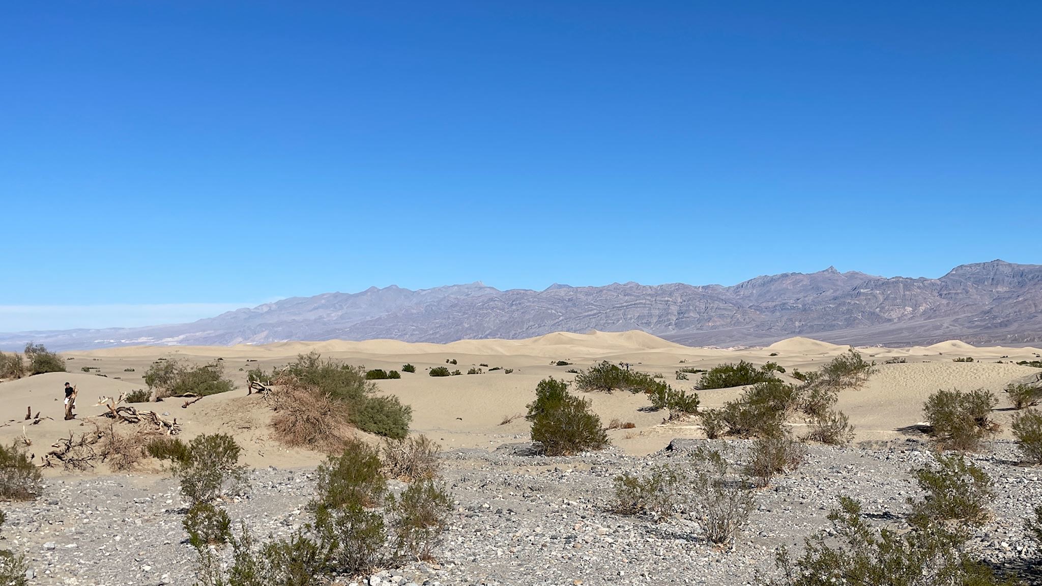
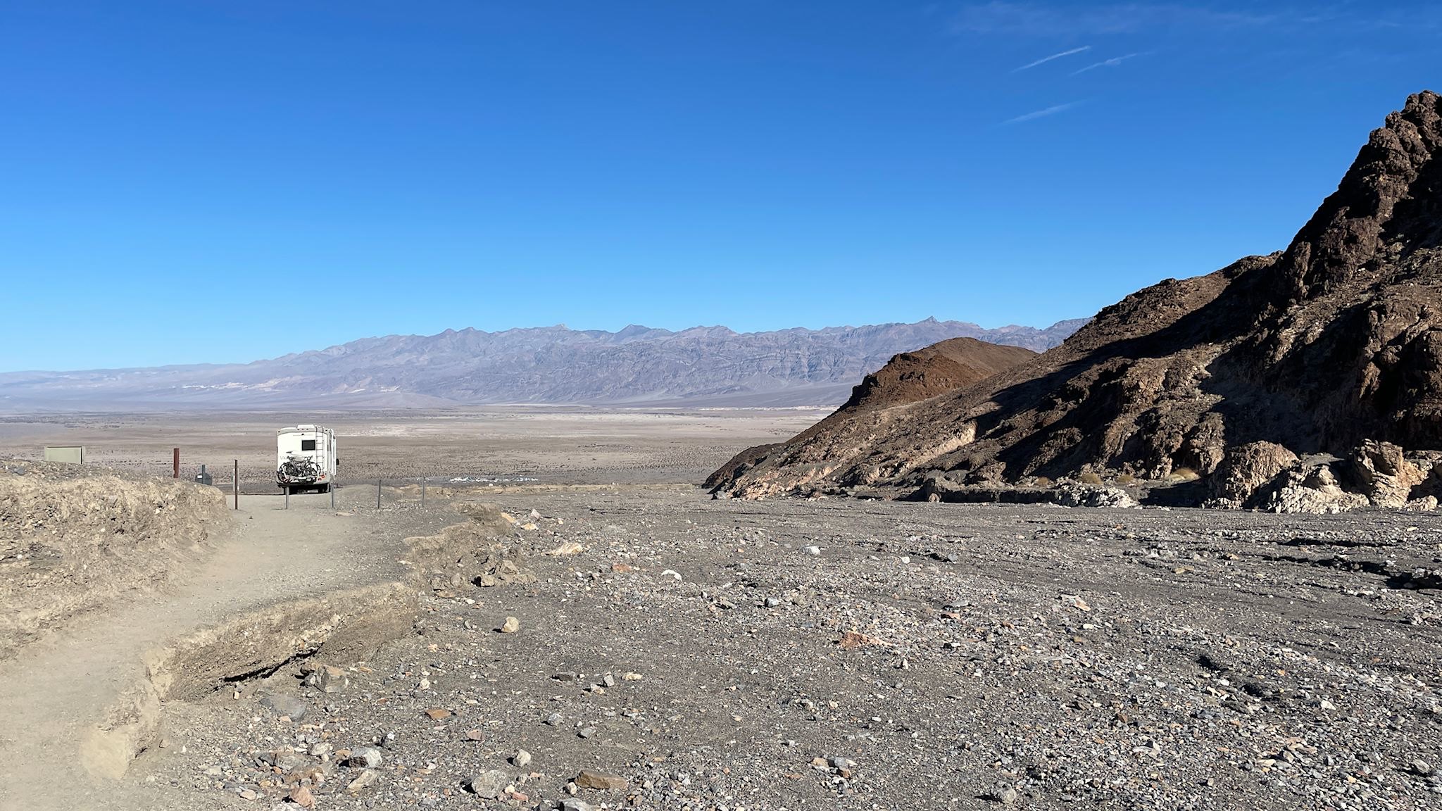
The main Visitor Center and campground at DVNP are at Furnace Creek, and both were open. Our plan was to see what there was to see on the way, and slowly make our way there to get details about the hiking and road closures and plan the adventures for the rest of our stay. Highlights on the way were the views from Towne Pass (4,961 elevation) and the 17-mile descent into Death Valley (at or near sea level) and the Mesquite Flat Sand Dunes. Armed with lots of info from the kind and well-informed rangers at the Visitor Center, we chose 2 of the longer hikes (from 3 candidates) and one bike ride. That combination would enable us to explore the full range of diverse sights and terrain within DVNP. Once at camp, we found ourselves with time to do a little exploration before dark, so we took a little drive…
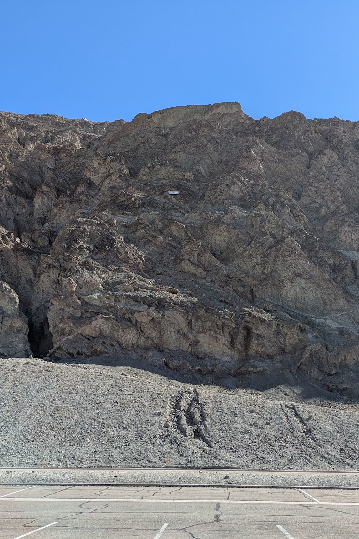
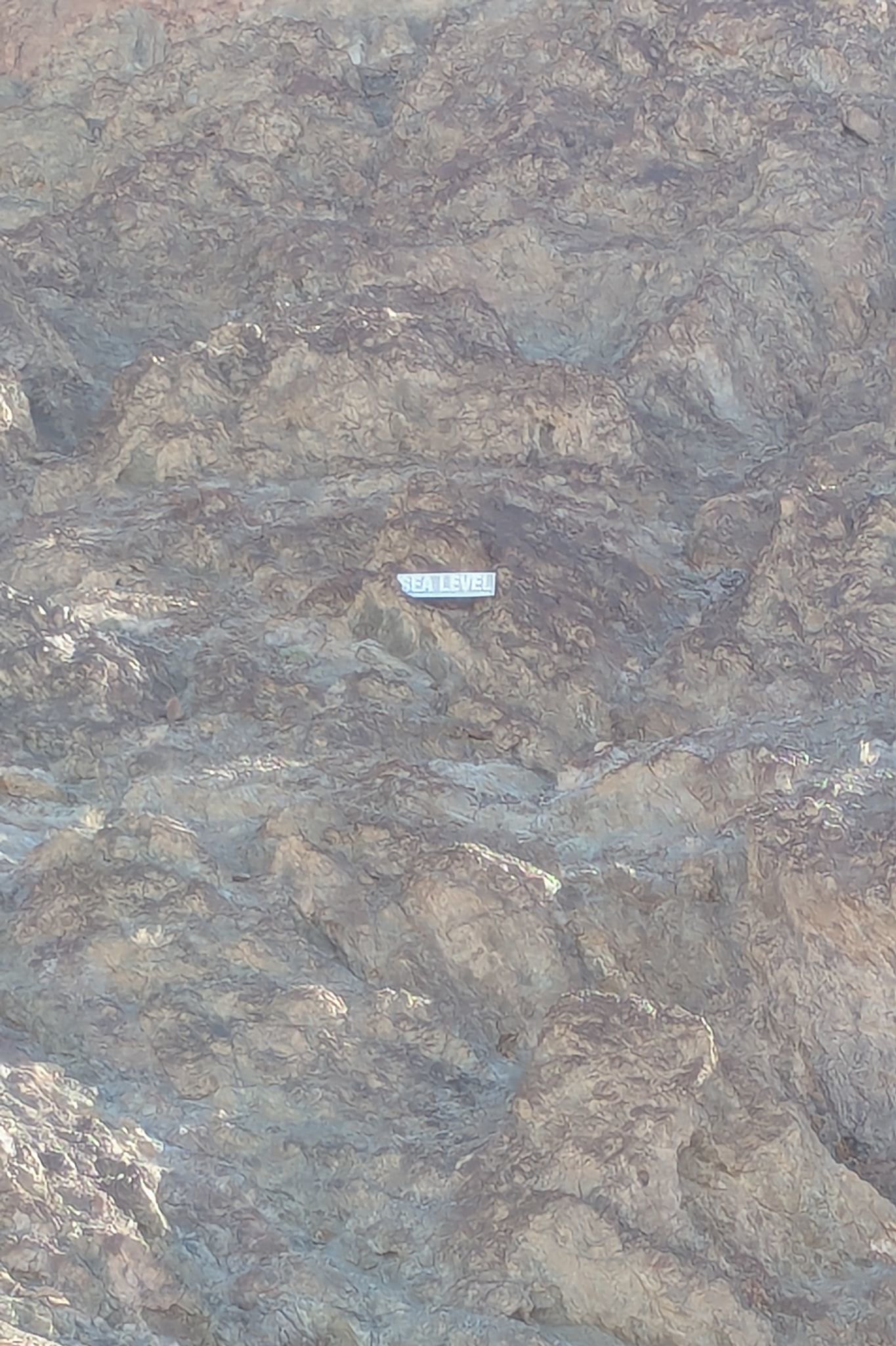
Dantes View, Dantes Peak
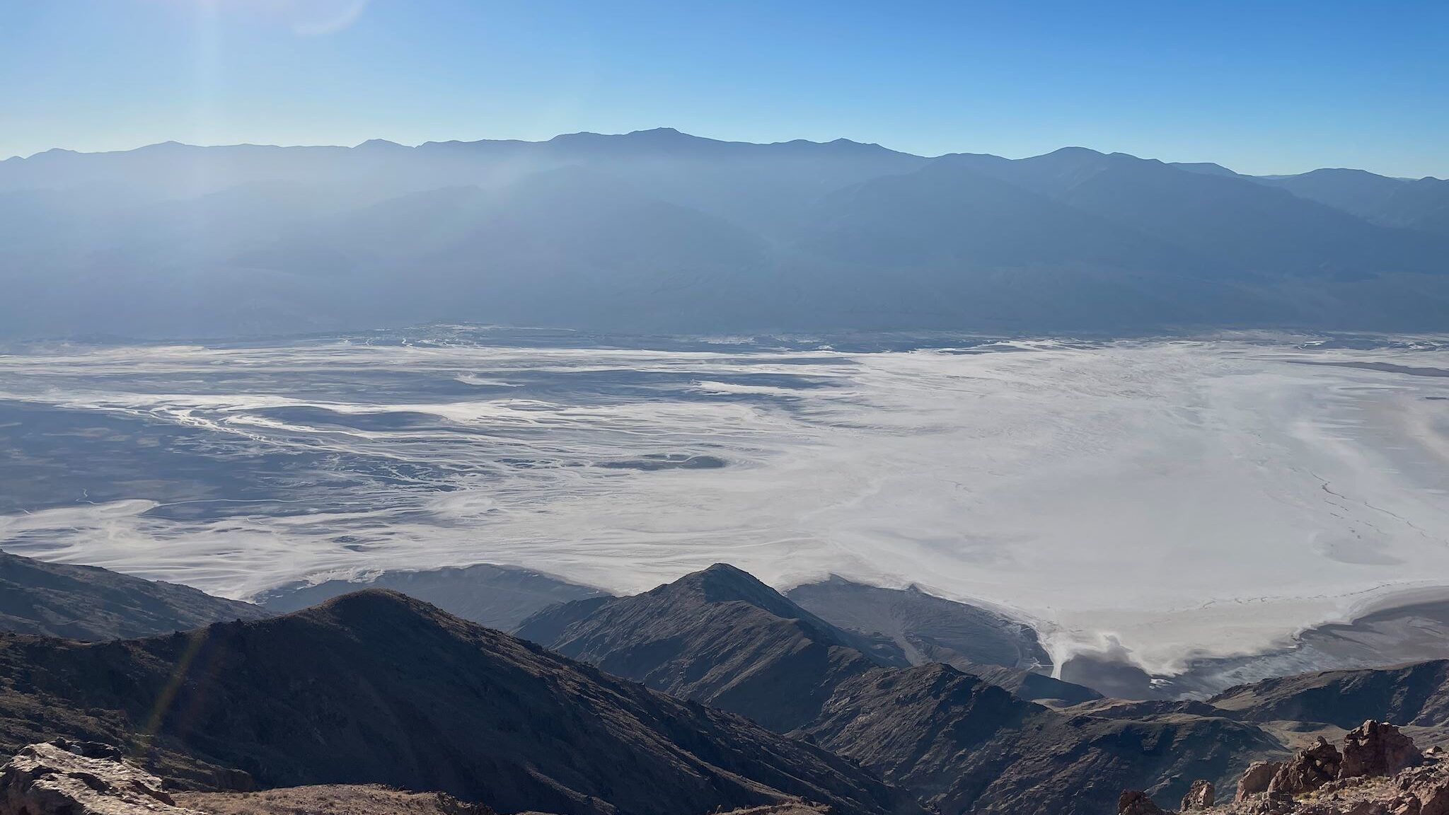
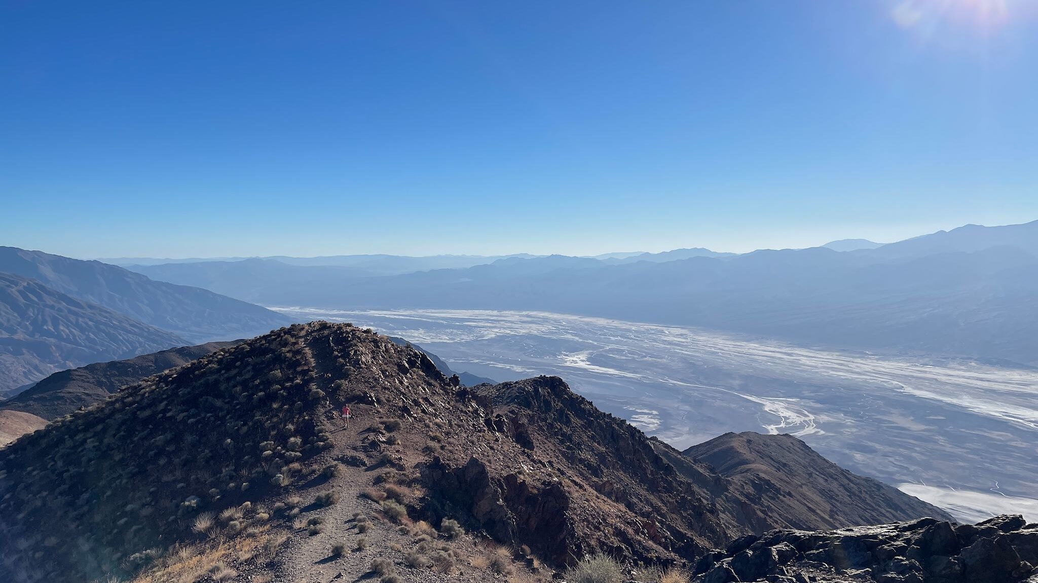
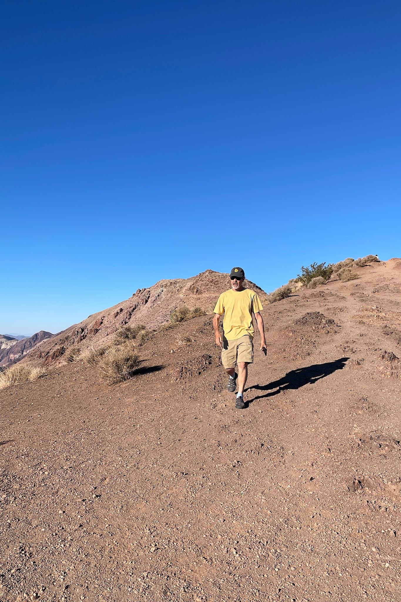
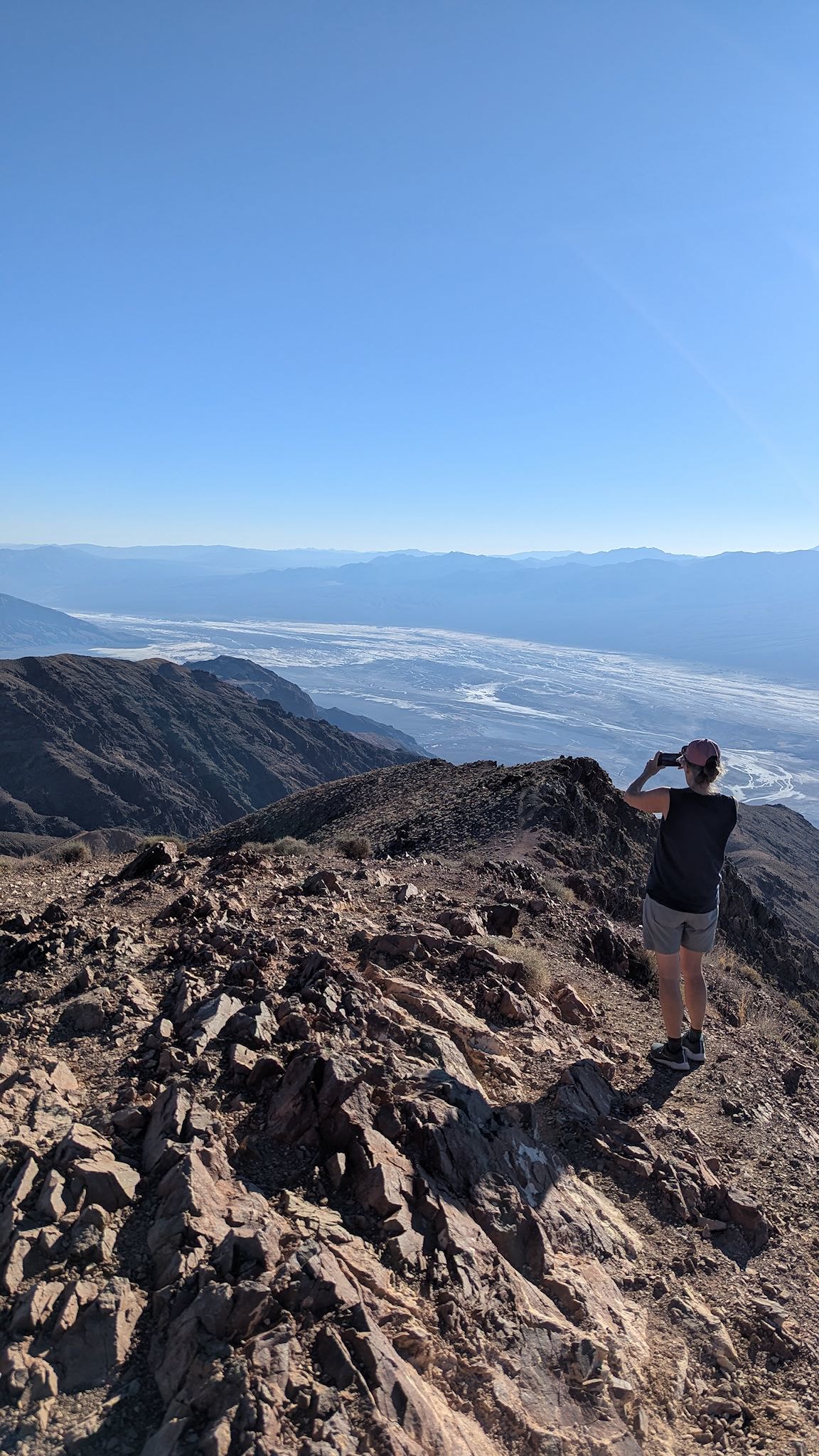
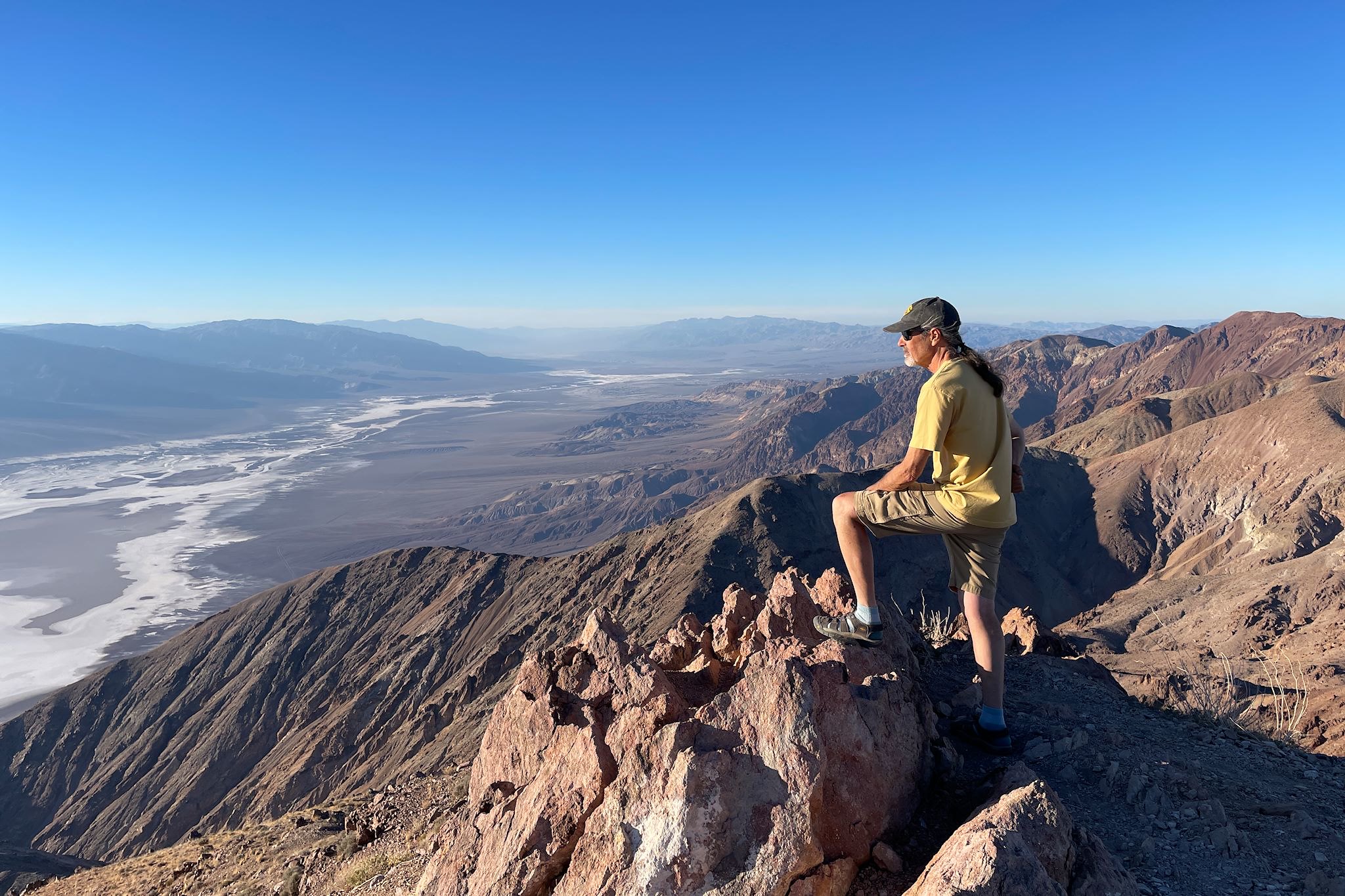
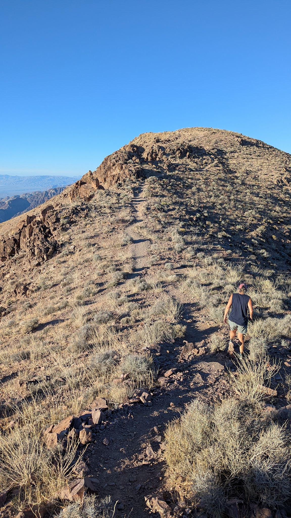
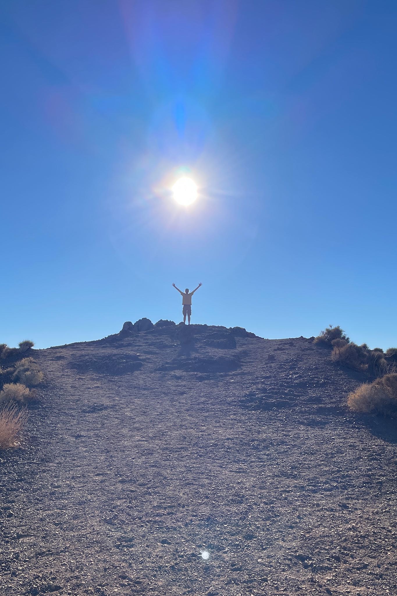
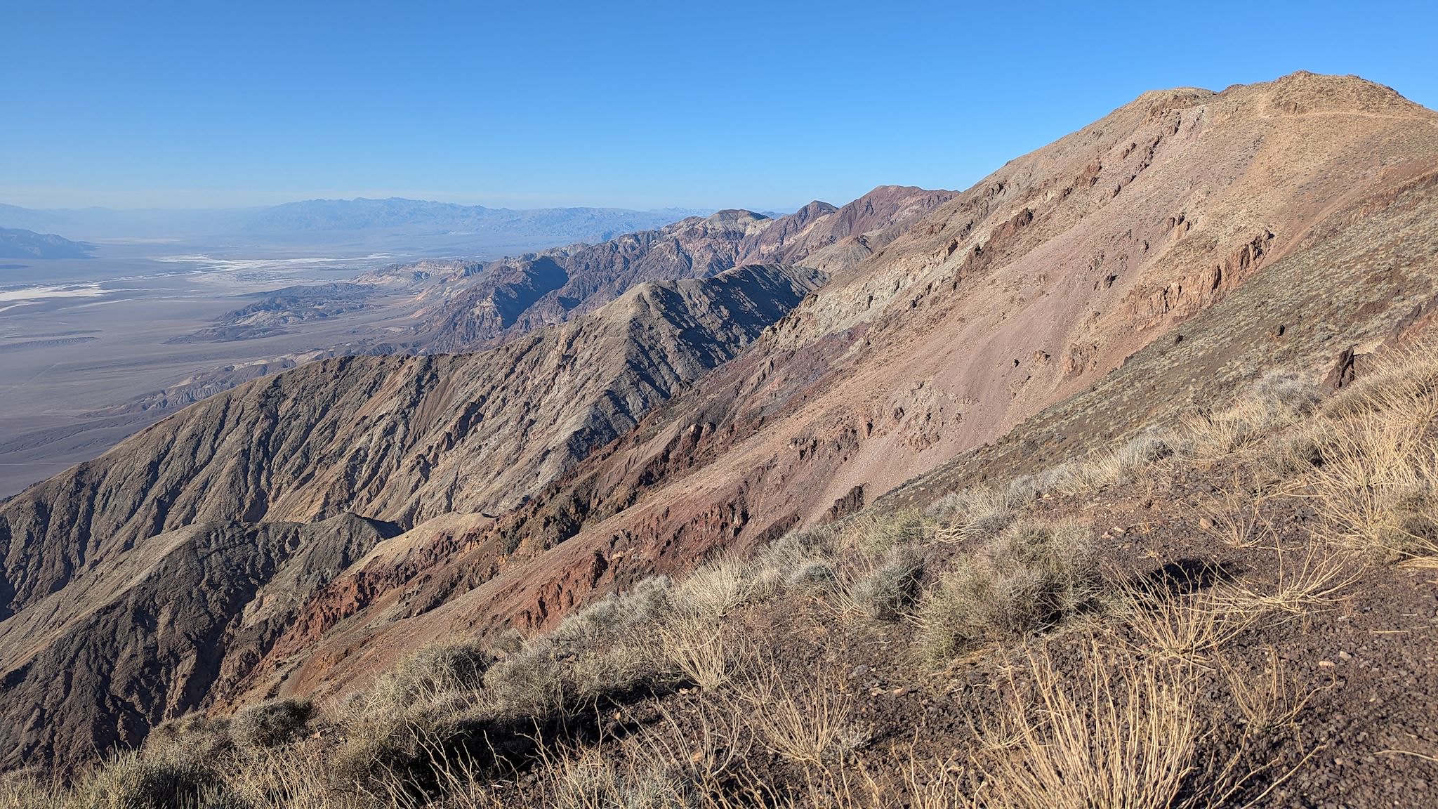
The obvious choice was Dantes View (also Dantes Peak), one of the best scenic views in the park and just a few miles from where we were. (Those are not typos – these sites were named after Dante Alighieri and would have apostrophes in them except for an obscure federal policy that prohibits possessive apostrophes in place names.) Undaunted by this grammatical offense, we drove to the viewpoint at 5,475′ elevation, atop the Black Mountains of the Amargosa Range and directly above the Badwater Basin (-282′), providing massive north-south views up and down Death Valley, and across to the Panamint Range that bounds the valley on the west. But there were a couple of trails leaving the parking lot to the north and south that caught our attention! There was one heading south along a ridge over a series of summits with ever-expanding views of the valley below, and another heading to Dantes Peak with 360° views. We did both!
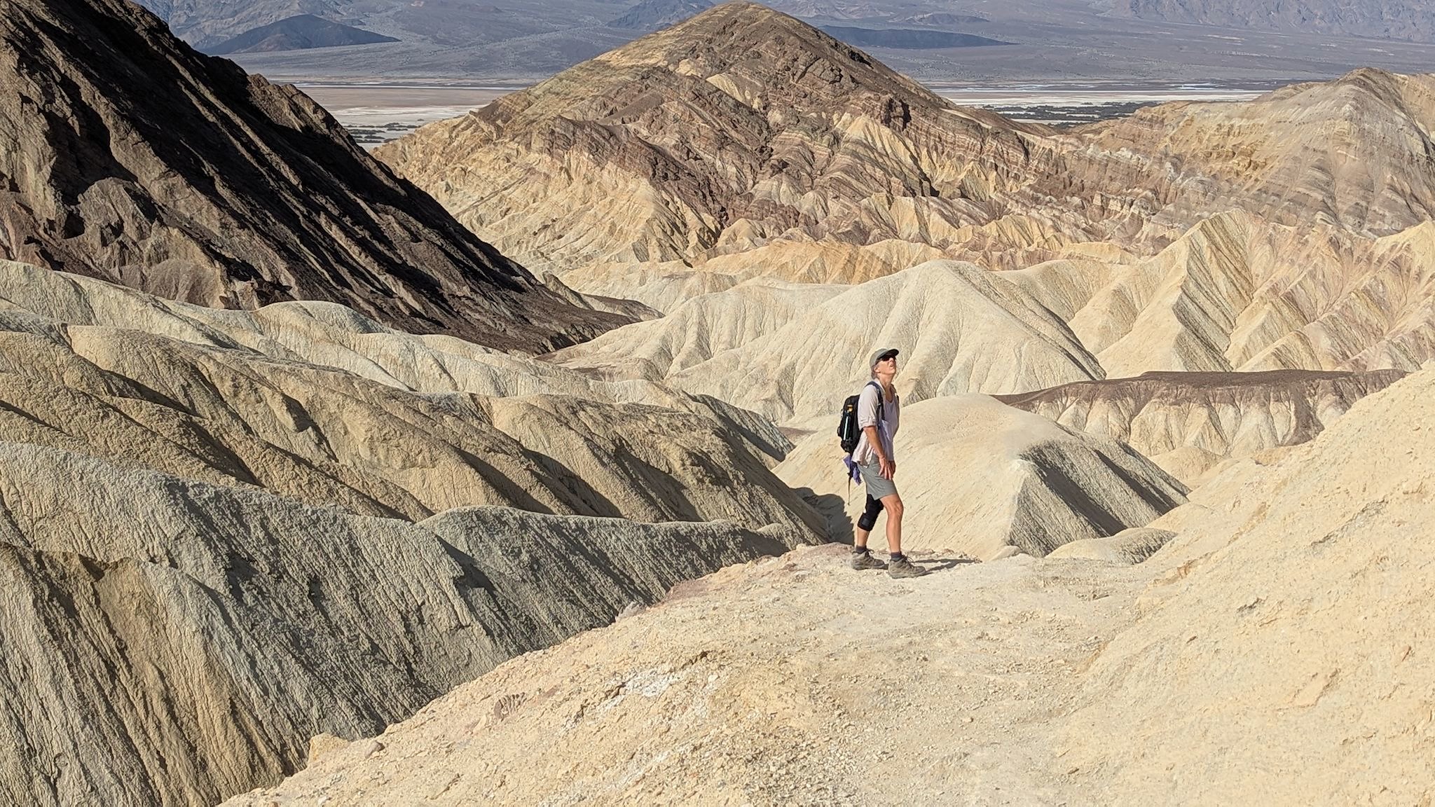
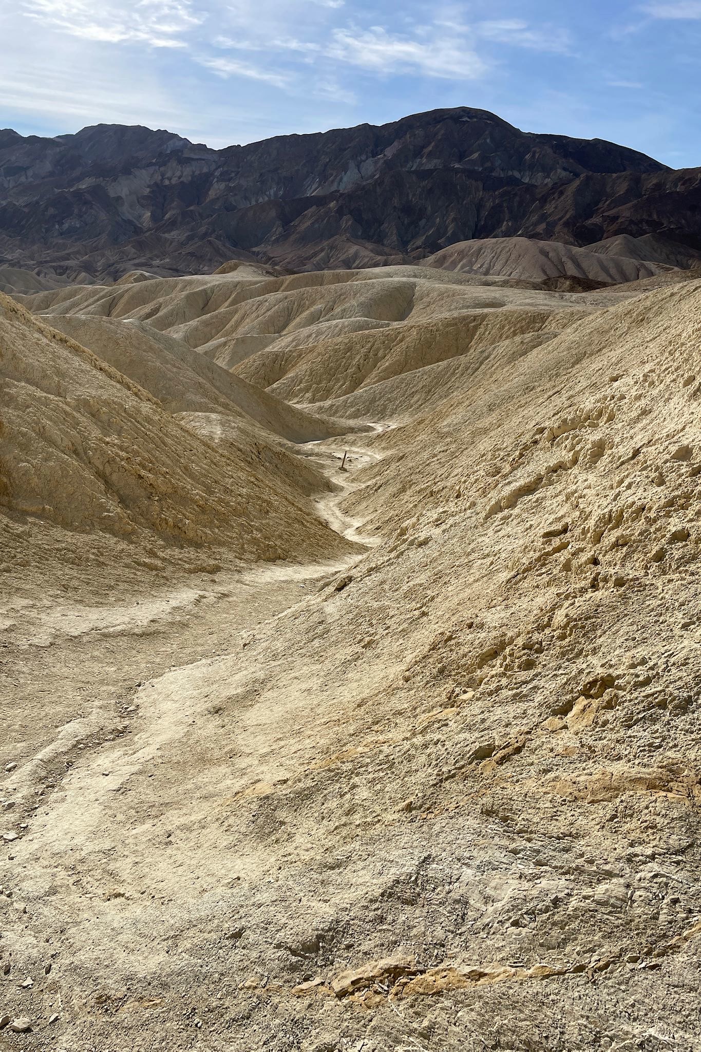
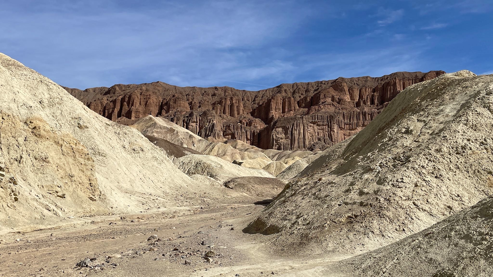
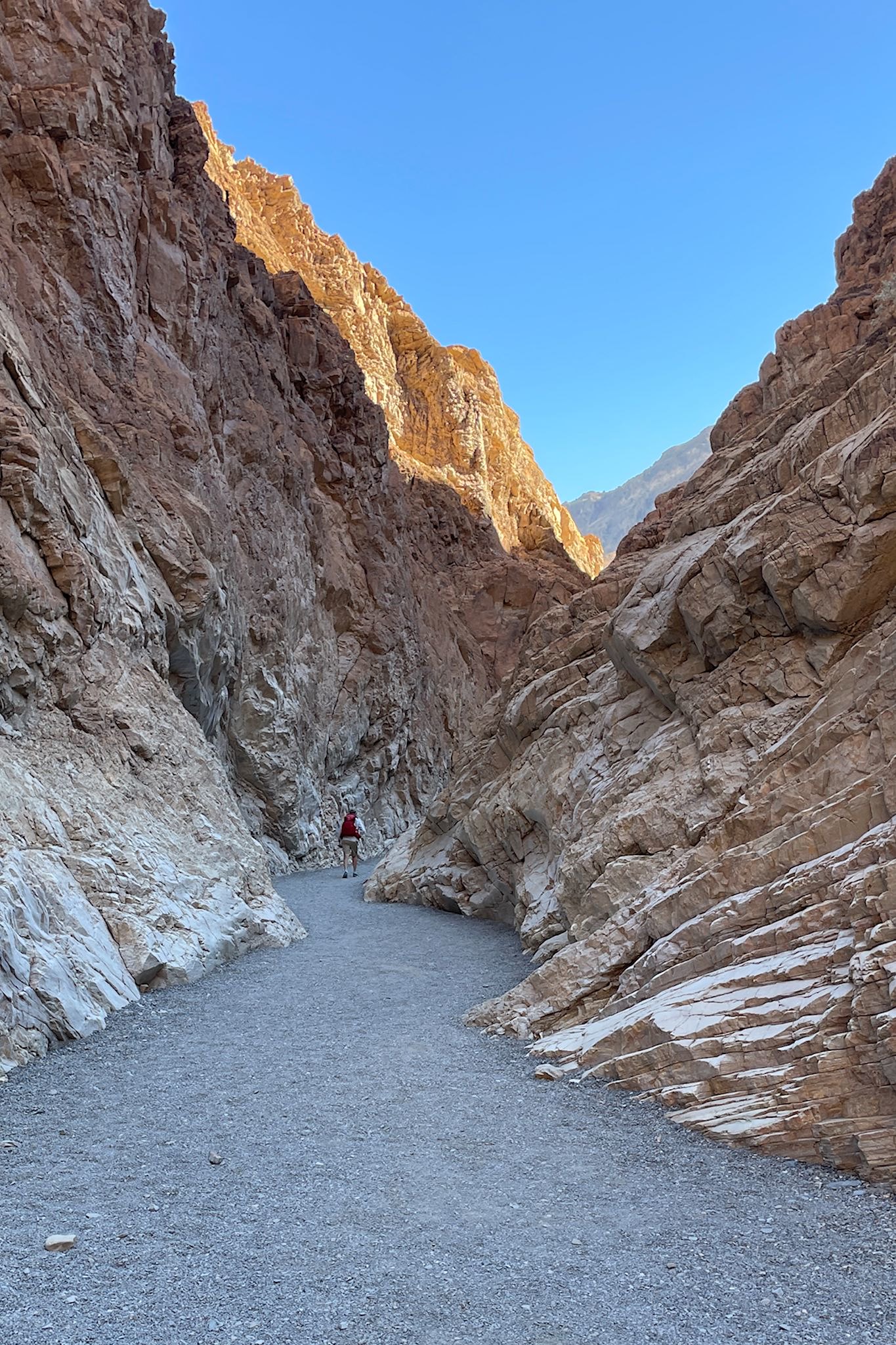
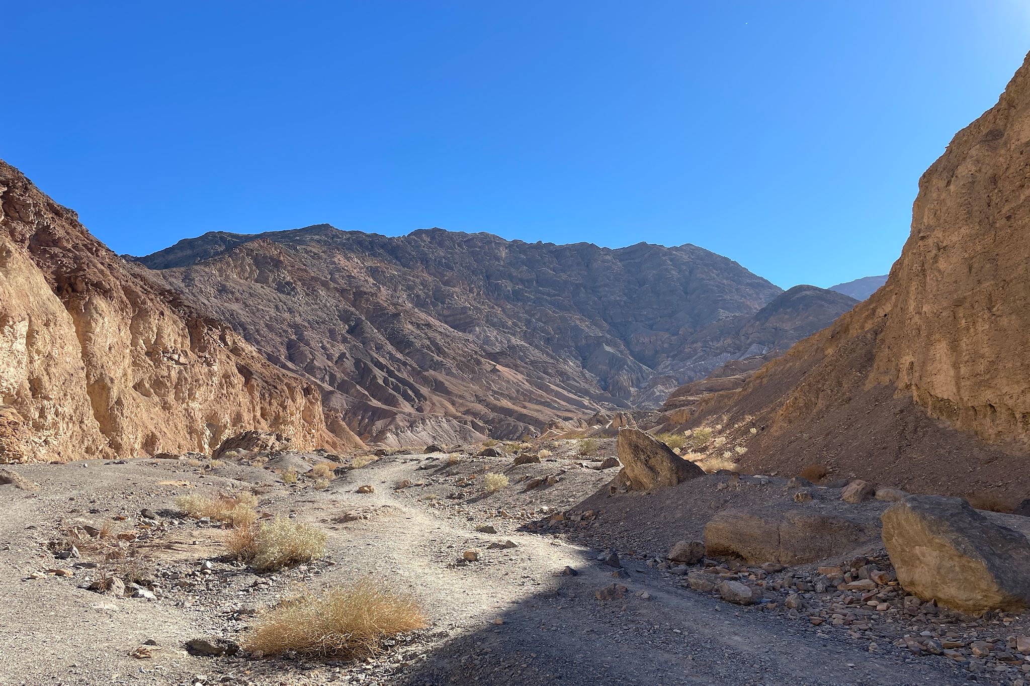
Golden Canyon/Gower Gulch/Bandlands Loop
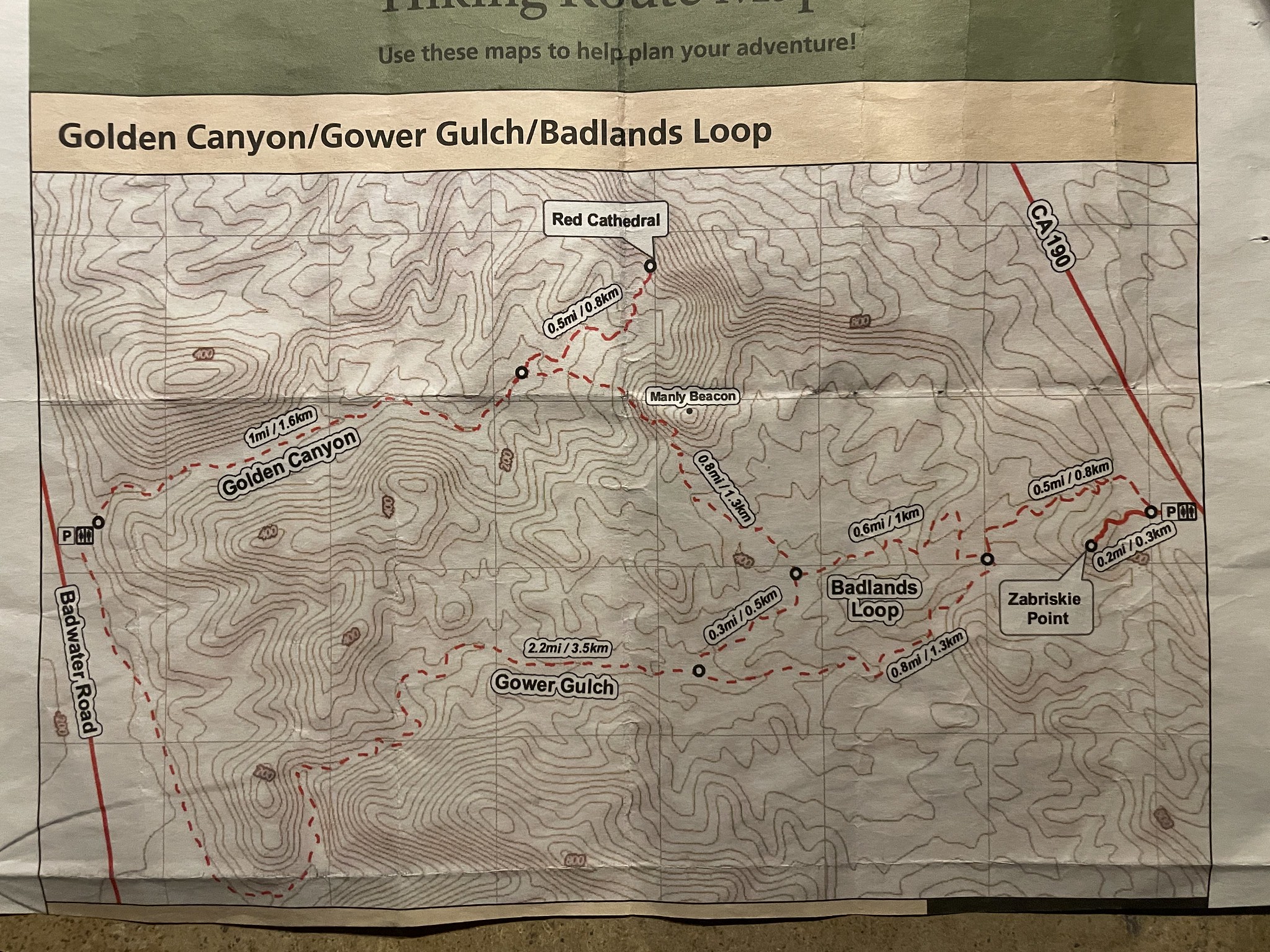
For an opportunity to see sights unique to Death Valley in a long day hike, the aforementioned kind ranger suggested that we could combine 3 hikes into the Golden Canyon/Gower Gulch/Badlands Loop hike. He nailed it!
Words can’t describe this hike so I’m going to take a break from trying. What follows are a few words and some pix. See the album links below for more!
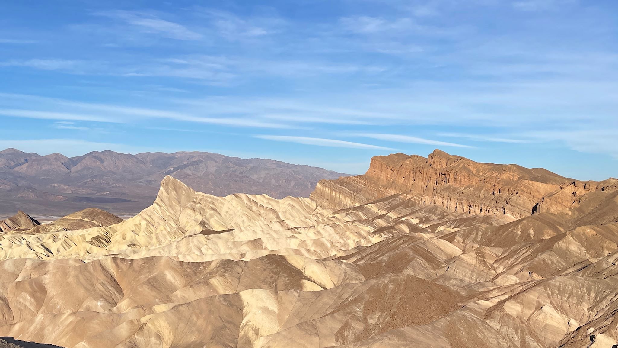
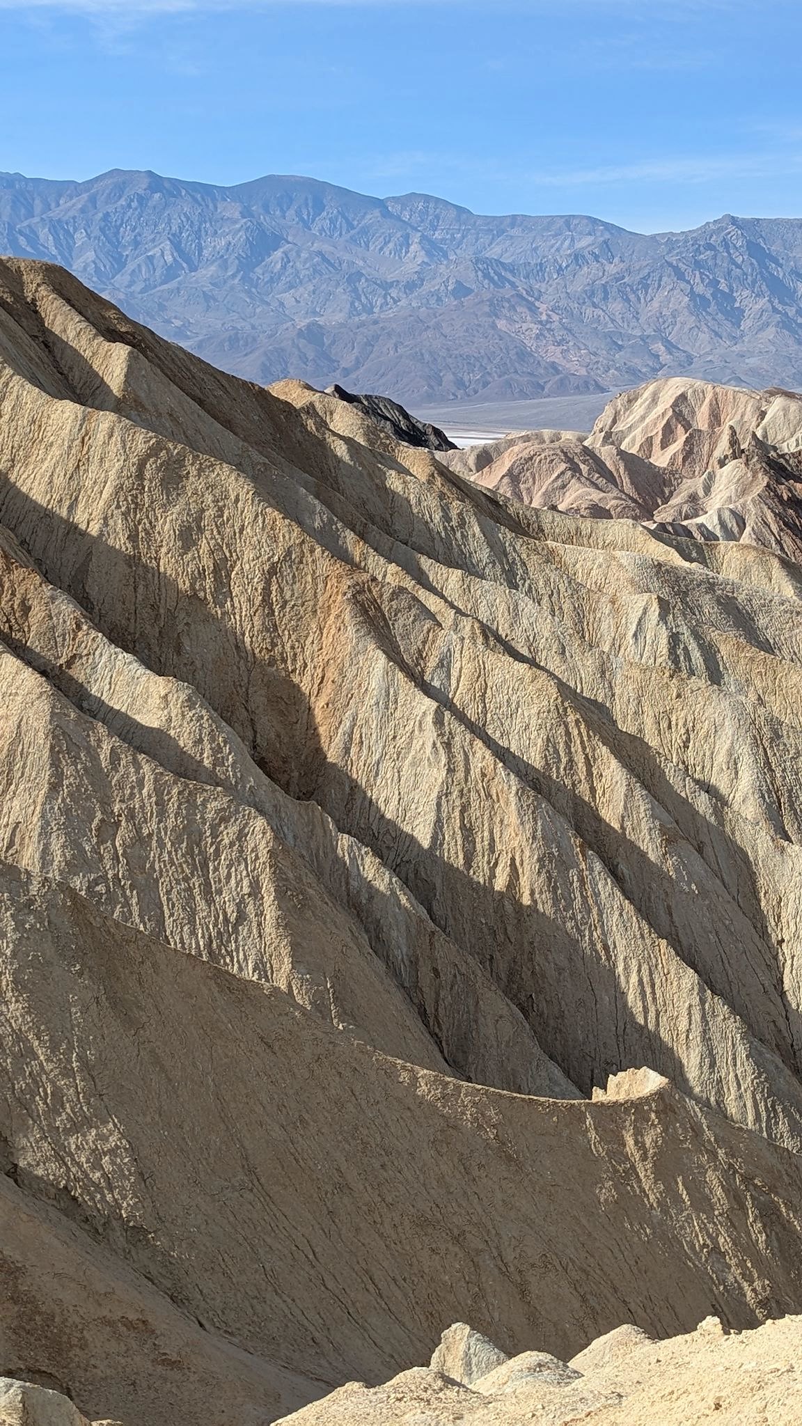
The hike starts from Zabriskie Point. [This rang a bell for Doug because he recalled it was the title of a counterculture movie that he never saw. As it turns out, one of the lead actors in the 1970 film was Mark Frechette (no known relation) and Doug says there is great potential here for falling into a deep rabbit hole – so be careful with that link.] Anyway… Once there, we were subjected to jaw-dropping views. OMG! And this is just the parking lot!
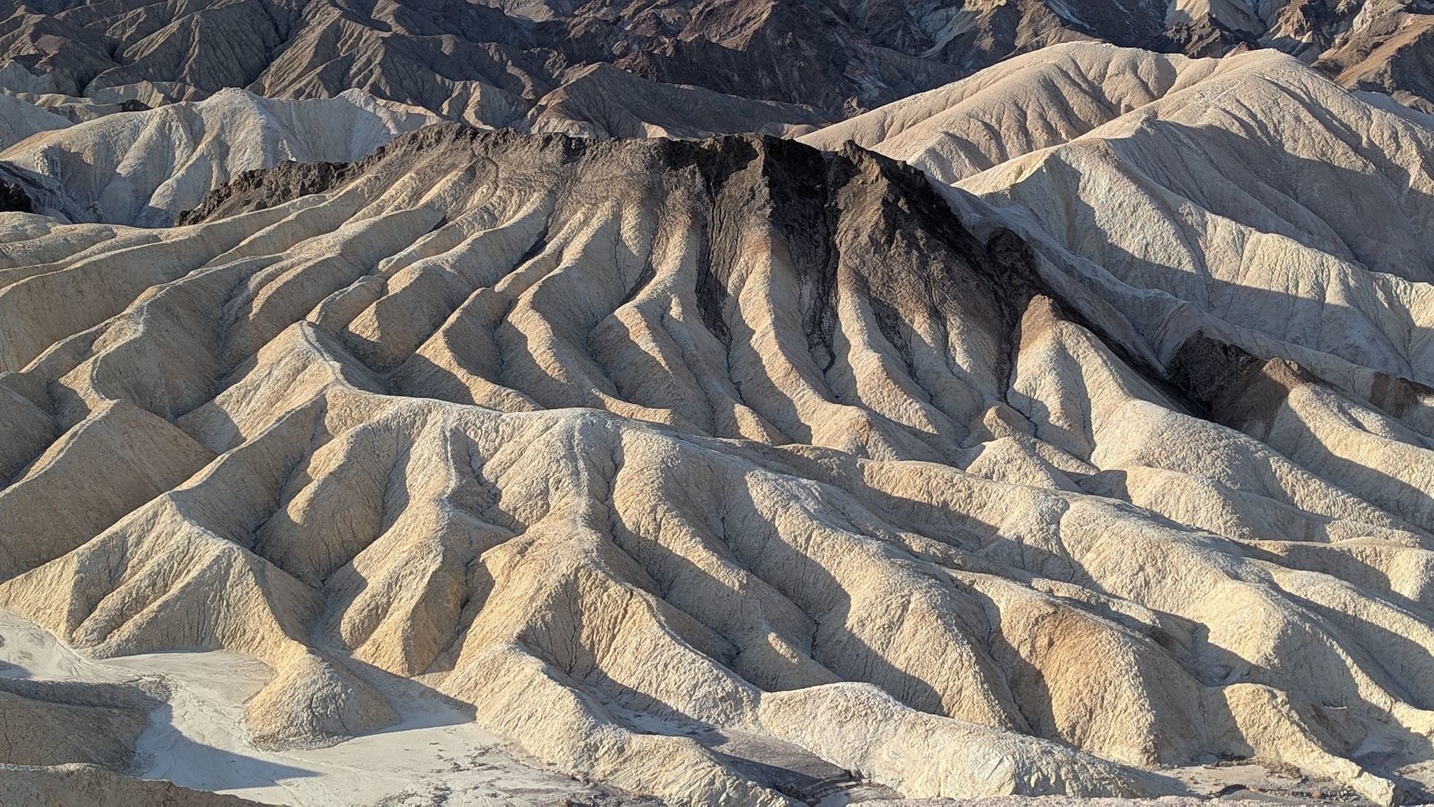
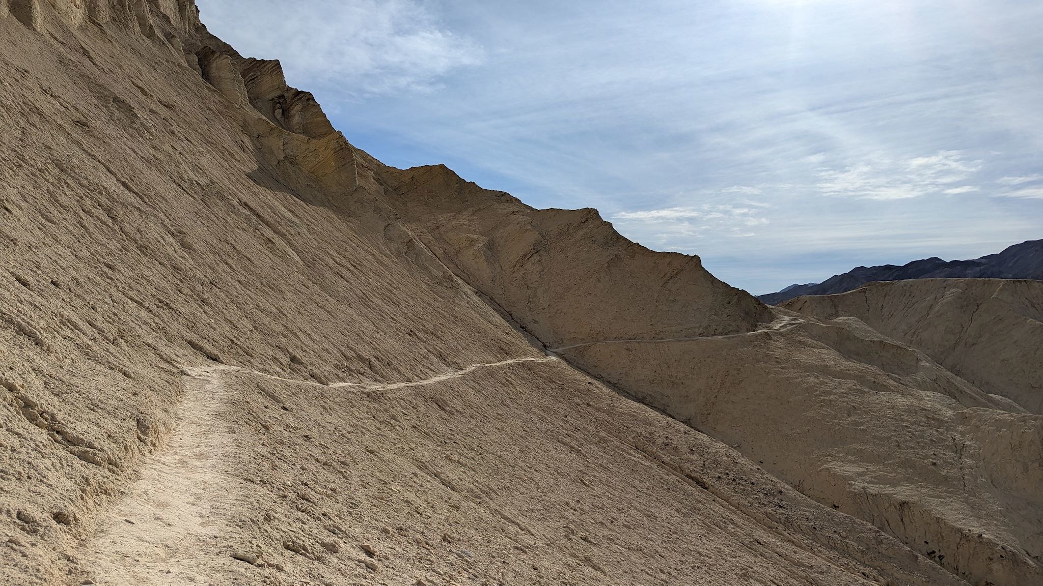
The first section of the Badlands Loop took us up, over and around these vibrantly colorful badlands and provided views of the features we’d be visiting along the next section of the hike, the most pronounced of these being Manly Beacon (named for William Manly, a pioneer who rescued several families from Death Valley during the California gold rush and who, by the way, was born in Vermont) and the Red Cathedral (named for looking like one).
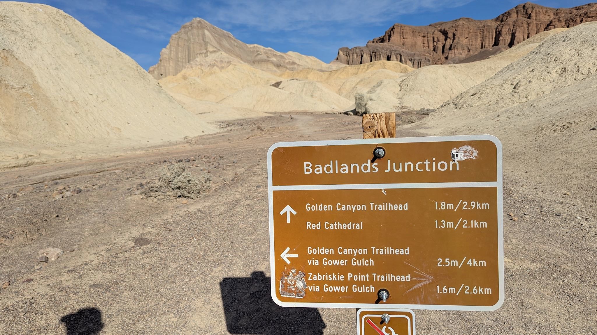
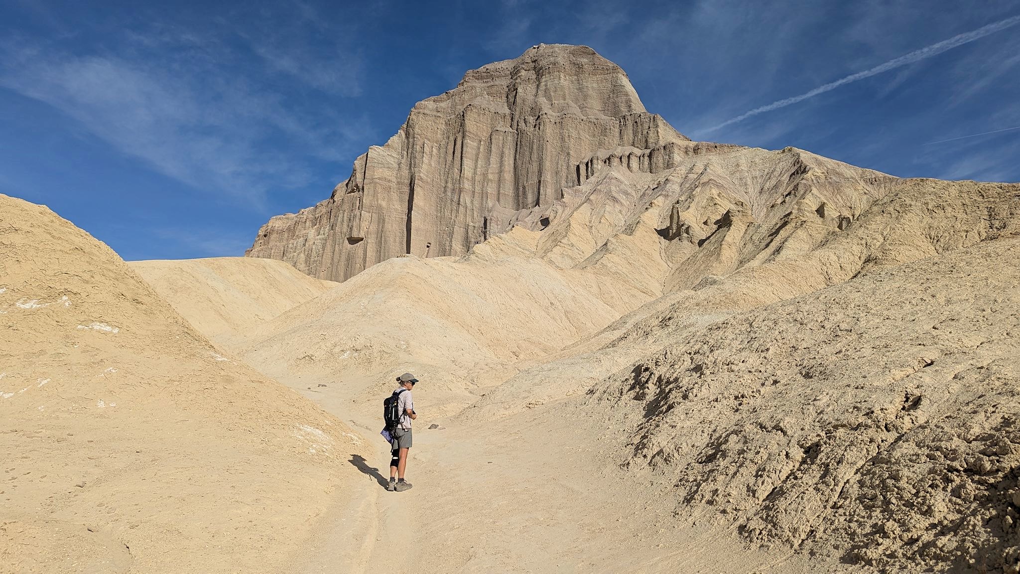
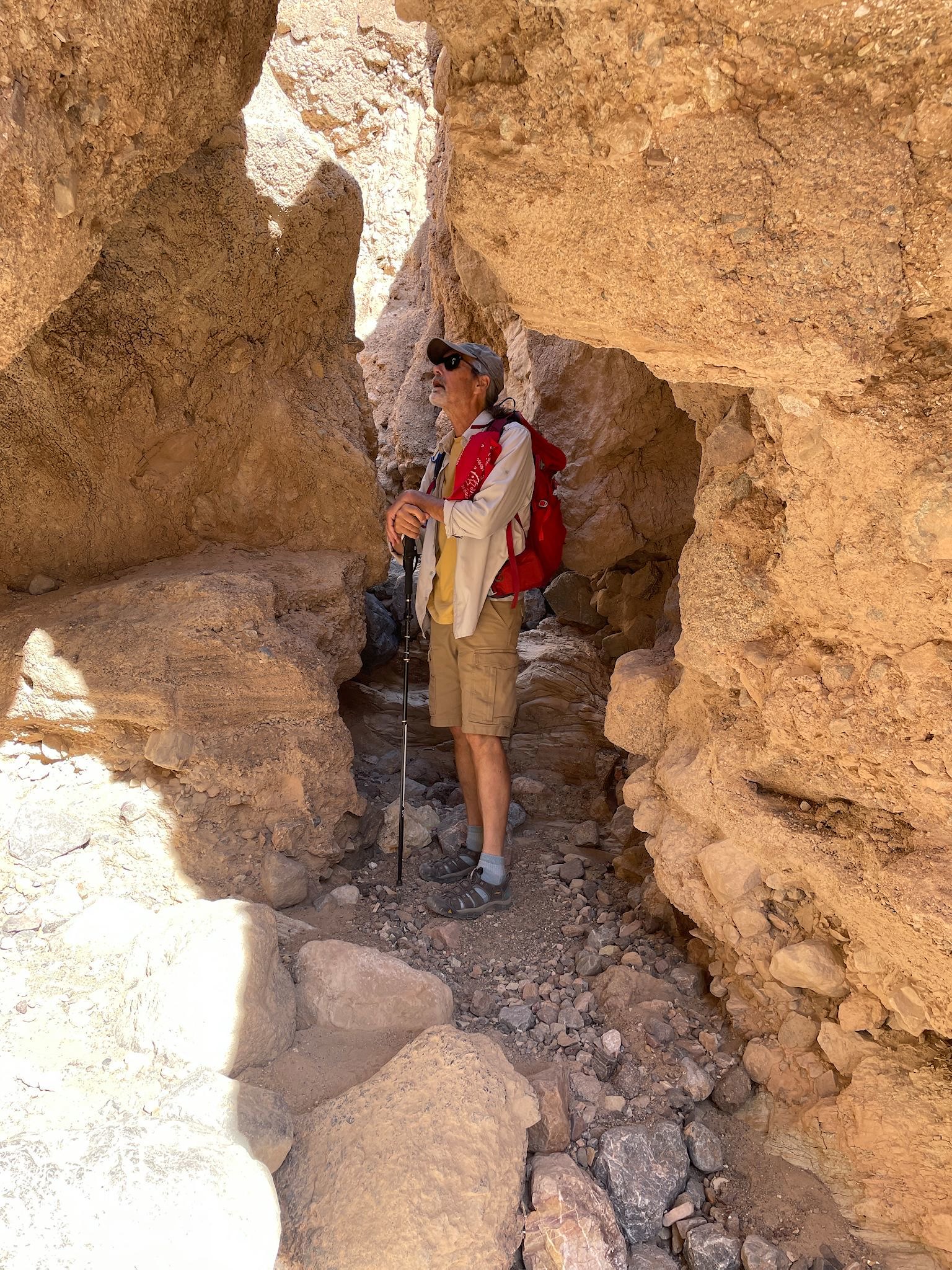
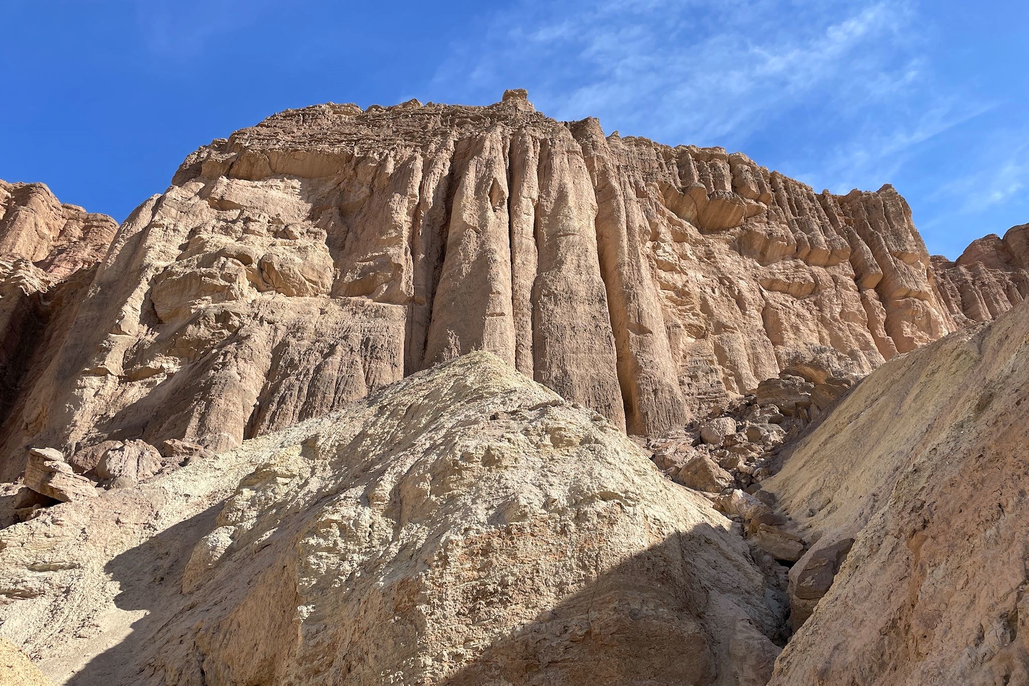
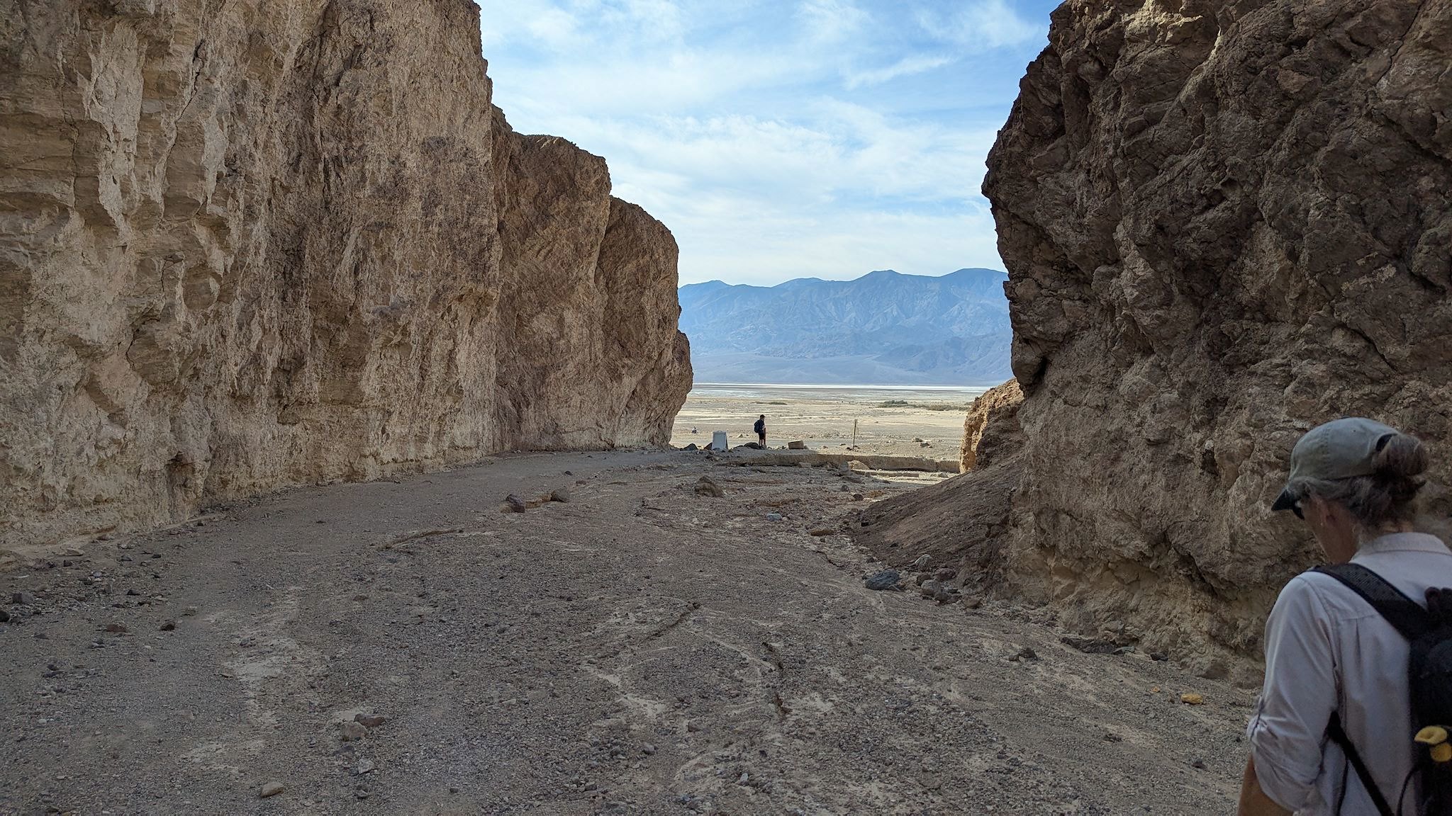
From Badlands Junction (really), we made our way to the base of Manly Beacon. Look. Straight. Up. Then the views toward Red Cathedral really opened up! There was a short trail to the base that included a tight squeeze through a narrow opening in the rocks, and there we were at the base of the cathedral. From this point, the trail continued through the canyon, mostly along washes with view of brightly colored mountains until we reached the end at the basin at the bottom of Death Valley.
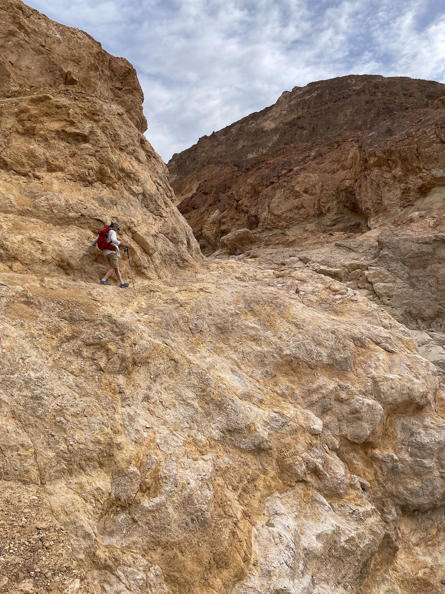
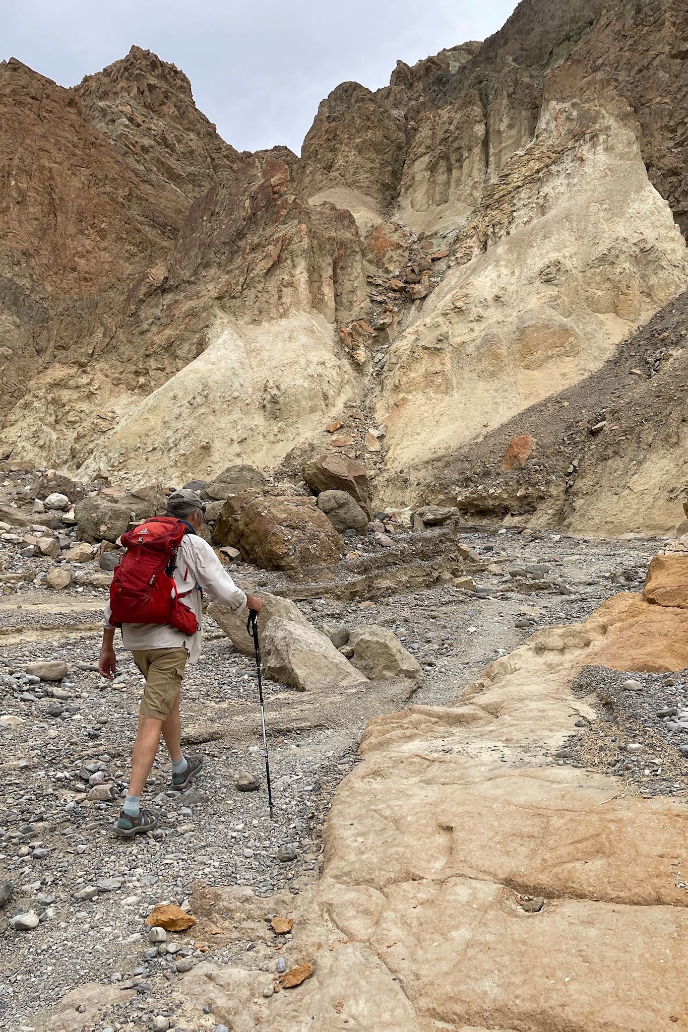
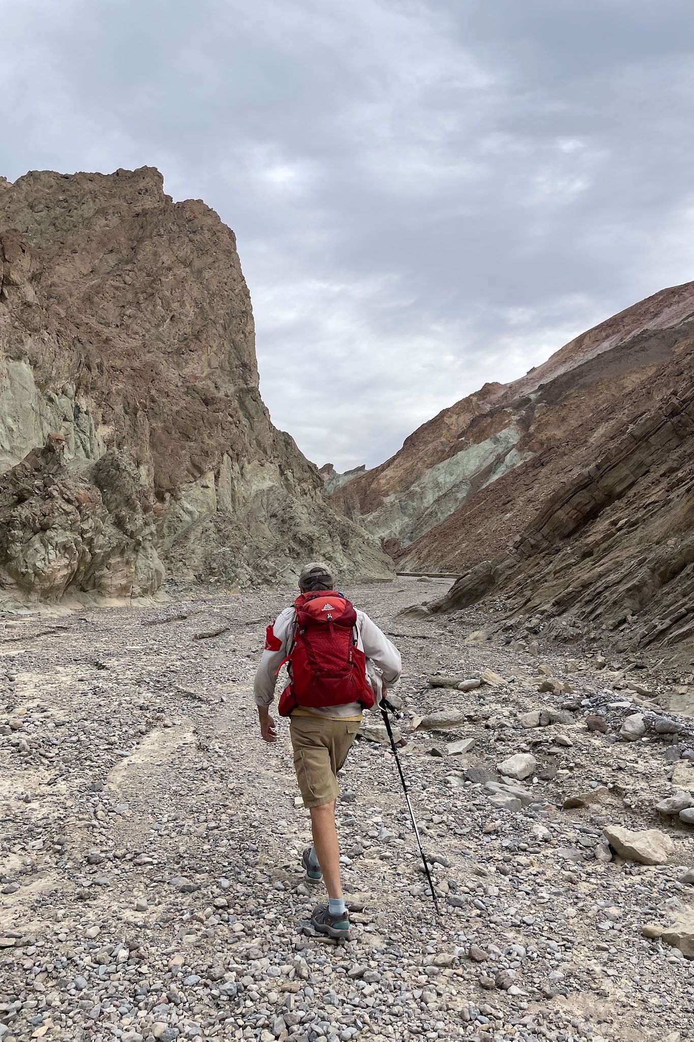
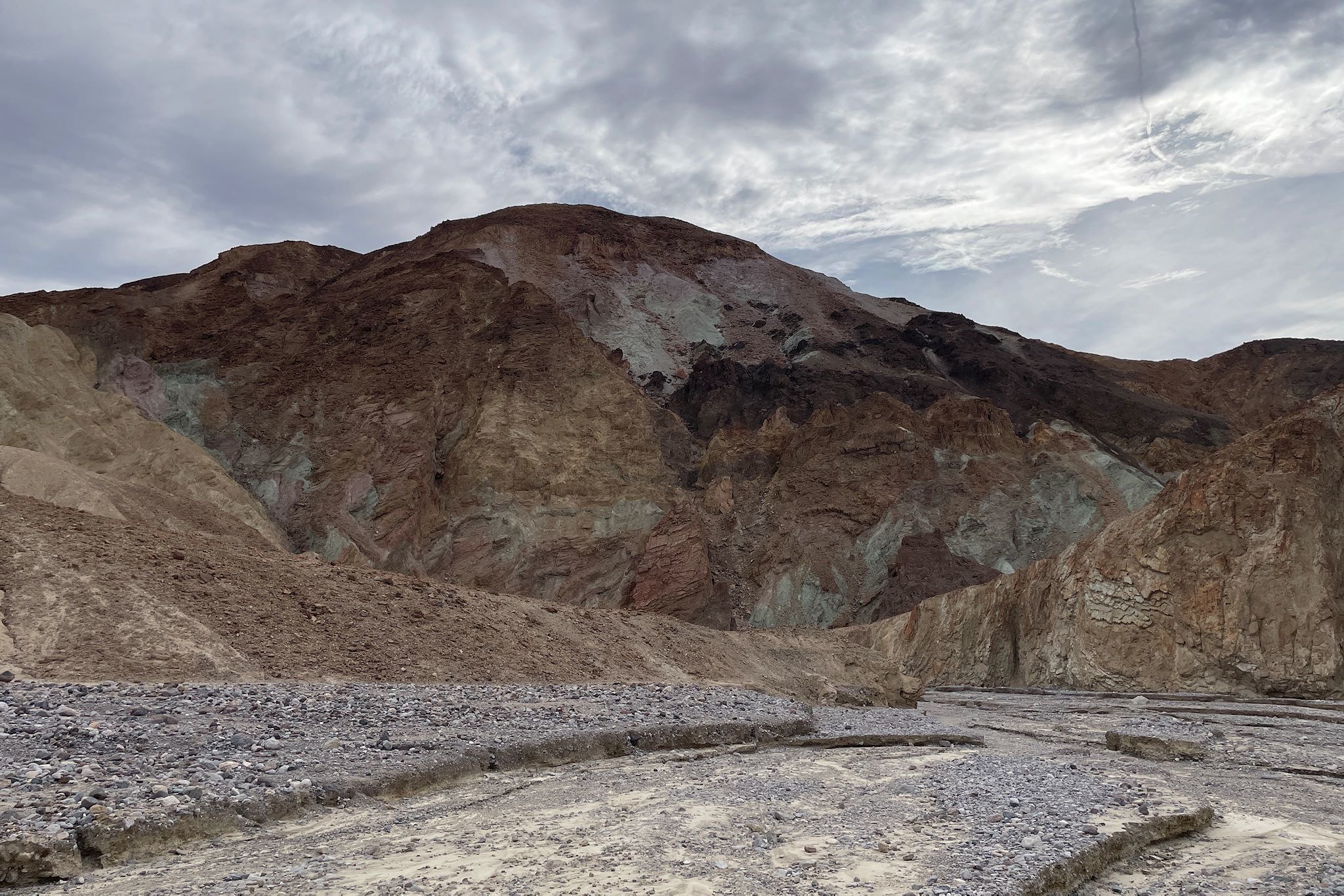
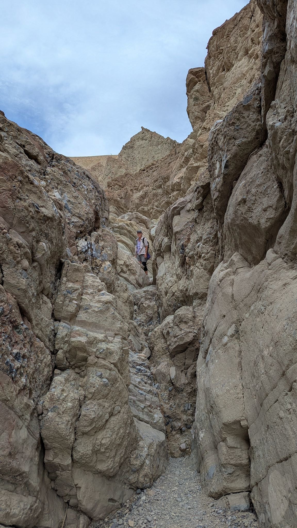
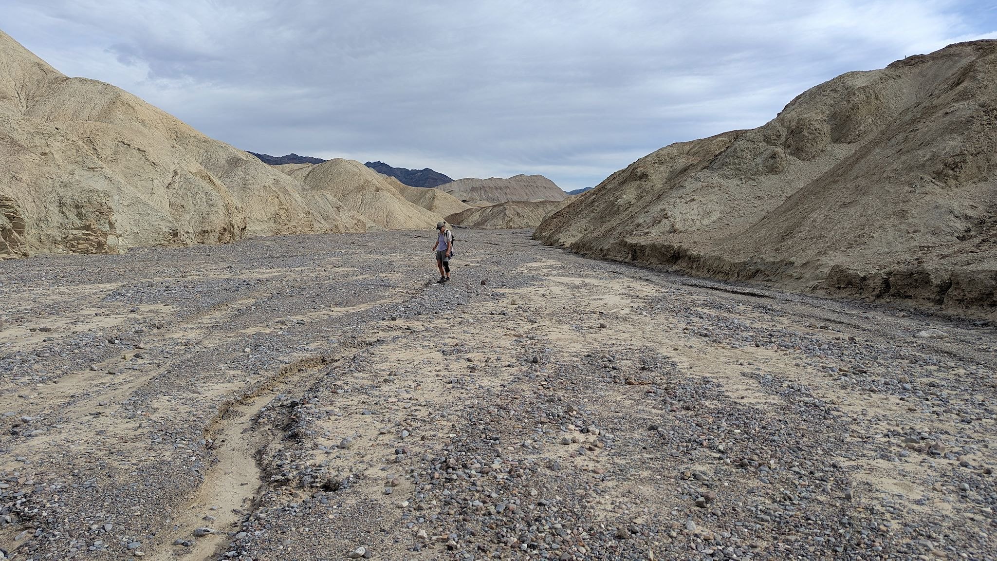
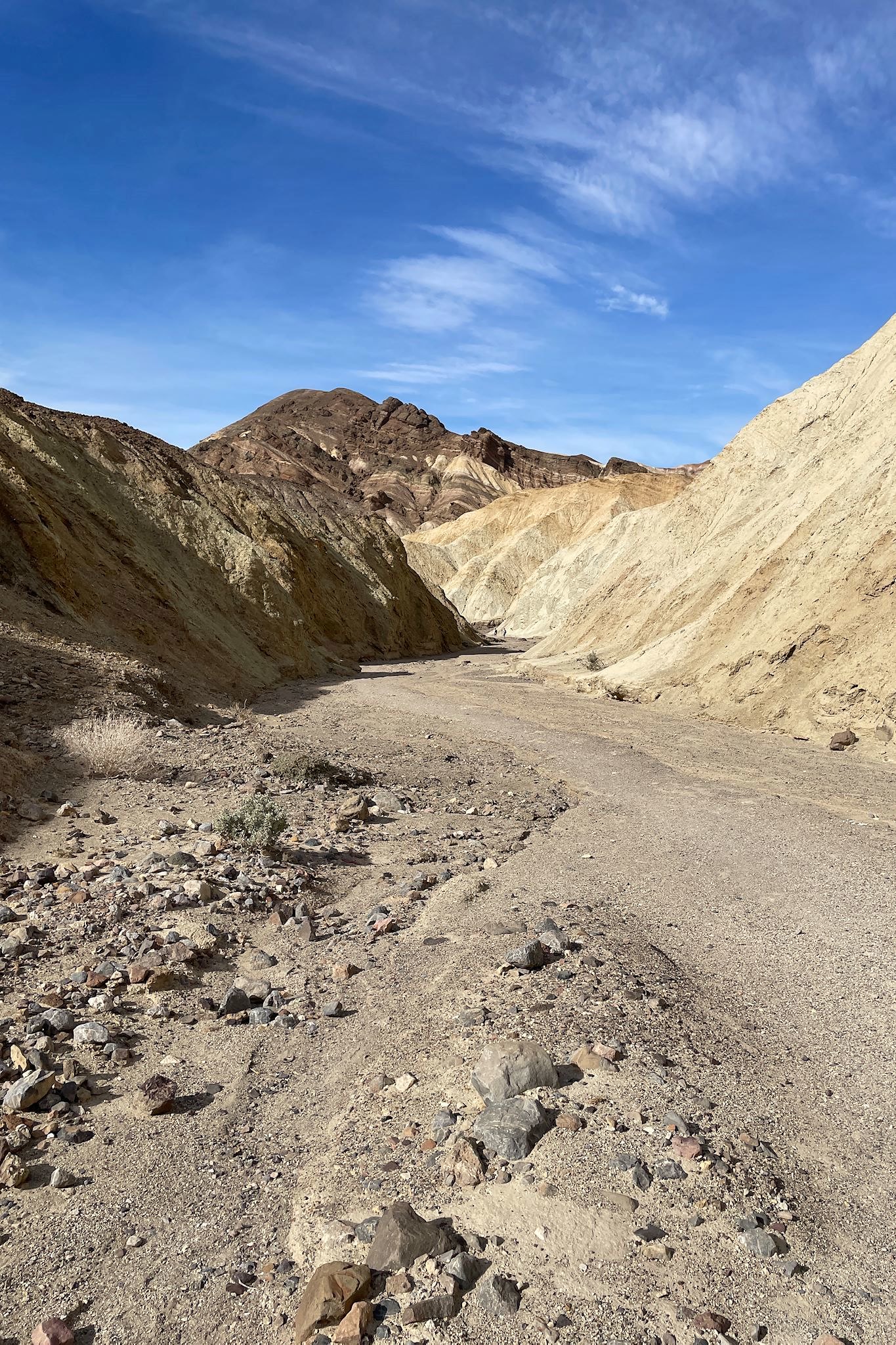
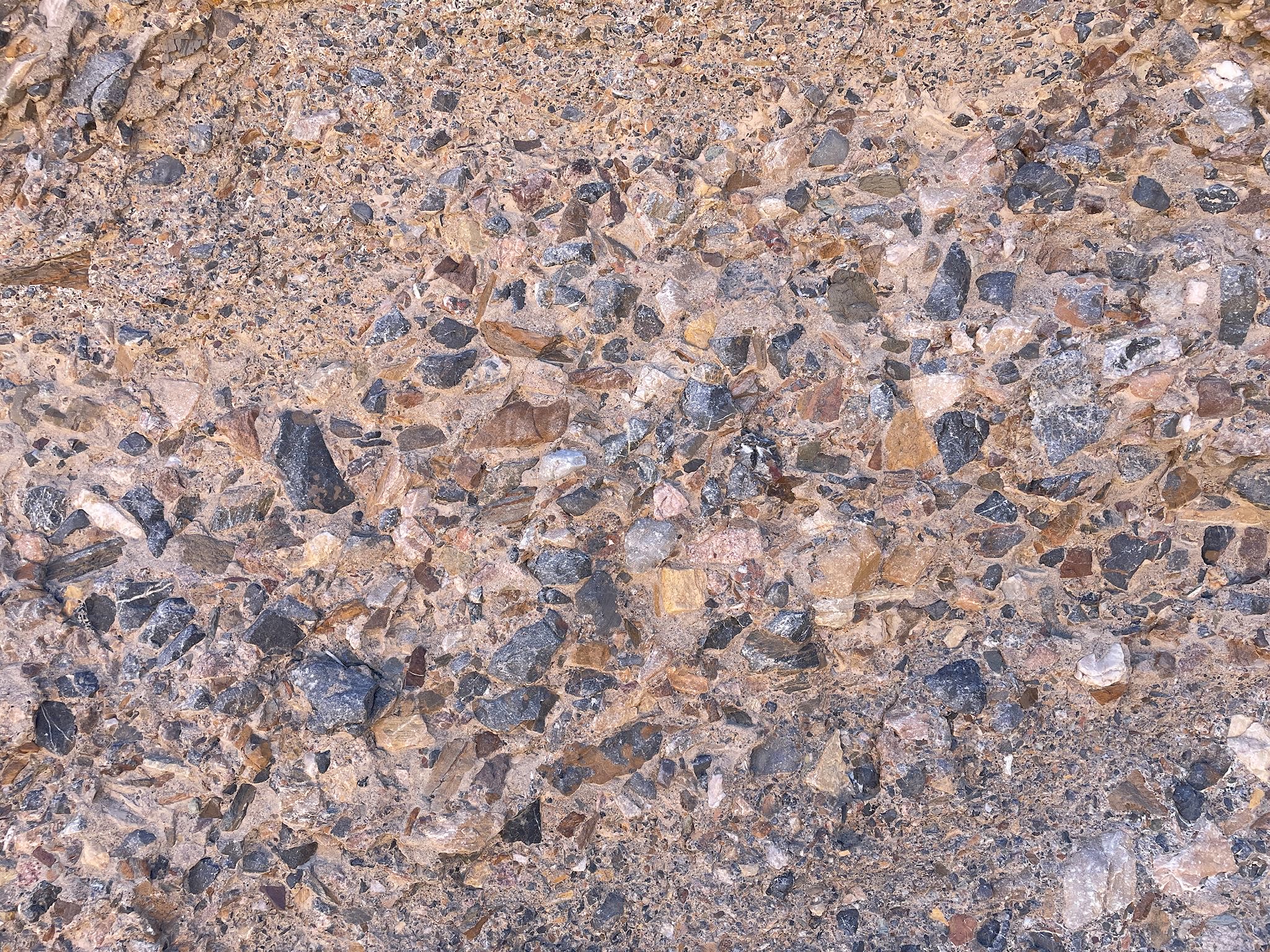
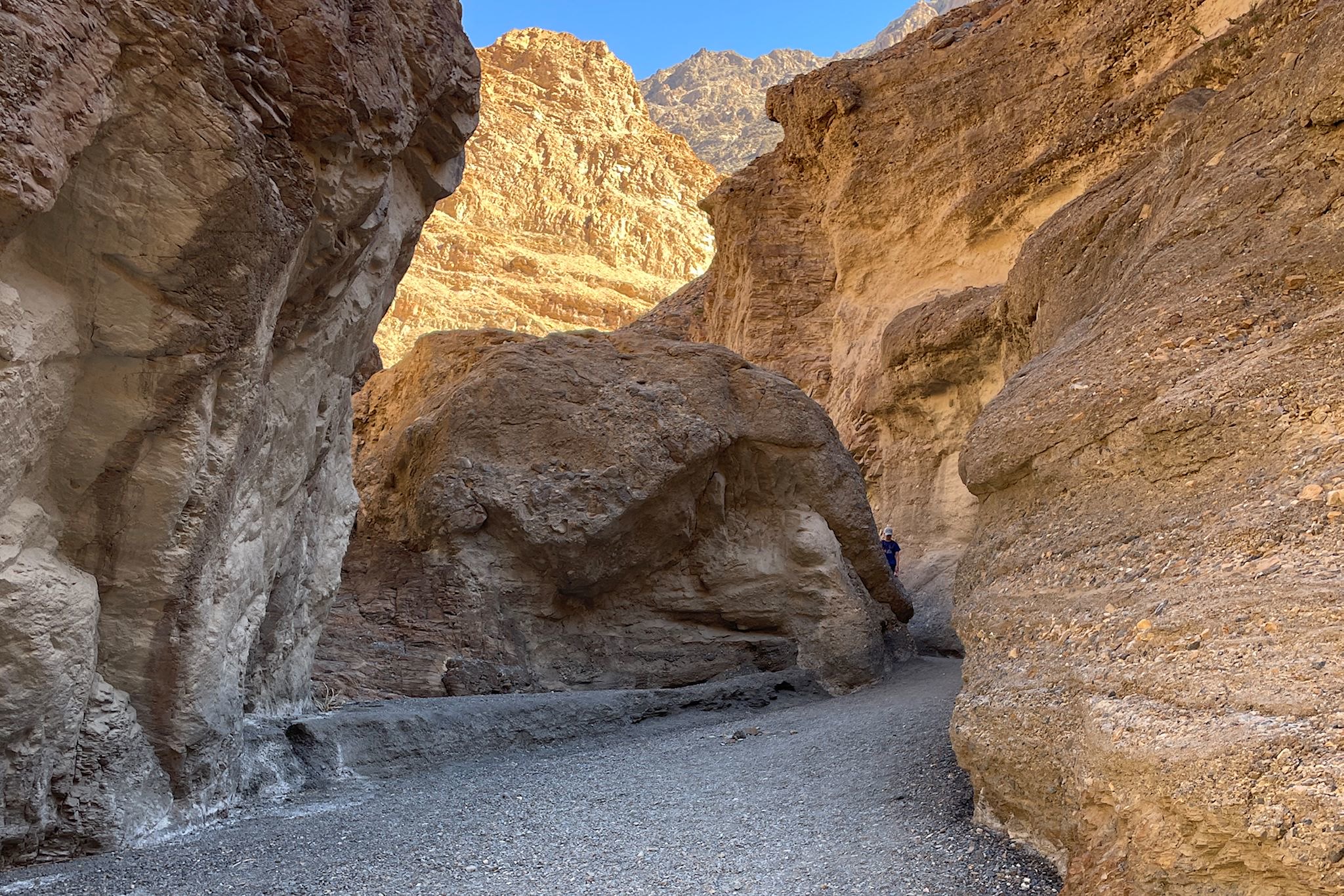
The Gower Gulch trail paralleled the basin for the first mile, before turning sharply upward into another canyon. There we were treated to differently colored mountains – lots of greens – and natural mosaics rocks (breccia) made of fragmented rocks of various sizes, shapes and colors that became locked together by natural cement. We had fun scrambling up the rocks in the middle of the gulch, where in many places we could easily reach both side of the rock walls. Above the narrows, we followed the trail along a long wide wash, eventually rejoining the end of the Badlands Loop back to the trailhead.
Badwater Basin
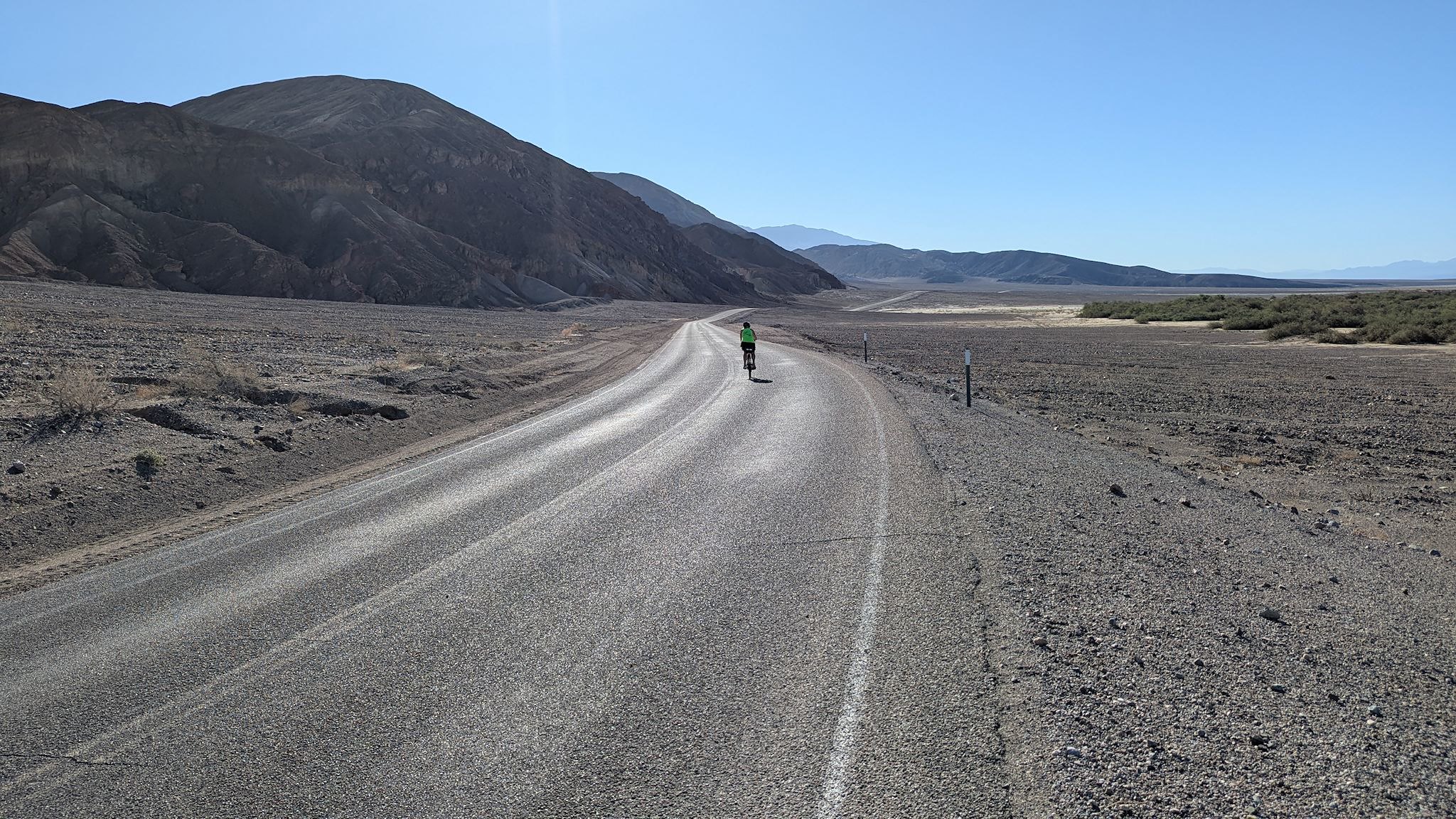
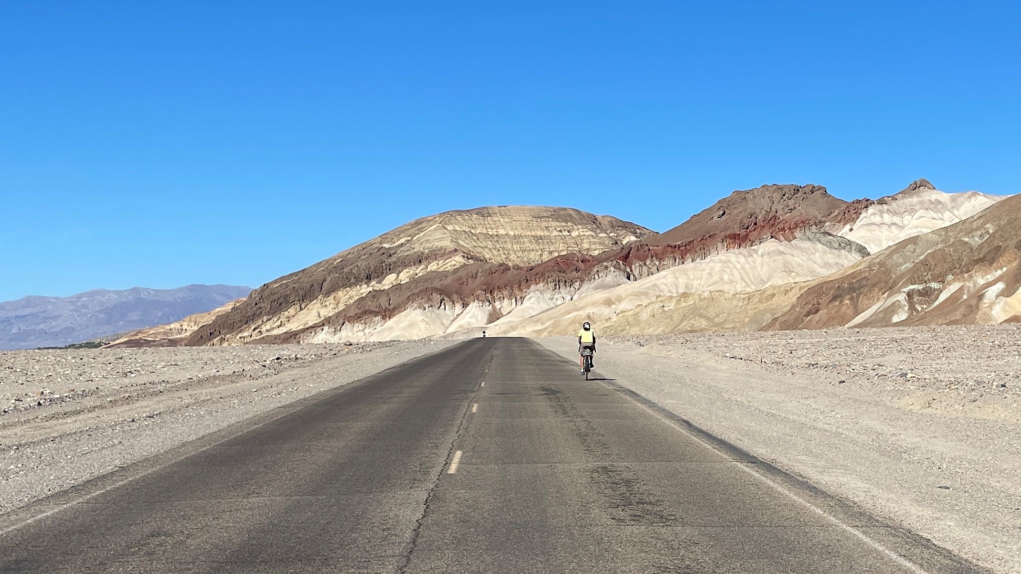
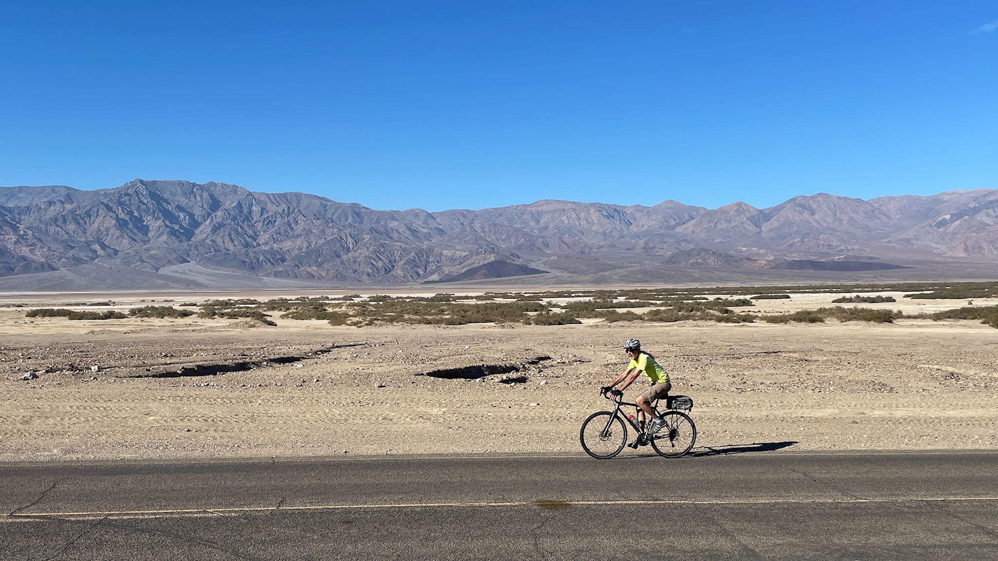
Death Valley is hot, of course. It’s also dry, averaging 2.2 inches of rain per year. However, two years in a row a couple of destructive storms dropped their year’s worth in a single shot – 1.7 inches of rain fell on August 5, 2022 and 2.2 inches on August 20, 2023. These storms caused a temporary lake to appear at Badwater Basin, as well massive flooding from the side canyons that washed out roads. In fact, 3 of the main roads in the park are still closed to motor vehicles, including Badwater Road. Wait, closed to MOTOR vehicles? Grab the bikes!
We set off on our (t)rusty bikes early in the morning, while the valley floor was still relatively cool, on our way to Badwater Basin. Once on the closed portion of the road, Death Valley was ours. I don’t know if words or photos can capture the feeling. It’s hard to describe the vastness we could feel while riding a (relatively) flat road alongside the massive salt flat situated between the exceptionally tall (11,000+ feet above sea level) Panamint Range and (oddly enough) the vivid hues of the Black Mountains.
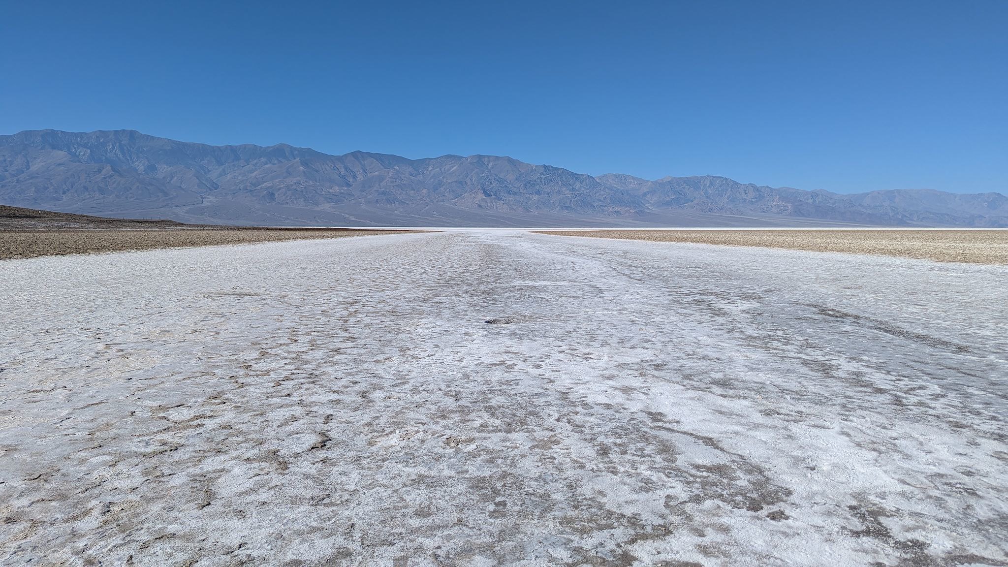
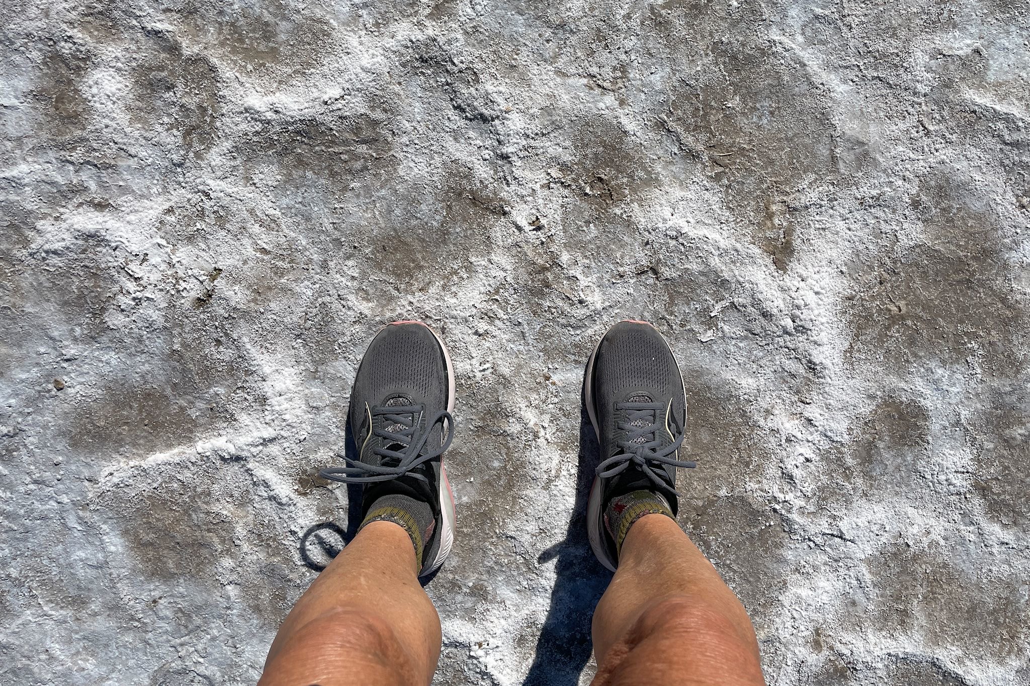
Along our ride, over the course of 5 hours, we saw 12 other cyclists and 3 backpackers. Arriving at Badwater Basin, 282 feet below sea level, we had the place completely to ourselves and satisfied our penchant for superlatives! We spent a bit of time walking out on the salt flats, viewing exhibits and contemplating the geological changes that took place over millions of years to lift the highest point in the continental US (Mount Whitney – elevation 14,505 and 85 miles away from us as the crow flies) up from the lowest.
As we left the Badwater Basin, we ran into the 3 backpackers who told us they had walked out to the Basin (because the road was closed) and were about to start their hike from there, the lowest point in the continental US, to the summit of Mt Whitney, the highest.
And Death Valley was still ours until we got back to camp.
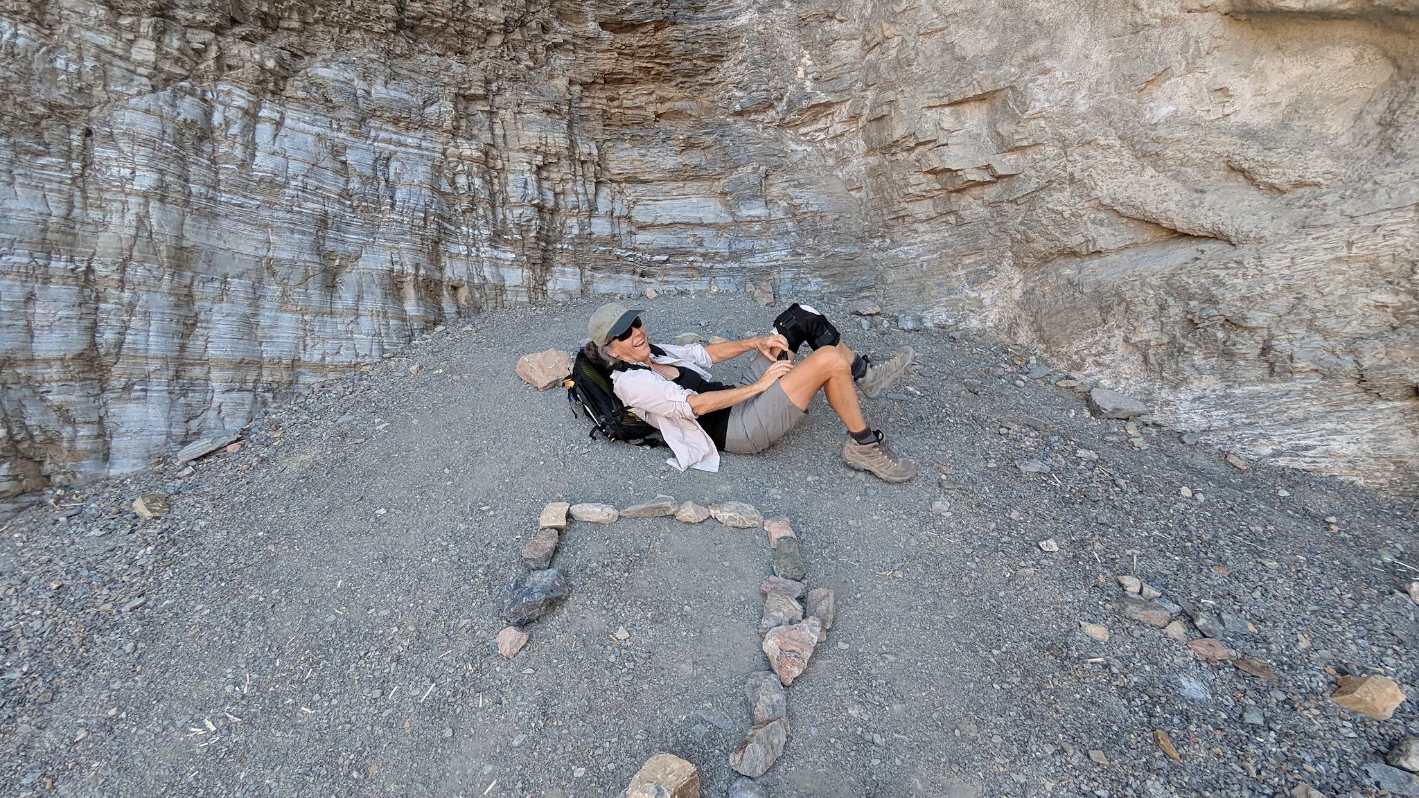
Mosaic Canyon
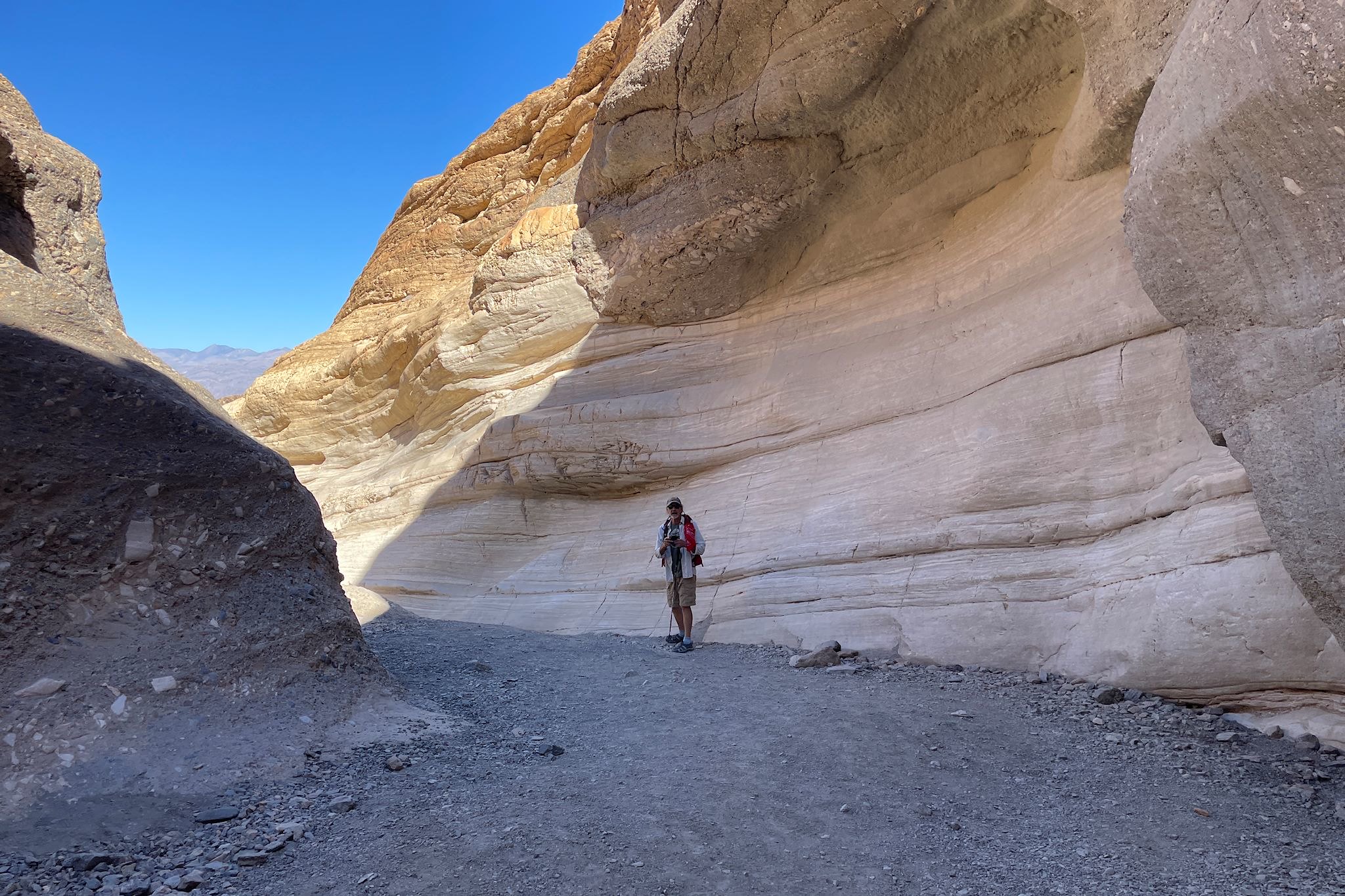
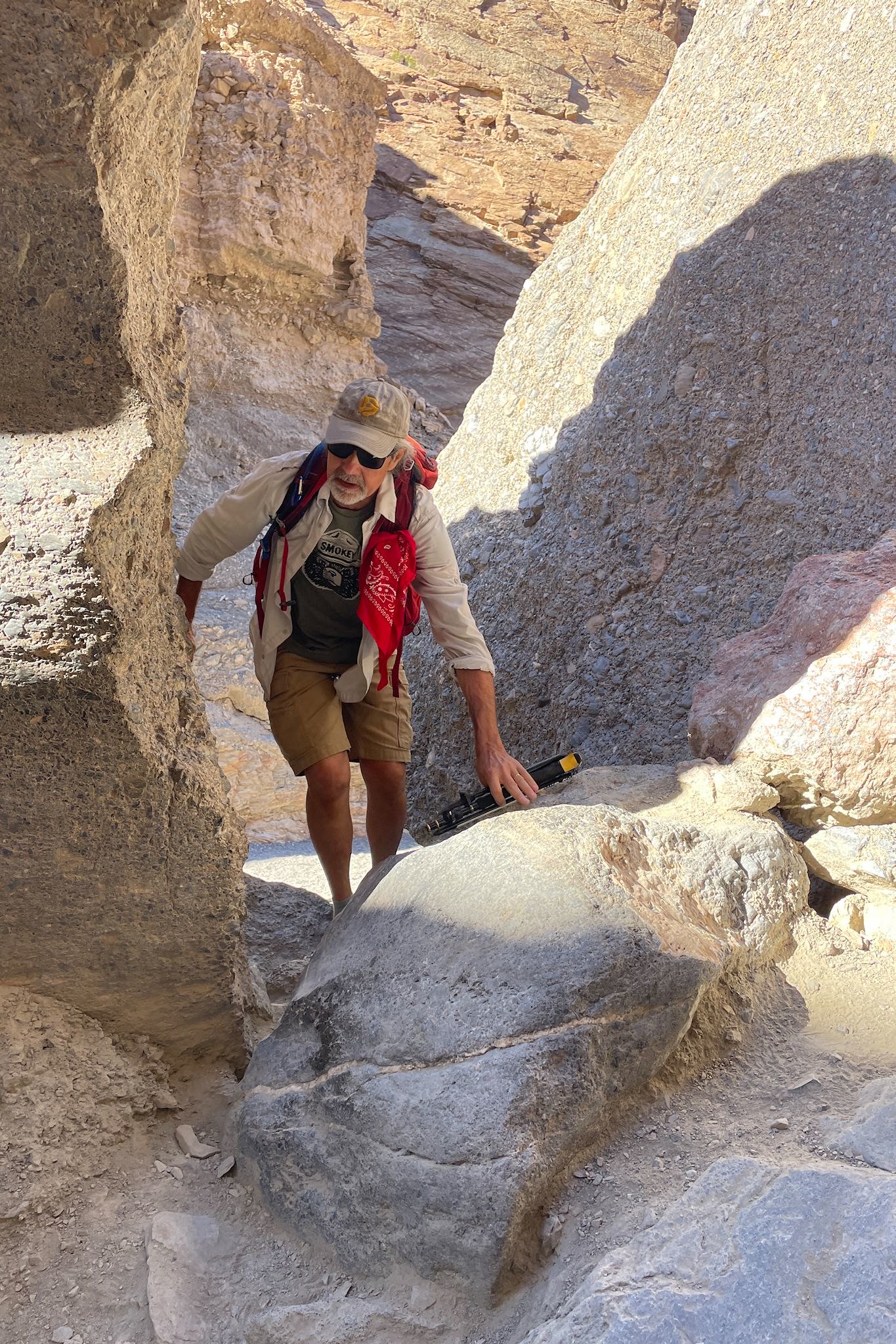
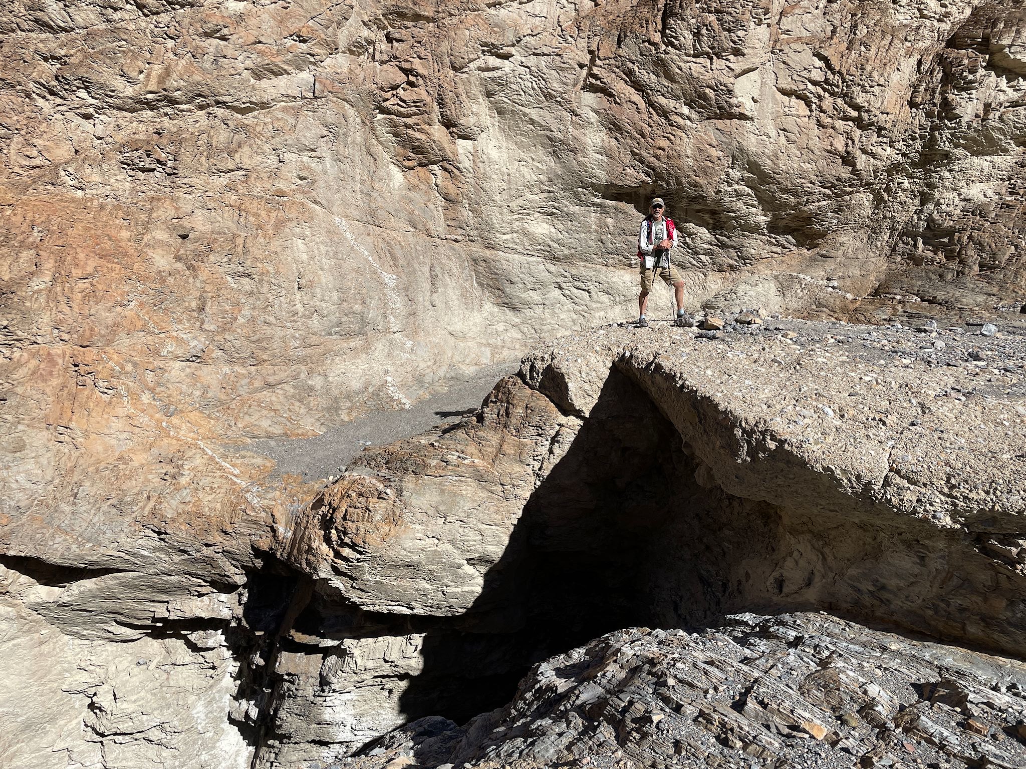
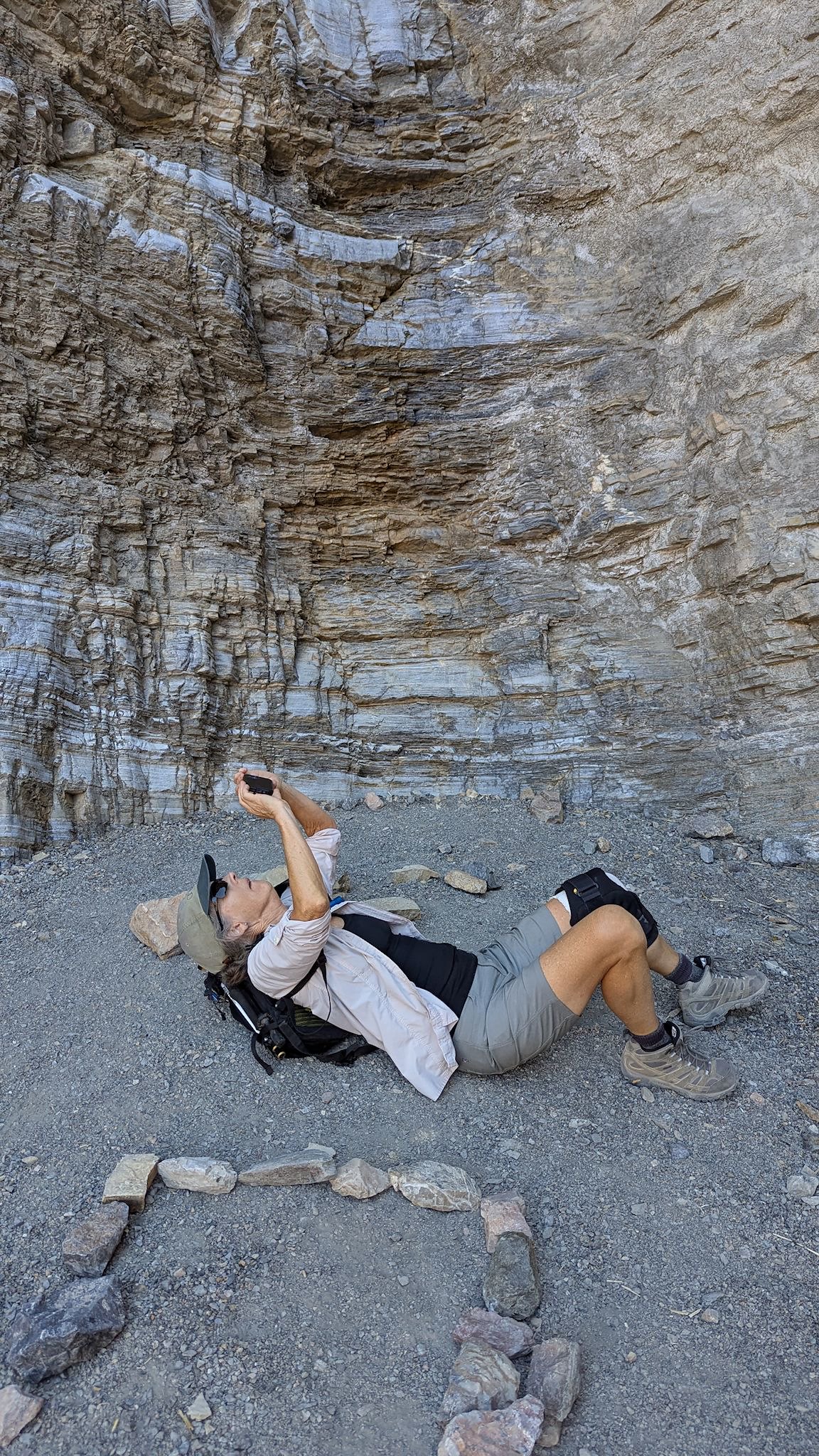
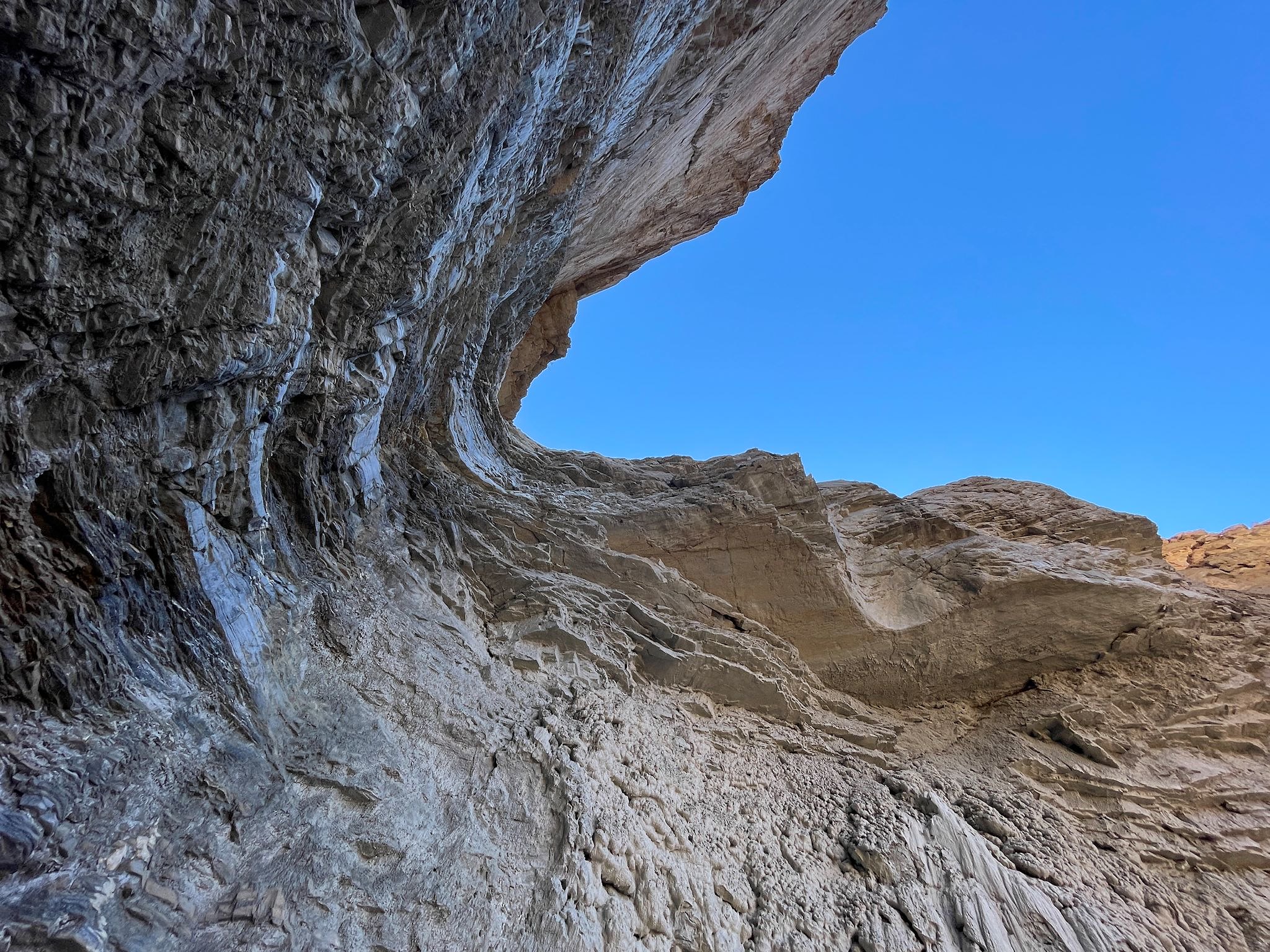
Another trailhead with a view! From the Mosaic Canyon parking lot, we had an expansive view of Death Valley looking north, Stovepipe Wells Village (a tiny commercial oasis within the park), the Mesquite Flat Dunes, and a giant cloud of dust trailing a car driving up the dirt road and approaching the trailhead.
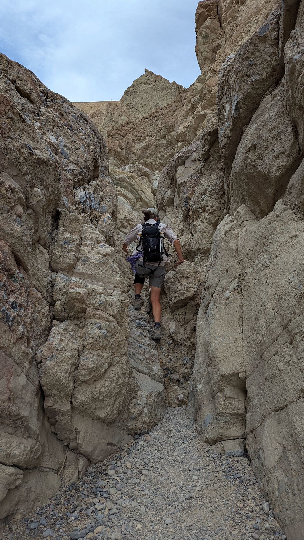
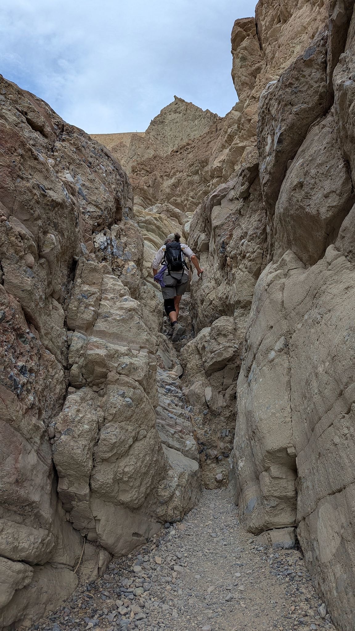
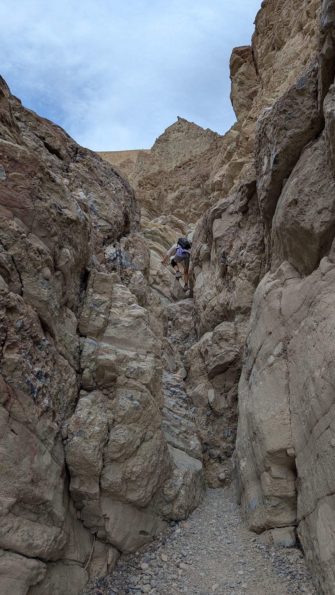
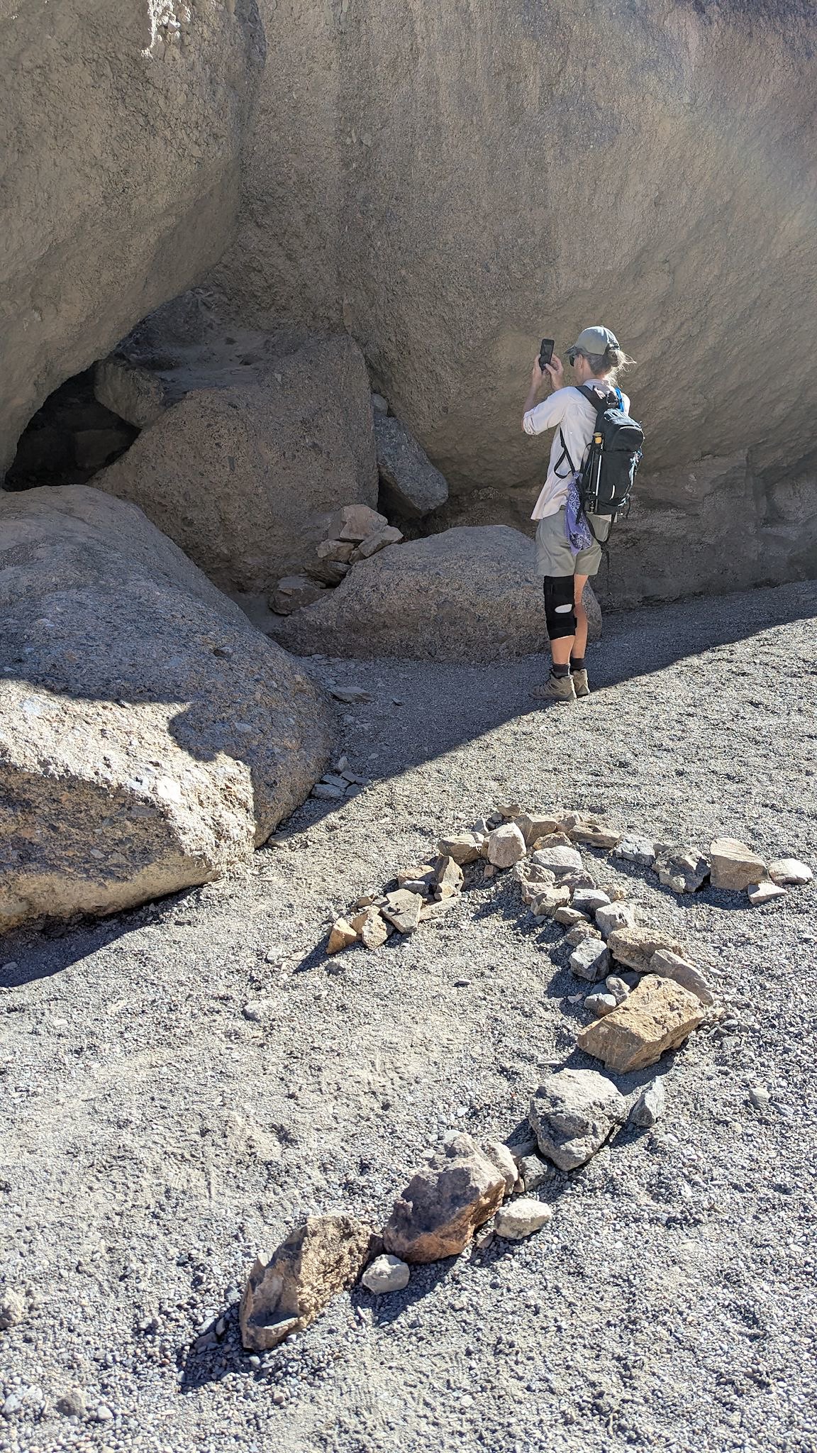
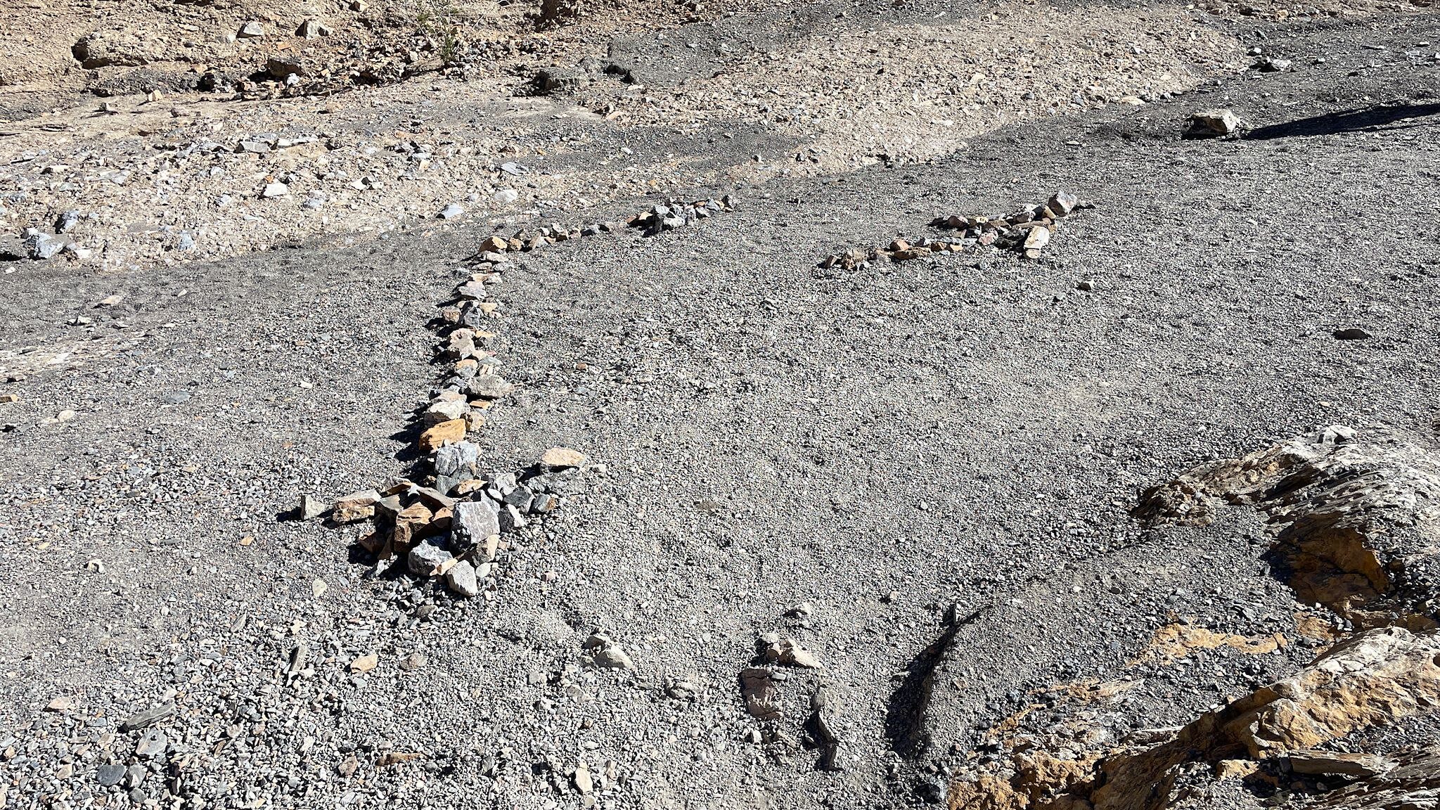
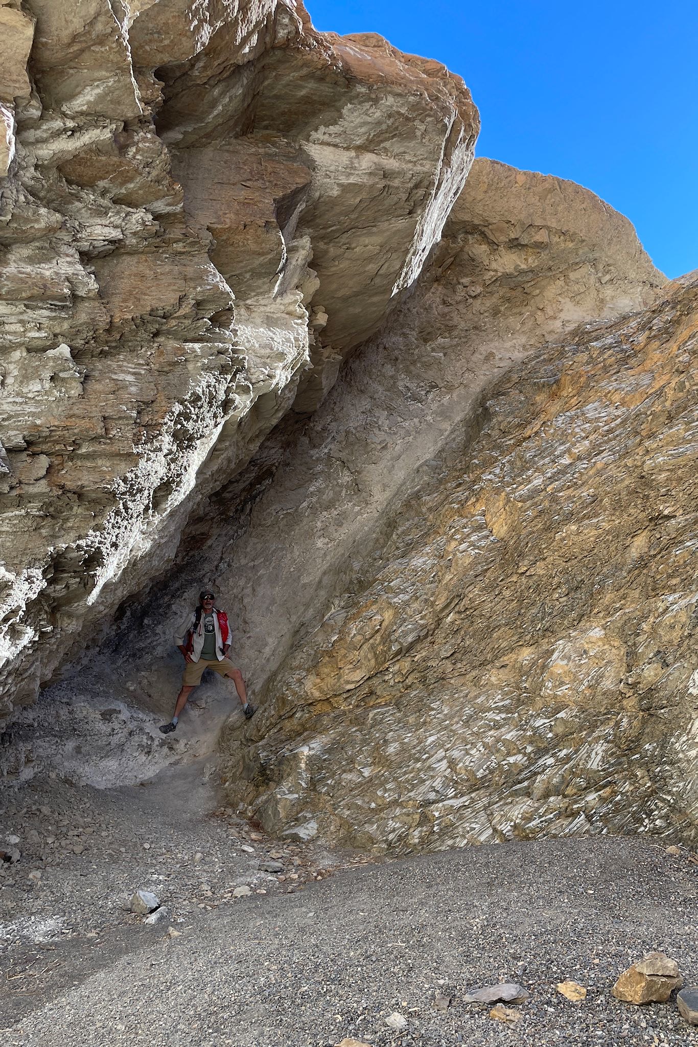
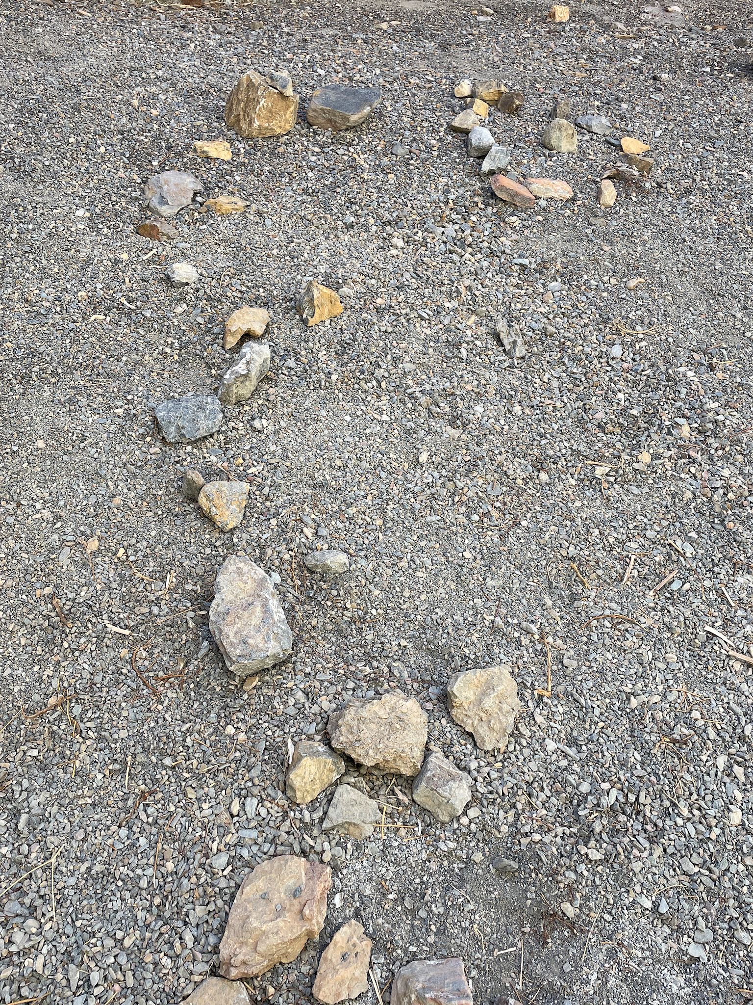
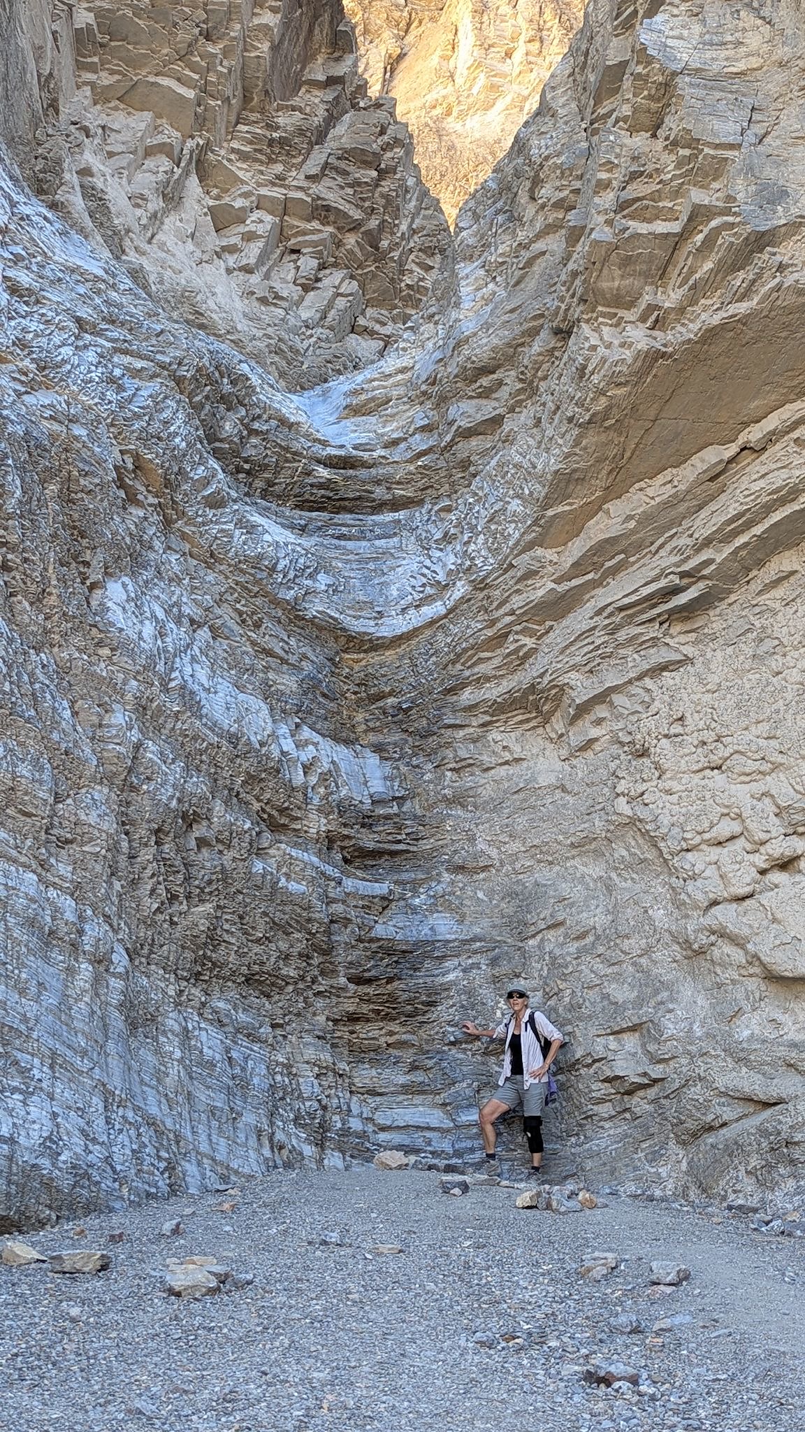
The hike up Mosaic Canyon was… fun! It starts with a narrow-ish slot canyon that alternates between giant rocks walls made shiny from the scouring of water over millions of years and hunks of mosaic rocks (breccia). The slot canyon soon opened into a broad canyon surrounded by rocks with a wide array of textures and colors and shapes. From there, the continued walk up the canyon included a few false ends – the trail description mentions at least two of these, and others are implied. We kept to our course by following a series of the most uniquely explicit and clearly intentioned cairns we’ve ever seen. These took us through a sequence of totally fun rock scrambles and, eventually, the actual end of the trail. The giant amphitheatre dryfall (no water, so can’t really call it a waterfall unless there’s flooding rain, right?) was indeed impressive, and an excellent place for some staged photography.
For anyone who’s interested, lots more Panamint Springs, Dantes, Badlands Loop, Golden Canyon, Gower Gulch, Badwater Basin, Mosaic Canyon and scenes around the park pix…
Wow, looks like you called ahead to reserve it for yourselves! Great post, makes us want to pull the trailer out of the snow and head west! Thanks-safe travels M&P
Thanks, friends! It is definitely worth a visit and you would love it, the downside (as you noticed) is that it’s most comfortable there when it’s time to be elsewhere, skiing!