Banff National Park, established in 1885, is Canada’s oldest national park. Like the other parks in the area, the westward expansion of the Canadian Pacific Railway played a major role in Banff’s discovery and introduction to the world. The CPR built the historic Banff Springs Hotel (1888) and Chateau Lake Louise (1911) to entice wealthy patrons aboard their trains for vacations in the Rockies. Both of these luxury hotels (with many renovations), and the resort towns of Banff and Lake Louise that grew around them, continue to draw tourists from around the world in the 21st century.
Banff is not the largest park in the Canadian Rockies – that honor belongs to Jasper. However, it’s the most popular of the parks, and with good reason. Even more so than the other parks, the largest and most spectacular mountains are right there in your face, and for non-hikers there’s a range of other activities in the 2 towns. For us, the quantity and variety of day hikes we could choose from really made us smile – and the number of squeals per hike so far, in the southern part of the park nearest the town of Banff, forced us to extend our stay. So, here’s part 1…
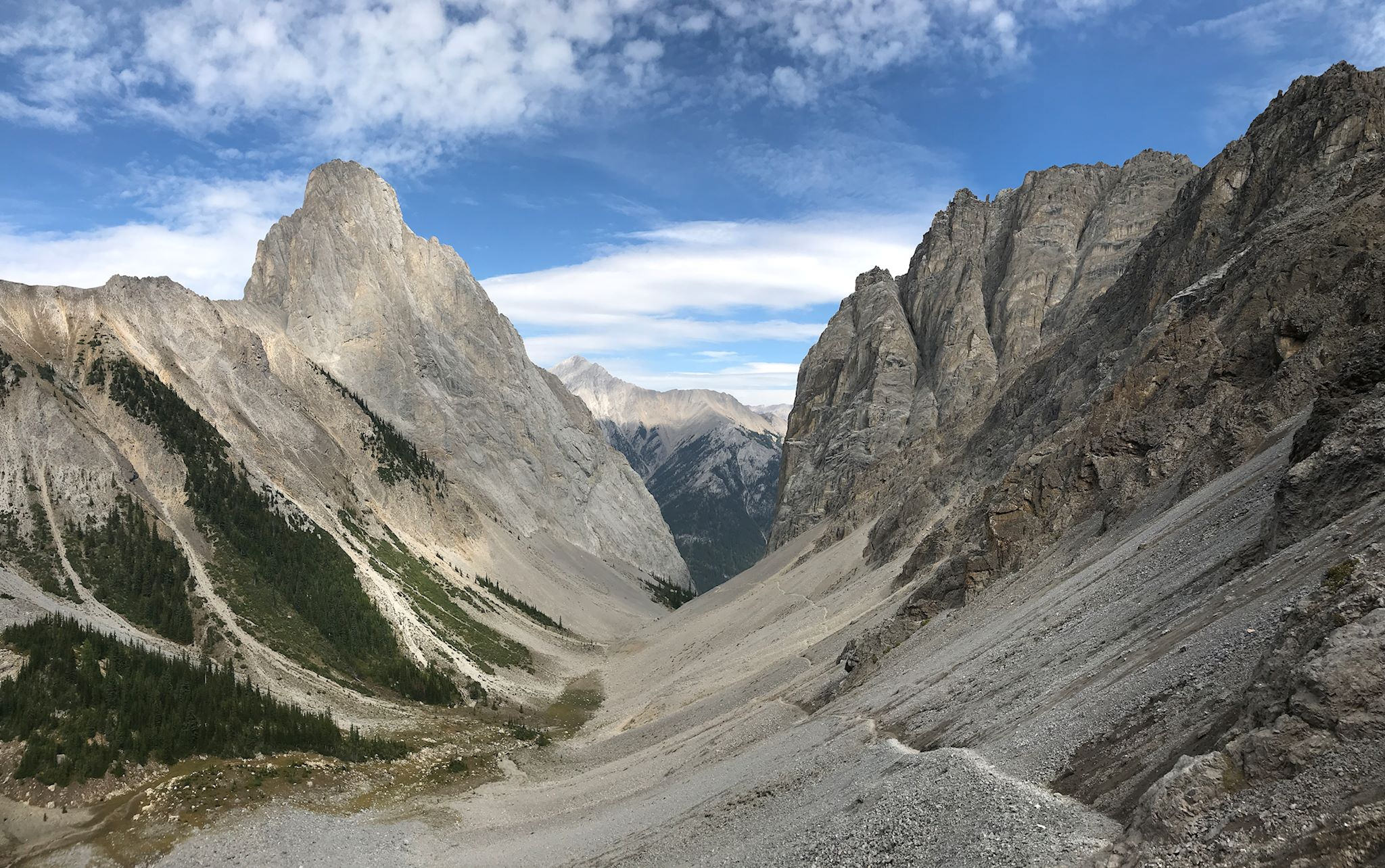
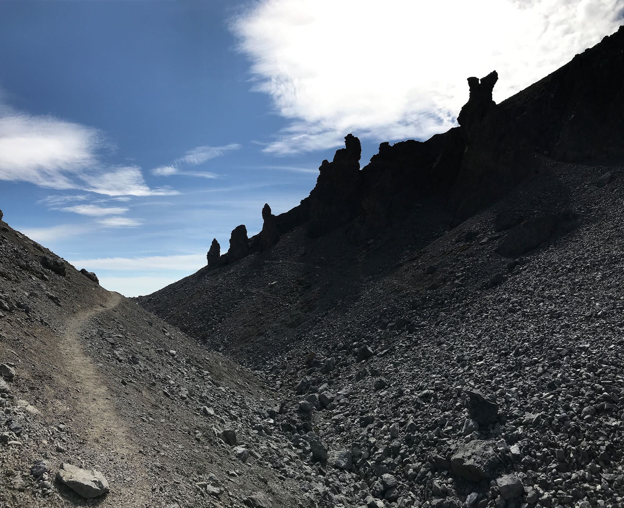
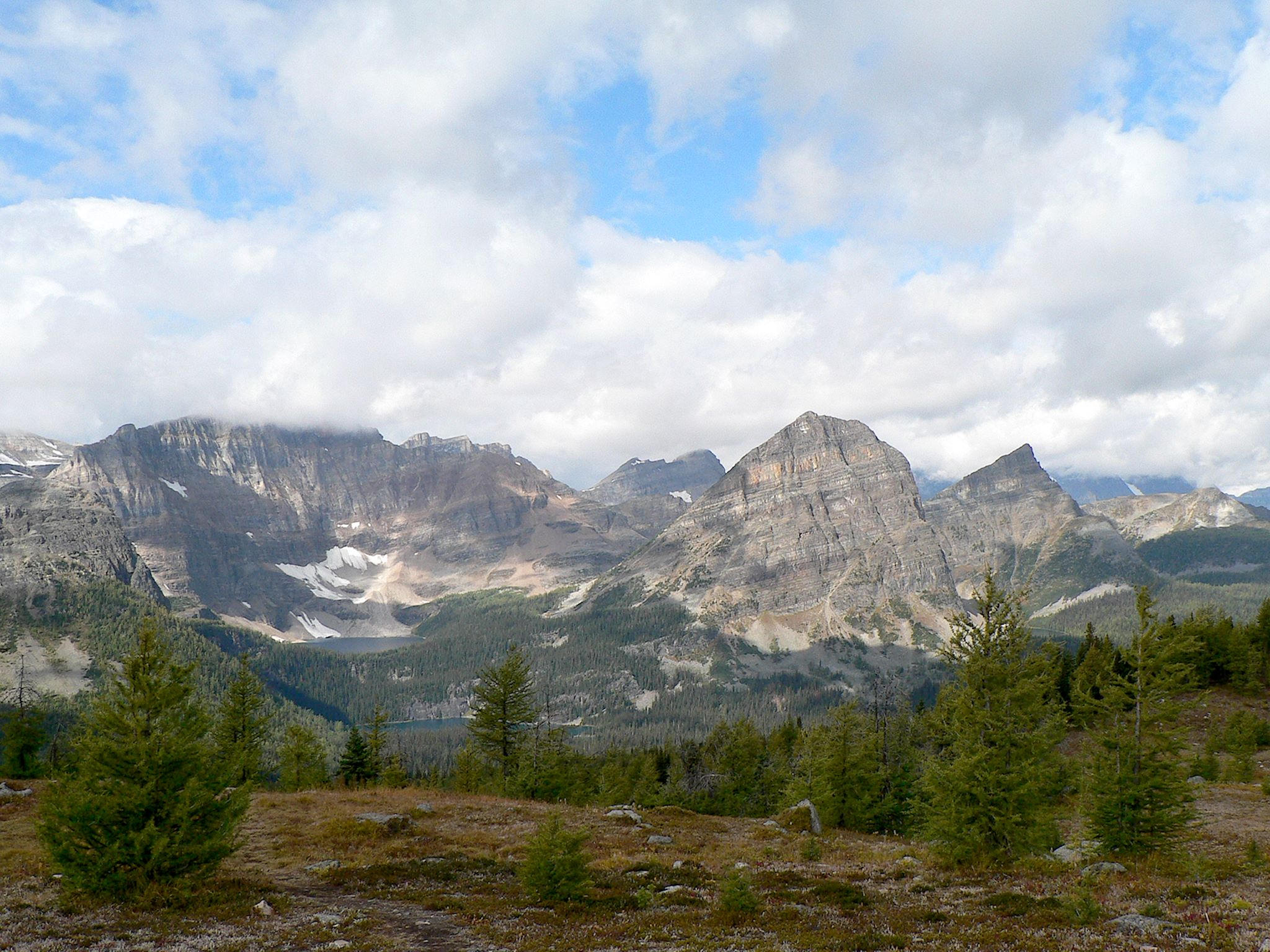
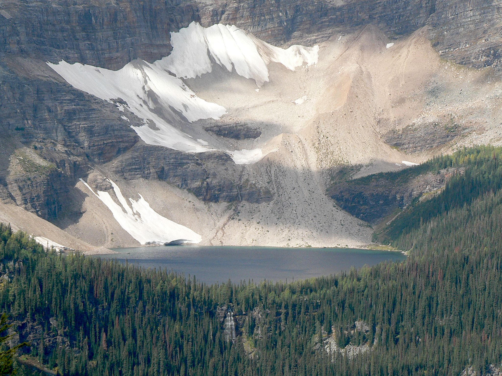
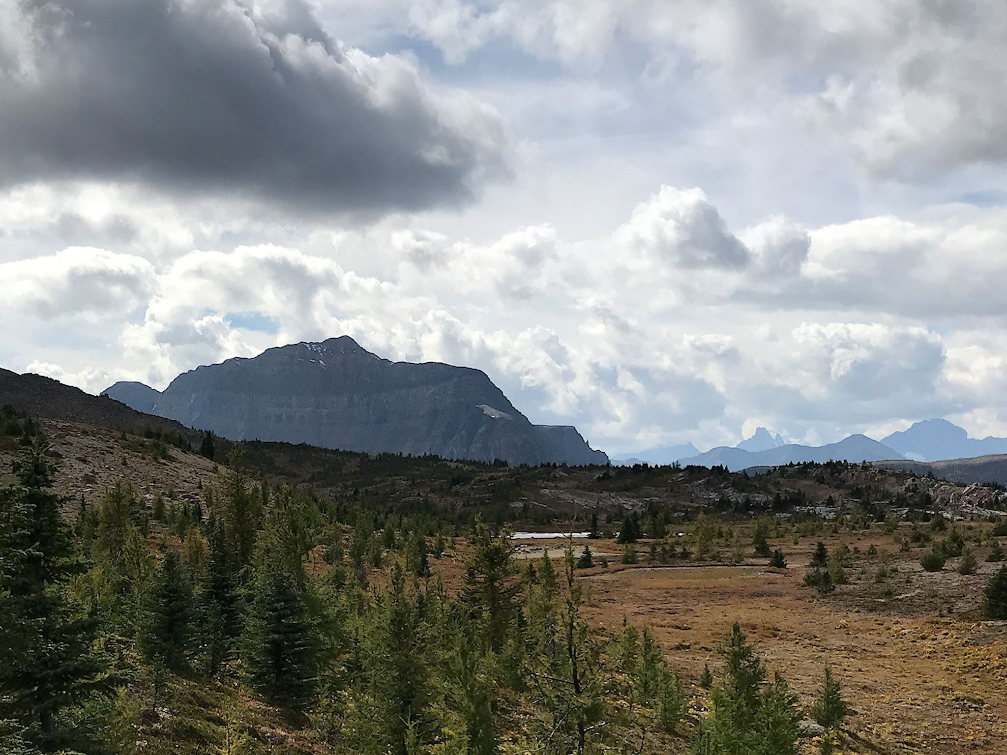
Our first hike was to Rockbound Lake. The trailhead was in our campground at Castle Mountain, so… On the map, the trail looked like Zorro had passed by notching a giant ‘Z’ across the forest. In just 2 switchbacks, we gained the elevation which took us from the Bow Valley floor to a delightful meadow in a horseshoe canyon with impressive views of the Eisenhower Tower of Castle Mountain and the Helena Ridge. First we came across Tower Lake, a picturesque, green-tinged glacial lake bound half by cliffs and rock and half by wildflowers on a mossy shore.
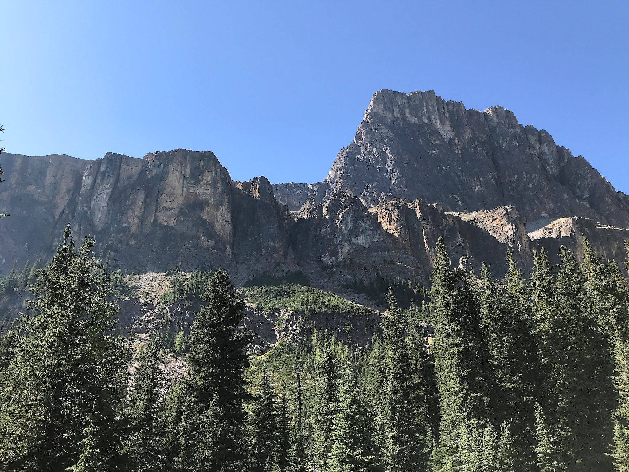
Ha! It’s not rock bound, so we continued up the trail, a quick series of steep switchbacks over the headwall to reach Rockbound Lake. True to its name, the lake is entirely surrounded by the plunging cliffs on the back side of Castle Mountain, Helena Mountain and Helena Ridge and a solid rock ‘beach’ of glacial debris where we savored the views on this cool, clear day.

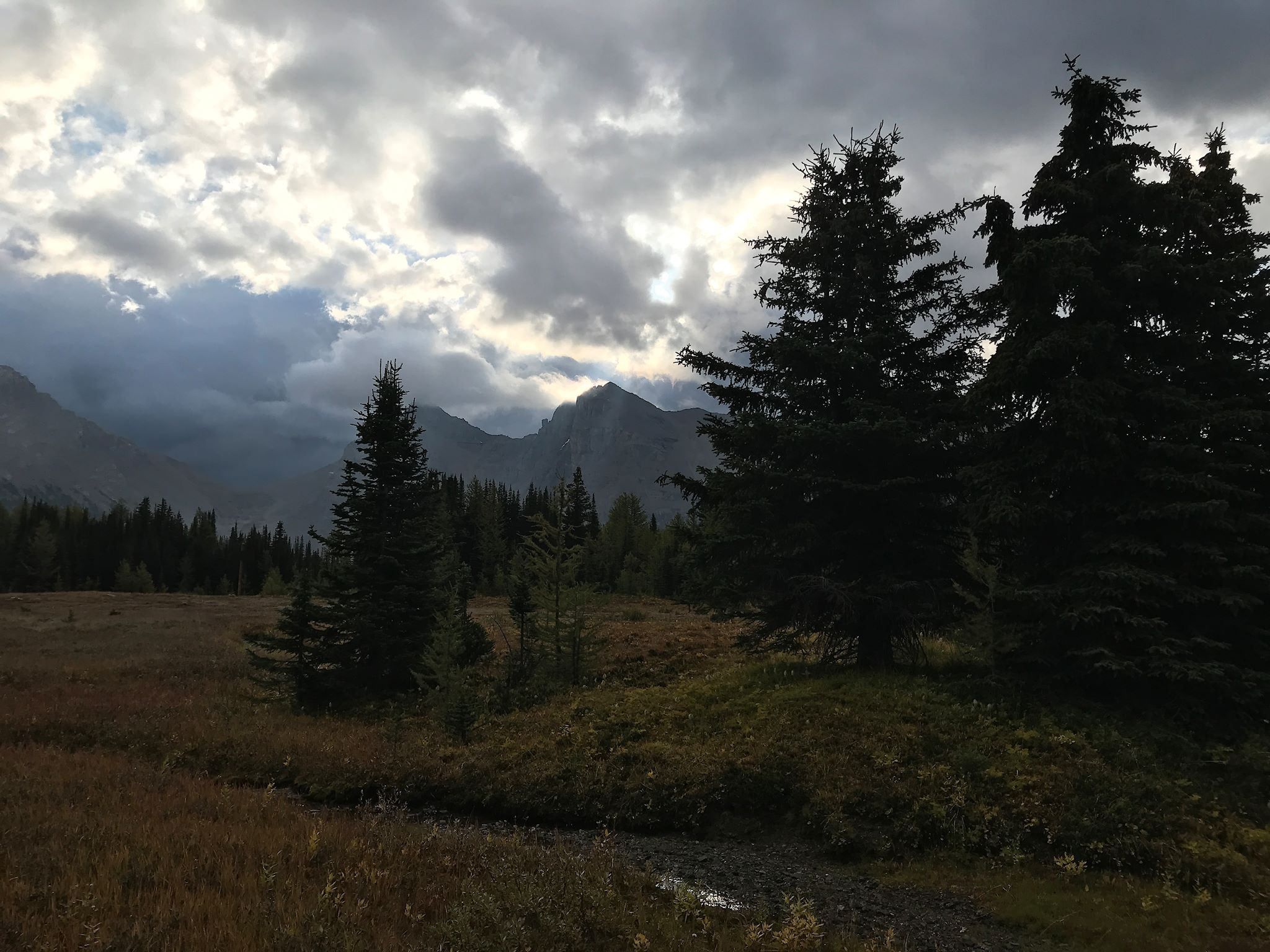
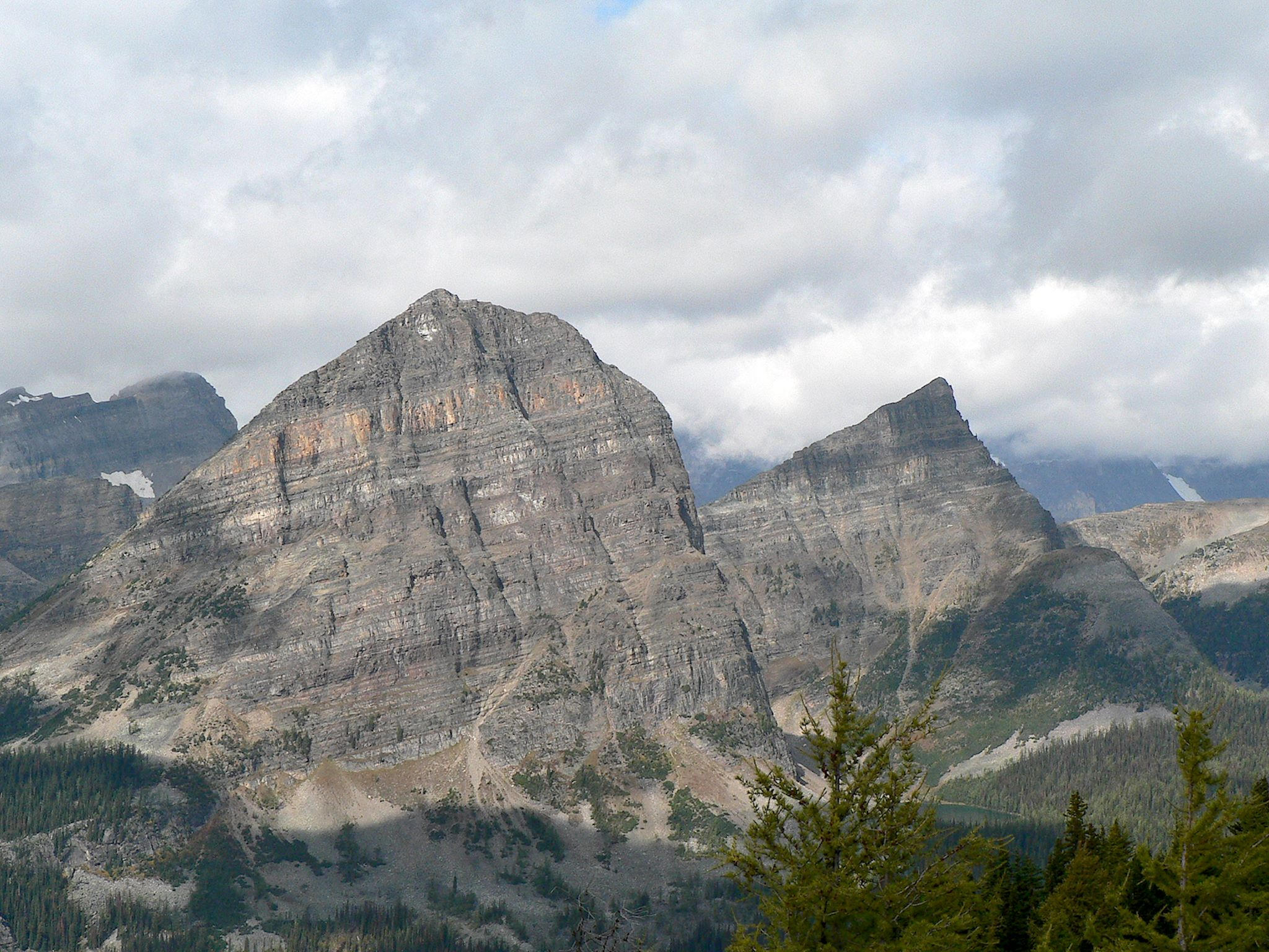
If hiking to a deep canyon provides focused vistas and creates a sense of enclosure, hiking around a high perimeter of a tall peak enables incredible, expansive 360-degree views and a sense of limitlessness. And so it was with our Cory Pass/Mount Edith hike. The trail starts innocently enough through a delightful aspen grove, then quickly heads straight up with nearly 900 switchbacks to get us to a sparsely forested ridge along Mount Edith. From that point, we had views to Mount Cory and the summit of Mount Edith as well as behind us to the south to the Bow Valley and peaks beyond. The approaching deep ‘V’ shape of Cory Pass was almost always in sight.
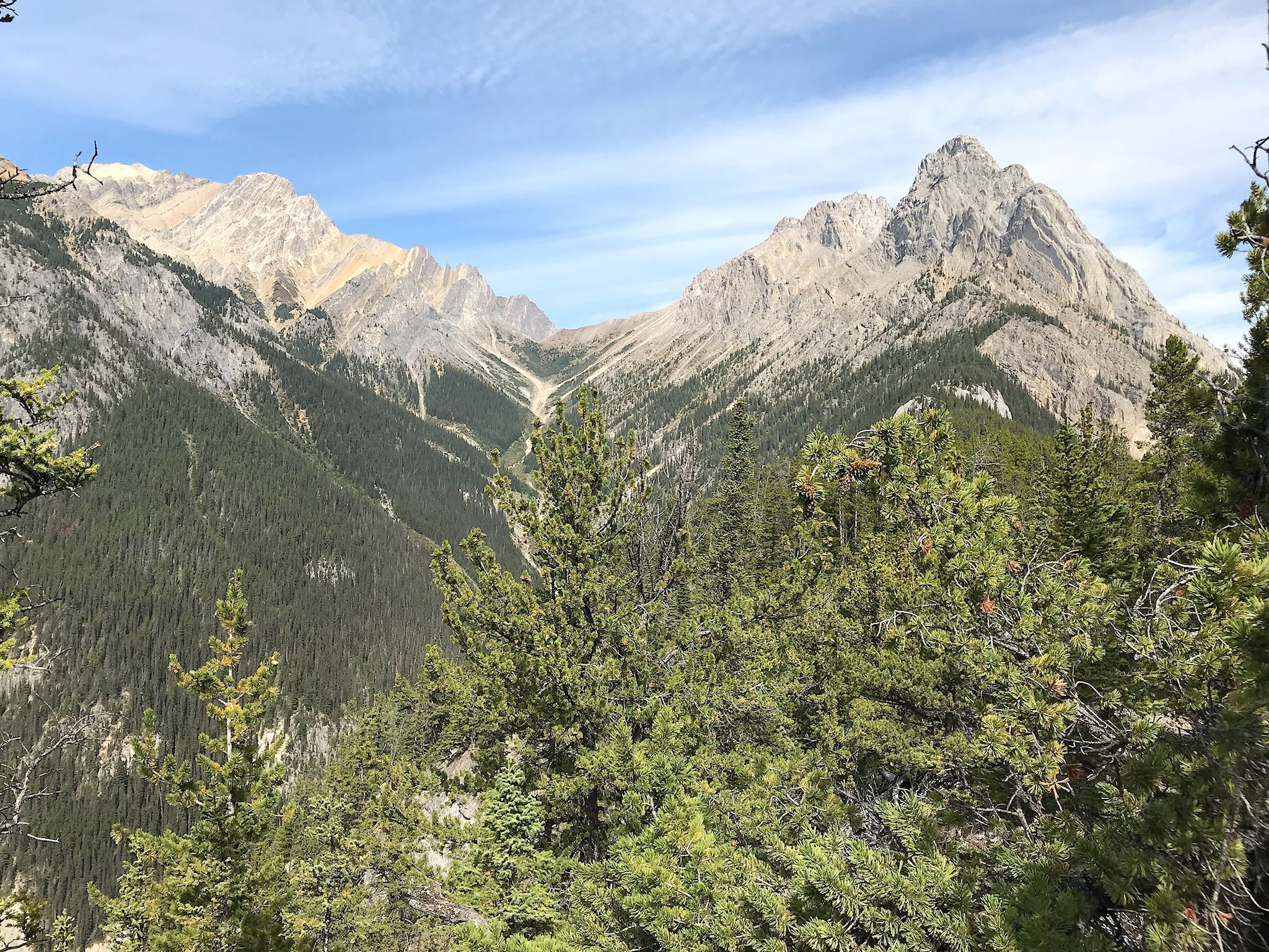


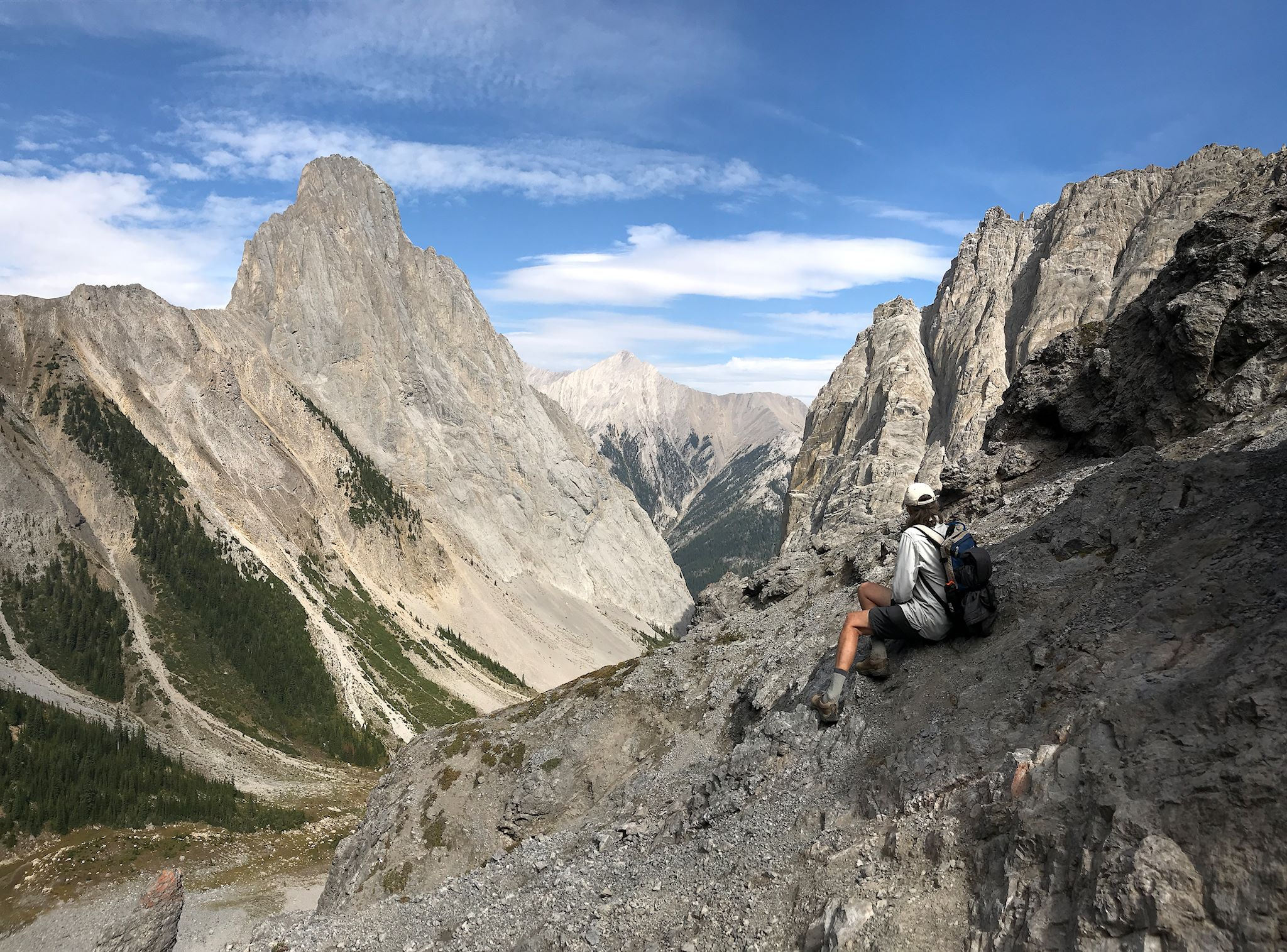
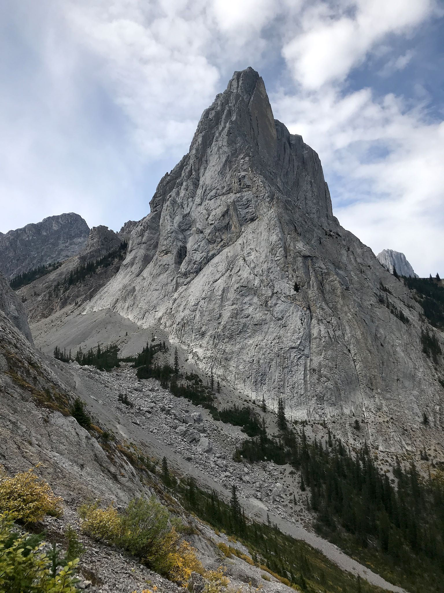
Although we’d planned a leisurely lunch at the pass, it just wasn’t possible… From Cory Pass, we could see the Gargoyle Valley on the other side, and were totally distracted by the imposing views of Mount Louis in our faces and Mount Brewster in the distance and the obvious trail in the scree that would get us around the back side of Mount Edith. Squealing again, we dropped into Gargoyle Valley, surrounded by tall granite peaks. Once on the back side of Edith, we continued around this peak by climbing to Edith Pass, opening upon a whole new set of valleys and peaks. We enjoyed views from the lightly forested slope for awhile longer before descending back to our start through a dense forest with moss covered floor and then, the delightful aspen grove.


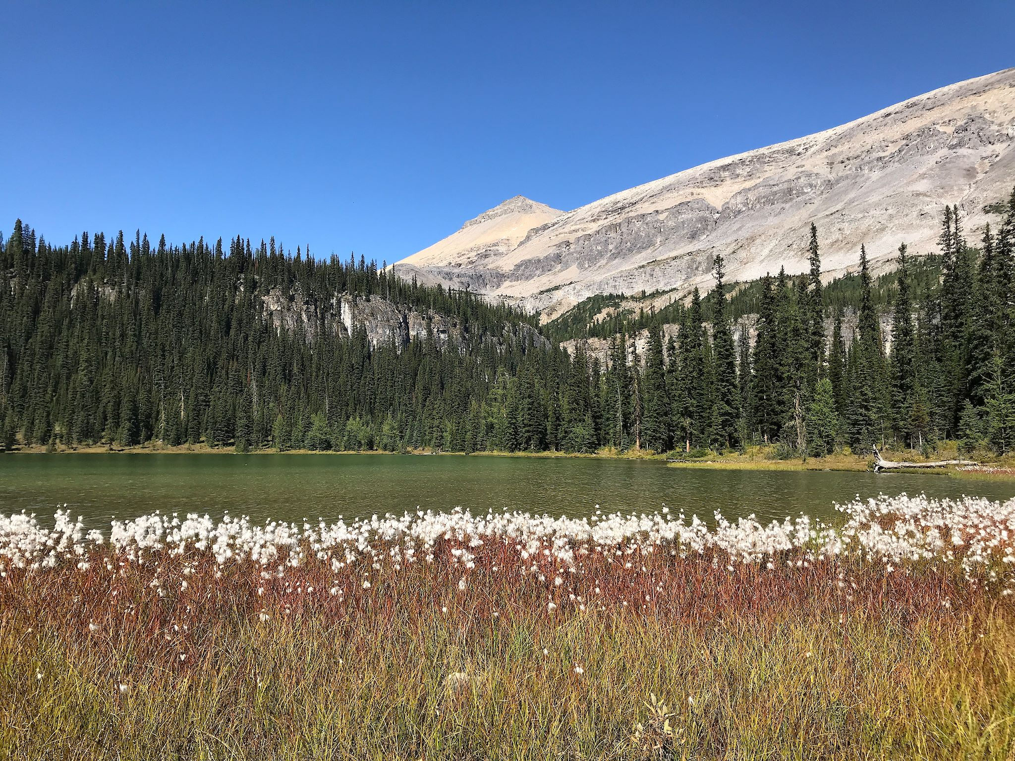
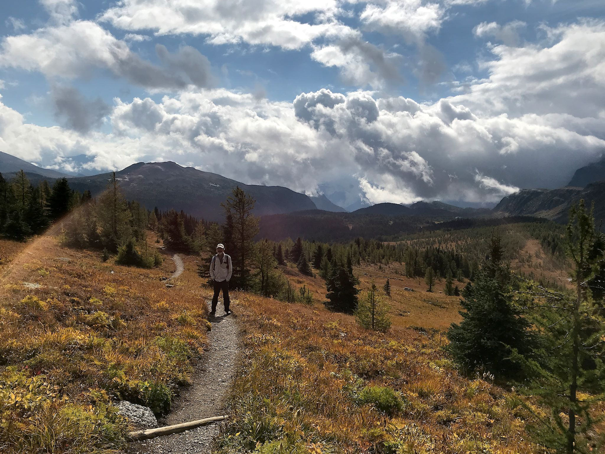
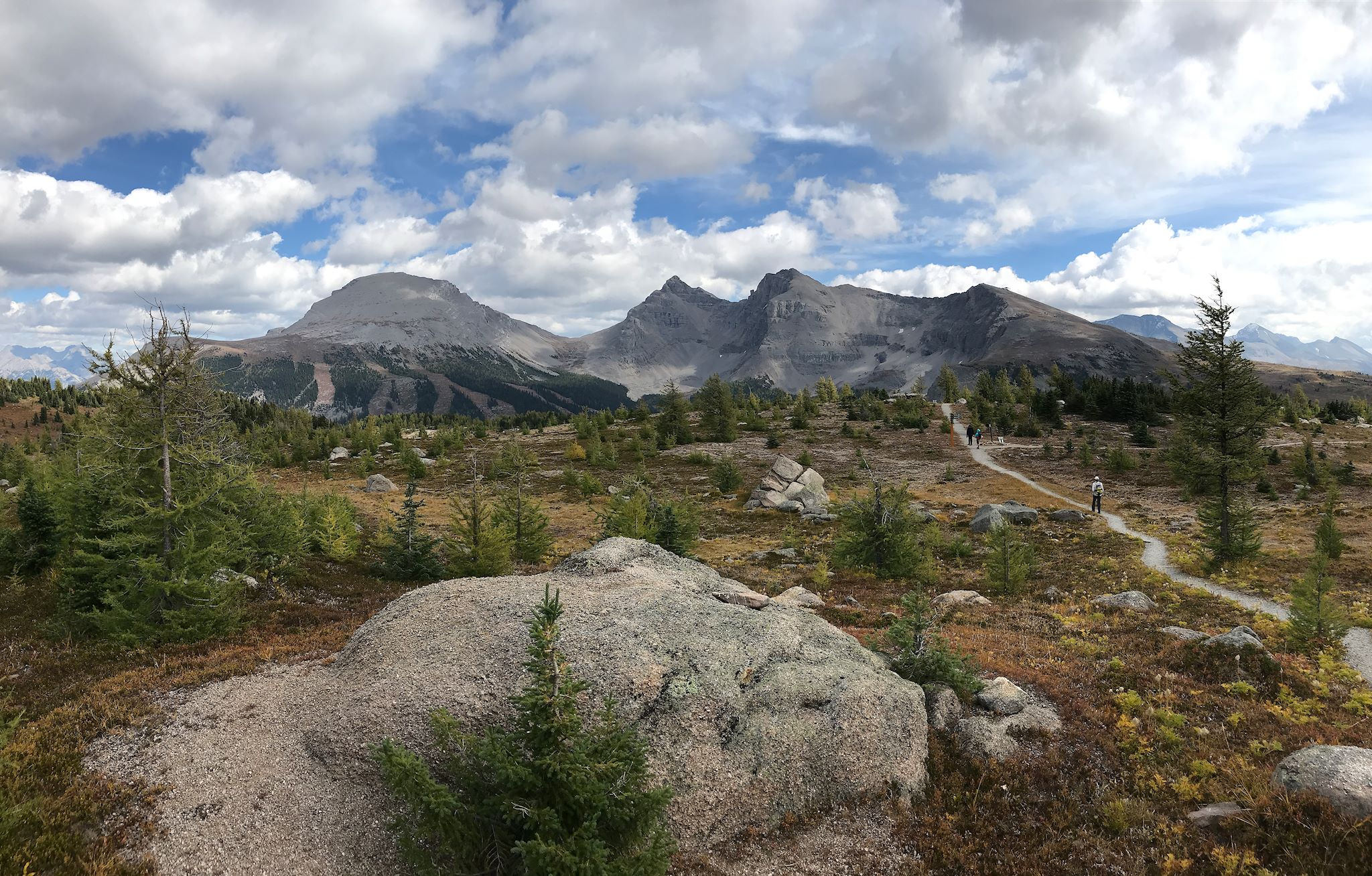
The Sunshine Meadows area is unique. When thinking of the continental Divide in the Rockies, most conjure up visions of tall peaks. Yet for about 15 km (9 miles), the Divide (which is also the border between Alberta and British Columbia) is straddled by a series of wide alpine meadows filled with wildflowers, rocks and small lakes. It’s also the home of the Sunshine Valley ski area, which has its lifts arranged around an alpine bowl. Hikes in this area begin at the top of the ski area, accessible by gondola (before Labor Day) or shuttle bus (after Labor Day) providing a welcomed 4.5-km-long (2.8 mi), 500-m-high (1,639 ft) head start to the day.
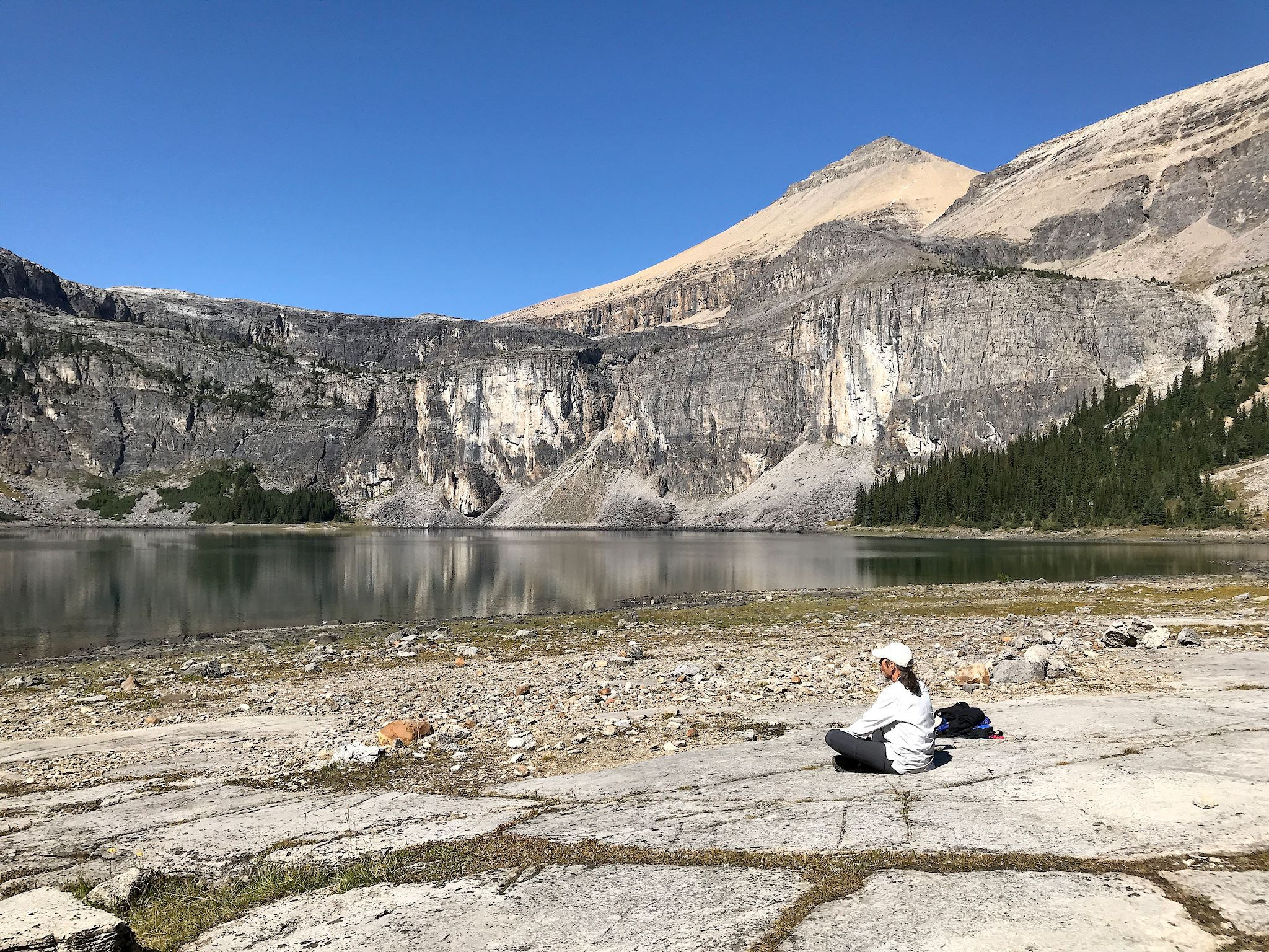
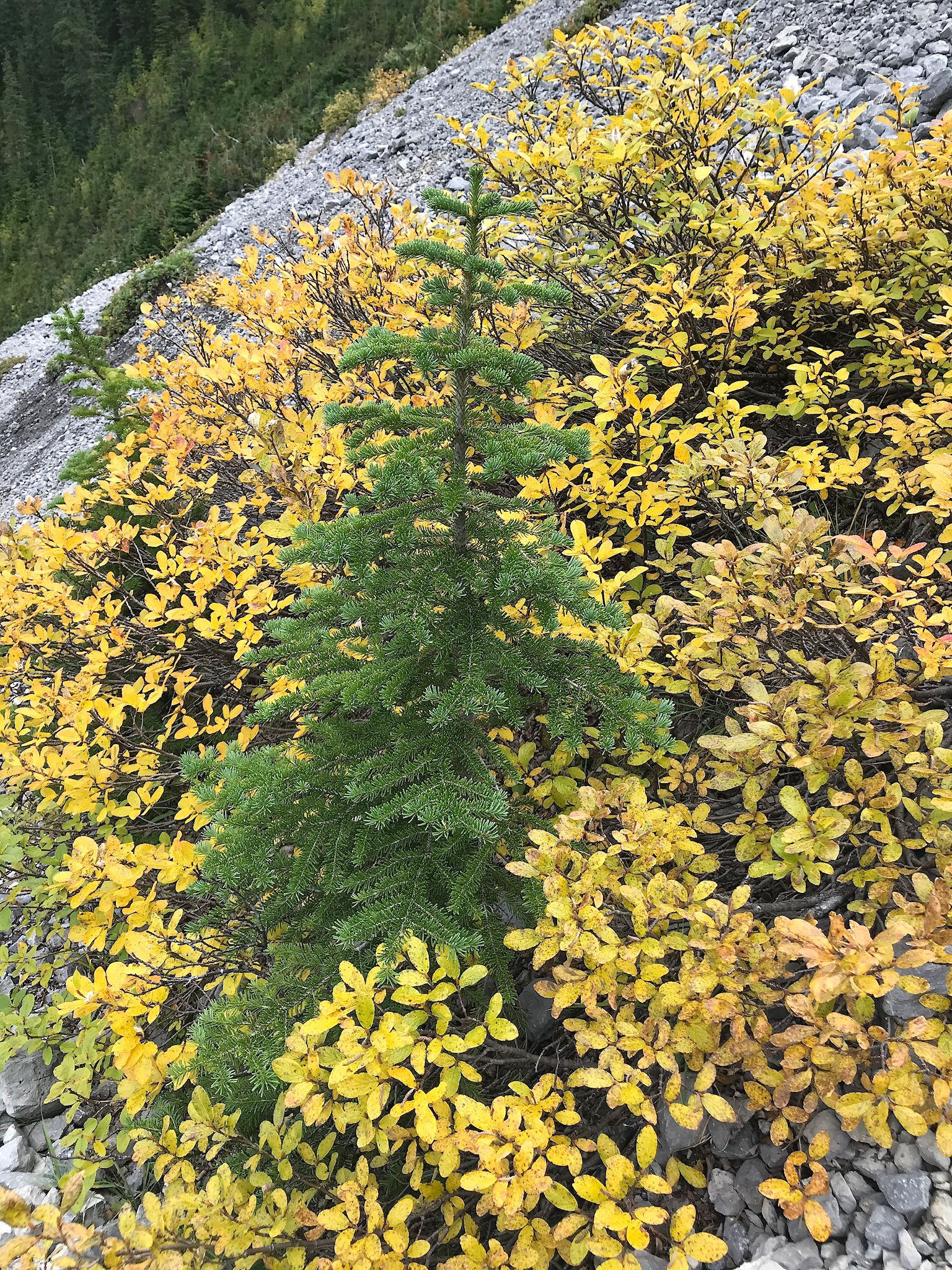
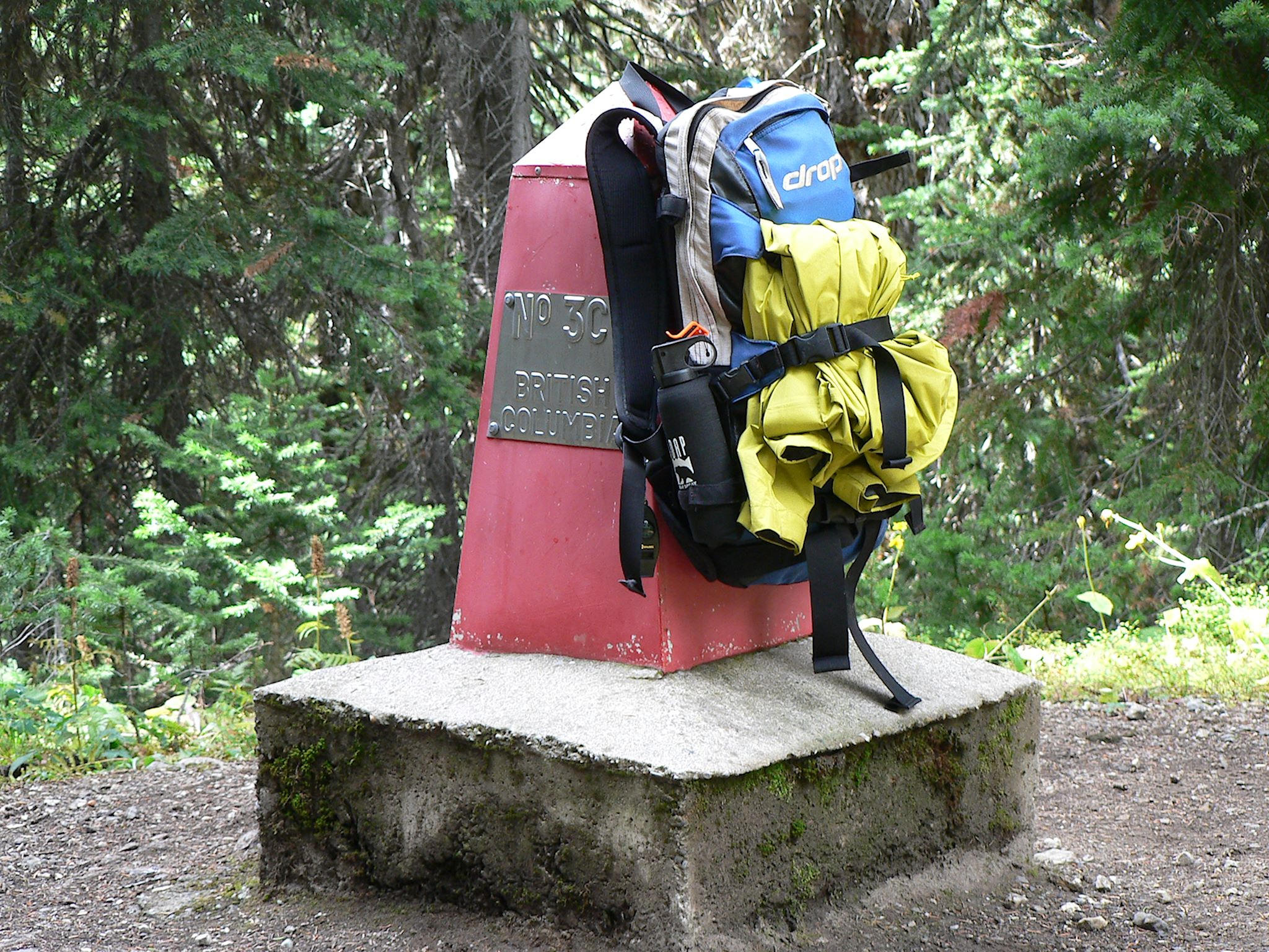
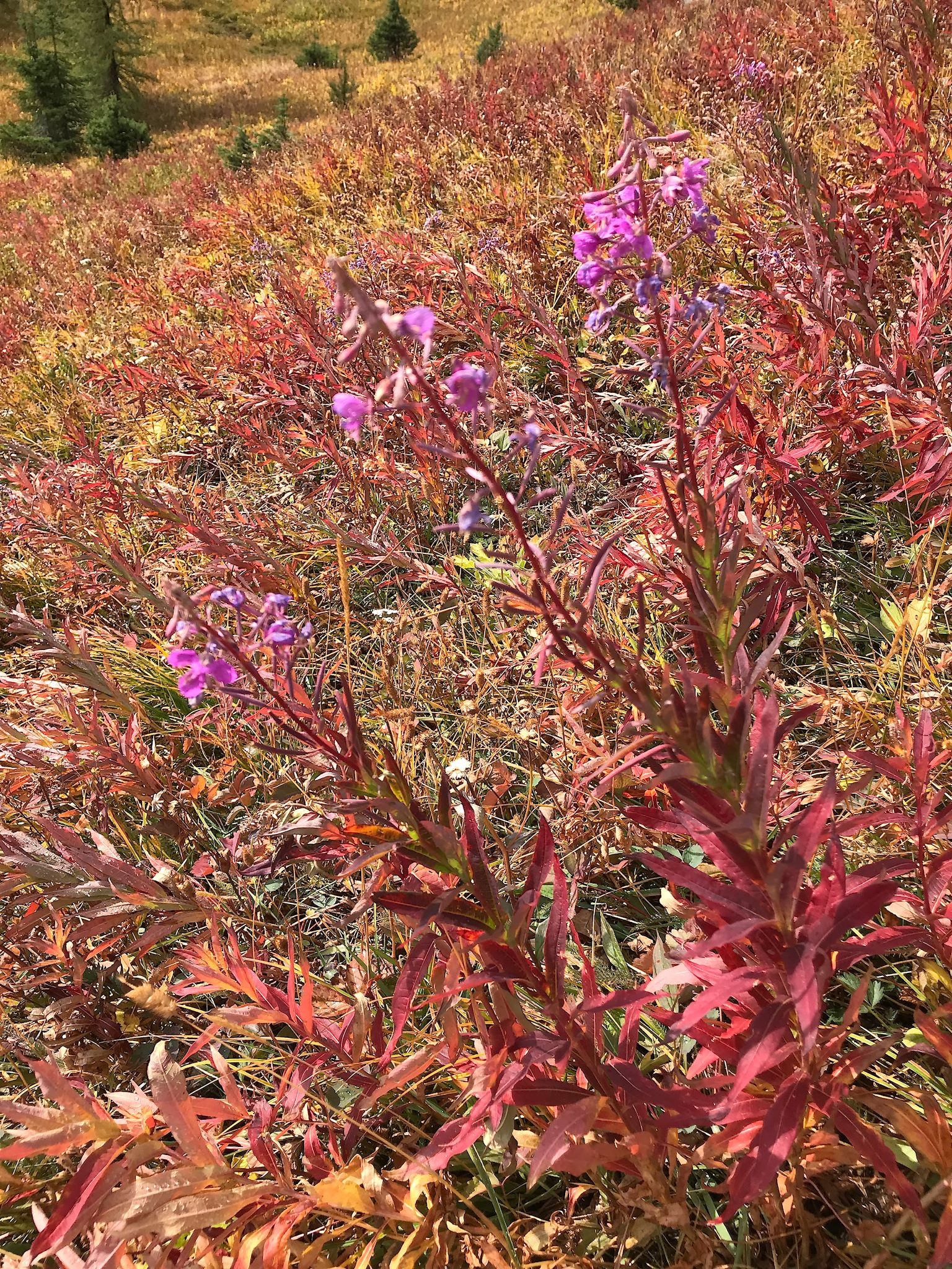
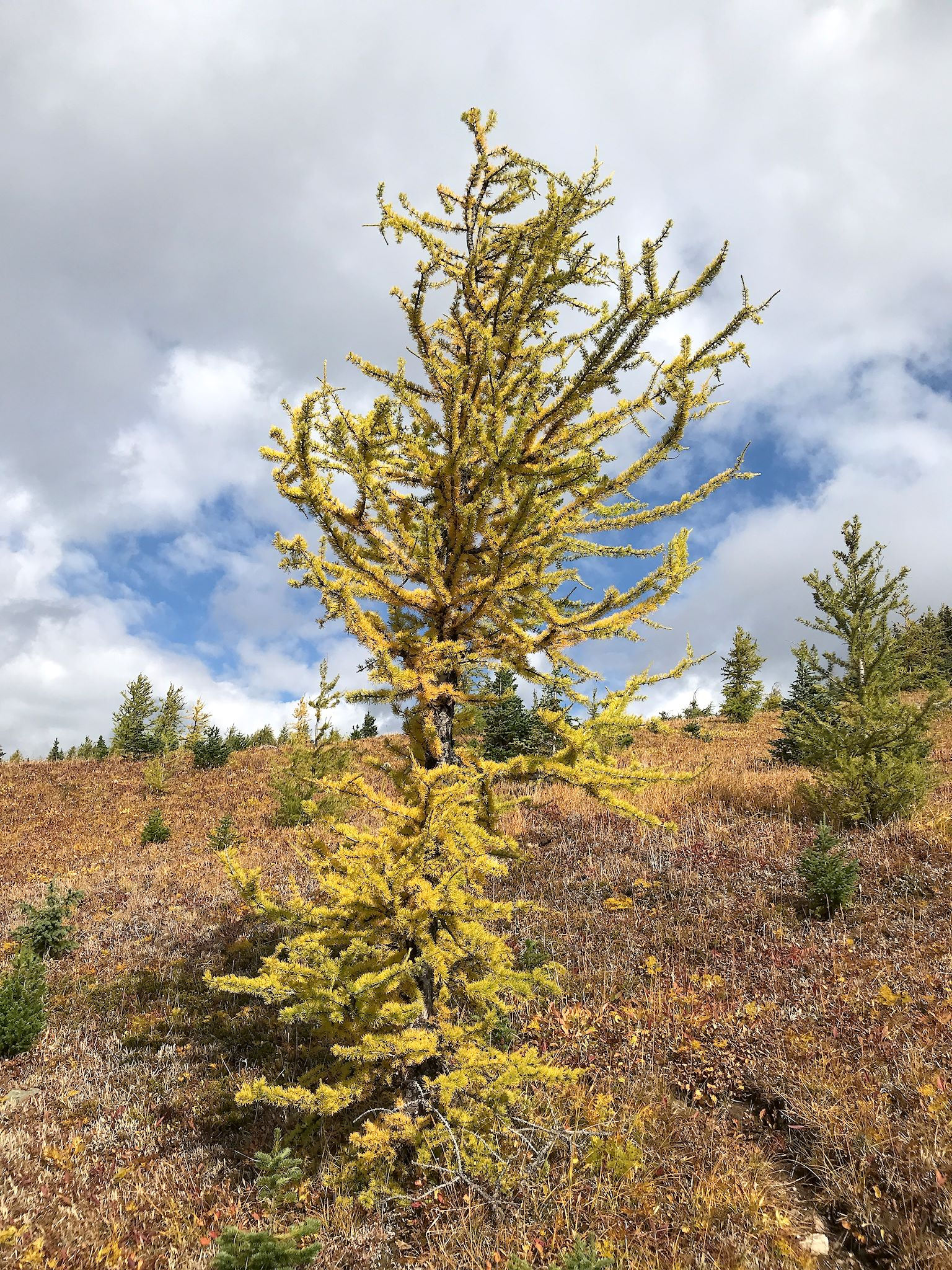
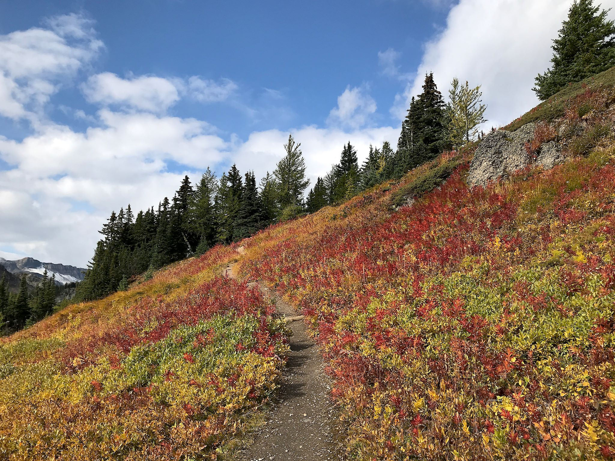
With a forecast for light rain in the morning and improving conditions throughout the day, we decided to hike to Healy Pass because it was less exposed than other options. From Sunshine Village, we quickly reached a knoll, the highest point on the trail, with beautiful views of, um… clouds. Through occasional periods of rain, the trail continued across the broad, rocky Wawa Ridge, crossing the border between Alberta and British Columbia a few times, eventually dropping into the fall-foliage-tinged meadow near Simpson Pass. With the sun starting to peek out between the clouds, we climbed to the stunning Healy Meadows, showcasing bright, fall foliage colors – purple and maroon Fireweed, rusty orange Beargrass, yellow grasses, and varying shades of light green and yellow to bright orange larches. From there, we enjoyed a steady, gently climb to Healy Pass.
Once again, concentration on lunch was disrupted by views on the other side! The Egypt Lakes area – Scarab Peak, Pharaoh Peaks, Egypt and Scarab Lakes – was in our faces. Wow! Once we recovered, we enjoyed a quick lunch with another like-minded couple from California, with whom we traded hiking tales (including their grizzly bear encounter!), adding several to our list of hikes to consider in the park.
On most of our out-and-back hikes, our photos pretty much end when we reach the ‘-and-.’ This hike was different since on the way out we were socked in by the clouds which broke just as we reached our turnaround point at Healy Pass. We were amazed to see all that was hidden behind those clouds earlier in the day!
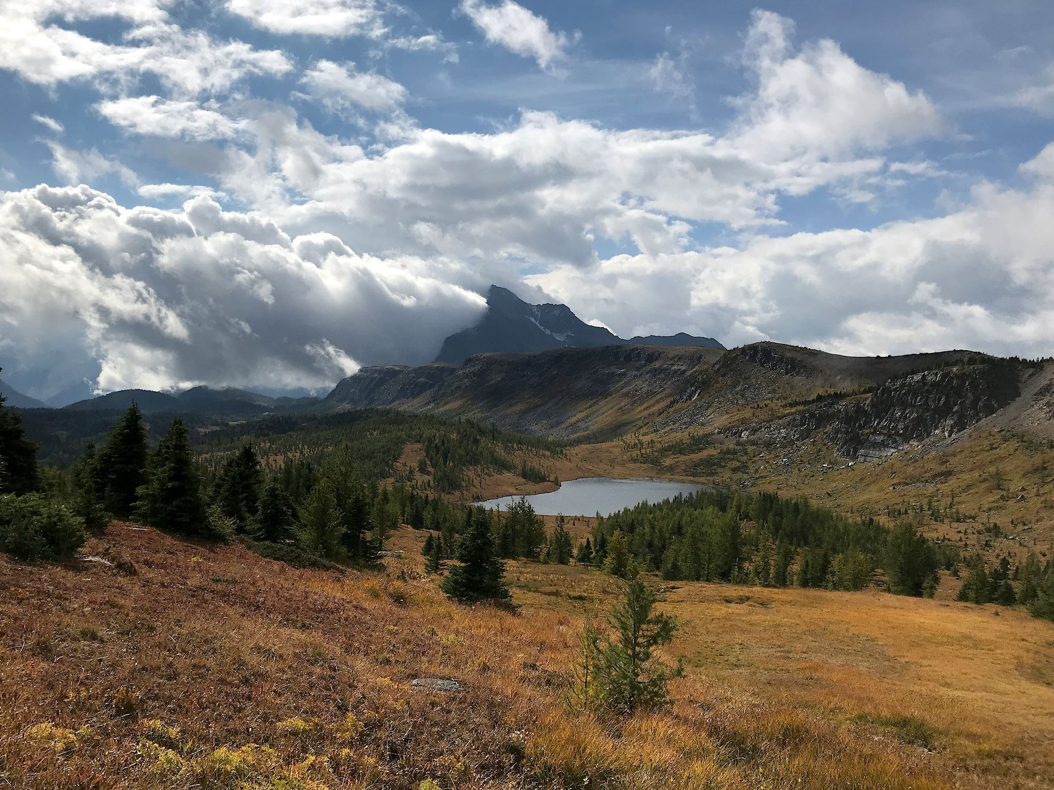

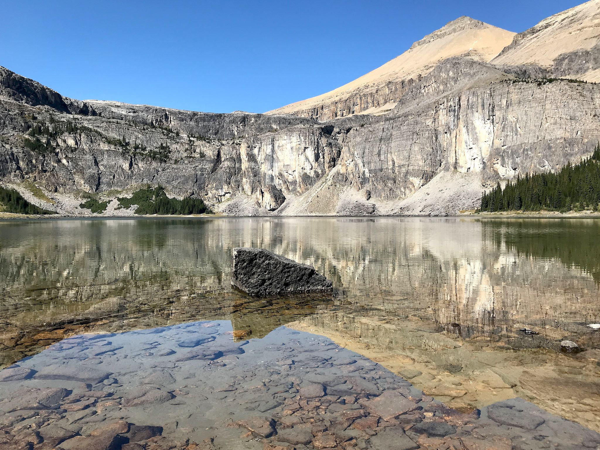
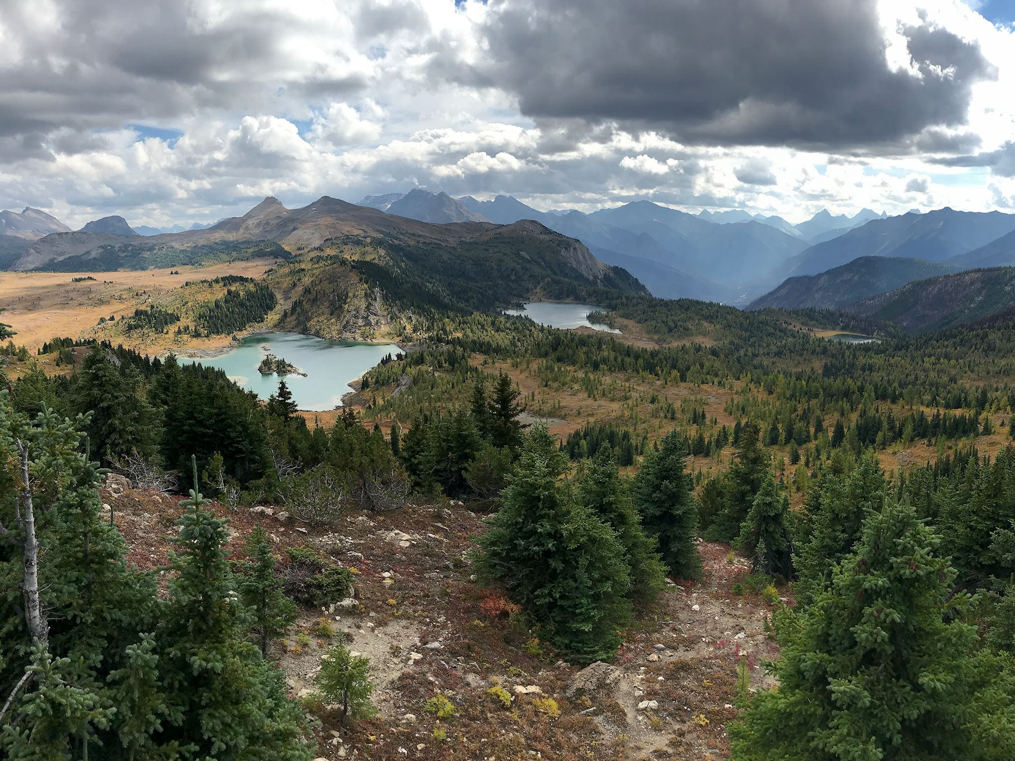
That head start provided by the shuttle bus left us with enough energy to add the Sunshine Meadows Loop to our day. Yet another beautiful trail through the high meadows at the top of the ski area, it brought us to different view points to the south and west. There were layers and layers of peaks on the horizon aligned along the deep Simpson River Valley. Closer in, we peeked over three nearby glacial lakes – Rock Island, Laryx and Grizzly. The trail ended at a pub near the shuttle stop. Didn’t I mention that Sunshine Meadows is unique?
Unable to tear ourselves away just yet, we’ve got a few more hikes and visits planned for the area around Lake Louise – stay tuned for part 2…
For those who are interested, more Banff camp, Rockbound Lake hike, Cory Pass/Mount Edith hike, Healy Pass hike, Sunshine Meadows hike pix…