
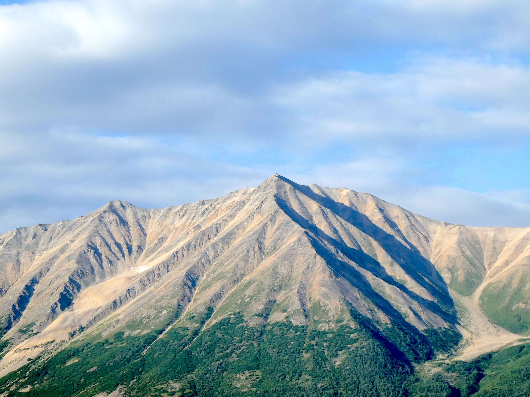
Wrangell-St Elias National Park and Preserve is the most superlative and unique-est we’ve ever visited. It’s the largest National Park in the US. At 13 million acres, it’s roughly 6 times the size of Yellowstone. It is surrounded on 3 sides by other parks including Glacier Bay National Park (US), as well as Canada’s Kluane National Park and Tatshenshini-Alsek Provincial Park, creating an enormous international wilderness area. Mount St Elias is the tallest peak in the park at 18,008 ft and the second highest peak in the US (Denali is 20,308 ft). Mount St Elias is also 10 miles as the eagle or raven flies (we’ve not seen many crows in Alaska!) from the ocean, providing one of the highest reliefs in the world as well as a uniquely preserved ecosystem in its entirety. Established in 1980, Wrangell-St Elias is one of the most recent additions to the National Park Service.
Like most National Parks, WSE’s mission is to preserve and protect natural scenic beauty, wildlife populations and their habitats all while providing and balancing access and recreational opportunities by visitors. WSE also celebrates the region’s 20th century mining history. Unlike most National Parks, WSE also provides continued opportunities for the few small communities and the subsistence lifestyles of the people who live there – yes, people live deep in this wilderness, surrounded by the National Park.
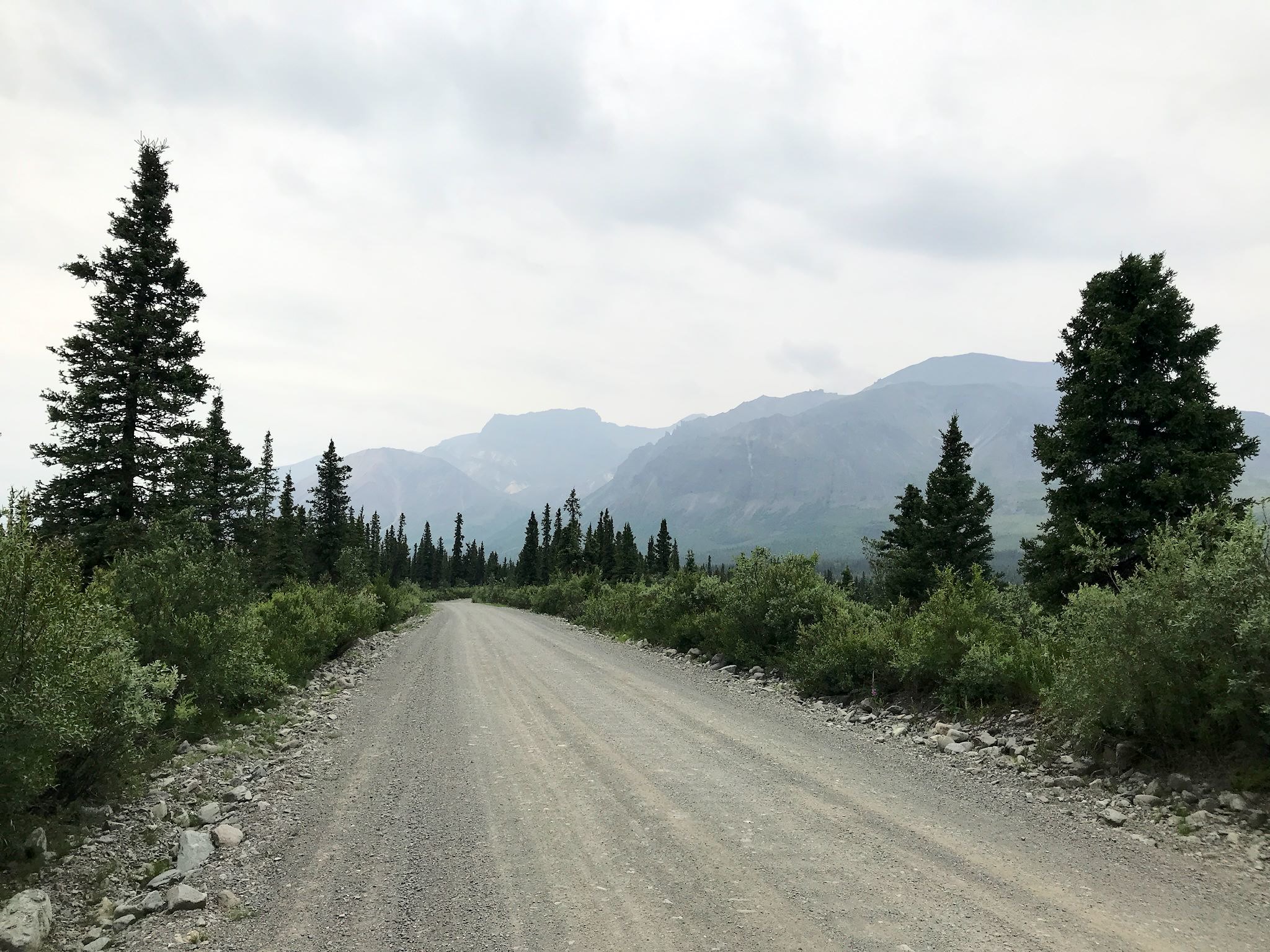
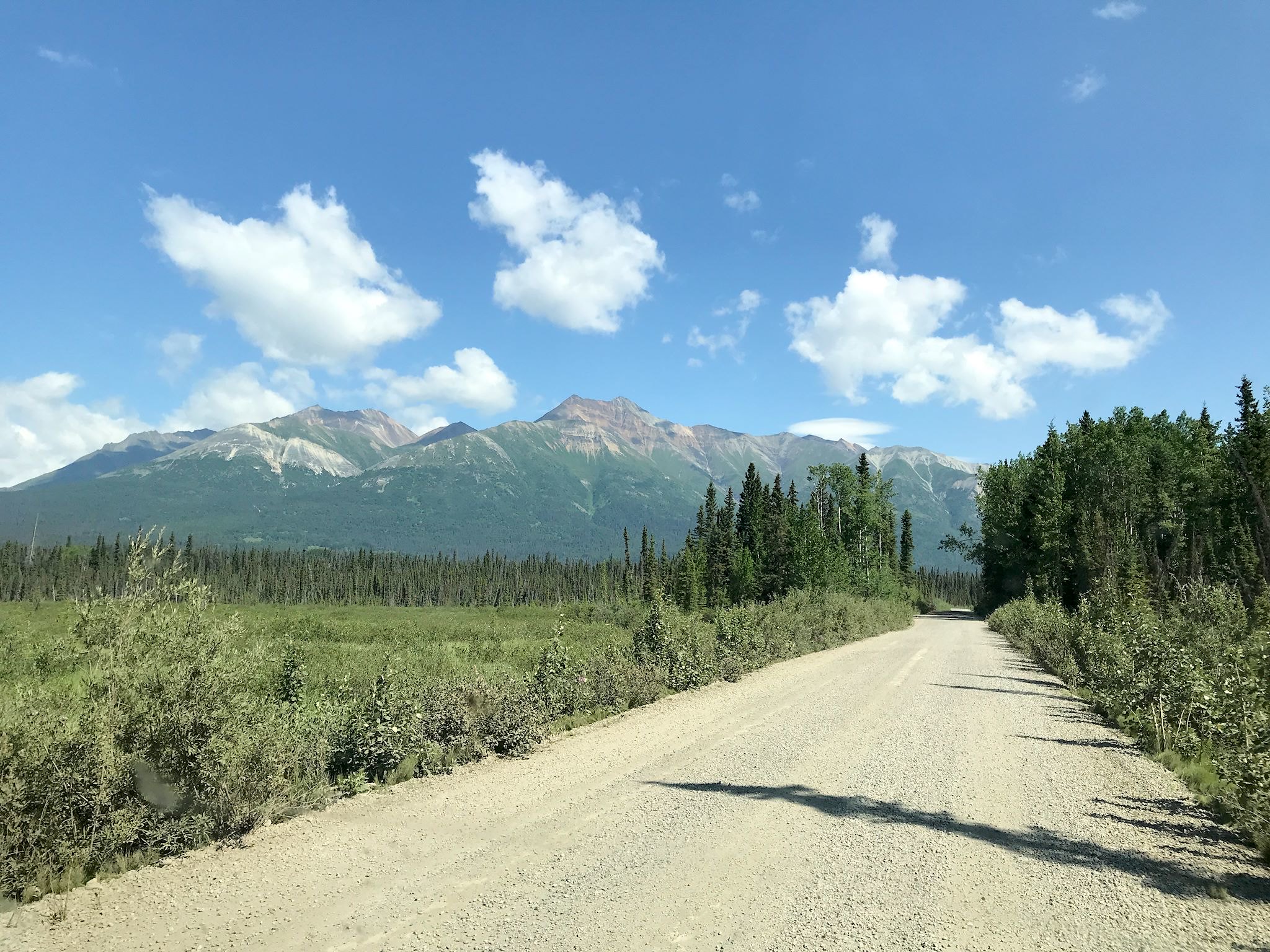
Within the 13 million acres, access is via only 2 rugged, unpaved roads – the 42-mile Nabesna Road in the Northern District and the 60-mile McCarthy Highway in the Southern District. The latter includes warnings about destroyed tires, broken windshields, and you could die. Fortunately, our RV likes to pretend it’s a jeep. And our friends Mike and Helen, who visited McCarthy/Kennecott last year, encouraged us to go, suggesting it would be just like the unpaved road we live on in Vermont, only longer. And our friends Al and Sandra inspired us with pix from their backpacking trip in the park last year.
Let’s start with Nabesna.
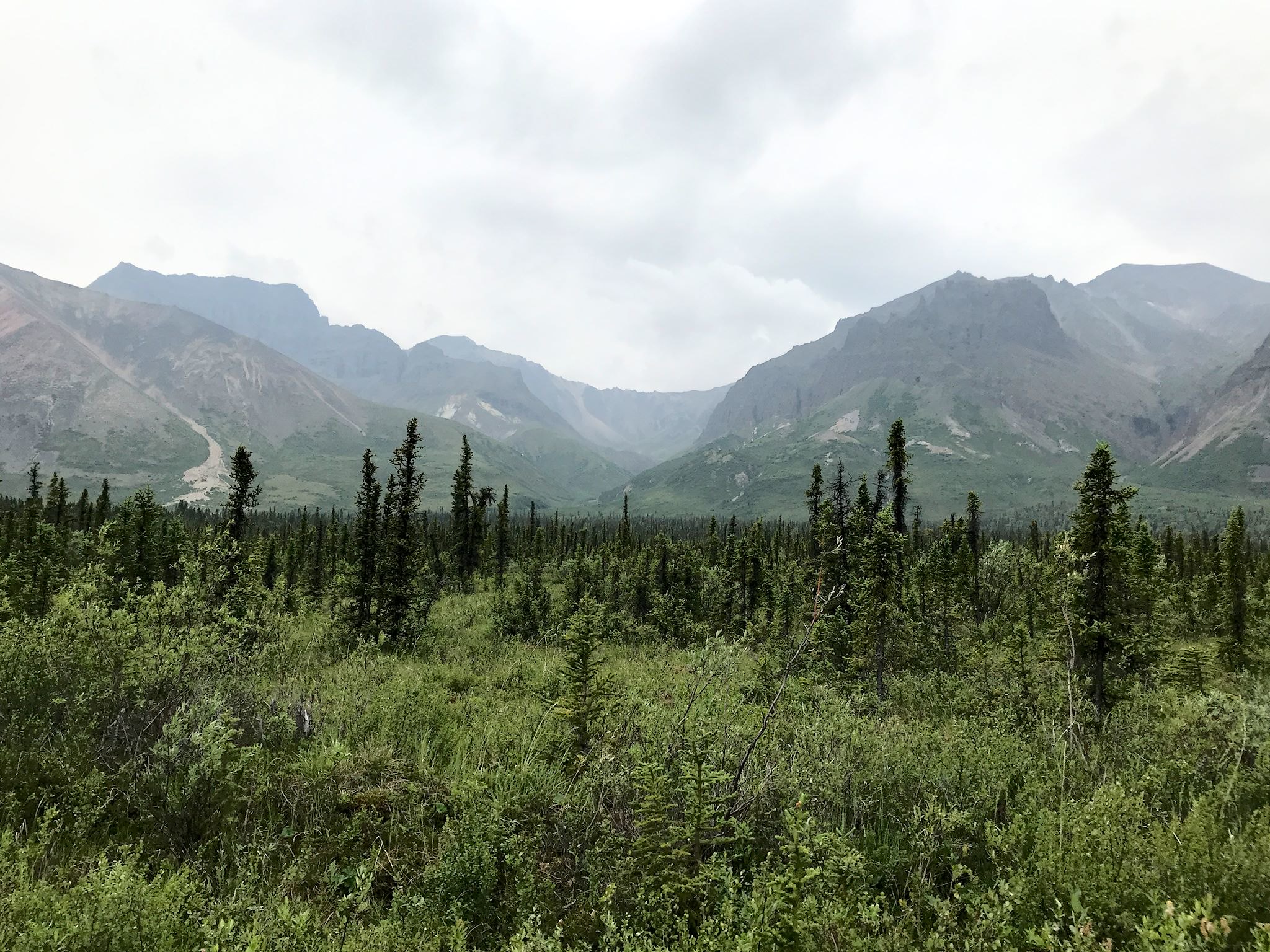
The drive along the Nabesna Road was pretty as we followed along the Mentasta Mountains, and later the Nutzotin Mountains, and in the shadow of WSE’s tallest peaks. After an activity-filled couple of weeks, we decided to take a day alongside the road to just soak in the views and absorb some National Parkness. Chill.
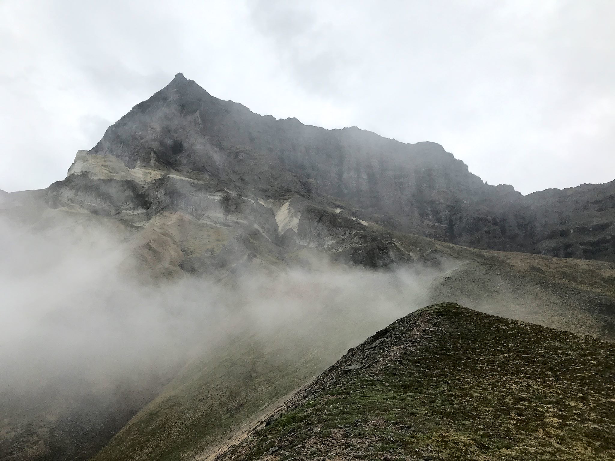
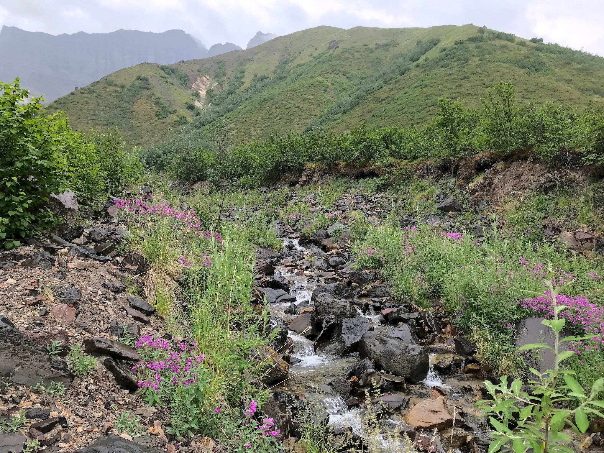
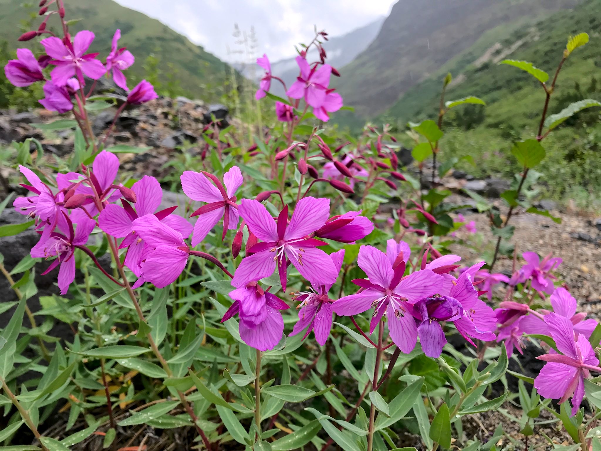

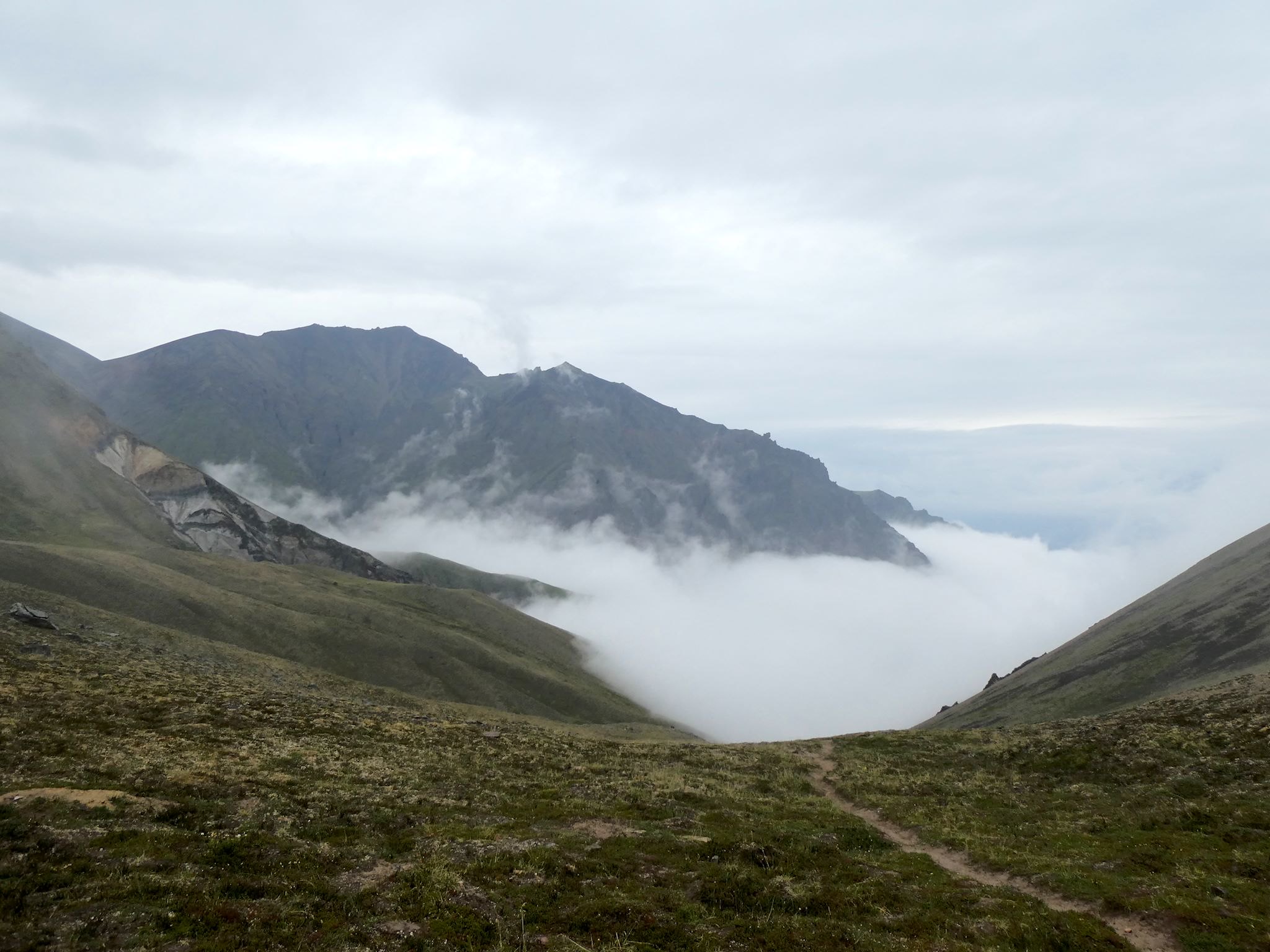
Ok, time’s up! The Skookum Volcano Trail description promised stunning views and it was time to find them! The trail started gradually through the forest, quickly merging with a rocky stream bed, then most of the hike was out in the open, meandering along, across and above a relatively open canyon with gorgeous views of the cliffs and peaks around us. About halfway up, we turned towards the sharp cliffs above us and noticed clouds moving in. Clouds accompanied us for the remainder of the hike to the summit of Skookum Pass. The peaks were mostly obscured as we reached the pass in a gentle rain. As we turned to start our descent, the clouds parted providing dramatic, almost eerie views. Quick! Take pix! Continuing down, we found the peaks we’d just seen to be totally obscured just a few minutes later. The universe had spoken and wished us another good day of hiking.

The drive between Nabesna Road and McCarthy Highway follows the park’s western boundary. Mountains know no boundaries, and we were unexpectedly treated to views of 4 of the major peaks in the Wrangell Mountains – Stanford, Drum, Wrangell (an active volcano) and Blackburn – for the duration of the drive. Yup, despite the nice paved road, it was slow going. Had to stop and gawk several times.
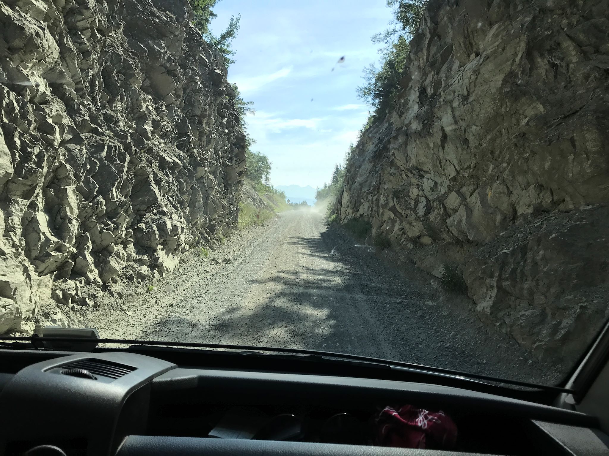
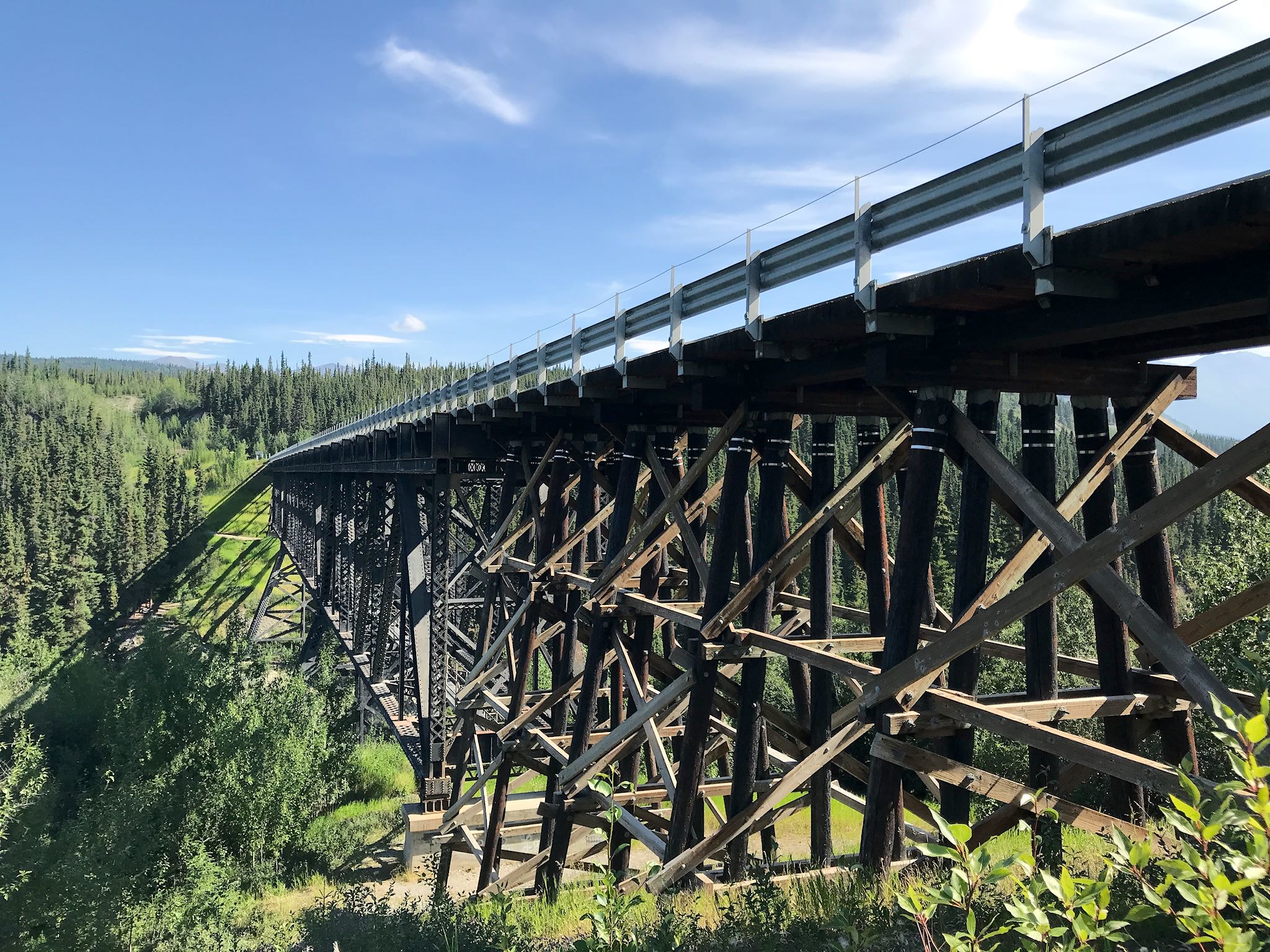
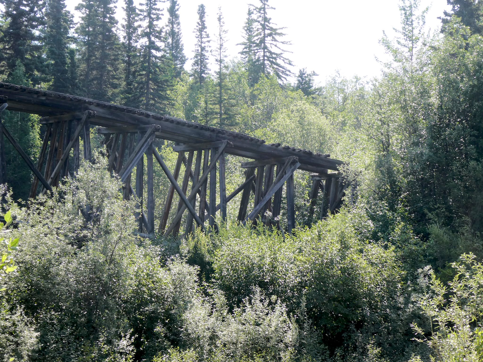
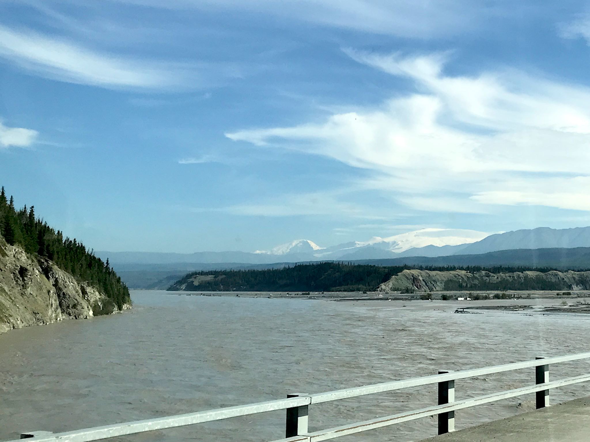
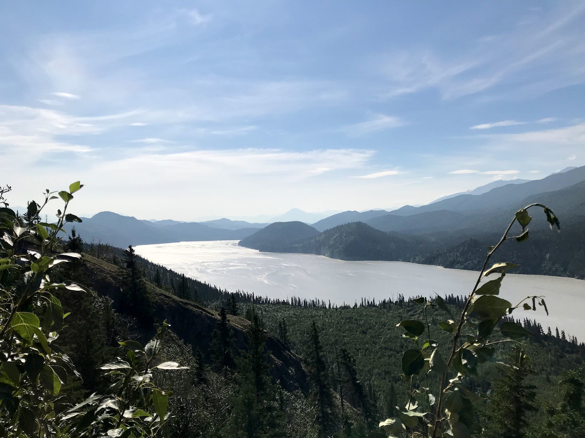
The McCarthy Highway was also pretty, following the Chitina (pronounced CHIT-na) River most of the way. A dramatic bridge crossing over the Copper River indicated good salmon fishing with hundreds of people out with dip nets. A few higher banks along the river provided awesome views. We crossed the Kuskulana River bridge, converted from one of the original railroad bridges (built in 1910), and viewed (did not cross!) another original but now crumbling rail trestle for a bit of history. Over 60 miles, we saw perhaps a dozen other vehicles.
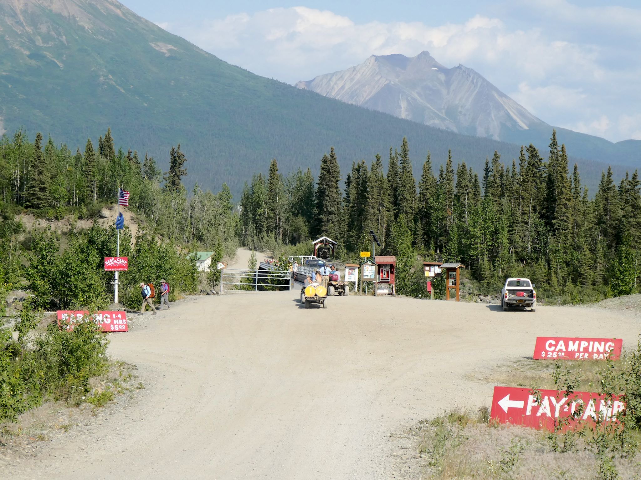
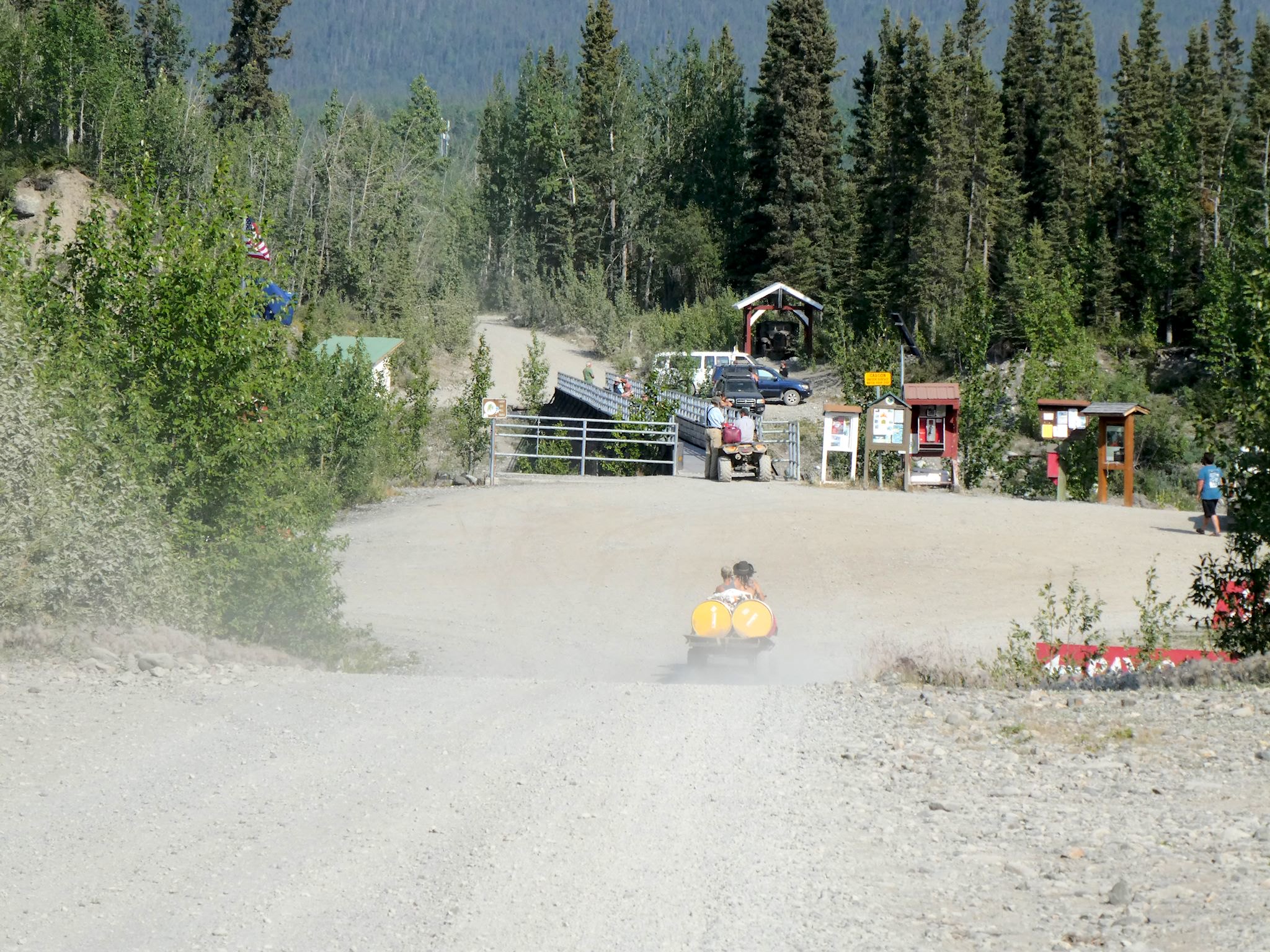
Nothing could have prepared us for the Road’s End (as it’s known in the Mile Post), where the McCarthy Highway ends at the raging Kennicott River. Within the last mile, there are cabins for rent and RV parking areas, along with a parking lot overflowing with cars. At the very end is a foot bridge and a $2 million view of the mountains and glaciers. There were people and bicycles and dirt bikes and ATVs everywhere! The towns of McCarthy and Kennecott were beyond, on the other side of the river.
Side note on the weather: Typical July weather in McCarthy/Kennecott is 70’s and rainy. The forecast for the next 6 days after we arrived was record breaking 90’s with no precipitation in sight. Unusual weather for Alaska, to say the least!
Side note on spelling: The mining company was named after the Kennicott Glacier. Due to a typographical error, the company and the town were established as Kennecott. Nowadays, natural items use the ‘i’ spelling – Kennicott Glacier, Kennicott River – while made items use the ‘e’ spelling – Kennecott Mines, Kennecott Lodge, etc.
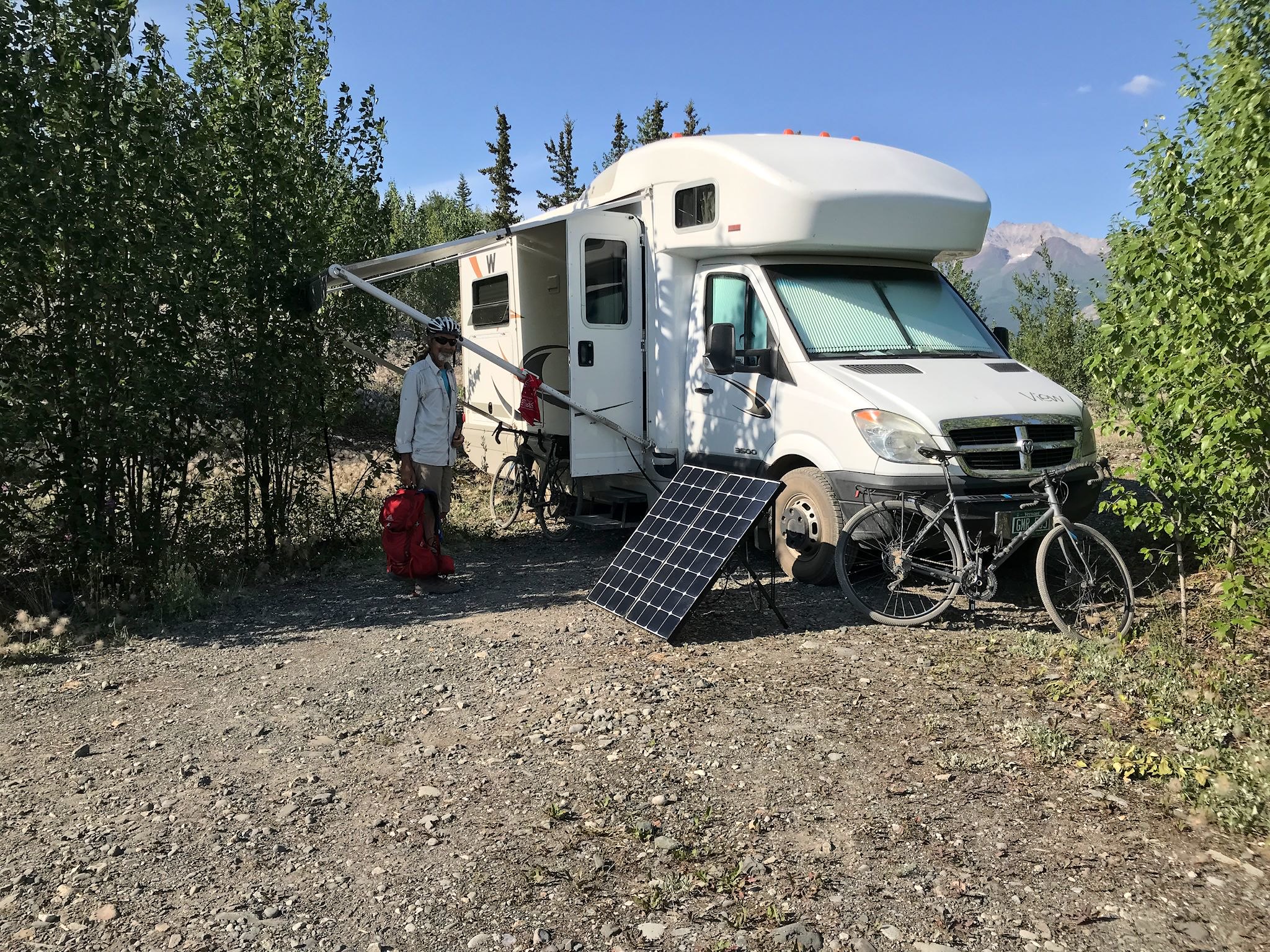
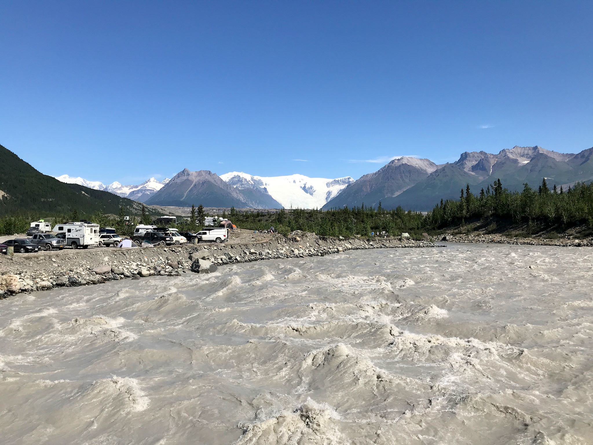
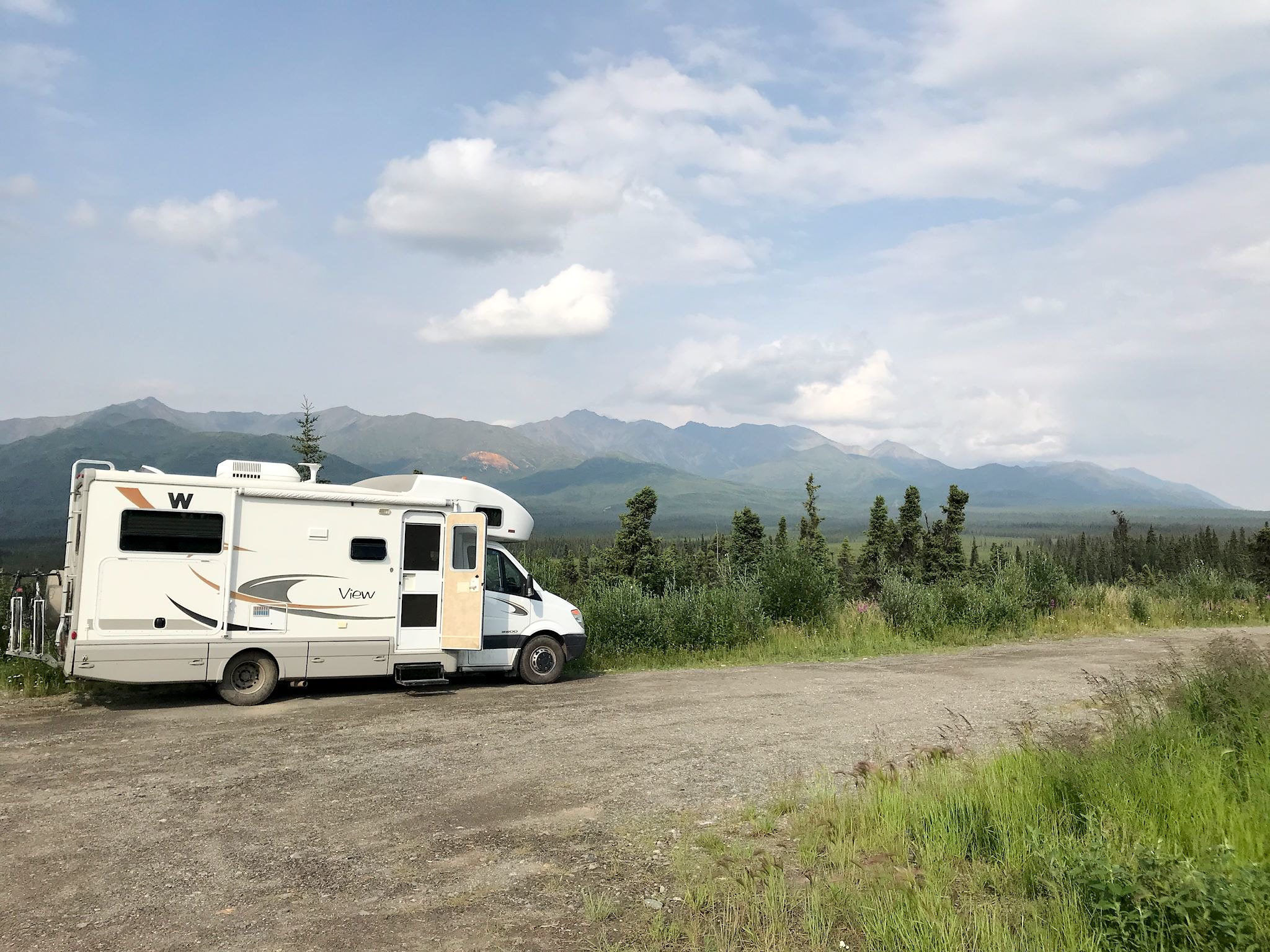
We needed a survival strategy… After assessing our options, we chose to camp nearest the Kennicott River. Camping was allowed anywhere along the gravel bars near the river. Although there was no shade, we could see the Kennicott Glacier that was melting into the river, and there was a nice breeze coming off the glacier. We decided parking perpendicular to the river would maximize the airflow through our open windows while our awning would shade the south side. (In retrospect, it was a brilliant move… Inside our RV has been the third most comfortable place to be during the heatwave, right after the glacier and the swimming hole!) That position also maximized our views. Did we mention the views?
Quick history lesson for context: Copper was found in Kennecott in 1900. From 1911-1938, the Kennecott Copper Company/Corporation ran one of the most profitable copper mines in history. At its peak in the mid-20’s about 400 people lived and worked in Kennecott. As with most mining company towns, alcohol and prostitution were prohibited. Thus, McCarthy, 5 miles away, became a booming support town to include a hospital, gym, school, bar and brothel. The Kennecott Mines stopped producing copper in 1938 and all but a family of 3 (caretakers) left on the last train. McCarthy’s population dwindled. During the 70’s, a few hardy souls interested in subsistence living returned to McCarthy and population has slowly grown since. Combined year round population is currently 35-50, depending on who you ask. More people spend the summer in the area, especially those serving as guides to summer visitors.
Residents, park staff, and certain delivery and support vehicles may drive across the gated toll bridge just south of the Road’s End, but everyone else must use the footbridge to get across the Kennicott River. You can hop on a shuttle bus ($$) on the other side to take you a mile into McCarthy or four miles up to Kennecott – or you can walk, ride a bike, or drive a four-wheeler/ATV.
Time to explore…
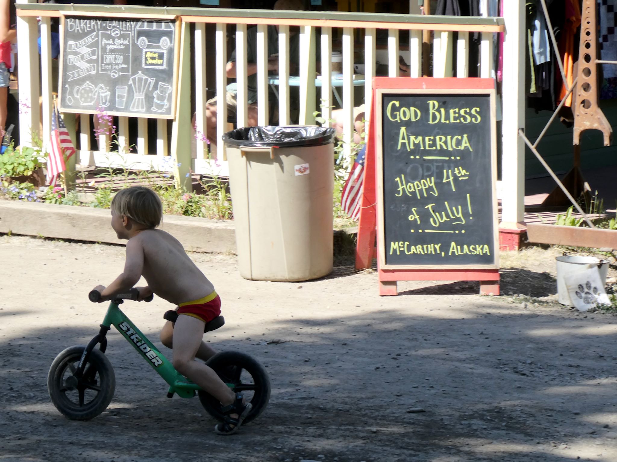
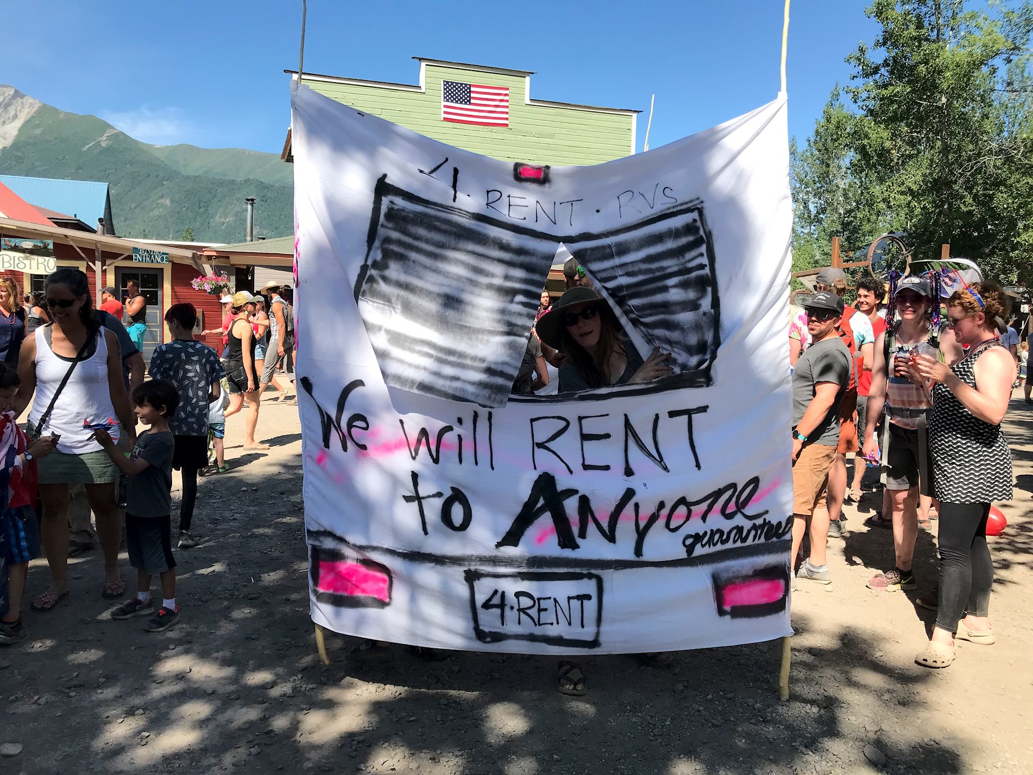
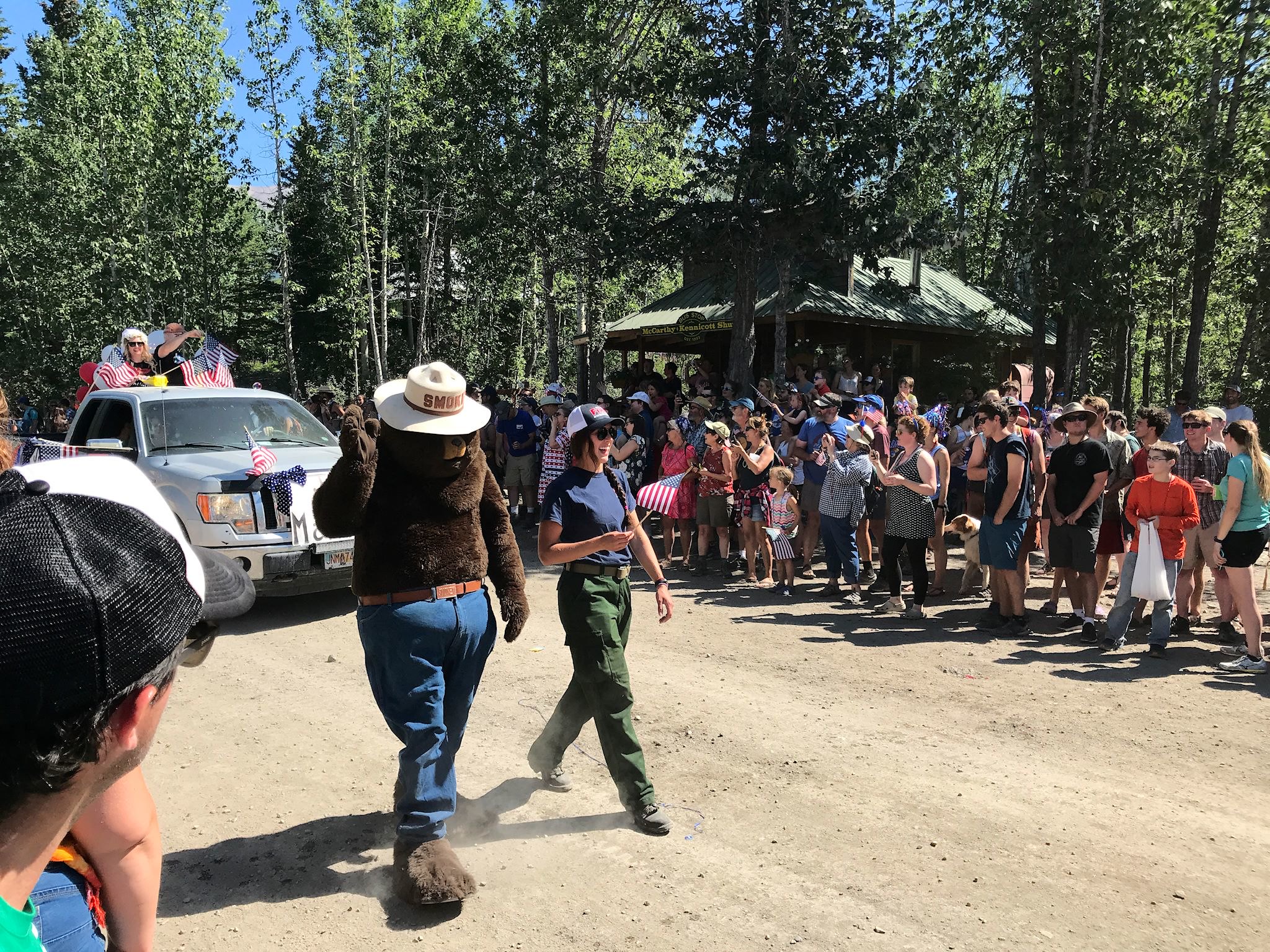
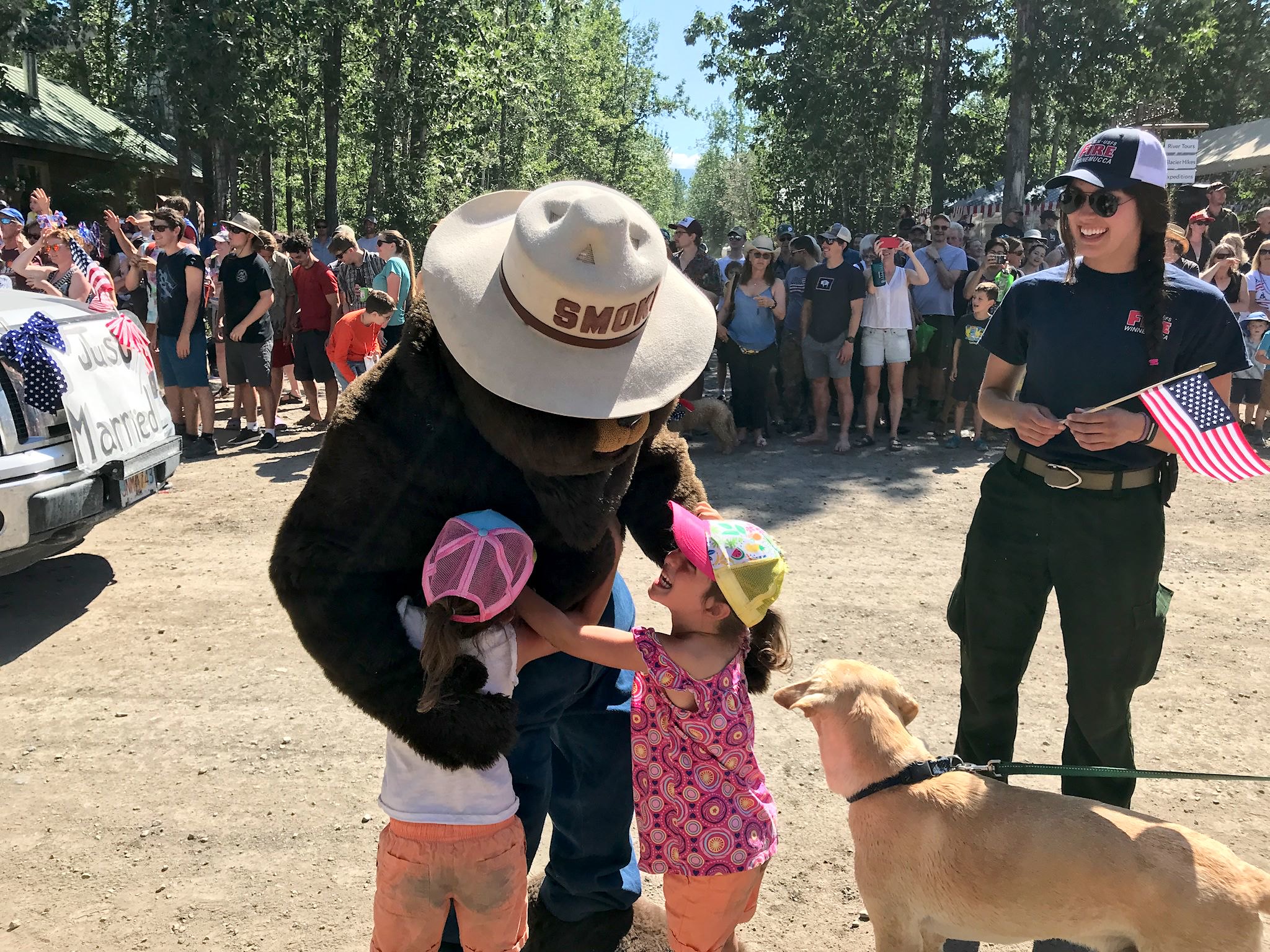

McCarthy is known for its Fourth of July parade and festivities. Anything goes and nothing in McCarthy is overly serious. Each business in town and anyone else who likes can join the parade. The town, the population, and the parade is small enough that it does 2 laps around town. Hundreds of people attend. Our favorite ‘float’ was a human-powered rental RV, good-naturedly spoofing a fair percentage of us visitors. Of course, on a hot day, any float with a bunch of water guns got extra points! Note: We hail from Warren, VT, the self-proclaimed and widely acknowledged Fourth-of-July Center of the Universe, so we have experience with small town parades. We give double kudos and high fives to the fun folks of McCarthy!
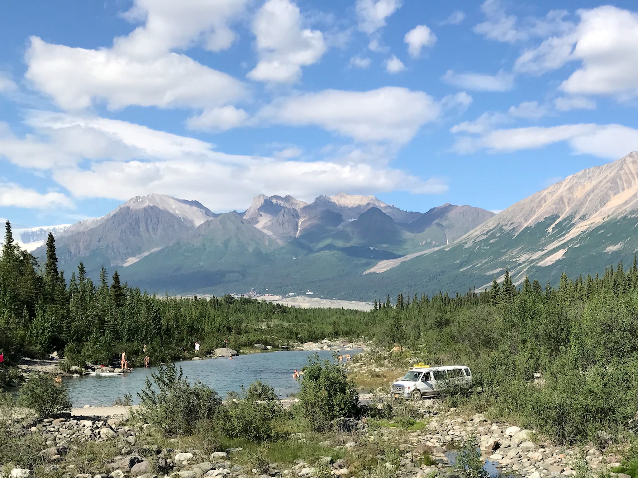
Although we passed on some of the apres parade festivities (the local swim hole was calling…), we enjoyed spending the evening out on the town seeing the sights, dining and hanging where a band was playing at one of the (two) local drinking and eating establishments.

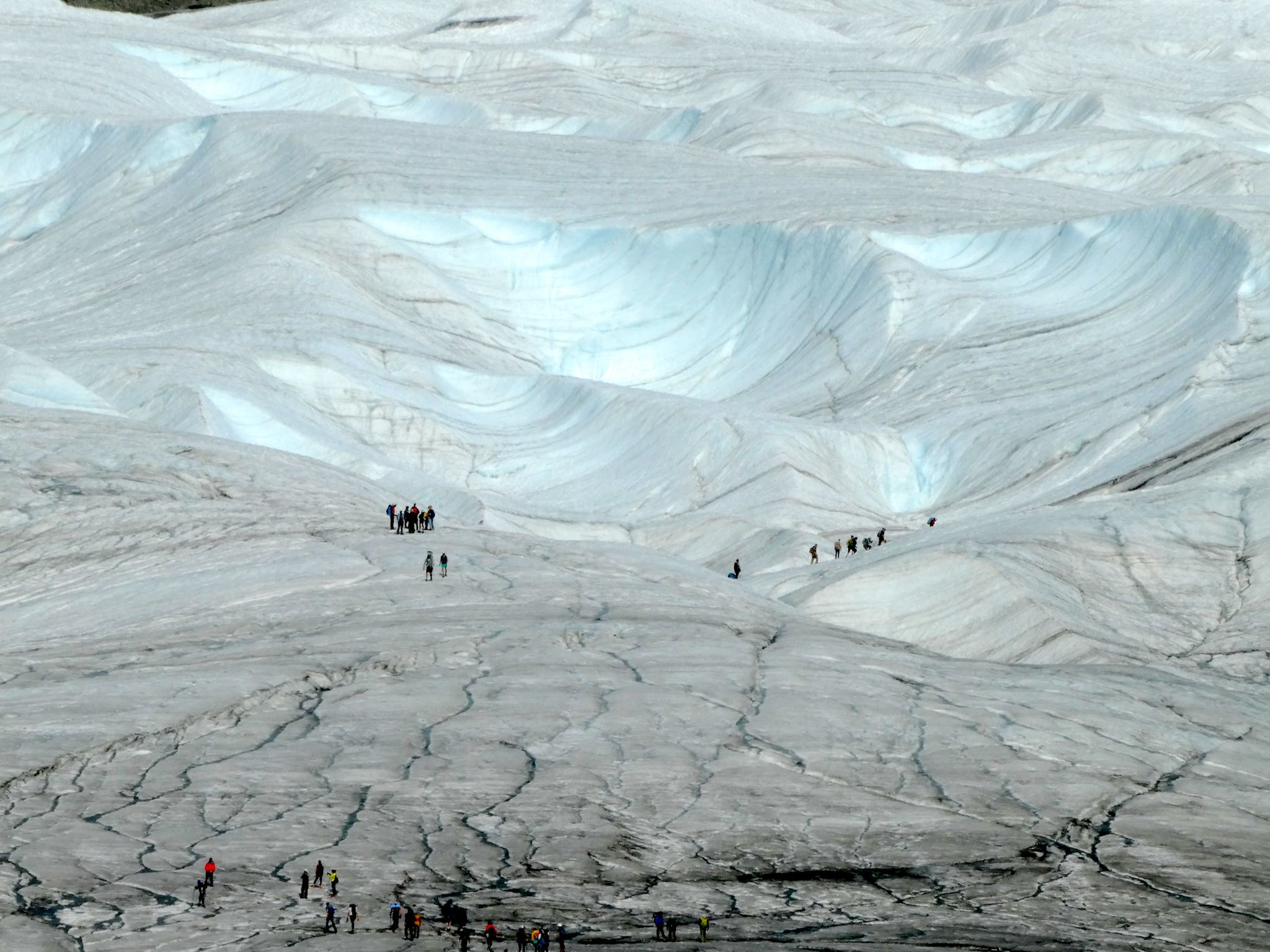
We took a look at the hiking options and thought that hiking on a glacier just might be delightful on a 90 degree day. It was! The Root Glacier hike started from Kennecott, 5 miles further on up the gravel road – perfect for our dirt road bikes! (There’s a shuttle bus, but… nah.) After a short walk through woods, the trail drops onto a gravel debris field, then up onto the glacier. We explored as much as we could without crampons, and lingered for a while. It was cool! And it was cool.

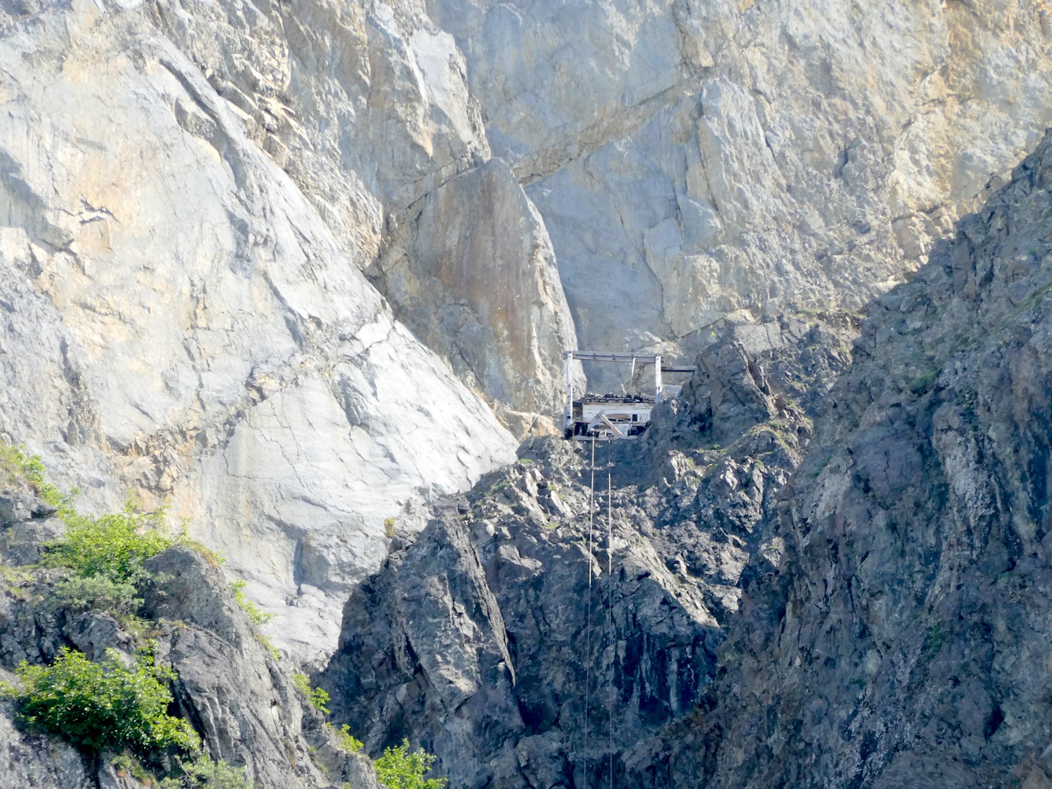
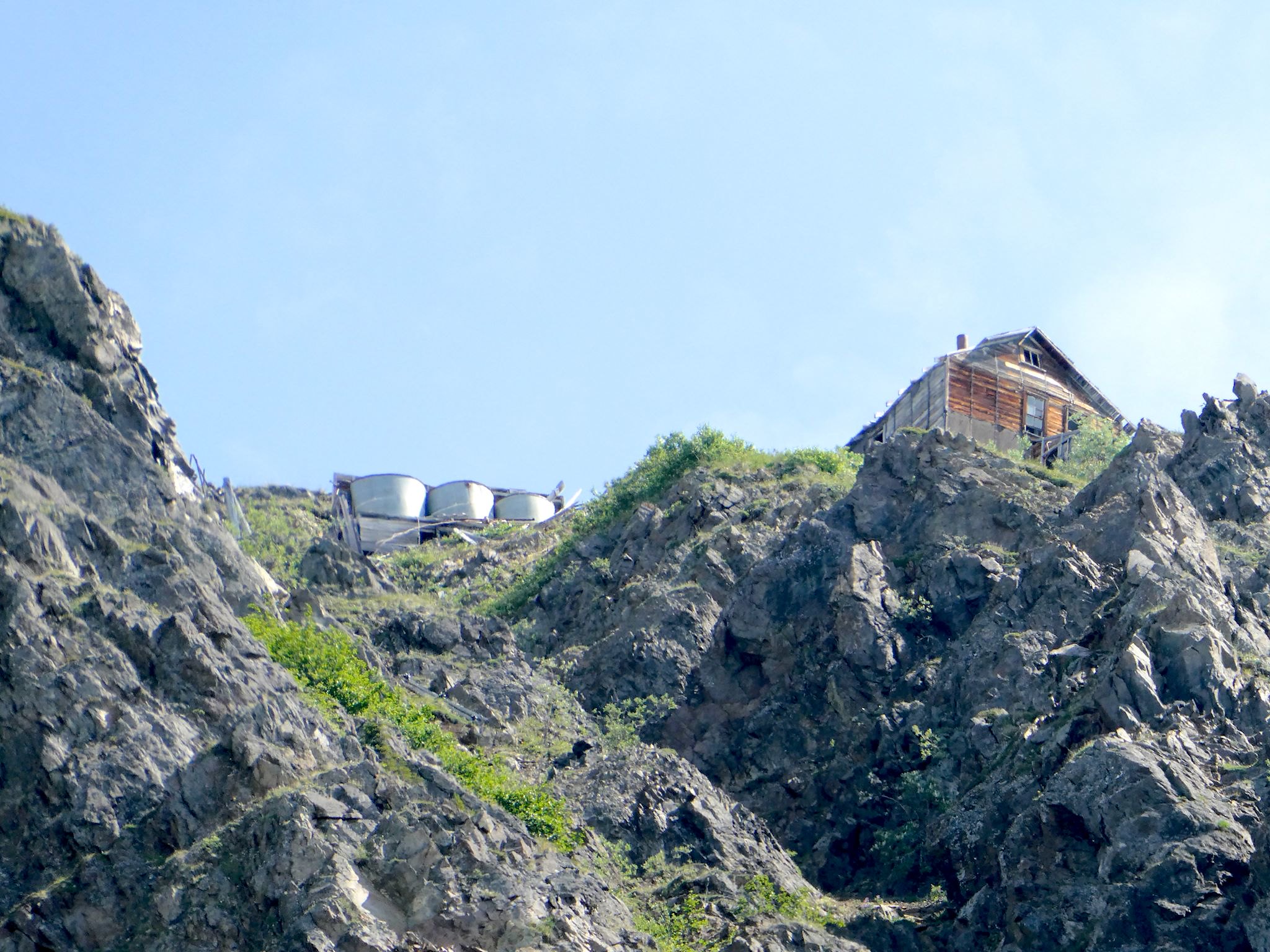
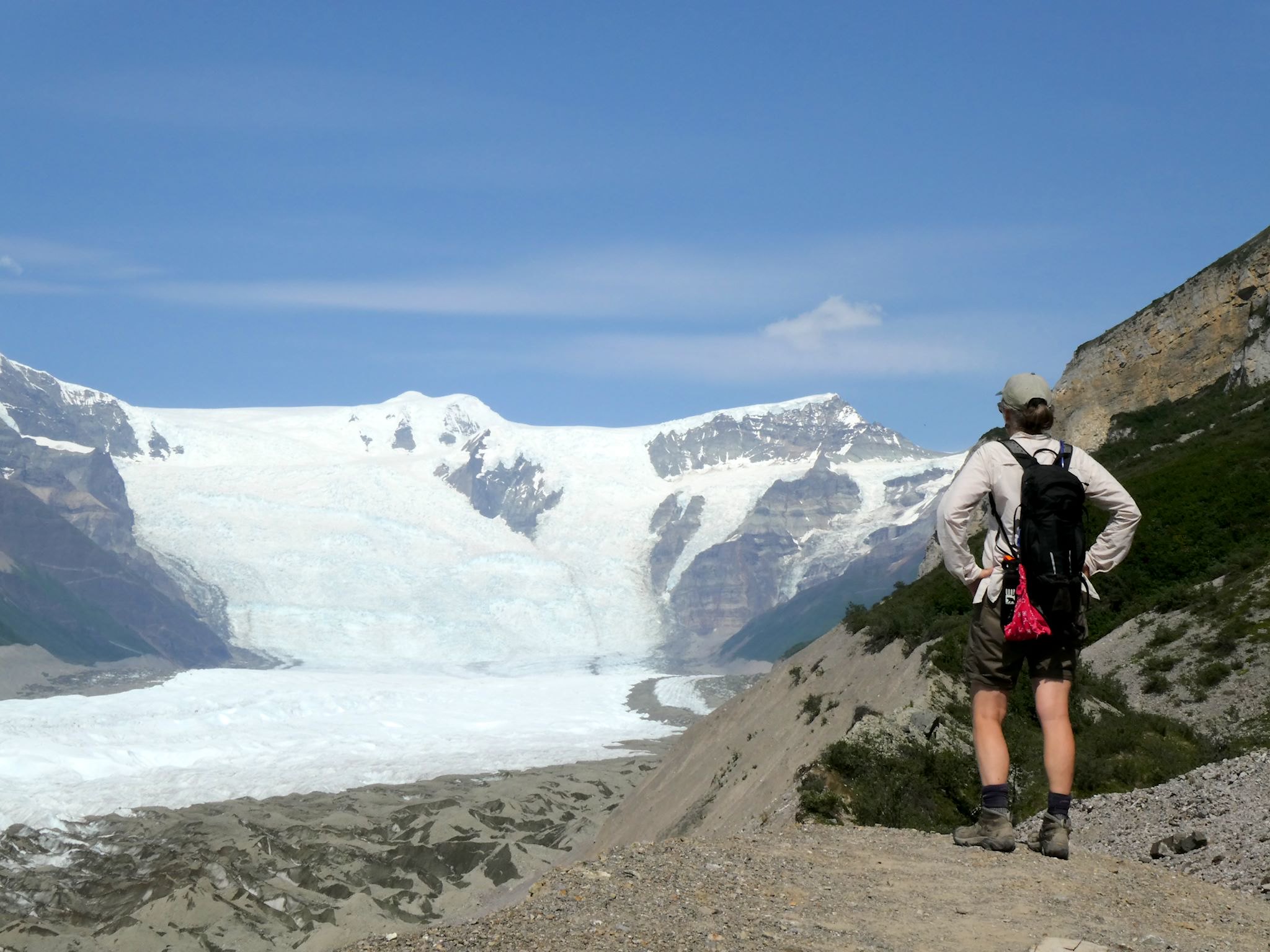
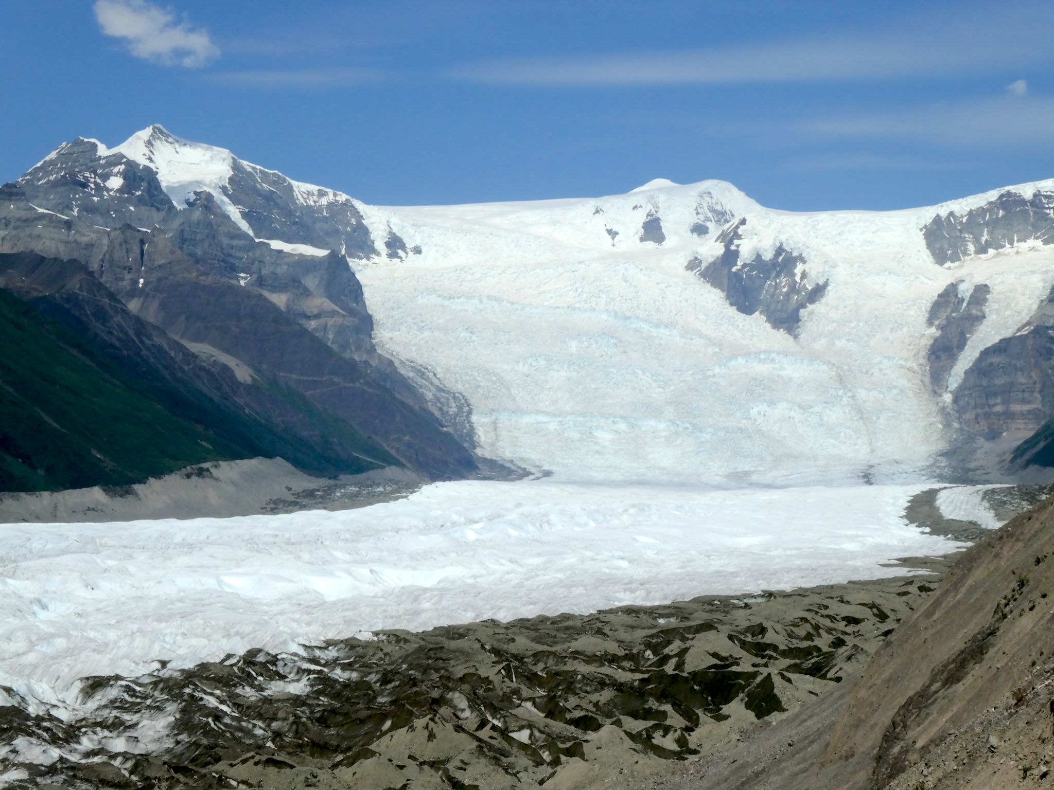
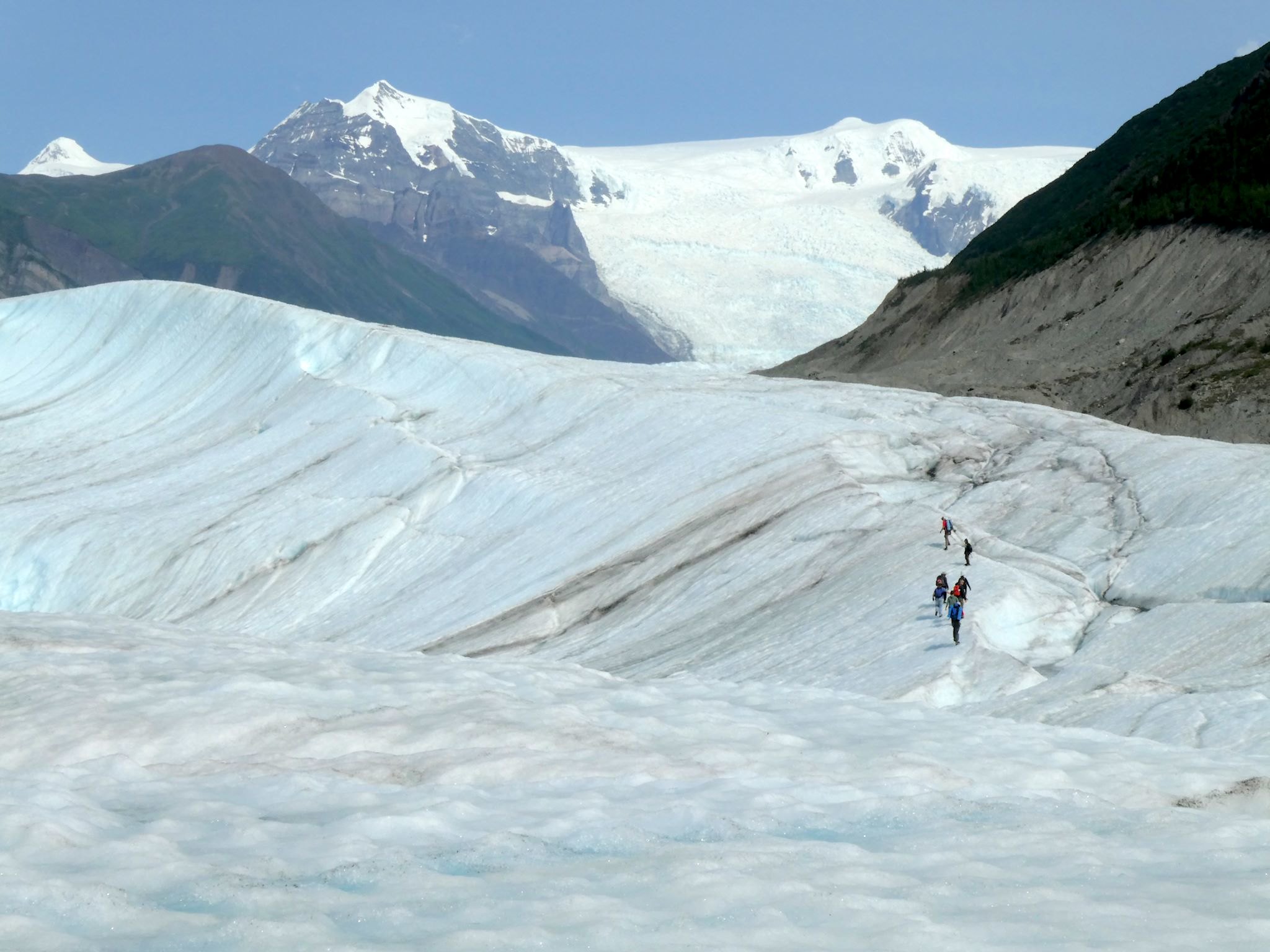
The Erie Mine hike wasn’t on a glacier, though it followed along the eastern edge of the Root Glacier for several miles. Works for us! Meandering along the edge of the glacier had the added attraction of some amazing views. Mining ruins marked the end of the trail. A few thick, rusted cables partially buried in the ground drew our eyes toward the upper tram station (kinda like a chair lift without skiers), perched on the edge of a cliff. As we looked upward, more mining structures came into view, clinging onto the edges of the cliffs, and we had to imagine what it would be like working so high up there in a mine. The end of the trail also provided a view of the Stairway Icefall, the start of the Root Glacier. Jaw dropping!
So now we were at the start of 2 major threads of WSE: the mining process and the glacier. Let’s follow both.
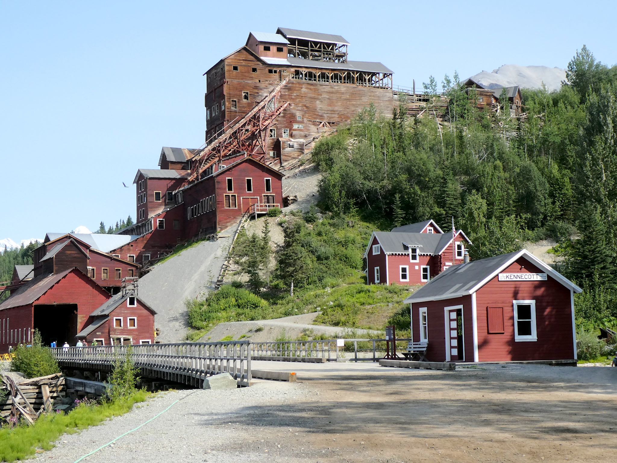
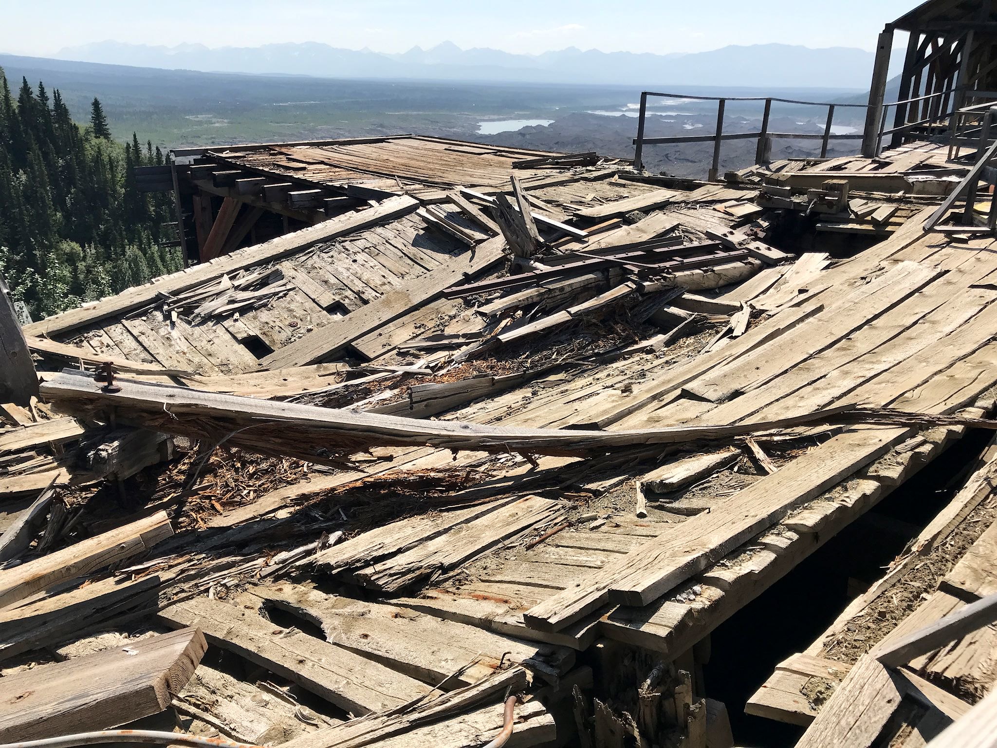
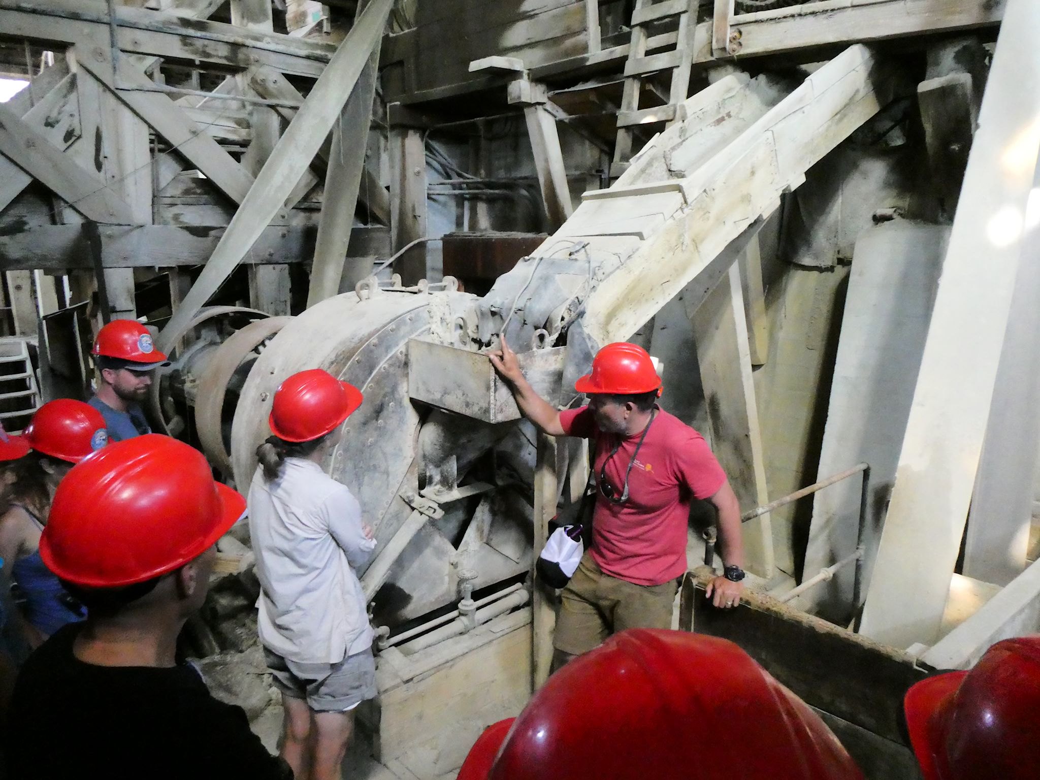
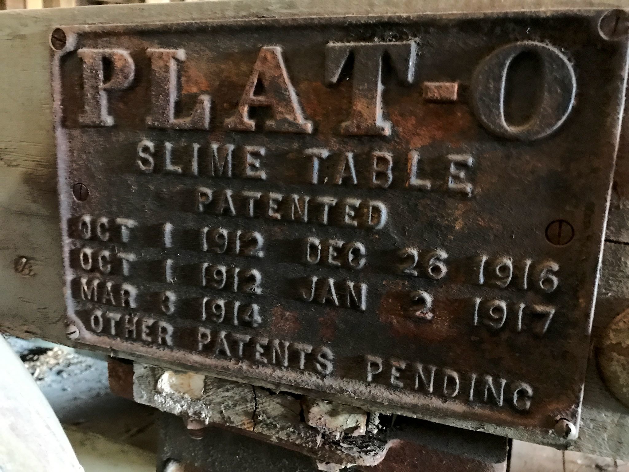

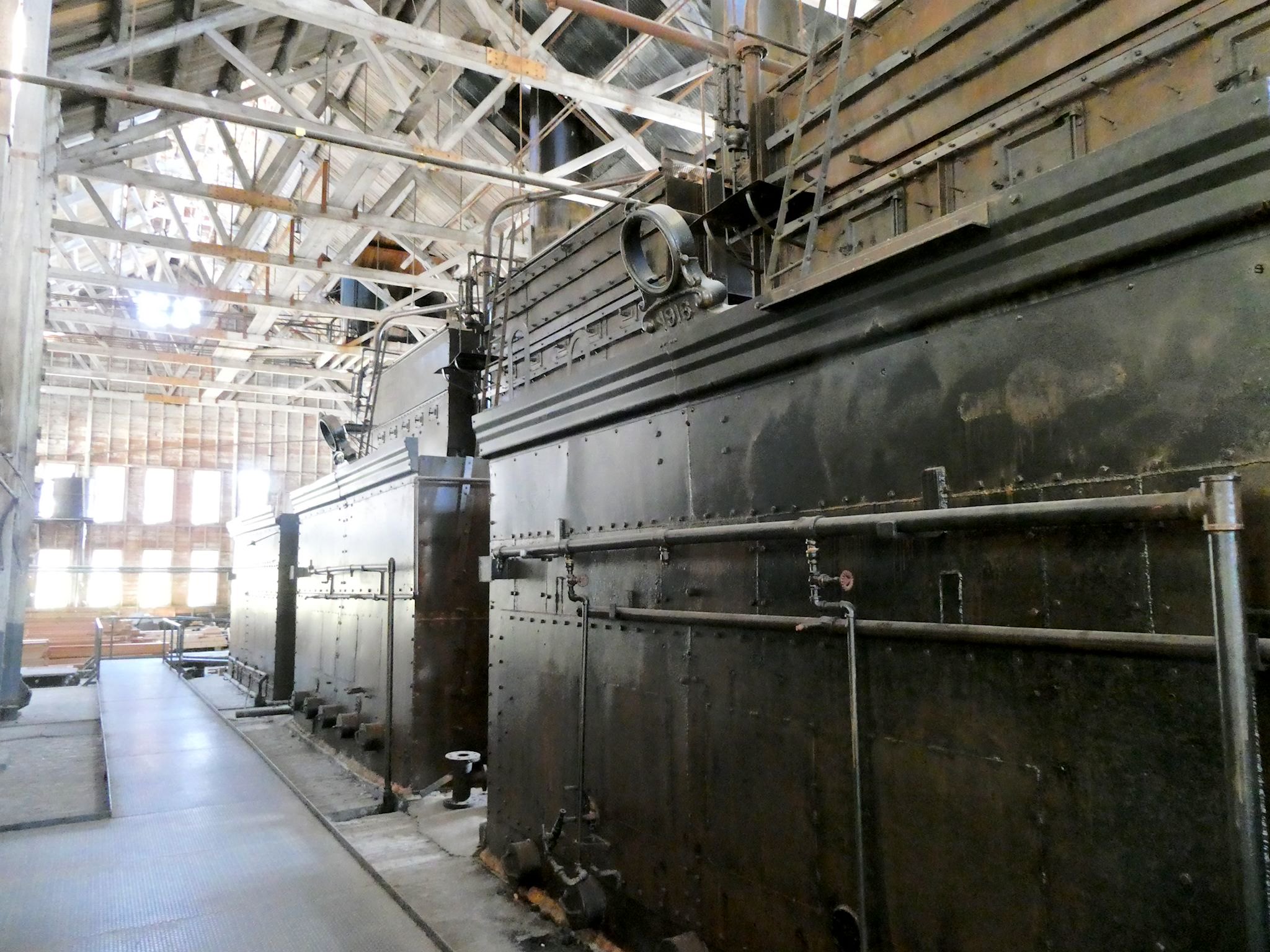

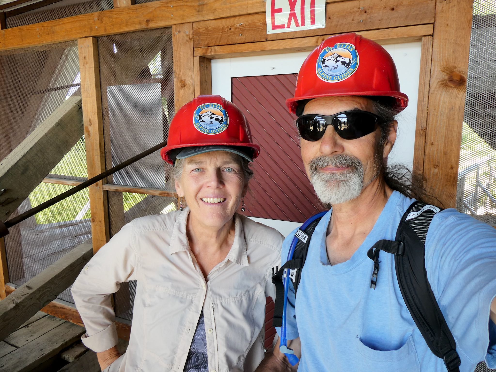
The copper ore came out of the Erie Mine and was transported by tram to Kennecott to be processed at the concentration mill. (There were 4 other mines – Bonanza, Jumbo, Mother Lode and Glacier – all sending ore to the mill.) We spent one day visiting Kennecott, where we joined a guided tour of the town and the Kennecott Mill. The iconic mill shows signs of wear since it was abandoned in 1938. It’s since become a National Landmark and is being stabilized and preserved, allowing us to spend time inside, again our imaginations stirring from seeing the chutes and ladders and intact giant machinery used to crush, sort/grade and bag the ore for shipping via rail to Cordoba, AK, onward from there via ship to Tacoma, WA for smelting, and the end of the road for the copper ore.
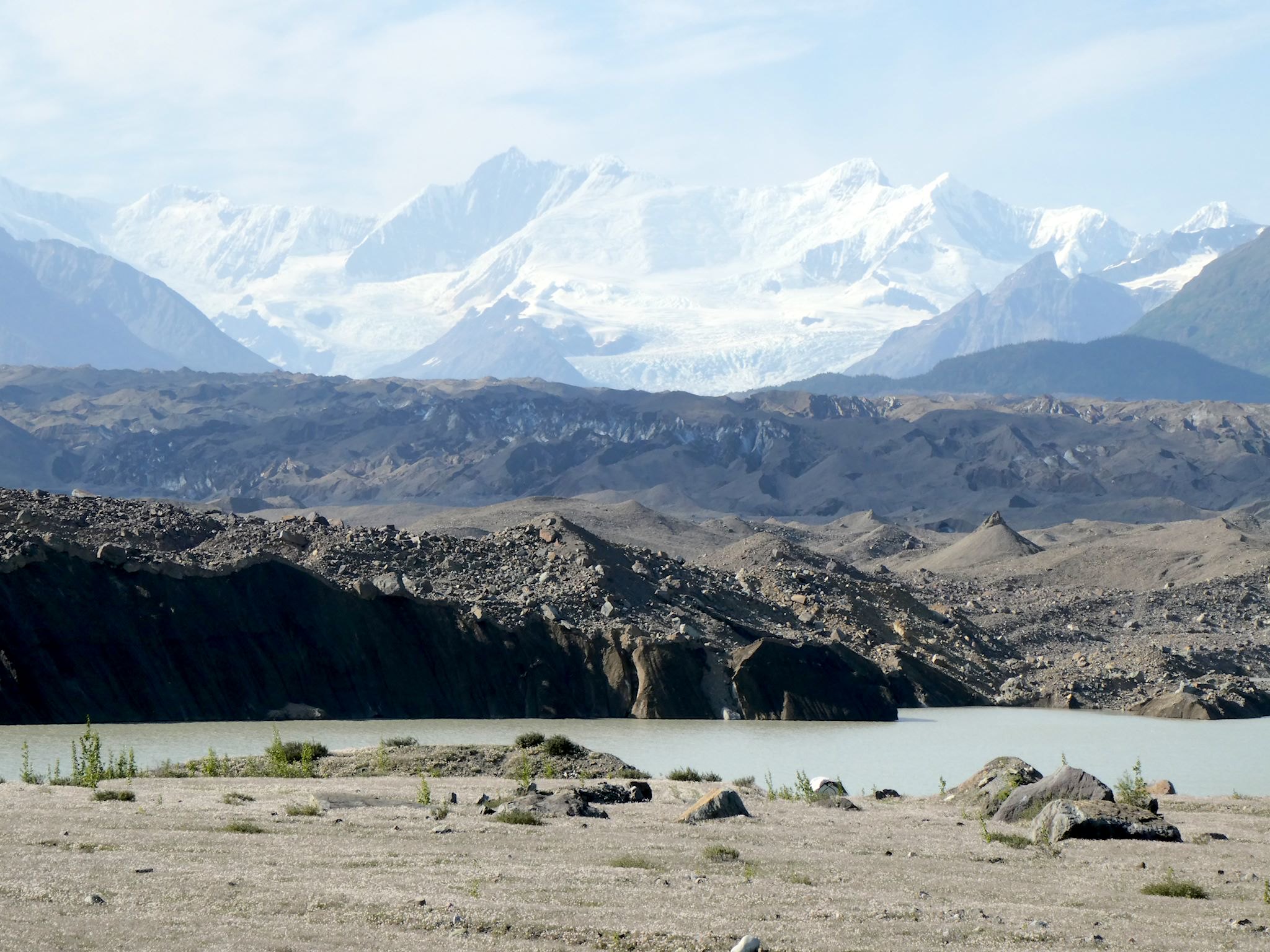
From the bottom of the Stairway Icefall, the Root Glacier slowed its course with gravity, joining the longer Kennicott Glacier from Mount Blackburn to the west. From the town of Kennecott, we could see the toe of the glacier – where the glacier abruptly ends and melts into a lake that becomes the Kennicott River that cools our RV just a few miles further. We asked a few locals and pieced together enough information to find the dirt roads that would bring us to the end of the glacier. Amazing! We turned our trusty bikes onto a gravel field to see both Mt. Blackburn/Kennicott Glacier and Regal Mountain/Root Glacier towering above us. We sat there on the edge of the lake with our mouths open, staring at the edge of the glacier that every minute or two would slough off a rockfall or chunk of ice into the lake. The end of the road for the glaciers!
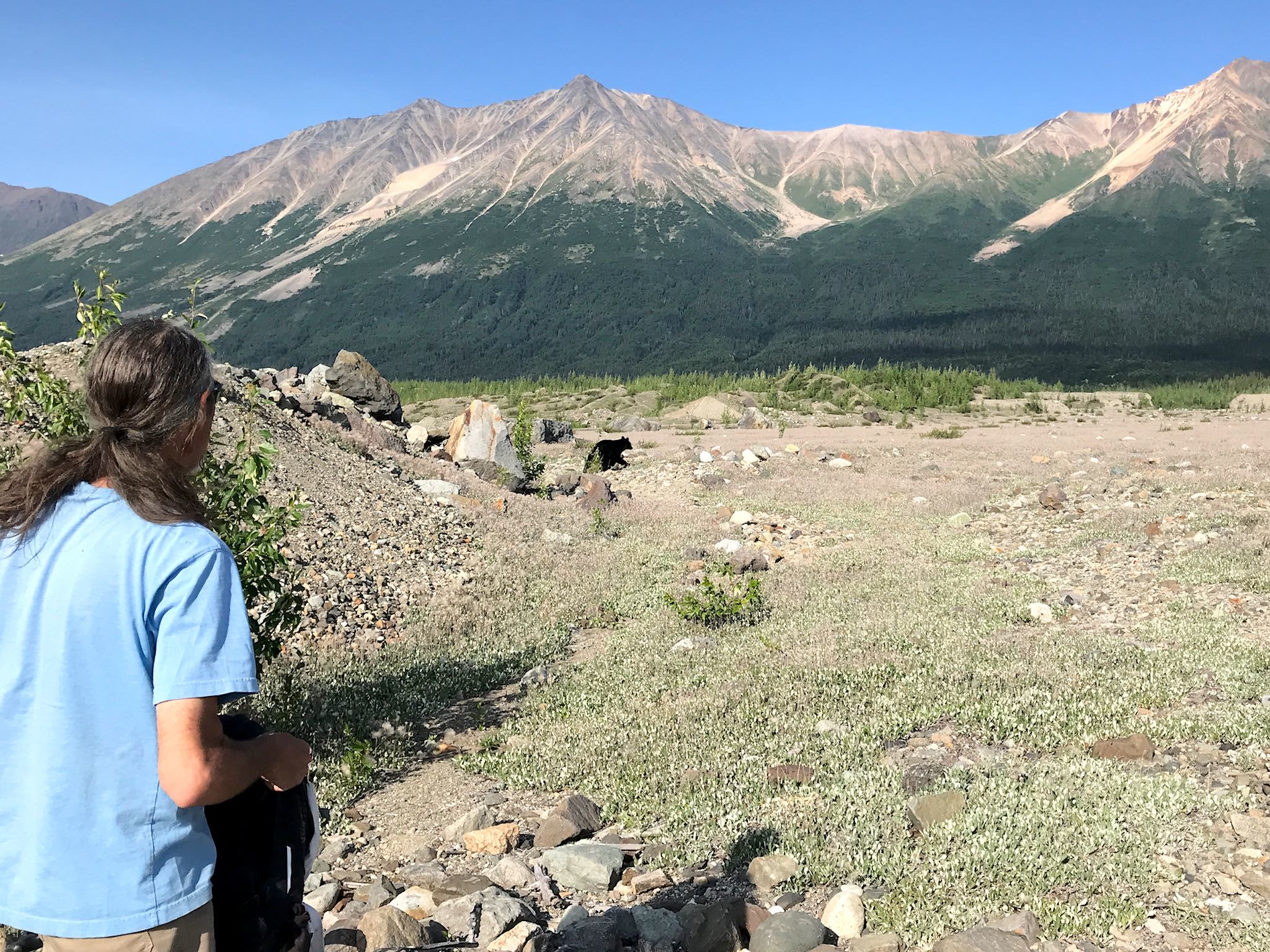
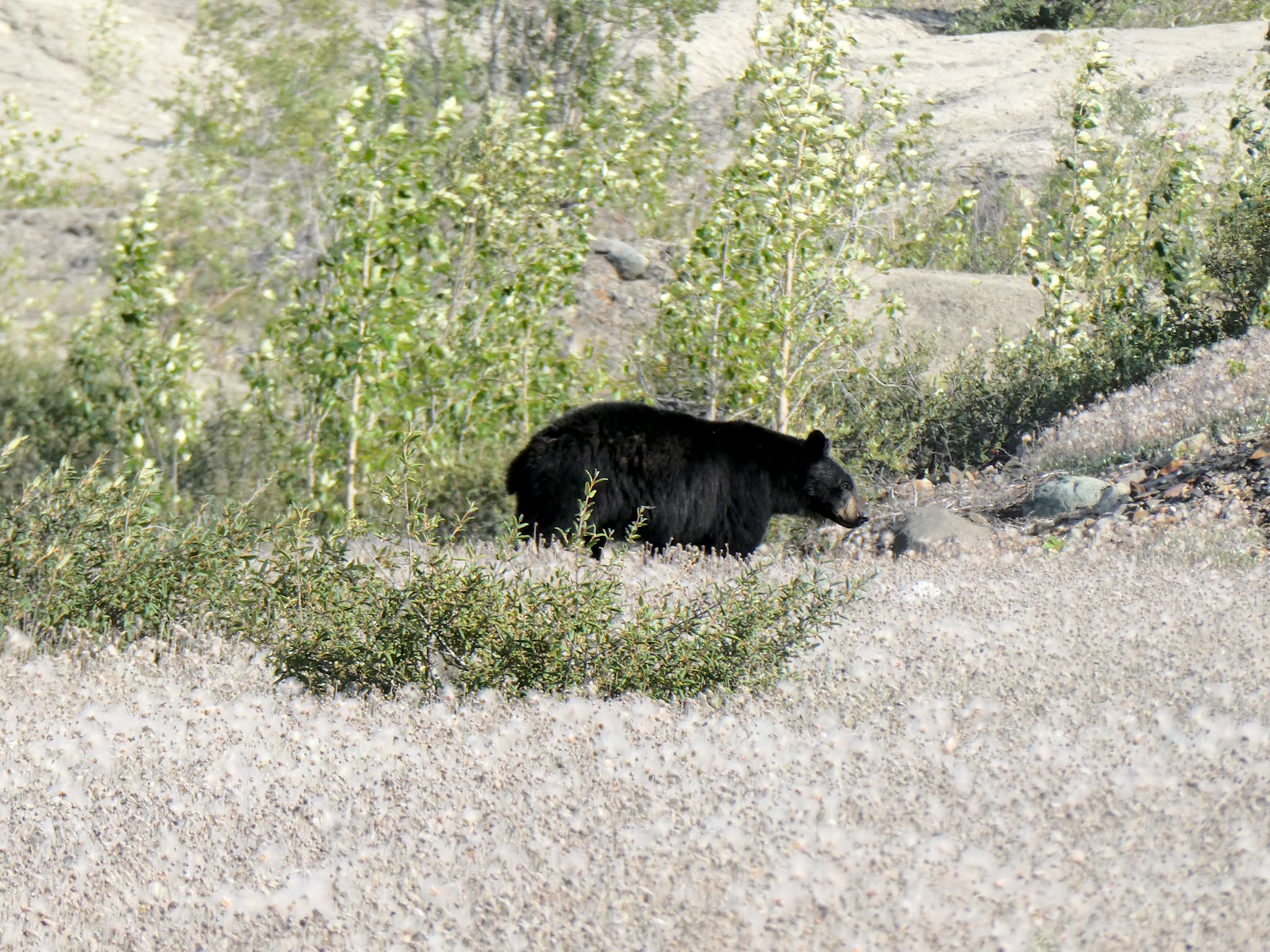
Totally satisfied with our adventures, we got up to head back to camp and saw that a big black bear was about 50 feet away, just watching us. We stood to say hi and it moved on.
A note on bloated posts and albums: Have you ever walked on a glacier? Seen the top of a glacier from the toe? Joined a Fourth of July parade hosted by a town of 35 people? Walked on the roof of a 108-year-old, 15-story, wooden ore mill that’s been abandoned for 81 years? Found a town of fun-loving, rugged individuals at the end of a 60-mile gravel road? Us neither. Our emotional response is to keep adding words and pix so that we remember this cool place.
And there’s so much more we’d like to say! Rather than continue, we’ll just wait for your questions in the comments. Indoor plumbing? Mail service? Grocery shopping? Winter temps?
For anyone who’s still interested, more Nabesna Road, Skookum Volcano Pass hike, driving around WSE NP, McCarthy Highway, Road’s End, McCarthy, Fourth of July Parade, Kennecott, Kennecott Mill Tour, Erie Mine hike, Root Glacier hike, toe of the glacier, jökulhlaup pix…
Thanks so much for a wonderful tour. We, of course, love the excitement of the tour and also a reminder of the copper business… just amazing! Enjoy!!!!
Thanks Helen, and you’re welcome! Glad to do it!
We’re so happy you and Mike shared your love and excitement of the area with us. That’s the magic that makes those e-pushpins get onto our map…
I love being reminded of the history of these beautiful areas. I had heard that the temps in parts of AK reached 90. Ugh. Thank goodness you had the glacier and river. I hate thinking about the impact these dramatic temps are creating.
Loved hearing about the Parade!
Thanks, Barb! Glad you’re enjoying the history. We’re fascinated by Alaskan history. Much of it takes place in our lifetimes…
The fun people of McCarthy would ‘get’ the Warren parade and vice versa. Interestingly enough, after the parade we ran into Mike Smith, formerly of Waitsfield (patrolled at MRG and Sugarbush), who now lives in Kennecott. Tiny planet!