Malibu, CA: VT-ID connection

Doug, Sue, Karen, Harry

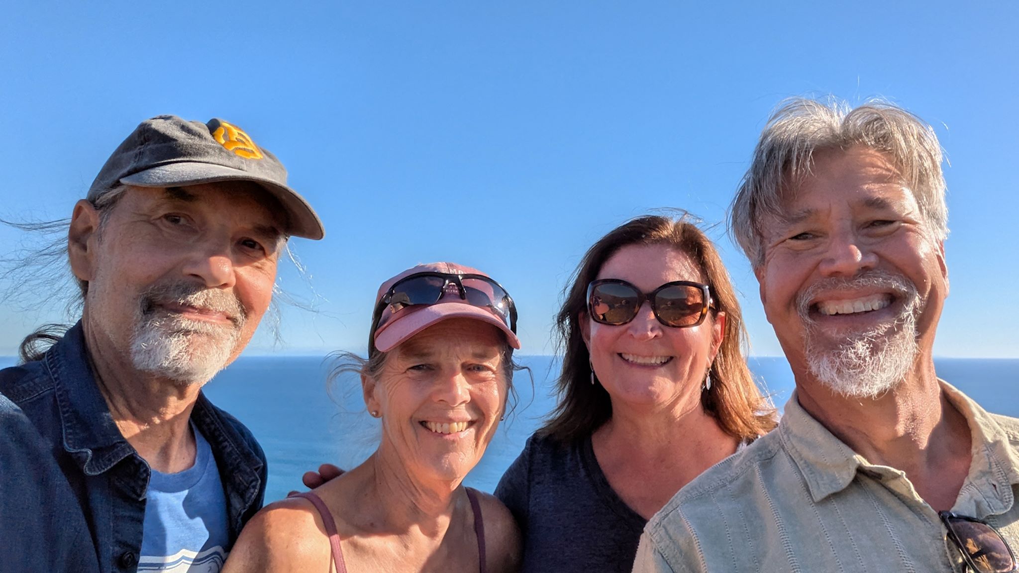
We’ve been friends with Harry and Karen since early in our CT days, when they lived in NY. Our shared history is well explained in this post from 2017, when we visited Harry and Karen at their current home in Boise, but here is a summary: Along with friends Pat and Geoff, we all used to do a fair amount of mountain biking and off-road tandem riding around the northeast, and for a number of years (right up until Sue and I started transitioning to Vermonters) we enjoyed a series of ski trips out west together. Visits slowed down once priorities changed (careers for us, and add raising families for the them). Now, well into retirement (us) or recently retired (them) and all the kids now grown, who knows what might happen next?

Continue reading “Malibu, CA: VT-ID connection”

Palo Duro Canyon State Park, TX

Our change in plans afforded us 4 more days in which to choose a new adventure en route to Albuquerque. We spent three of them in Palo Duro Canyon State Park and loved every minute.

Palo Duro Canyon is the 2nd largest canyon system in the US, after (what else?) the Grand Canyon. Really? In the Texas Panhandle? Yup! It’s 40 miles long, averages 6 miles wide and drops 600 feet from the rim to the canyon floor.* The Prairie Dog Town Fork of the Red River cut the canyon over millions of year leaving behind caves, hoodoos and colorful rock and sandstone formations. Unlike the Grand Canyon, most of the action at Palo Duro takes place on the canyon floor.

Continue reading “Palo Duro Canyon State Park, TX”

Bradbury Mountain State Park

View from South Ridge

Having just spent a fair amount of our touring and visiting time within sight of the ocean, or at least the sound of the waves, for our next bit of exploration we looked around for a place to visit that would take us away from the coast a bit to see a different part of Maine, if possible staying away from larger towns because that’s our M.O. We didn’t want to get too far inland, though, since most of the rest of our visits are also along the coast. Well, what’s that green splotch there on the map? That’s Bradbury Mountain State Park. Set a course…

Continue reading “Bradbury Mountain State Park”

Penobscot Bay

We had plans to meet up with friends in Rockland and Islesboro, leaving us with a little free time to explore this bit of Maine on our own. I had never been to the Penobscot Bay area, and Doug hadn’t visited since his college days at Bates (in Lewiston, Maine). Researching places to hike, we found that the Camden/Rockland area on Penobscot Bay featured the kinds of hikes we most like – moderate climbs to higher elevation places with great views. We identified 3 hikes to do and found a nice, small campground convenient to all of them. And Penobscot Bay was quite convenient for meeting up with our friends.

Continue reading “Penobscot Bay”

Argentia, NL

Our ferry (yes, they keep getting bigger…)

With the joy of our stay in Bonavista fresh in our hearts, the realization that our ferry reservations would take us away from Newfoundland in just a few days meant we needed to head toward the ferry dock in Argentia. We wanted to arrive there a few days early to take care of a few road necessities like long hot showers, laundry, cleaning the waste tanks, washing the rig, paying bills, updating the blog, why not another round of long hot showers, yadayada. We’d just head on over and maybe see a few sights along the way. We even agreed to a no photo rule, so we wouldn’t have to spend time sorting and processing – just do the drive and take it all in as it came. Yeah right…

Continue reading “Argentia, NL”

SW Ontario, part 1 – South and West

We spent some quality time exploring Ontario in 2018. We headed east through North Ontario in May, and returned via South Ontario in October. The difference between the two is striking. North Ontario is nearly 1 million square kilometers of arboreal forest and many, many lakes on the rocky Canadian Shield. With <1 person per square kilometer, there are more moose than people. South Ontario is just under 100,000 square kilometers of farms, wineries and orchards with 5 big lakes, 3 of them great – Erie, Ontario and Huron. Canada’s largest city, Toronto, and the capital of Canada, Ottawa (on the northern edge of South Ontario), drive the population density to 120 people per square kilometer. The dividing line is the nearly 10,000 square kilometer Algonquin Provincial Park, home to 12 million* beavers.

There was one area of Ontario we had yet to visit – Southwest Ontario. This is an area within South Ontario that touches Lake Ontario and Lake Huron. Half of this area is north of our 44° home latitude, half is south.

Continue reading “SW Ontario, part 1 – South and West”

Elmore, VT

Elmore Mountain fire tower

Our good friends Patti and Milo, whom we first met years ago out on the ski hill, are also RVer’s with a sense of adventure and a penchant for hiking and biking. Over dinner one night at the end of the ski season, we mentioned that we were thinking of exploring places closer to home in our RV this summer, and that, ironically, we’d never spent a night in our RV in Vermont except in our own driveway. That conversation evolved into a plan for a meet up for the four of us at Elmore State Park, just a bit north of where we all live in the Mad River Valley.

Continue reading “Elmore, VT”

Heading east

Well it’s been about a week and a half since I dropped Sue off at the airport in Salt Lake City. Unfortunately, there is much to keep her busy down in Florida and it doesn’t look like she’ll be able to rejoin me on the road. The upshot is that I’m gaining a fuller appreciation for the things she takes care of while we’re traveling, which include route planning and navigation as well as all or most of the food planning and preparation, among many other things. The astute reader may well ask, “Wait, then what’s left for you to do?”, to which I simply walk away in a huff.

Continue reading “Heading east”

Vancouver Island, part 1 – north

Sunset over Queen Charlotte Strait

With a week or two left for exploring before we need to start heading toward Vermont, we decided to spend some of it on Vancouver Island. We got passage on the MV Coastal Renaissance, one of the largest double-ended ferries in the world and radically different from the 6- to 10-vehicle river ferries we boarded while in the Yukon and Northwest Territories. The height of our camper required that we board the truck deck – 6 lanes wide and seemingly a mile long, filled with trucks and other RVs. On an absolutely gorgeous day, we spent the 2-hour trip on the immense upper deck, trekking back and forth and all around as we took in the sights. From the departure dock at Horseshoe Bay, we could look back on the Sea to Sky Highway hanging off the mountain, splotchy with low clouds. Islands in all directions looked like mountains popping out of the ocean, many dotted with small communities along the shores. We looked back on the city of Vancouver, beautifully situated on the ocean, as more mountains came into sight on the horizon – Vancouver Island.

We debarked in Nanaimo, a pretty city on the east shore of the island. Without a plan, we headed north toward the most remote part of the island. Little did we know, the moon was soon to enter the seventh house, and Jupiter would align with Mars, and we were about to get a unique Vancouver Island experience…

Continue reading “Vancouver Island, part 1 – north”