Chugach State Park is the third largest State Park in the country. It features 6000-foot peaks within sight of sea level. And it’s right outside Anchorage, where the population is 300,000 fortunate souls. Although there are access points to hiking trails and other recreation opportunities all around the park perimeter, including within the Anchorage city limits, there are three main access areas to explore – Eklutna Lake, Eagle River and Girdwood and we’d been given suggestions for great hikes in all three.
Planning hikes in this area has interesting challenges. So close to the city, we need to consider weekend crowds in all three areas. The forecast for this time of year is always the same – cloudy with 40-100% chance of rain. Yet the Chugach is so large and the mountain ranges so tall, the actual weather is all over the place – it can be raining in one valley and sunny in the next. The ‘rainy season’ has just begun, so a few wildfires are still burning and the forecasted wind direction provides some hints about expected air quality (ok, and views). To facilitate peaceful coexistence between the motor sports (ATVers and snowmobilers) and non-motor sports (hikers, bikers, nordic skiers) crowds, different areas of the park separate them by area (north or south of a road), by specific trail, or in some cases, by specific days of the week.
Planning hikes is like a 4-D puzzle. And worth it!


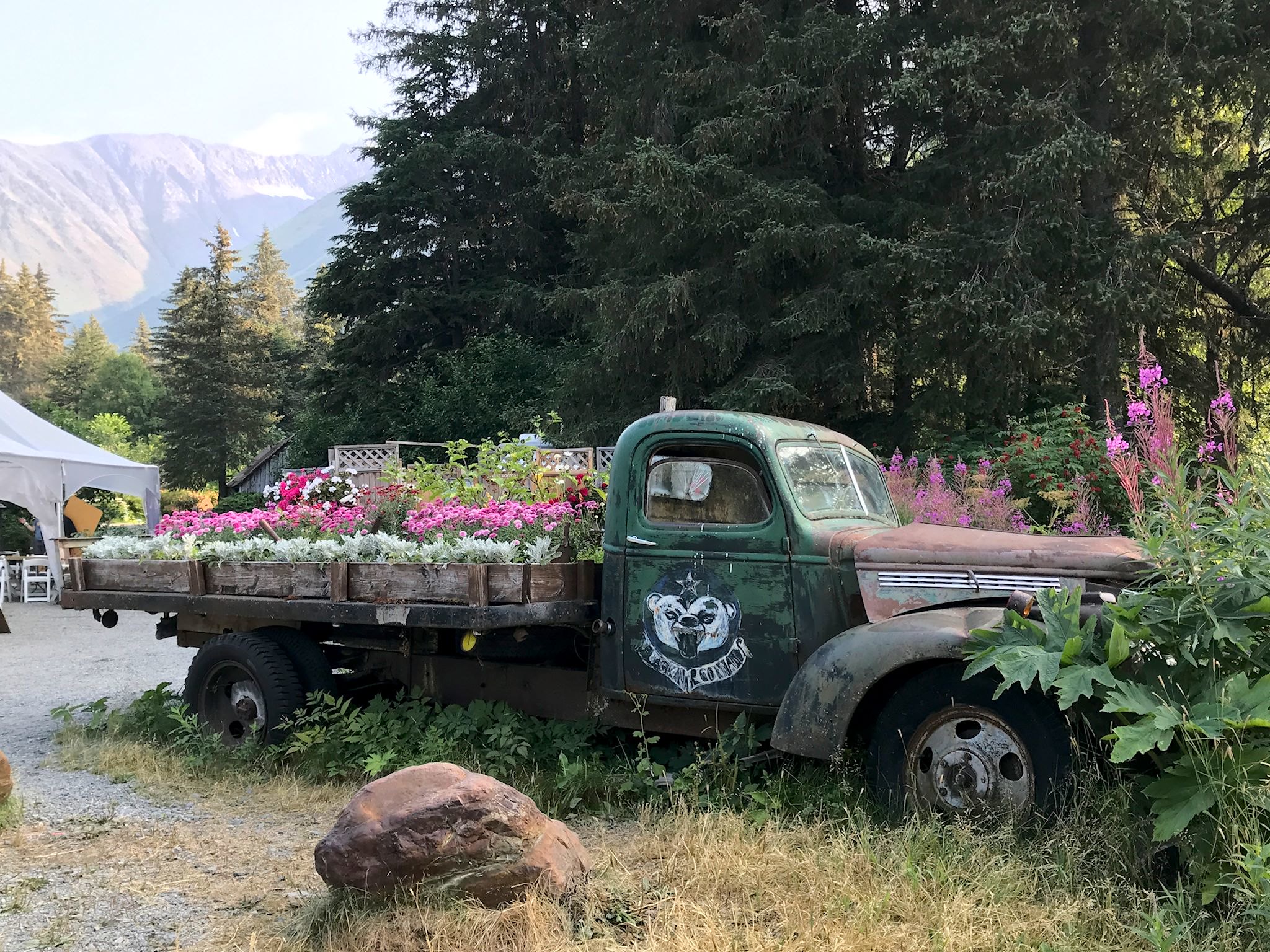
We arrived at Girdwood, home of the famed Alyeska Ski Resort, on a Sunday. We made camp at a quirky, small campground at the Crow Creek Mines where the 10 sites were small, private, and annotated with colorful, kid-drawn signs. Oh, and it happened to be near 2 of the trails on our suggested hiking list. Monday’s forecast was a rare 20% chance of rain. Hmmm, how to best use this break in the weather…?

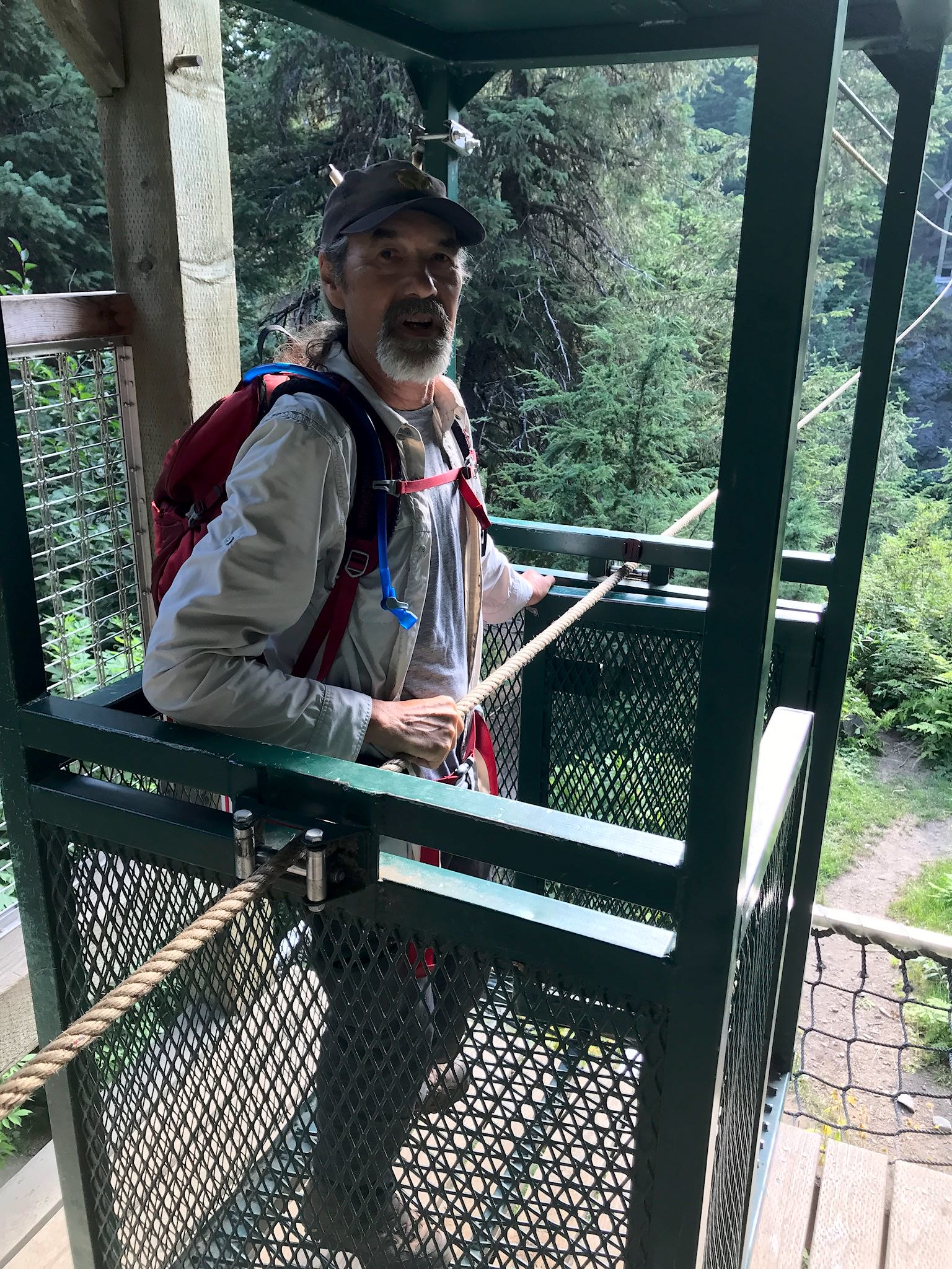
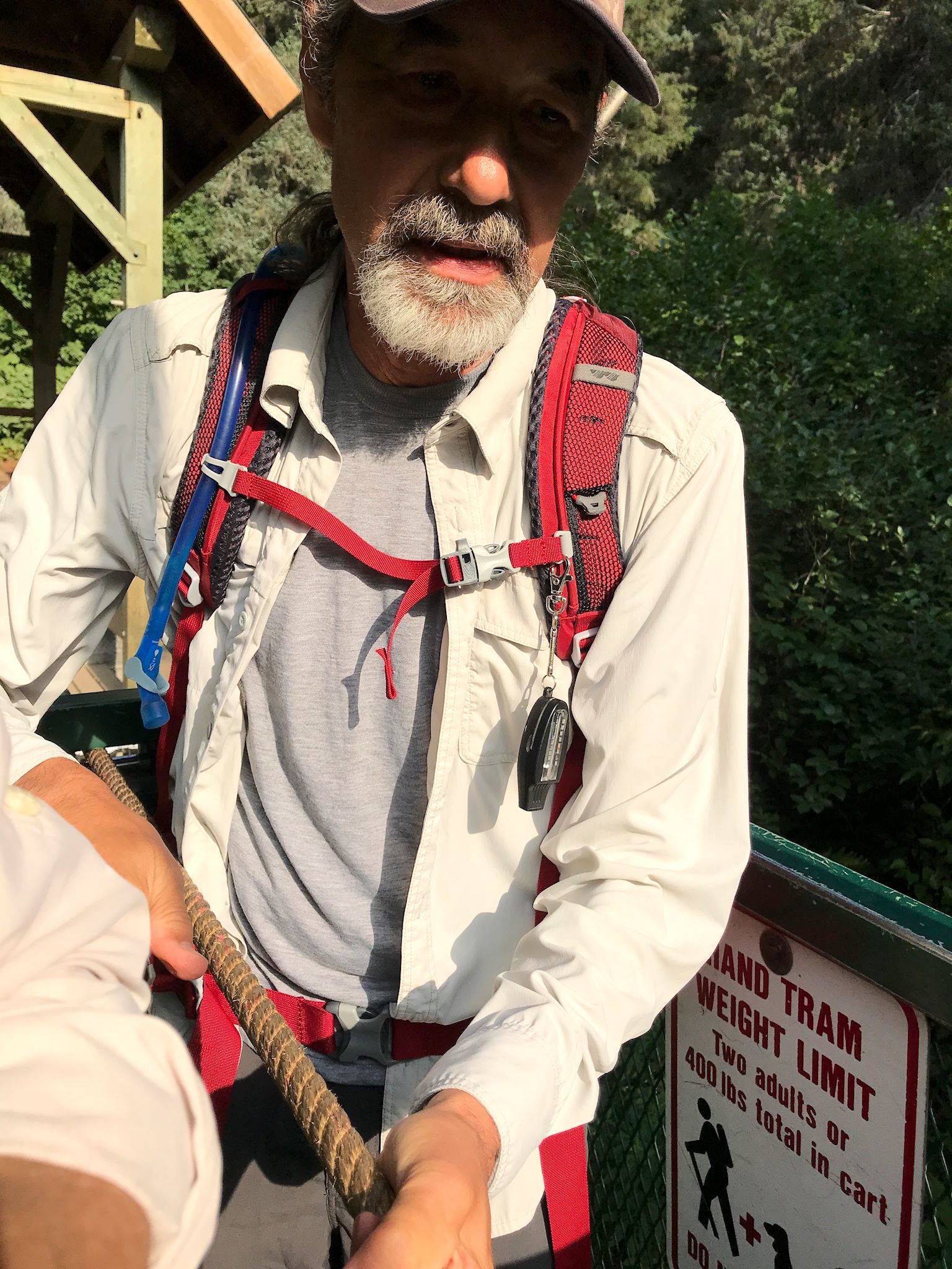
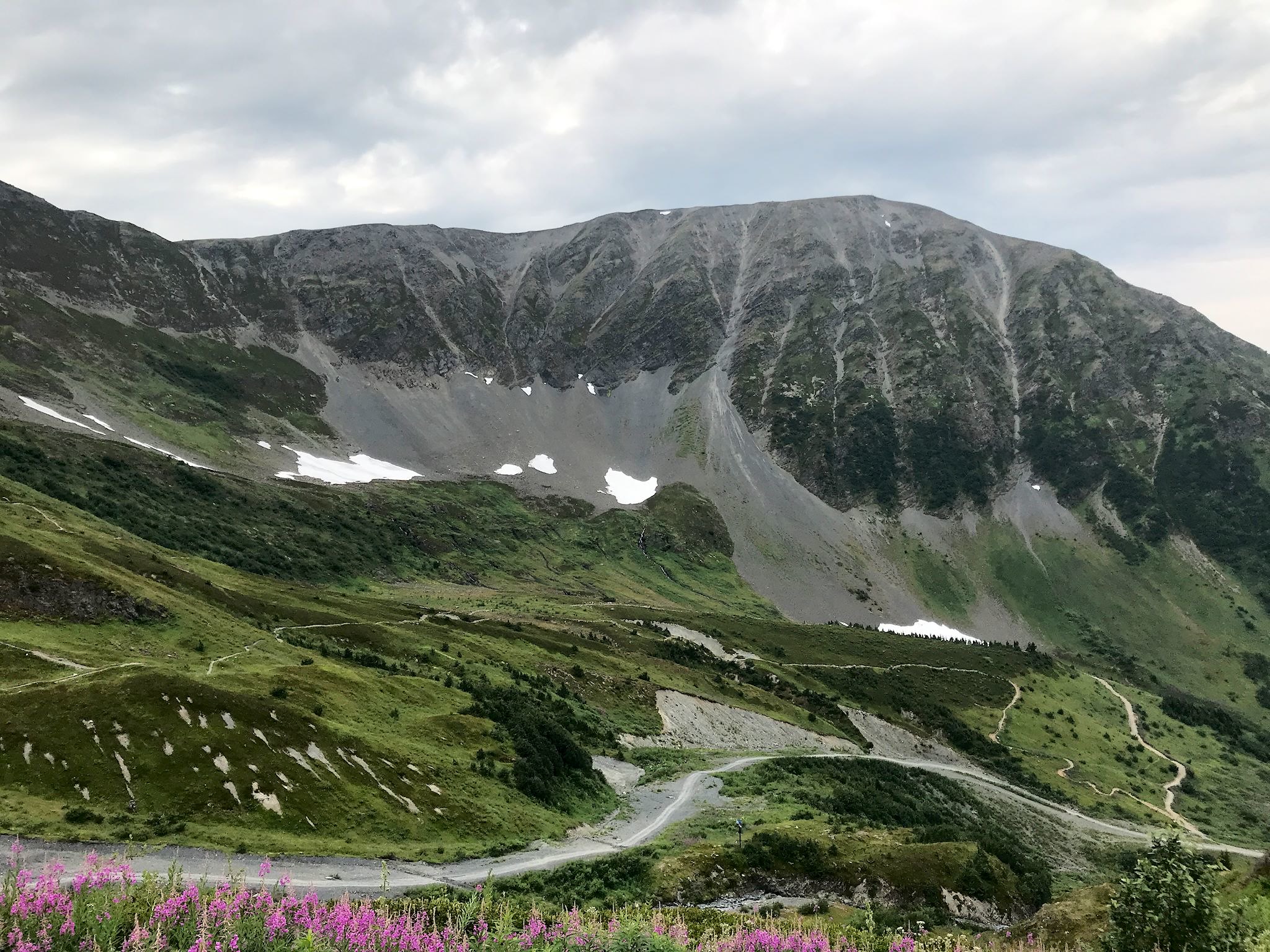
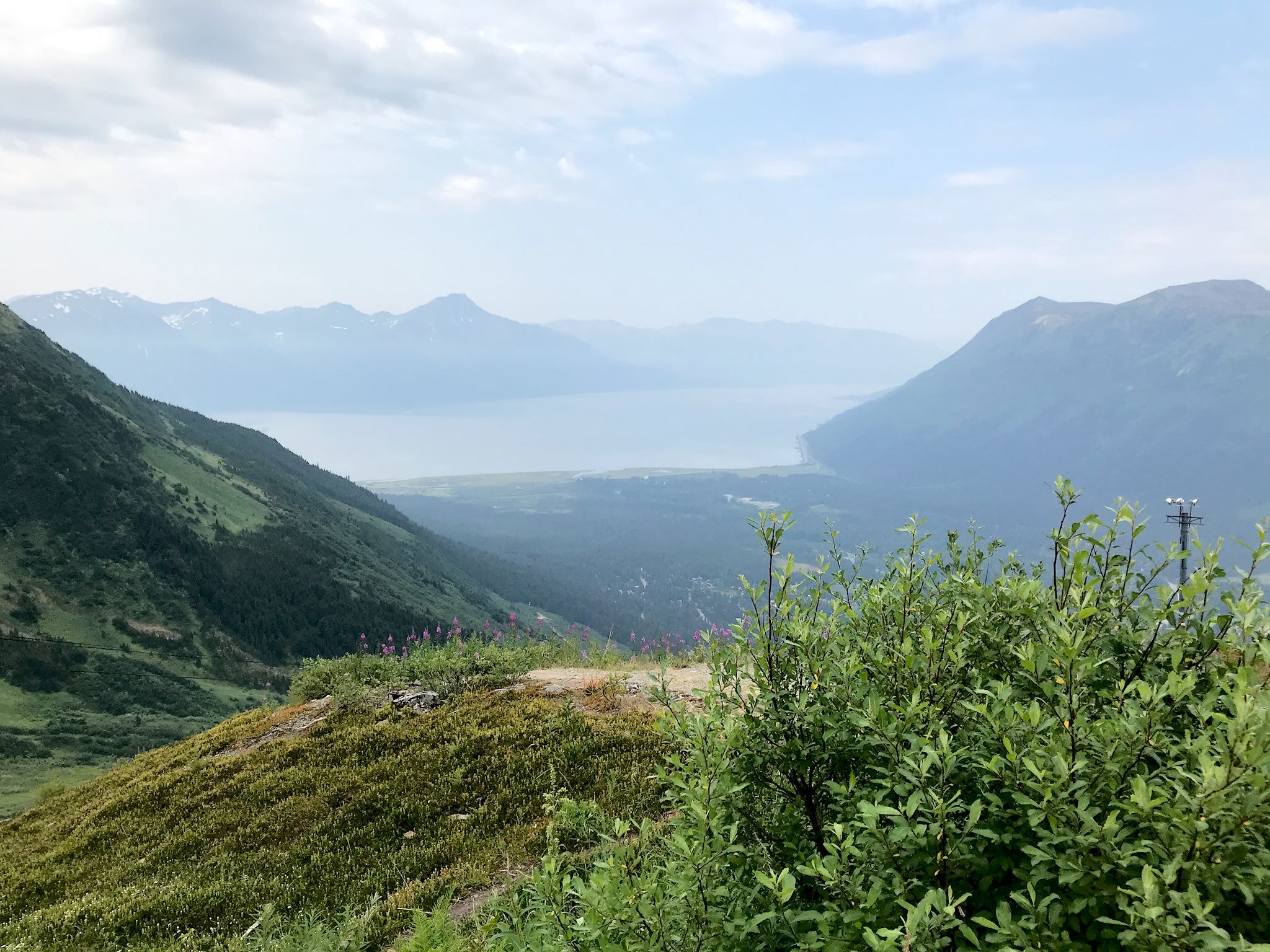
Connect two trails, including one with big views! We started on the Winner Creek trail, well known in the area – and a hit with kids – for a hand-powered tram used to cross fast-running Glacier Creek. From the other side of the tram, we followed Winner Creek, with lovely views of the deep and steep Winner Gorge. As the trail continued up along the creek, we turned off onto a trail toward the Alyeska Ski Resort base area. From the base area, we climbed the (relatively) new North Face Trail which took us up the steep face via switchbacks under the ski area tram, past meadows exploding with fireweed, views of glaciers, and a bull moose cooling off in the snow. From the top of the tram, we followed ski trails to the highest lift-served peak on the mountain. There we had 180-degree views of the valley below, Turnagain Arm, and peaks and glaciers deeper into the Chugach Mountains in the distance. It was a 360-degree view if you count staring up and into Glacier Bowl and South Bowl (which we did), both steep, high ridges within the resort offering challenging, hike-to ski terrain. There was a bit of smoke in the southern sky, otherwise, a gorgeous day!
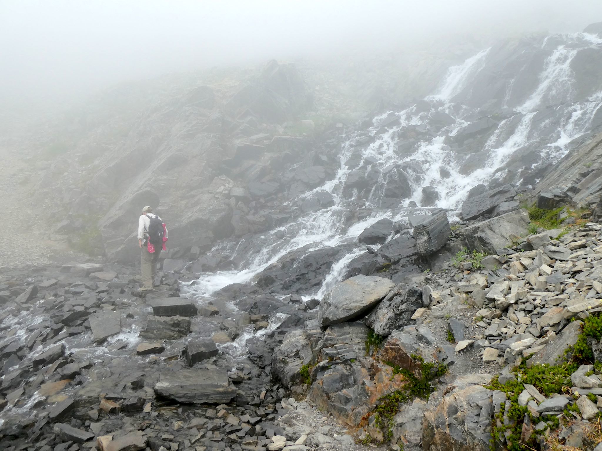
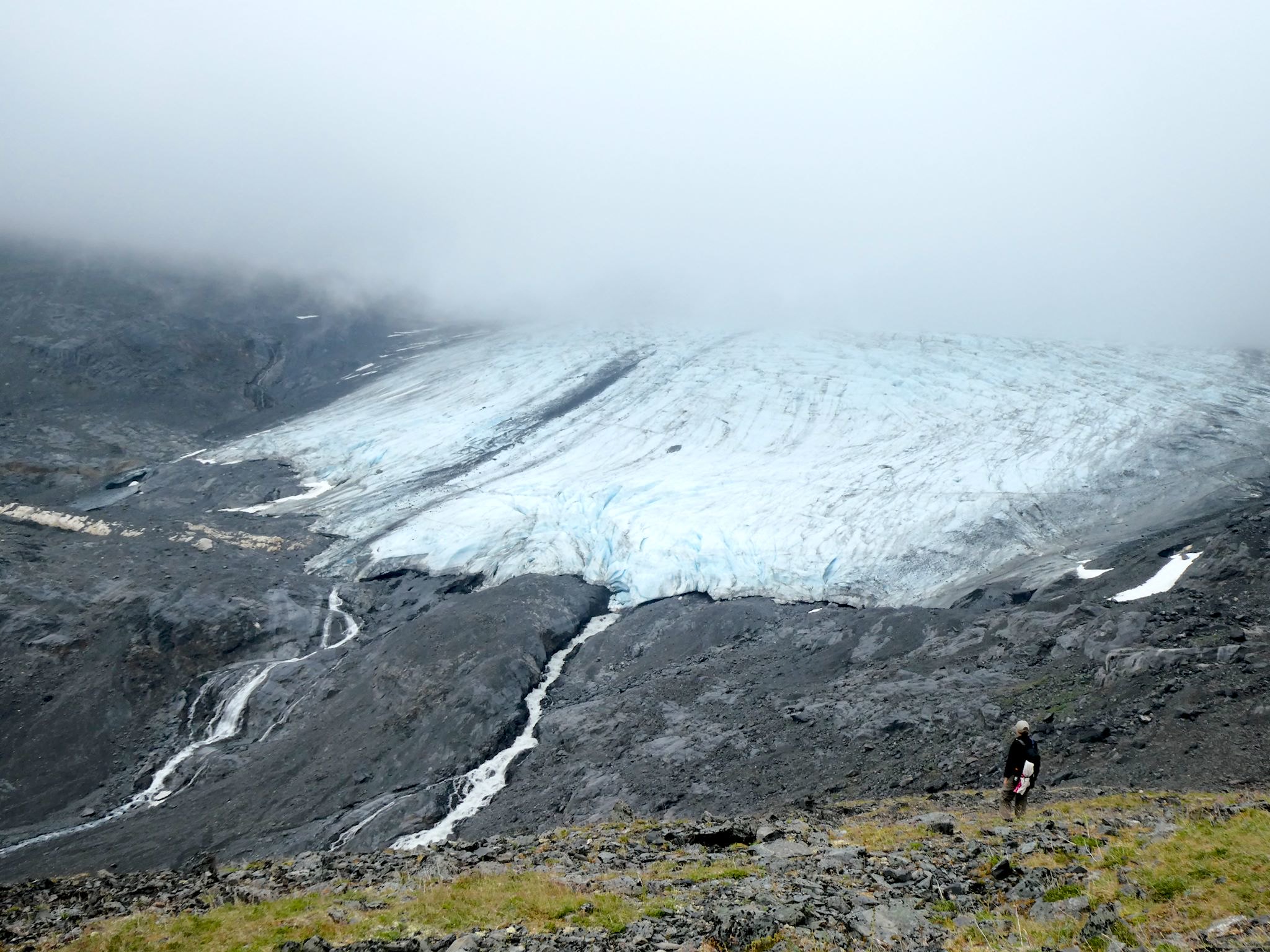
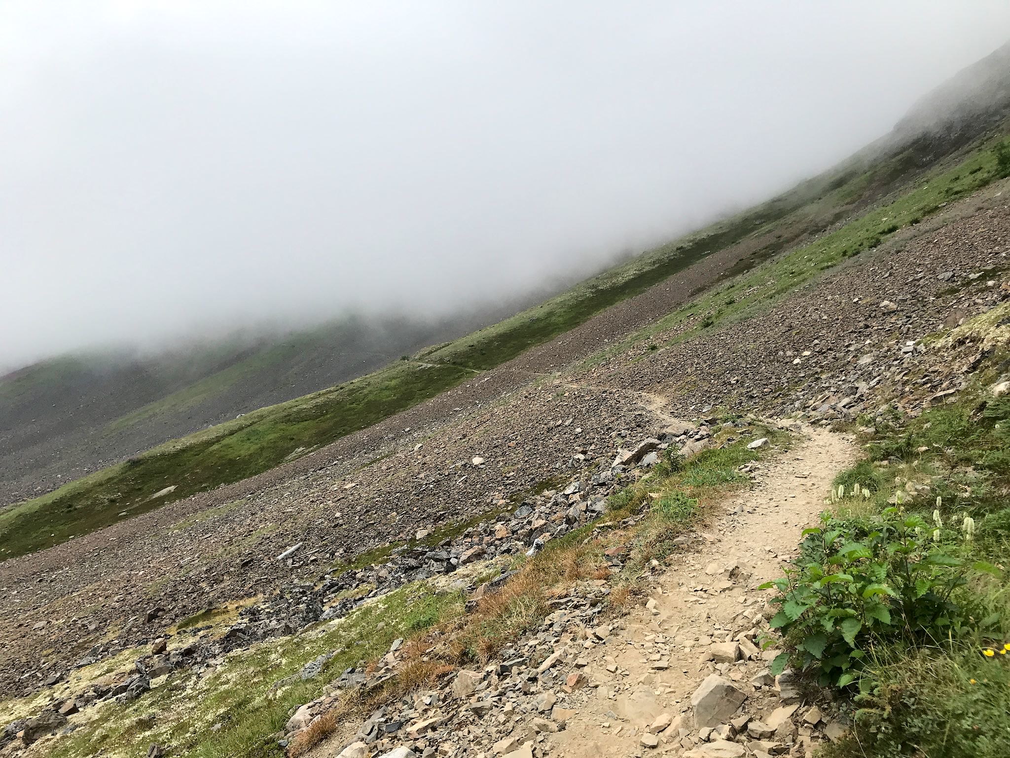

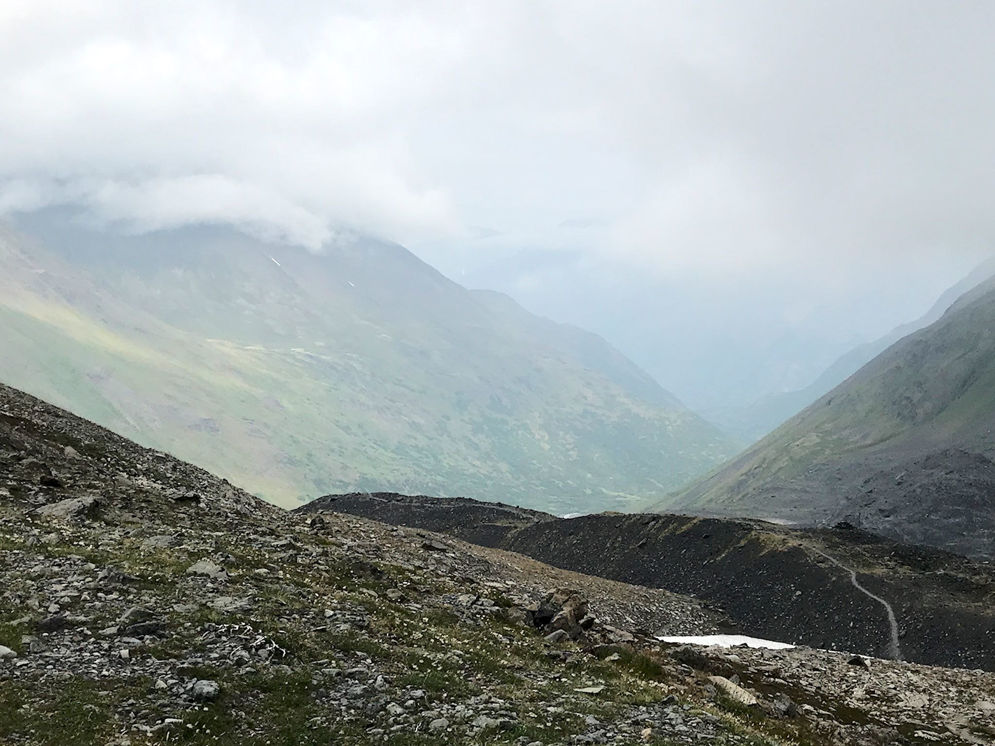
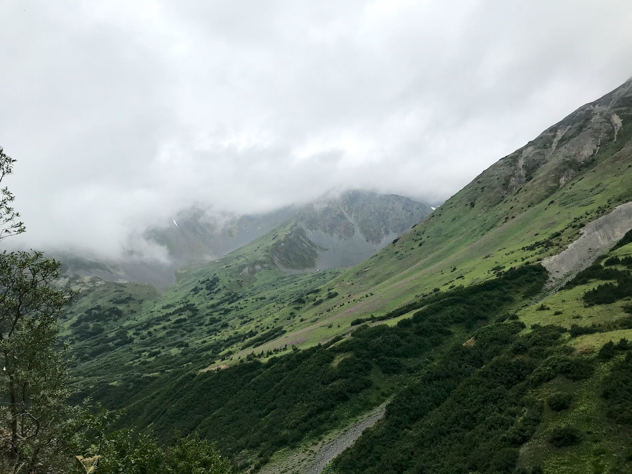
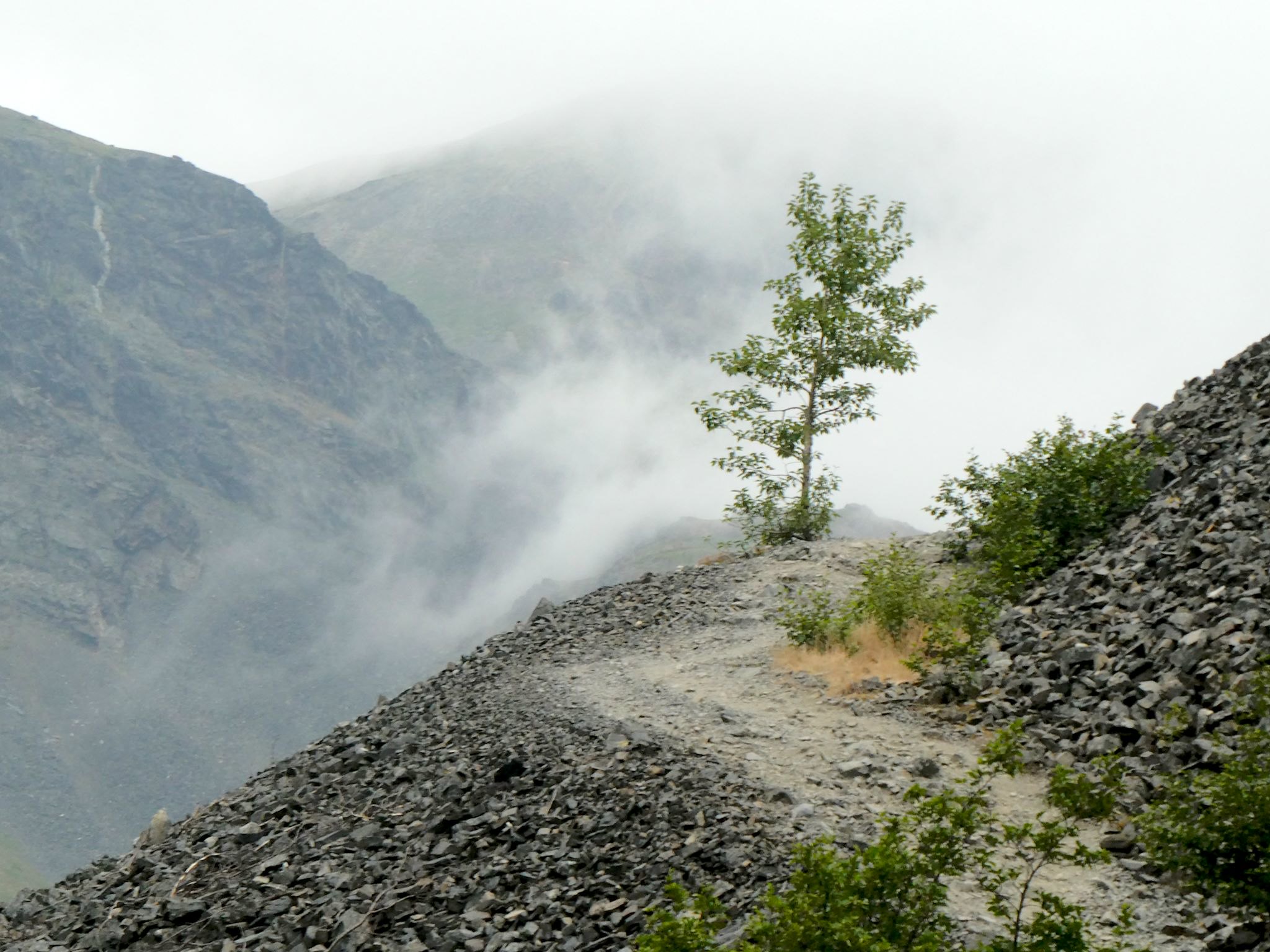
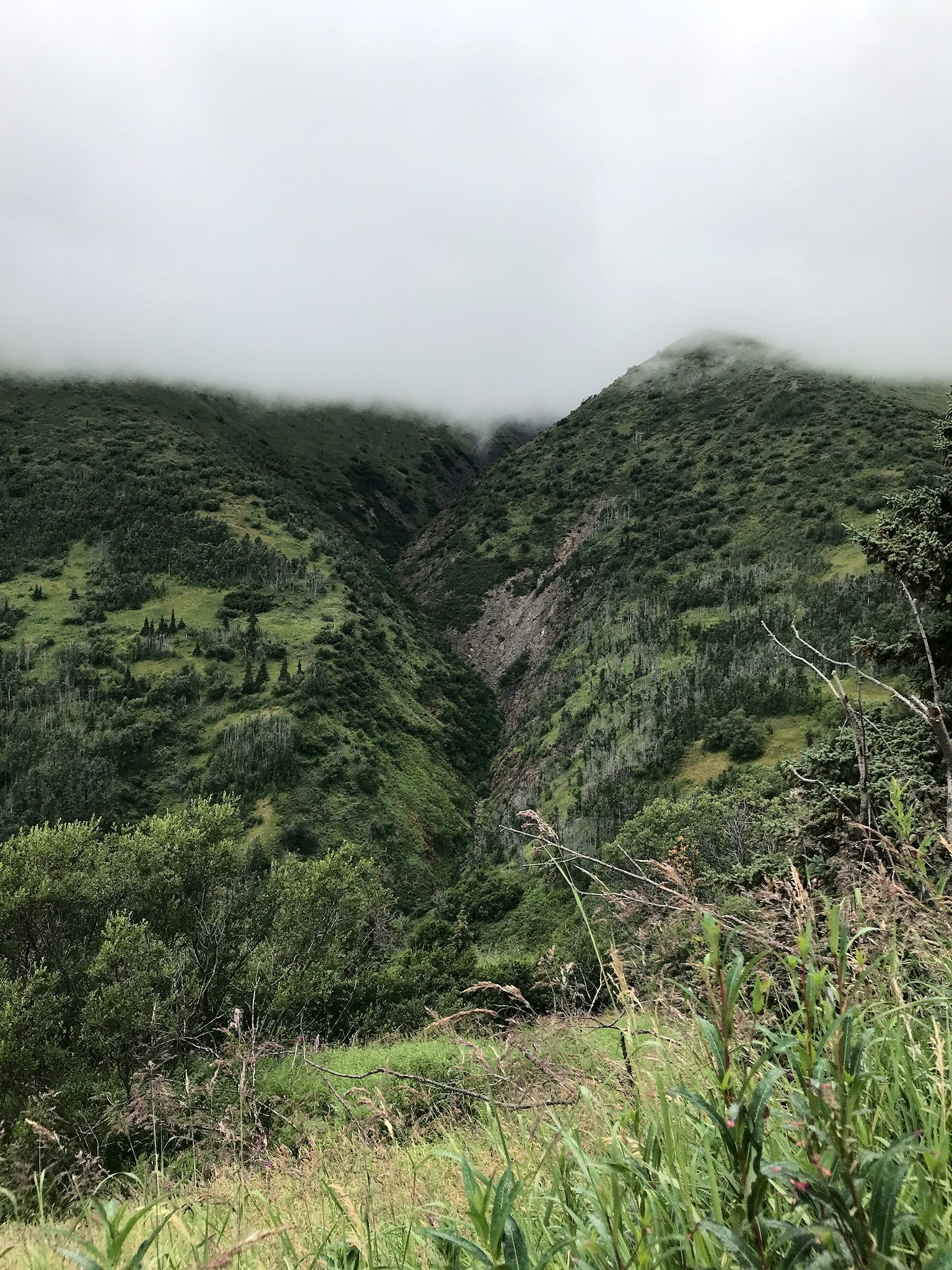
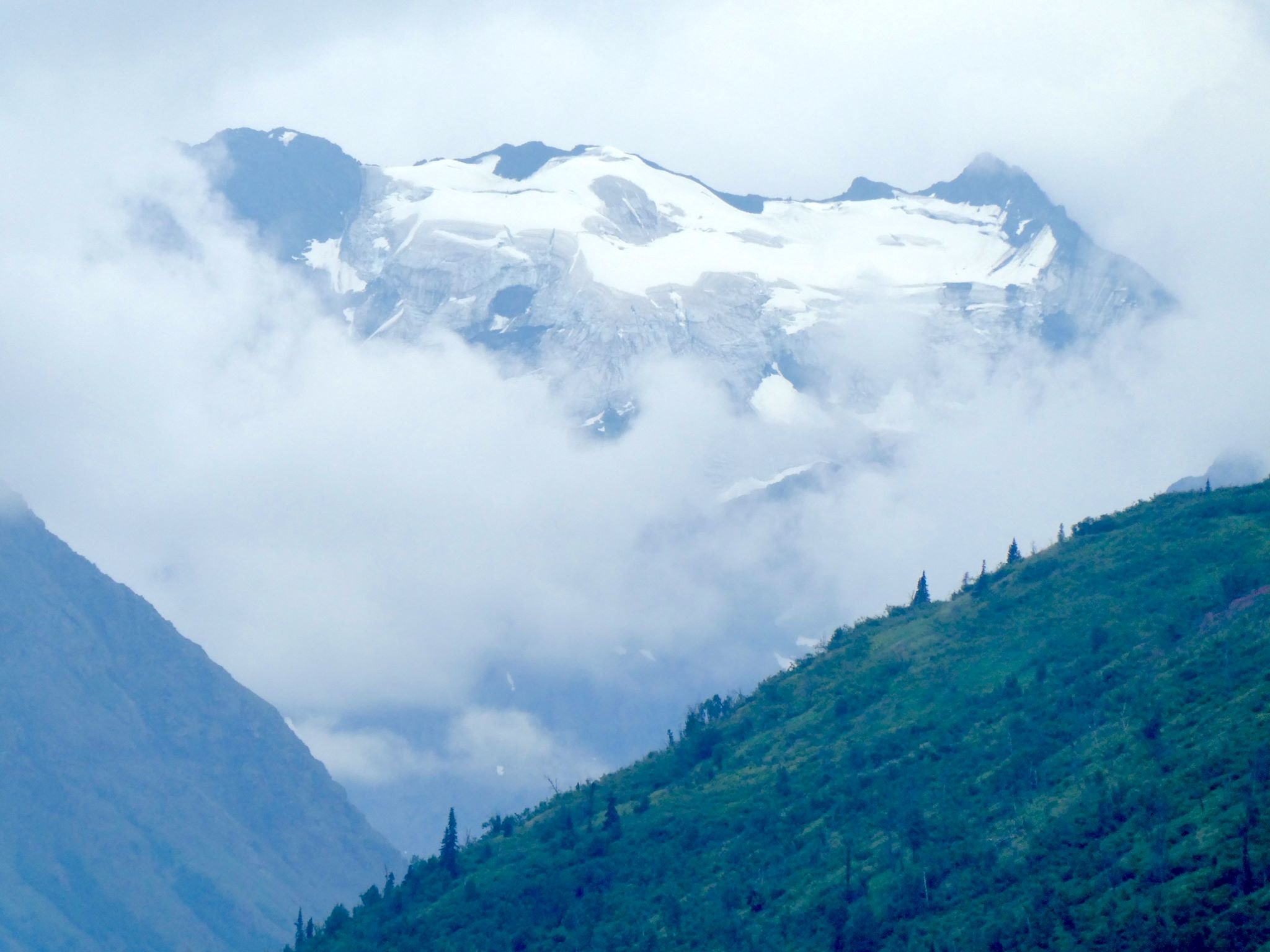
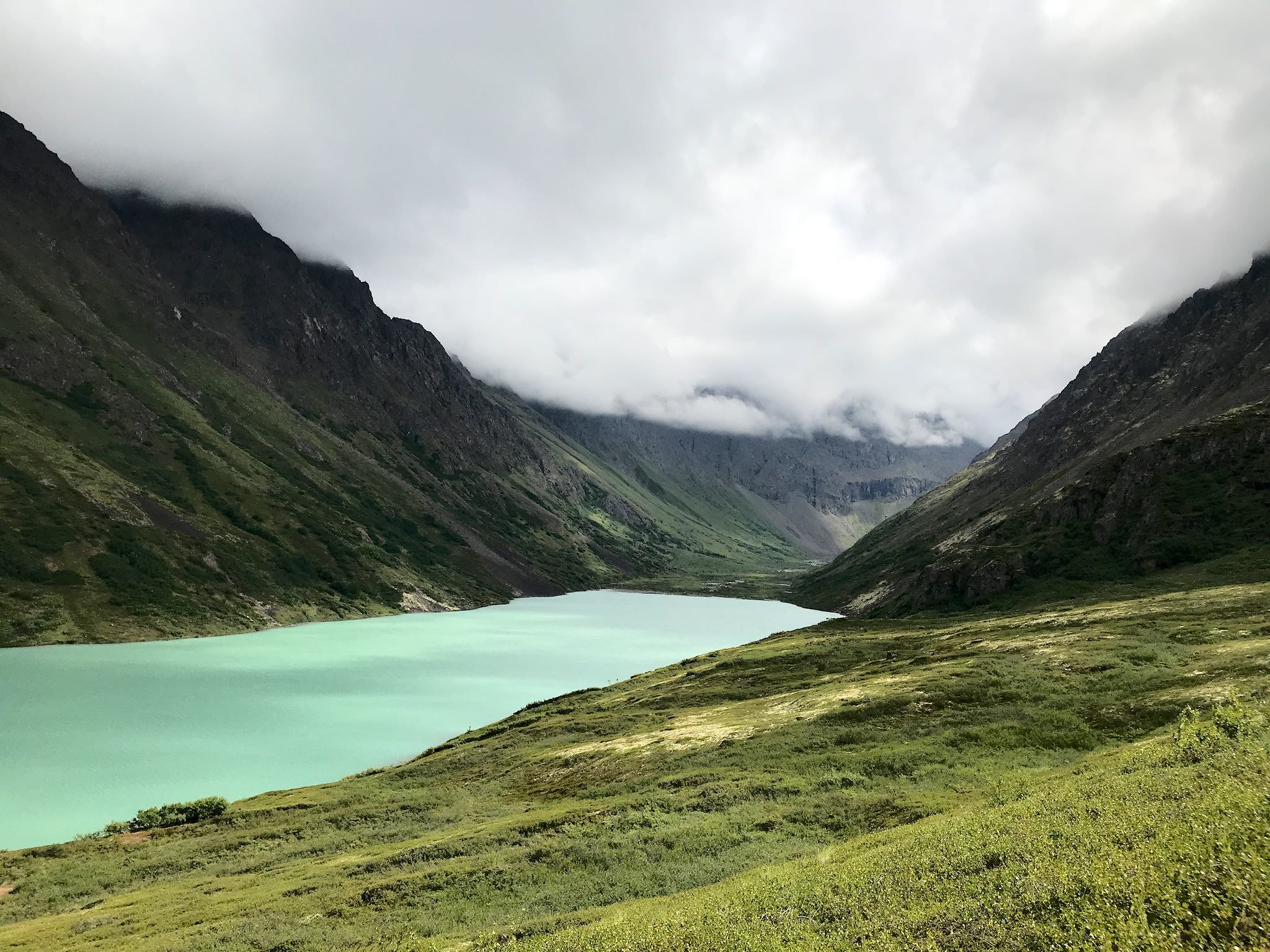
The weather forecast for our trip to Crow Creek Pass was more typical – a 40% chance of rain. Low clouds obscured most views, yet created an otherworldly sensation while hiking, continuously revealing craggy peaks, giant glaciers, bright green valleys, waterfalls, rock faces, and lakes in small, random portions. A series of switchbacks got us quickly to the shoulder of Jewel Peak where we traversed scree fields interrupted by waterfalls, colorful rock formations, and mine ruins for most of the hike. Near the pass, we were free to explore as the clouds were lifting and falling, drawing our attention in different directions as they highlighted new sights: a tiny cabin you can rent for the night on the tiny Crystal Lake; the enormous Raven Glacier with its dual waterfalls; brief bits of sunlight on the Raven Creek Valley beyond the pass. Views continuously improved throughout the hike. No rain!
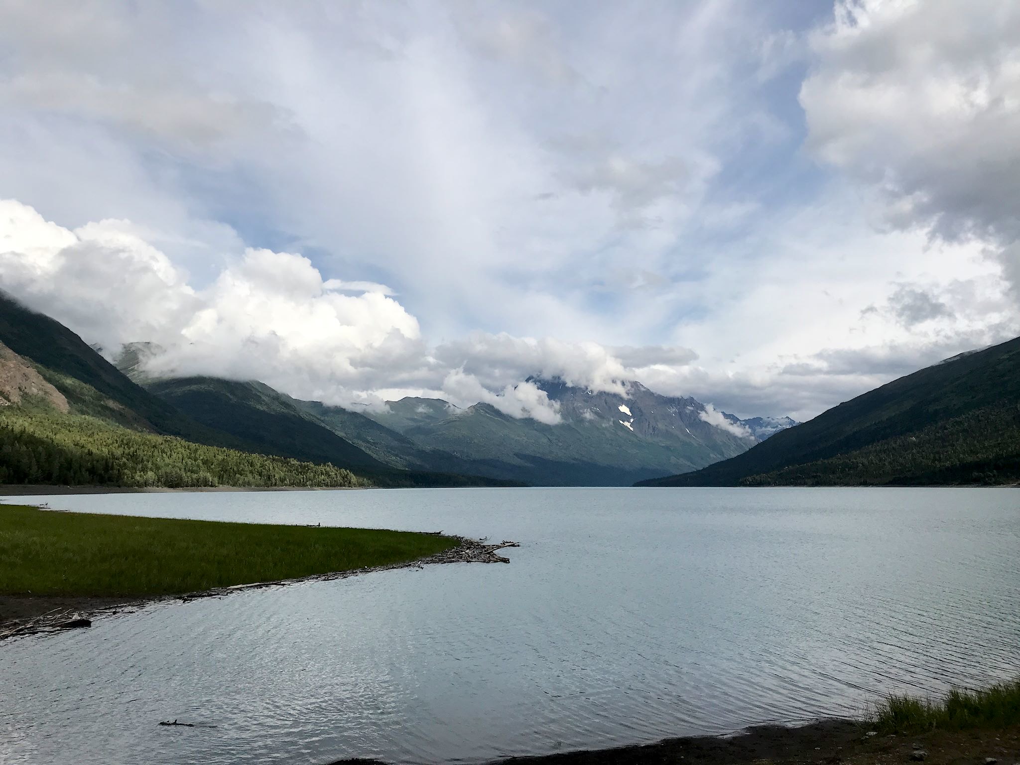
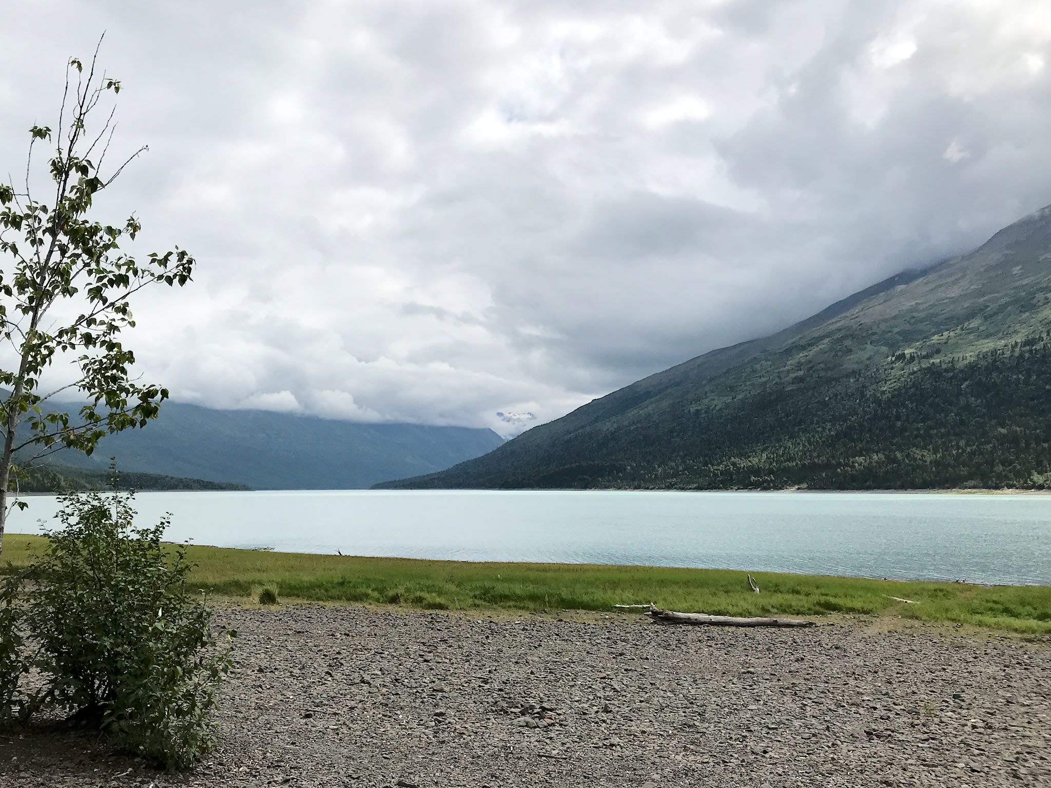
The next-best forecasted day was Thursday with a 50% chance of rain. That’s a non-motorized sport day at Eklutna Lake, so we arrived on Wednesday night, early enough to explore the shore of this long, glacial lake. We got a glimpse of the Twin Peaks, where we planned to hike the next day, which promised views over Eklutna Lake and to another valley beyond.
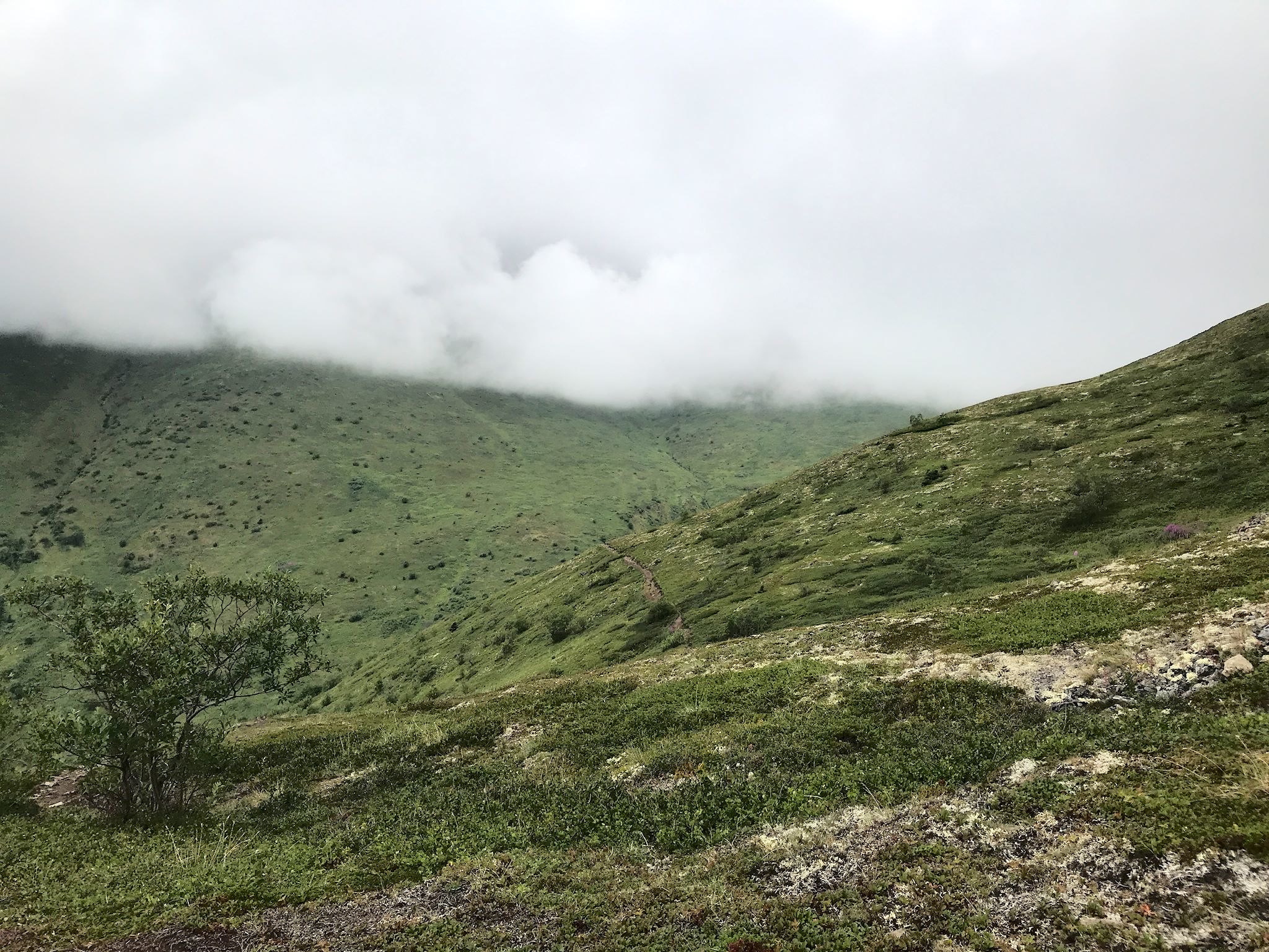


As we started, the clouds were low and obscuring most views, but we were optimistic they’d eventually reveal the goods. At a trail junction two thirds of the way to the pass, we noticed the clouds hadn’t moved – they were just hanging thick and heavy over the ridge. We met 2 backpackers coming down from the pass. Their report was zero visibility in the dense fog, and high wet grass along both sides of the steep, narrow trail. They were cold, soaking wet, and having far less than 100% fun. Hmmm… A trail in the other direction, according to one of our guidebooks, would lead us to ‘a ridge with views’ – let’s take that route, instead.
Wow! Gorgeous views of Eklutna Lake, the ridge across the lake and Knit (pronounced Ka-NIT) Arm in the distance. Although the Twin Peaks and their pass stayed tucked into the clouds all day, no rain!

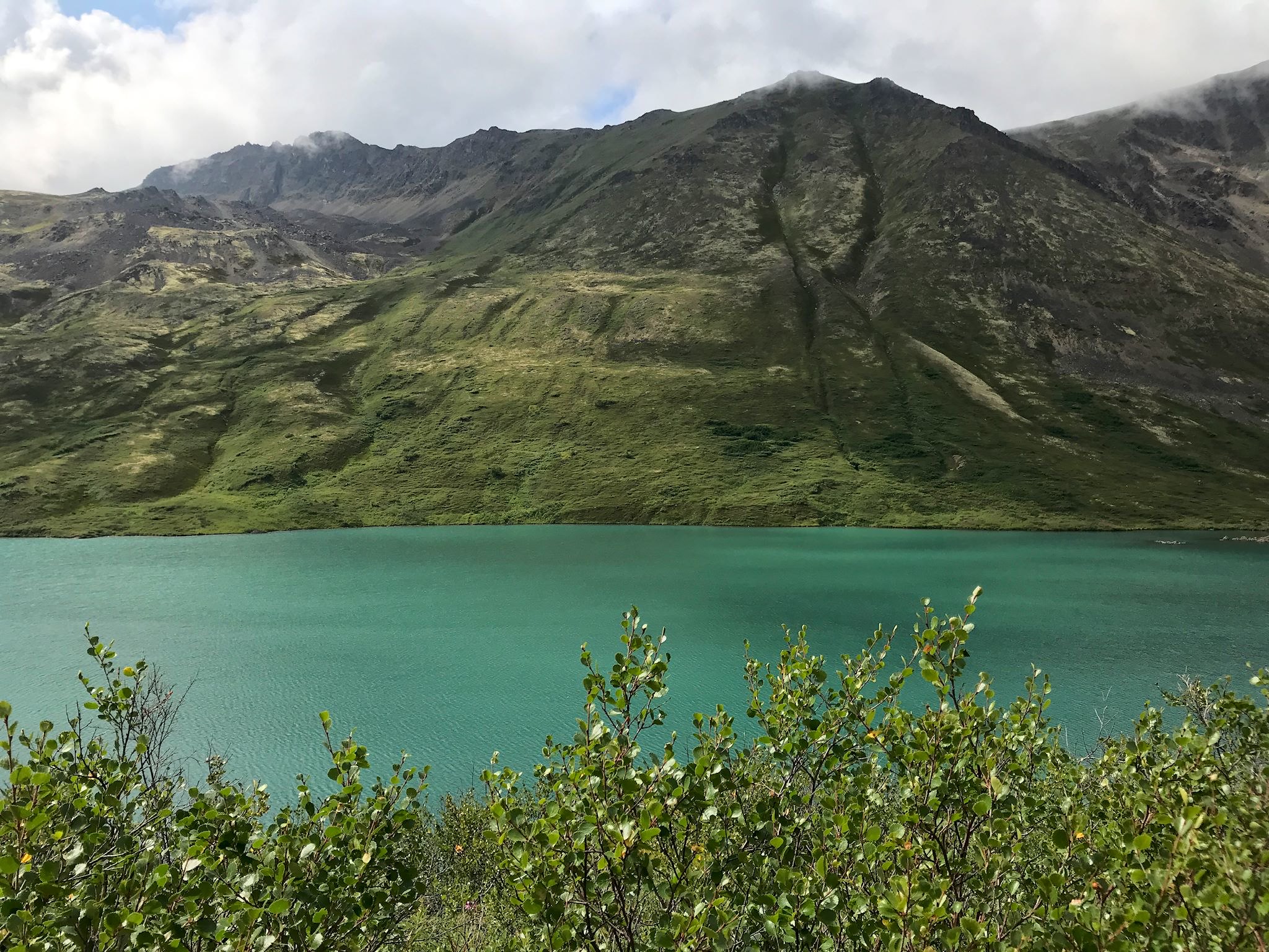
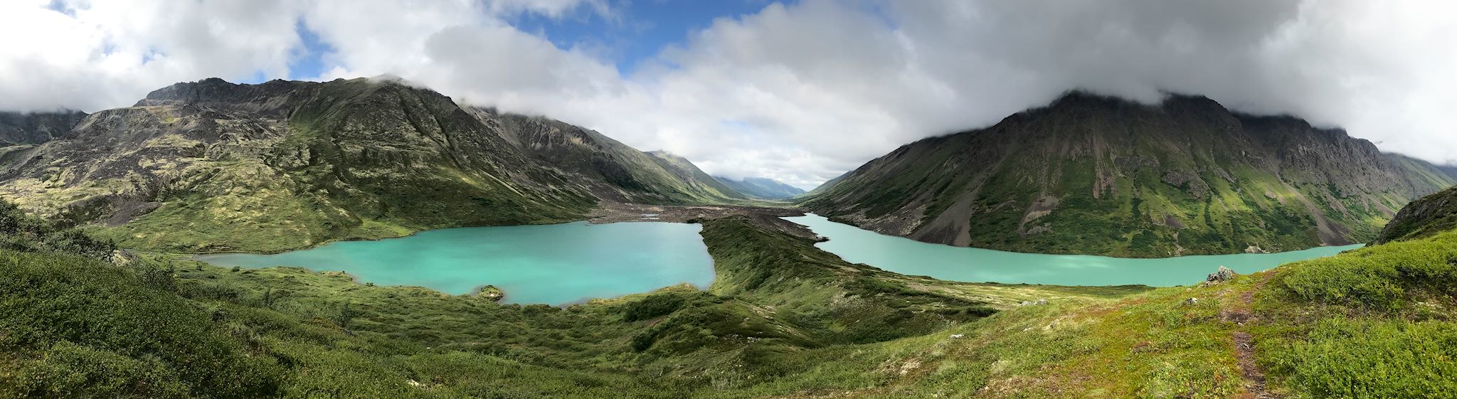
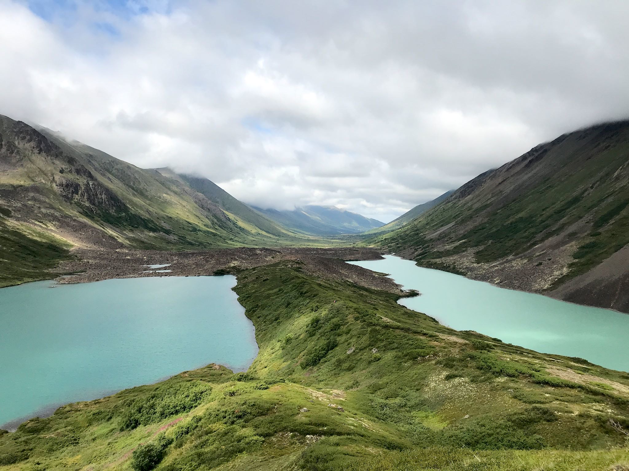
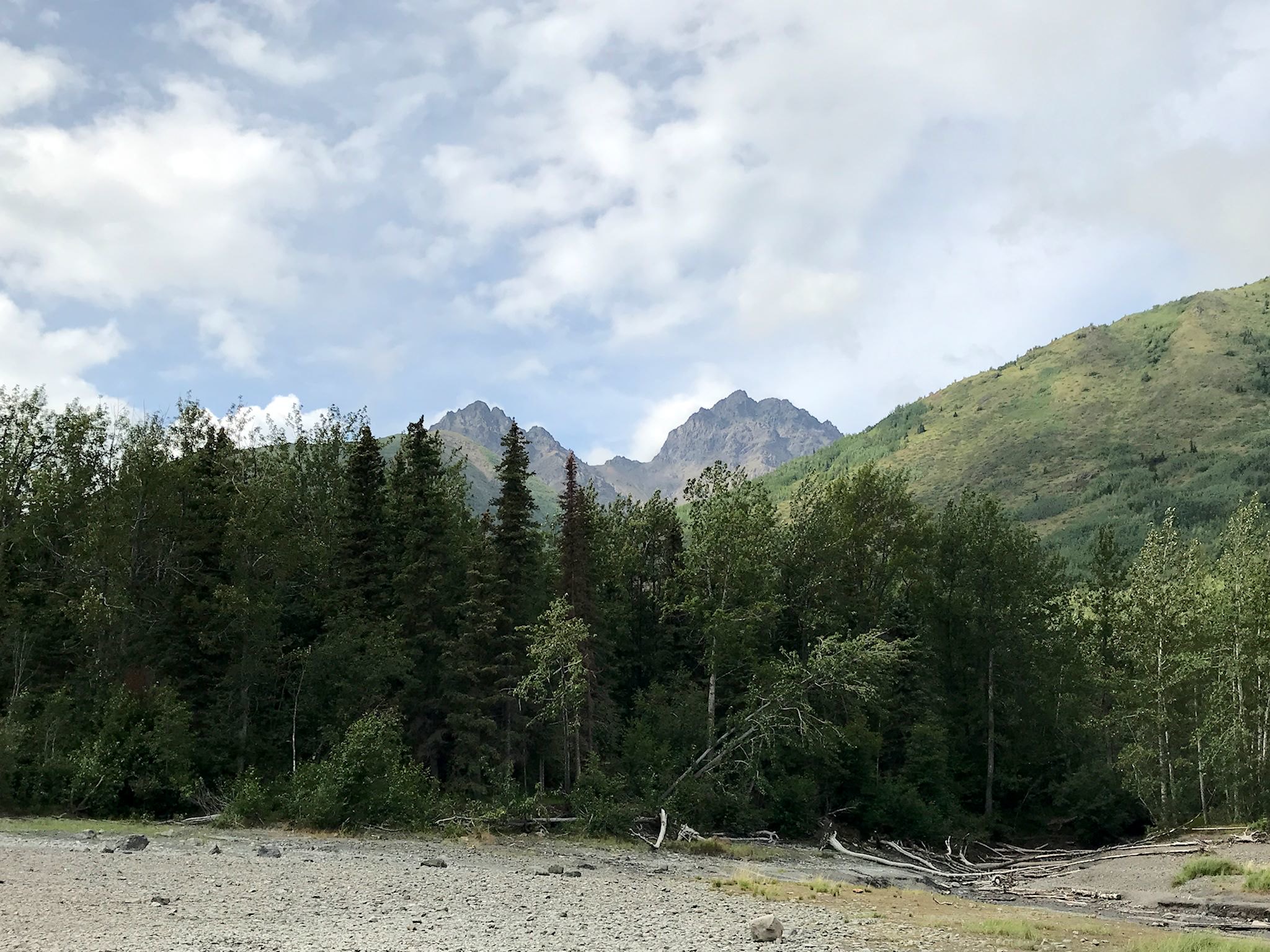
To explore the Eagle River area, we extended our stay considering a forecast for a party cloudy day with zero percent chance of rain! We opted to hike to Eagle and Symphony Lakes, a very different type of hike from all the others. The trail starts at a trailhead inside a suburban neighborhood which is quickly left behind as the trail follows the South Fork of the Eagle River, gradually entering the widest glacial valley we’ve ever seen… The barely noticeable incline enabled us to explore the valley floor while patiently awaiting the anticipated rise in the low-hanging clouds. With a short climb over a rocky moraine, we first saw Eagle Lake, then climbed a bit more to see Symphony Lake. Formed by glaciers descending from two different peaks and meeting in a bowl, the glacial debris collected between the two arms of the glaciers, leaving a ridge when glaciers eventually receded – and a lake on either side. The two lakes are completely separate. Also, due to differences in rock composition of the peaks, they are slightly different shades of glacier-aqua-marine (aka gatorade blue). The clouds did lift in the valley as the gorgeous day progressed, however, the peaks and glaciers from which the lakes were formed remained shy behind the clouds. We thoroughly enjoyed a warm day in the valley where the sunshine made the greens a little bit greener, the fireweed purpler, and the lakes more brilliant. Joy!
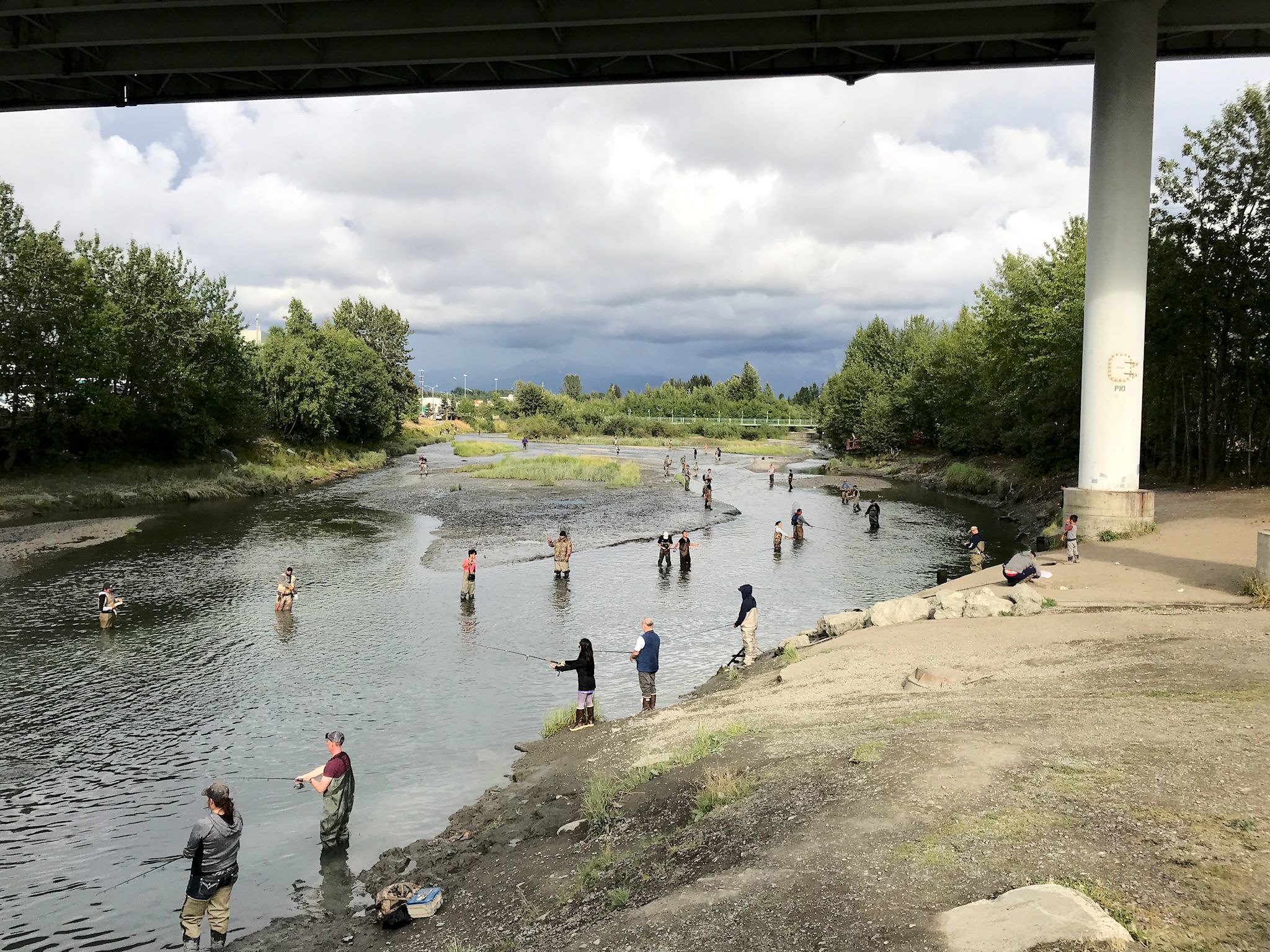
Between the hikes, there were a few total rain days. We used those for a mix of rest days, naps, provisioning, and a few indoor visits including the Eagle River Nature Center, the Alaska Native Heritage Center, and a delightful dinner in downtown Anchorage at the Bridge restaurant, which is literally a bridge spanning the Ship Creek and where the featured entertainment was combat salmon fishing taking place below…
And, for the first time since we entered Alaska, we turned on the lights after dinner…
For anyone who’s interested, more Crow Creek Mine, Winner Gorge/North Face hike, Crow Creek Pass hike, Eklutna Lake, Twin Peaks hike, Eagle River camp, Eagle and Symphony Lakes hike, Eagle River Nature Center, Alaska Native Heritage Center, and Anchorage pix…