
We do love mountains! Views, mountain air, hiking, mountains in your face with glimpses of remote river valleys and distant peaks; forests and critters big and small, tiny mountain communities and ski towns, (usually) cooler temps. We were on our way to see the Canadian Rockies and set a course for Jasper National Park, the northernmost of the parks there.
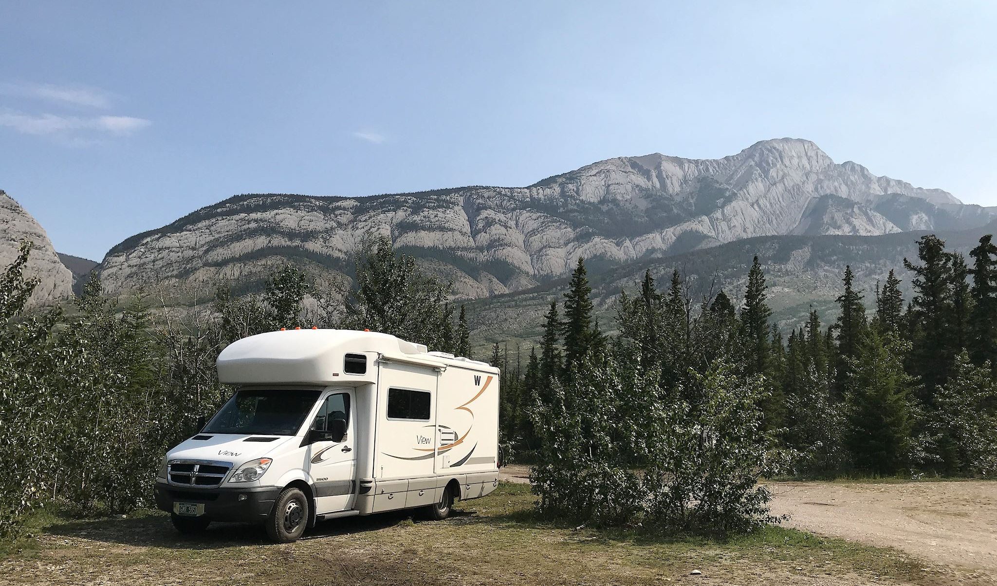
Jasper is divided into 5 regions. We’d hoped to hike in each region – spread the love and get a feel for the whole park – so we headed first for Snaring River Campground, convenient to 4 of them. Although we arrived early, the campground was already full. Not a problem as we were aware that an ‘overflow’ camping area was nearby. We were not aware that the overflow camping would be beautiful! It’s a great, flat field surrounded by mountain ranges on 3 sides – like being in a giant salad bowl with carved granite sides and jagged edges. We kept walking around taking photos with our mouths wide open.

We recovered enough to bike into the town of Jasper. It’s a pretty little ski town that is overwhelmed by RVs in the summer. Yet with special parking lots, amenities and signage, the RVs, the town and the other tourists successfully coexist. The National Park people at the Visitor Center helped us fine-tune our hiking selections and provided maps and local knowledge. Unfortunately, the road to the Mount Edith Cavell region was closed for construction. Hiking there wasn’t going to happen on this visit.
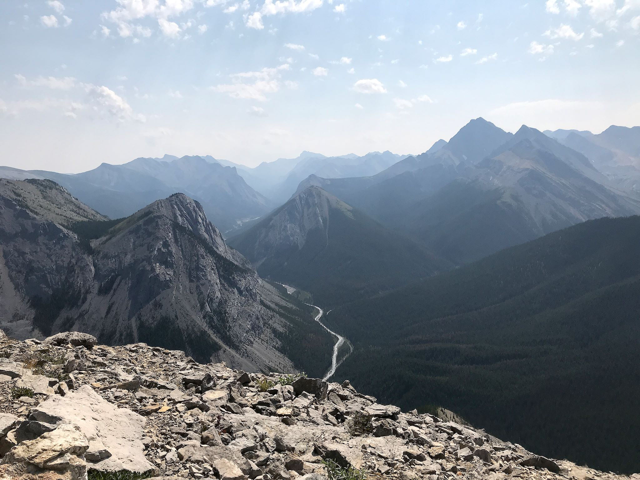
We opted to hike to Sulphur Skyline in the Miette Hot Springs region of the park. This was a lovely hike on gentle switchbacks through the forest decorated with wildflowers along the edges all the way. The trail popped out onto a wide shoulder of the Sulphur Skyline peak. From that point, it was a view-intensive climb to the top where we had 360° views of the Miette Range and the Fiddle Range and the entire Fiddle River Valley.
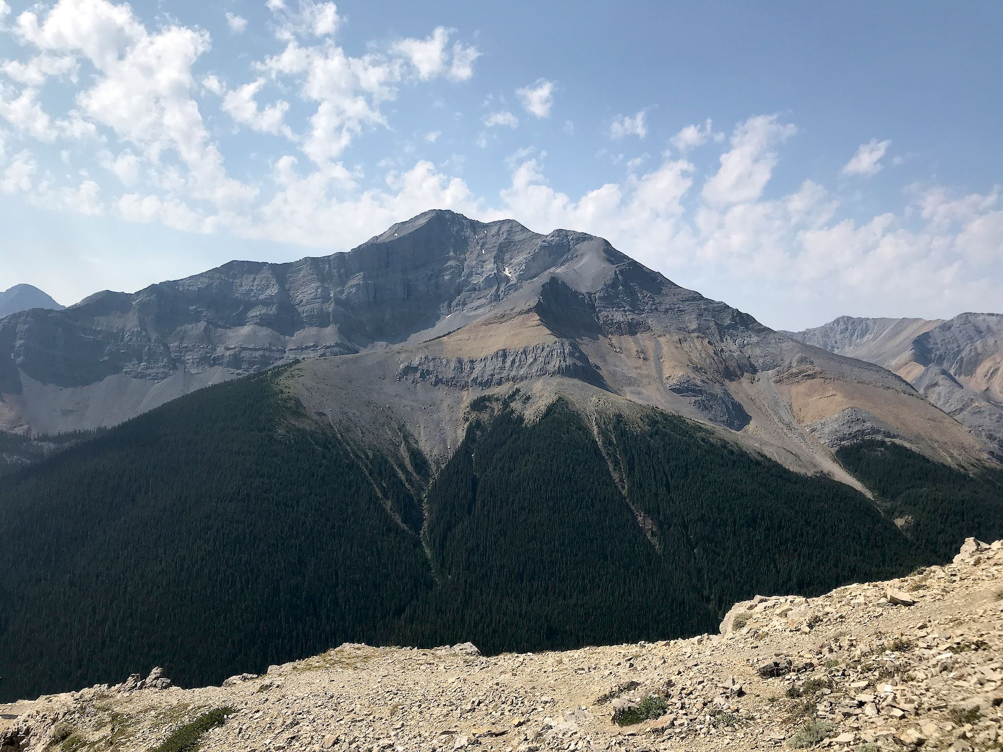
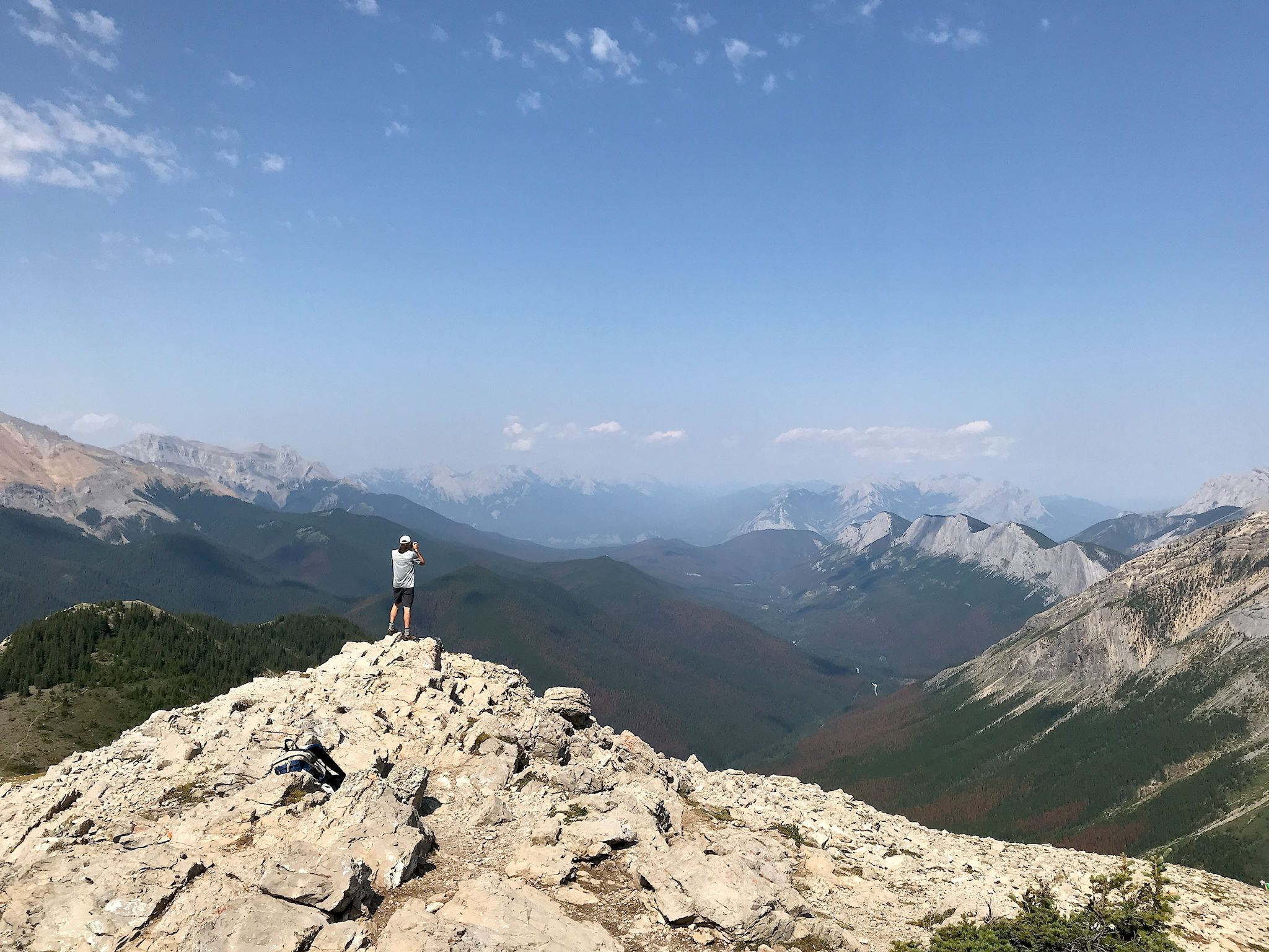
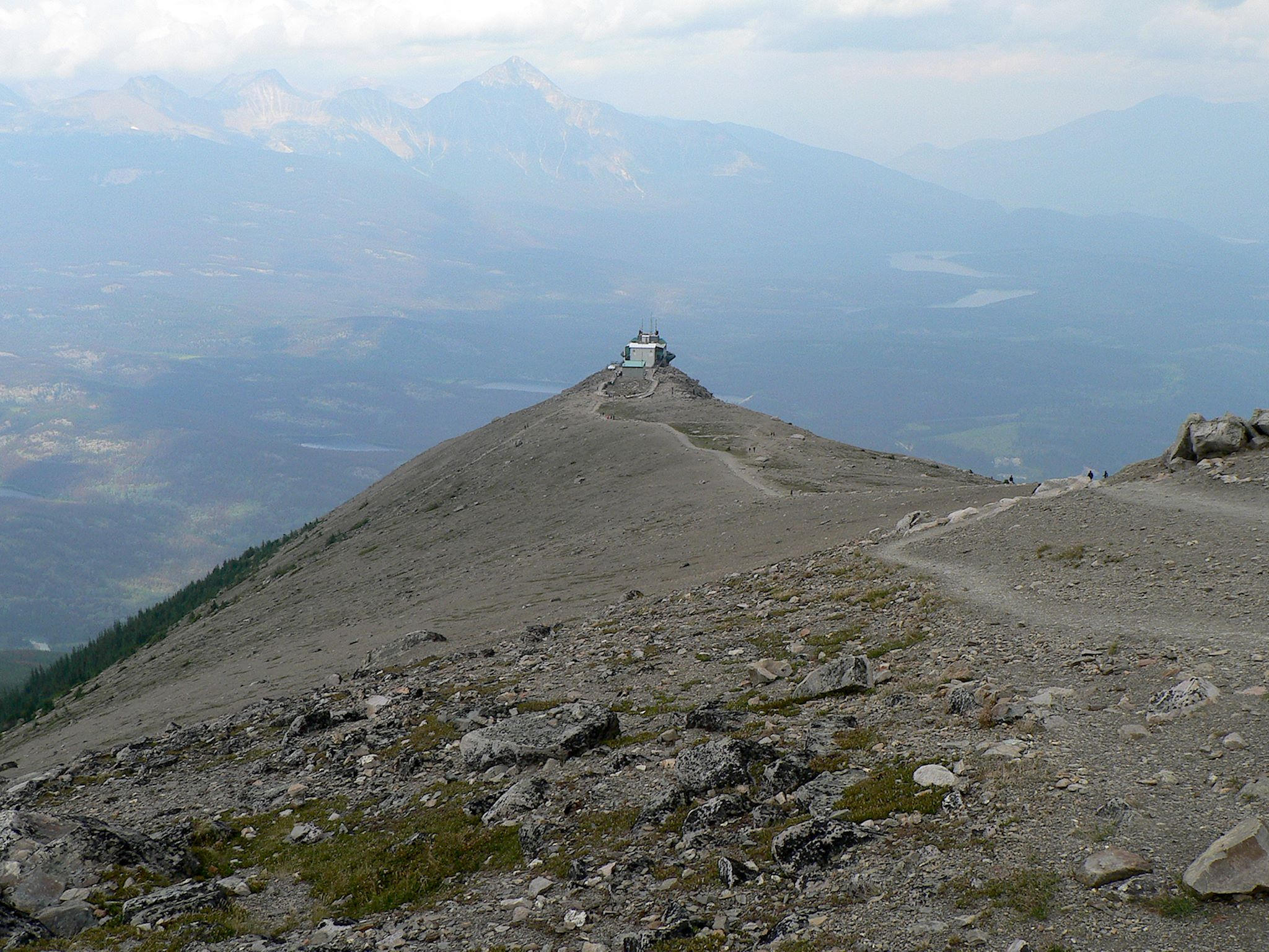
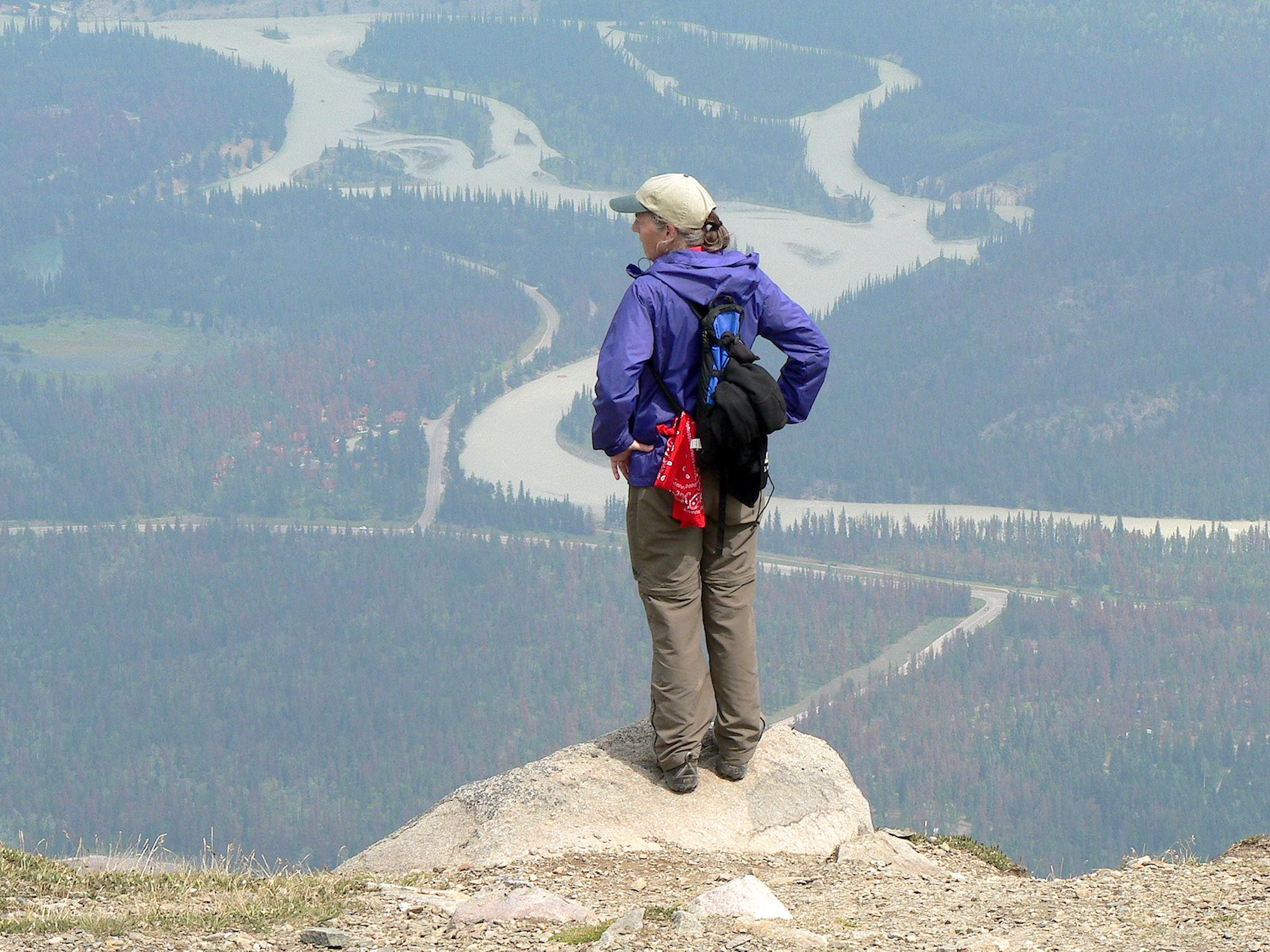
The Whistlers is a tall, prominent peak in the immediate Jasper townsite region of the park. Many visitors take the SkyTram to a knob not quite a kilometer (about half a mile) from the summit. Ha! Not for us! The Whistlers Trail is one of the few in the park to progress through 3 mountain ‘life zones’ – montane, sub-alpine, and alpine. The surprisingly fearless ptarmigans, always friendly marmots, and skittish pika greeted us at numerous spots along the trail. As we approached the summit, we enjoyed yet another 360° view including the Athabasca River Valley and endless ranges beyond. Oh, and a view of storm clouds coming quickly towards us. With a few quick pix at the summit, we started our descent into a brief rain shower, after which we continued on down the way we came up, having thoroughly enjoyed our preferred mode of transportation to this beautiful summit.
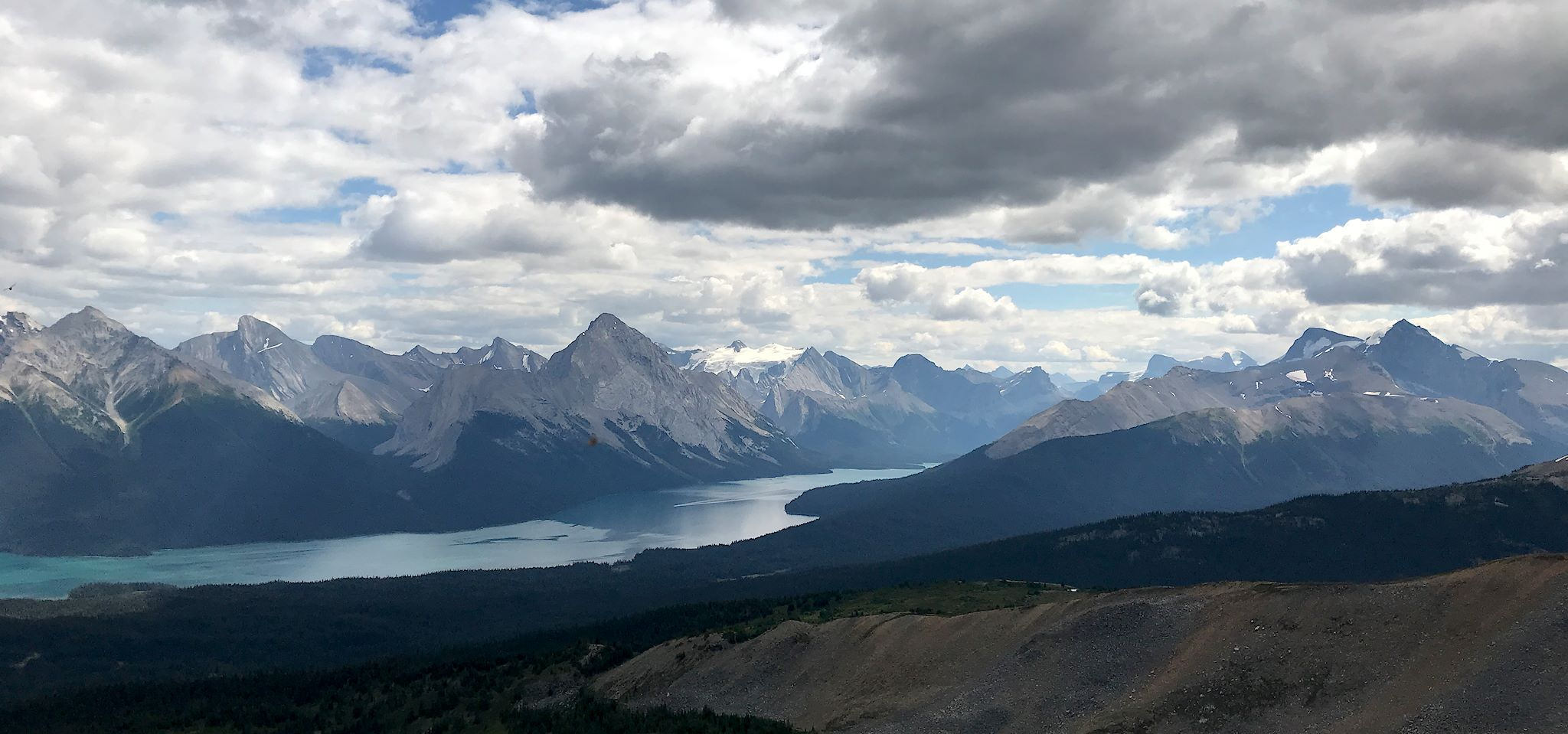
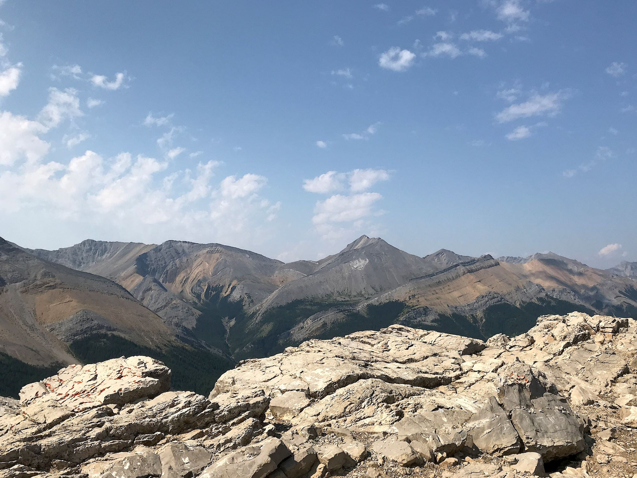
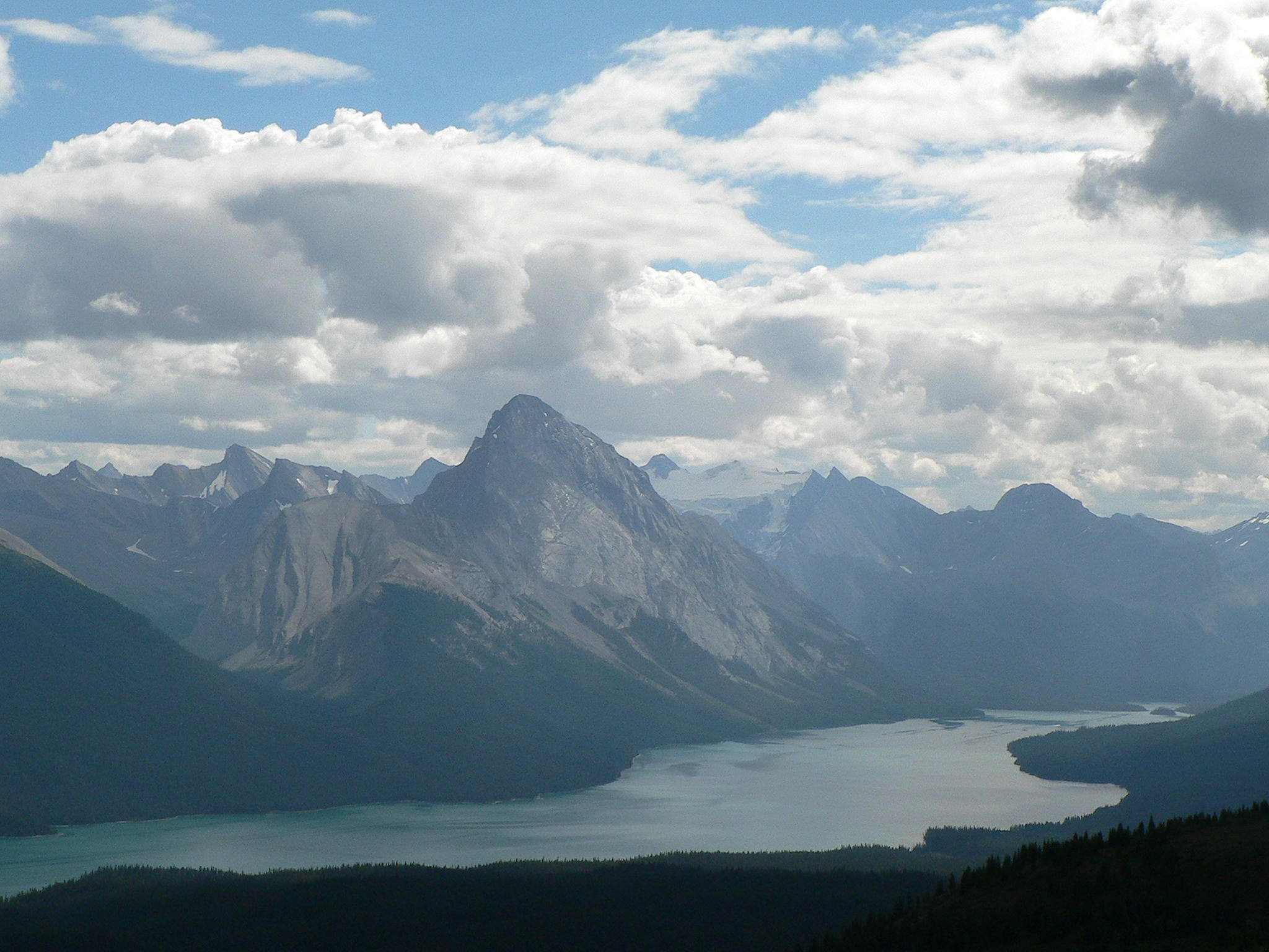
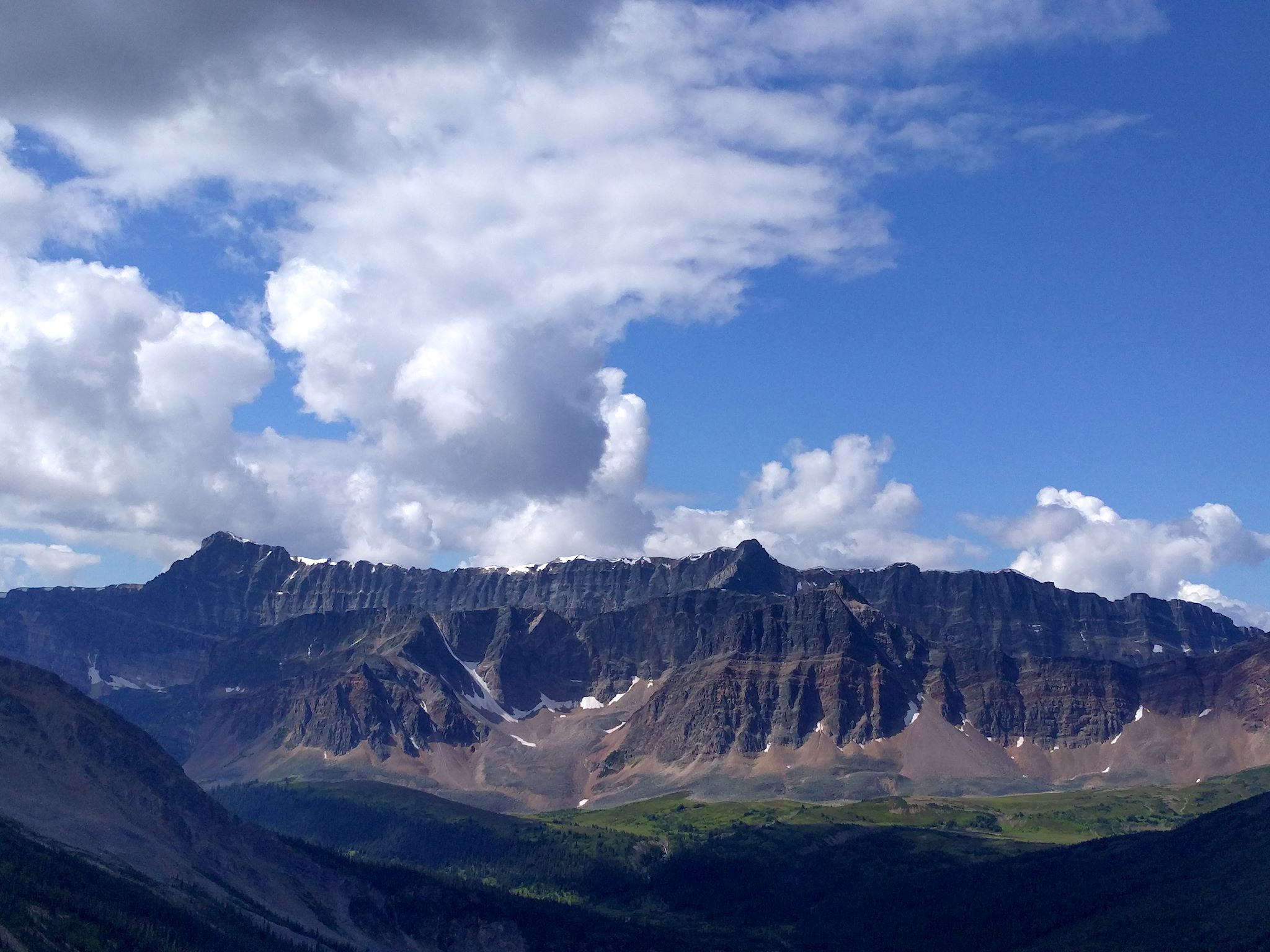
The Bald Hills promised great views in the Maligne Valley region of the park and overdelivered. The gradual climb up an old gravel road took us to a view point at the former site of a fire tower. And that was only the beginning. From there, once again completely above tree line, the trail provided views in multiple directions as we scrambled to the summit. Upon reaching this summit, we realized there were 4 more! (Bald Hills, not Hill, eh?) A trail through meadows and wildflowers high on the ridge linked the ‘hills,’ each just a bit taller than the last and introducing stunning views into different valleys. The highlight was the view over Maligne Lake to the Queen Elizabeth Range, Malign Mountain and the Maligne Glacier.


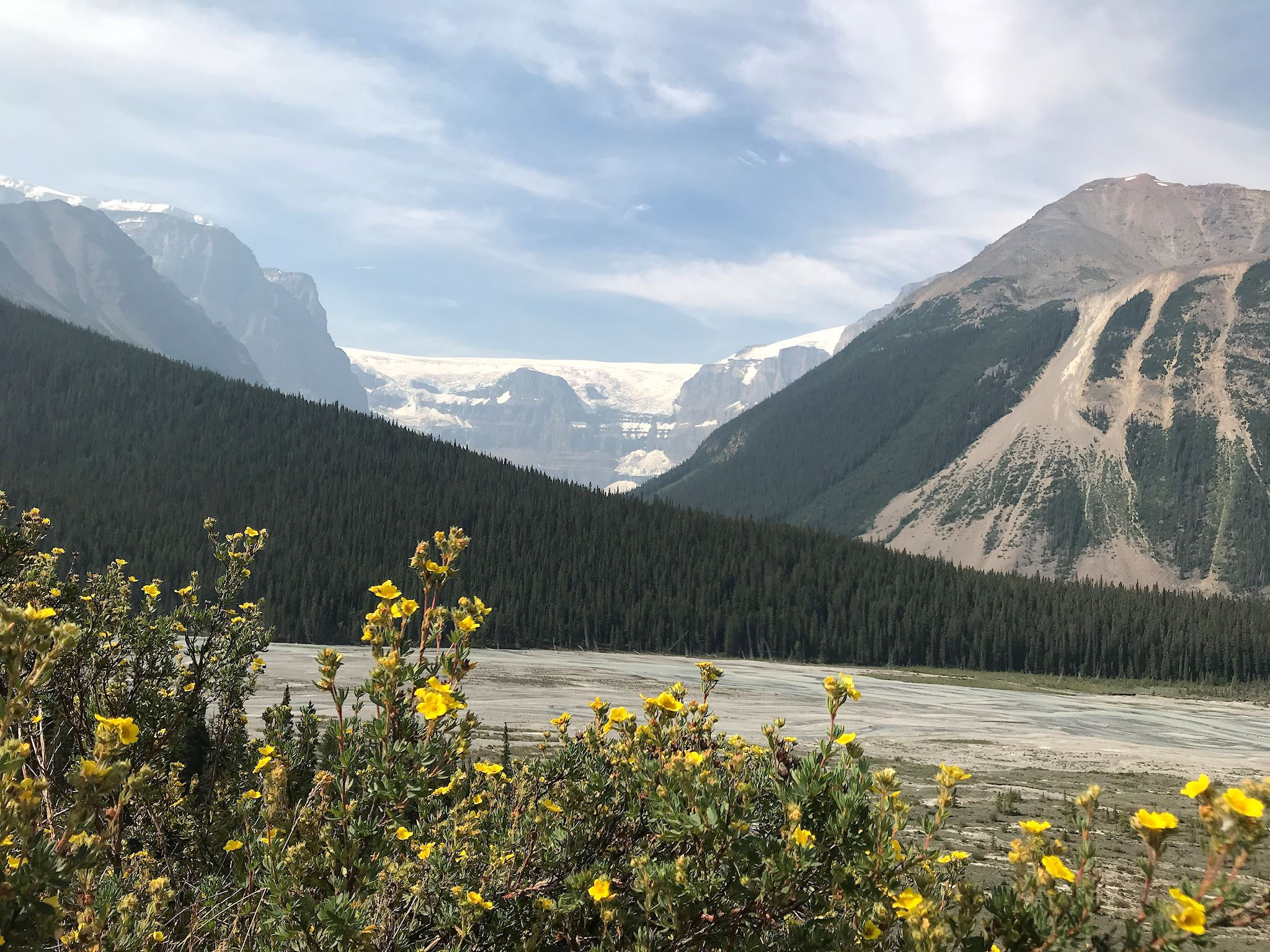
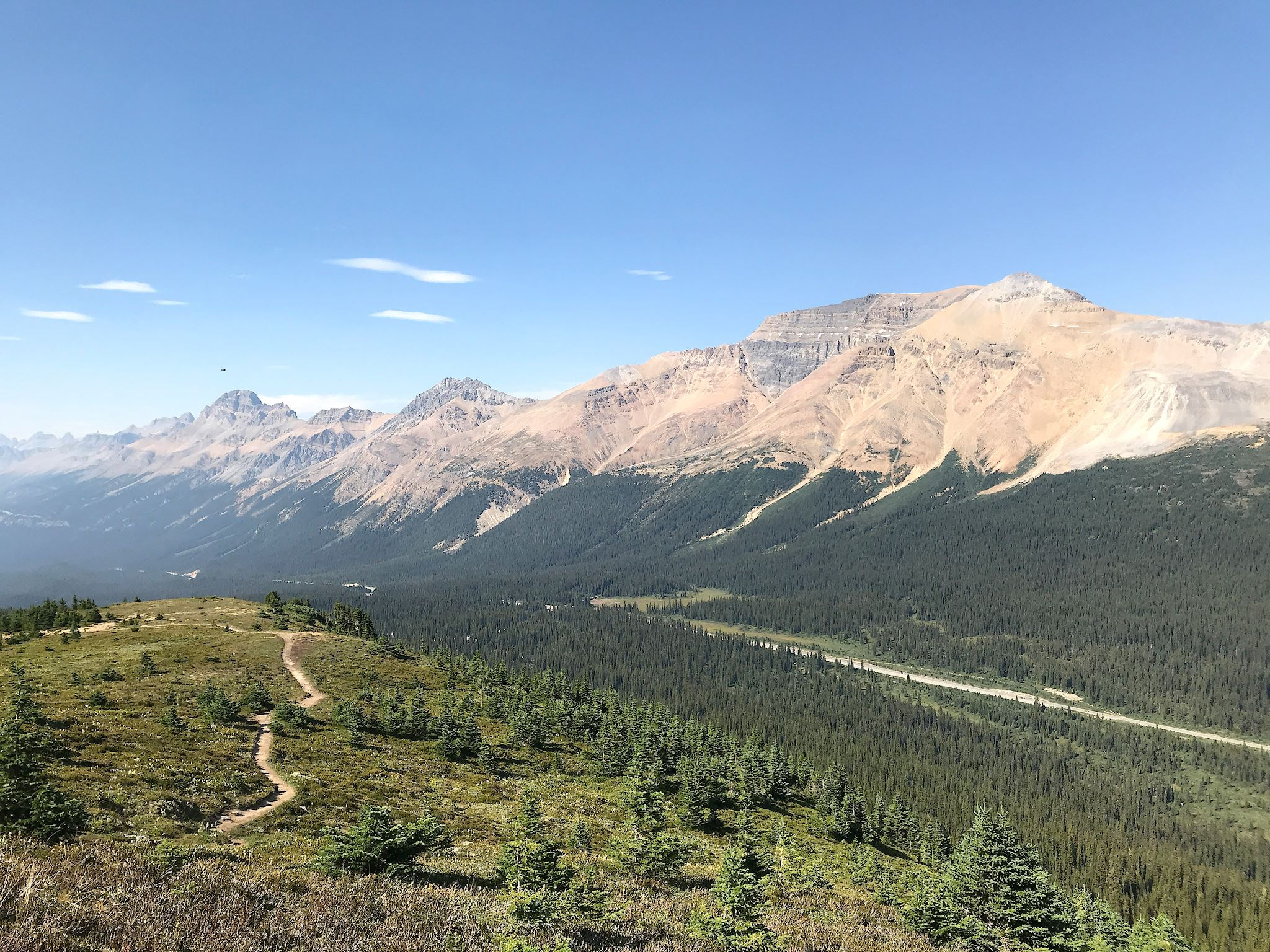
We’re happy we were able to ‘practice’ being immersed in overwhelming beauty before we set out for the Icefields Parkway, the fifth region of the park. We needed it! And I was grateful that Doug was driving, which provided me with the opportunity to squeal and squirm in my seat for the whole way. OMG! The Icefields Parkway, which spans parts of both Jasper and Banff National Parks, is a 233 km (150 mi) drive along the continental divide, through deep valleys showcasing glacially tinged rivers and lakes and majestic rocky mountain peaks, past some of the largest glaciers that remain south of the Arctic Circle. At every turn ‘ Oooh, look at that, find a place to pull over!’
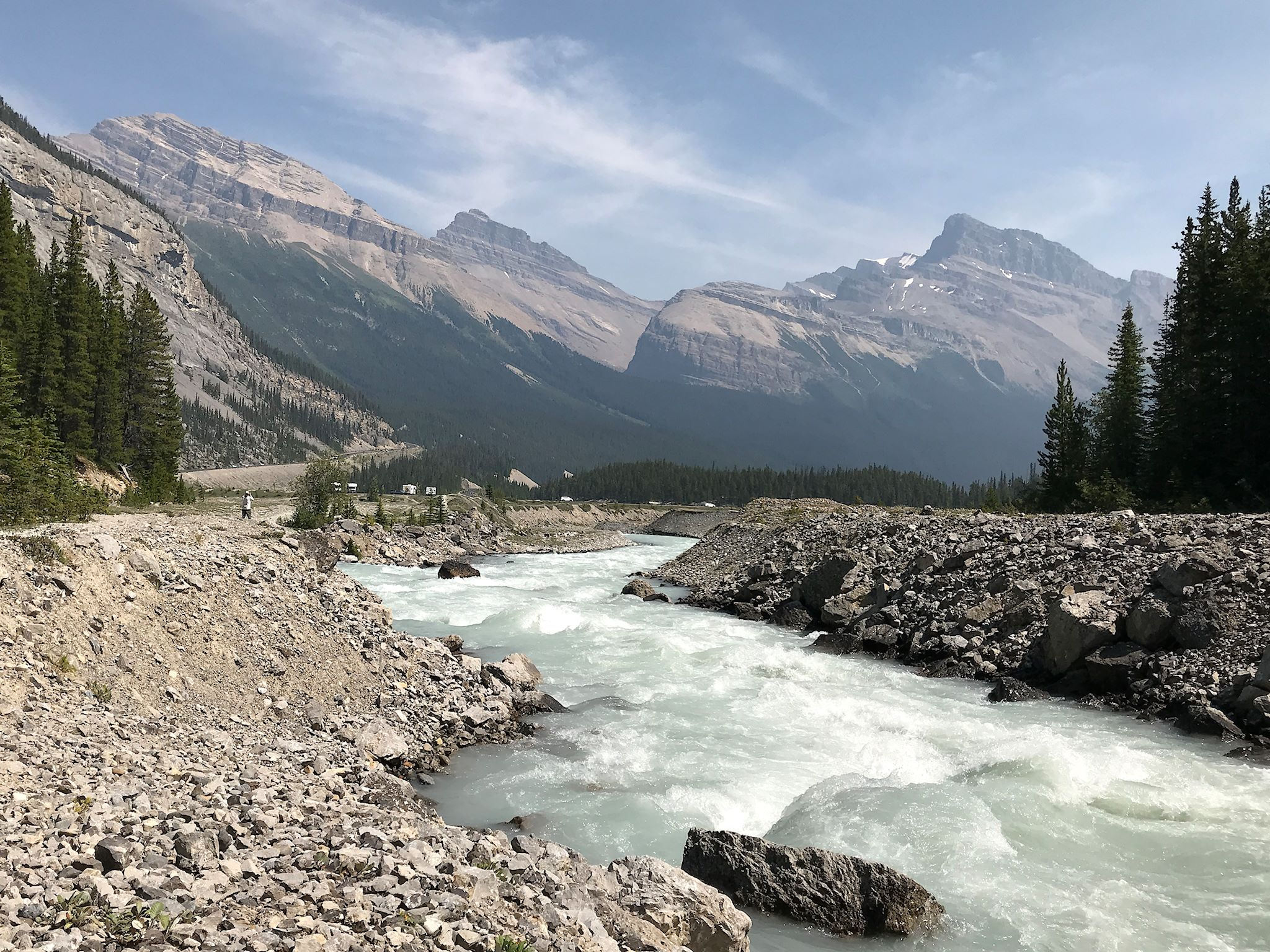
We had hoped to hike along the Icefields Parkway. Aware it was the busiest region of the park, we had tempered our expectations accordingly. At our first stop, at Athabasca Falls (Jasper NP), the oversized parking lot was nearly full at 9am. We enjoyed a short hike above and below the falls and marveled at the power of the water to erode shapes and swirls into the rock that forms the riverbed. After that, we passed by many trailheads with lines of vehicles waiting to get in.

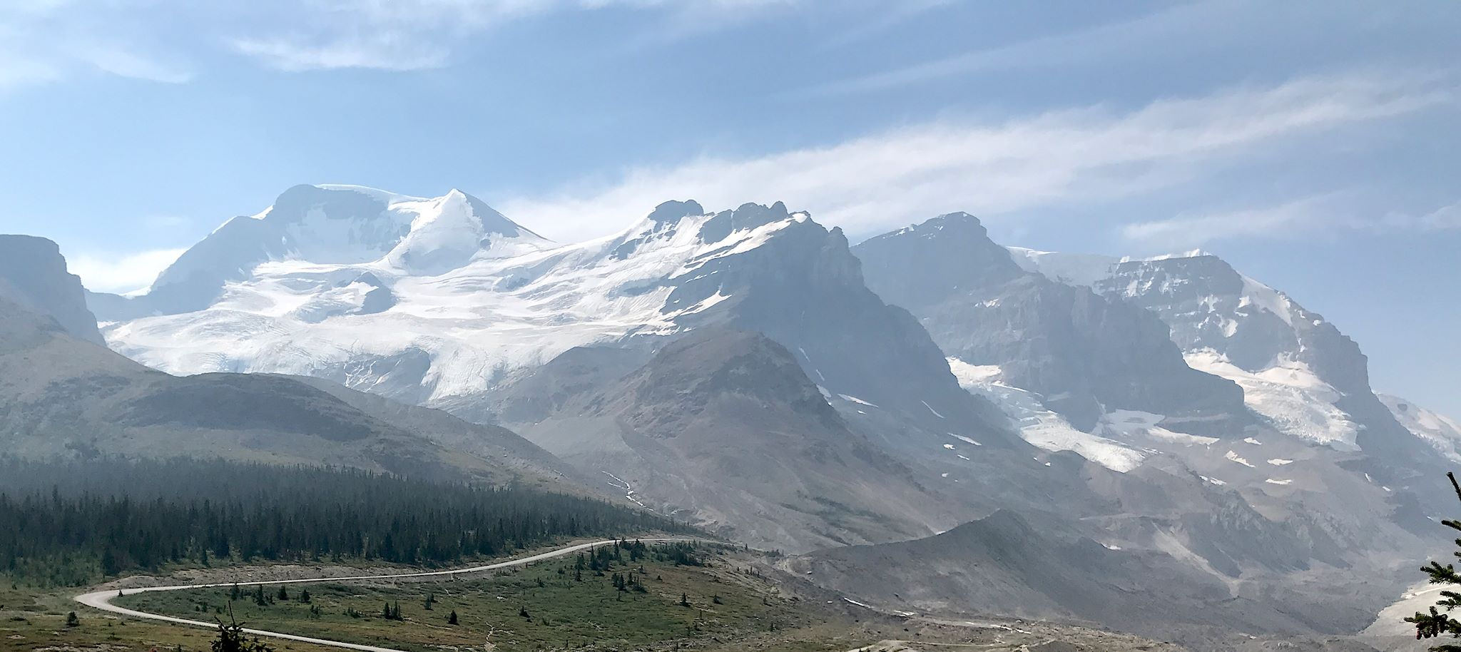
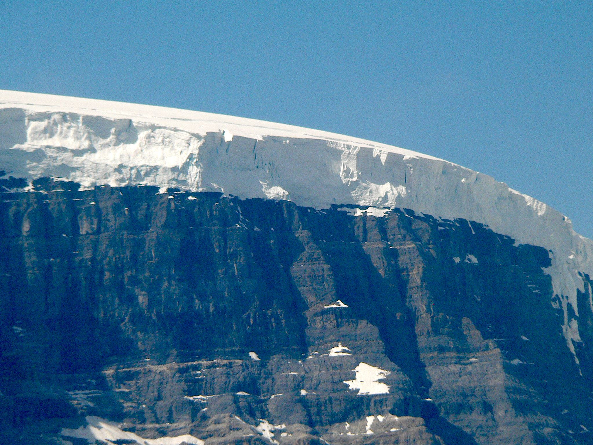
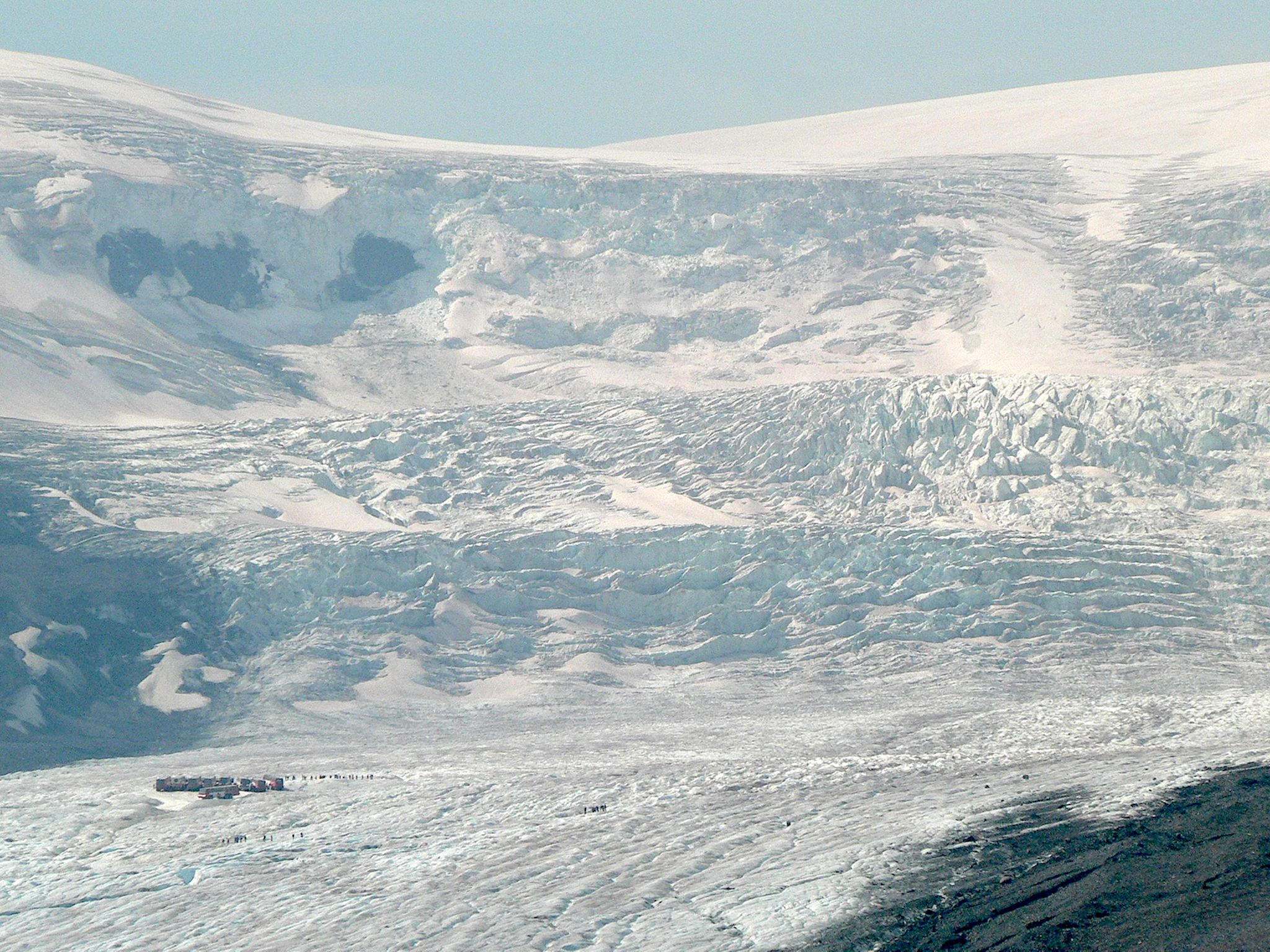
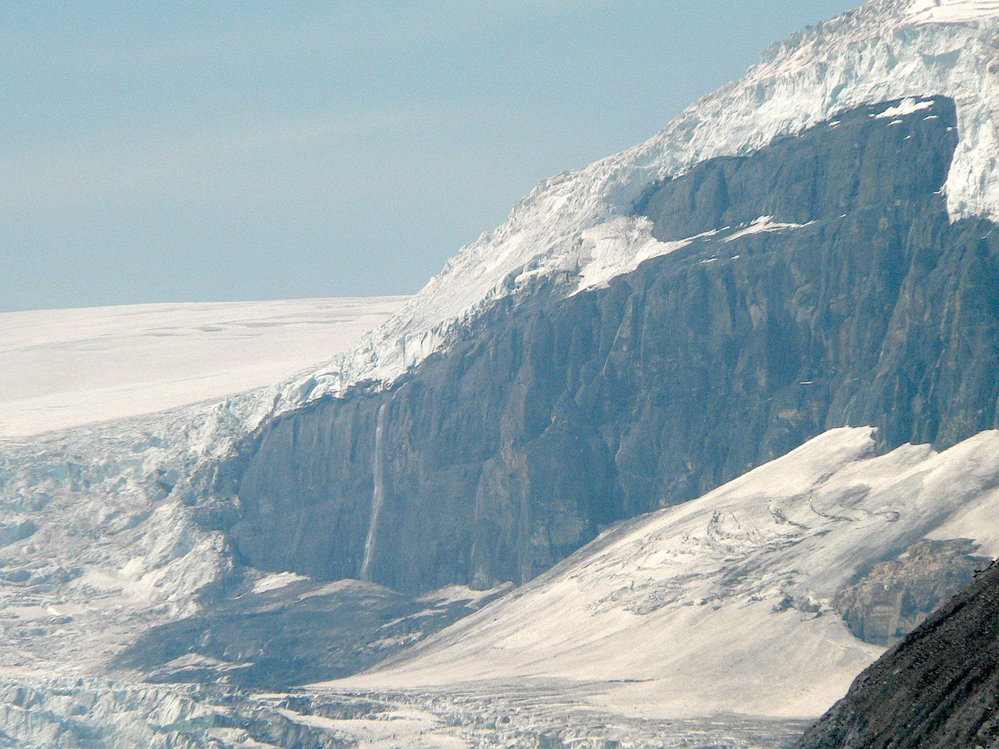
We did a touristy stop at the Icefield Center, an informative visitor center perfectly situated for viewing the Columbia Icefield and the Athabasca and Kitchener Glaciers. This site is near the Snow Dome, a larger than massive peak that serves as a triple divide. Named because of the shape of its glacial cap, as ice from the glacier melts the water may make it way to the Pacific Ocean, the Arctic Ocean, or the Atlantic Ocean (via Hudson Bay). The Snow Dome is also the border between Jasper and Banff National Parks, and between Alberta and British Columbia.
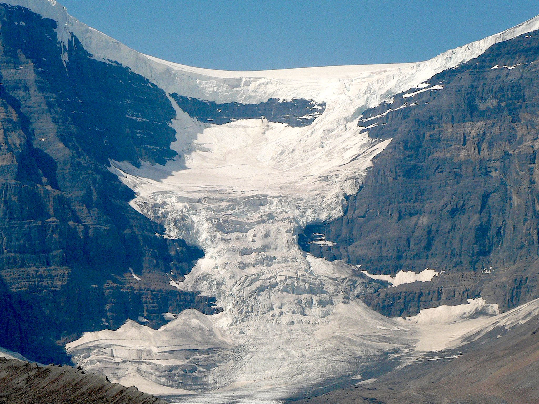

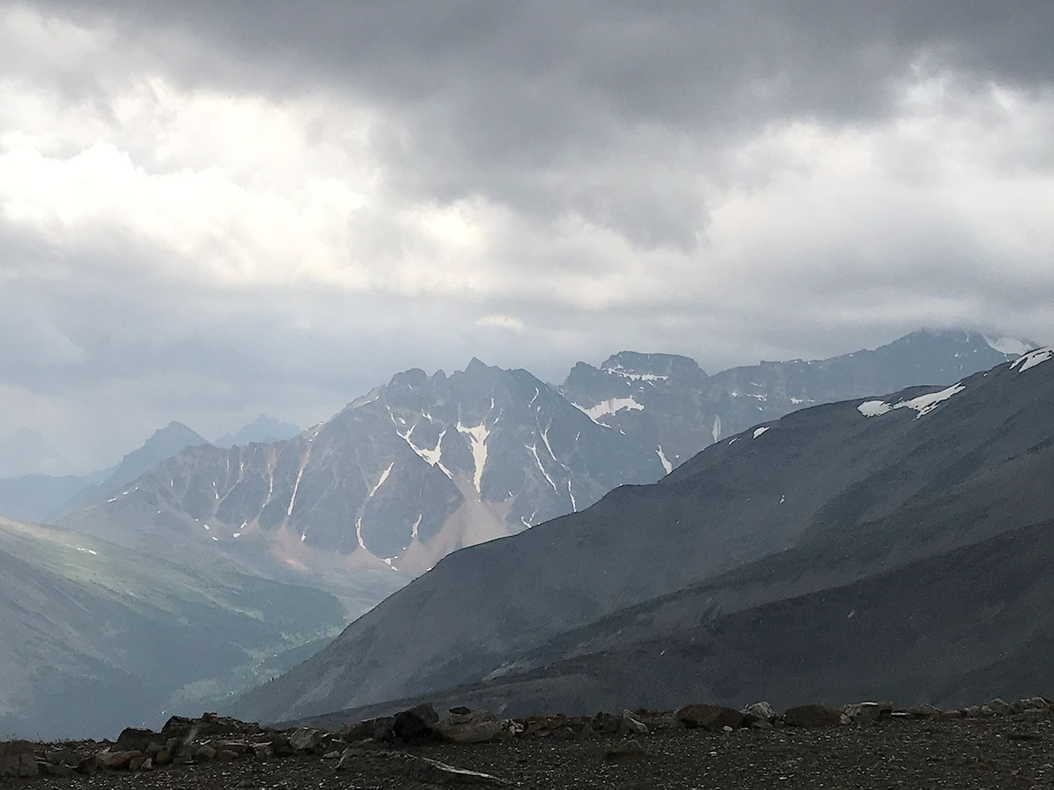
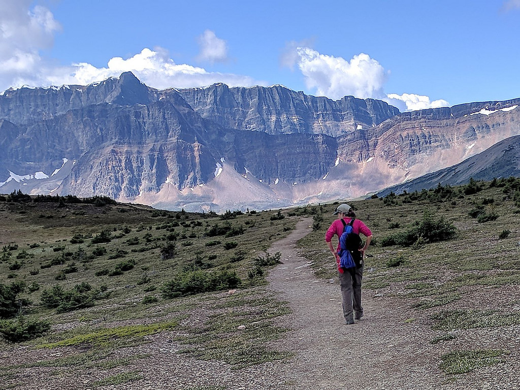
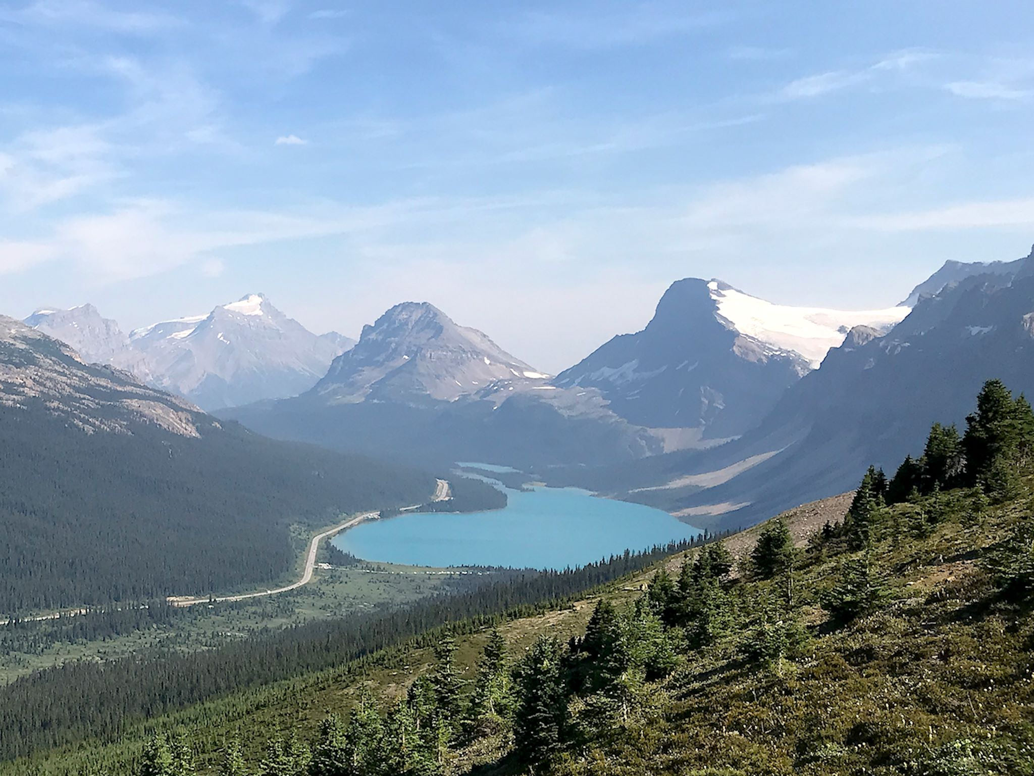
Once in Banff National Park, the jaw-dropping views continued. It was hard to imagine that the valleys would be deeper, and the mountains taller still! It was getting later in the day, after 4pm, crowds were abating, and we were able to squeeze our RV into trailhead parking at Petyo Lake. Yea! We hiked to Peyto Lake and to the Bow Summit Lookout which allowed for long views up the Mistaya Valley, over to Peyto Mountain and Peyto Glacier, and down into Bow Lake. Banff is the busiest of the Canadian Rocky National Parks, and this is the busy season, so we fueled up at Lake Louise and headed west to Yoho National Park. We’ll come back to Banff in September as the crowds start to subside.

Glad we’ve been practicing… Yoho is Cree for ‘awe and wonder.’
For those who are interested, more overflow camp, Snaring Camp/Jasper, Sulphur Skyline hike, The Whistlers hike, Bald Hills hike, Athabasca Falls, Icefields Parkway – Jasper NP, Icefield Centre, Icefields Parkway – Banff NP, Bow Summit Overlook/Peyto Lake pix…
P.S. It looks like we’re back to 1,000+ photo days and extra-large, overstuffed albums. Hope you don’t mind…
Happy you found our mountain playground. Love the blog.
Cheers,
Larry
Thanks Larry! Glad you’re enjoying the blog. You are so fortunate to have this playground right in your backyard and to have explored as much as you have over the years.
I love the mountains so much. They are beautiful. So glad you are enjoying the beauty of our Province. Drink it all in.
Thanks Barb! We love mountains, too – there’s something deeply inspiring about being surrounded by tall peaks, hidden lakes, waterfalls… We can only imagine what it was like for you and Larry to be riding these awesome mountain passes on your motorcycles. You’re so lucky to live here!