
Though it doesn’t appear so at first, after being here for a week we realize that Yoho National Park, Canada’s second oldest park, has a split personality.
The discovery of Kicking Horse Pass, the first pass across the Canadian Rockies deemed ‘safe’ for the railroad in the 1850’s, put Yoho on the map. This discovery allowed Canadian Pacific Railway (CPR) to complete the transcontinental railroad. After numerous catastrophic train crashes, CPR reduced the grade through Kicking Horse Pass (aka ‘The Big Mountain’) with the use of the spiral tunnels, completed 1909. CPR also built the famed Canadian Pacific Hotels – beautiful lodges in gorgeous, remote places marketed to elite travelers in order to encourage more rail travel. Although no longer owned by the railroad, Emerald Lake, Yoho Valley, and Lake O’Hara Lodges in the park continue to provide luxurious accommodations in ‘we-are-but-specks-on-this-planet’ nature. (Italics from their brochures. And they really nail it.) Of course, where goes the CPR, now also goes the Trans-Canada Highway.
Away from the railroad, the highway, and the Kicking Horse Valley, Yoho is a hiker’s paradise. There are three super-steep, super-deep valleys in the park with towering, nearly vertical rocks walls, hidden glacial lakes and countless waterfalls. Accessible by paved roads, the end points of the valleys include lodging, tourist vistas and trailheads. Those end points are where the two Yoho personalities cross paths. Not far from these points, hikers leave the resort guests and tourist crowds on the shorter paved trails and head out for some of the best hiking we’ve experienced anywhere in our travels of North America. Thank you CPR.
We met Gail last year at Capitol Reef National Park. She retired early, lives full time in her RV, and travels to seek out great hikes. Kindred spirits? You bet! She’d recently been to the Canadian Rockies and reported that the Iceline Trail in Yoho NP had earned a spot on her top 10 absolute favorite hikes list. That endorsement was all we needed!
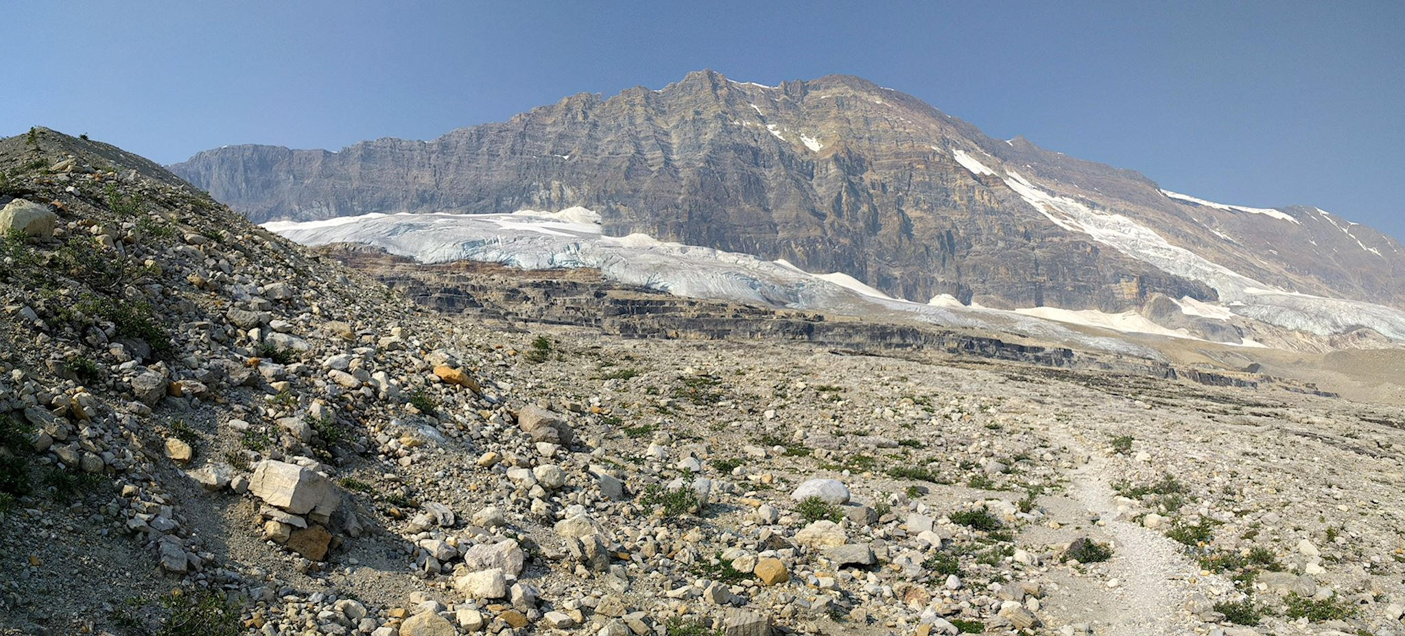
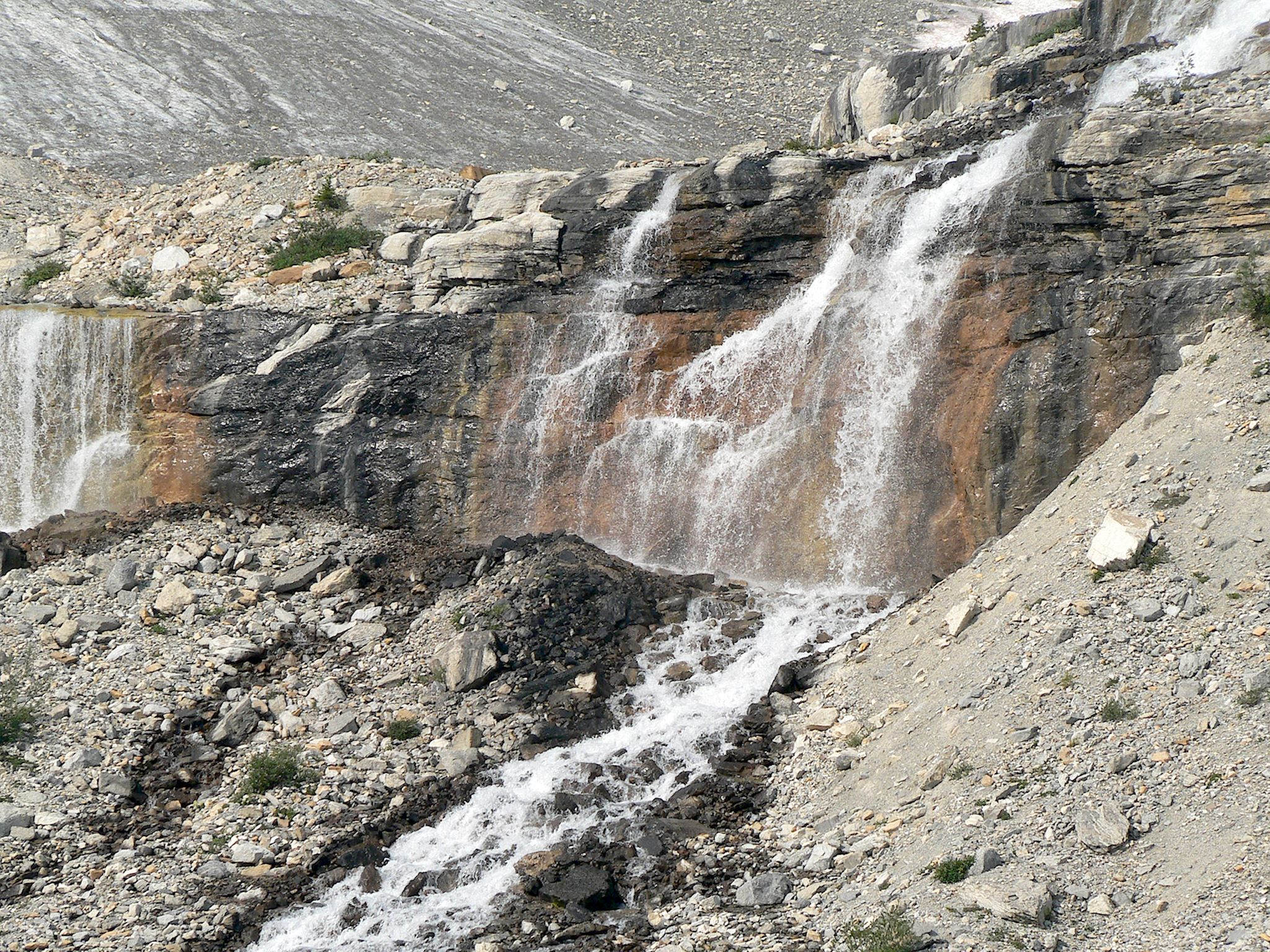
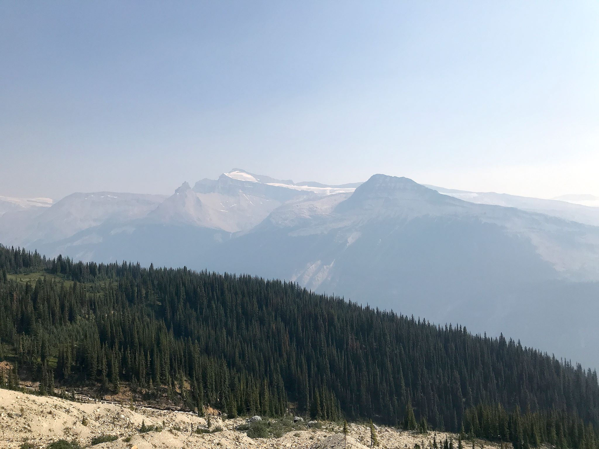
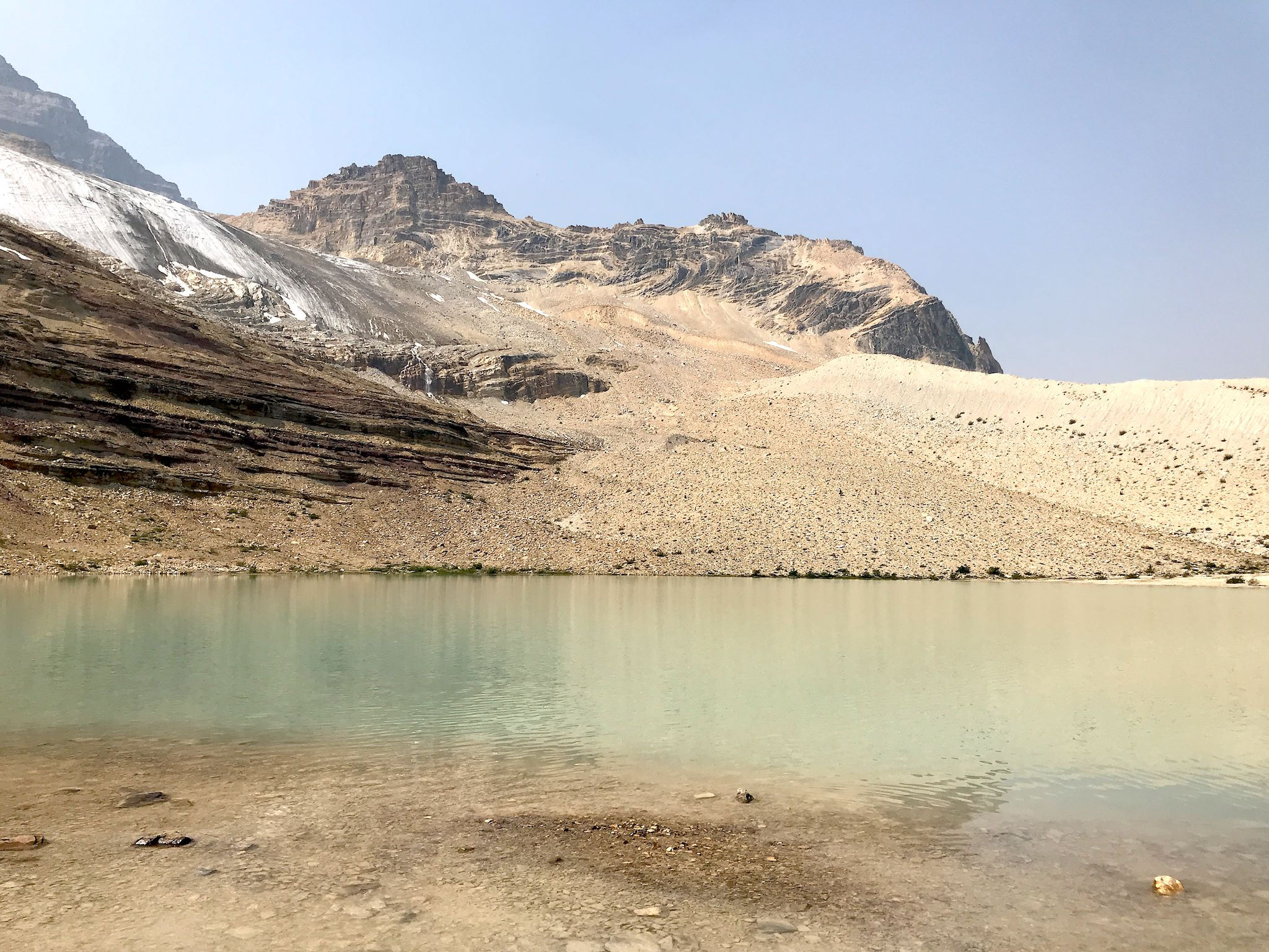
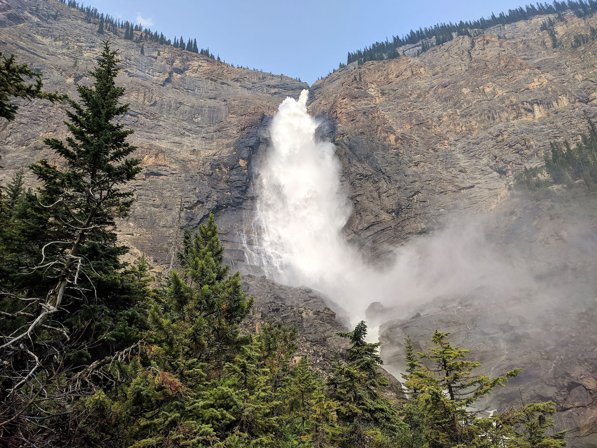
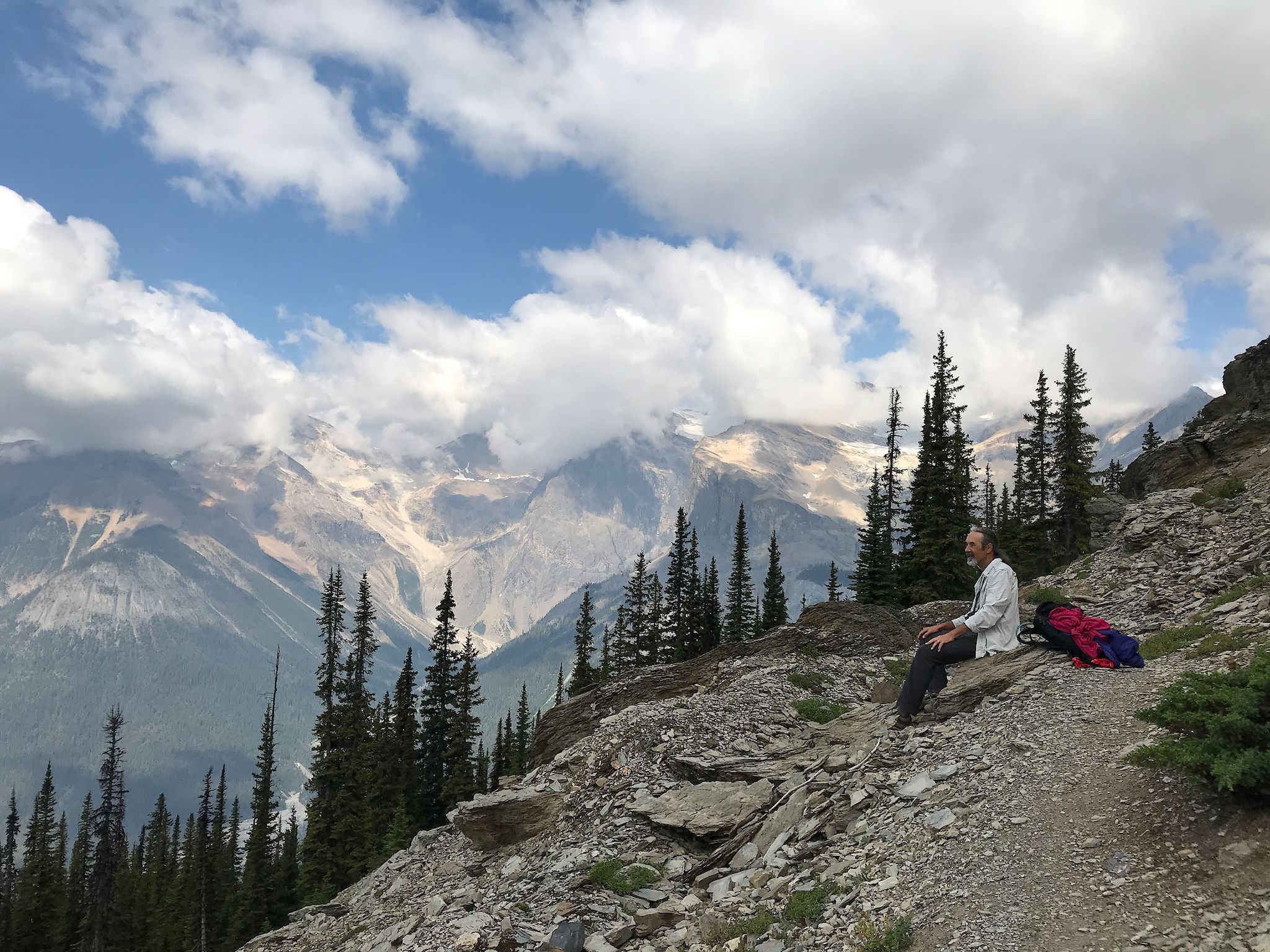
It was early and still cool when we left the Takakkaw Falls Trailhead. We took about an hour through a pretty, forested, switchbacking trail to get to the treeline and the Iceline Trail. We spent the next 3.5 hours literally above it all. The southern half of the trail meandered along a rocky meadow at the base of the President Range where we could almost touch the Emerald Glacier. We couldn’t hike on the glacier (hiking on these glaciers in summer is not such a good idea – they have fragile crevasses that cave in and drop hikers into streams flowing under the ice), yet we were close enough to feel the cool air and watch the streams as they came out from under the leading edge of the glacier and combined to form small waterfalls, huge waterfalls, or larger streams that were refreshingly cold on a very hot day. We could see across the Yoho River Valley and gawk at the Waputik Icefield, the source of the Takakkaw Falls below.
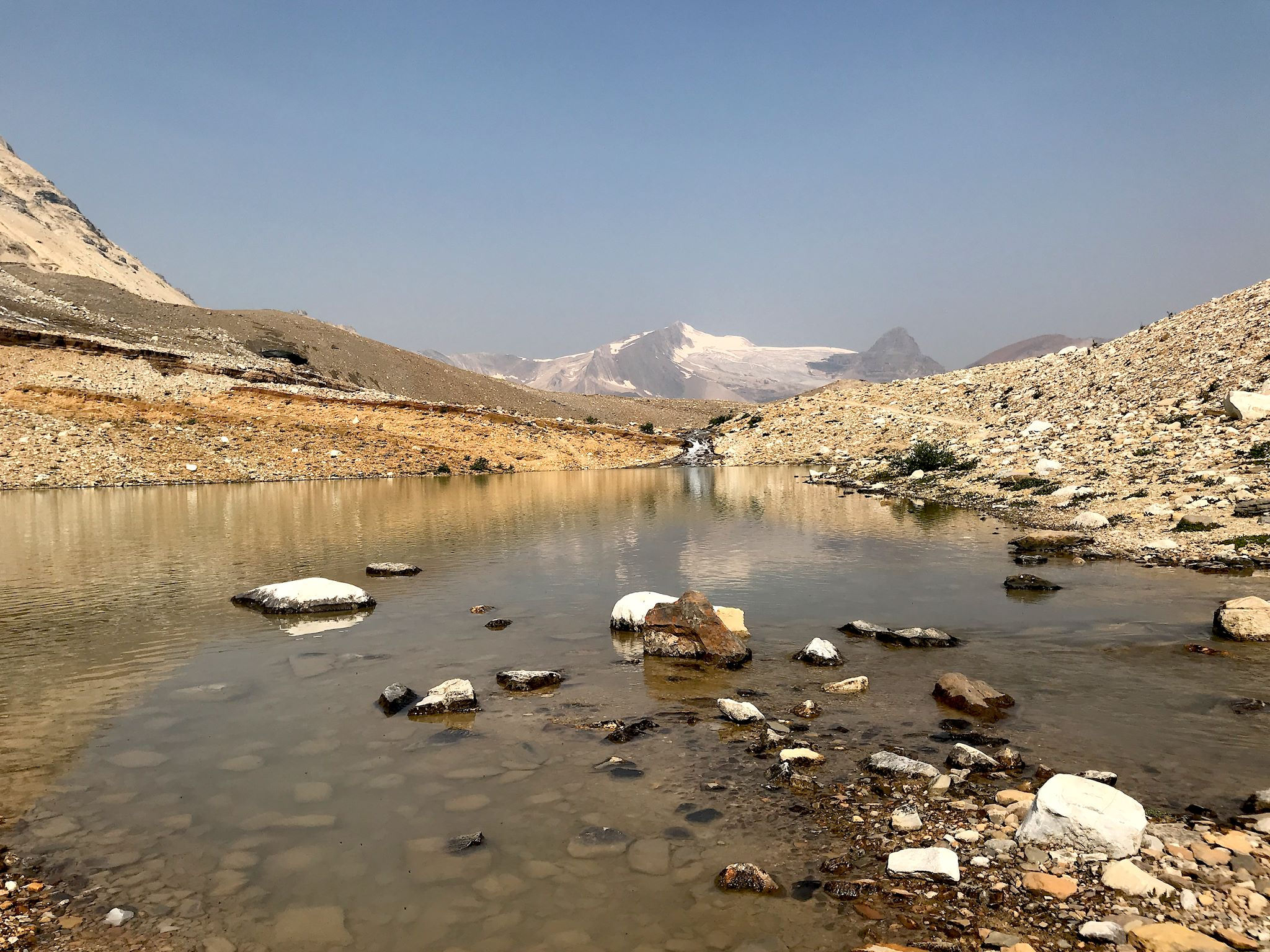
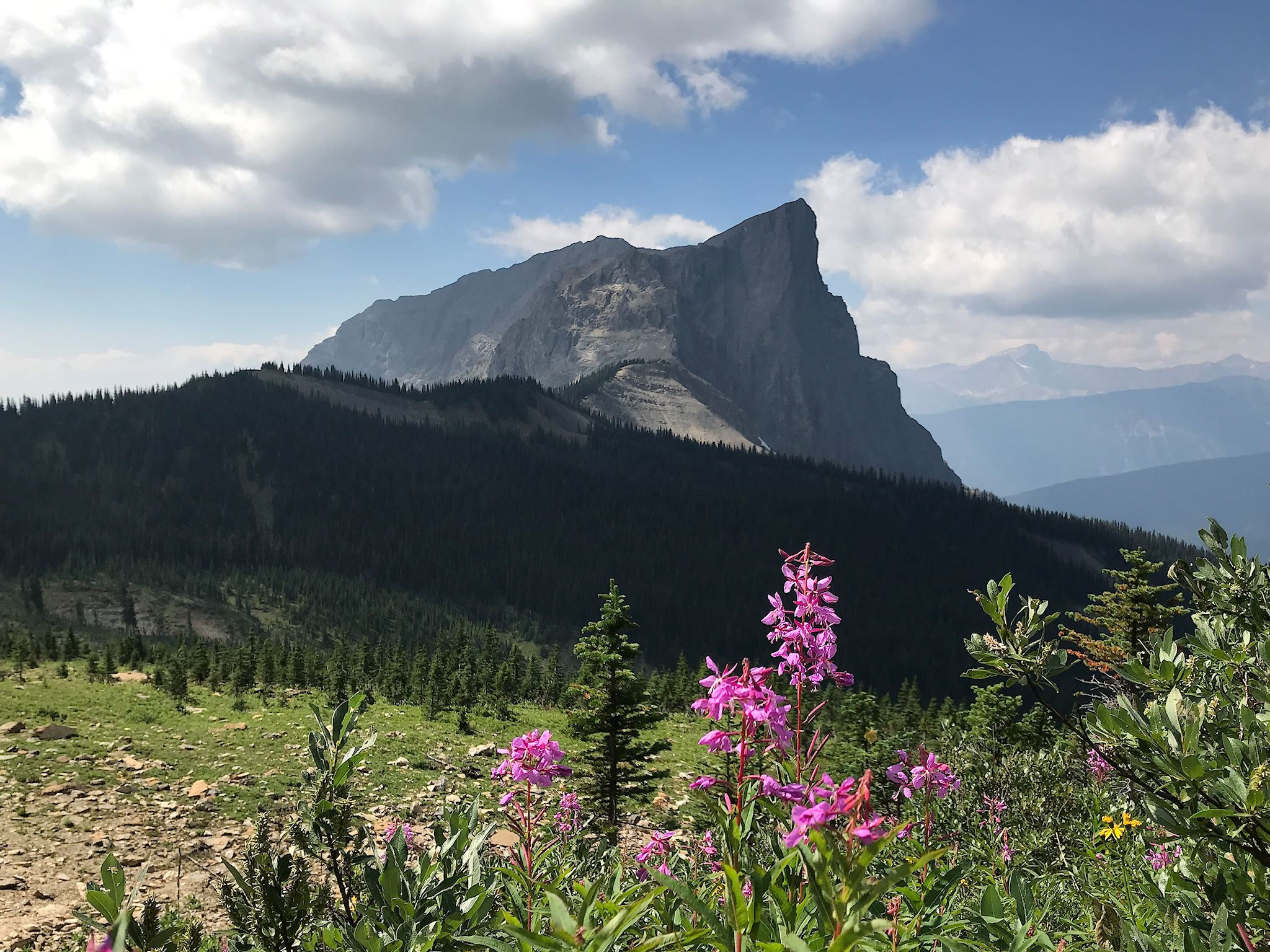
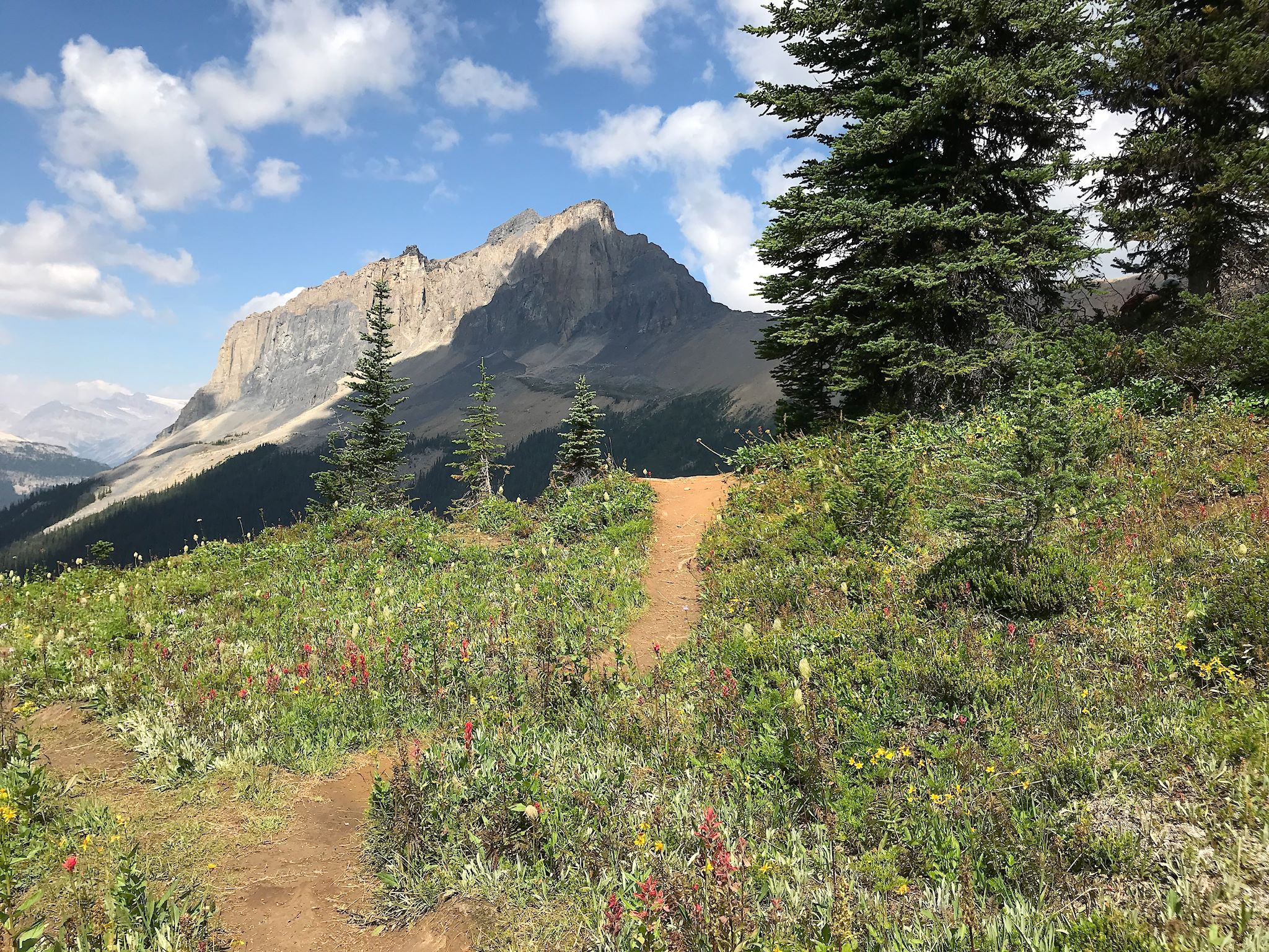
The northern half of the trail (roughly, north of the Celeste Trail junction and the high point on the trail) turned our attention toward Isolated Peak and Whaleback Mountain and many, many colorful glacial pools, ponds, and lakes along the way along with views across the Little Yoho Valley. The Iceline Trail ends along a large meadow absolutely filled with wildflowers, just before circling a giant rock garden and dropping down to the Little Yoho River. The remnants of huge (snow) avalanches crossed the trail in a few places revealing the power of nature with broken pines littering the valley floor (releasing an oh-so-lovely fresh pine scent!) Once in the (plain old regular) Yoho River Valley, we were rewarded by views of one waterfall after another until we were back to Takakkaw Falls (380 metre/1,250 feet drop), where we started this jaunt. And yes, now it’s on our top 10 list – thanks Gail!
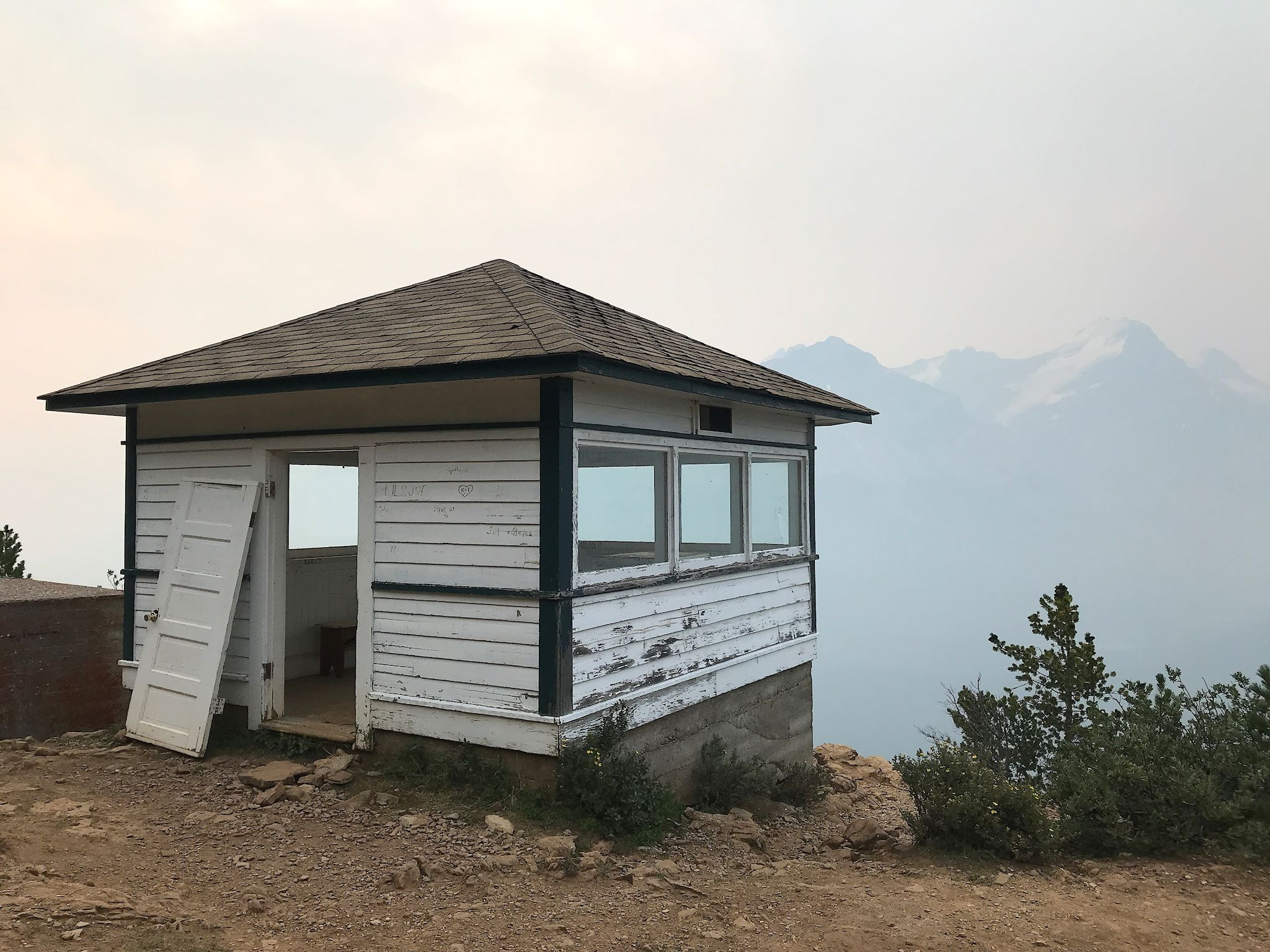
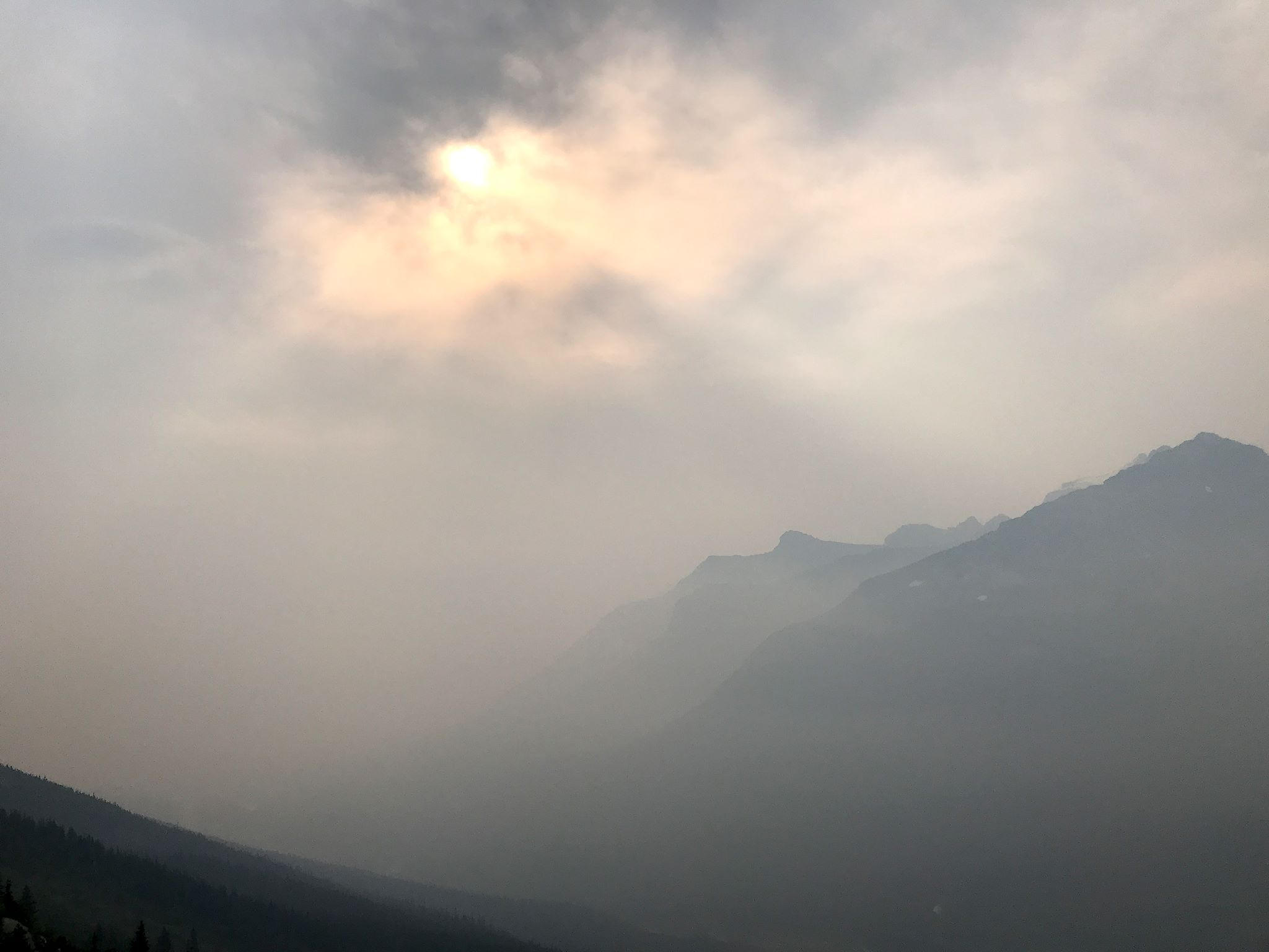
Of course, even here the weather changes from day to day. So what’re a couple of Destinators to do when the forecast is for ‘severe thunderstorms after noon?’ We hike early! We headed out for Paget Lookout, site of a former fire spotters’ cabin. Ironically enough, after a fun steep climb to the cabin which promised views up and down Kicking Horse Valley, our views were obscured… by wildfire smoke! The trail offered an optional side trip to Sherbrooke Lake at the base of Mount Ogden. We found ourselves alone at the lake with its green, still waters reflecting the ridges and peaks nearby. Safely back at camp by noon, we spent time catching up on reading as a series of small thunderstorms took turns passing by all afternoon. And most of the next day.
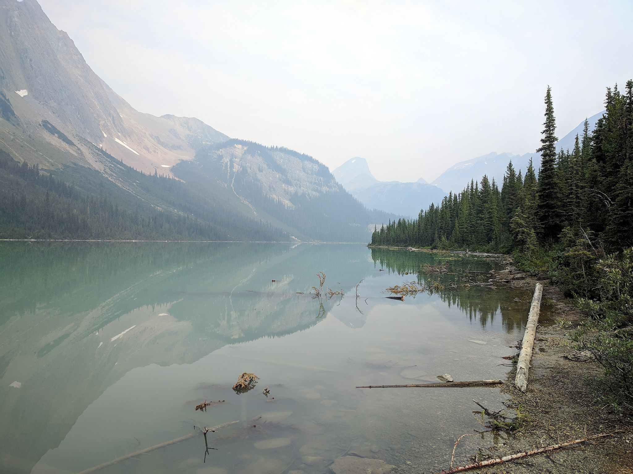
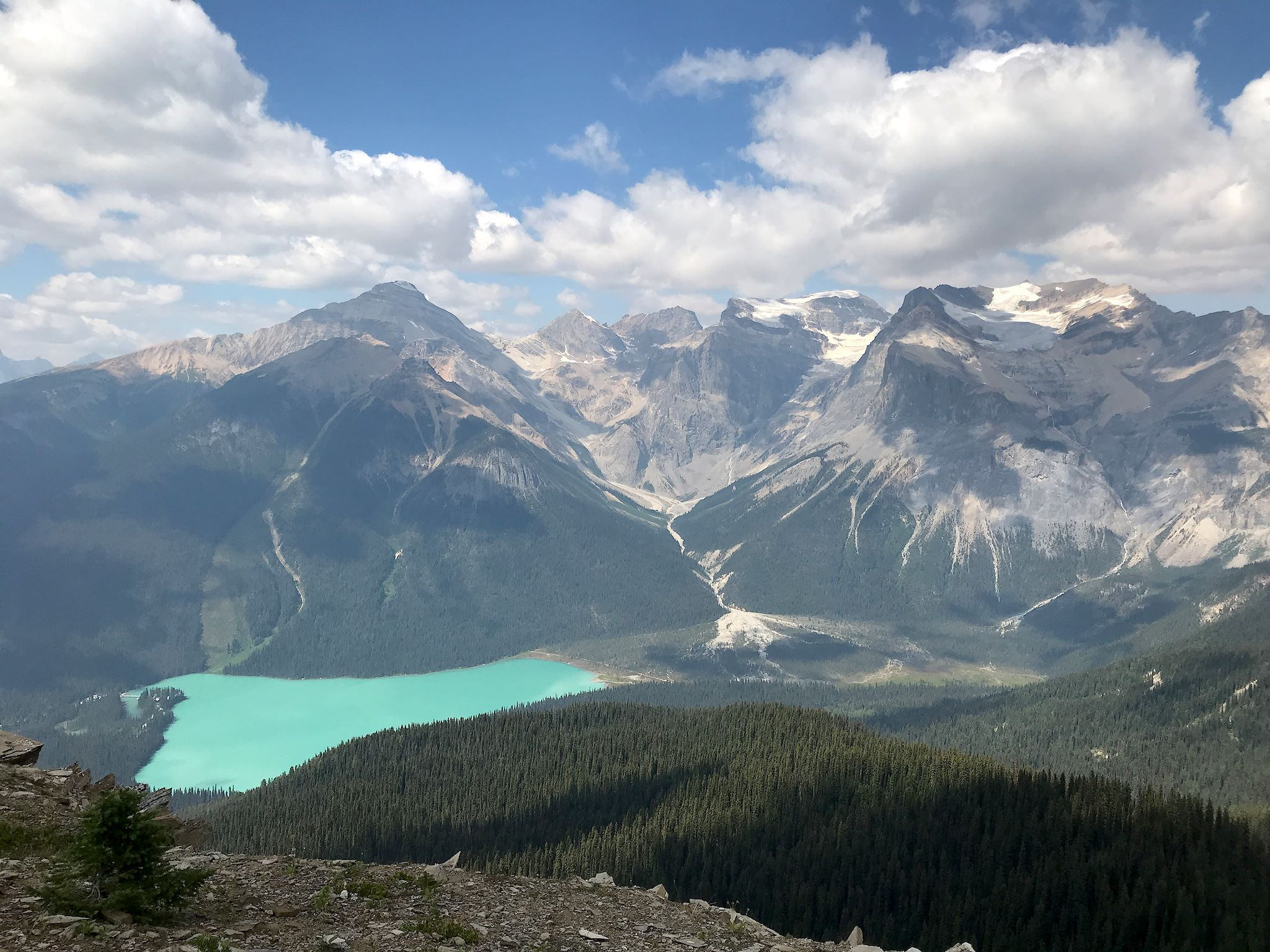
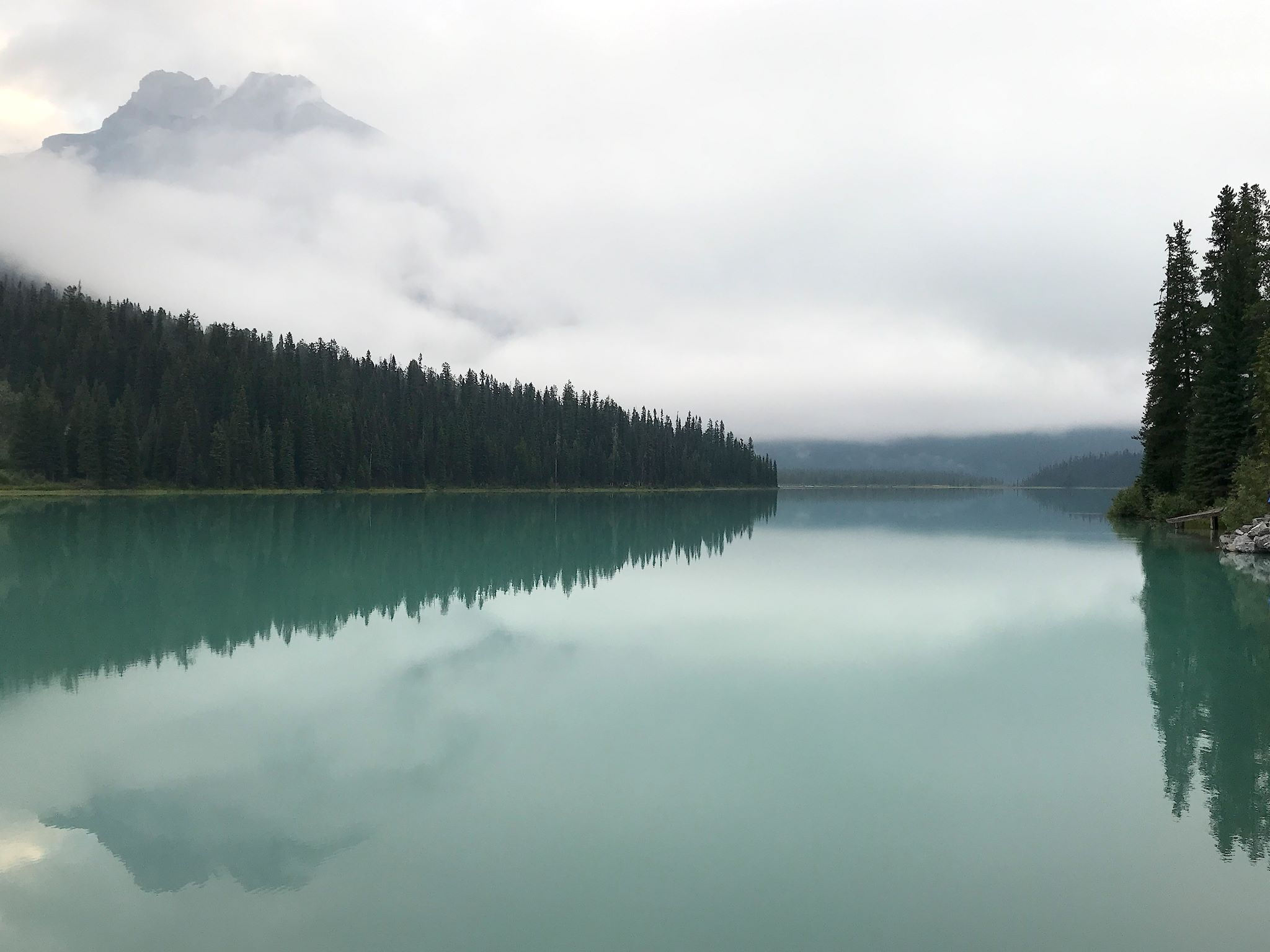
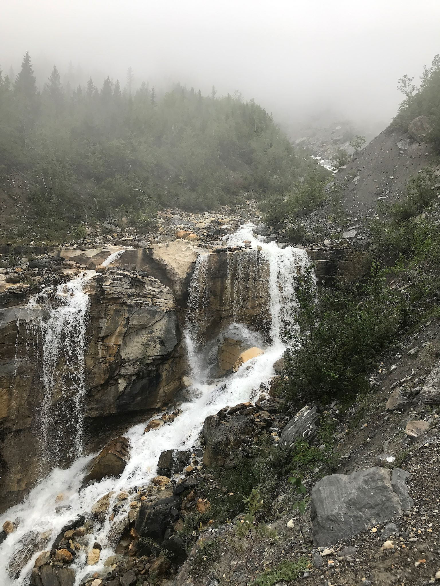
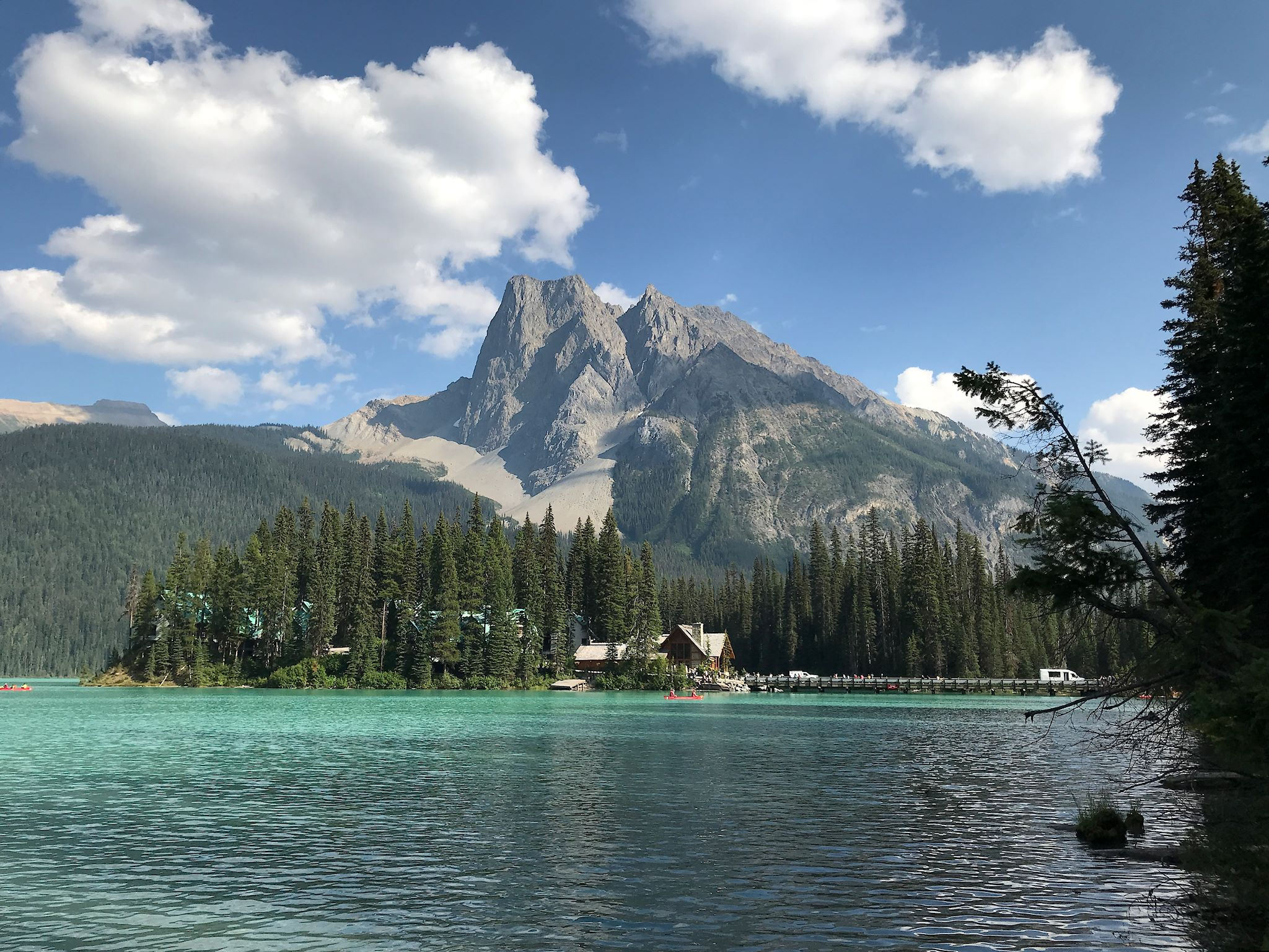
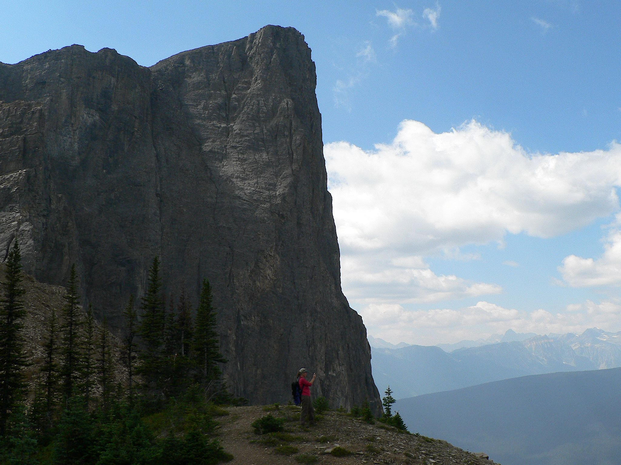
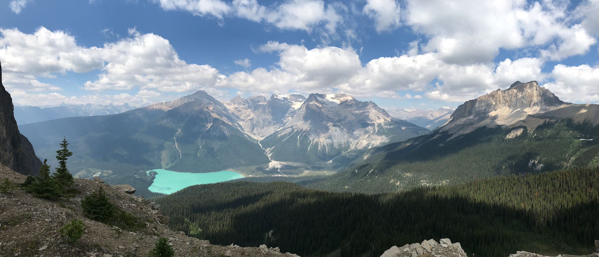
The day after the thunderstorms, a dense, heavy fog was forecasted to burn off by noon, so we selected the Emerald Triangle (aka the Wapta Highline Circuit) for our next hike. We started along the still, turquoise-colored waters of Emerald Lake, crossed the flat alluvial fan (silt and gravel from the melting glaciers in the President Range), and made our way up about 42 switchbacks alongside a waterfall allegedly just below Michael Peak (couldn’t see it through the clouds) to reach Yoho Pass. The whole time, the clouds were teasing us, slowly dissipating and revealing tantalyzing hints of the views around us. A short side trip took us to Yoho Lake, a backpacking camp at a glacial tarn surrounded by meadows of wildflowers in full bloom. The tease continued as we traversed the slope just below Mount Wapta, in and out of the trees, and views of Emerald Lake, President Range and Mount Burgess continued to unfold. When we began to think the views couldn’t possibly be any better, we crossed a basin of yet more wildflowers in full bloom and climbed up a side trail to a rocky shoulder of Mount Burgess. Speechless! (Squeals aren’t speech…) We lingered there for a while. With great difficulty we tore ourselves from the viewpoint and started our descent back to the lake, down about 62 switchbacks. On the way down, we considered an important question: Could two of our top ten hikes be in Yoho National Park? Answer: Yup.

And the Cree translation of Yoho – awe and wonder? Perfect!
For anyone who’s interested, more Monarch camp, Iceline Trail South, Iceline Trail North, Little Yoho and Yoho River Valleys, Paget Lookout/Sherbrook Lake hike, Emerald Triangle – Yoho Pass, Emerald Triangle – Wapta Highline, Emerald Triangle – Burgess Pass pix…
Wow, what fabulous photos of unbelievable scenery. From the wide panoramas to the wildflowers; the shots are amazing! You both look so happy. Travel on my friends; your journey is inspirational.
Thanks Patti & Milo! Glad you like the pix. We’re happy to get out there and take them for you! We’re looking forward to crossing paths with you on an adventure one of these days…
Gorgeous. Simply gorgeous. Almost overwhelmingly gorgeous!!!
Thanks Barb! We kinda said the same thing… ‘Do you think it’s safe to be squealing this much at our age?’ And we kept hiking…