
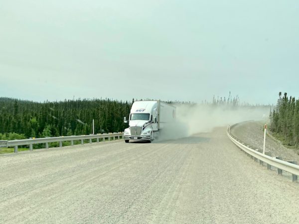
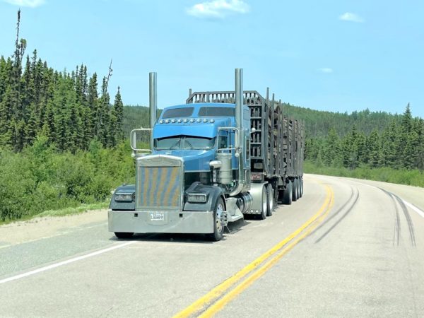
Quebec 389 is described as dangerous by public safety organizations, beautiful by tourism publications, and remote by both. It is unquestionably remote, winding its way through the boreal forest 547 km/340 miles from Baie Comeau on the St Lawrence River, past a series of ‘Manic’ dams owned by Hydro-Quebec (Manic-1 through Manic-5, all named after Lake Manicoualan which they hold back) and multiple open pit mines on the way to Fermont (French for Iron Mountain). There are 2 tiny settlements and 3 fuel stations along the way. There’s cell coverage at the fuel stations. For safety, there are 10 good, old-fashioned telephone booths spread out along the road (more than remain in the entire state of Vermont) for anyone who’s stranded. It’s the only road north from the Côte Nord/North Coast of Quebec and, once connected to the Trans-Labrador Highway, allowed for overland passage to the coast of Labrador. But that’s getting ahead of ourselves.
Baie Comeau, about 2 hours north of Tadoussac on the St Lawrence River, is a base town for several companies with large operations to the north. Key employers are Abitibi Consolidated pulp and paper company, Hydro-Quebec energy, Alcoa Aluminum and Cargill (grain transfer to the great lakes). Neighborhoods of tidy, apartment complexes are spread throughout the town. It’s also a perfect reprovisioning spot before heading out into the wilderness and the site of the quietest Walmart we’ve ever visited overnight.
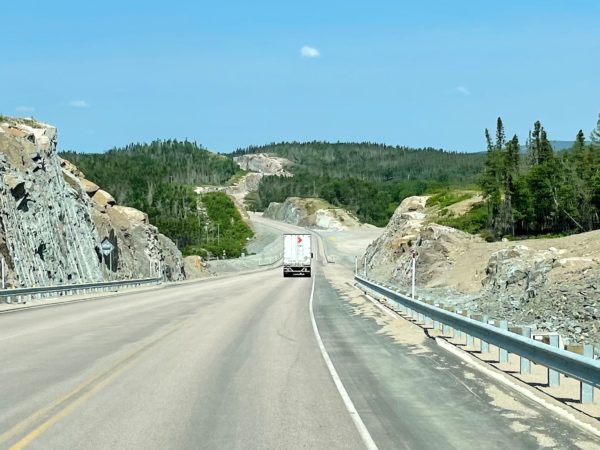
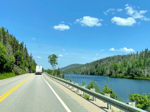
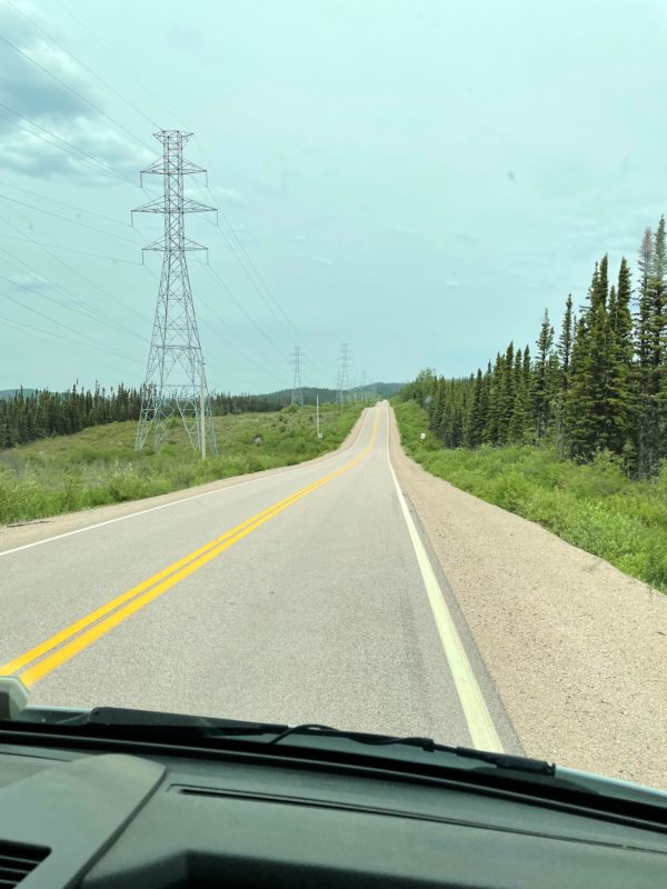
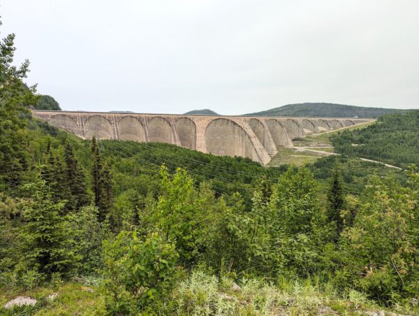
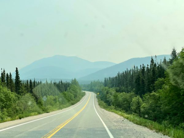
The southern end of Quebec 389 features dramatic curves carved through mountains before settling into rolling hills, often alongside rivers and lakes. The route is never far from Hydro-Quebec transmission lines. We got a glimpse of the Manic 2 dam as we passed, along with a tiny settlement/work camp at Relais Manic-Outards. The curve in the road just before Manic 5 stopped us in our tracks. Manic-cinq/Manic 5 is the largest arch-construction dam in the world, and it seems to just rise up from the road. A series of super-steep, switchbacked grades got us up and over the dam as we continued our way north.
We’d planned to spend the night at Relais Gabriel, another tiny settlement/work camp with a restaurant and RV parking roughly halfway between Baie Comeau and Fermont. We also knew it would be walking distance from Lake Manicouagan, the most awesomely weirdest thing you can’t photograph. We first noticed it on the map.
Me: Check this out! Gotta be man made…
Doug: Meteorite.
Me: Naw, really?
Wikepedia: Meteorite.
Really. You can check it out on google maps. It’s often called the ‘eye of Quebec.’
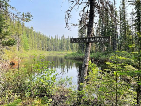
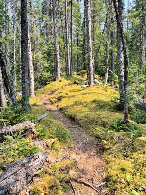
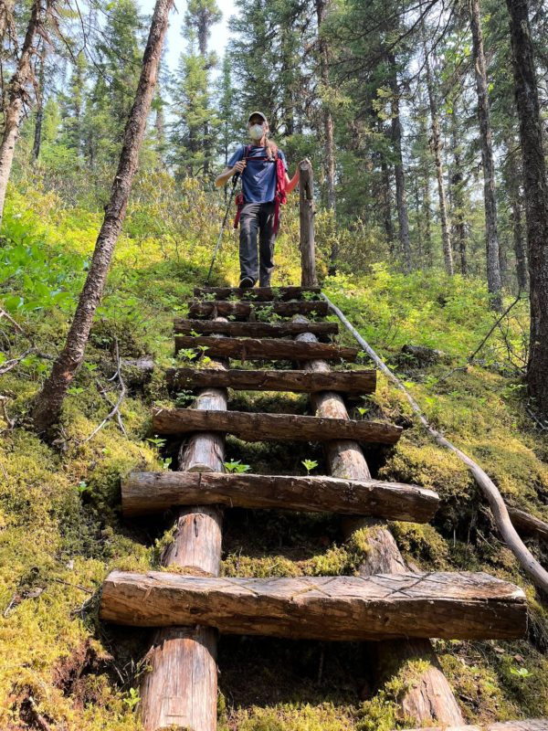
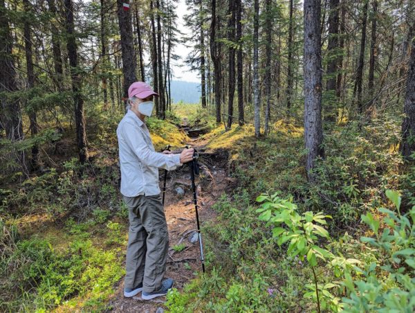
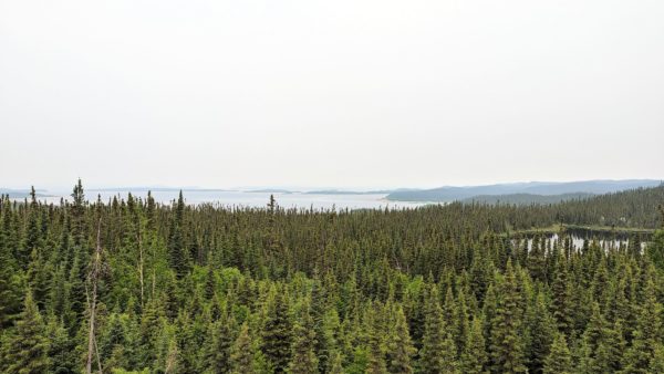
Just north of Relais Gabriel are the Groulx Mountains. As an early season/soon after ankle rehab hike, we chose the lowest peak with the shortest, least aggressive trail description. Though we didn’t get to the summit (and a potential view of the lake), we did throroughly enjoy a hike along the Harfang river through gorgeous moss-covered woods.
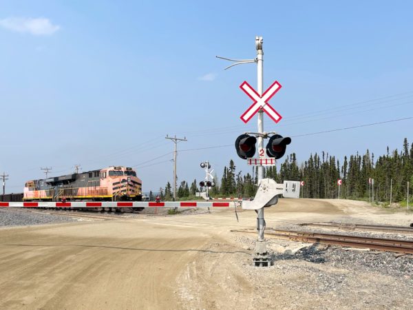
You’ll notice the N95 masks we’re wearing on the hike. Unfortunately wildfire smoke moved in and continued to worsen, blurring the mountain views of the northern end of 389. We passed through the ghost town of Gagnon and noticed truck traffic and train crossings picked up as we approached the Fire Lake Mine. From there, a gravel road took us alongside the Mont-Wright mine and into Fermont, Quebec.
Most towns and villages (ok, and cities, too) have commonalities, although each is unique. Fermont (pop ~2,6oo) is, well, extra unique. It brings the concept of company town to a whole different level.
When the mine at Gagnon played itself out, the company successfully sought a new source of iron mining at Mont-Wright, 200 km/120 miles to the north. Many of the miners from Gagnon agreed to move in support of the new mine, dismantling Gagnon on the way out of town. Needing all these miners and more, then Quebec Cartier (after several ownership transfers, now ArcelorMittal) built the town of Fermont in 1970-74. To attract workers to this small town in the isolated nordic north of Quebec, no efforts were spared to make the town a great place to live and to create a sense of community while dealing with the subarctic cold.
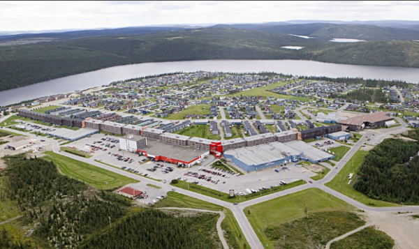
Architects Norbert Schoenauer and Maurice Desnoyers were hired to plan the town. To deal with the climate, they designed and built the Mur-eclan (Wall-screen). It’s a building that is 1.3 km/0.8 miles long and shaped like an arrow head pointing north north west. At 5 stories in the center and 3 on the ends, it’s designed to block the fierce artic winds of the area and create a micro climate in its lee side. It originally housed 500 apartments (~400 now) as well as the commercial district of the town (stores, restaurants, bars, post office, hair salon, etc.), the town hall and police station, library and school. Oh, and an arena, swimming pool and hotel. And covered parking garage. You never have to go outside! (Unless you need to go to work in the mine…) In the shadow of the building are other apartments and about 750 single family homes reserved for workers with children. Most structures were pre-fabricated and carried in on trucks.
Being in such a remote area, attention was paid to making the town a safe place to live. All intersections in town are 3-way and there are no structures on any street corners to block sight lines in an effort to reduce motor vehicle accidents, especially in winter. Houses are designed with the shortest possible driveways in order to minimize the need for snow plowing. All residences are owned by the mining company. Subsidized rent is withdrawn from paychecks of the miners (did I mention this is a company town?). When an employee stops working at the mine for any reason – job change, illness, death, retirement – the apartment/house must be vacated.
Finally, the town could have been closer to the mines. However, the site was purposely chosen to be closer to Labrador City, NL, providing additional neighbors and resources for the new residents.
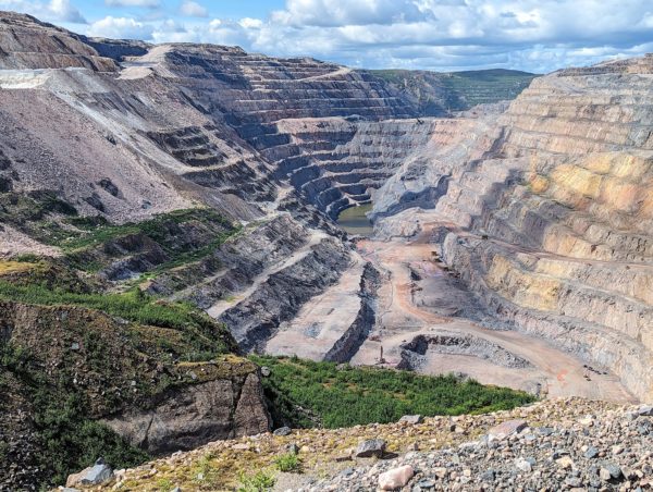
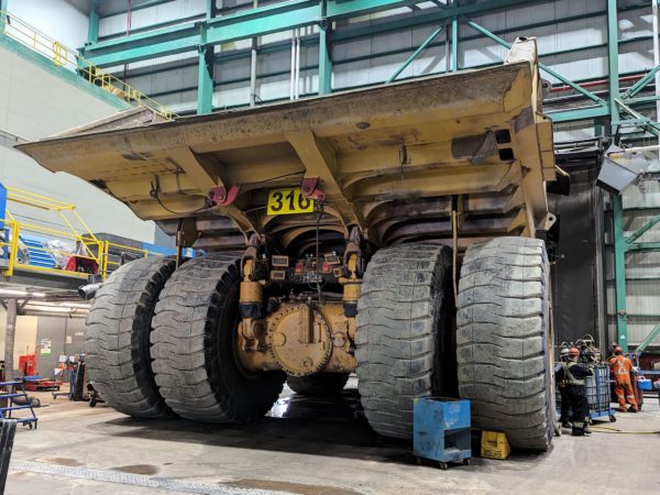
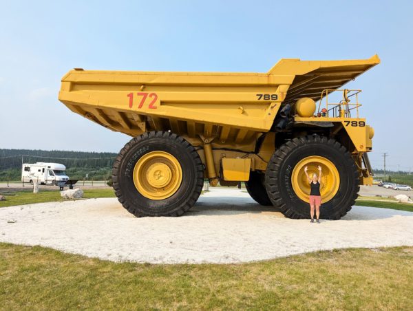
No visit to Fermont would be complete without a tour of the Mont-Wright mine owned and operated by ArcelorMittal. It’s the largest iron ore mining and processing company in Canada. With its 1000 employees, the company annually produces 26 million tons of the highest quality iron ore concentrate and pellets in Canada, shipped through its private port on the St Lawrence to 4 continents. It also boasts a dedication to safety and sustainable mining practices. Our tour guide spoke nearly no English and in his excitement to describe these practices, his French was quite fast – a little too fast for us to follow – but we could see what was going on around us. In comparison to other mines we’ve seen or visited in Alaska and a few other northern Canada towns, the sheer size of the Mont-Wright mine, its crushing and concentrating process, even the equipment maintenance facilites, was mind-blowing.
Much appreciation to Jennifer at the Tourism Center in Fermont for answering so many of my questions and sharing so many stories on my 3 visits.
For anyone who’s interested, more 389 south, 389 north, Fermont and Mont-Wright mine pix…
Bravo ma petite cousine, je suis fière de toi,
Quel blog intéressant!
Je vous lis et je vais continuer à le faire, c’est formidable!
Bonjour Suzanne! Merci! Et, je suis content que tu l’aime!