
The history of Newfoundland and Labrador is long and colorful. Here’s the super condensed version…. The earliest known inhabitants were Inuit (hunters of sub-arctic sea mammals, like whales), Innu (caribou hunters) and Mi’kmaq (seafood harvesters in the summer and forest hunters in the winter). The earliest European settlers are thought to have been Vikings, just after 1000 AD. Starting in the early 15oo’s, explorers from France, Spain, Portugal, Ireland, and England began to visit. Eventually, these folks came to be in conflict with each other and the original inhabitants in their efforts to claim portions of the newly found land in order to control resources. Perhaps the most immediately obvious of these resources was an insane abundance of great fishing. Over the centuries since, additional resources of interest have been identified all over this vast area and have included furs, forests, minerals (iron ore), and hydropower.
Although control of Newfoundland and Labrador varied over the years, it was its own governing entity – initially called the Dominion of Newfoundland – from the early 1900’s. WWI and the great depression left the small colony in dire straights. Britain temporarily regained control of Newfoundland to help keep the country solvent until another tremendous resource was identified during WWII – location, location, location.
Airports were built in Goose Bay, Labrador and Gander, Newfoundland (goose and gander- was that done on purpose? Seems like it must have been, but I haven’t found anything about it. LMK if you do!) Both were in strategic locations, near the Great Circle (shortest flying distance between New York and London) and facilitated by the jet stream, to ferry planes from the US and Canada to the UK, as well as to serve as refueling stops enroute to and from Europe. Both towns flourished. By 1949, Newfoundland and Labrador became a province in Canada.
We’re getting ahead of ourselves again… First, we need to get ourselves across Labrador, starting in Labrador City, just over the border with Quebec.
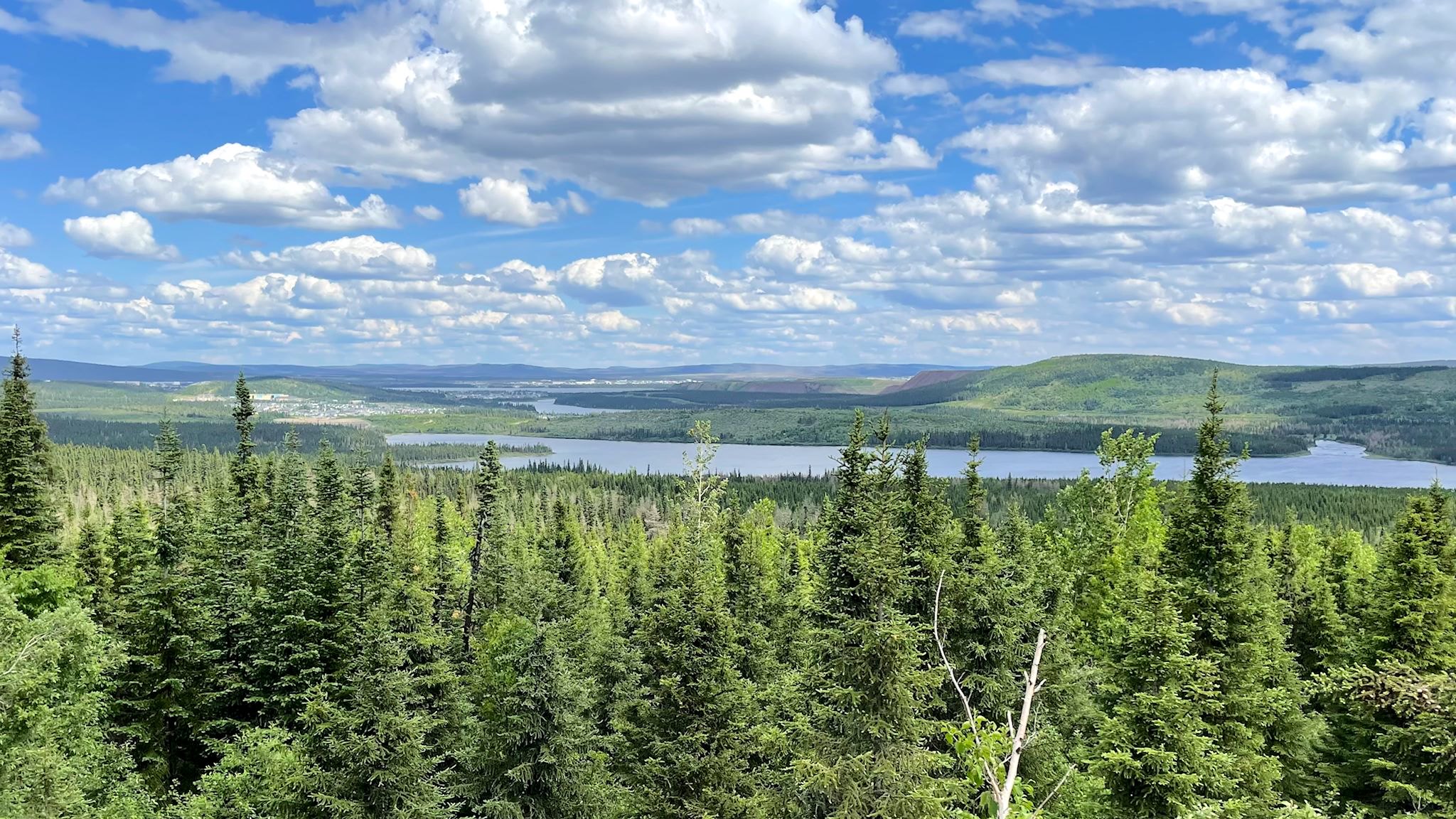
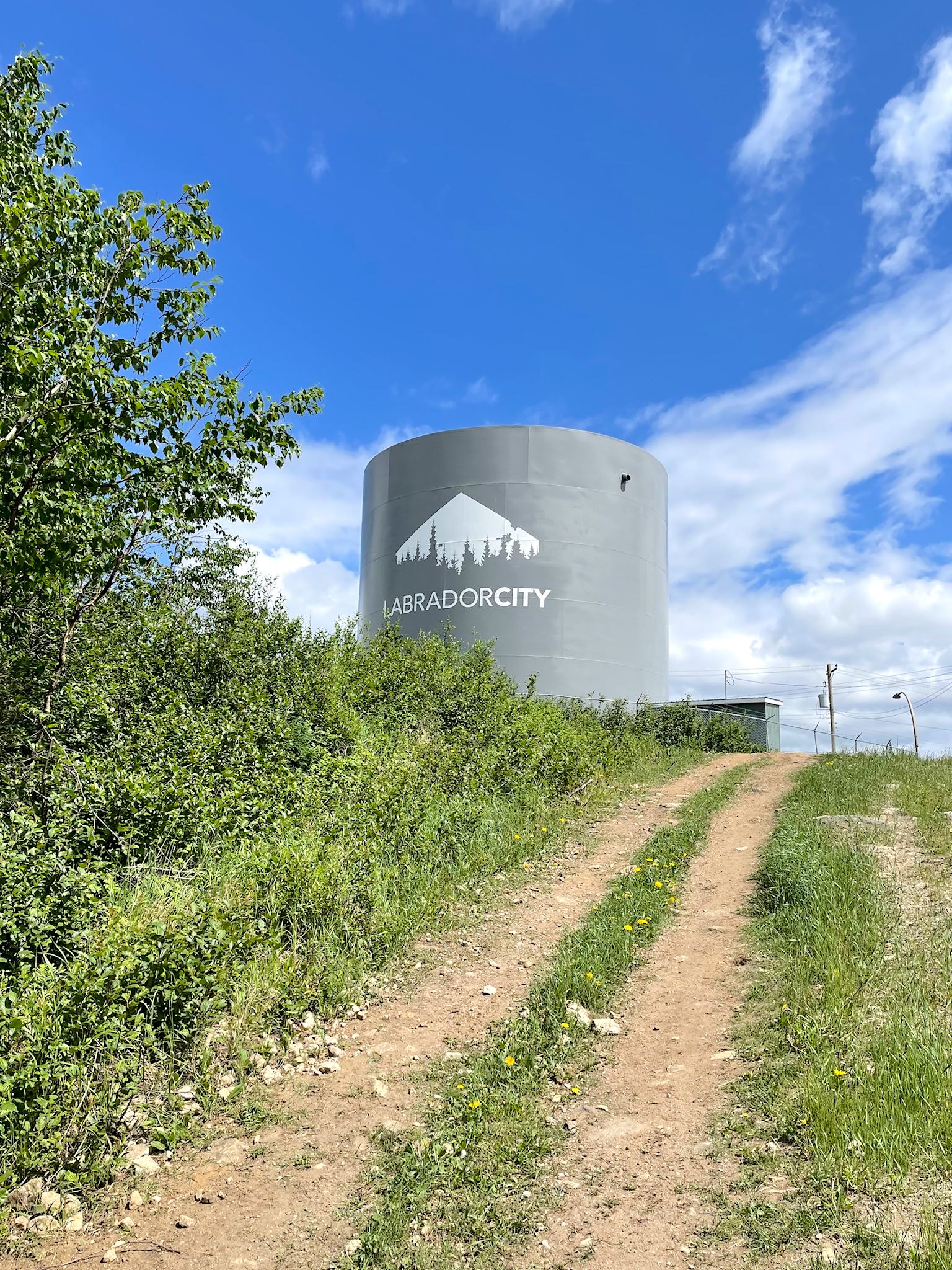
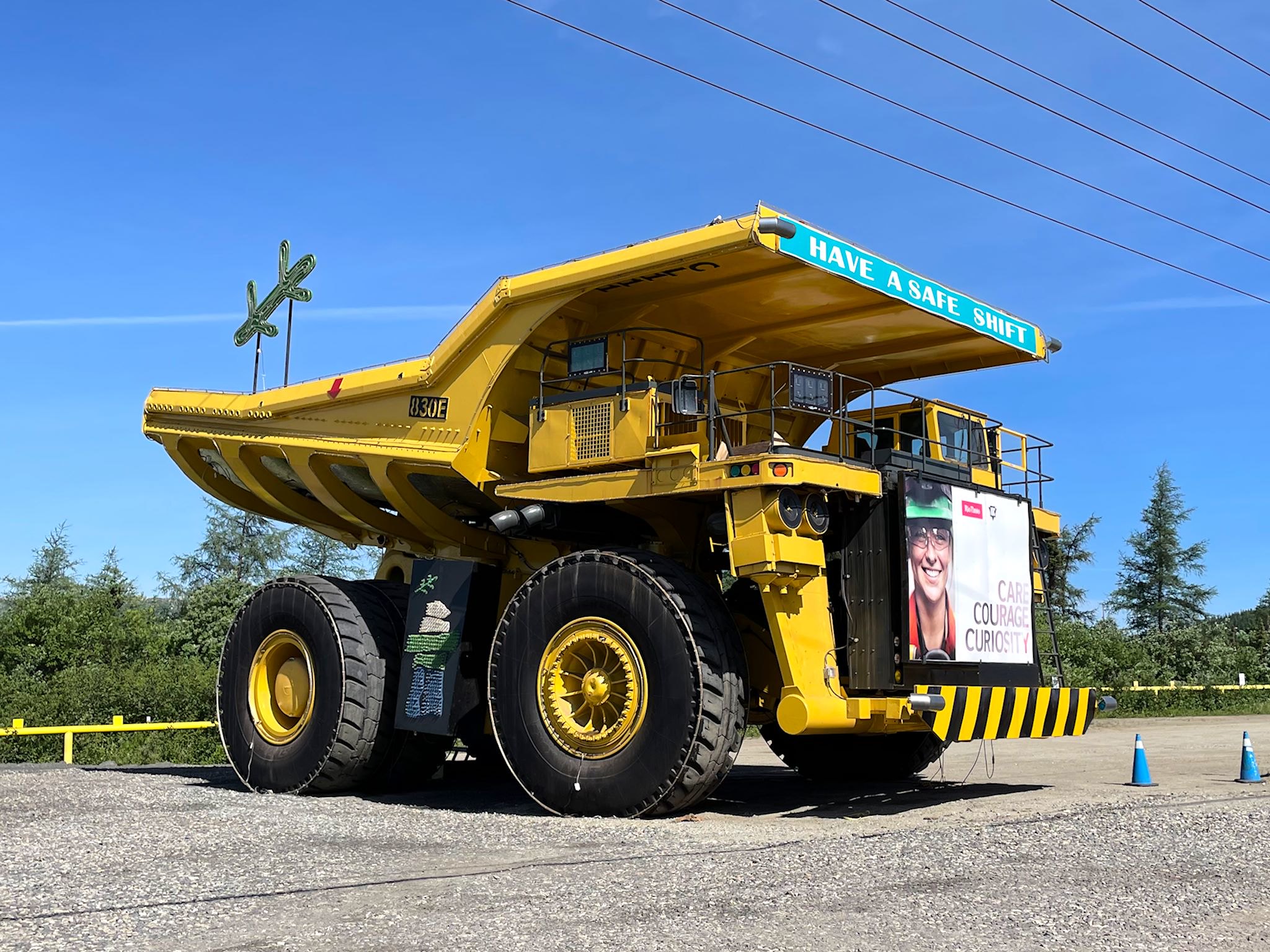
Just a few minutes outside of Fermont, Quebec 389 becomes Newfoundland and Labrador 500, aka the Trans-Labrador Highway (TLH). Labrador City was our first stop, just 30 minutes away. With a population of ~8000, it’s one of the two largest population centers in Labrador (Happy Valley-Goose Bay is the other). Rio Tinto operates the iron ore mine that is the town’s major employer. Company housing is notable throughout the town, though unlike some others we’ve visited there appears to be room for some independent businesses to support the residents as well as provide services, and it is not strictly a ‘company town.’ The town is diverse with people, many indigenous and many hailing from all over Canada as well as other parts of the world, and hosts a wide array of services such as shopping areas, restaurants, car dealerships and the Two-Season Hotel (presumably Winter and Mosquito). In Lab City we stopped at our first traffic signal in almost 600 km/380 miles.
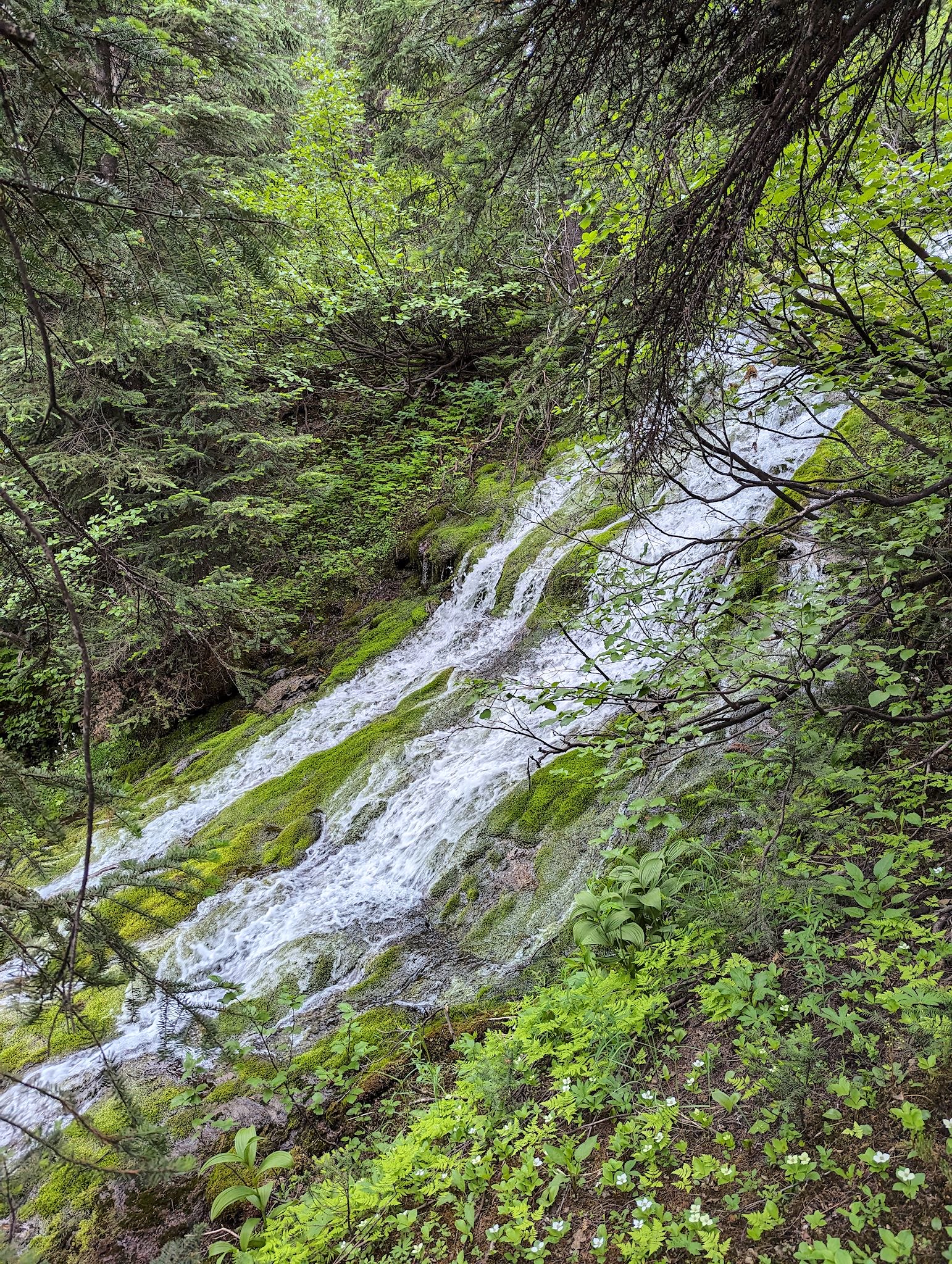
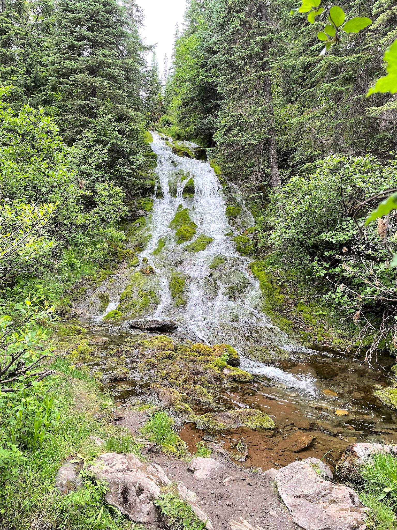
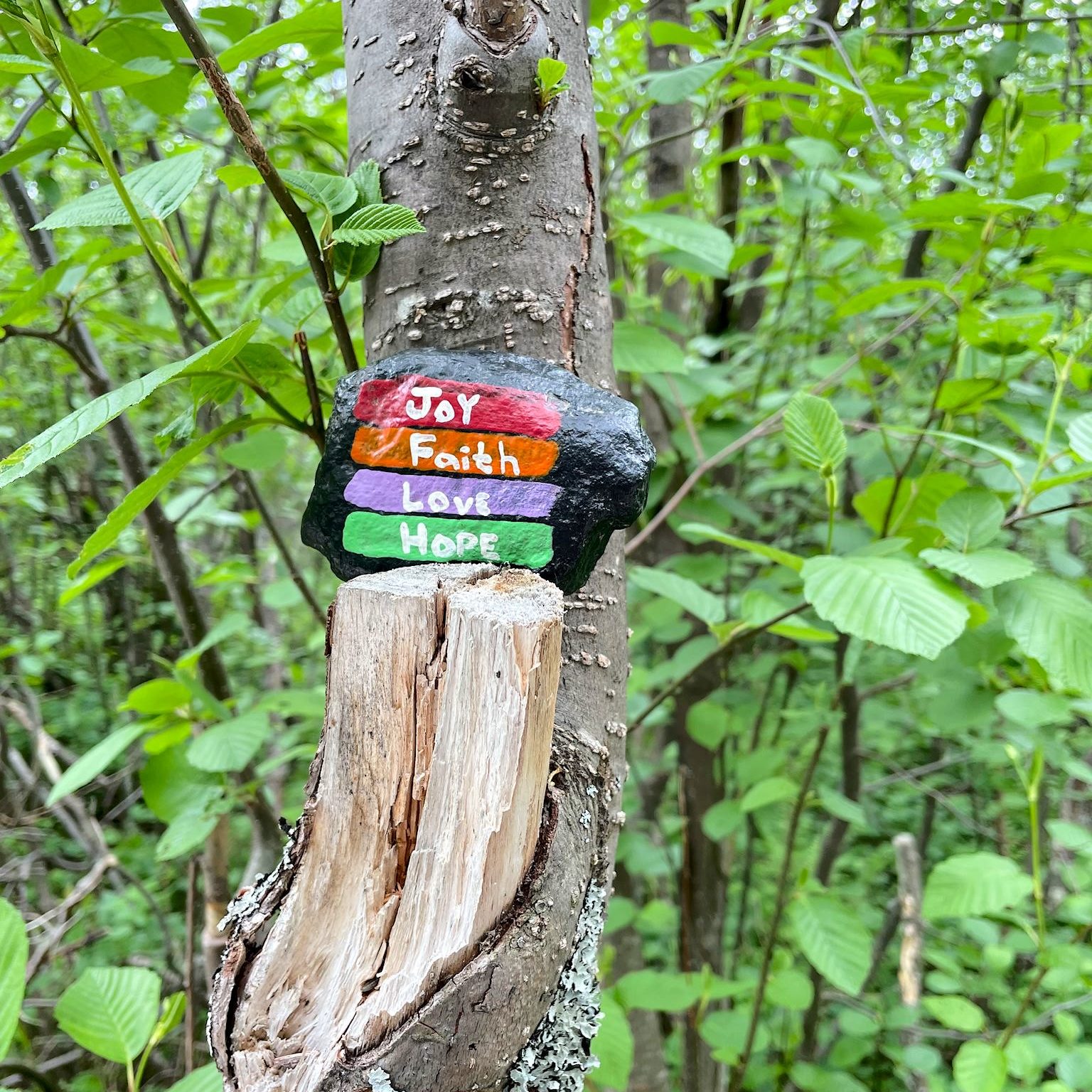
Like most towns in the arctic north, sports, particularly winter sports, are a big attraction – hockey, curling, snowmobiling, ice fishing, and skiing (both alpine and nordic). Fortunately for us, the Bill Koch (a Vermonter!) designed trails at Menihek Nordic Ski area are open for hiking in the summer. We enjoyed the waterfall hike at the Nordic ski area, as well as the Crystal Falls hike just on the outskirts of town.
The Gateway Center Visitor Center houses the Ed Montague Exhibit Hall which depicts the settlement history of West Labrador. As a bonus, the Visitor Center offers overnight RV parking, and the helpful staff was able to give us a heads-up on a few hiking opportunities to come as we made our way east.
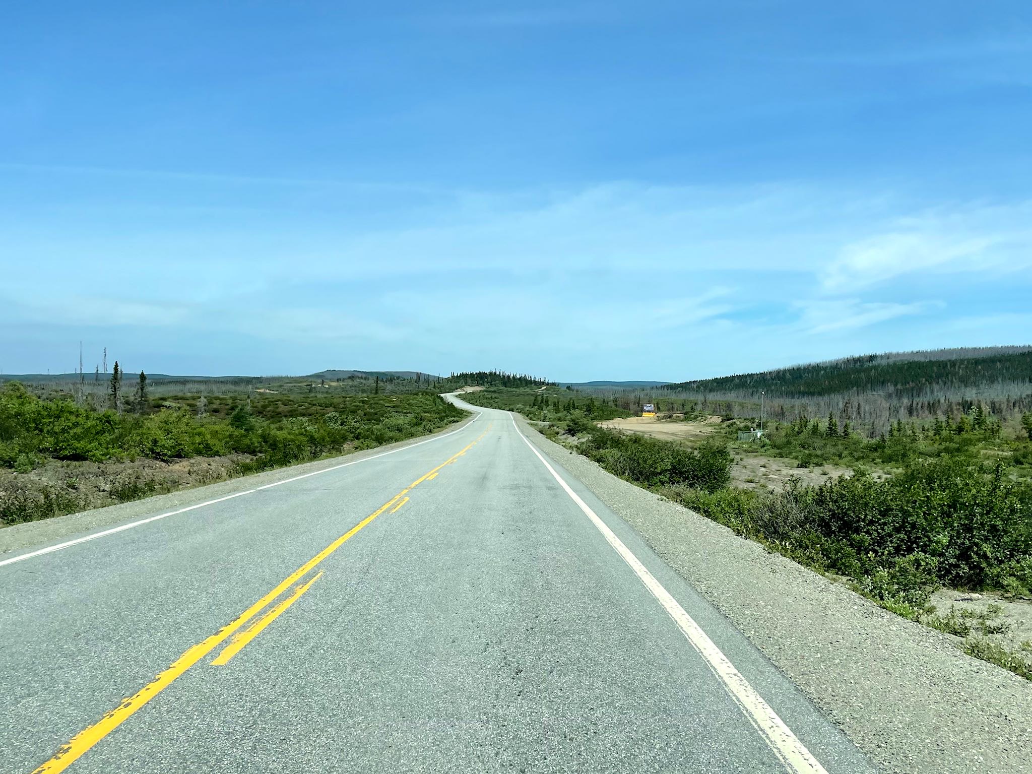
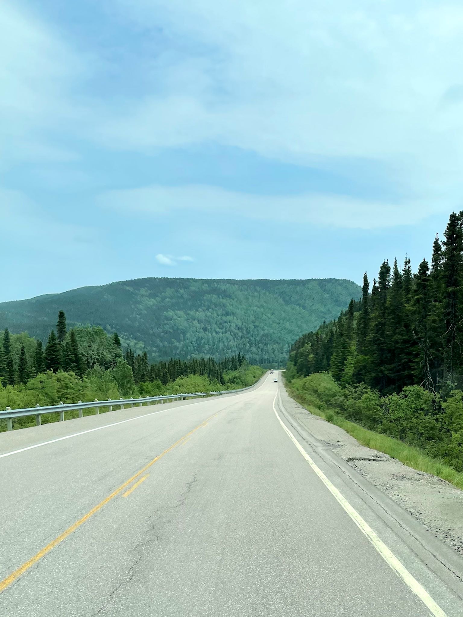
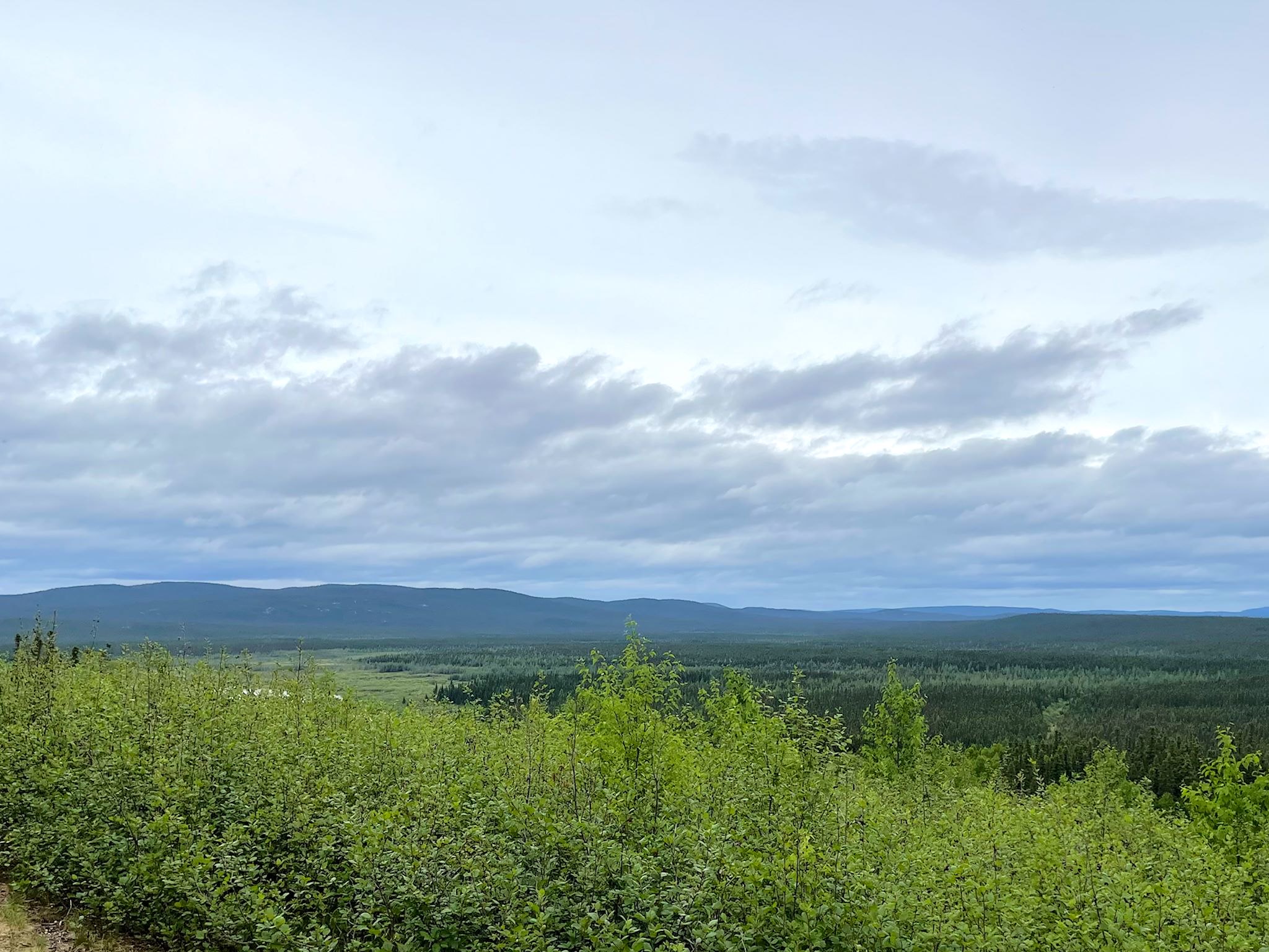
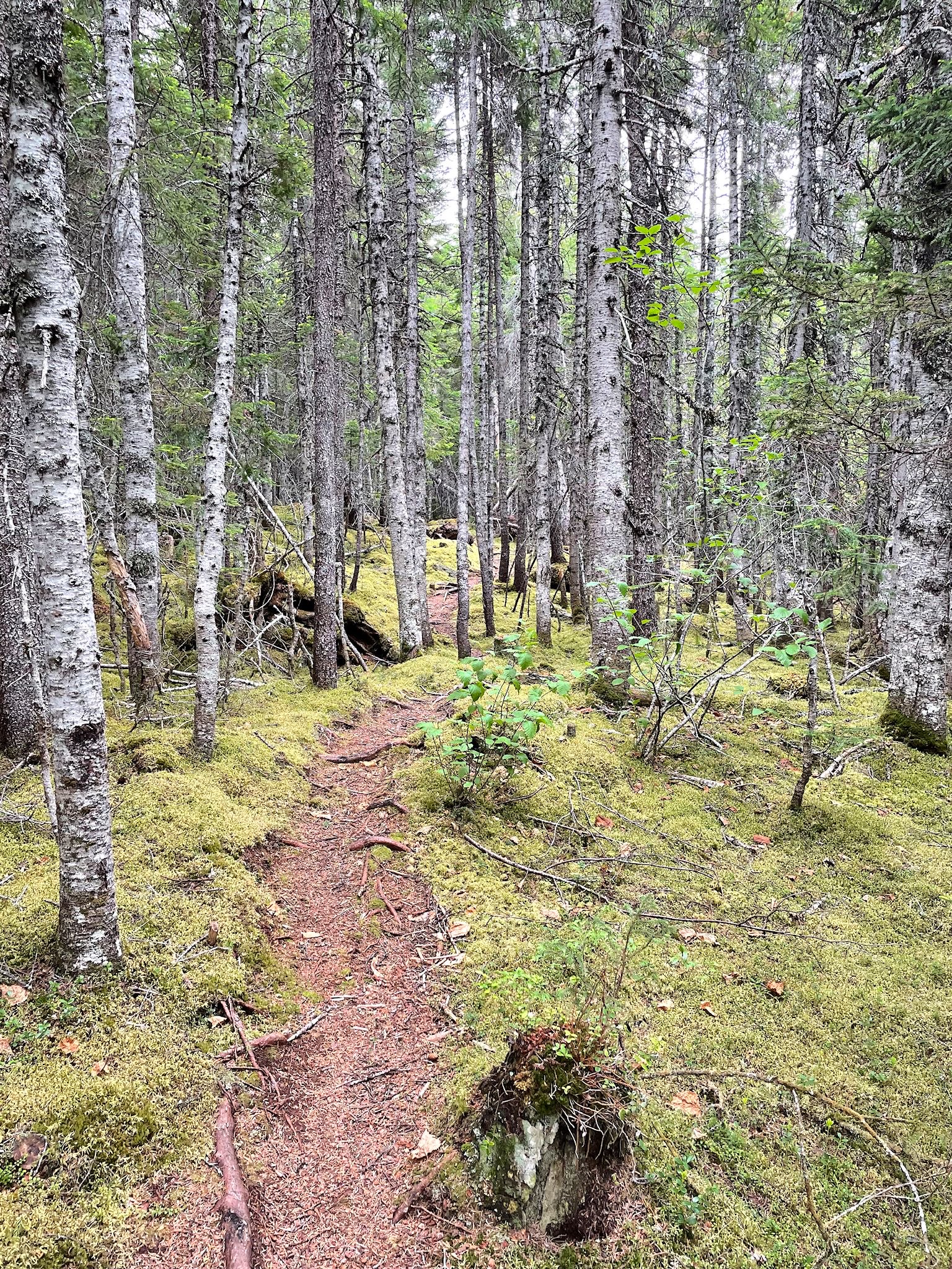
The TLH continues to run through a boreal forest across Labrador between the 52nd and 53rd parallels. Finding options for hiking are critical since you can’t just walk into a boreal forest. The ground is mostly spongy expanses of damp moss studded with tall, thin trees and surrounding anything from small, shallow bodies of water to giant lakes, with intermittent rocky spots or rivers. Leaving Labrador City, the road rolls through the forest, becoming a bit more mountainous as we traveled east.
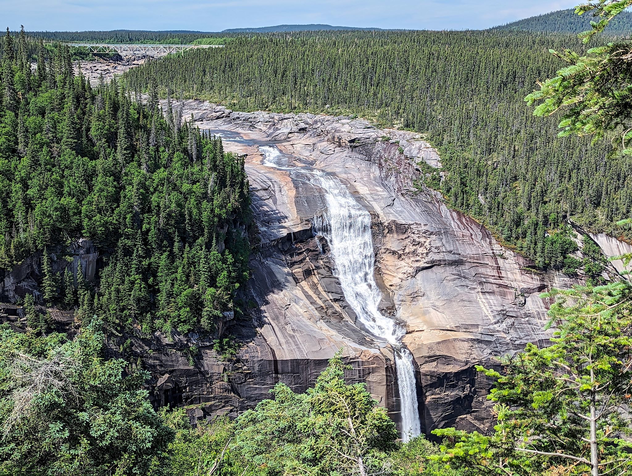
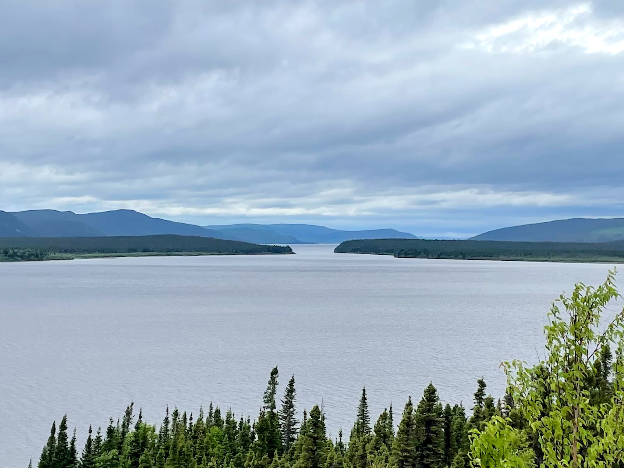
We had been told the prettiest hike would be just west of Churchill Falls. We agree with the descriptor! The hike initially followed along the Churchill River, as it reached a cliff with views down the Bowdoin Canyon. Further along the river, views opened up to the beautiful Hamilton Falls.

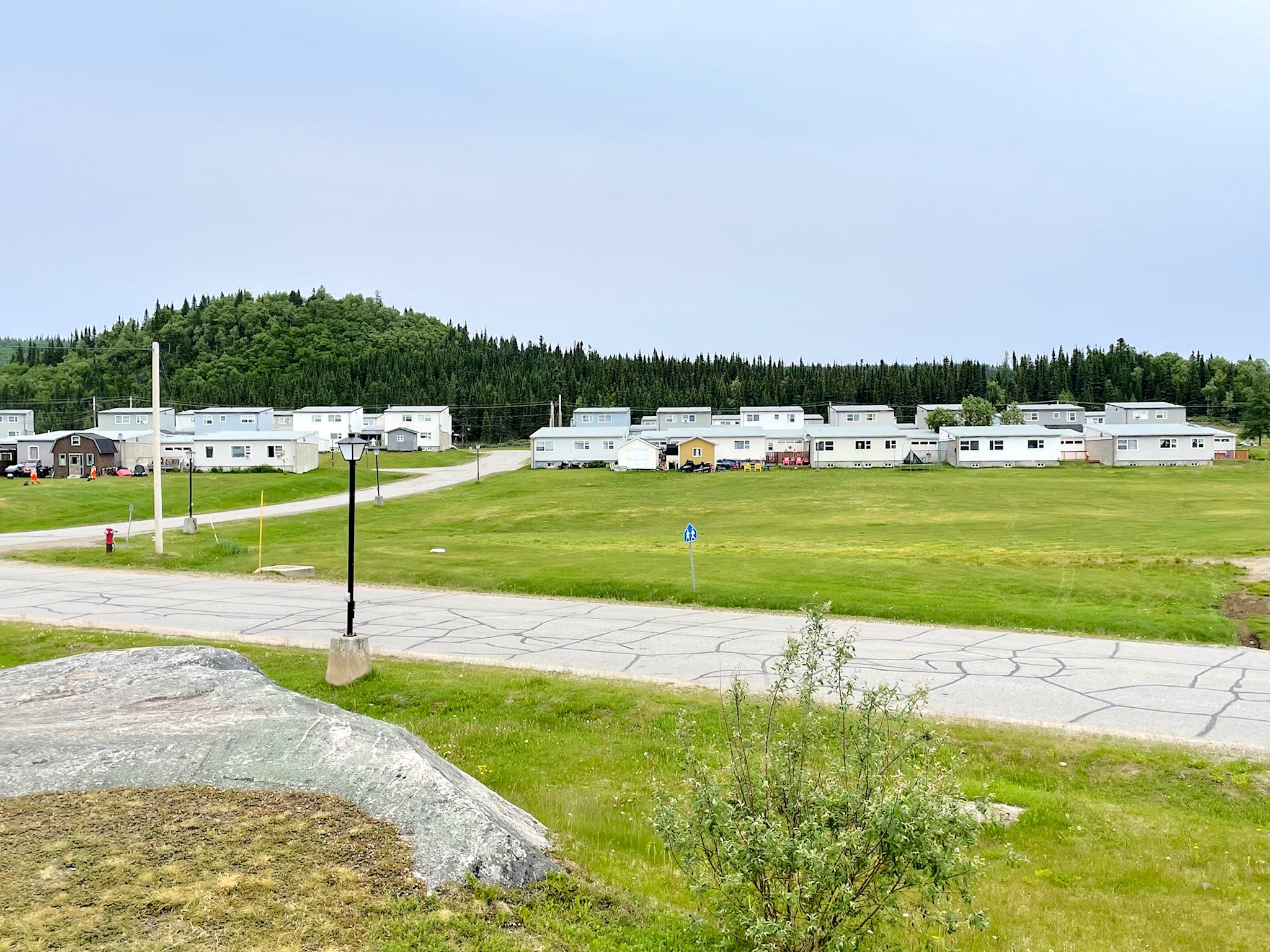
Churchill Falls, pop 650, is truly a company town. The company is Nalcor Energy. Everyone in the town works for the company and lives in a company dwelling. If you leave the company for any reason, you will leave the town. The only exception is if you work for the single commercial business in town, which is the hotel/restaurant run by a contractor. The town’s coolest feature is the Town Centre which is housed in a colorful building that looks like a huge set of blocks. Small pre-fab houses and a few apartment buildings, all lighter shades of beige, blue or gray, are scattered in neat, friendly neighborhoods around town. From across town, every house (and RV visitor) can see the multi-colored, modern building that houses the entire commercial district, as well as the town hall, school, library, grocery store, hotel, restaurant – not to mention (of course) curling rink, gym and swimming pool.
We did breakfast at the restaurant in this all-in-one establishment. In addition to enjoying our breakfast, we loved hearing more about the town from the staff. They enjoyed the snowmobiling in winter despite temps that fall to about -60 celsius. We asked about things to visit. Laughter. No, was all they said. OK, unless you want to hike to Bowdoin Canyon.
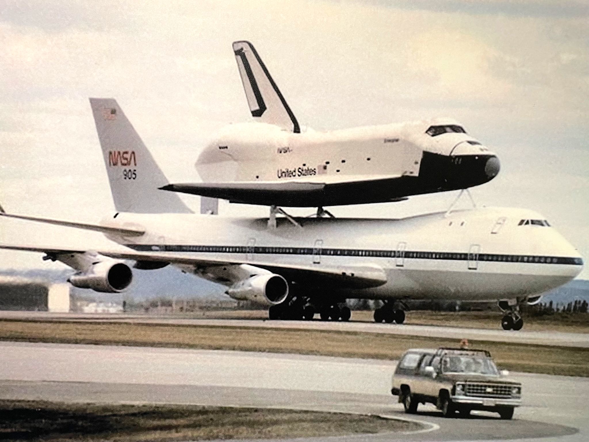
Another 3 hours down the road, we stopped in Happy Valley-Goose Bay – pop ~8000 (similar to Lab City). Initially, we were amazed by the traffic! Then we realized there was only one road through town. HV-GB is essentially a one industry town – transportation in 2023. By the end of WWII it was the largest air base in North America. Following the War, it continued to be used by Canadians, Americans and the British for low altitude flight training, as well as for surveillance during the Cold War. Defense aircraft were on base ready to intercept any enemy aircraft and to maintain threats against the enemy. Although the size of the base has reduced since the end of the Cold War, its civilian services have expanded with a larger role in search and rescue, transporting people and supplies to mining operations further north, and providing links to smaller indigenous communities deep in north Labrador previously accessible only by kayak or dog sled.
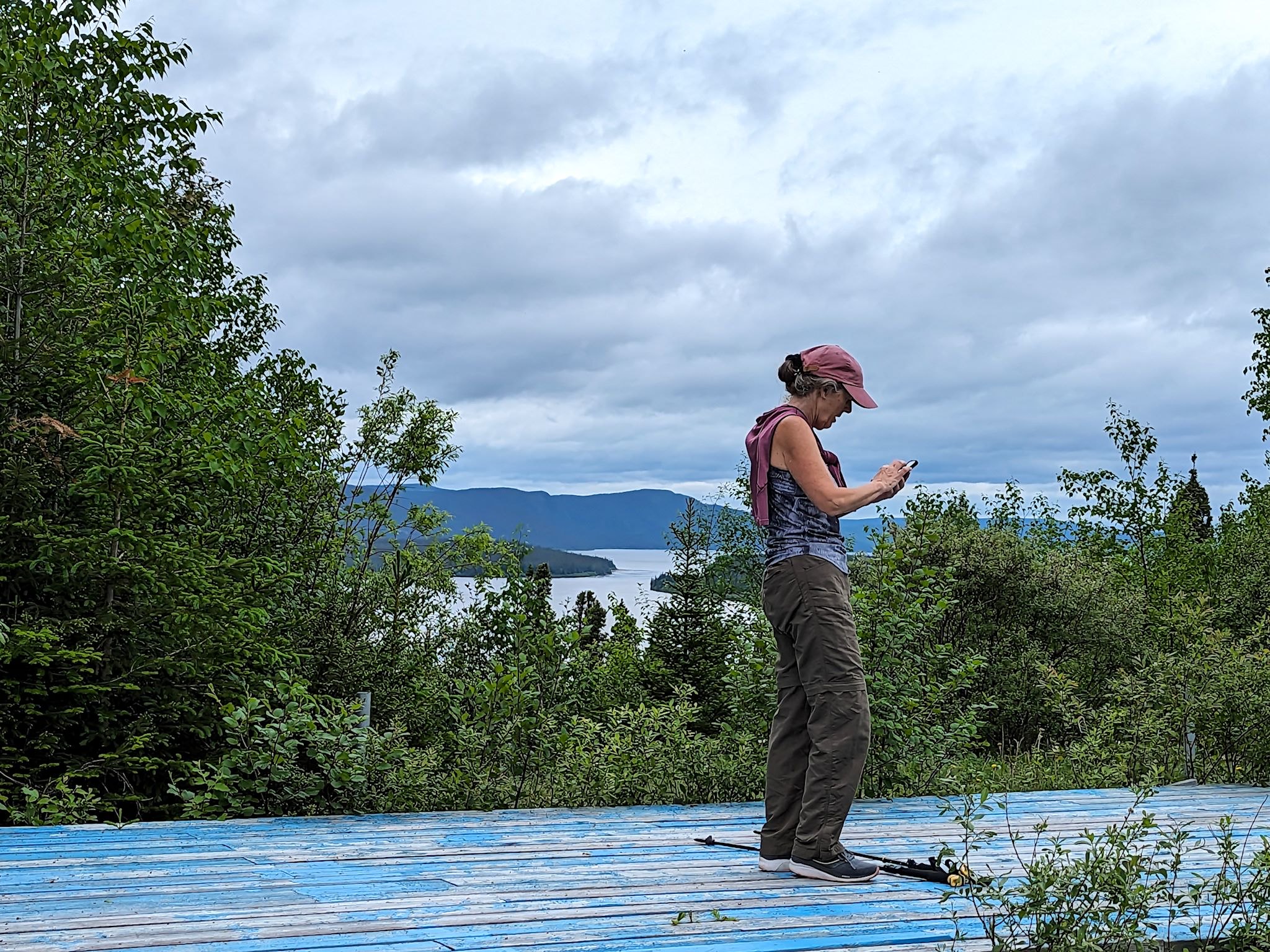
We made stops at the Labrador Military Museum on the air base, as well as at the Labrador Interpretation Centre in the tiny community of Northwest River. Both were low-key, well laid out, and fascinating. The staff at the Interprestive Center suggested we would enjoy a short trail to Sunday Hill Park, where we would find inspiring views of Grand Lake to the west, mountains to the north and Lake Melville to the east. Inspiring views, indeed!
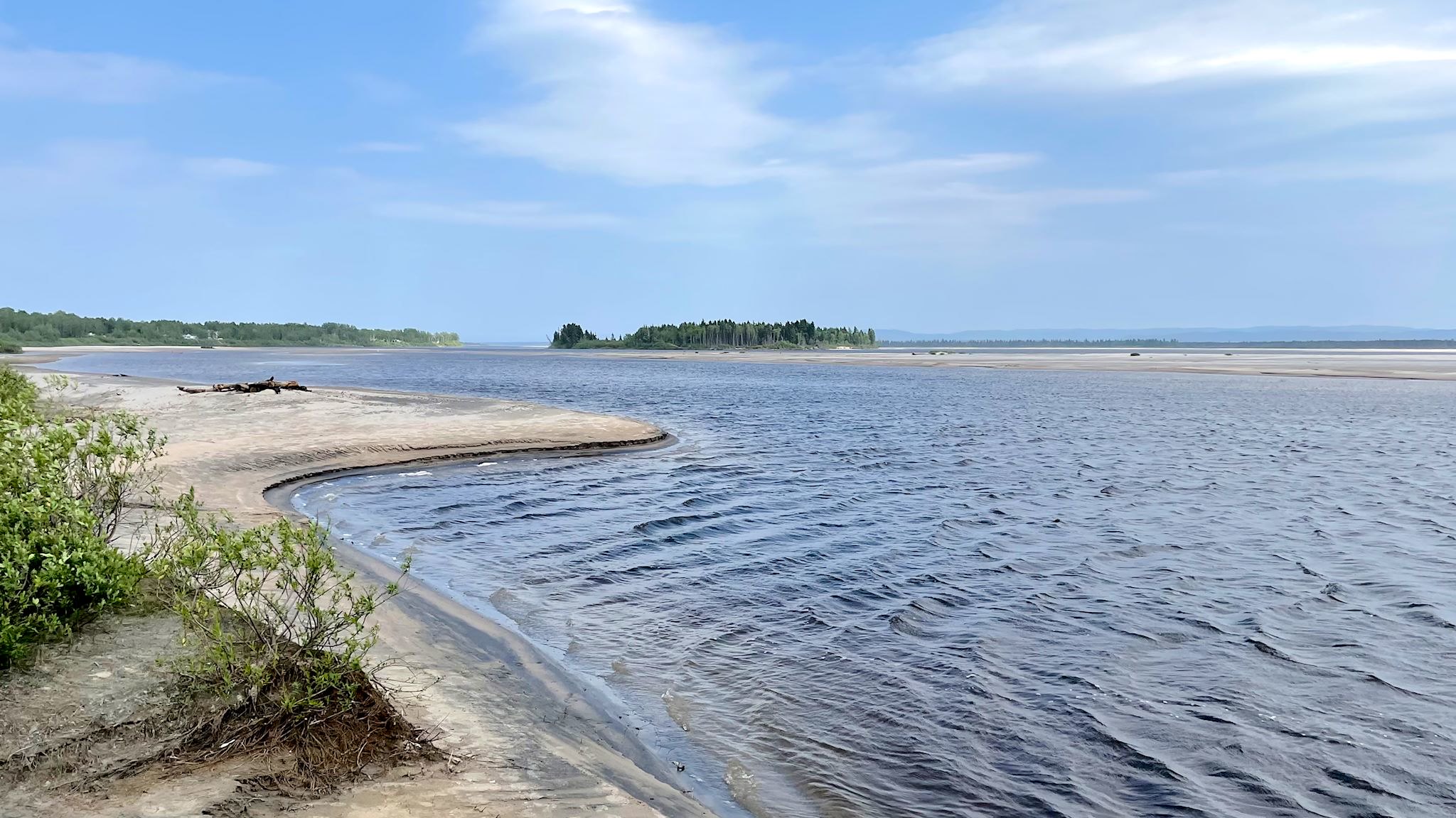
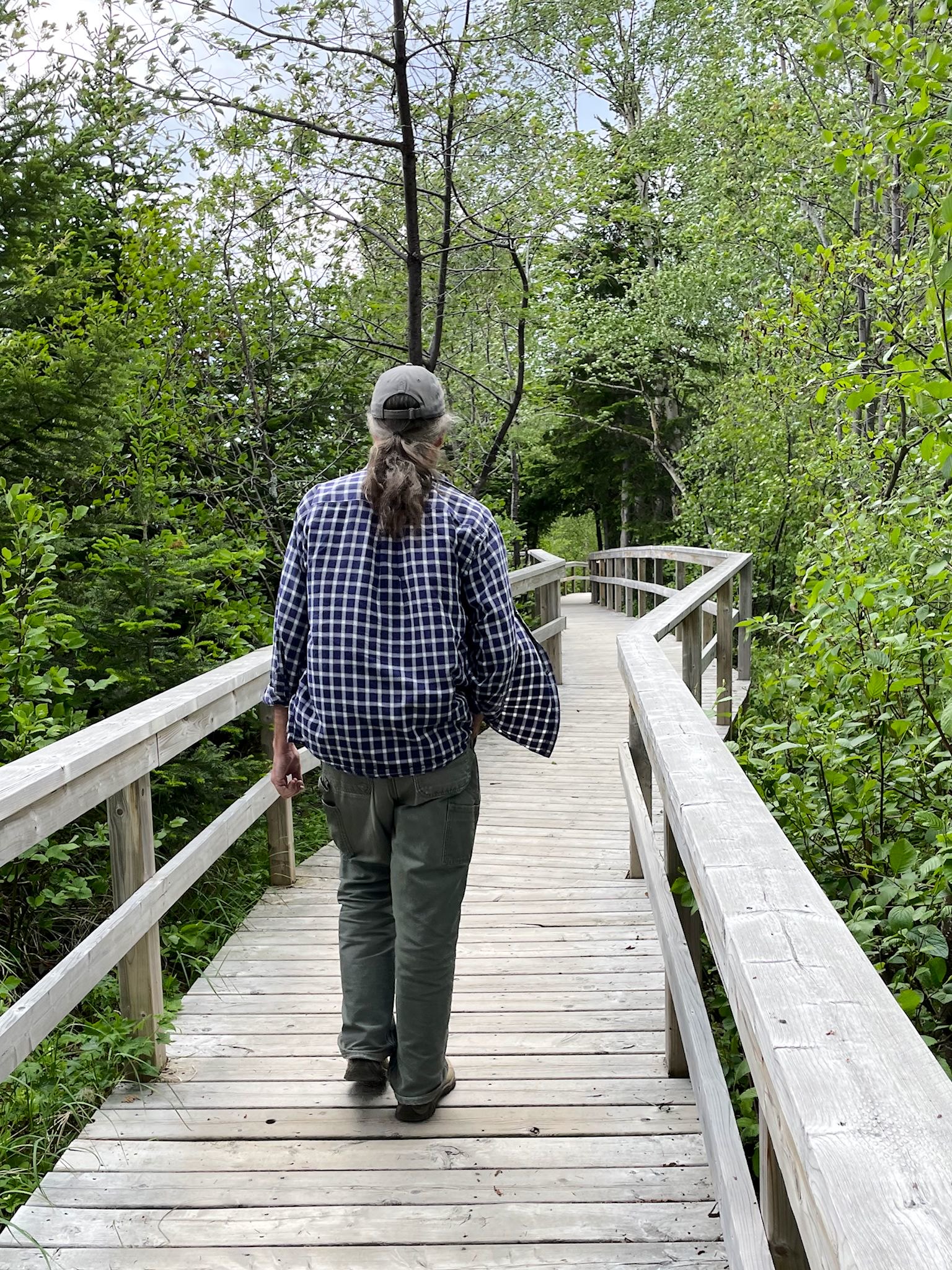
Right in town, we found the Birch Island conservation area with 5 km of boardwalk trails along the mouth of the wide, sandy Churchill River and through a picturesque bog with water flowers, grasses and baby ducks (and their mom).
It was also notable to see something we hadn’t seen in over a week – other seniors! People actually retire and stay in HV-GB.
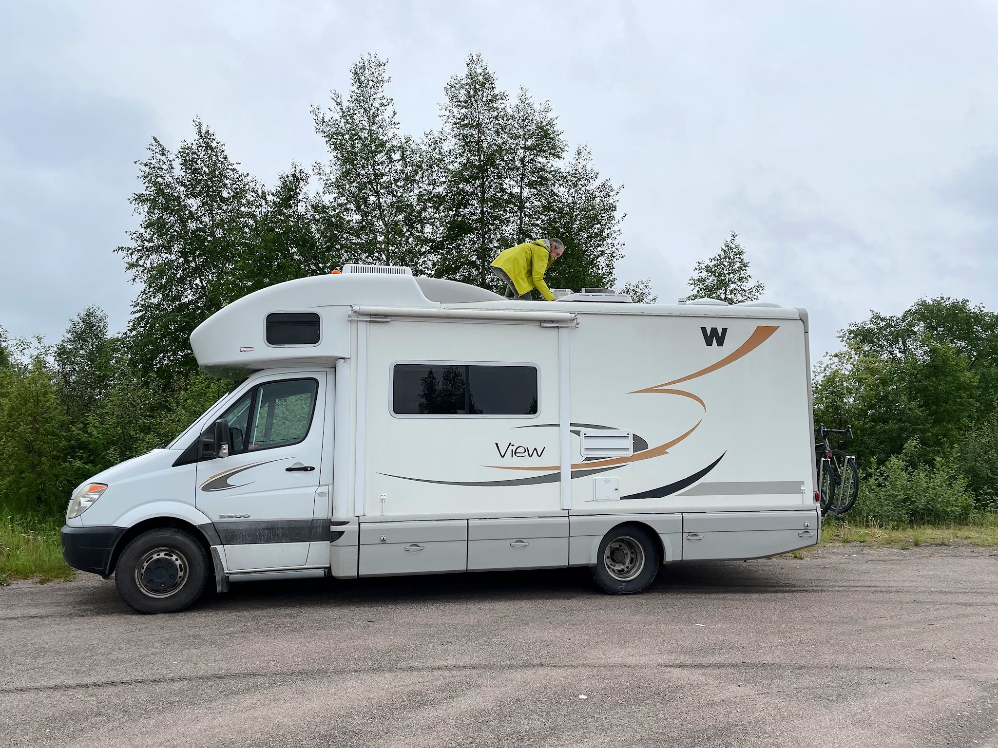
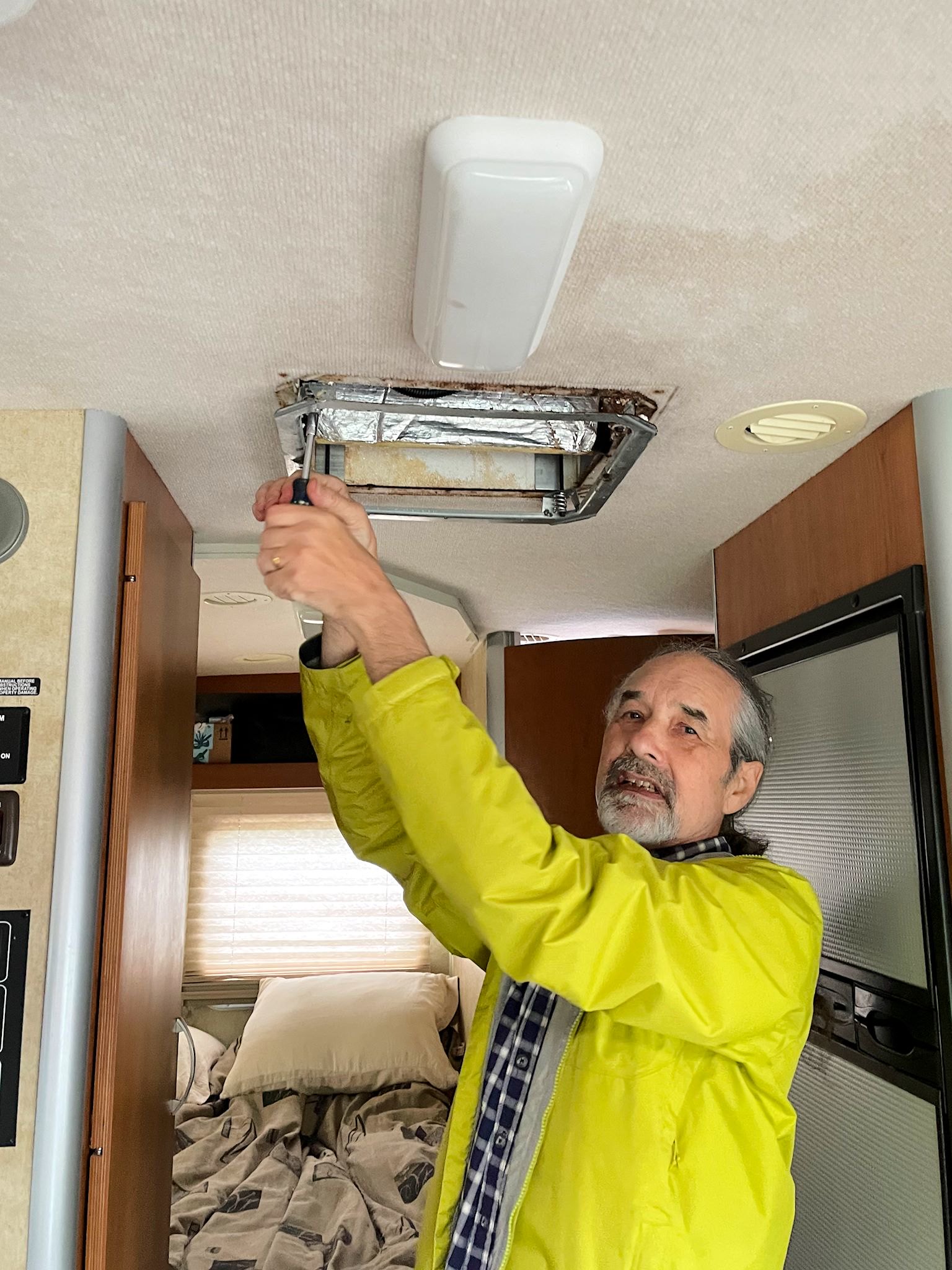
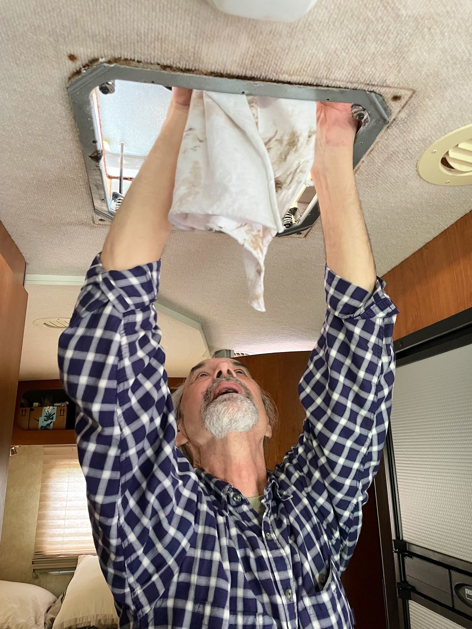
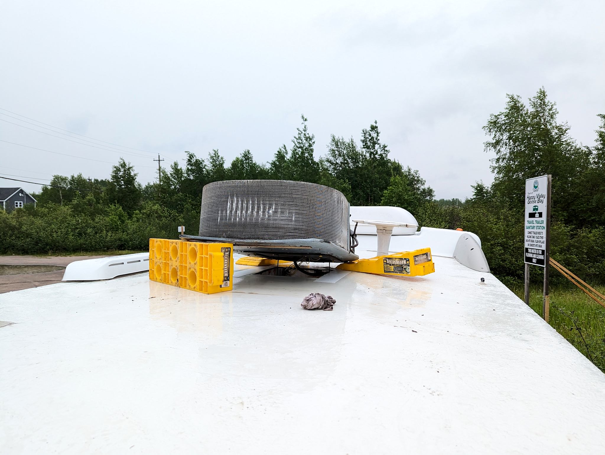
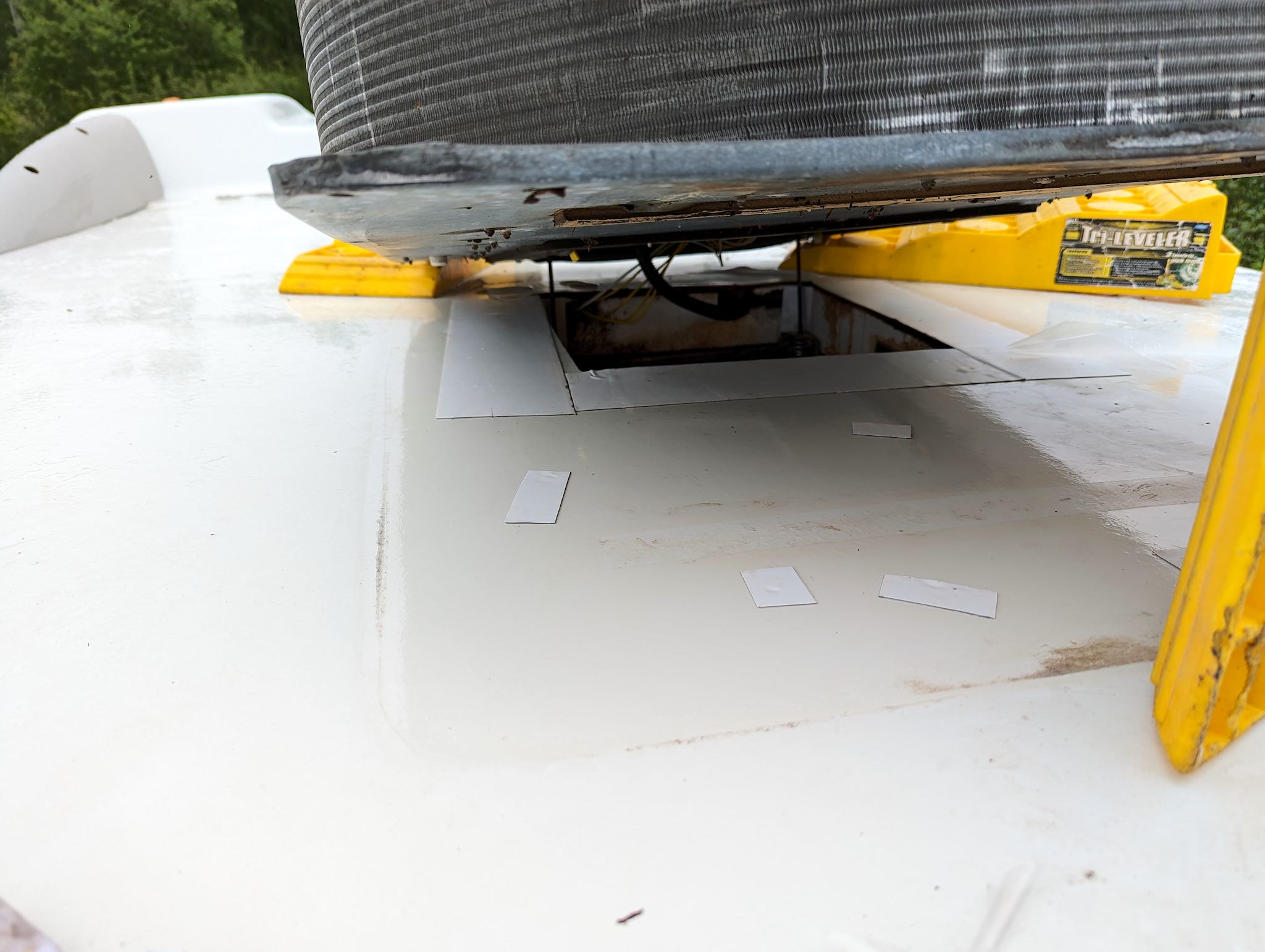
We hadn’t seen a lot of rain for quite a while – not since before the washboards of Quebec 389 that gave our rig a HUGE shaking, the likes of which we’ve only previously seen on the Dalton in AK. That night, we slept through and woke up to a heavy and persistent downpour – not to mention a leak in our roof where the air conditioning unit was apparently no longer hermetically secured. And it looked like it was going to rain all day. Frowny face. We called around town to find a high roof or an auto or truck repair business with a bay large enough for our RV so we could get out of the rain and address the leak. Everyone was friendly and helpful, and eventually we found a truck shop that had a bay open that would hold our RV, but not until the afternoon. We staged ourselves around the corner from the shop to wait. As the rain let up around lunch time, Doug started disassembling the rooftop air conditioner. More quickly than expected, he found the problem and came up with a fix that was doable with things we had on board, and fixed it right there. We think the leak is repaired – so far so good, anyway – and we’re optimistically awaiting the next heavy rain.
For anyone interested, here’re more Labrador City, Bowdoin Canyon, Churchill Falls, Scenes from the Road and Happy Valley-Goose Bay pix…
Addendum: After 2 days of relatively steady rain, no new leaks. We’re considering the AC leak repair a success!