
OK! Who wants to hear about our 1000-mile excursion out and back on a (mostly) great, (mostly) gravel road? It totally rocked!
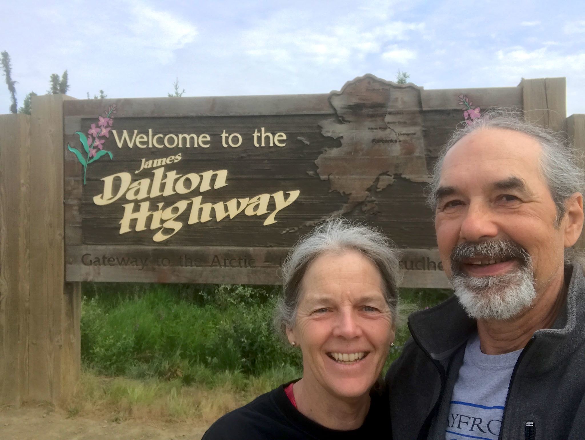
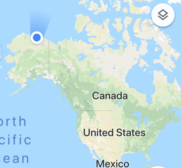
The James W. Dalton Highway, originally known as the North Slope Haul Road and now also known as Alaska Route 11, is the northernmost road in all of North America. It is one of the most remote roads in the US. We did some research before deciding to drive it. Guide books, including the Dalton Highway Visitor Guide, all mention the challenges of the drive and warn about rough gravel, no shoulders, steep grades, trucks, flat tires, broken windshields, breakdowns (and waiting for days for a tow truck), lack of services, no cell coverage, and that you could die. The Wikipedia entry: ‘Anyone embarking on a journey on the Dalton is encouraged to bring survival gear.’ We checked in again with Ed and A-J who drove the highway last year: ‘Yeah, you’ll love it!’

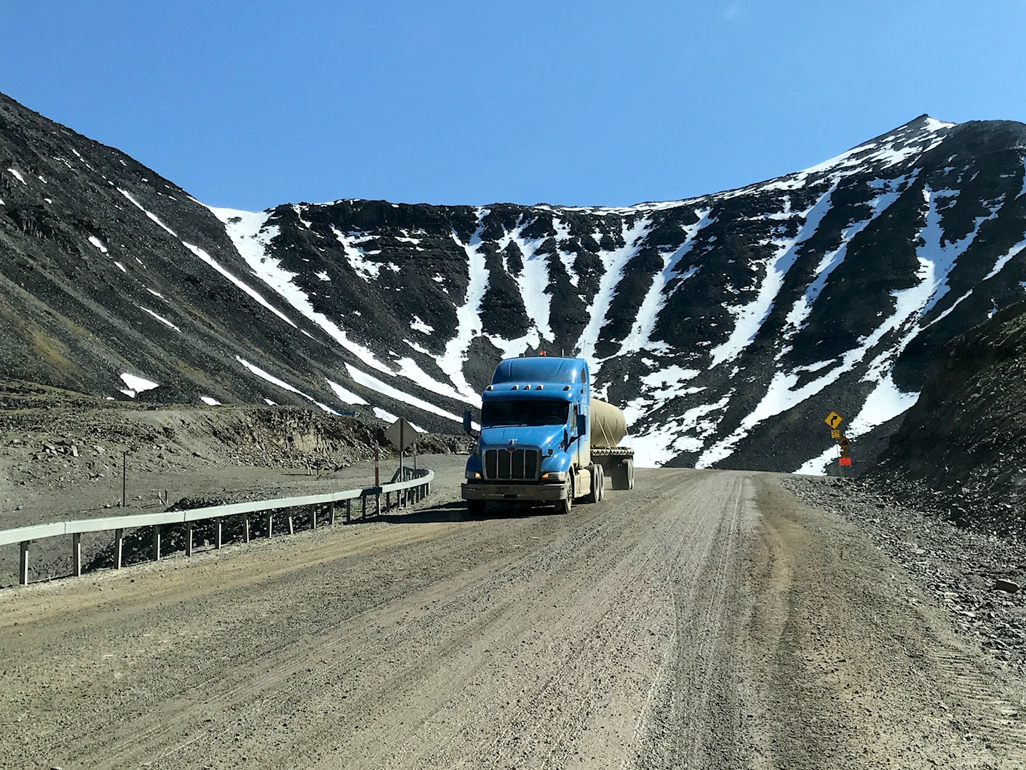
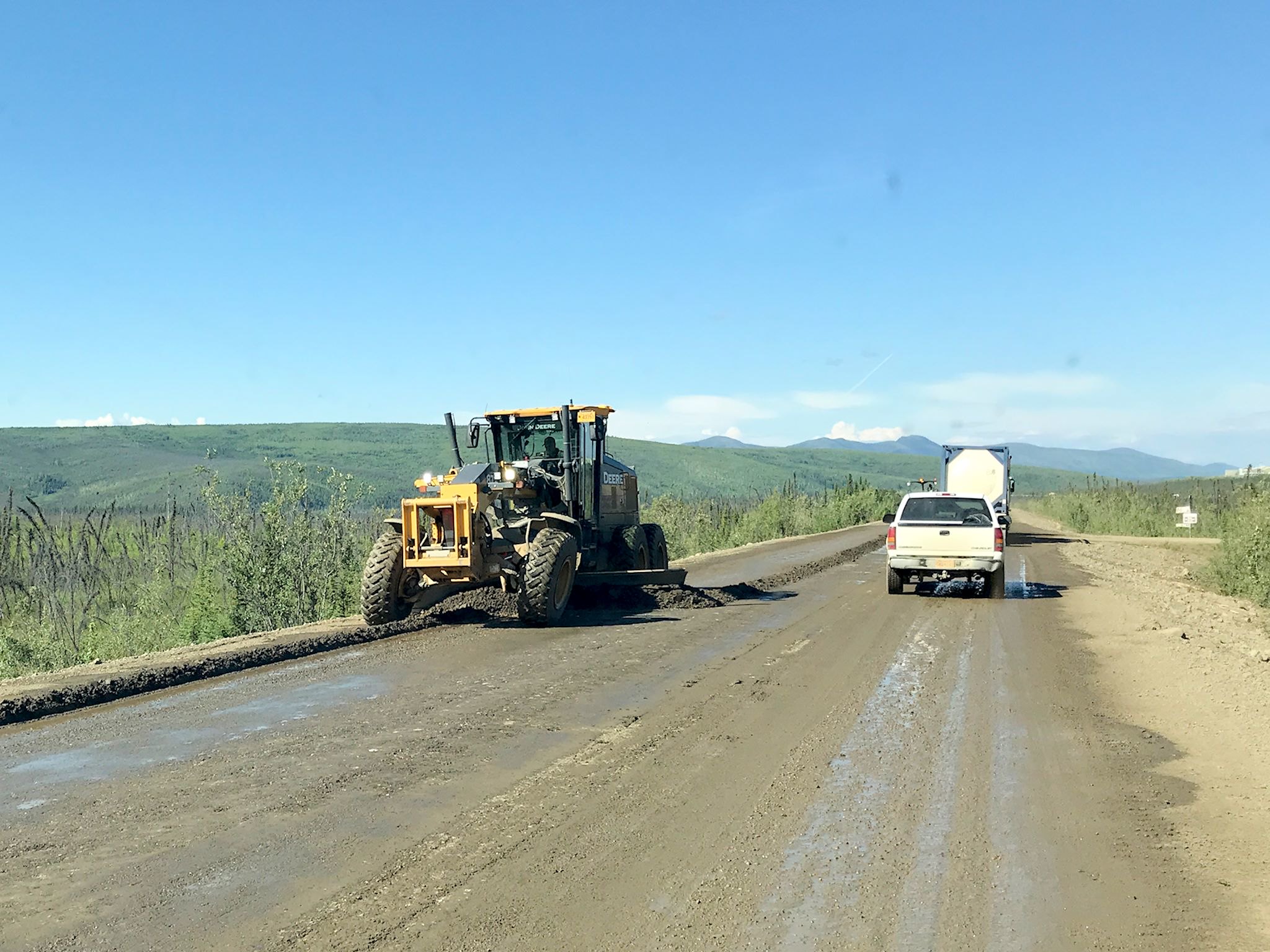
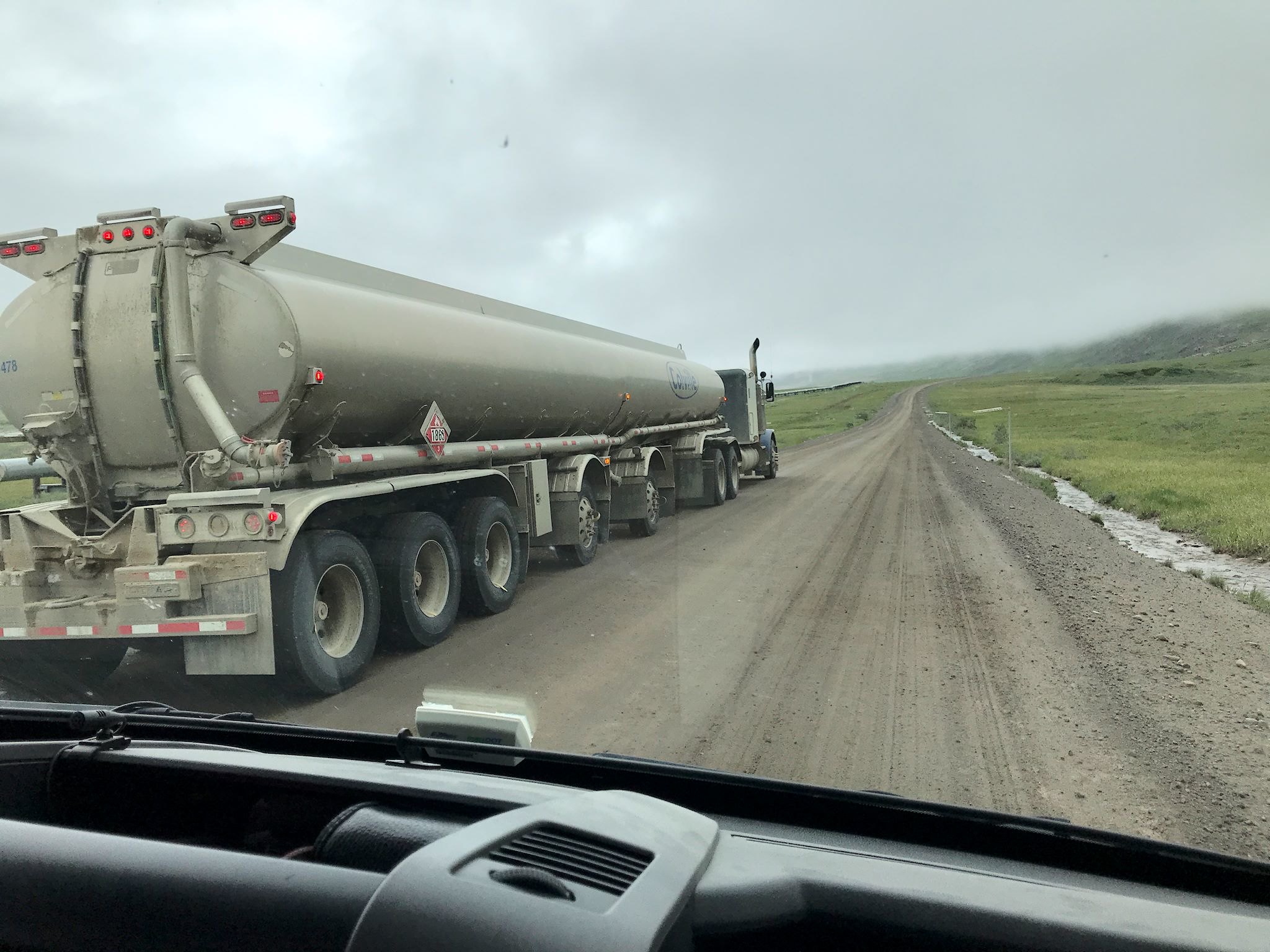
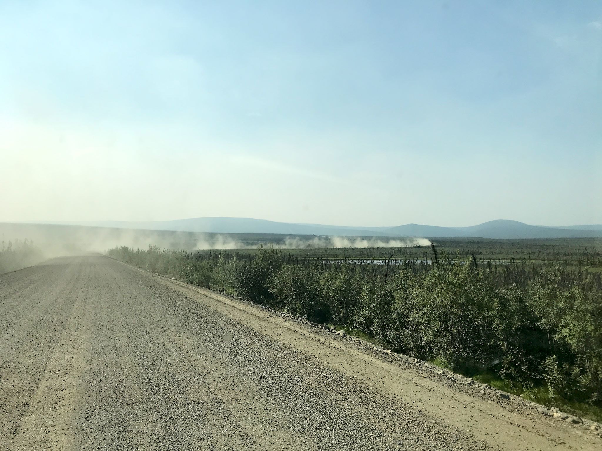
Let’s get this over with – I’ll be serious just for a bit. One paragraph. You truly could die on the Dalton Highway. If you have a medical emergency, you’d have to flag down a truck with a CB radio who’d radio a state trooper who’d radio an ambulance that could be 250 miles away. The nearest hospital could be 2-3 hours away by helicopter. If you break down, a tow truck would come up from Fairbanks, which could be over 400 miles away (one way). If you’re waiting for a tow or changing a flat tire anywhere but one of the straightaways or a pullout, you’d need a person flagging the trucks so they can see you and get around you, all while watching for grizzly bears. Also, the road is high and the shoulders are soft. If you run off the road for any reason, say swerve to avoid a moose, you are likely to roll over. Building roads in the permafrost requires gravel that’s 12-15 feet thick in places with steep, deep shoulders to the soft wet tundra below. Can’t really even stop to pee…
(OK, maybe two paragraphs.) We prepared. We’d left home with 6 new heavy-duty tires, new shocks and a heavy-duty antisway bar. We had the truck fully serviced in Edmonton. We planned to do the drive in 4-5 days and had 10 days of food and water on board. Although stuff happens, neither one of us has any known medical condition that would pose an unusual risk. We’ve prepared for and enjoyed backpacking days away from roads and cell coverage, enjoying the challenges. Where we live in Vermont, half the roads are unpaved. From there and our experience last summer in the wilds of Canada, we know what it’s like to drive long distances on rutted or washboarded or frost-heaved or freshly graded roads. While we were a little wary of these risks, we felt reasonably confident in our abilities and adequately prepared for the trip. It’s a written rule that the trucks have the right of way. We came to understand how they move up and down hills and over bridges and how to stay out of their way. We had a list of places to call out our presence on CB channel 19. It’s an unwritten rule that if you see someone on the side of the road, (unless they’re clearly just taking photos), you check to see if they need help. Not everybody would enjoy driving the Dalton. We loved it!
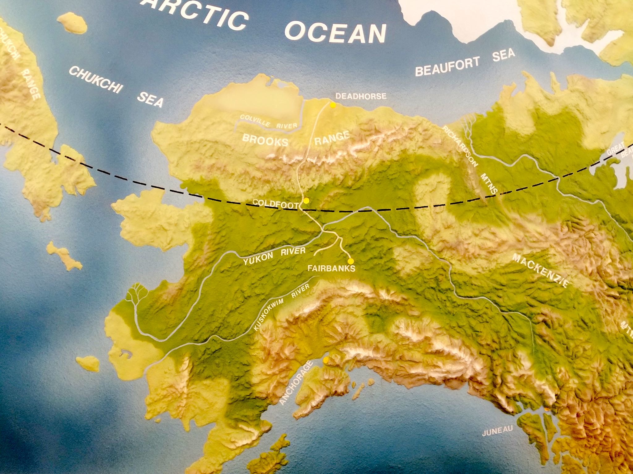
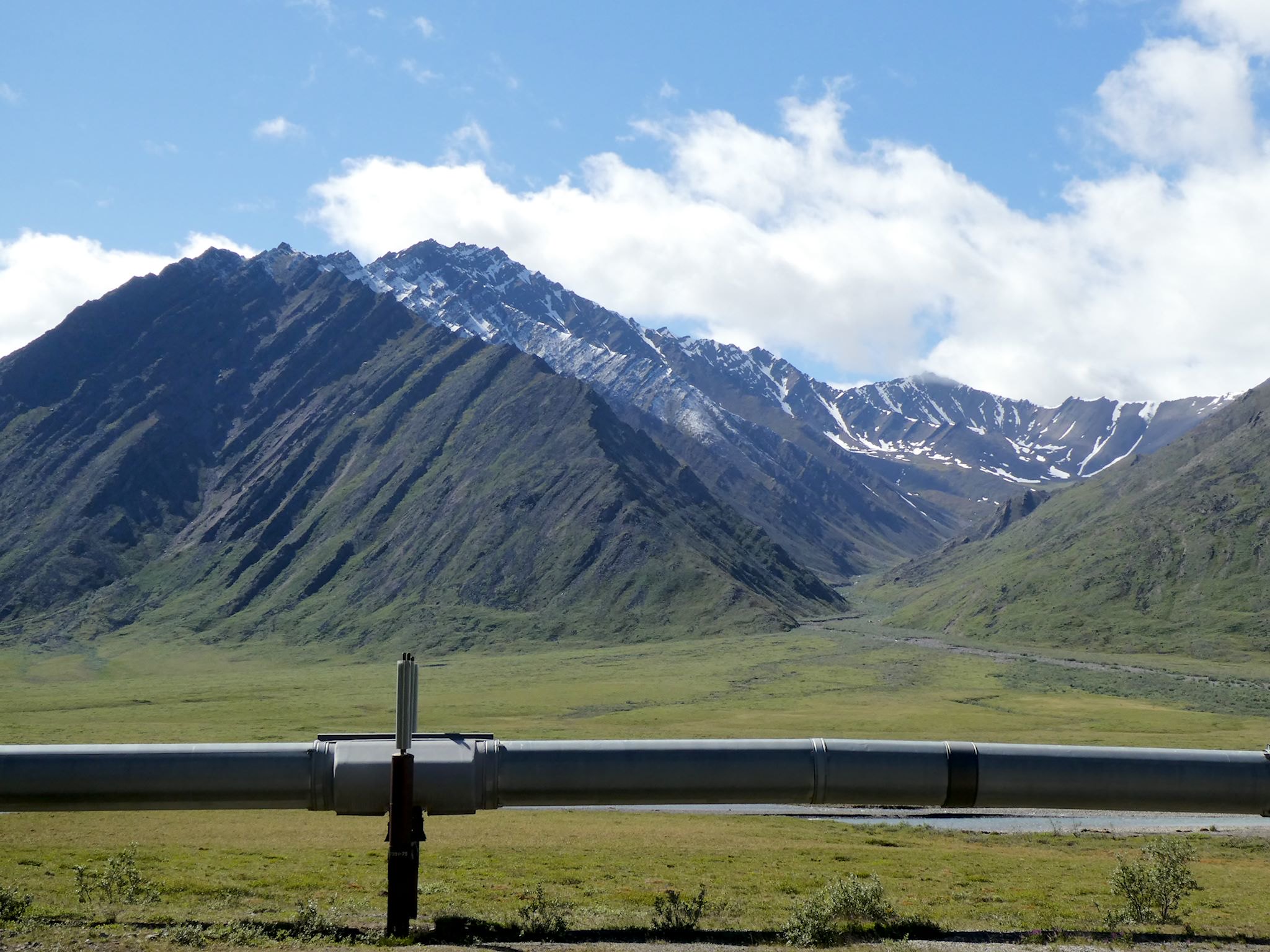
Oil was discovered in Prudhoe Bay in 1967. The Dalton Highway was built 1970-1974 as a supply road for trucks to support the extraction operations and for access to build and maintain the Trans-Alaska Pipeline System which was completed in 1977. The Dalton Highway connects the oil extraction industry in Deadhorse/Prudhoe Bay to Fairbanks and the rest of the world. It was improved (it’s all relative) and opened to the public in 1994.
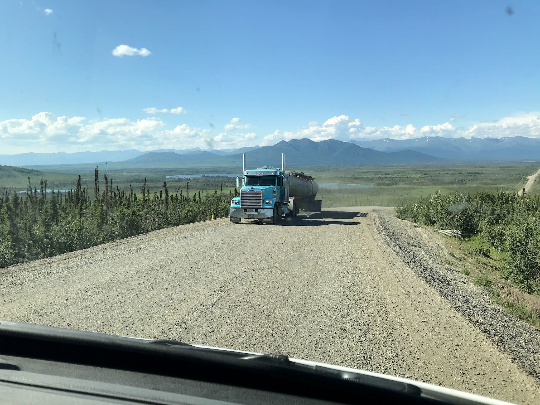
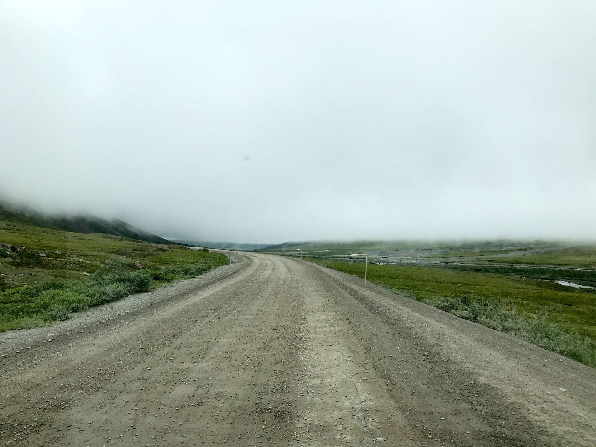
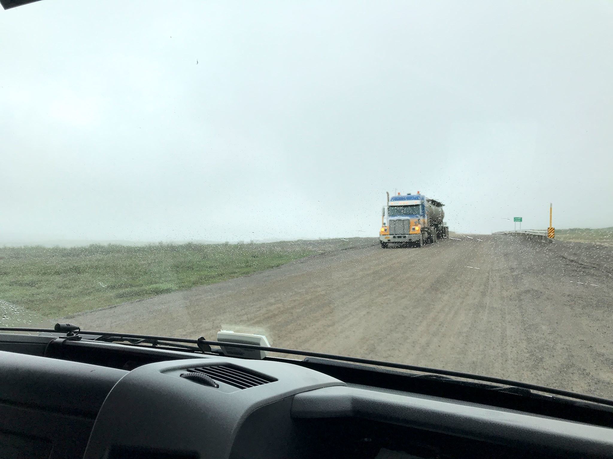
There are 3 unincorporated communities along the 414-mile road (one way), with a combined year-round population of 15. Although there are views and mountains and critters, the road is about the trucks and the truckers. About 160 trucks travel the road every day, along with a number of pipeline and Alaska Department of Transportation workers in mud-covered white pick-up trucks, lots of mud-covered motorcyclists assaulting their bucket lists, a dozen or so mud-covered private cars and a scant handful of small mud-covered RVs.
Words can’t really describe the travel and the experience. So, here’s a summary of highlights from south to north with lots of photos.

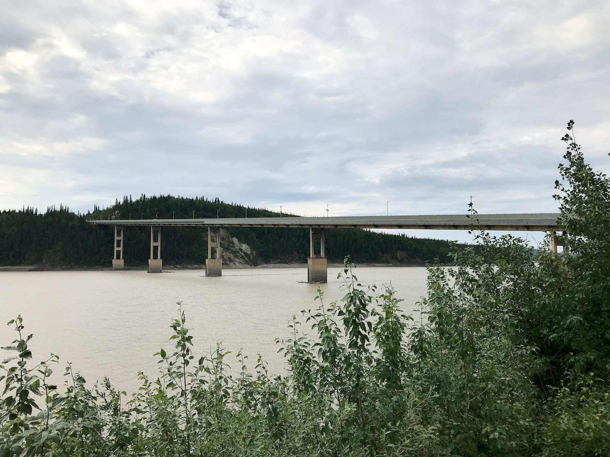
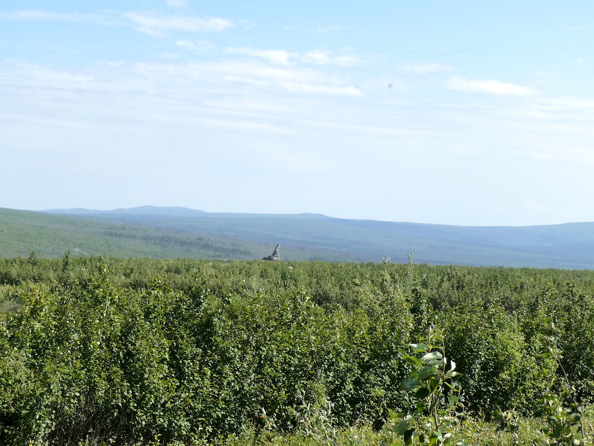

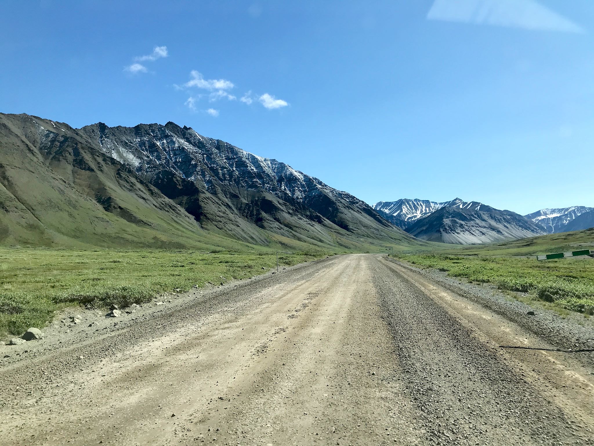
The Dalton starts by winding through the boreal forest, first rolling then climbing (they weren’t kidding about the steep grades!) through the White Mountains. The views reminded us of vastness we felt on last year’s drive through the Northwest Territories, only inclined – millions of acres of wilderness, just one road and the pipeline. Past the Yukon River Bridge – the only bridge that crosses the nearly 1300 miles of the Yukon River in Alaska – the boreal forest thins with stunted black spruce trees that meld to tundra. From the summit of one of the hills, we saw massive rock outcroppings – the Finger Mountain area. One isolated peak, tall and thin and crocked, allegedly points to Fairbanks and was used by early hunters and later early aviators to find their way over the open tundra. Short black spruce trees line the road as we reach the Arctic Circle.
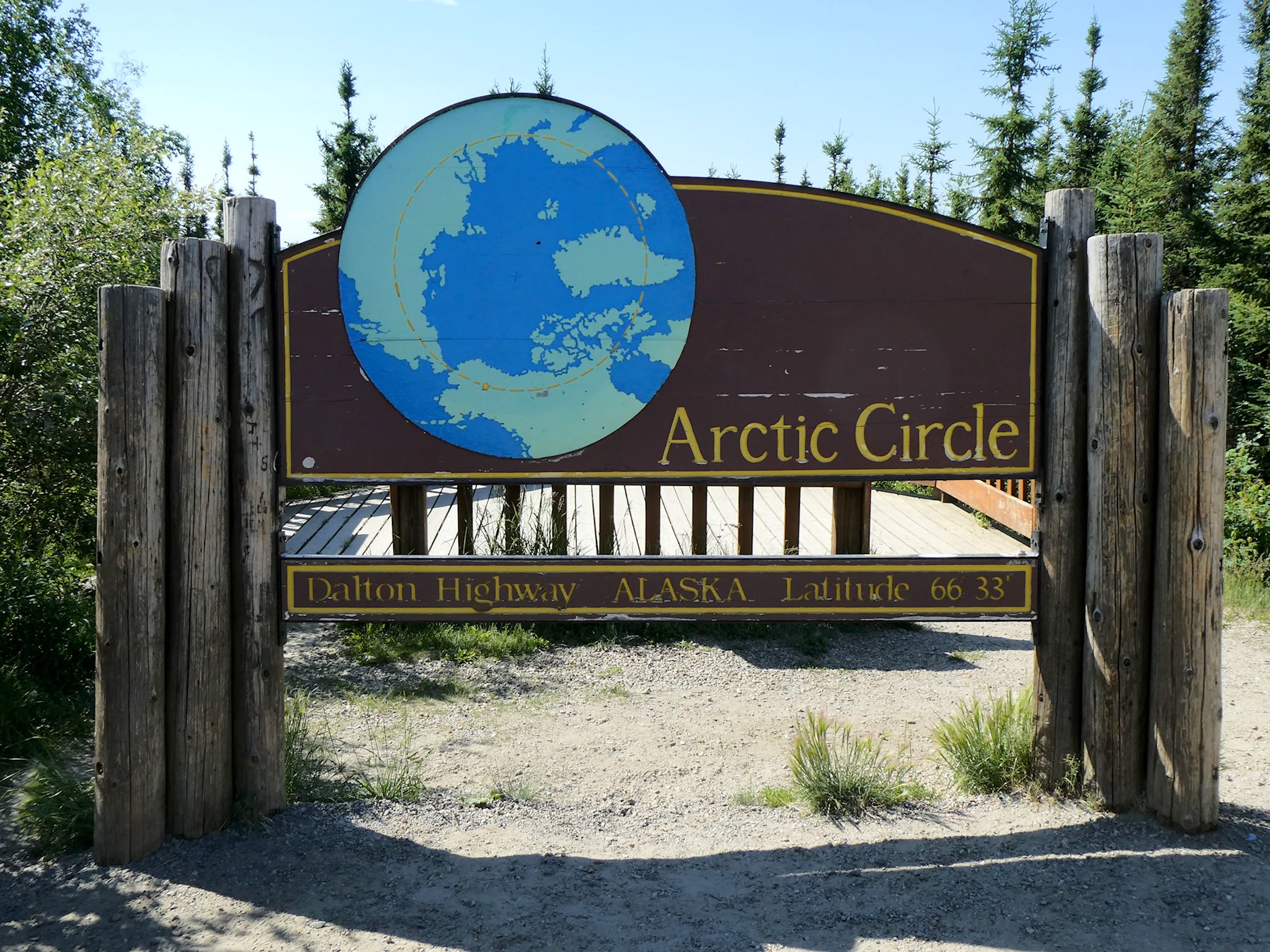

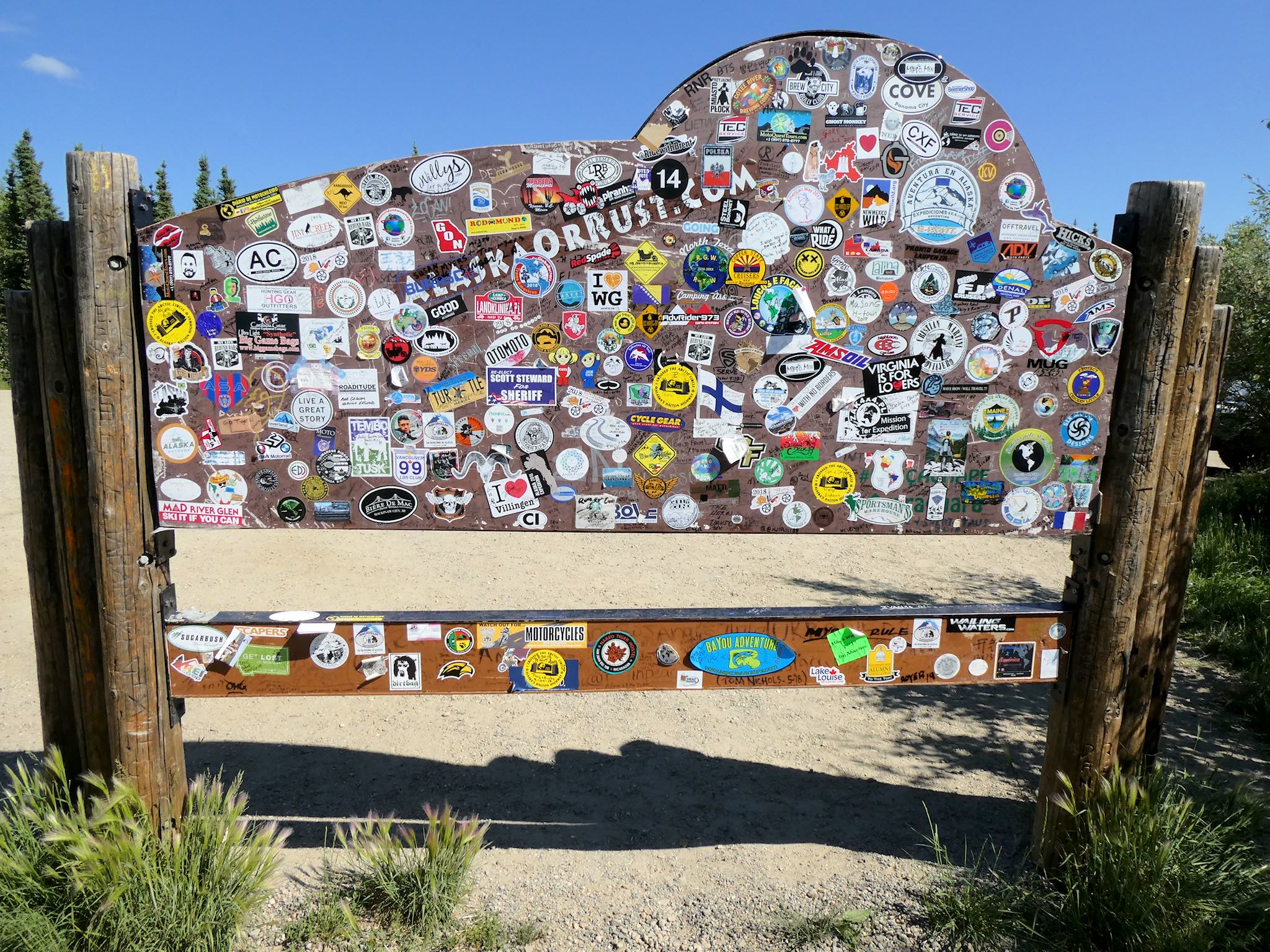
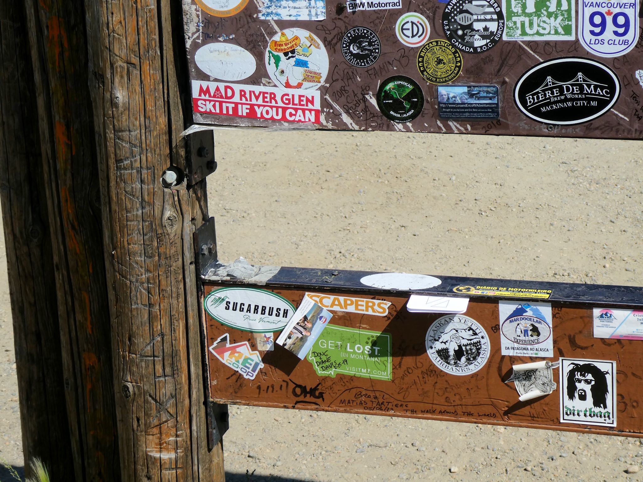
The Arctic Circle goes around the globe at the latitude at which the sun doesn’t set for at least one day each year. Points further north note how many days per year when the sun doesn’t set. The Circle also denotes the turnaround point for many travelers on the Dalton. And, it’s also a major photo stop. Speaking of which, check this out! The back side of the Arctic Circle sign is a magnet for stickers from around the world. And of course, Sugarbush and Mad River Glen are now well represented!
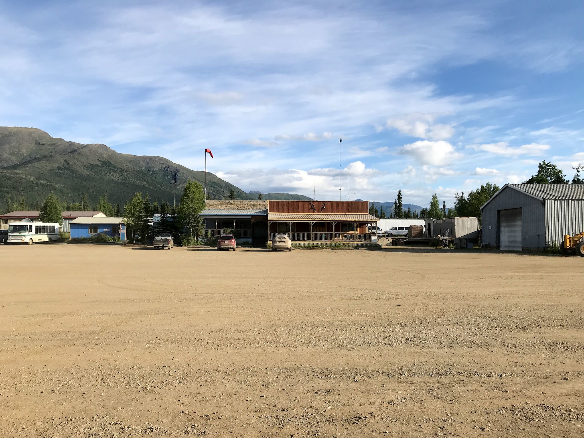

There are mountains in the distance as we reach Coldfoot (pop 10, plus seasonal help), the half-way point of the Dalton and the major truck stop. Talking to Jenna, one of the 10 year-rounders, we learned that although there are fewer tourists (and I’ll bet zero motorcycles), the truck stop is busier in the winter than the summer. Oh, and the truck stop all-you-can-eat buffet was good enough for us to splurge both ways. They also allowed us to camp overnight in their parking lot, which we also enjoyed north- and southbound. Each time, Coldfoot had a small crowd (it’s all relative) bustling about with a tour van or two stopping for dinner, several truckers refueling and several guests milling about the small lodge.
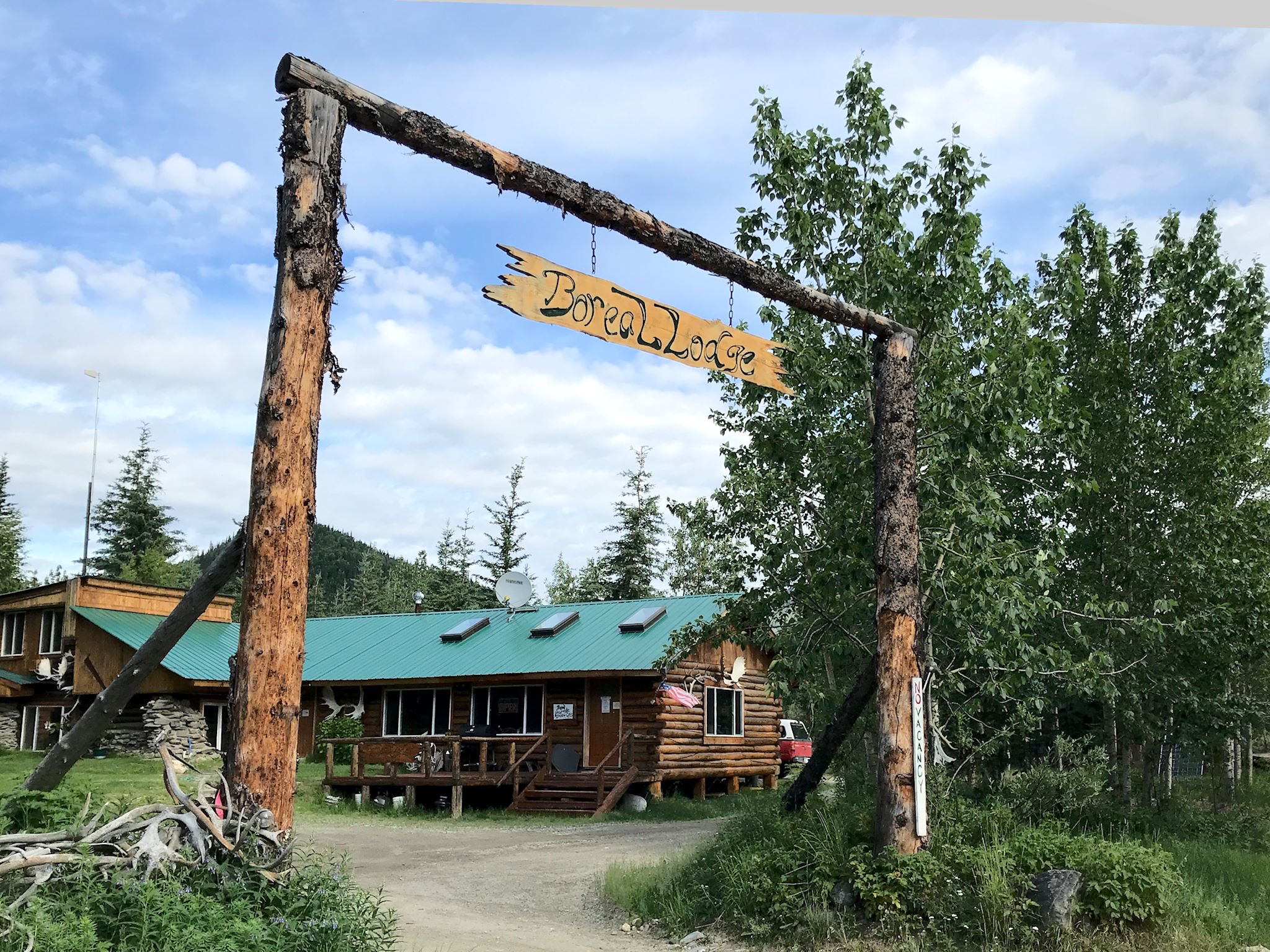
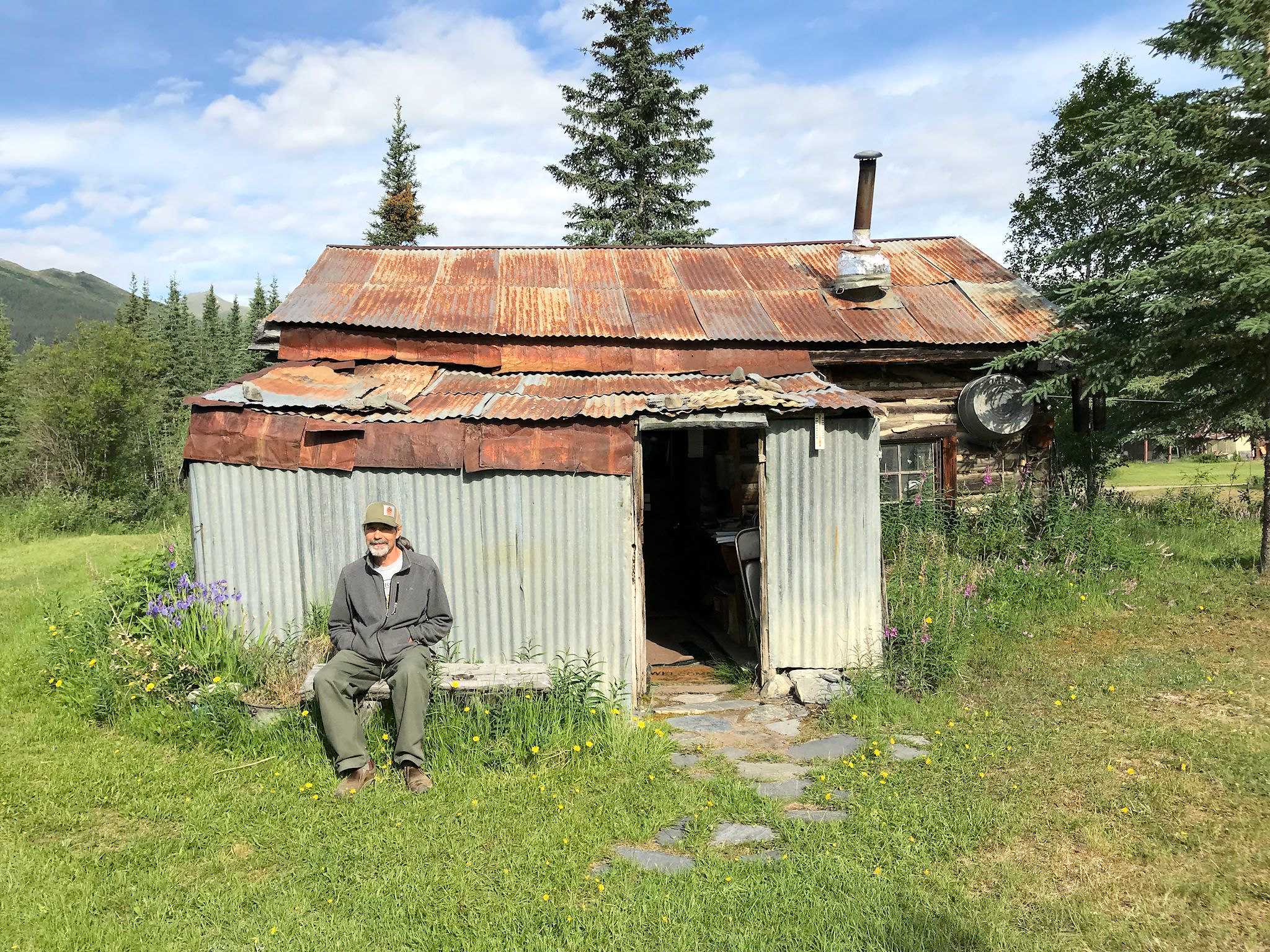
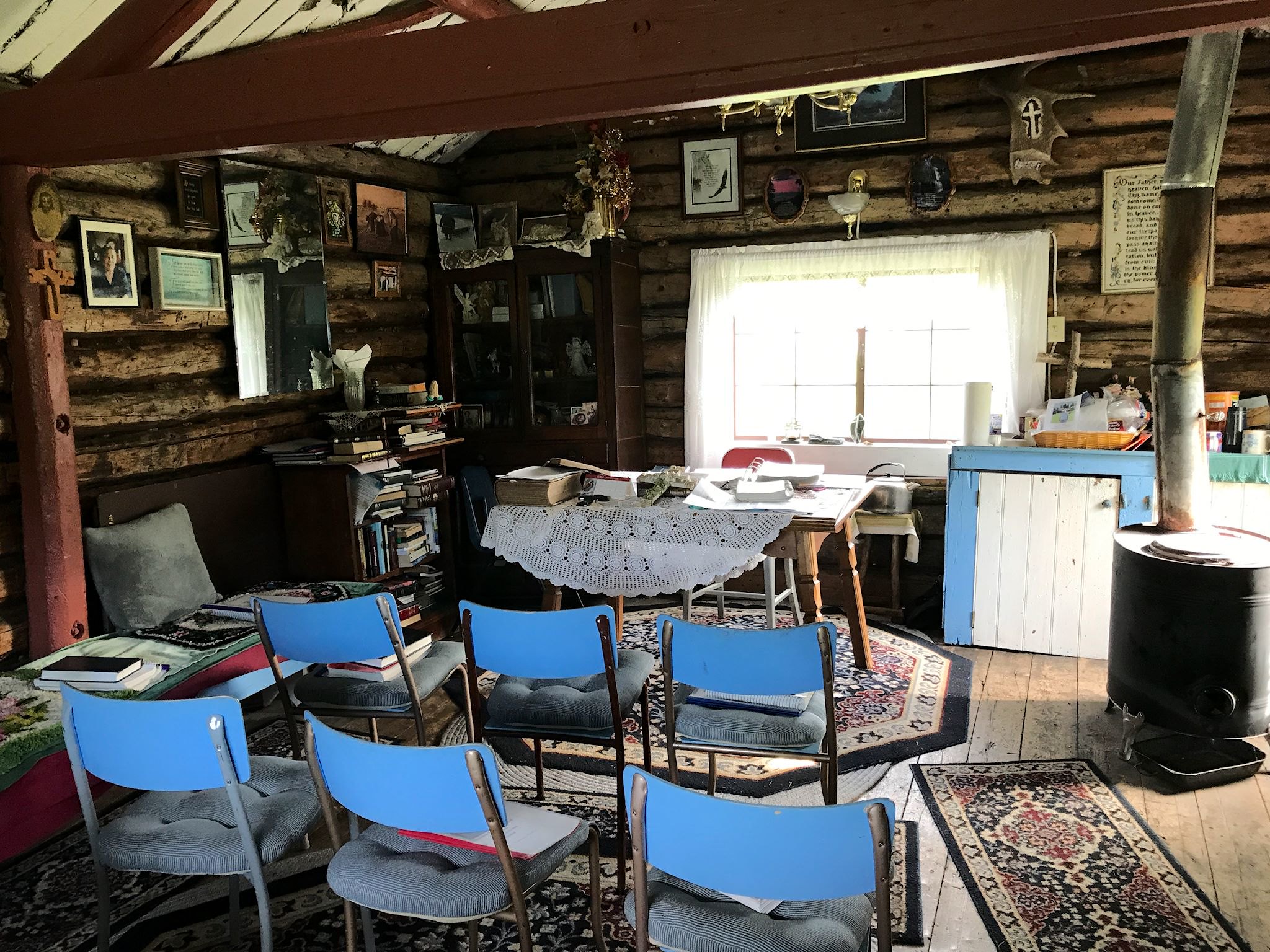
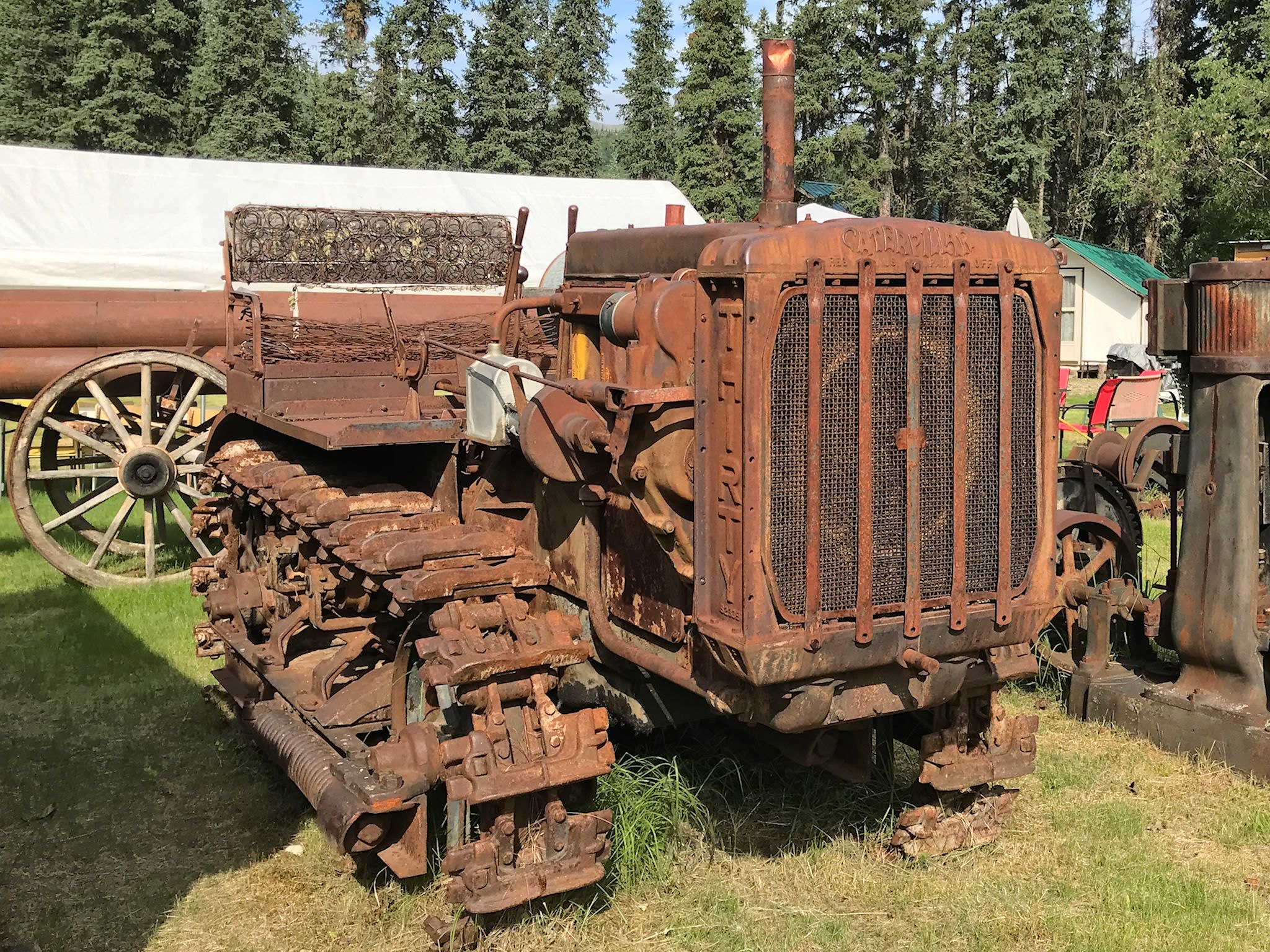

Just 15 miles north of Coldfoot is a village called Wiseman (pop 5, 15 in summer). The sign said coffee at the Boreal Lodge, reason enough to visit. Historically, it was a mining town and is now a residence for a few hardy introverts. Heidi, owner of the Lodge, grew up in Wiseman, raised her family there and enjoys the simple, peaceful, subsistence lifestyle. What do Wiseman people do? According to Heidi, they either work in Coldfoot, own a lodge, or are retired. Heidi’s mom built the small chapel in ‘town’ to honor a Native American neighbor, and it is still in use. The 6-room lodge had no vacancy. A gentleman named Clutch runs the Koyukuk Mining Museum. If you can catch him around, he’ll open it up for you. We were fortunate to meet him, see his collection of historical mining artifacts inside and outside of the museum, as well as hear about his adventures with car repair and help with the car club that drives Model A’s from Fairbanks to Deadhorse. When we met, Clutch was on his way to ‘town’ for supplies. Which town would that be? Fairbanks, a mere 8 hours away…
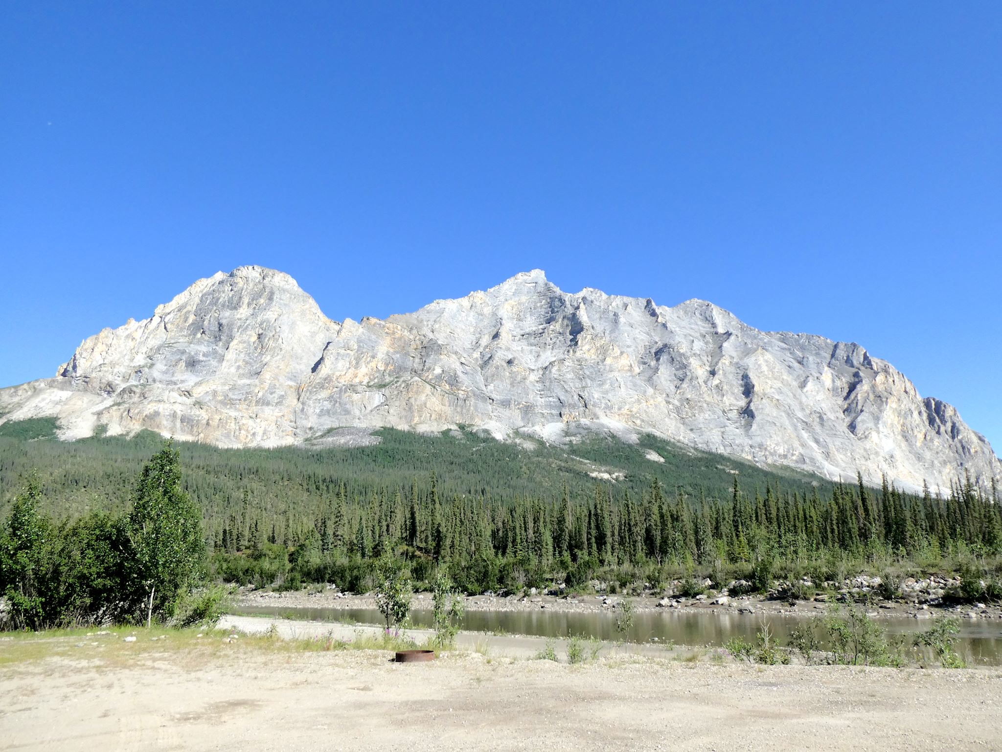

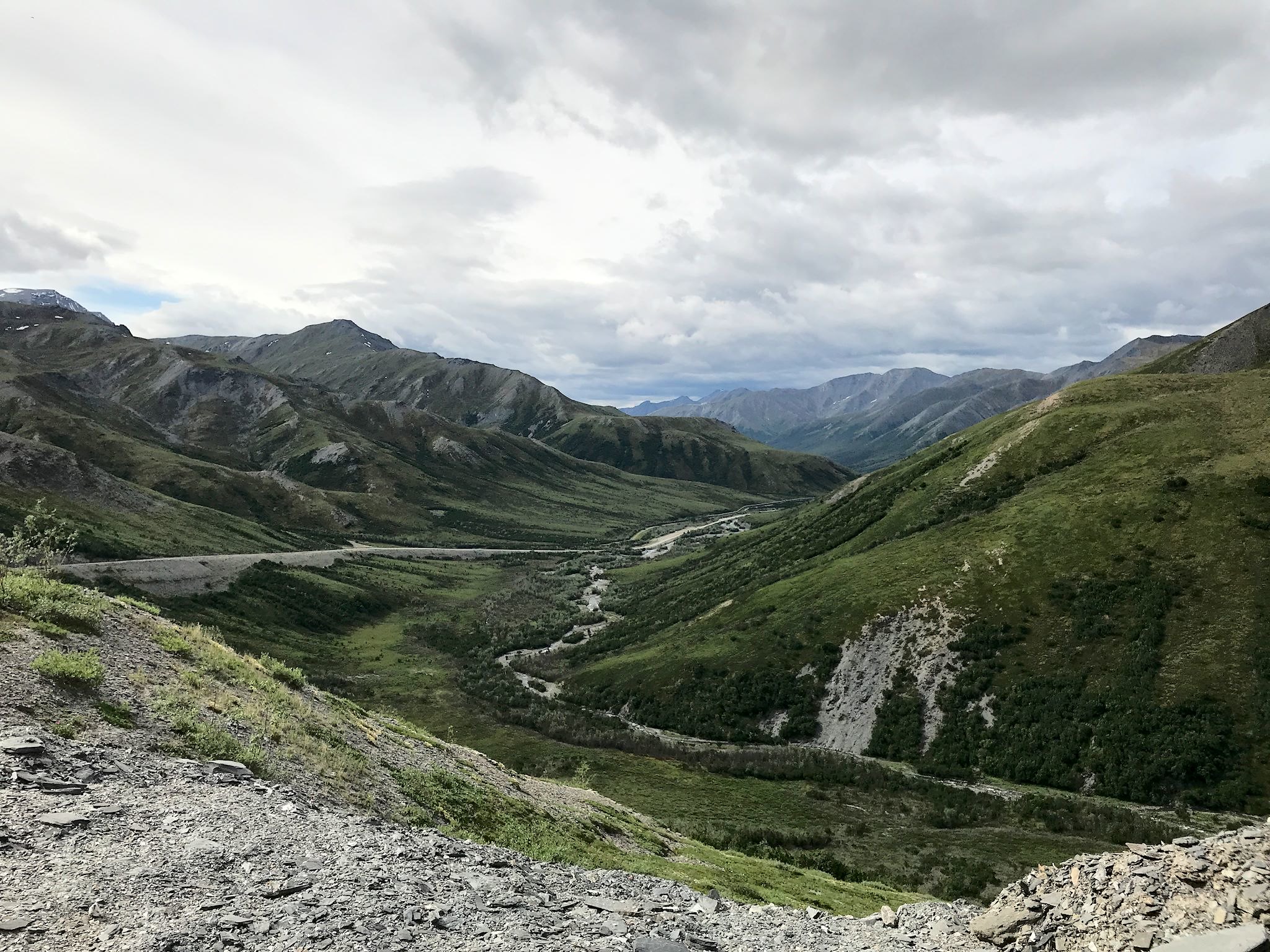

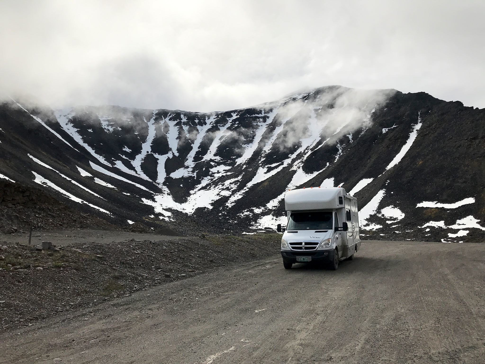
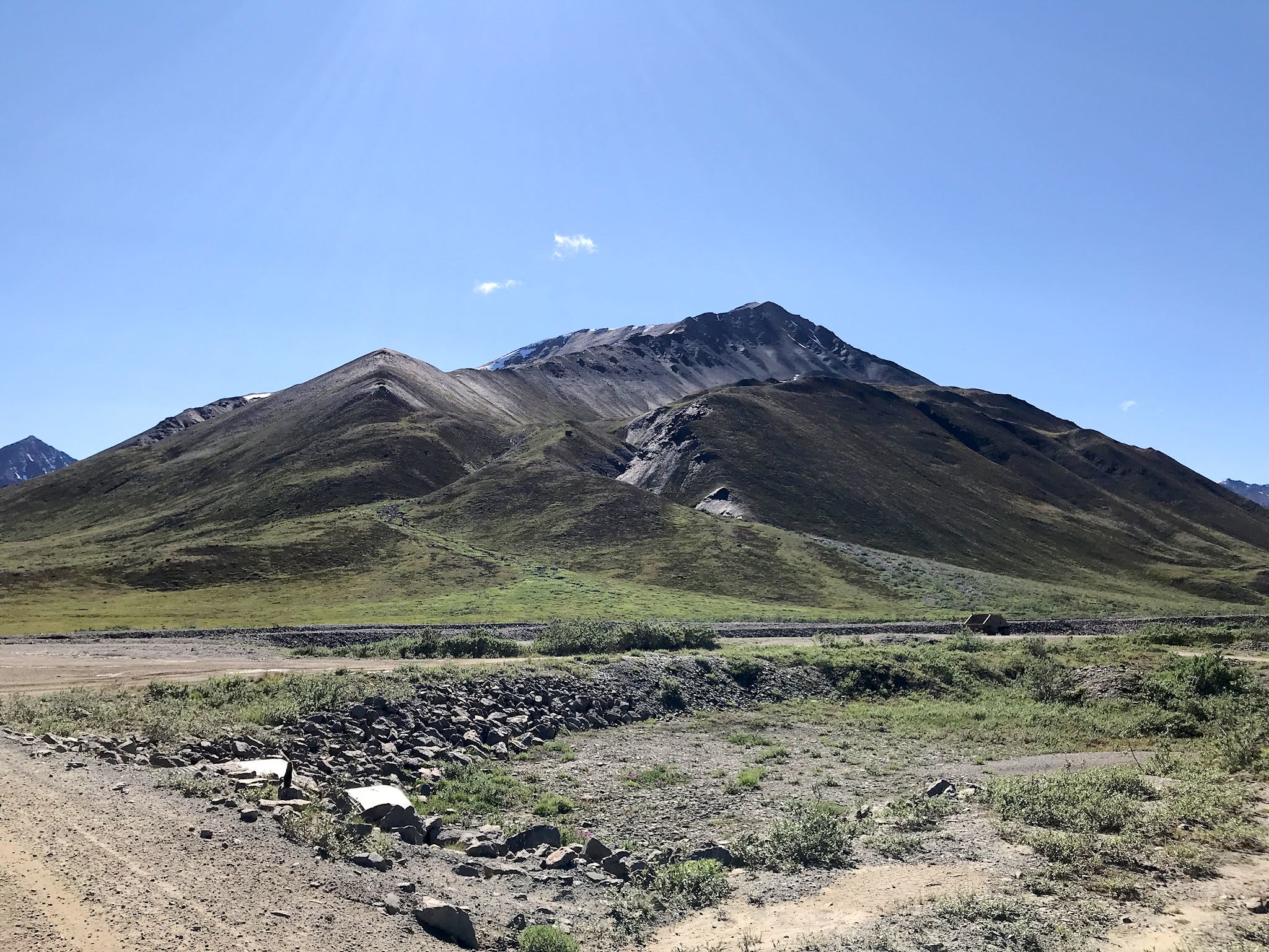
Not much further north we found ourselves in the foothills of the Brooks Range, steep, rocky peaks and glacier-carved valleys that run east to west for 700 miles. Views of 2 dramatic granite peaks – Sukakpak Mountain and Dillon Mountain – provide a hint of things to come. We climbed Atigun Pass (elevation 4800 ft), the highest roadway pass in Alaska (and the Continental Divide), with breathtaking views all along the way. We (ok, Doug) coaxed the RV up the massive grades, and we wondered if the truckers hated the brutal climb or appreciated the dramatic views.
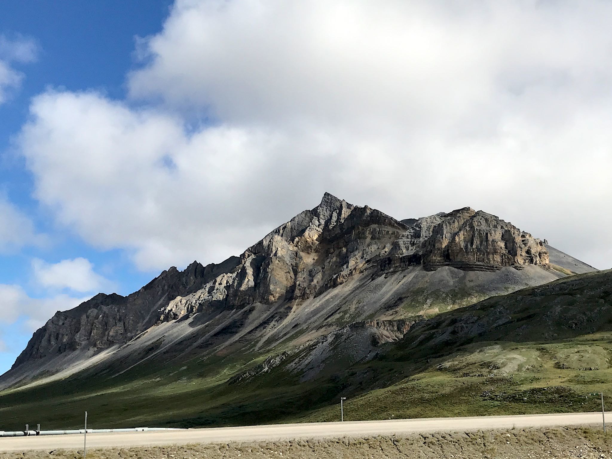
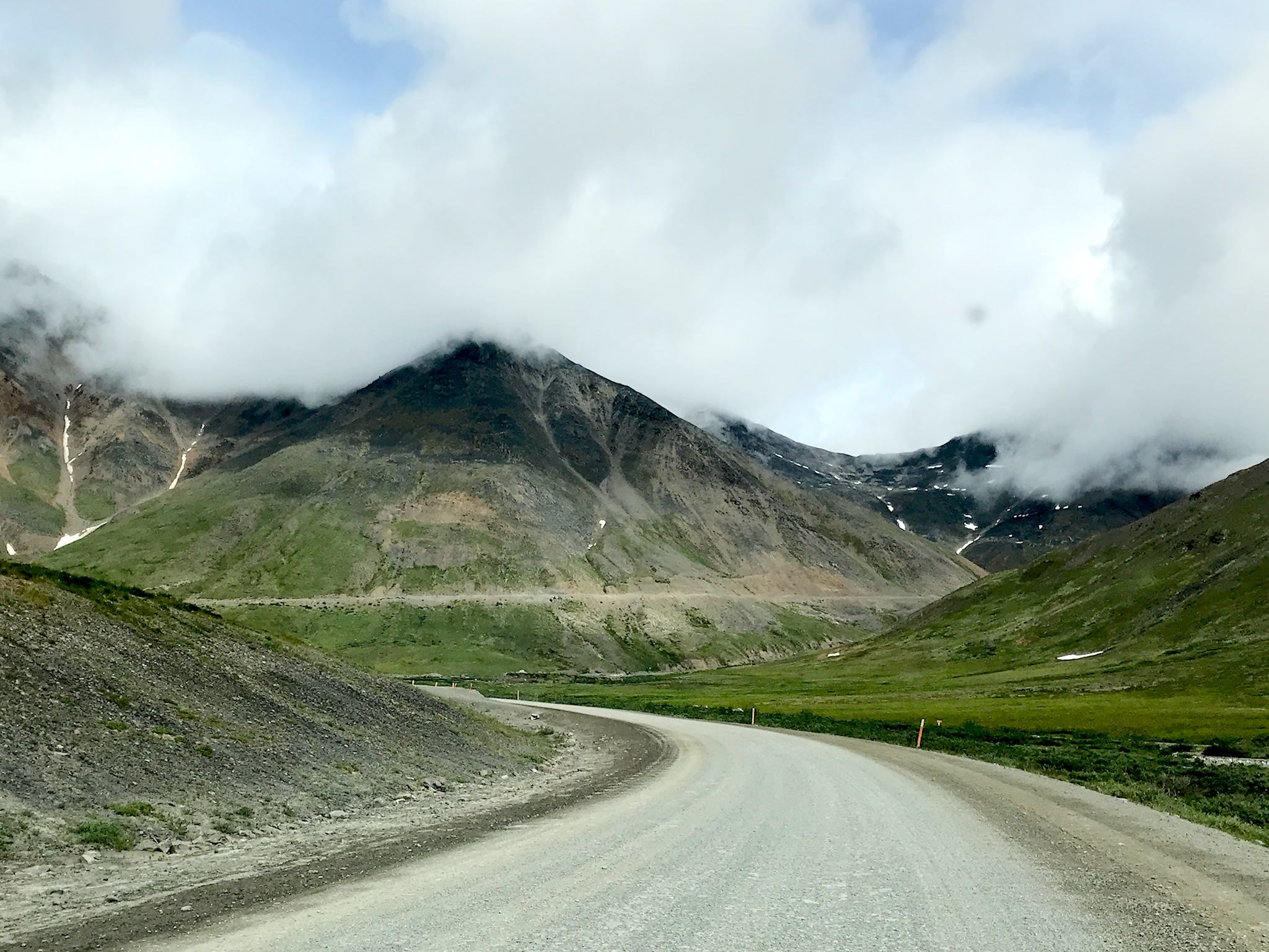
Just north of the pass, the Milepost Guide described a beautiful stretch of road with 7000-foot peaks on either side. Unfortunately, we descended into such a dense mist that we could barely see the pipeline 20 feet above the ground! We more than made up for that the following day on our southbound return, when we had perfect weather and unrestricted views.
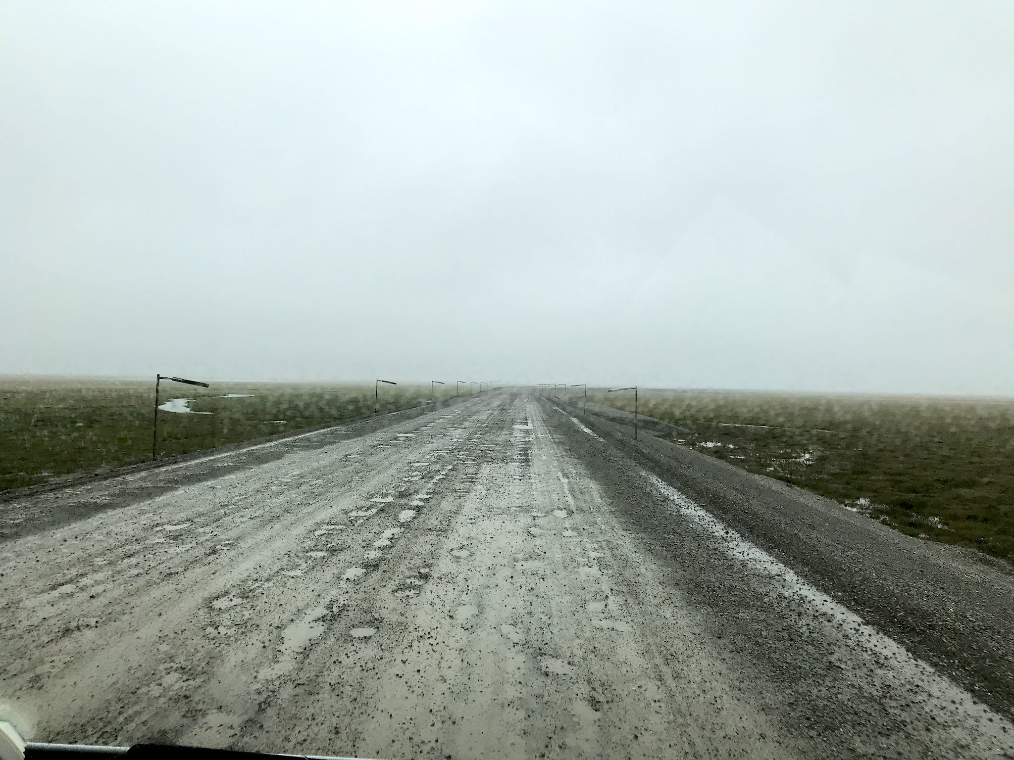
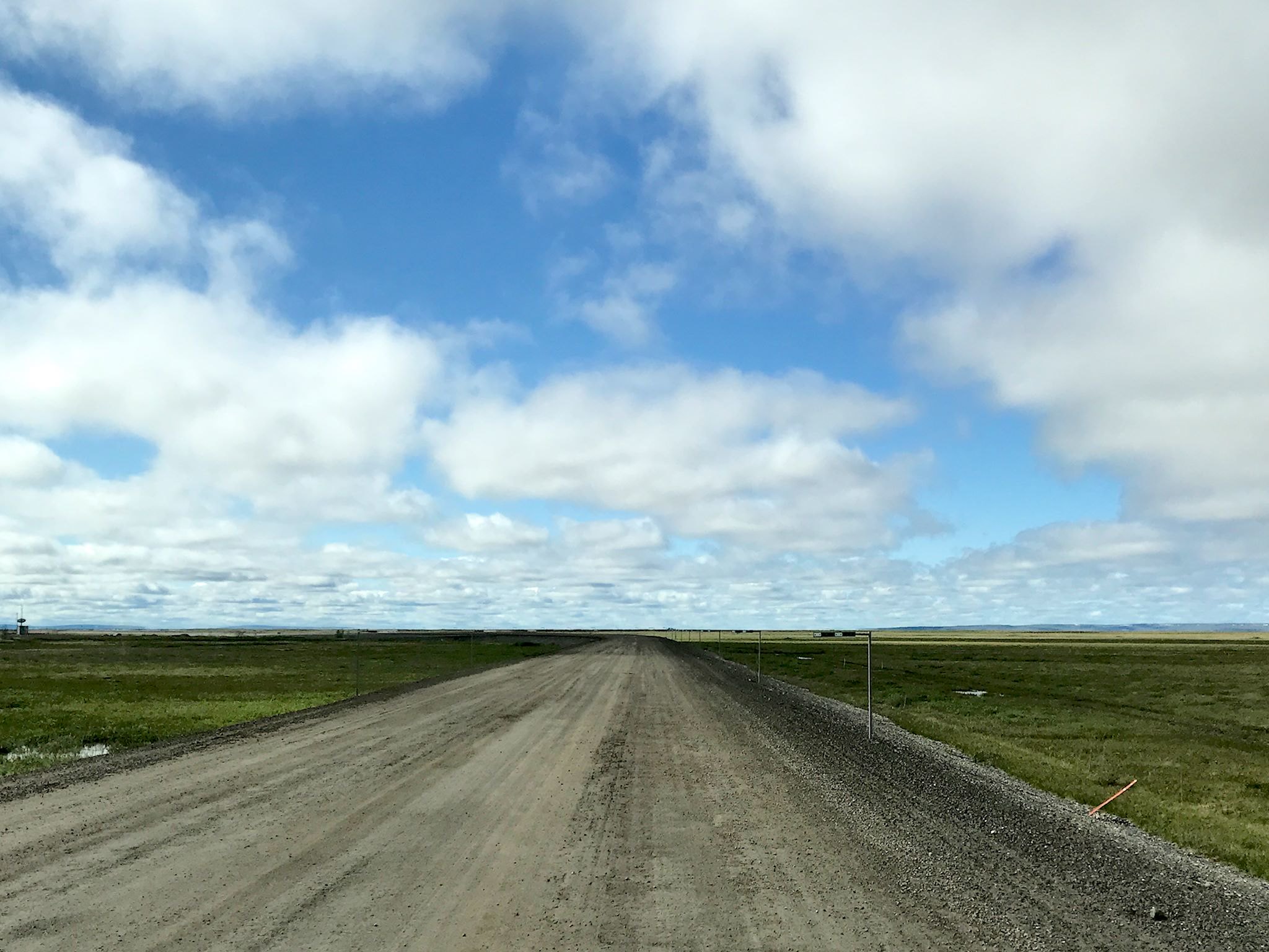
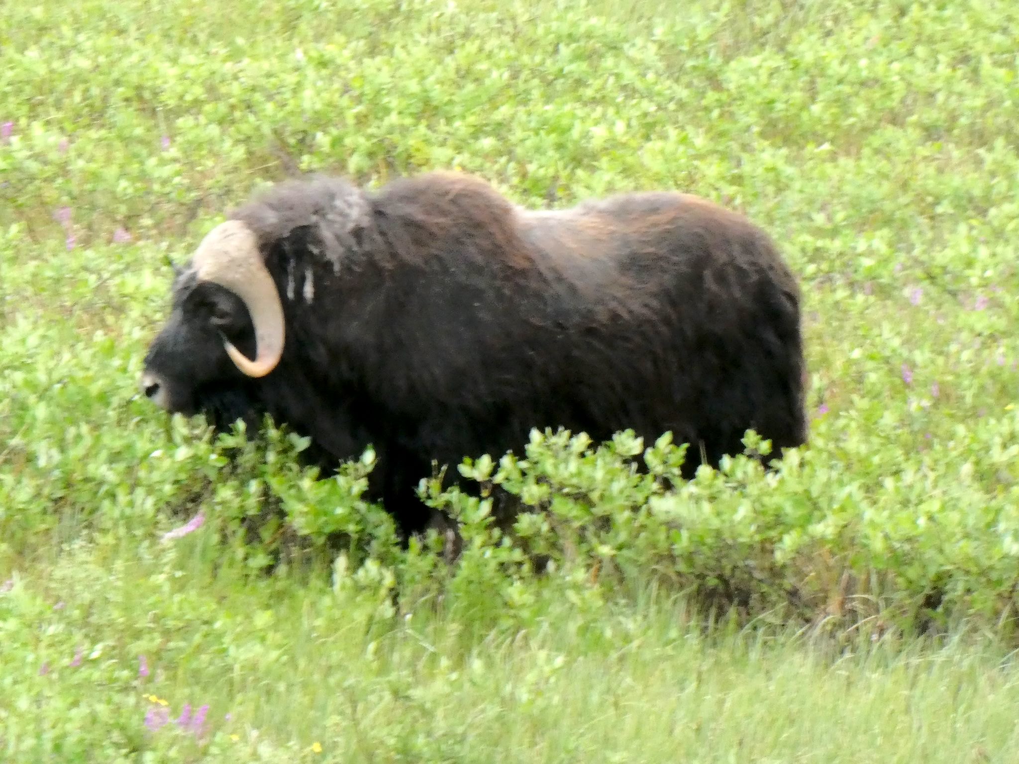


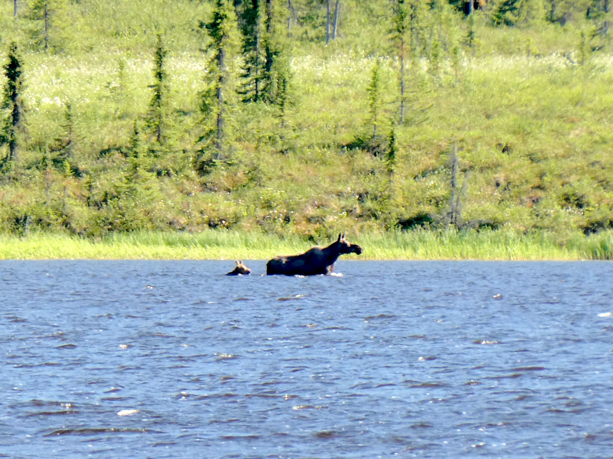
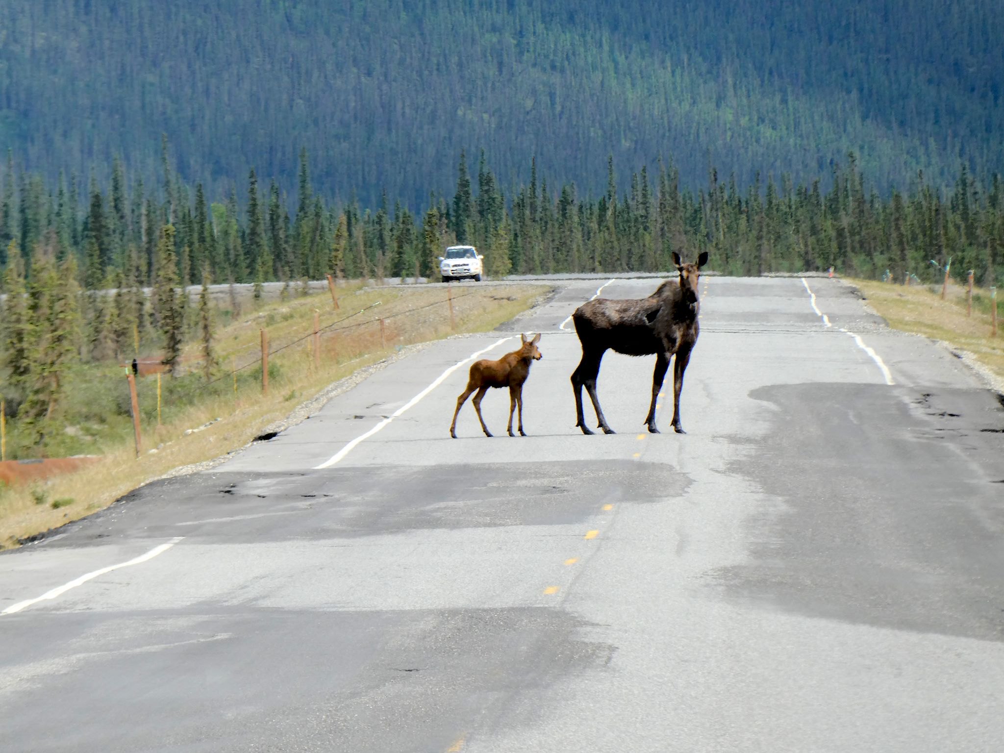
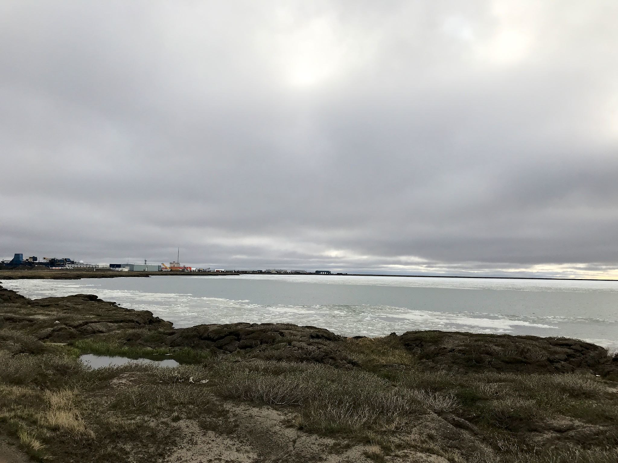
Beyond the Brooks Range is the North Slope, the gradual decline over rolling tundra toward the ocean. It was in this section that we saw our first herd of muskox grazing alongside the road. Although they look like a cross between a bovine and a dancer with a grass skirt, muskox are more closely related to goats, evolved to not mind being in minus 80 degree temps. The last 100 miles to the Arctic Ocean are super flat tundra along the Sagavanirktok (Sag) River. It was ten miles outside of Deadhorse where we watched a grizzly bear cross the road in front of us.
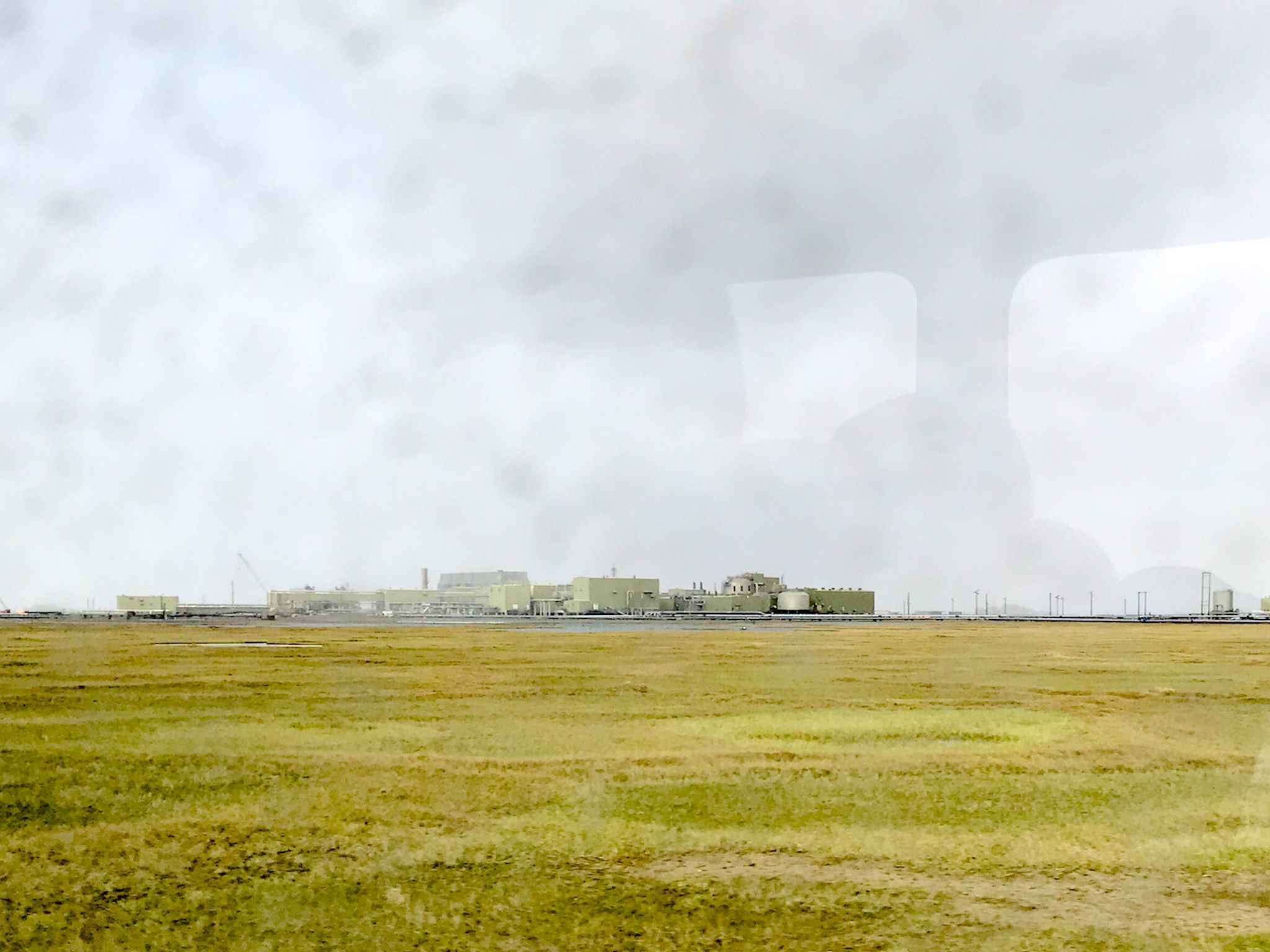
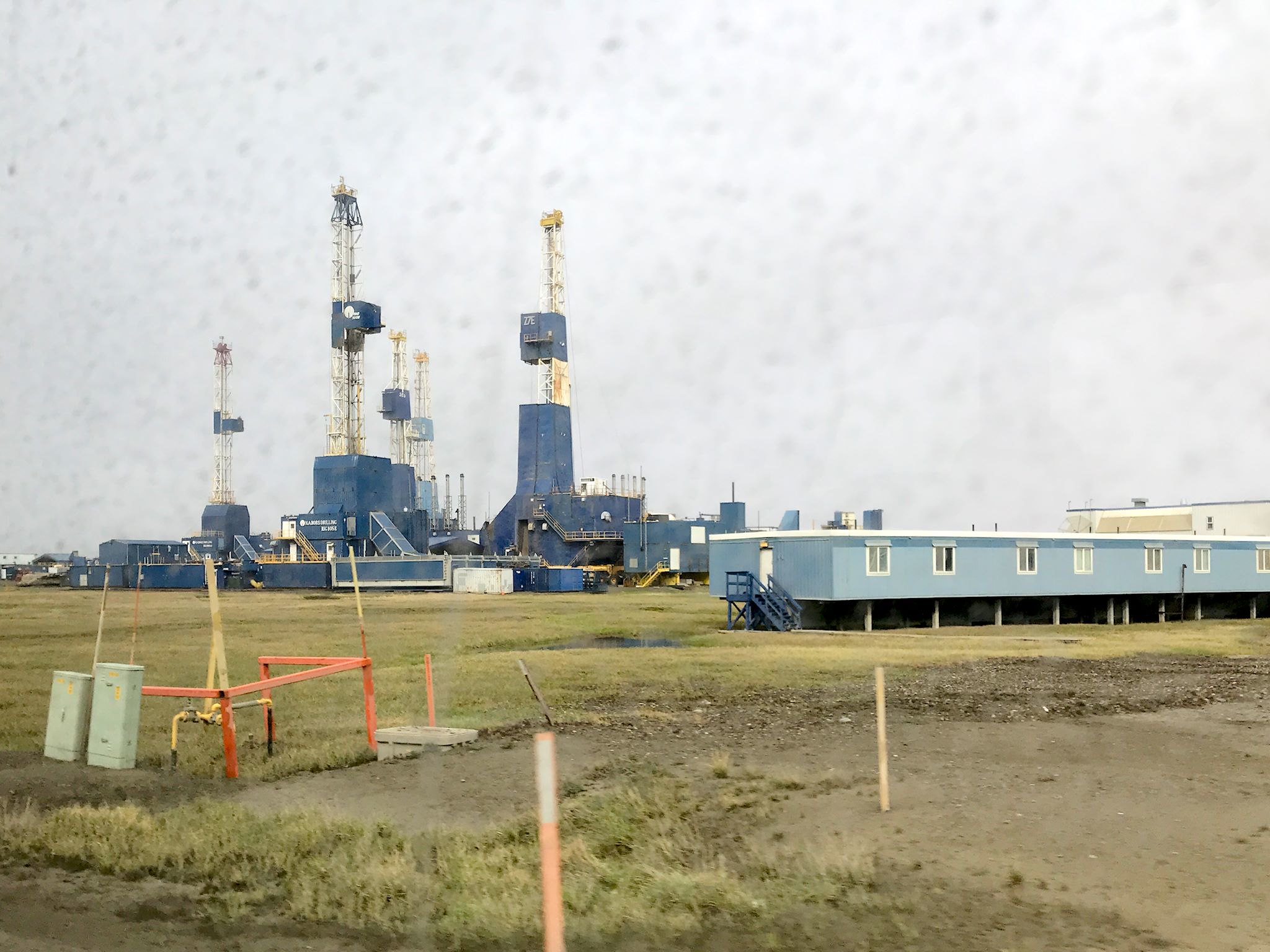
Driving into Deadhorse feels like driving into a space port on a backwater planet in a Star Wars movie. There are vast areas filled with unidentifiable (to us) heavy equipment. There are very tall, thin structures (these are the oil wells) surrounded by 1-3 story structures that appear to be boxes built on stilts. Occasionally, there’s a box with a sign – perhaps a business or a lodge. There’s a wide, fast flowing river on one side and other still bodies of water ranging from big puddles to small lakes, some covered with ice, everywhere else. Not a tree in sight, the tallest greenery looks like a small blueberry bush. The only visible movement are the haul trucks and an occasional pick-up truck.
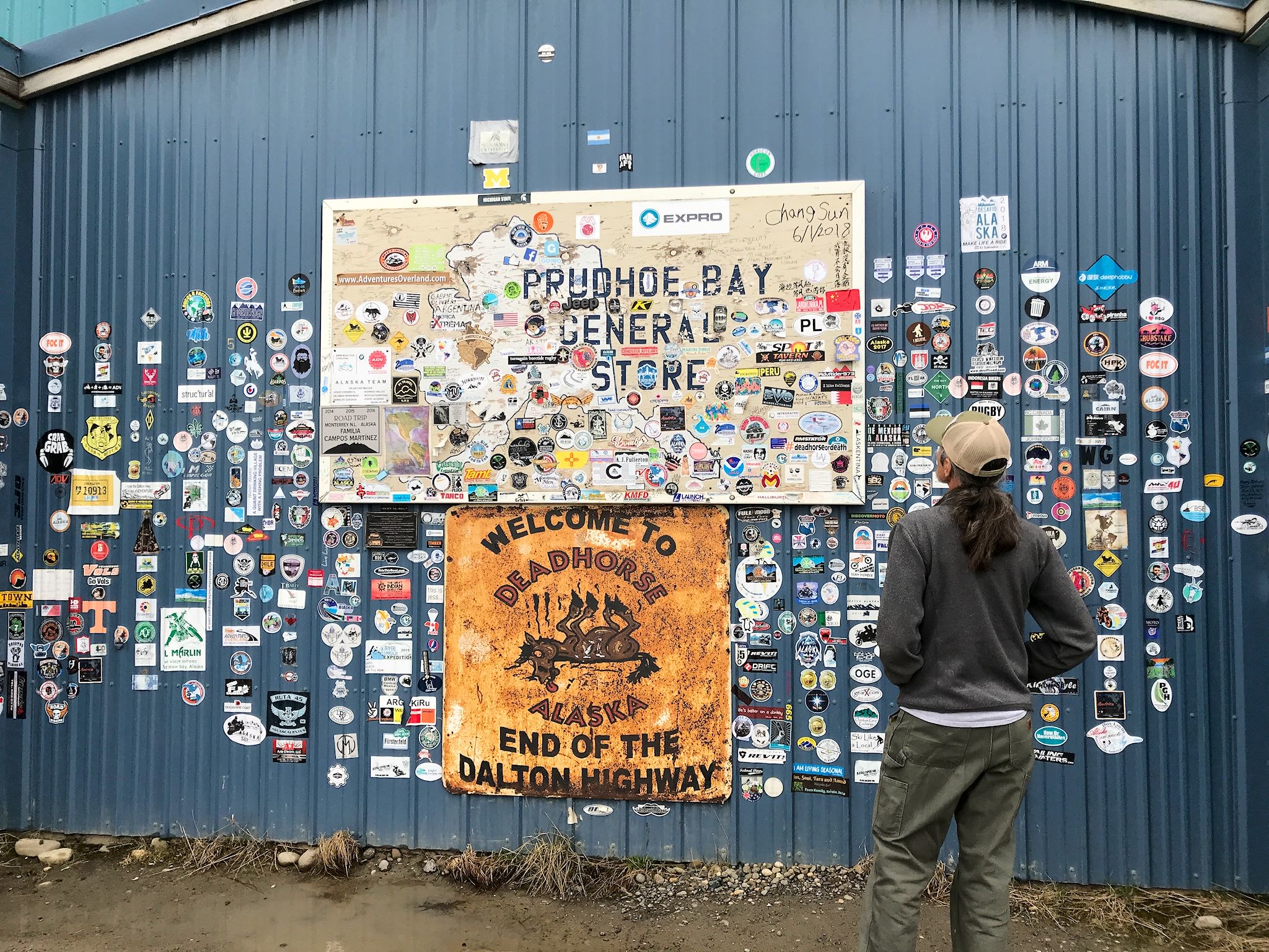
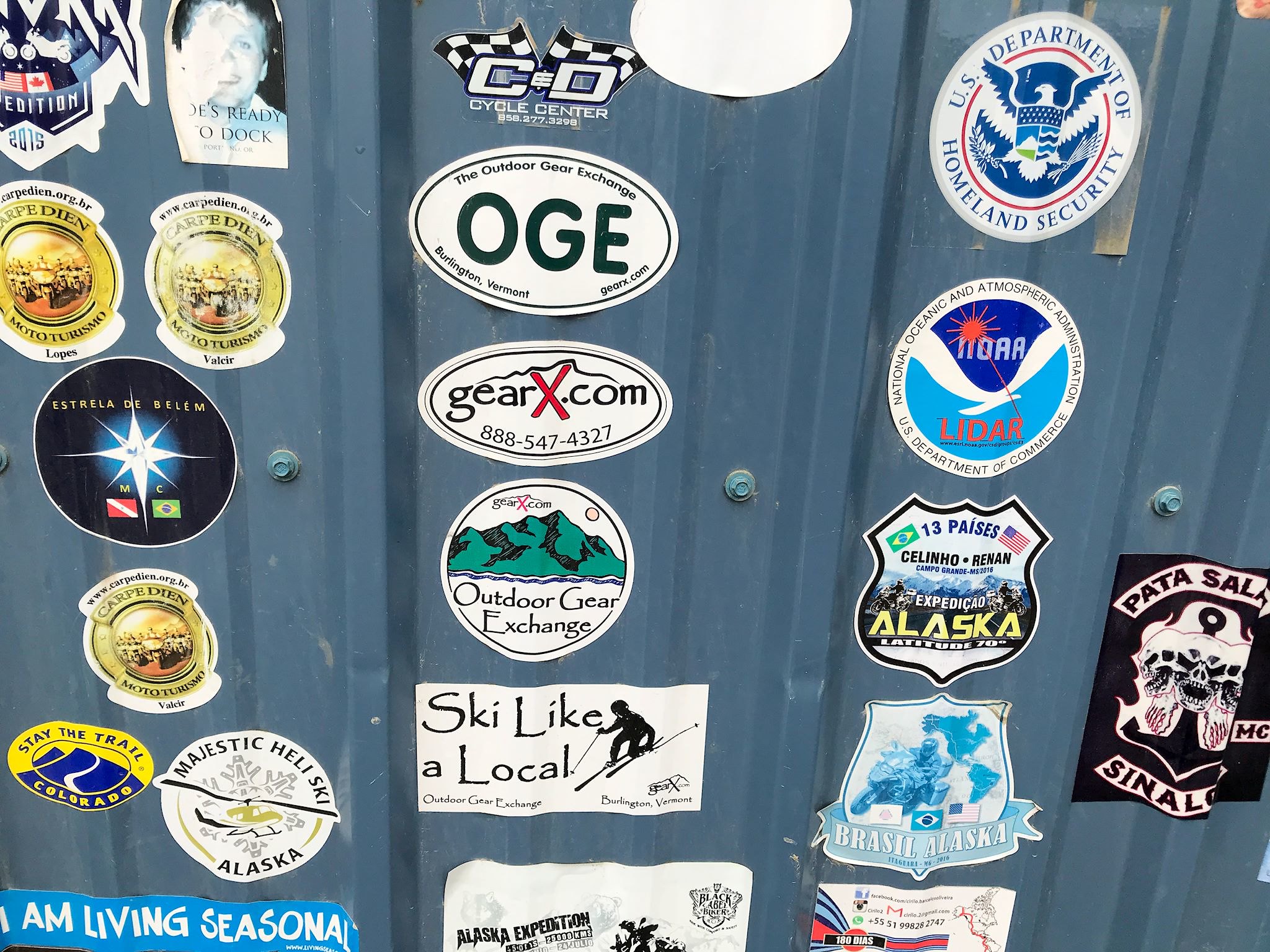
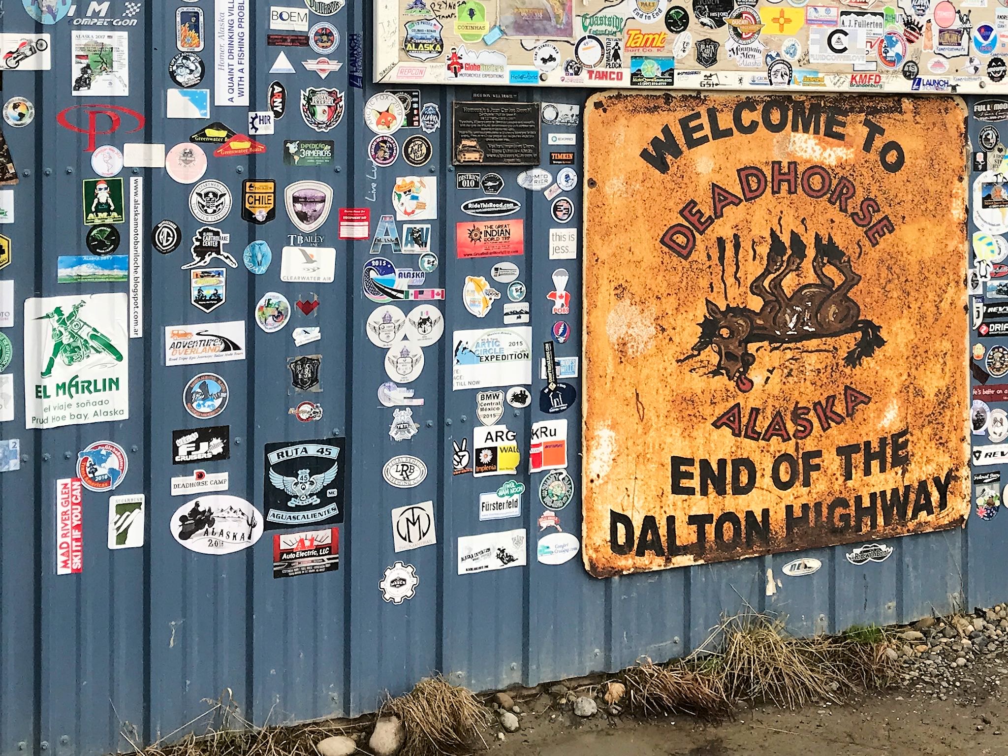
The official end of the Dalton Highway is at the Prudhoe Bay General Store. Here was something familiar – once again, we found ourselves staring at a sticker wall. Among the international stickers we immediately noticed a handful from Outdoor Gear Exchange, a favorite Burlington, Vermont outdoor store. Wasting no time (it was cold!), we once again made sure Sugarbush and Mad River Glen had a place on the wall. (For our non-New Englander friends, placing Mad River Glen stickers in out-of-the-way, interesting places is ‘a thing.’ Deadhorse is pretty out of the way, certainly the furthest place from home that we’ve ever been, though there’s been a MRG sticker on the International Space Station. Hard to beat that…) The store is a hub of activity. Several people stopped by while we were there, and a few glanced at our mud-covered RV and offered that knowing grin and a hello.

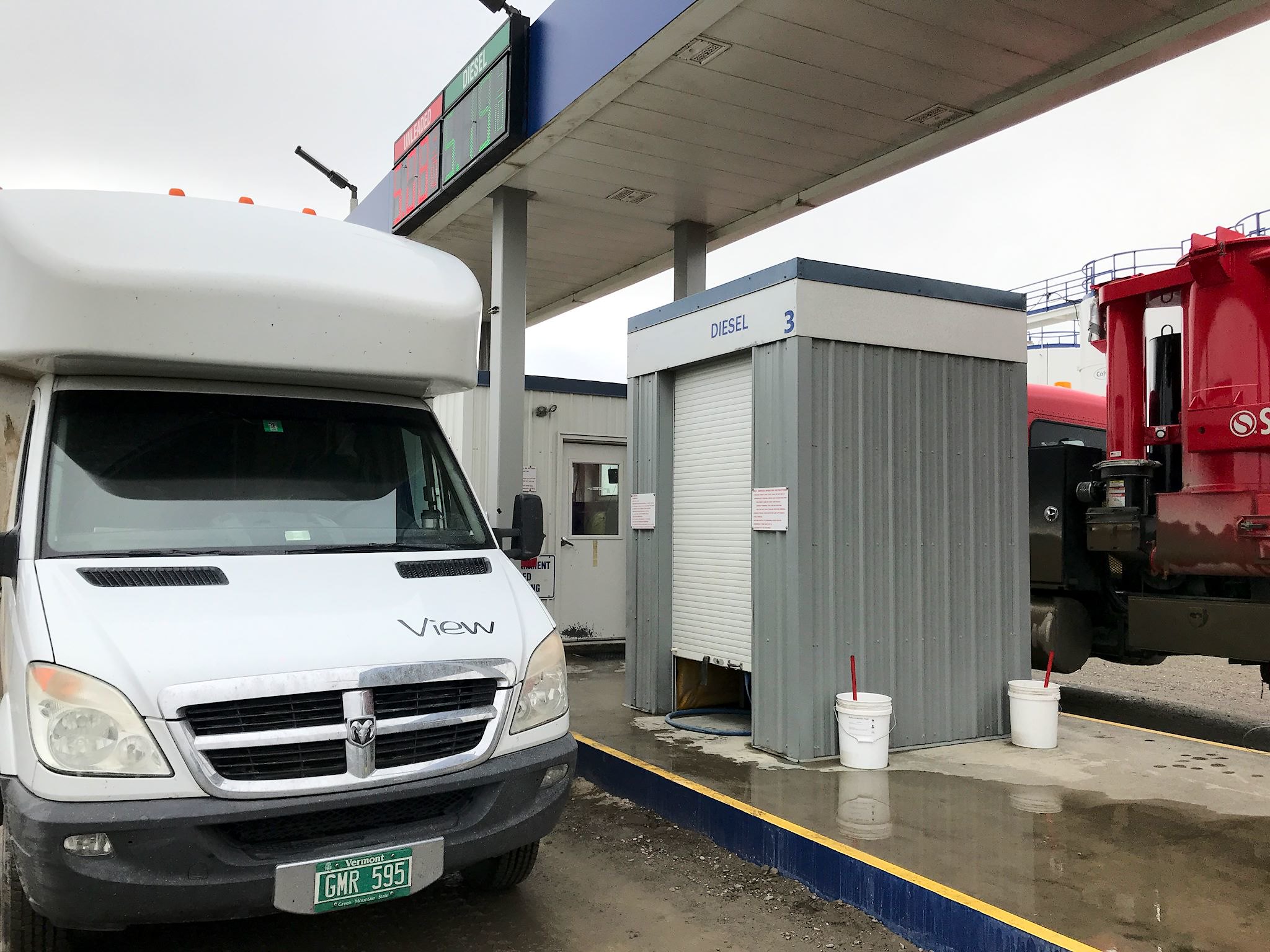
Just a few structures over from the store was the fuel station where the gas and diesel pumps live in tiny, super-insulated garages. You swipe your credit card and select your pump in a small insulated booth, then go outside and lift the tiny garage door to access fuel. Diesel was $5.19/gallon – a new record! End of the road pricing, worth every penny!
The end of the Dalton Highway is 10 miles from the Arctic Ocean. and the land on those last 10 miles is a secure area, owned by the State of Alaska and leased to the oil companies. The only access to the Arctic Ocean, on the other side of the security gate, is via a shuttle bus run by the security company. Of course we got seats on the shuttle! And of course, we had a million questions. Mike, our driver and host, delivered. He narrated the drive through the oil fields and answered everybody’s questions. Including, perhaps, some of yours…
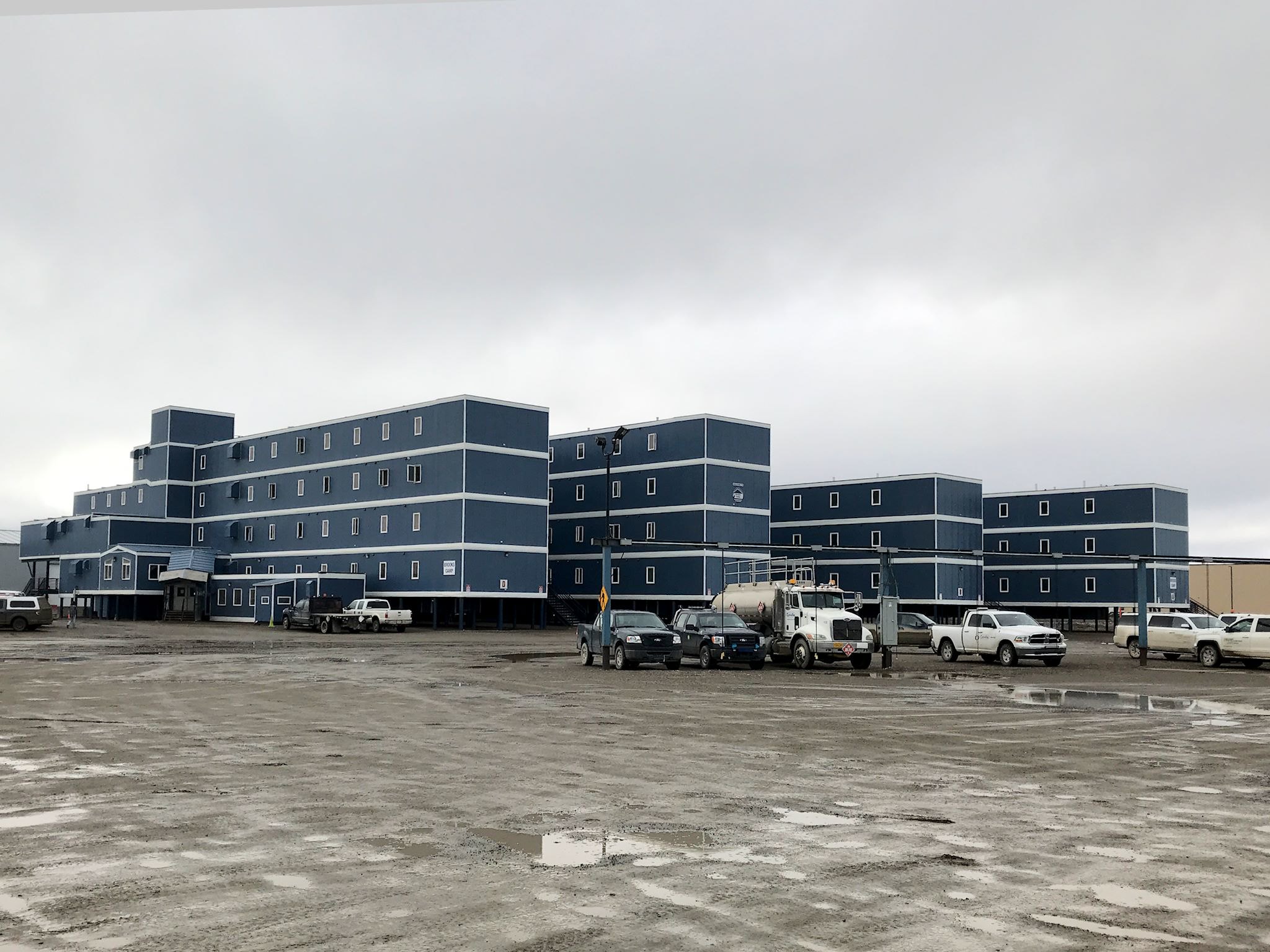
Deadhorse (aka Prudhoe Bay – same town) has a full-time population of zero, and a revolving population of 3000-4000 oil workers and support personnel at any one time. Fluctuations in personnel are related to the price of oil – more oil is extracted when the price per barrel is higher so more folks come to Deadhorse. Essentially all of the workers in the oil fields (also those in the Alaska Department of Transportation, Alaska Pipeline maintenance, and truckstops) work a rotating 2-weeks-on/2-weeks-off schedule of 12-hour work days. Benefits include living in a ‘camp,’ a unit in one of those boxes on stilts where 4 meals a day are served to accommodate two shifts, and a company-provided flight to and from Anchorage or Fairbanks every other week.
The North Slope – the land between the Brooks Range and the Arctic Ocean – is an arid wetland. It only sounds like an oxymoron… Permafrost is a deep layer of frozen earth, up to 2000 feet deep near Deadhorse. The tundra is a water-logged layer of soil or peat sitting on top of the permafrost. It’s like a sponge, varying in texture from a kitchen sponge with a rough green side to one of those big, puffy sponges you might use to wash your car. Walking on it, you can break through and sink ankle- or knee-deep into soft muck. Although it’s almost always foggy around Deadhorse, it rains less than 6 inches a year.
Temperatures in Deadhorse range from minus 80° F to plus 80° F, with an average temperature of plus 12° F. Everything is easier in the tundra when it’s frozen, so that’s when there’s more activity in the oil fields. The unidentifiable equipment we saw is all about construction, drilling, and maintenance and keeping people and stuff warm in minus 80° temperatures. Road and building construction techniques are highly specialized. Both, if built directly on the ground, would cause melting of the permafrost which would then turn to muck, which is easy to sink into, so they are built on deep insulated pads or, especially in the case of buildings, on stilts. (For anyone who’s interested, look up permafrost construction and ice road construction for some fascinating reading. I won’t bore everybody else with the fascinating (to me) details.)
The longest day of the year in Deadhorse is… 63 days, 23 hours, 40 min. Yup, the sun remains above the horizon for more than 63 days.

Mike’s duties as the shuttle bus driver also include handing out towels and Polar Plunge certificates to the brave souls who chose to dip into the Arctic Ocean. Doug would have none of that. I’m crazy enough, but not stupid. It was 32° F, snowing lightly, and there were mini-icebergs floating in the ocean along the mud-covered beach. So although we didn’t plunge in, we did touch the Arctic Ocean!
As for the truckers, they were pretty busy driving. We saw none at the truck stops or pullouts in situations where we could’ve struck up a conversation. As we met or were passed by truckers, we observed that they were all professional, respectful, and cautious. We have a tremendous respect for those who drive this highway once or twice a week. We waved to all as we met, and most waves were returned.
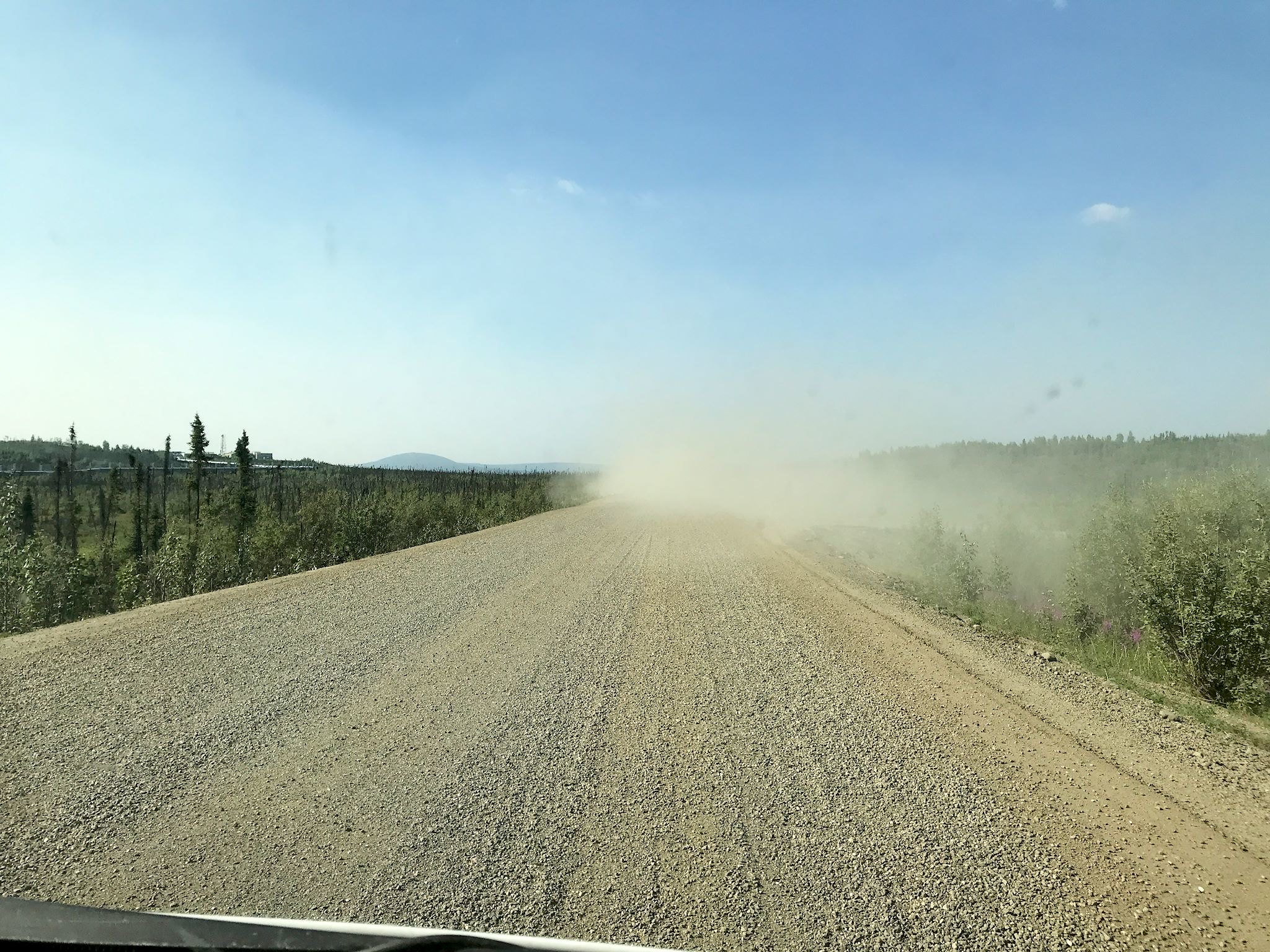
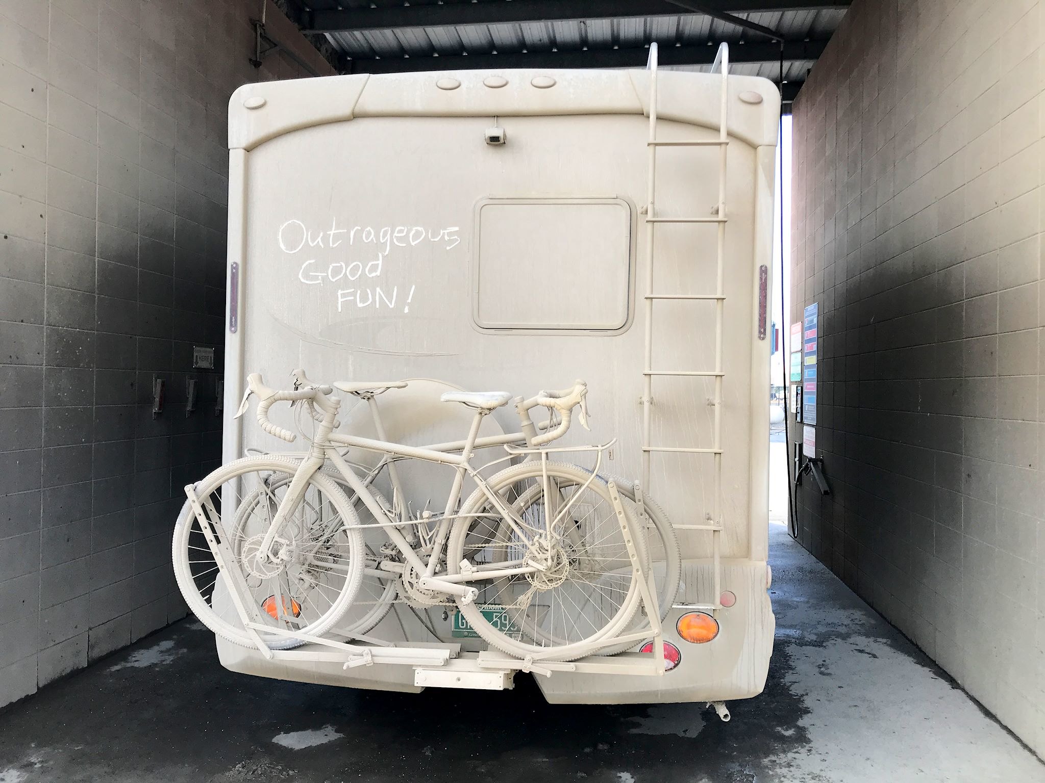
Yes, we got muddy, and we got shaken quite vigorously on the washboard sections. We didn’t lose our windshield to rock chips. We didn’t break down, had no flat tires, didn’t sink into the soft shoulders, didn’t get attacked by a bear, didn’t get eaten by mosquitoes. And we got muddier still. All in all, outrageous good fun!
For anyone who’s interested, more pix – Fairbanks to Coldfoot, Coldfoot to Deadhorse, Deadhorse and the Arctic Ocean, Deadhorse to Coldfoot, Coldfoot to Fox…
Outrageous good fun definitely sums it up. What an amazing adventure. Thanks for sharing!
You’re welcome! Thanks for being loyal readers! Your notes are fun! Looking forward to hearing about you adventures…
Hey Doug. What a blast! What’s the max range on your RV? In that terrain.
How close did you cut it? Dual tanks?
Thanks
Hi Pete! The tank holds 24 gallons and we’ve averaged 15 mpg since we’ve owned the rig, which would give us a range of ~360 miles. We actually did a bit better than 15 on that adventure, and the largest distance between fuel stops was about 240 miles, so no problems. The worst we’ve ever seen was 11.3 mpg so even then we would’ve been ok.
Love reading about your adventure. Will be headed that way to do some trucking on that same road. Sounds like a total blast was had by all.