The road to connect the settlements and resources of western and coastal Labrador – the Trans-Labrador Highway – had been in the works since the early 80’s. Dirt roads and walking trails between settlements were widened into gravel roads in sections, then paved as demand and budgets allowed. The last remaining section of gravel was paved in July, 2022 – and the road was complete!
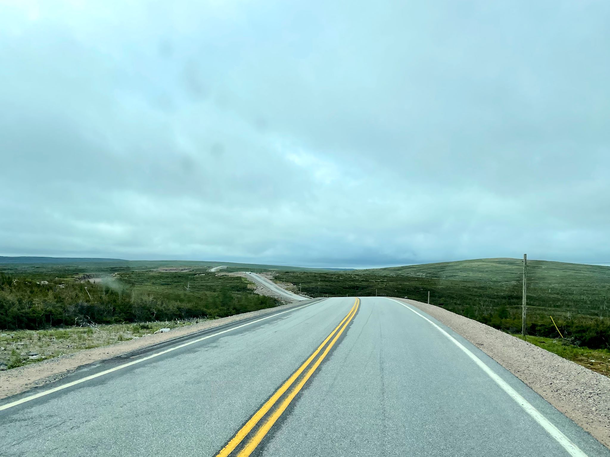
Just past the sign thanking us for visiting Happy Valley-Goose Bay, there is another sign that says ‘no fuel for 400 km/250 miles.’ So we filled the tank before leaving, and then we headed east. The terrain continued through boreal forest and became increasingly mountainous until we reached the coast. Along the coast, the mountains continue, although the boreal forest gives way to the wide expanses of taiga with views of coves and bays and the Atlantic Ocean, with occasional sightings of icebergs slowly melting their way south.
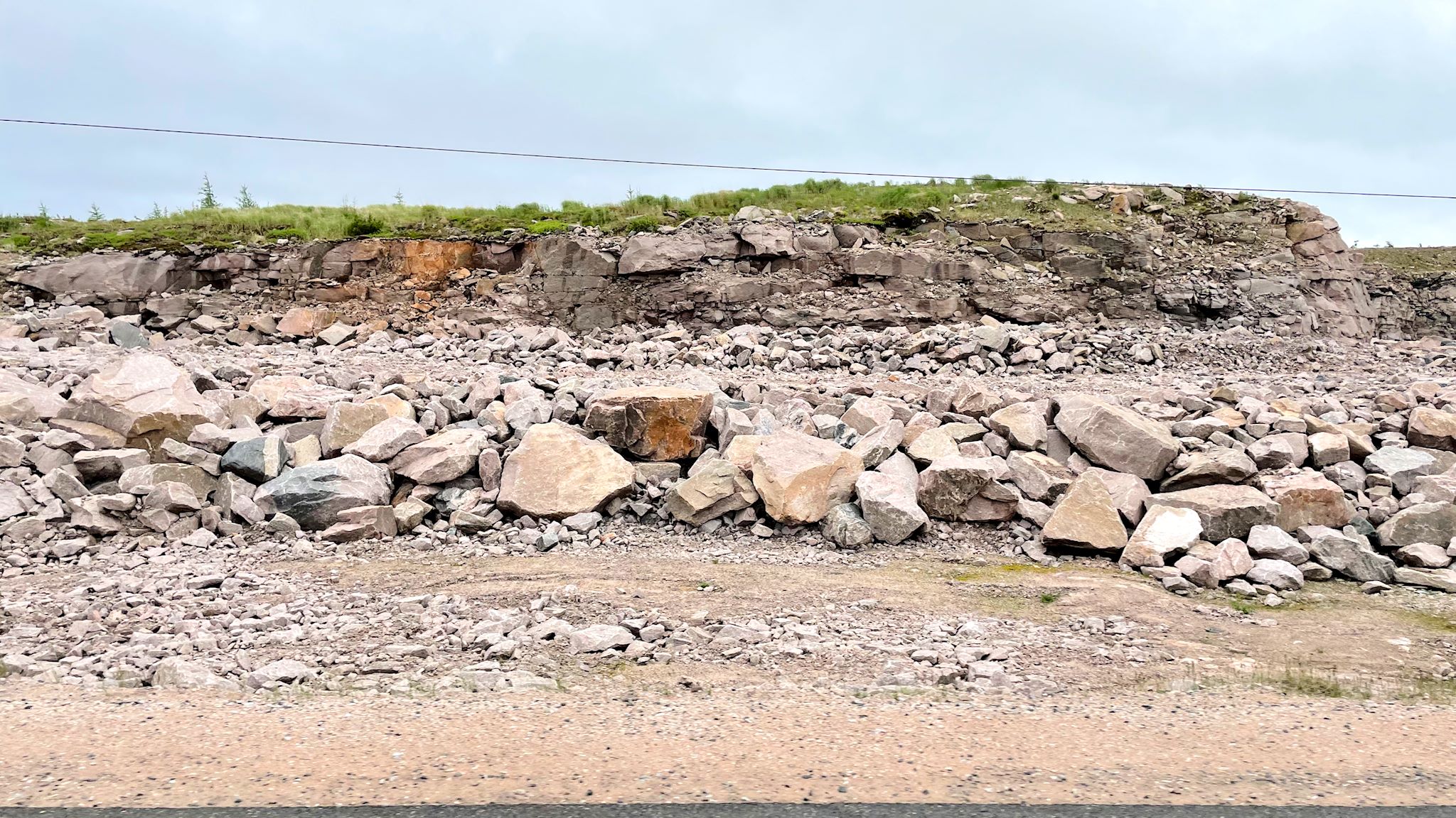
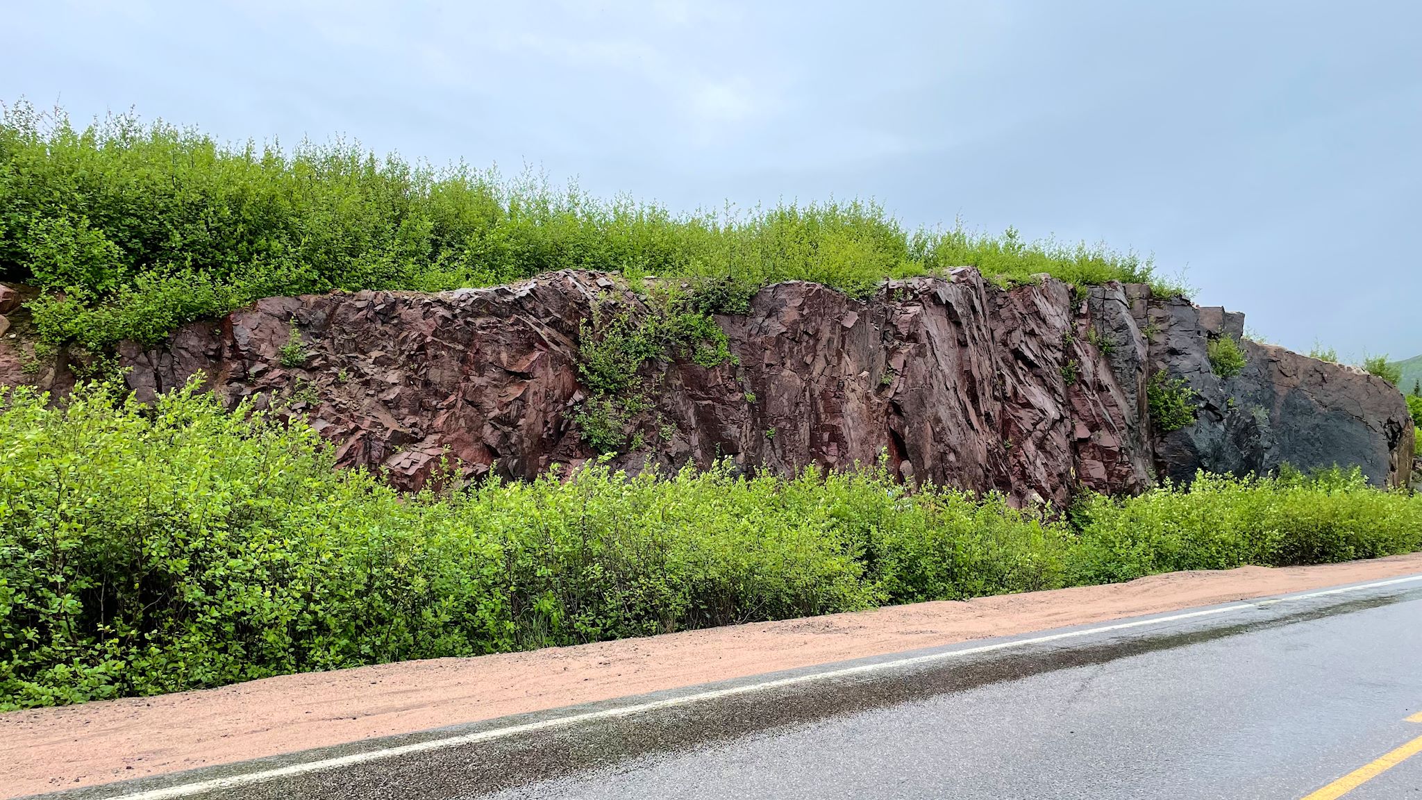
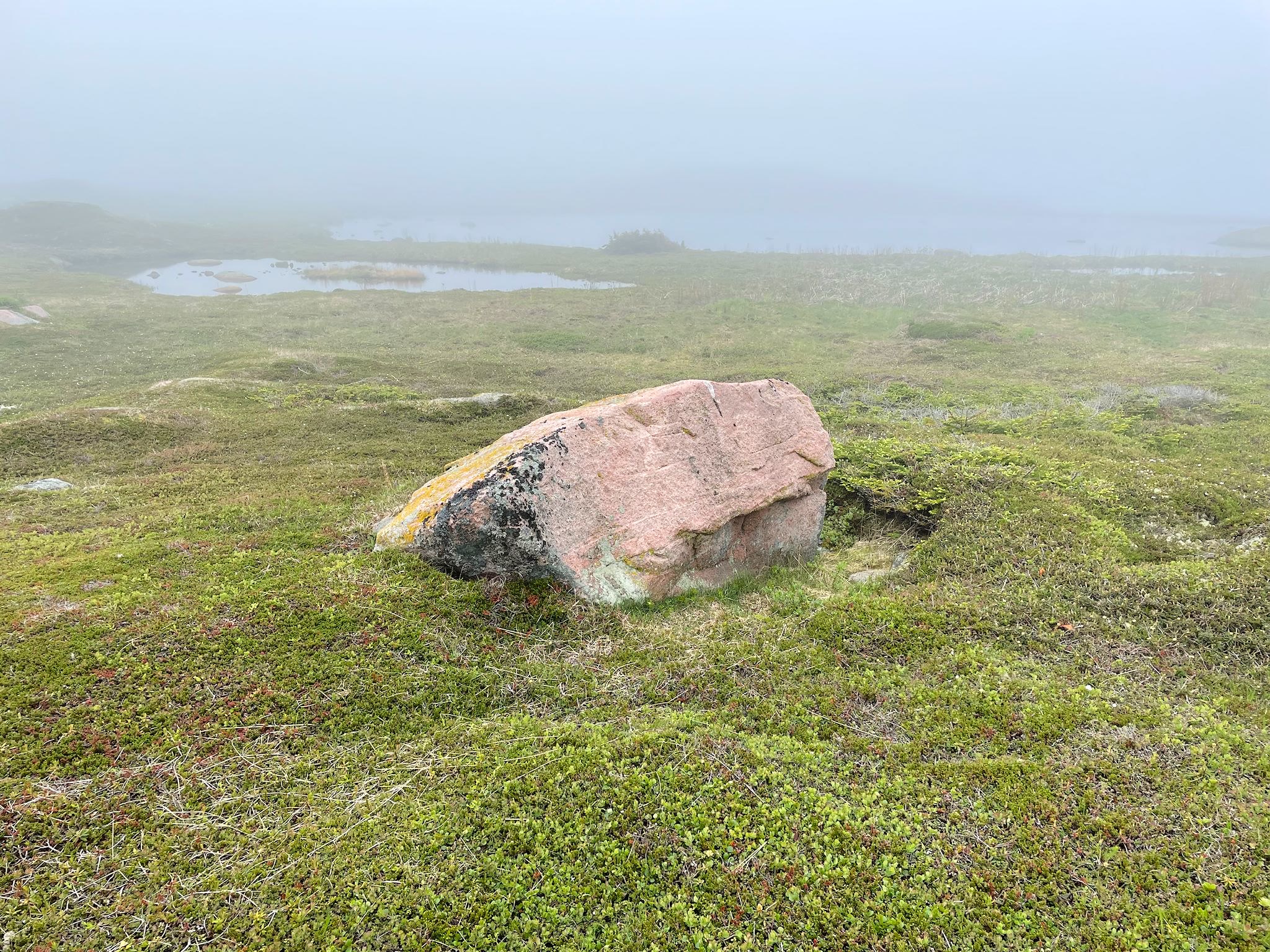
Something I found interesting… Road construction on the Canadian shield is unique. It consists of quarrying rock very local to the section being built. There’s a quarry every few miles where rock was cut away then crushed into stone, gravel and sand as needed. When that section was done, it appears they closed the quarry by dumping a pile of rocks at the entrance. Why? Who would steal giant rocks? Maybe liability? (Thinking like an American…) Once we reached the coast, I think I found the answer – rock art! The coastal sections of the road were 40 years old. Over time, mother nature had converted these former rock quarries into beautiful displays of the worn cut rock framed by greenery. Squealing at a rock quarry!? Yup, Doug heard it…
Despite signs warning us about moose all along the TLH, we saw only one. Also three bears, 4 rabbits, and a beaver.
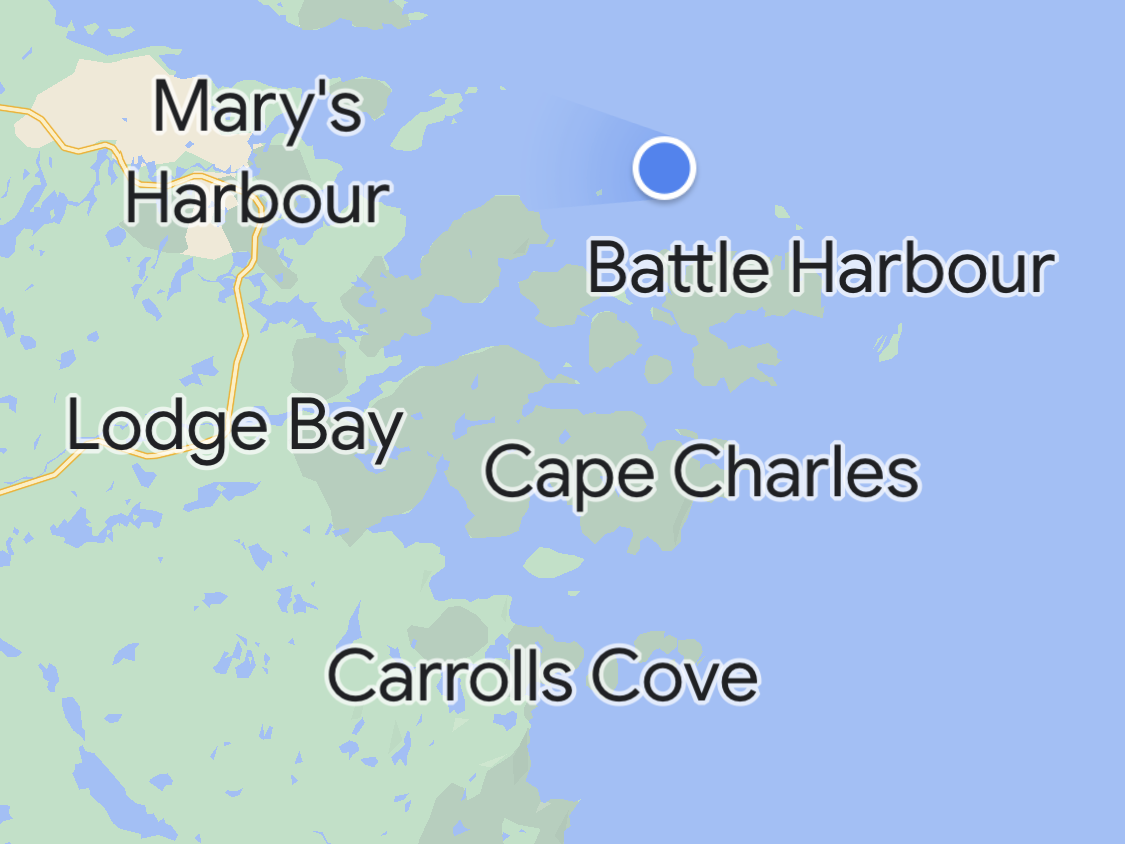
We refueled at Port Hope Simpson, a tiny town on the Alexis River, the first fuel stop since Goose Bay, and the last diesel we’d see for quite some time. From there we made our way to Mary’s Harbour, where we spent the next three nights.
To set the stage for Mary’s Harbour and other small communities on the coast of Newfoundland and Labrador, here are three bits of fascinating (to us) history, super condensed, that will apply to essentially all places we’ll likely visit in the next month.
The British physician Wilfred Grenfell was sent to Labrador in 1892 on a mission to support the health of the fishermen in communities dotting the Labrador coast. He fell in love with Labrador, its rugged coastline, and its people. Over time his support formally expanded into the Grenfell Mission, which built and staffed hospitals, schools, and other social service systems improving the lives of the settlers and indigenous people. The Mission continued until 1981, when health services were transitioned to the provincial government. In the town of North West River, we spoke with a nurse from Ireland who mentioned being recruited to work in a Grenfell hospital. So far, every small community we’ve visited in Labrador has had a Grenfell story to tell. For anyone who’s interested, here’s more on Dr. Grenfell, who spent the last portion of his life in Charlotte, VT.
Shortly after Newfoundland and Labrador became a province in Canada, the Canadian federal government approached the province with a resettlement program. The intent was to stimulate the economy by providing financial assistance for settlers to move from their many tiny and isolated communities to ‘growth centers,’ where a larger population could stimulate the development of sustainable industries. It would also reduce the government’s cost of providing healthcare, education and social services to people in these hard-to-access communities, often reachable only by boat, foot paths, or dog sleds. In the first 20 years of the program, 30,000 people relocated, leaving behind 300 ghost towns. Although the program was deemed successful by the federal and provincial governments, the move was difficult for many, both financially and socially, as the stipend for moving didn’t cover all costs for starting over in a new town, and culturally there was much left behind. The program remains controversial, although a voluntary, seldom-used program remains in place today. If you are interested in more information, check here.
Remember the insane abundance of great fishing? Canadians, Americans and Europeans enjoyed sustainable cod fishing for nearly 500 years in the region, as indigenous residents had for millenia before. New fishing technology developed in the 1950’s, specifically trawlers and longliners, cod traps and gill nets, followed by offshore fisheries (freezer ships) enabled wider and deeper fishing over longer periods of time, with huge increases in catch. By the early 80’s, cod stock was unsustainably depleted and the fish no longer existed in commercially viable quantities. In 1992, the Canadian government placed an emergency moratorium on cod fishing off the east coast. Nearly 40,000 people (fishers and those in related industries such as processing and shipping) lost their work and their livelihood. Although the moratorium was initially proposed to be in place for 2 years, it is still in place 30+ years later and recent research indicates that it will take another 80+ years for the cod population to recover. All those living in fishing communities on the coast of Newfoundland and Labrador have had to reinvent themselves – other types of fishing (crab, salmon), construction, fly-in/fly-out work at remote mines, coastal tourism, or something else. Many have had to move away from the coast to find work. For anyone who’s interested, here’s more info on the 1992 cod fishing moratorium.
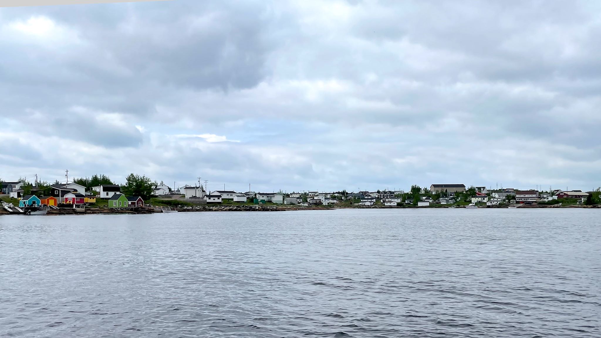
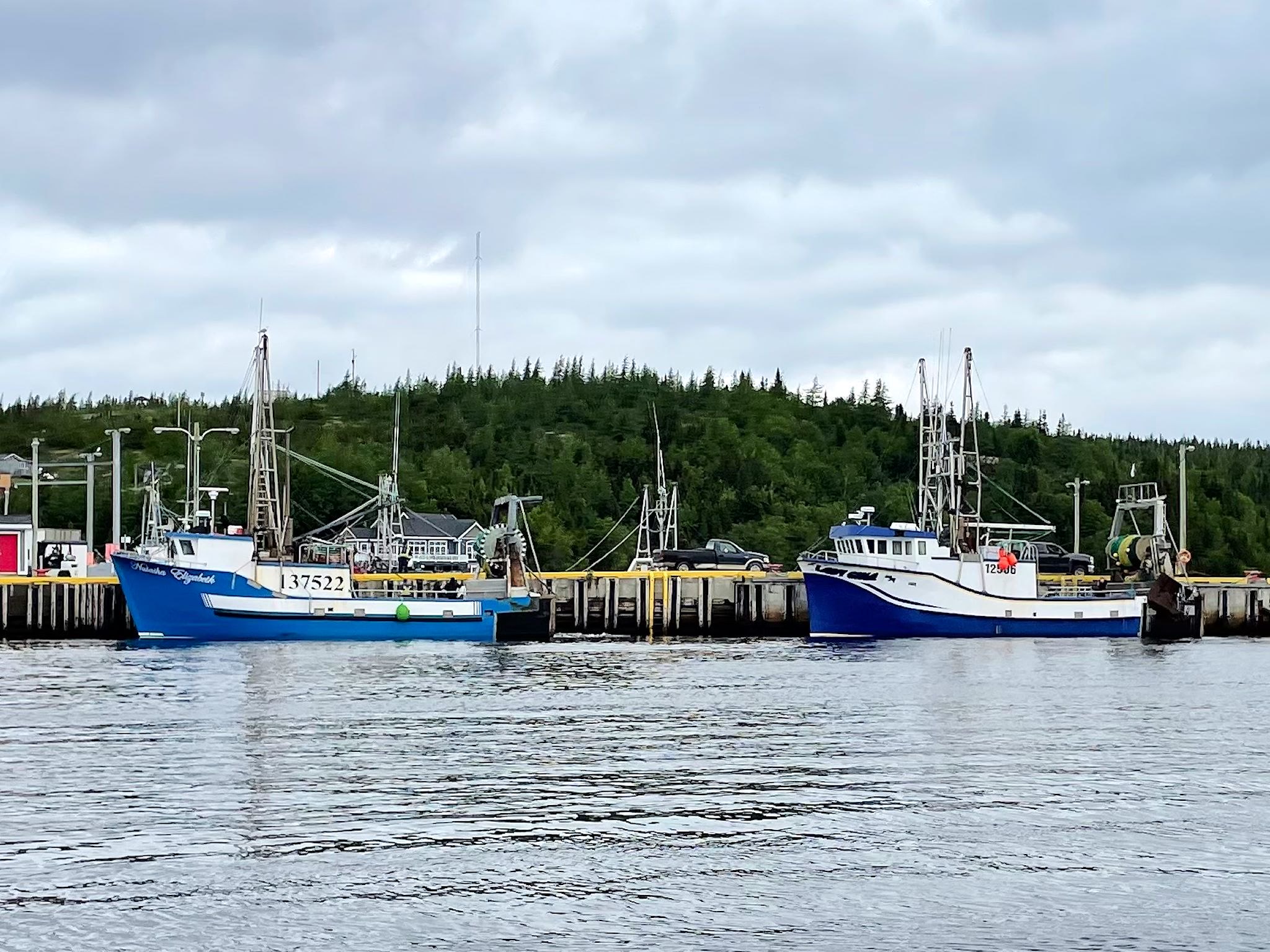
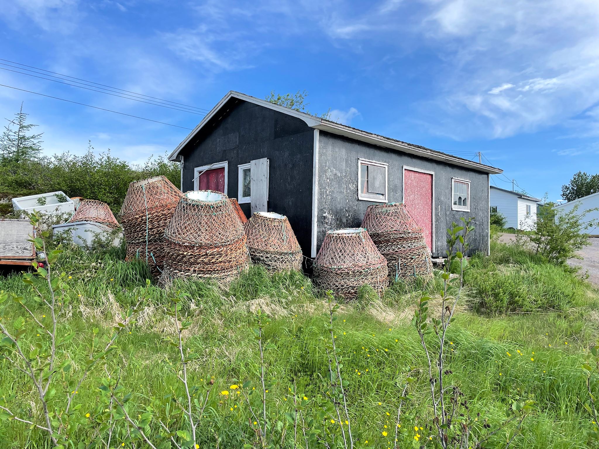
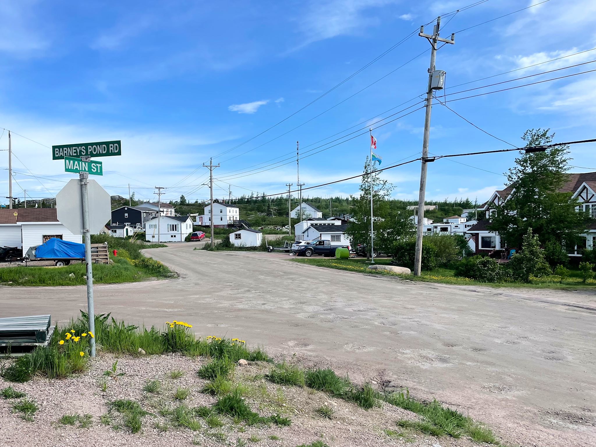
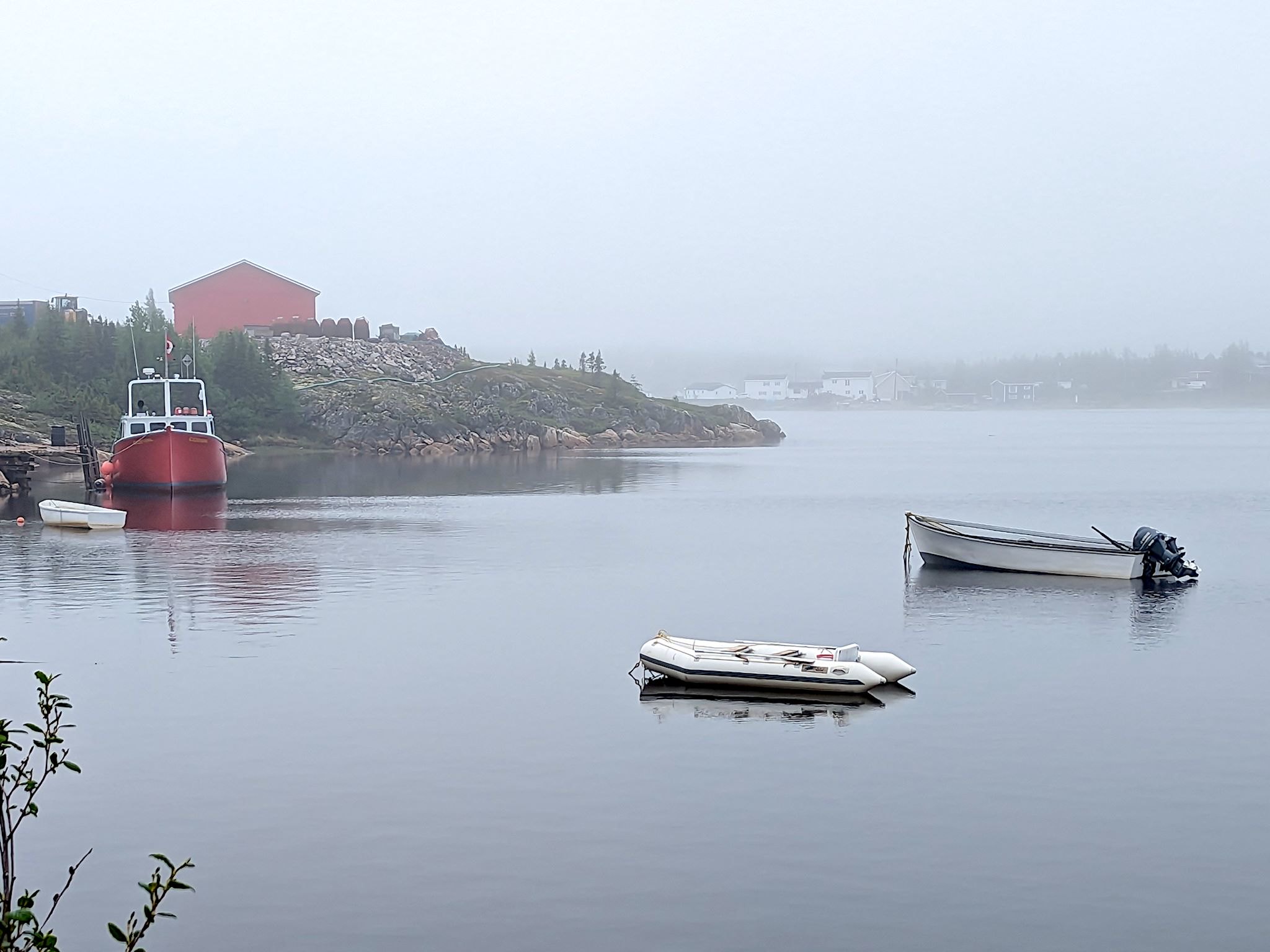
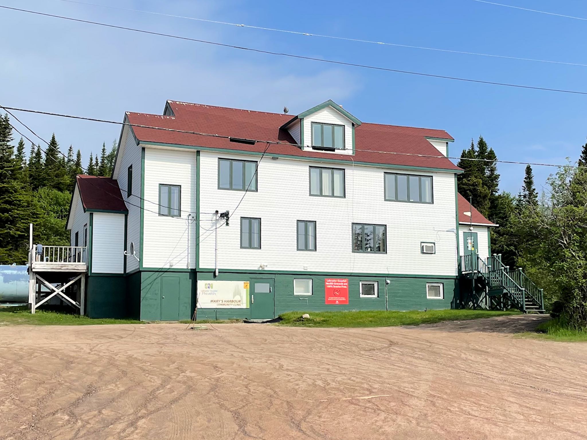
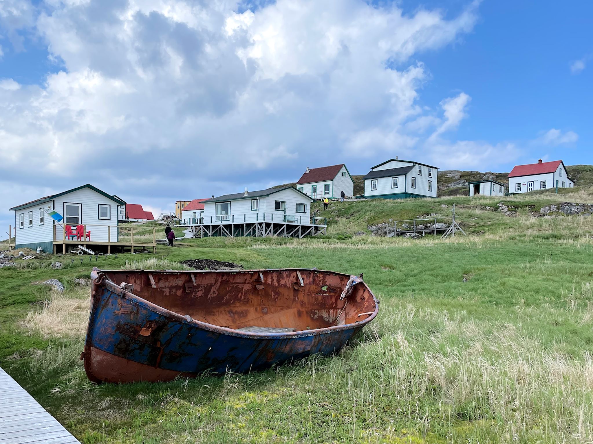
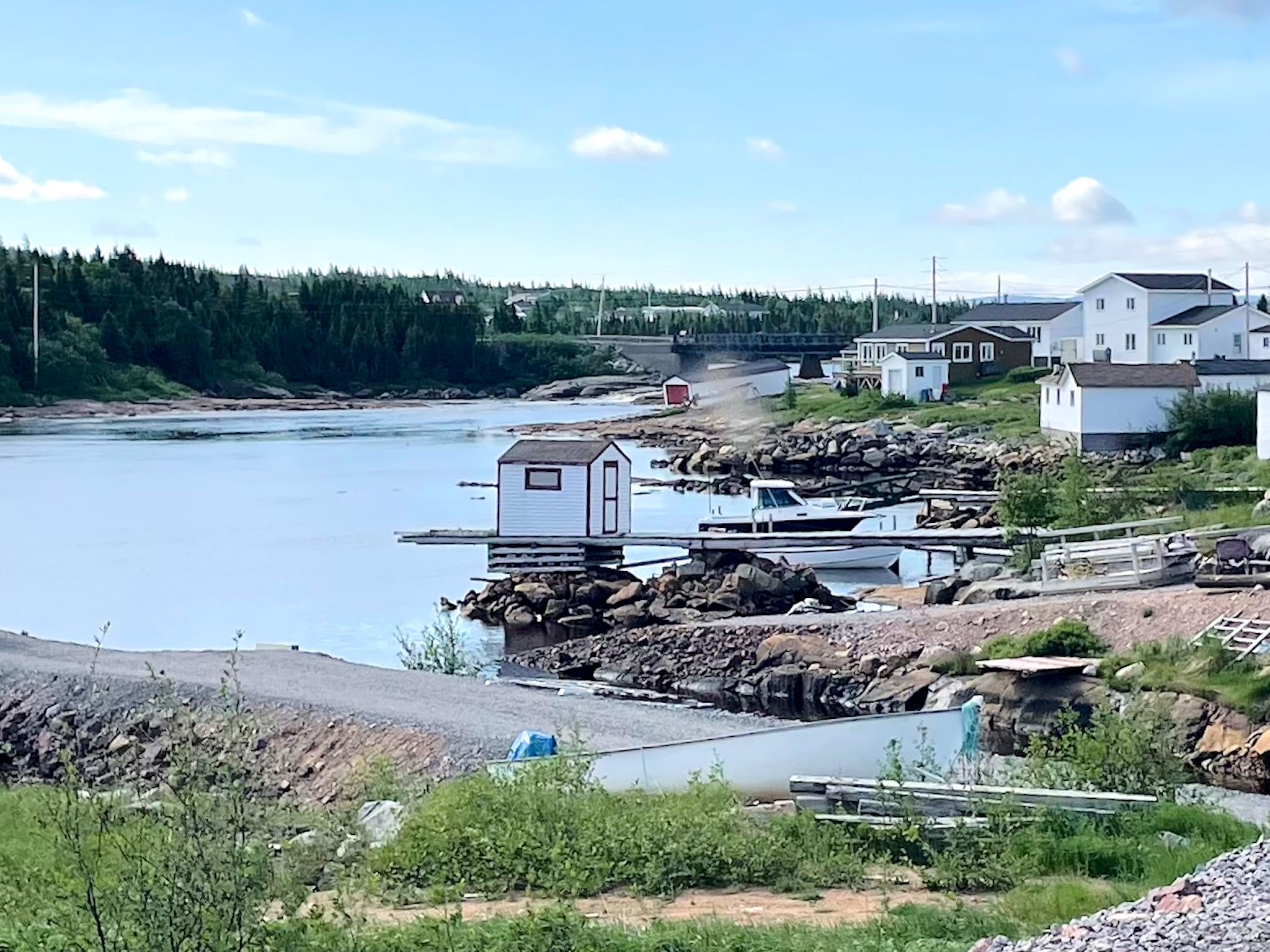
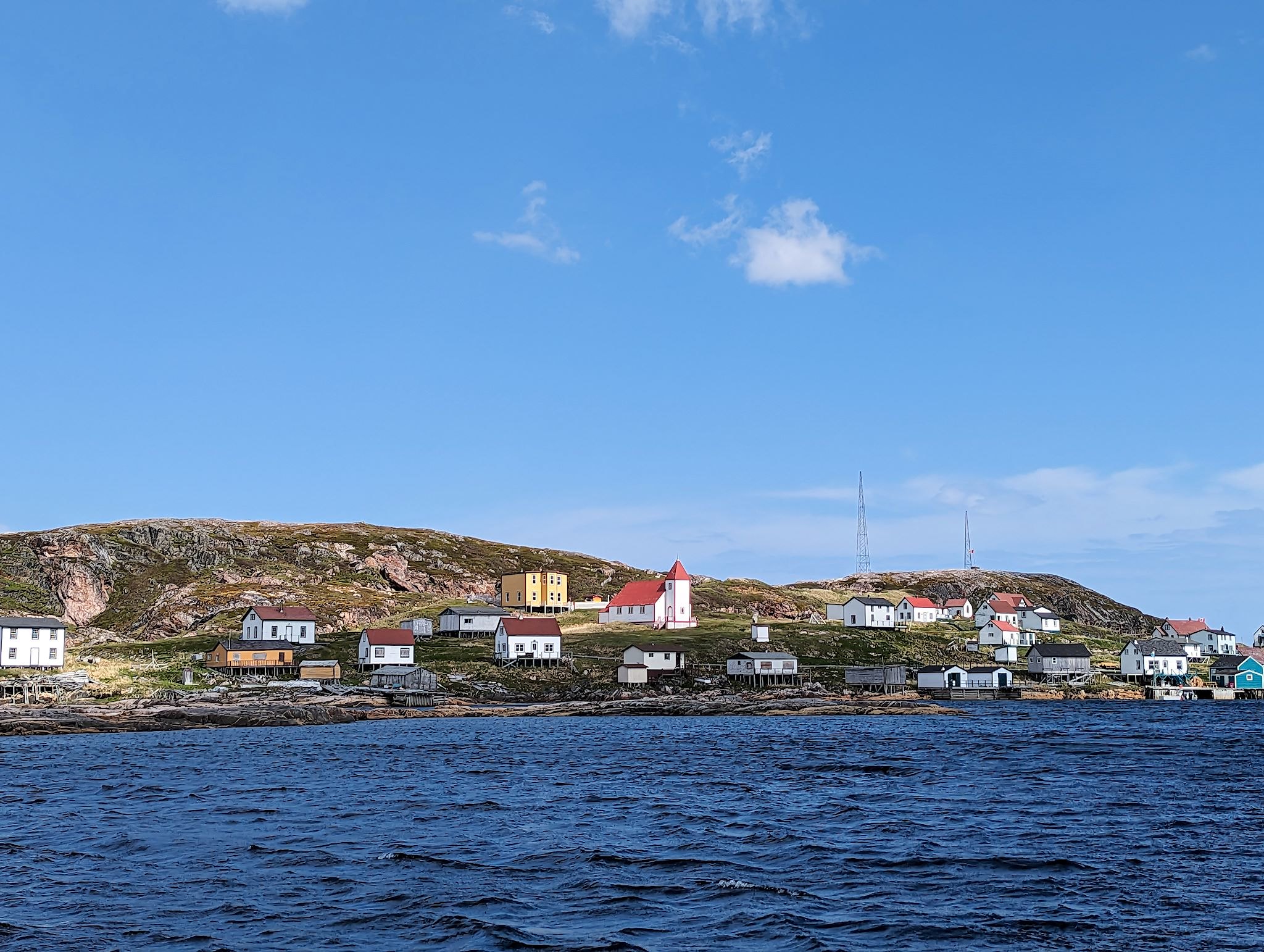
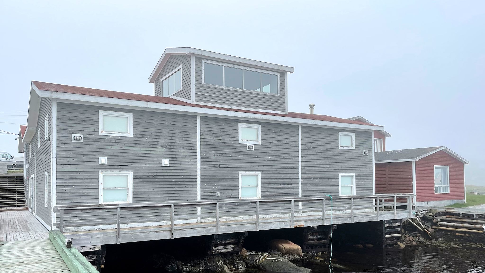
The beautiful town of Mary’s Harbour was established in the 1960’s when the hospital from Battle Harbour on Battle Island was relocated to the mainland. Today, it looks like the quintessential photo of a Labrador fishing community. Houses dot the shore around the harbor, many with fishing boats tied to docks. The town prospered during the cod boom, and following the cod moratorium was able to transform itself into the crab fishing and processing center it is today. This transformation allowed it to retain the characteristic look and feel of traditional coastal fishing towns. Although we enjoyed the long drives through west Labrador, walking the unpaved Main Street through Mary’s Harbour during our leisurely stay was a pleasant change.
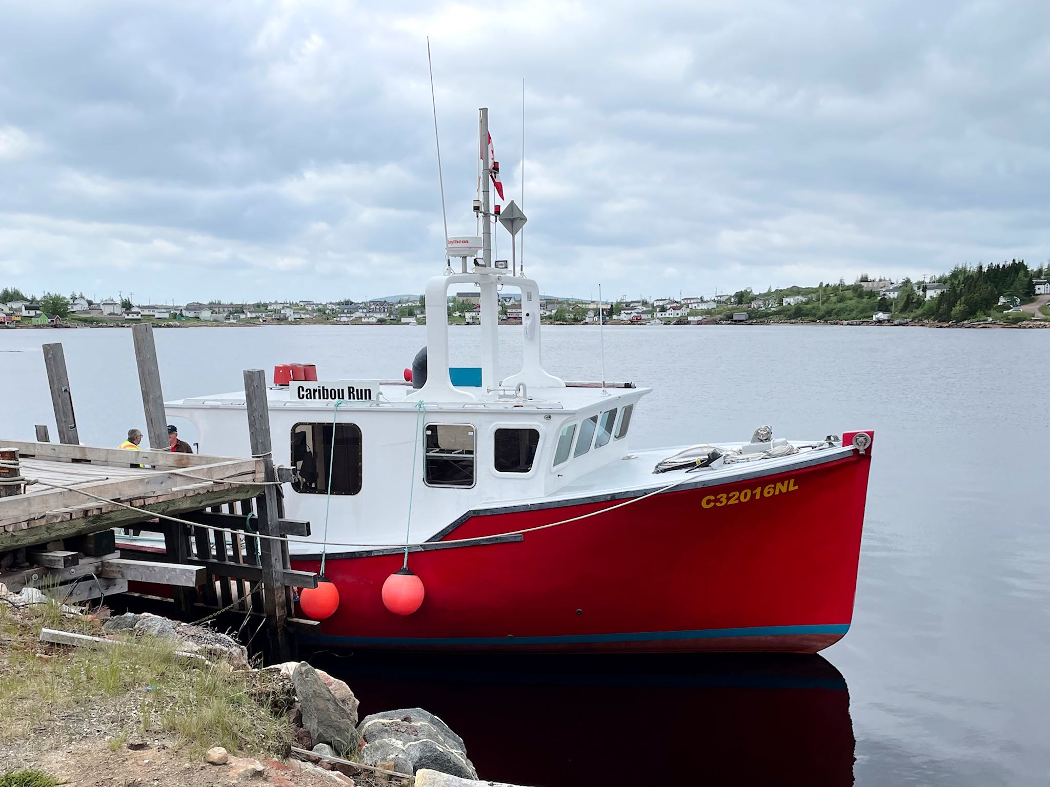
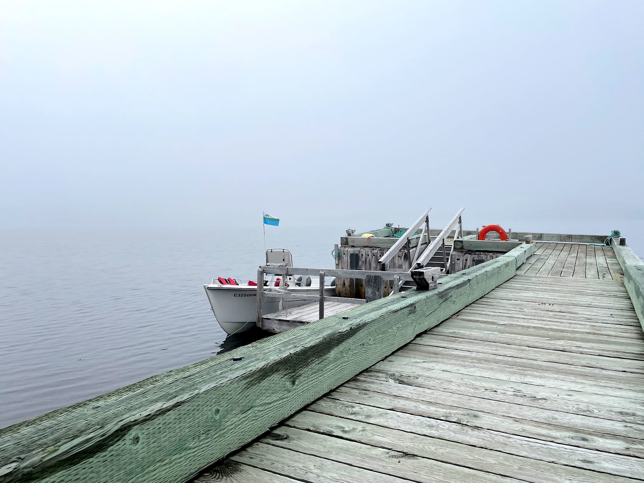
We took a day trip to Battle Island with Jim and Cindy Jones, who own and operate a beautiful red and white fishing vessel called the Caribou Run – clearly much more than a simple shuttle and one of the highlights of our visit! Cindy told stories en route and answered thousands of questions from the 8 of us passengers on board. Captain Jim sought out for us an iceberg floating by, circling it (safely, of course) so we could all squeal, and harpooned a mini-iceberg, presumably to be used for cocktails later on. We learned that Jim had grown up in Battle Harbour, so there were stories to be heard.
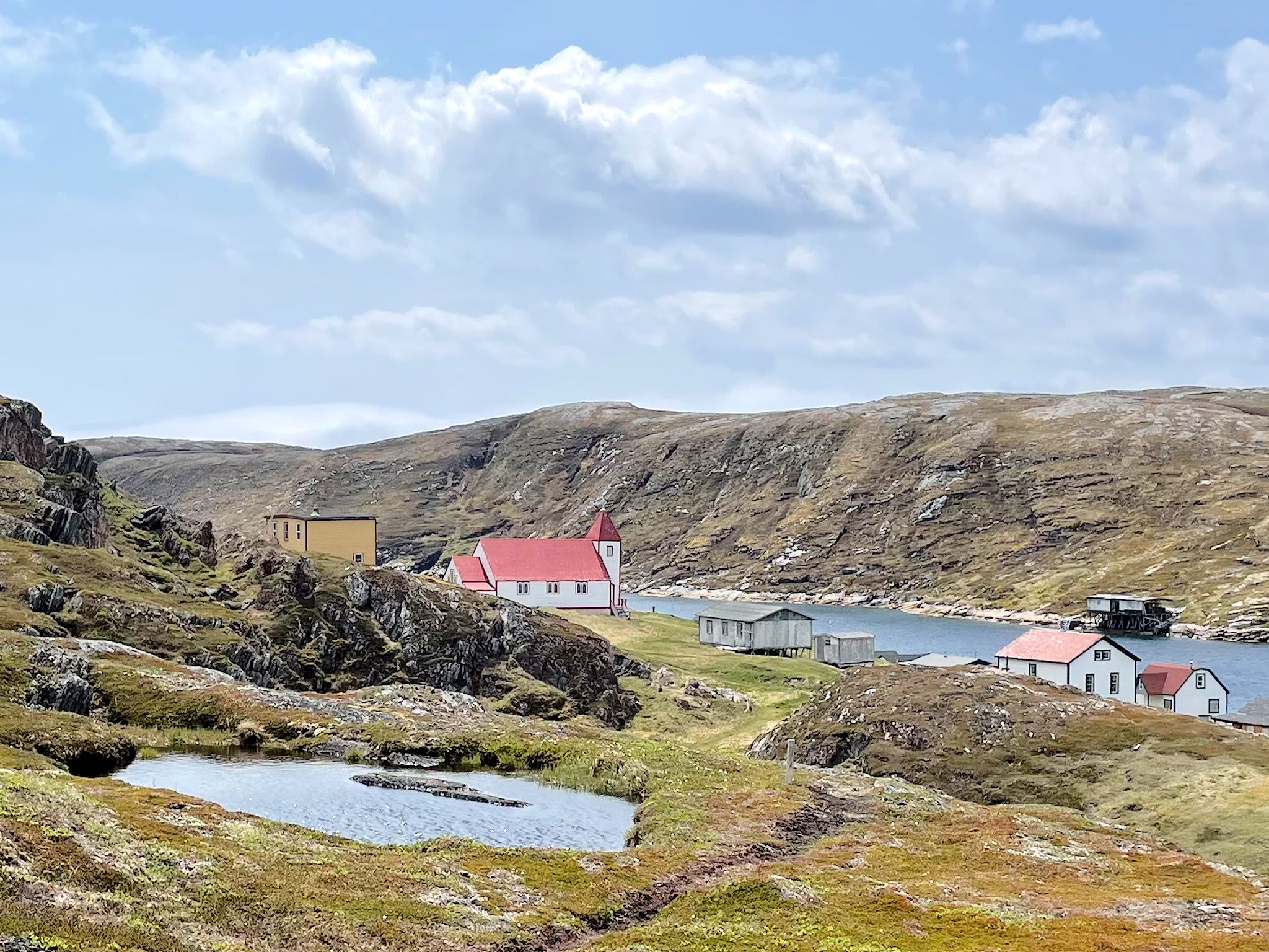
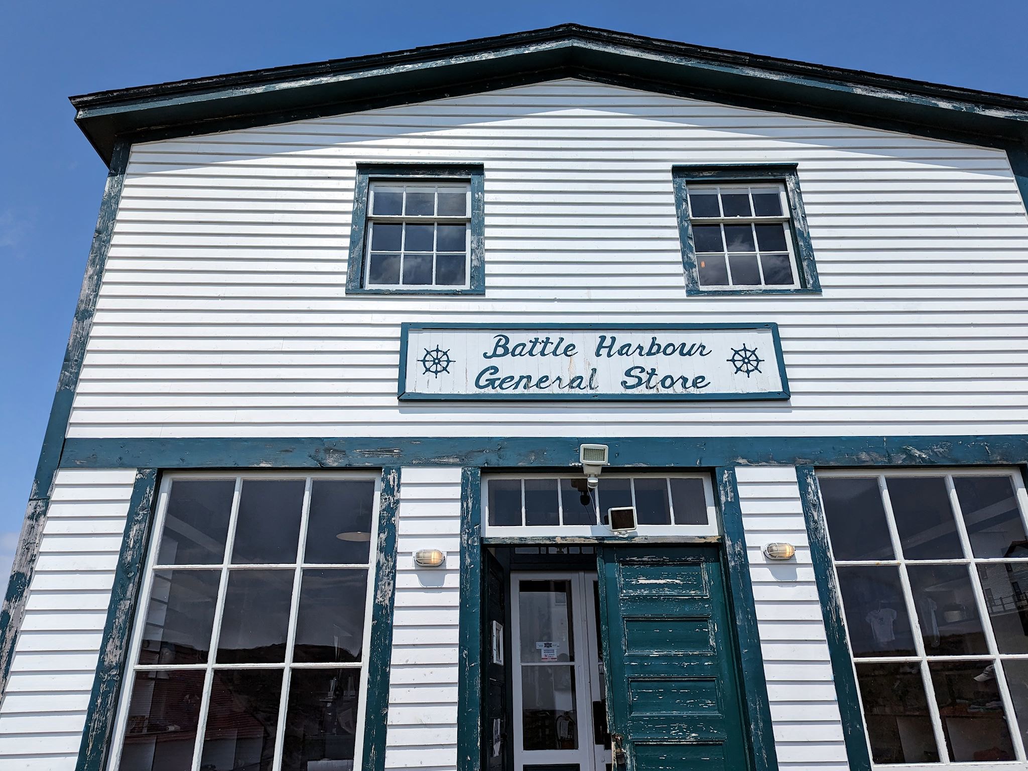
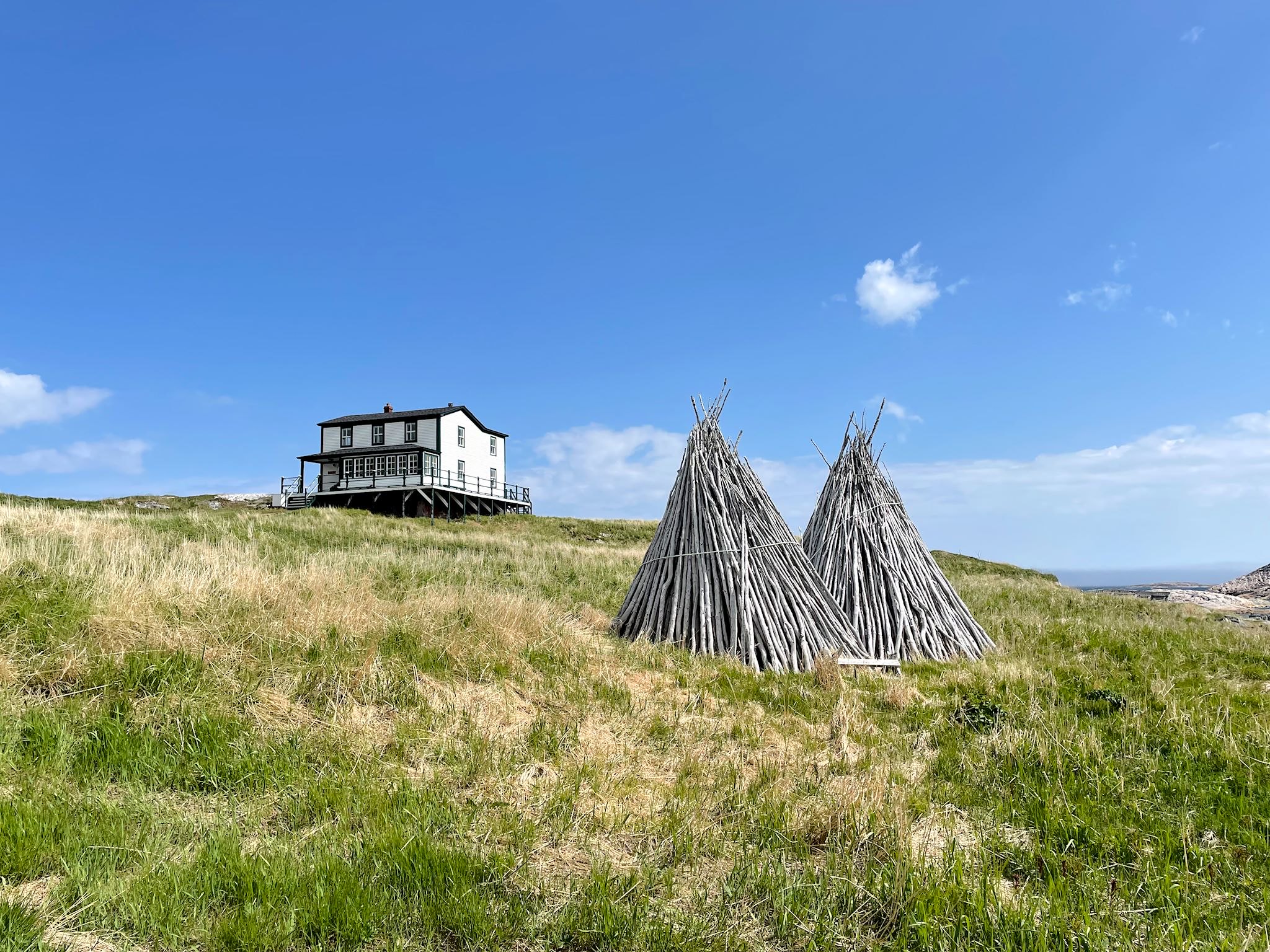
We loved Battle Harbour! The town on Battle Island was known as the Capitol of Labrador in the 1770’s, being at the center of a bustling salt cod industry, and a major port for exporting said cod to Europe. When the town was resettled in the 1960’s, the remaining commercial buildings, church and many residences were left for the most part intact and unmolested, albeit subject to weather. Years later a group of volunteers, including many former residents and family members of the Island, formed the Battle Harbour Historic Trust. They restored the church starting in 1991, eventually restoring and rebuilding what remained of the village. The Trust runs a hotel for a true getaway on this island with a handful of residents. The hotel’s overnight guests are shuttled by boat from Mary’s Harbour, and the staff gives daily tours of the village. There is a pleasant hiking trail around the island.
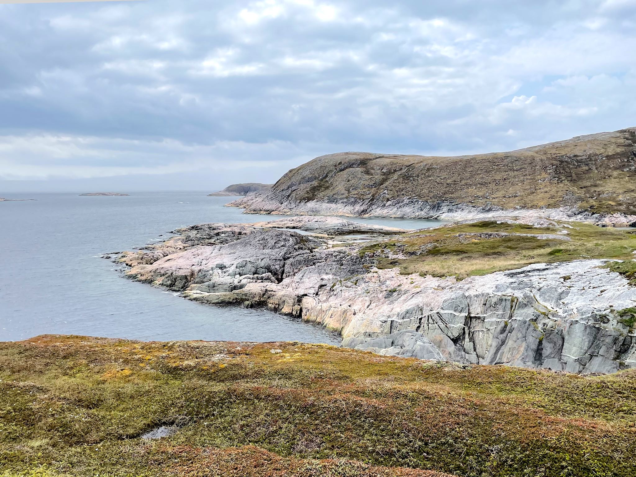
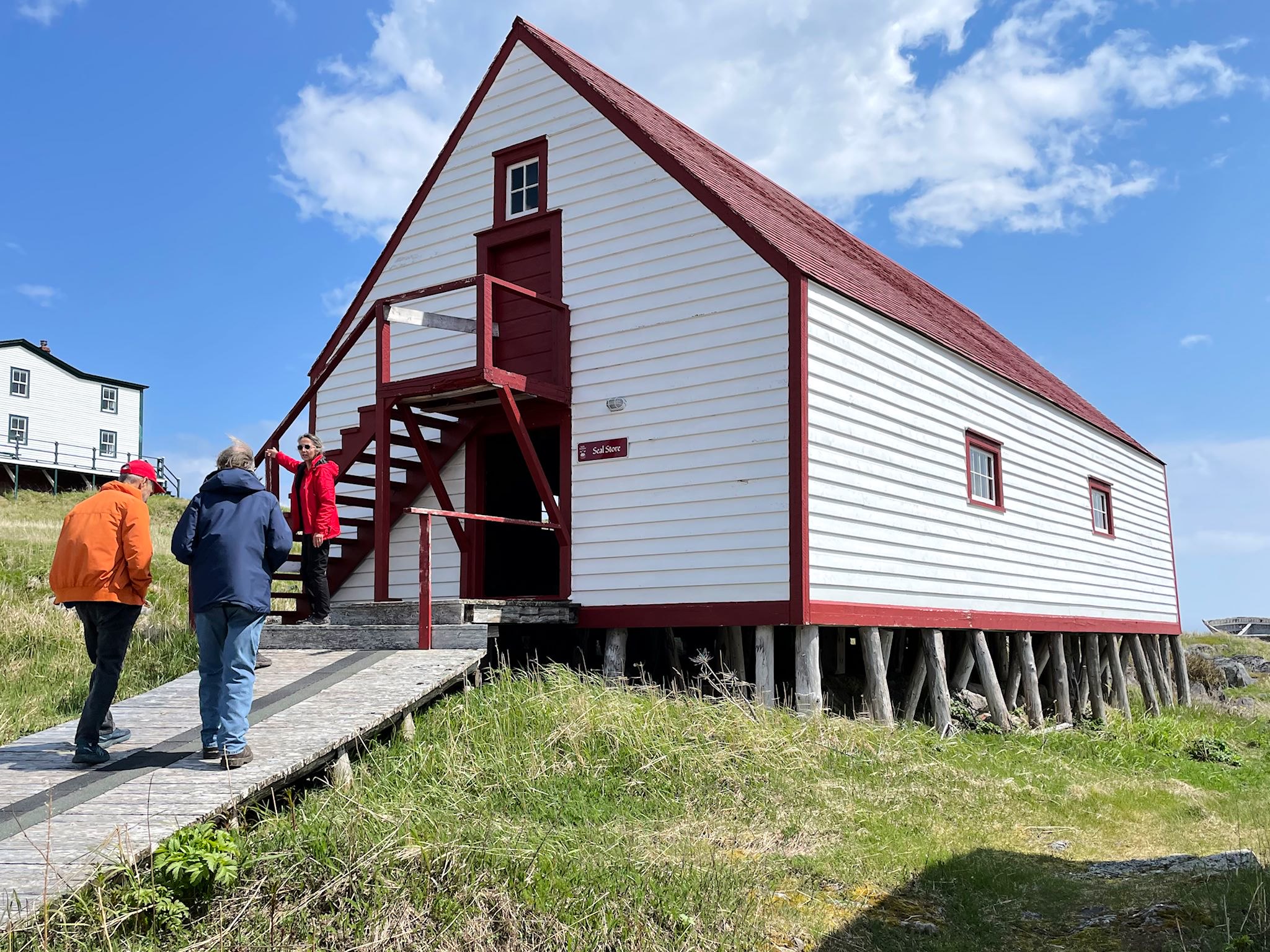
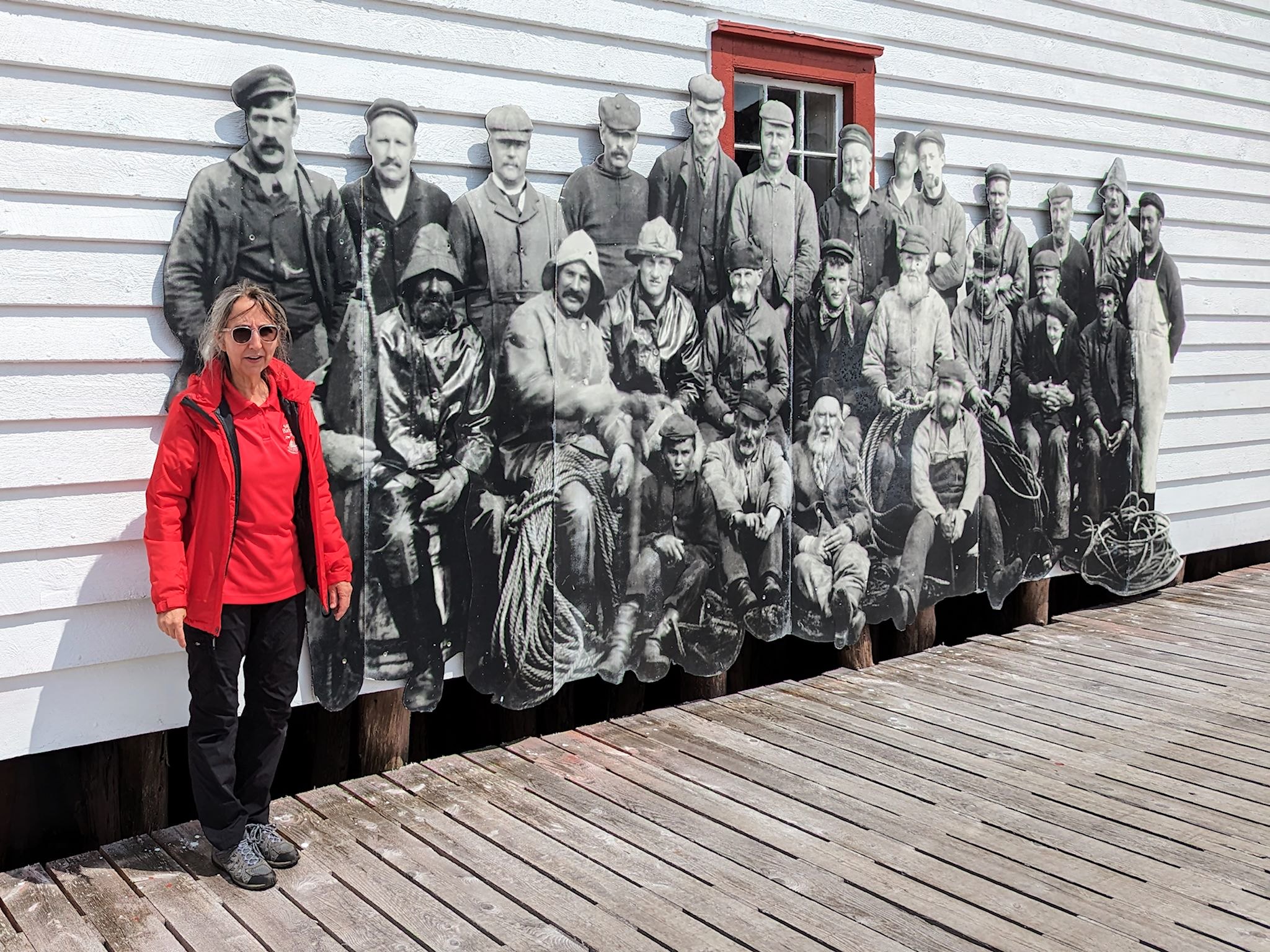
When we arrived, Jim and Cindy turned us over to the Hotel/Trust staff. Another highlight of the day was our tour guide, Jenny, an historian and Trustee who had recently moved back to Battle Harbour. Yes, back – her dad was a fish trader and she, too, grew up in town on the Island. She provided a tour of the commercial buildings, how the cod was fished, processed, sold, and transported. Her narration drew delightfully from her family’s experience, much of it coming through the eyes of a child. In addition to the guided tour, we hiked (surprise!) the unguided trails over and around Battle Harbour Island with stunning views of the Labrador coast on a bright sunny day.
Our loyal readers will know we have a thing for geographic superlatives – furthest north, south, east, west, etc. The acknowledged furthest point east in continental North America (excluding islands) is Cape St Charles. The road to get there appeared to be closed. We asked around and found that the road was indeed closed, and the town was abandoned. Most people who do visit get there by snowmobile in the winter. There is a ~10 km trail one could walk, although it was said to be overgrown with brush due to disuse – a difficult trek in which insects might be a factor. There was at one time a boat tour, but that was discontinued some years ago. It was suggested that we could charter a boat. We decided we were satisfied with our efforts and sufficiently pleased to have visited within 13 km/8 miles of the easternmost point in continental North America. (Alas, no photo, though.)
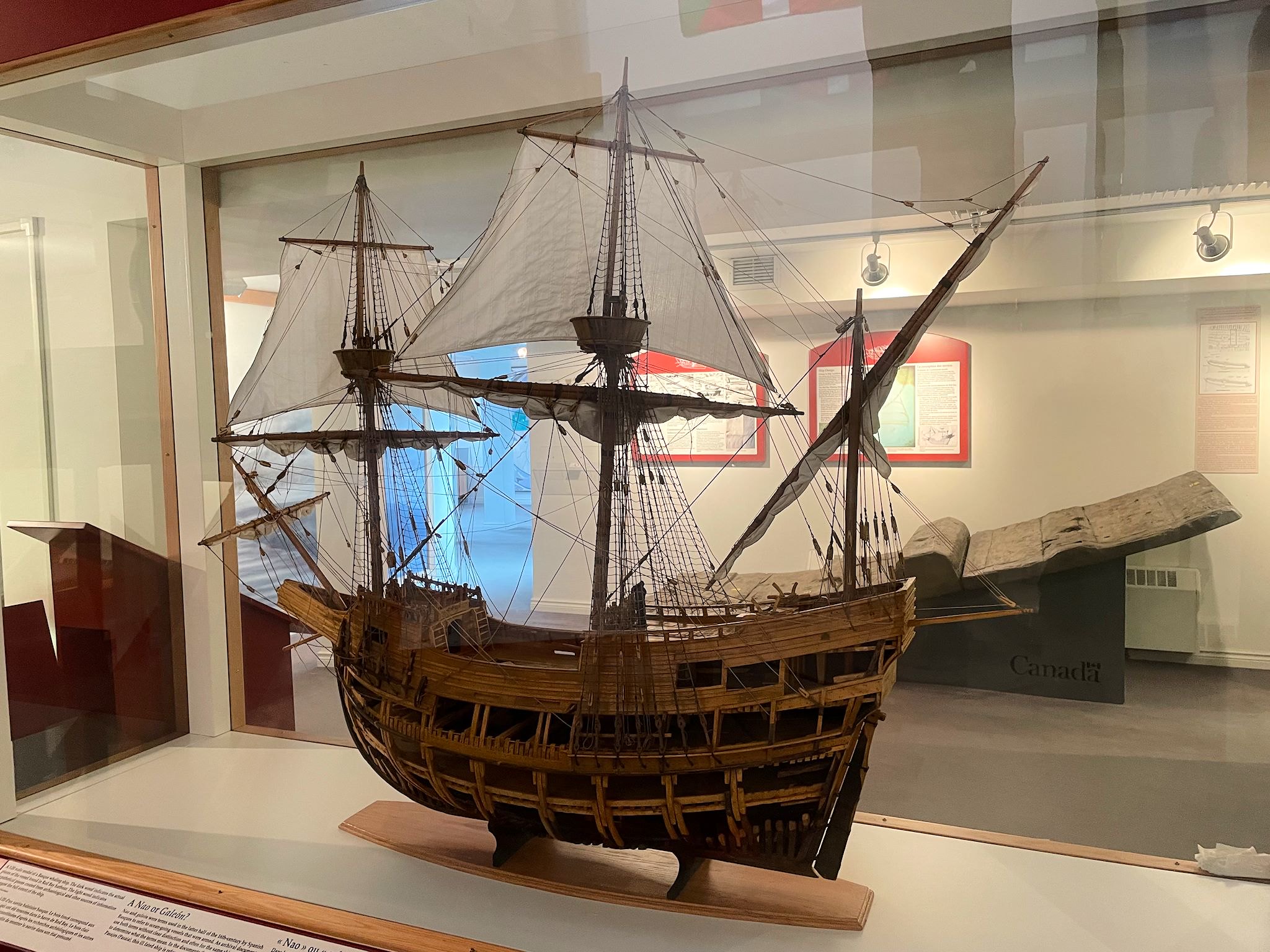
The fog rolled in as we visited Red Bay. Here there is a Canadian National Historical Site, as well as an UNESCO World Heritage Site, with extensive displays, a museum, and archaeological sites that trace the Basque whaling history of the region. Whales typically migrated from Greenland to the St Lawrence River twice a year in the waters off the Labrador coast. Whalers from the Basque region established the the first known large-scale whale oil production center in Red Bay in 1500’s to supply whale oil to Europe. However, none of this was well known until the 1970’s when research in Basque archives led researchers to look for archival sites in Red Bay.
Over time, archaeologists, divers and archivists dug deep (pun intended) and found that ~25,000 whales were hunted and processed for oil over the course of 60 years. Additional research led to finding the wreck of the San Juan, a whaling ship that foundered just off Red Bay’s Saddle Island in 1565. The museum tour included a short boat ride to Saddle Island where archaeological remains and interpretive signs brought us through what was once a busy whale processing area. The boardwalk hike over and around the island was delightful and the fog added mystique to the photos.
From the Tracey Hill trailhead parking area, a high vantage point across the bay, we could see all of the tiny town (pop <200) with homes arrayed around the bay. The red rock quarries and red tinged gravel lining the sides of the roads gave a hint to the origin of the name of Red Bay. More views, including to our first views of the Straights of Belle Isle, were made available by climbing the 689 steps to the summit of Tracy Hill.
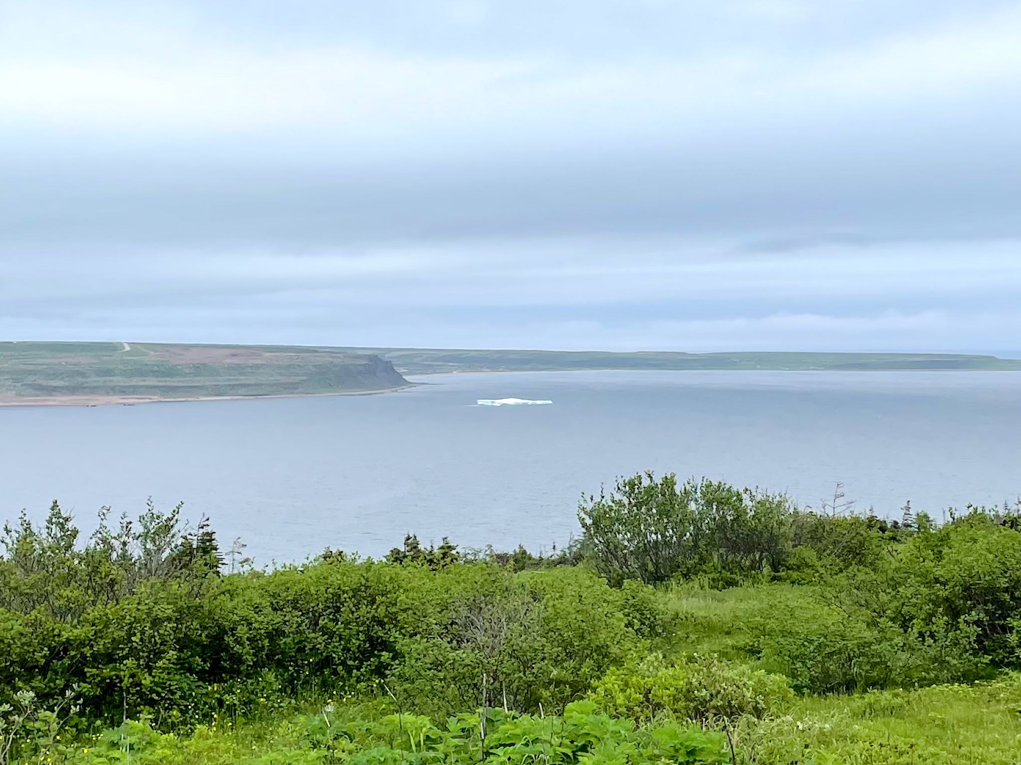
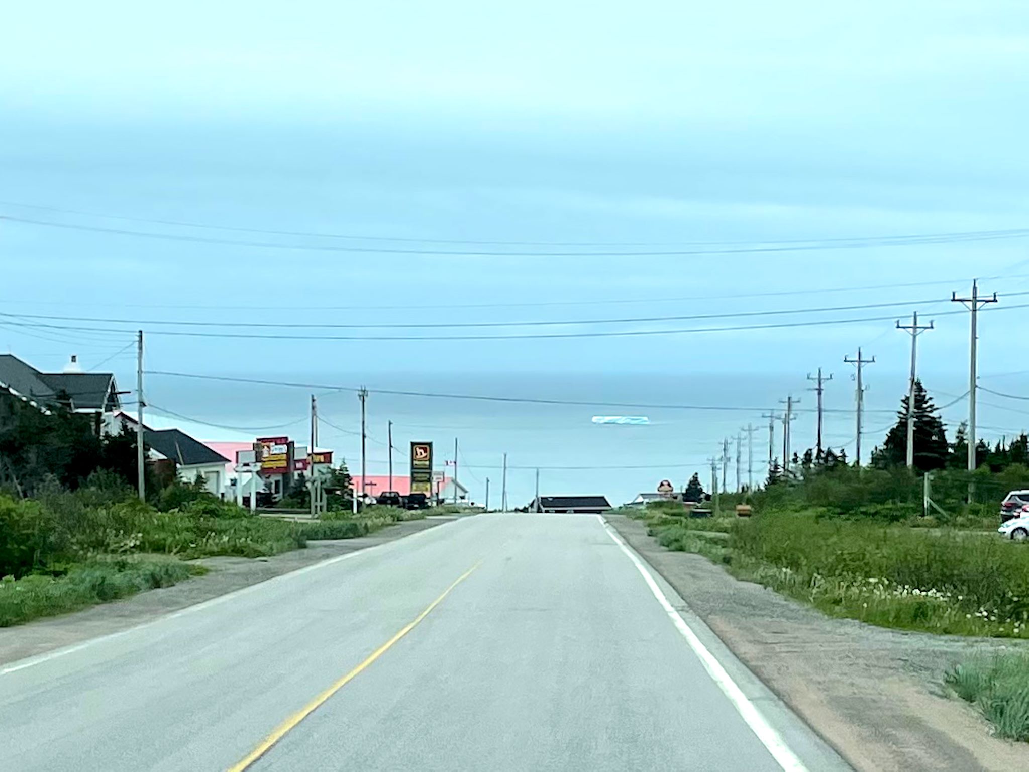
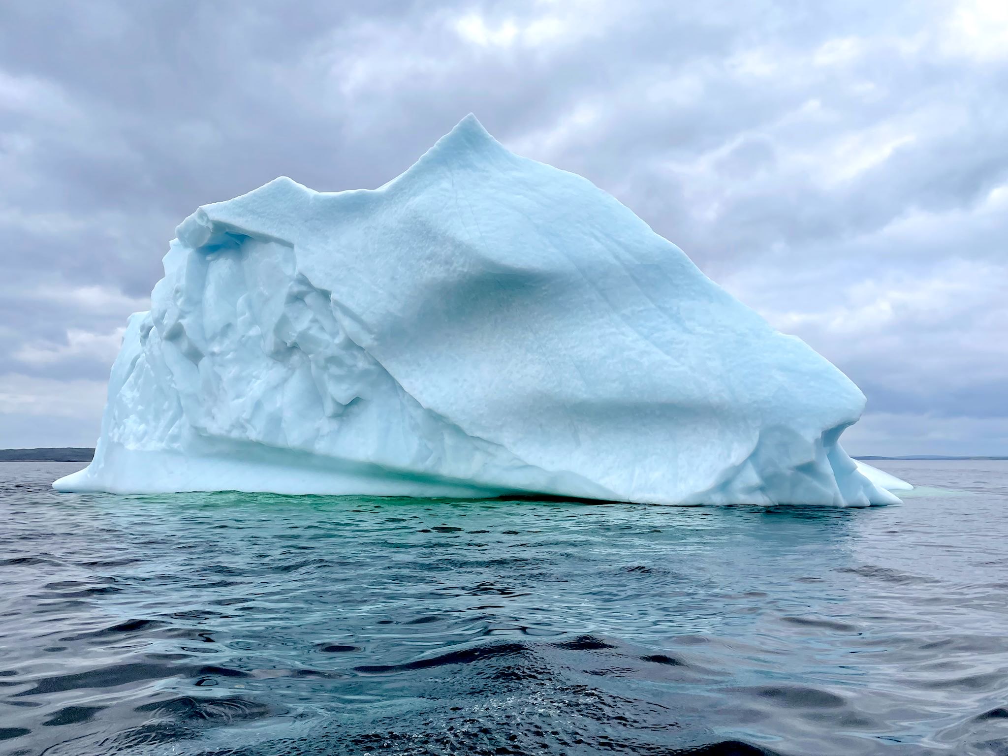
At L’Anse Amour we saw an iceberg just floating around in the bay. Then we saw another, and another!
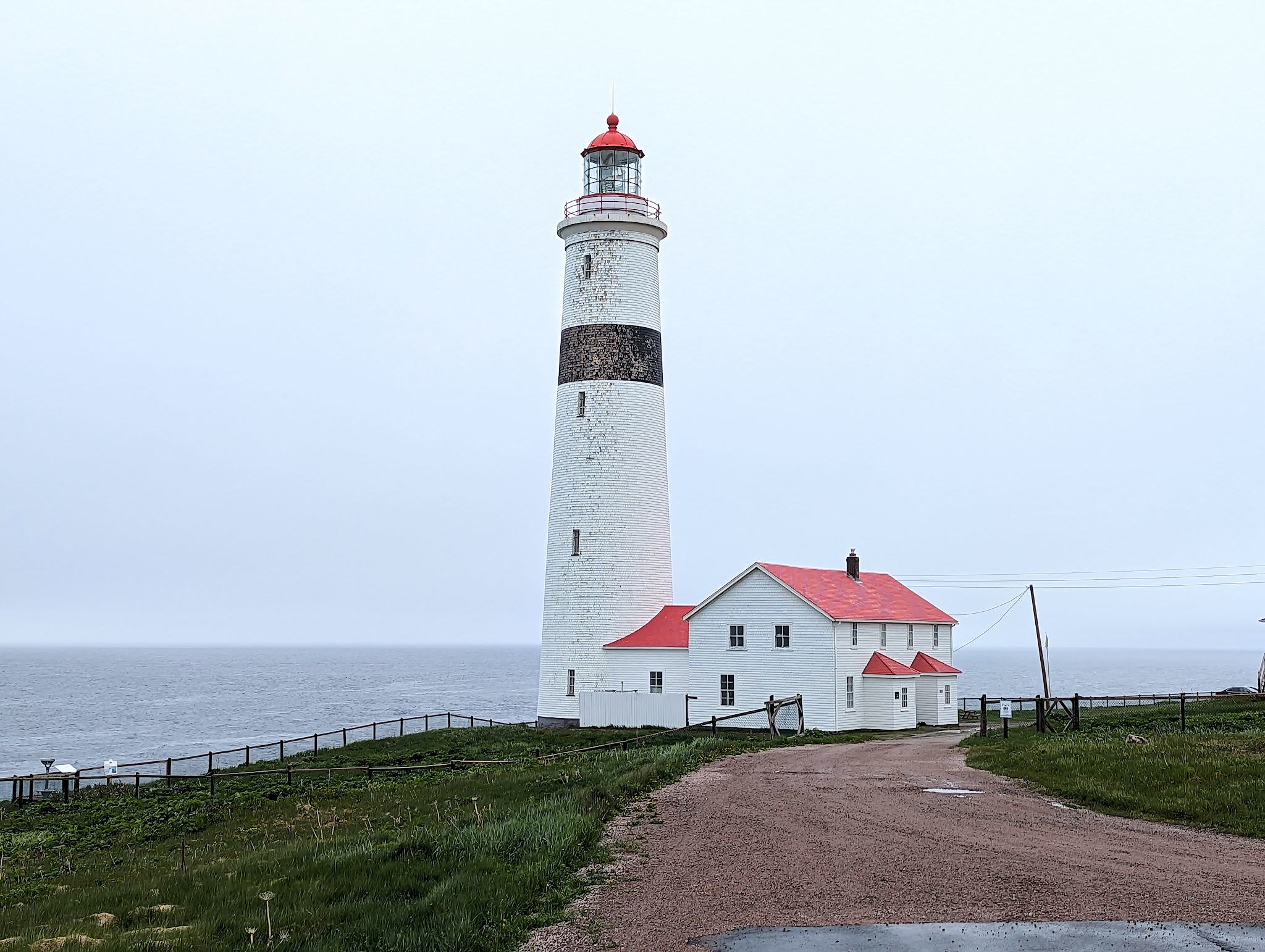
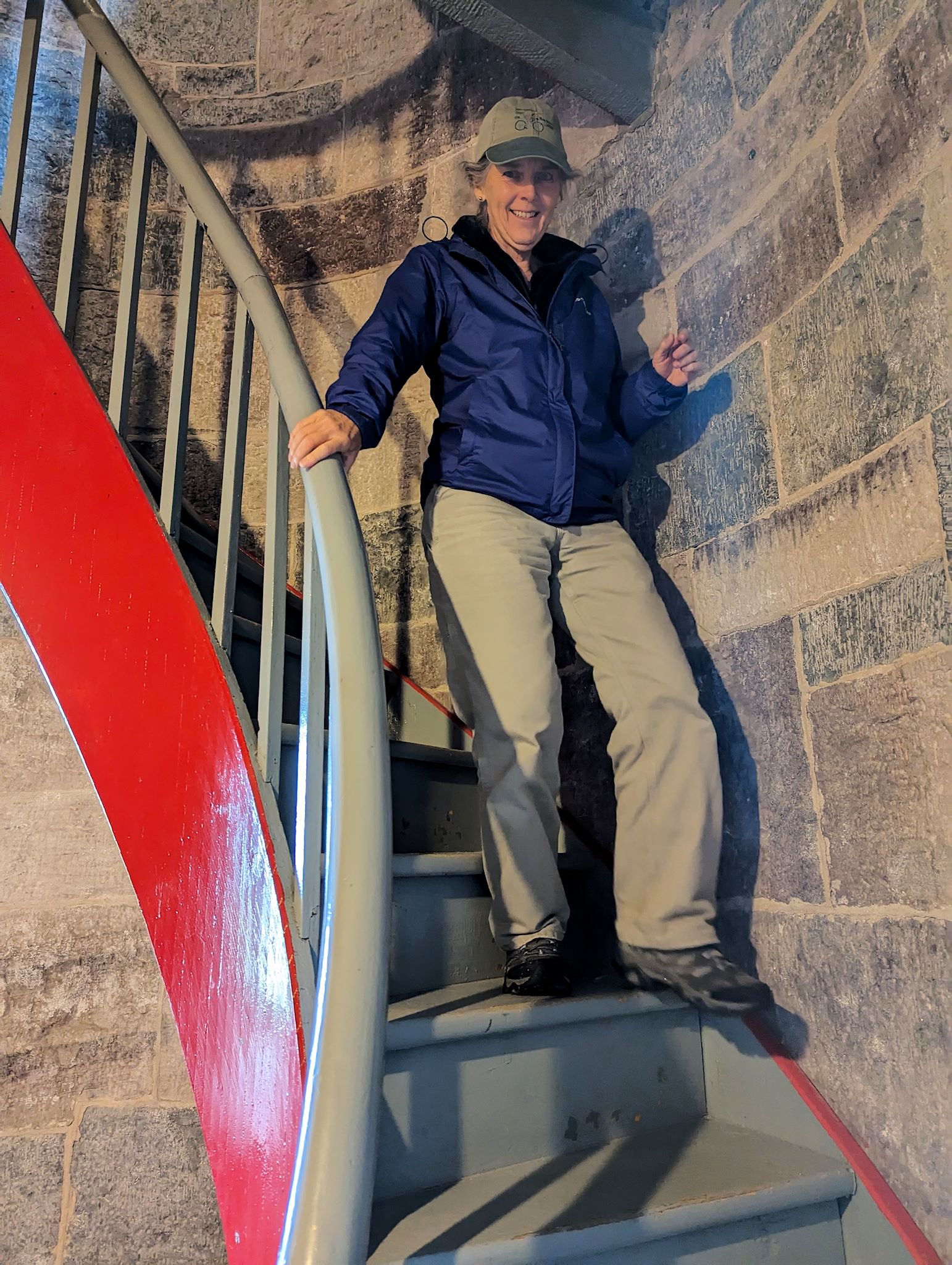
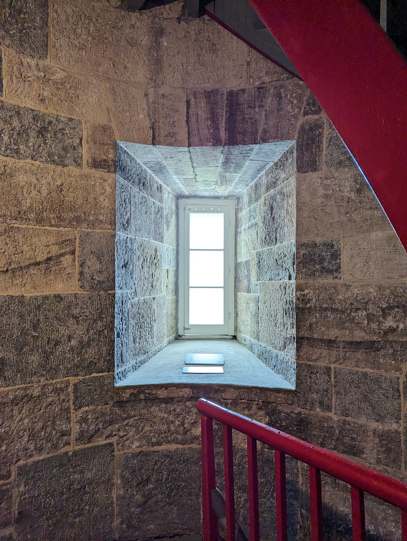
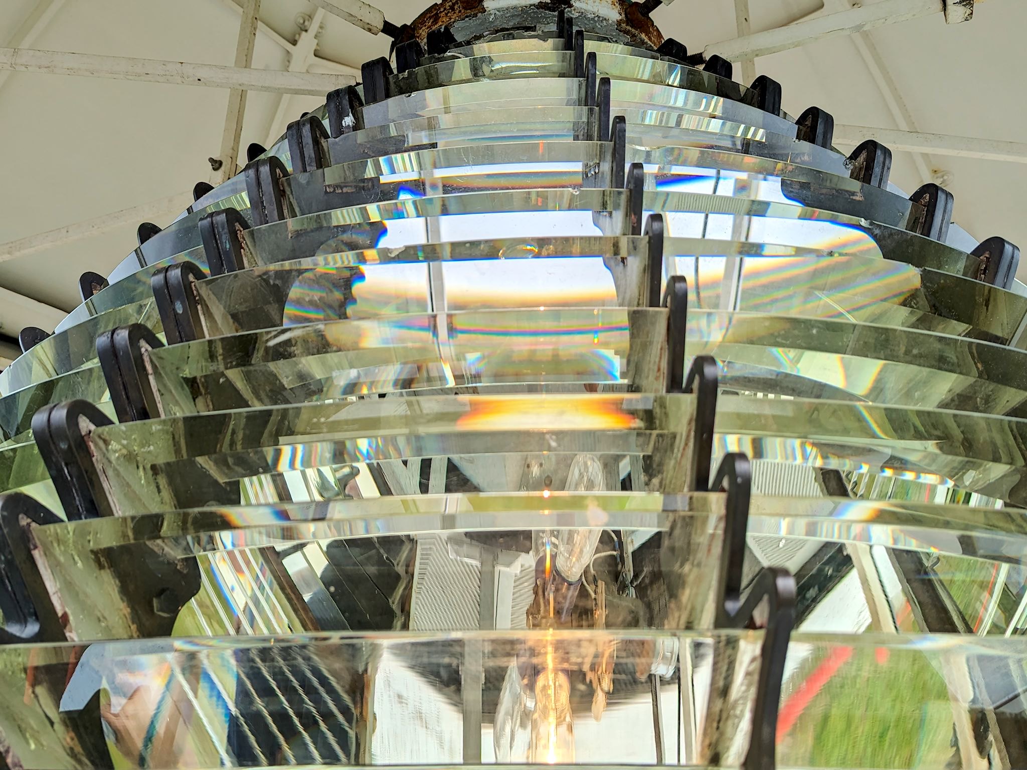
We visited the Point Amour lighthouse, at 33 metres/ 108 feet the tallest lighthouse in Labrador and 2nd tallest along the St Lawrence. We’ve seen many lighthouses (having toured the Great Lakes, Oregon Coast, and more) yet the structure at Point Amour was jaw dropping. Build in 1858, it’s made with 3-5 layers of carved, curved limestone blocks from local quarries. The cylindrical walls were 2 metres/6 feet deep in places and fortunately able to handle the regular 200 kph/125 mph winds. The view of the fog was… limiting, yet somehow picturesque.
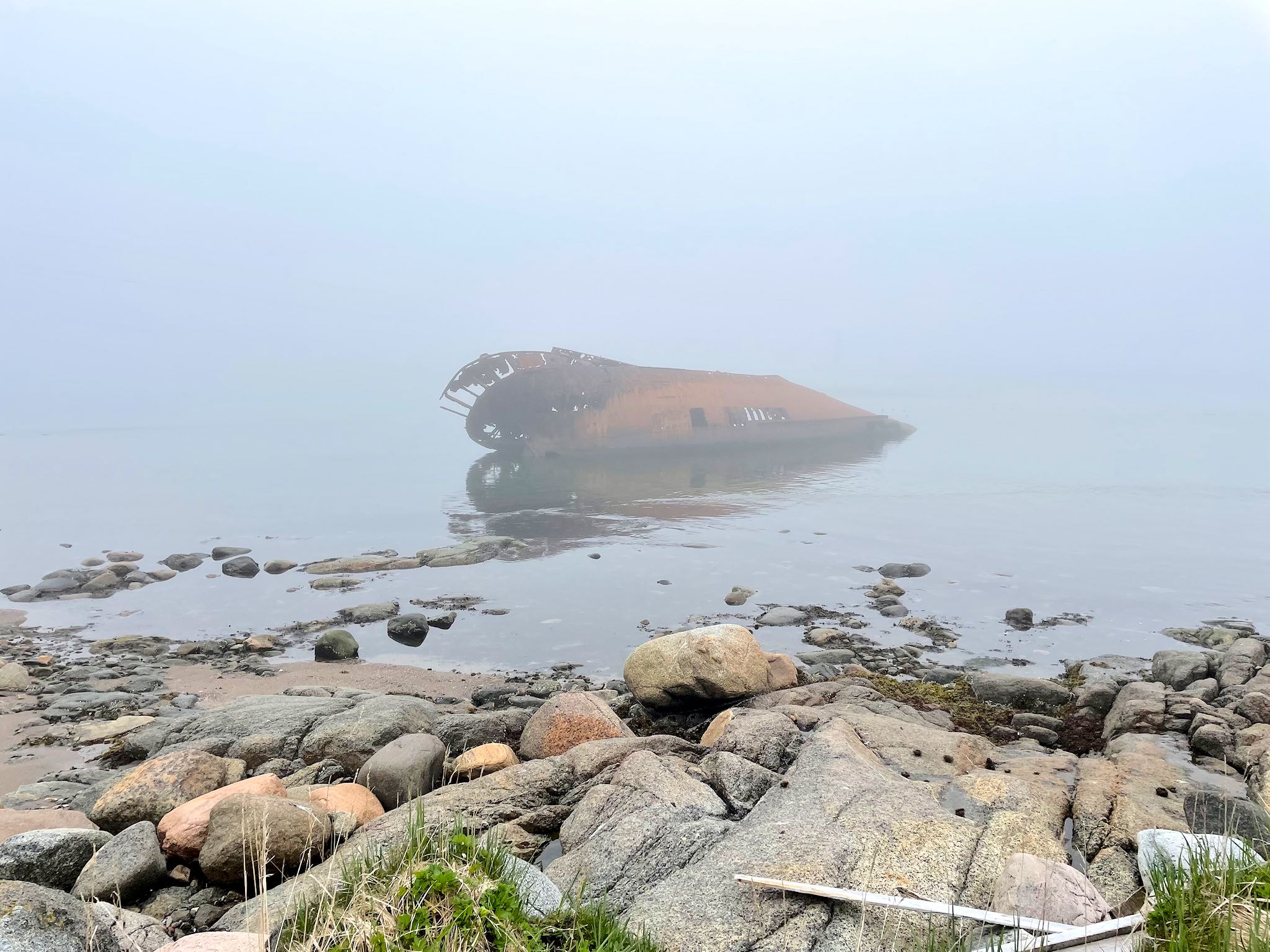
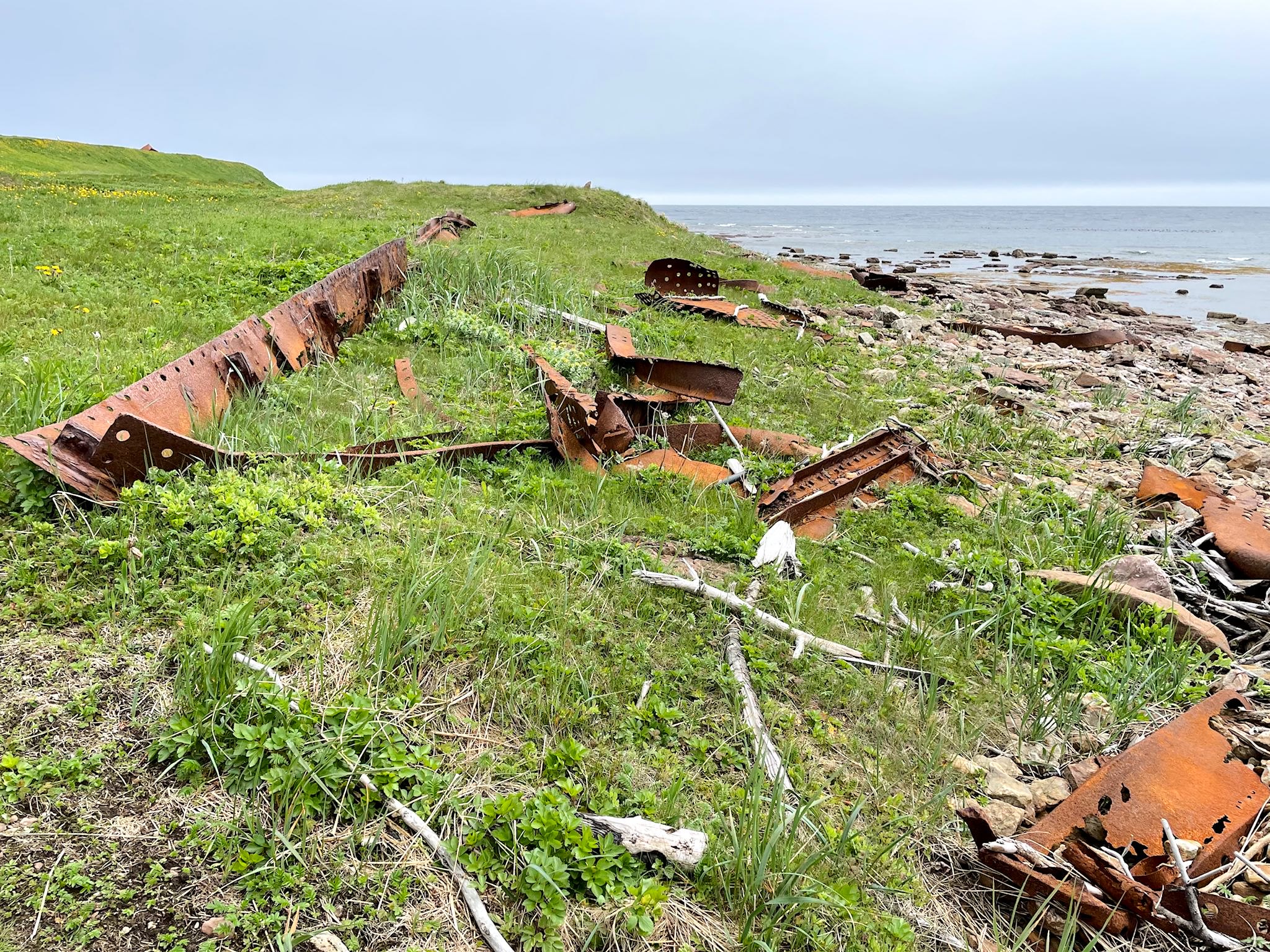
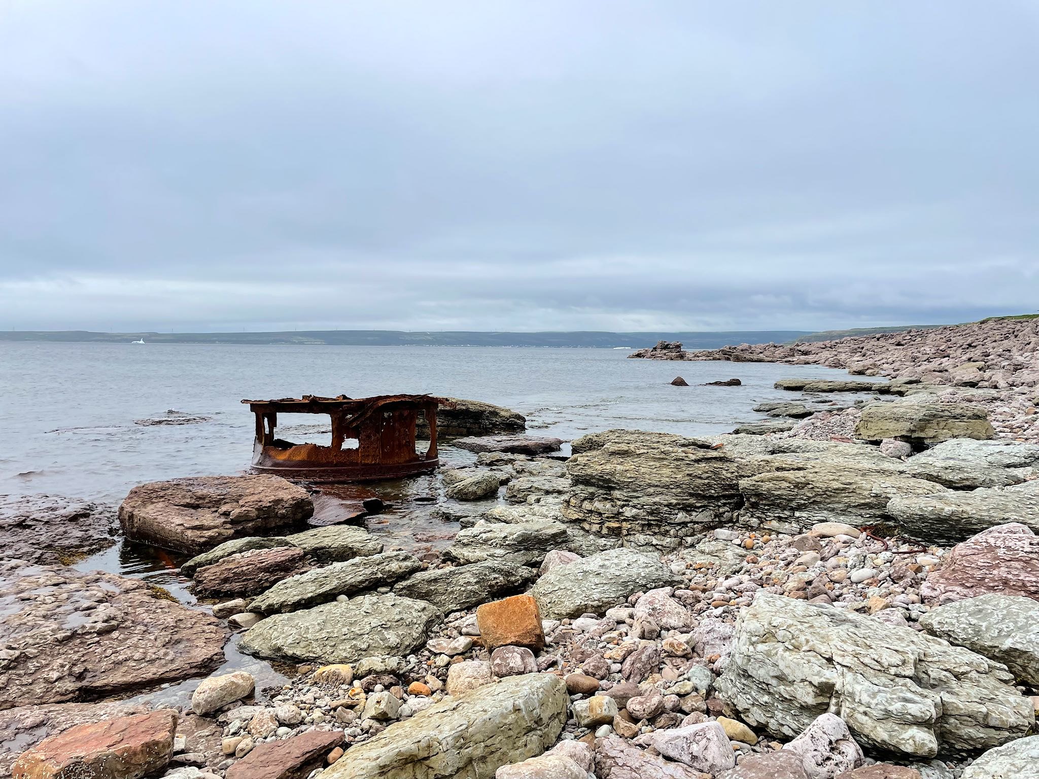
After visiting the lighthouse keepers’ quarters – the Wyatt family tended to the lighthouse for 3 generation over 80 years – we walked the Raleigh Trail. As fog makes a regular appearance in this area, shipwrecks were not uncommon, especially before today’s satellite-based navigational technology. The remains of the HMS Raleigh, wrecked in 1922, washed up along the rocky shore. Of course, we were able to keep an eye on the icebergs, bobbing along in the bay, making their way south so they could melt into the warmer waters.
Another interesting tidbit… The orignial name of the town was L’Anse aux Morts (Cove of Deaths), related to the number of shipwrecks. For the sake of being less dreary, the name was changed to L’Anse Amour (Love Cove). In French, the pronounciation of the two names is quite different. In English, they sound much alike!
After a satisfying PBJ lunch in the RV, we realized we were 20 minutes from the Quebec border and the Ferry to Newfoundland. Time to say goodbye to Labrador!
For anyone who’s interested, more Trans-Labrador Highway, Mary’s Harbour, Battle Harbour, Red Bay, Pinware Provincial Park, Point Amour lighthouse pix…