Terra Nova National Park

Newman Sound, Terra Nova National Park

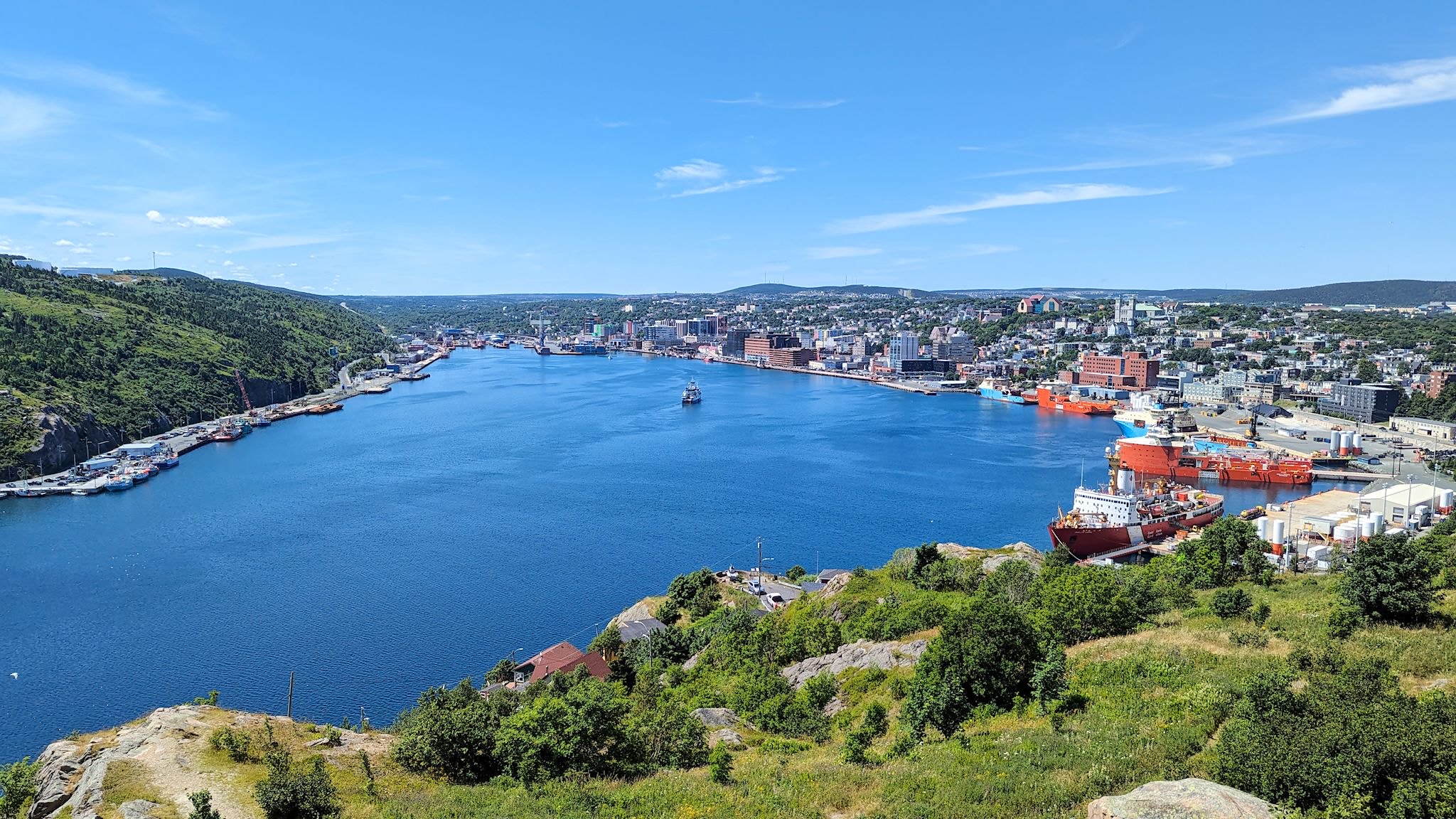
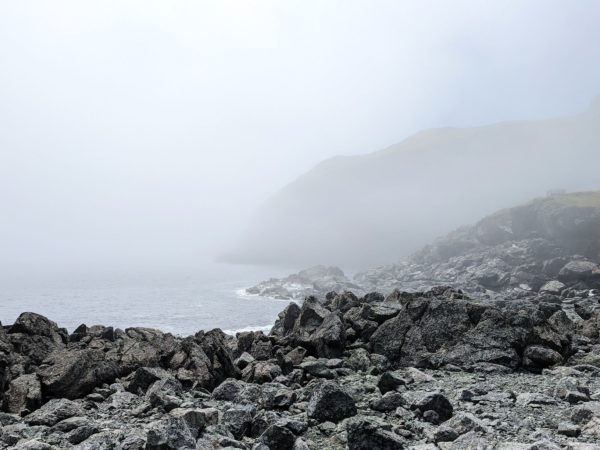
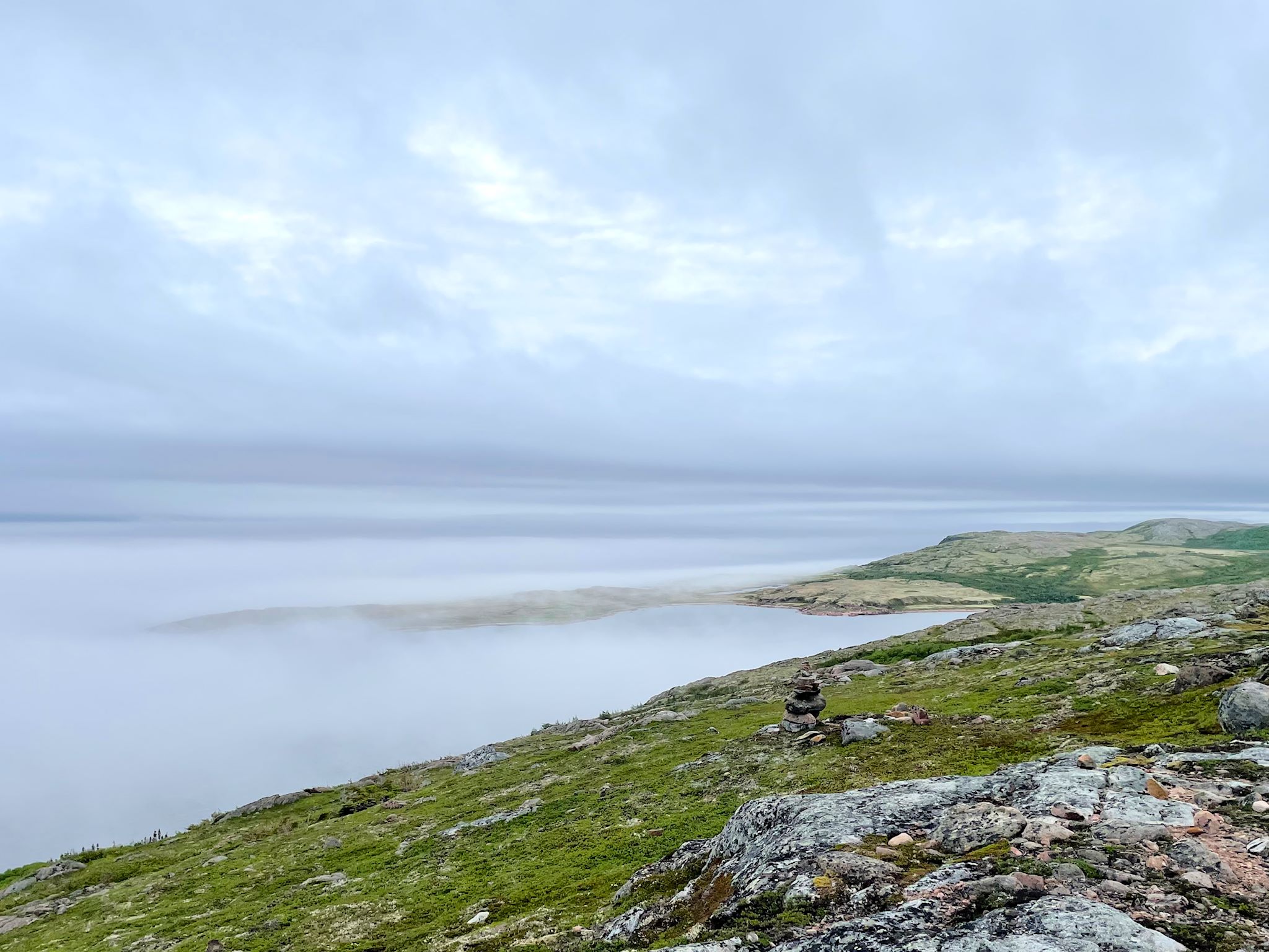
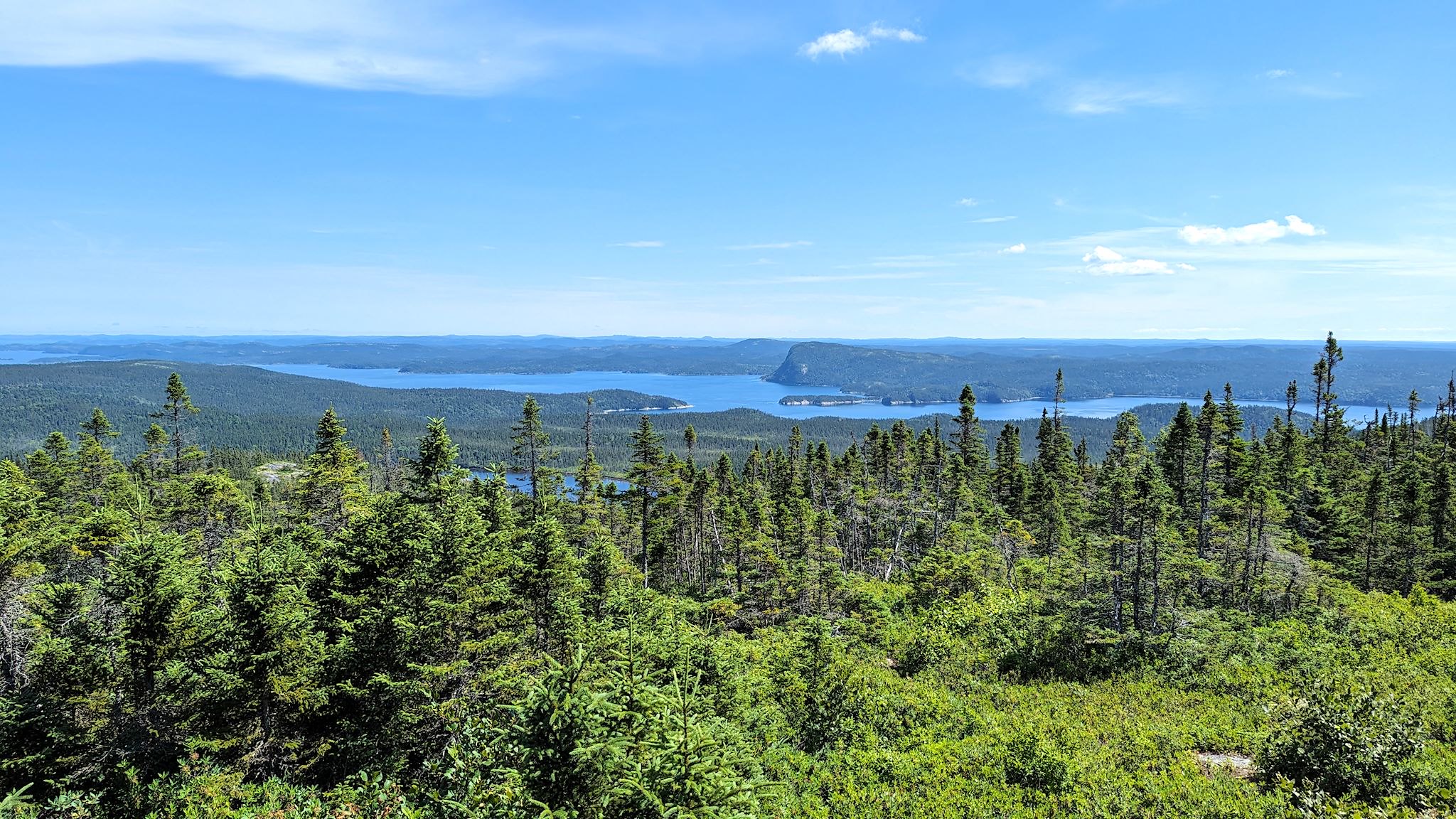
Terra Nova National Park is situated on the northeast coast of Newfoundland. It encompasses 238 km/150 miles of shoreline, all of it within a north to south span of 45 km/30 miles and within 5 km/3 miles of the coast. It comprises islands, sounds, points, fjords, bogs, headlands, inlets, forests, ponds, fingers (of land), arms (of water), tickles (look it up), and straits. The park’s PR people share our penchant for superlatives… Brochures boast that Terra Nova is Canada’s easternmost National Park (yes, we’ve been to Pacific Rim National Park) and Newfoundland’s oldest, established in 1957 (Gros Morne was established in 1970). As with all National Parks, Terra Nova manages access to the beautiful parklands and its primary mission is conserving and restoring ecological integrity.

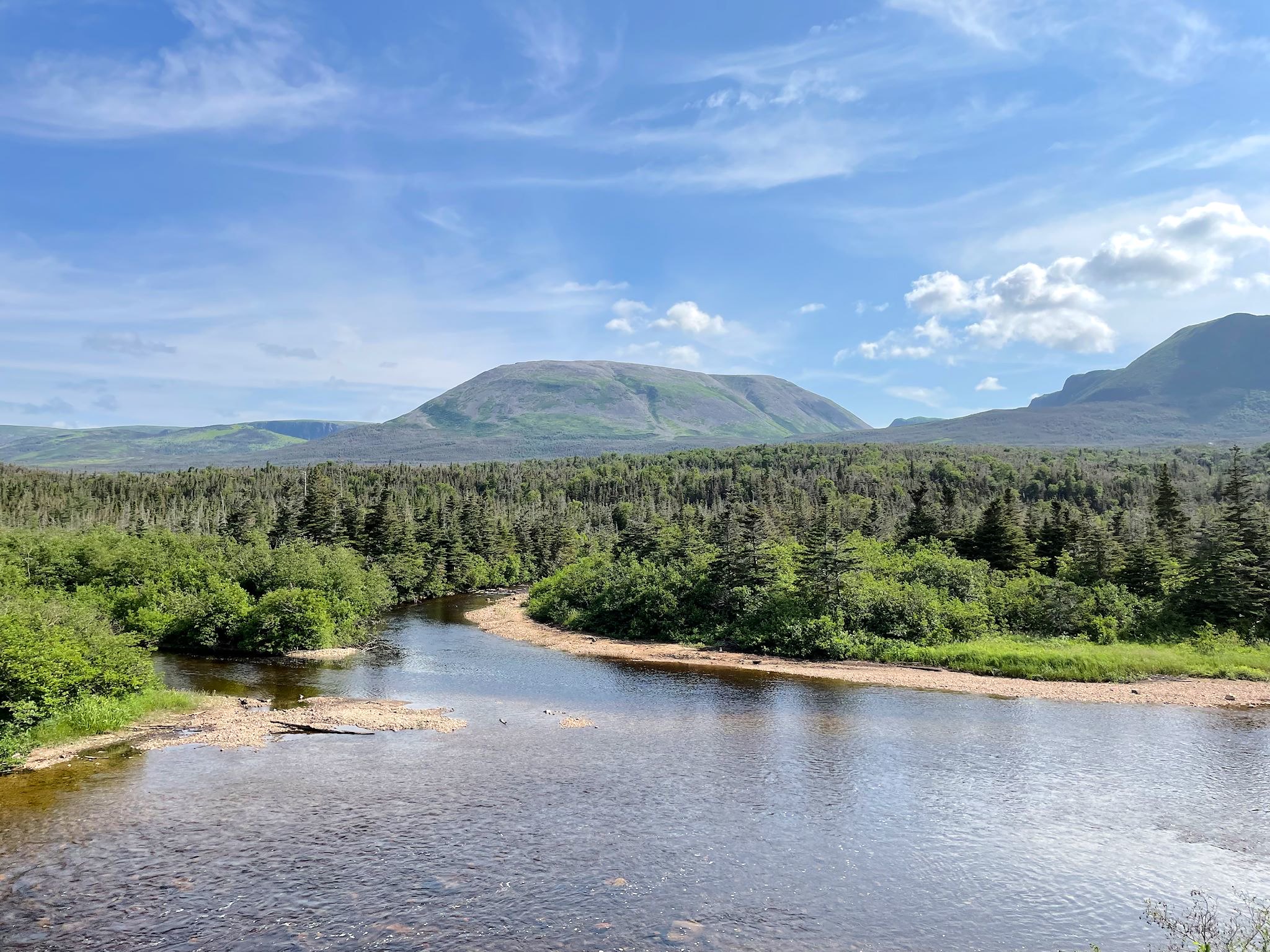
If Gros Morne is about the rocks, Terra Nova is about balancing the health of the forest that supports the critters that eat the lichen that grows on the rocks, the rocks down in the valley-o (oops, Newfoundland music…).

Continue reading “Terra Nova National Park”

St John’s NL

St John’s Harbour

At the southeastern corner of the island of Newfoundland, St John’s is the largest city in Newfoundland and Labrador. At this moment, about 530,000 people live in NL, and 212,000 of them (40%) live in the St John’s metro area. [By contrast, just 26,650 (5%) live in all of Labrador, though Labrador accounts for 72% of the land area of the province.] Anyway, statistics aside, we were eagerly anticipating our visit to the urban St John’s for several things we would find there: music, history, hiking, sightseeing… and a Sprinter service center.

Continue reading “St John’s NL”

The Road to the Isles

Sunset over Back Cove, Fogo

Newfoundland and Labrador covers a pretty large area. If the province were a state in the US it would be the 4th largest, after Alaska, California and Texas based on landmass. (Based on population, it would be the 2nd smallest, right in between Vermont and Wyoming…). Similar to Alaska, it’s a big space up north with very few roads. What that means is that people touring Newfoundland in RVs often find themselves moving around in cohorts based on which of the 3 ferries they took and when they arrived, and we just keep running into each other over and over again.

As we chatted with people in our northwest Newfoundland cohort (because that’s where we arrived on July 7), they all mentioned plans to visit Fogo Island and Twillingate. Those 2 places were on our list, as well. As we crossed paths and chatted with travelers in other cohorts, heading in the reverse direction, they all said you’ve got to see Fogo Island and Twillingate. Newfoundland and Labrador Route 340, known as the Road to the Isles, heads north from Gander – and so did we.

Continue reading “The Road to the Isles”

Gander

Well rested and with the truck’s vents blowing cool and conditioned air, we moved an hour on up the road to Gander. Located on a ‘Great Circle’ route between North America and Europe, Gander was built to be an airport town for refueling trans-Atlantic flights, and for a time was the largest and busiest airport in the world. It has lately become well known for its townwide hospitality when planes were unexpectedly grounded there on September 11, 2001. On that day, North American airspace was closed and all planes were required to land. Within a few hours, 38 planes landed in this town of (then) 9,300, unloading 7,000 unexpected guest from 95 different countries for an unknown duration. It ended up being 5 days. Among locals, the stayover is now known as ‘9/12,’ and the guests are called ‘Come From Away’s (CFAs). We were interested to see this historic town. Maybe we’d have a chance to talk to some of the kind people and thank them for their generosity.

Continue reading “Gander”

Grand Falls-Windsor and Bishop’s Falls

Atlantic salmon

We headed inland from the west coast, driving along big rolling hills, almost always with a lake or river beside the road. The sign said ‘Welcome to Grand Falls-Windsor – Perfectly Centered!’ That’s a fact. GFW is in the center of Newfoundland, and it’s the largest town in the interior. It’s also away from the natural breezes that keep things cool along the coast – a feature which, during the rare heat wave that’s been afflicting Newfoundland, made for a hot town!

Continue reading “Grand Falls-Windsor and Bishop’s Falls”

Gros Morne National Park

Gros Morne Mountain

National parks in Canada are established to manage wild and natural spaces, and balance access for visitors to appreciate and enjoy while protecting and conserving their unique ecological offerings. We’ve come to especially appreciate them as beautiful places to learn more about nature and indulge in one of our favorite activities – hiking. Gros Morne checks all the boxes and more. Much more. Its global geological significance is mind blowing.

Continue reading “Gros Morne National Park”

Blanc-Sablon, QC

The Qajaq W

We are not keen on reservations, as a general rule. Reservations force us to arrive somewhere at a certain day or time – what if we find something interesting along the way there!?! So, even though we didn’t make reservations on the ferry making the crossing from Blanc-Sablon, QC (2 km/1.2 miles from the Labrador border) to St Barbe, Newfoundland, finding that there was no room for another RV on the day we arrived planning to cross was not a cause for distress. To the contrary, yay! We have an extra day to explore this tiny corner of Quebec.

Continue reading “Blanc-Sablon, QC”

Recording: The Studio On The Road

Strait of Belle Isle

It’s getting to be about time for a musical post. We’ve been learning and practicing a particular song with an eye towards recording it to use as a joint “summer recital” piece for an online music school we’re both involved with, also as a recording we can share, as well as just to add the song to our repertoire.

This would be the most elaborate on-the-road recording we’ve done, and a first test of our latest traveling studio gear.

Continue reading “Recording: The Studio On The Road”

Labrador 510 – Trans-Labrador Highway, part 2

Battle Harbour

The road to connect the settlements and resources of western and coastal Labrador – the Trans-Labrador Highway – had been in the works since the early 80’s. Dirt roads and walking trails between settlements were widened into gravel roads in sections, then paved as demand and budgets allowed. The last remaining section of gravel was paved in July, 2022 – and the road was complete!

Continue reading “Labrador 510 – Trans-Labrador Highway, part 2”