Doug: Holy cow! Look at that! Sue: OMG! So beautiful! D: We’ve been driving for an hour and already have a hundred photos. Too many? S: You’re right. Maybe we have enough for today. D: Oh, wow, look at that. Let me get a photo… S: You’re right. Pull over!
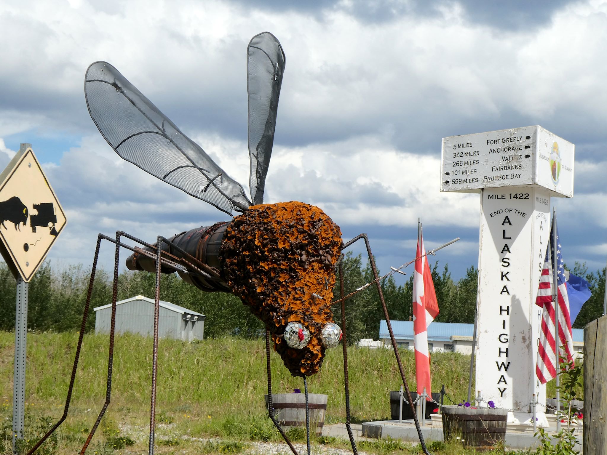
A bit more than two weeks after leaving Mile 0 in Dawson Creek, BC, we arrived in Delta Junction, AK, at Mile 1422 and the official end of the Alaska Highway. Unlike Dawson Creek, where RVs line up for pix of the start and much of the town’s activity is focused on this unique claim to fame, there’s not usually much of a line at the highway’s end in Dalton Junction. Many travelers split off once in Alaska at Tok, choosing one of three directions, so there are fewer and far more distributed tourists arriving in Delta Junction, though we did see another RV during short our visit. And of course we did take the required Mile 1422 marker photo!
When people think of Alaska, a lot of us think first of the Interior – that huge landmass that includes Fairbanks and Denali, just south of the polar bears. There’s also southeastern Alaska, also called the Inland Waterway or the Inside Passage or the Alaska panhandle. It’s a bunch of beautiful islands and peninsulas, featuring rain forests in close proximity to glaciated mountains. Our friend Gail who previously lived in Haines loved it and recommended a visit.
Fascinating and beautiful it is, but travel in southeast Alaska is primarily via the Alaska Marine Highway (aka ferries), cruise boats, and airplanes. It’s tough to visit southeast Alaska driving an RV! There are but two roads, for a total of 246 paved miles. One connects Whitehorse (which we’d just departed en route to Haines Junction, YT) with Skagway, AK, 100 miles to the south. The other 146 miles make up the Haines Highway which connects Haines Junction, YT (where we just happened to be) with Haines AK.
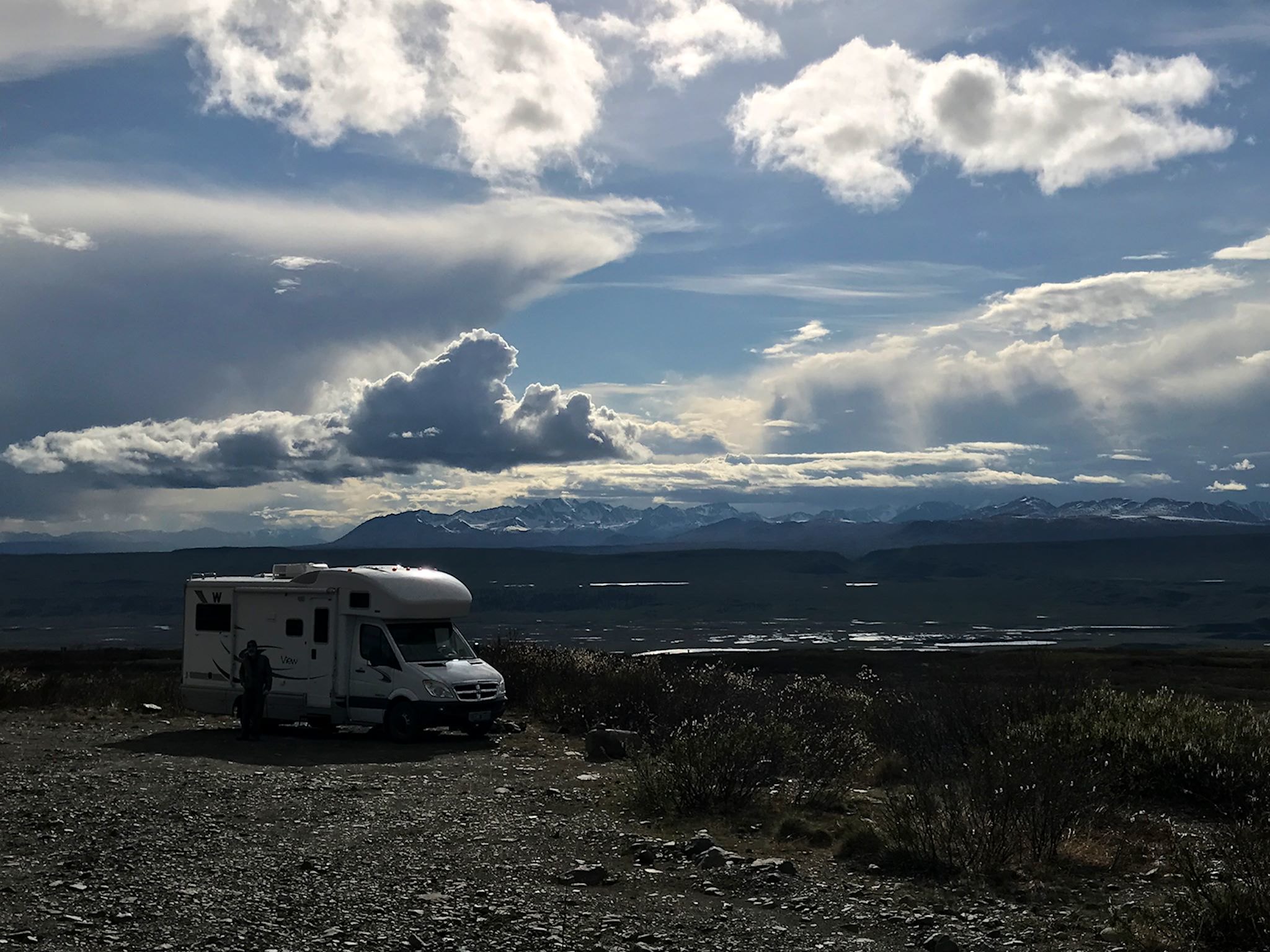
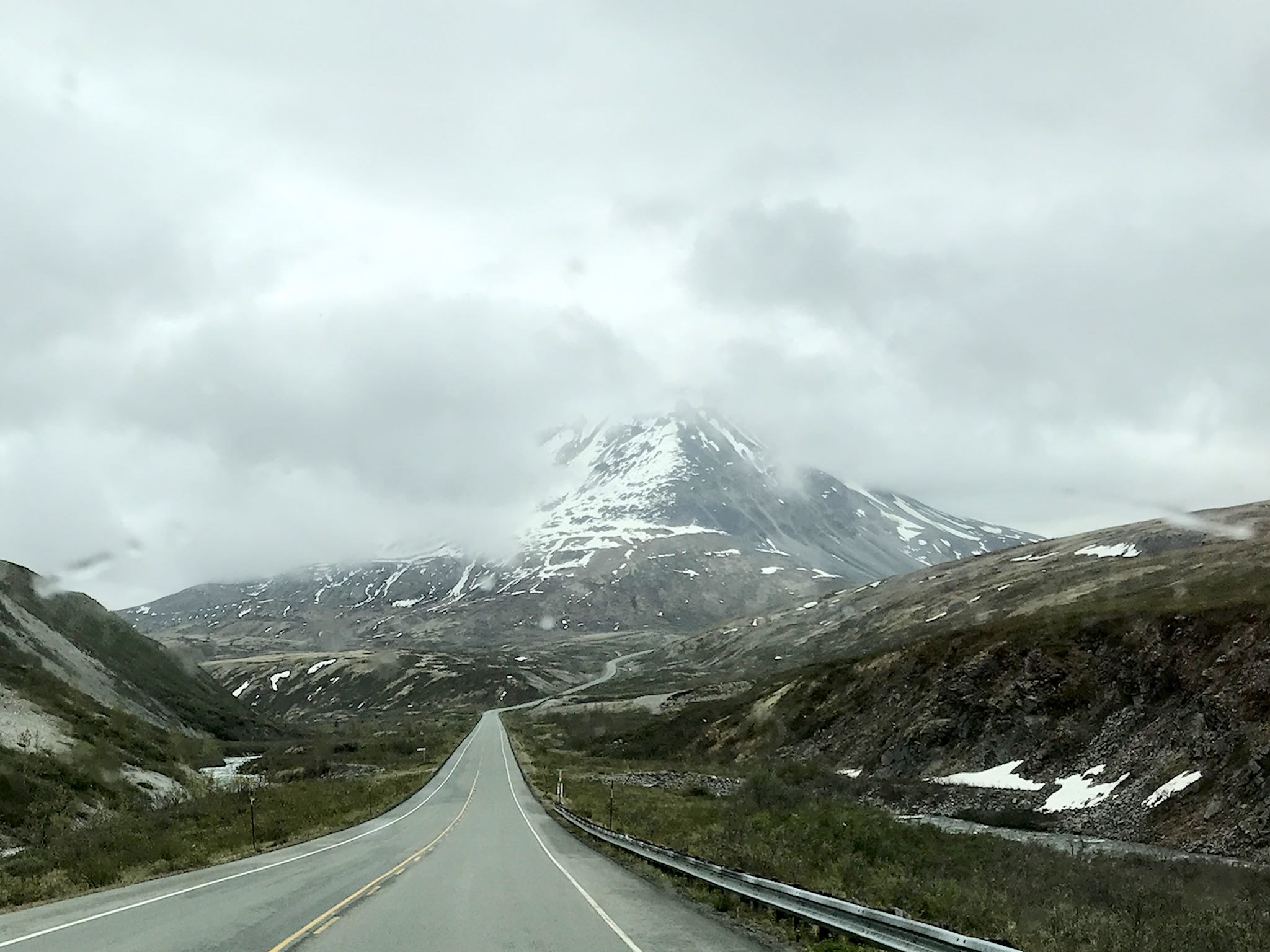
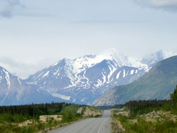
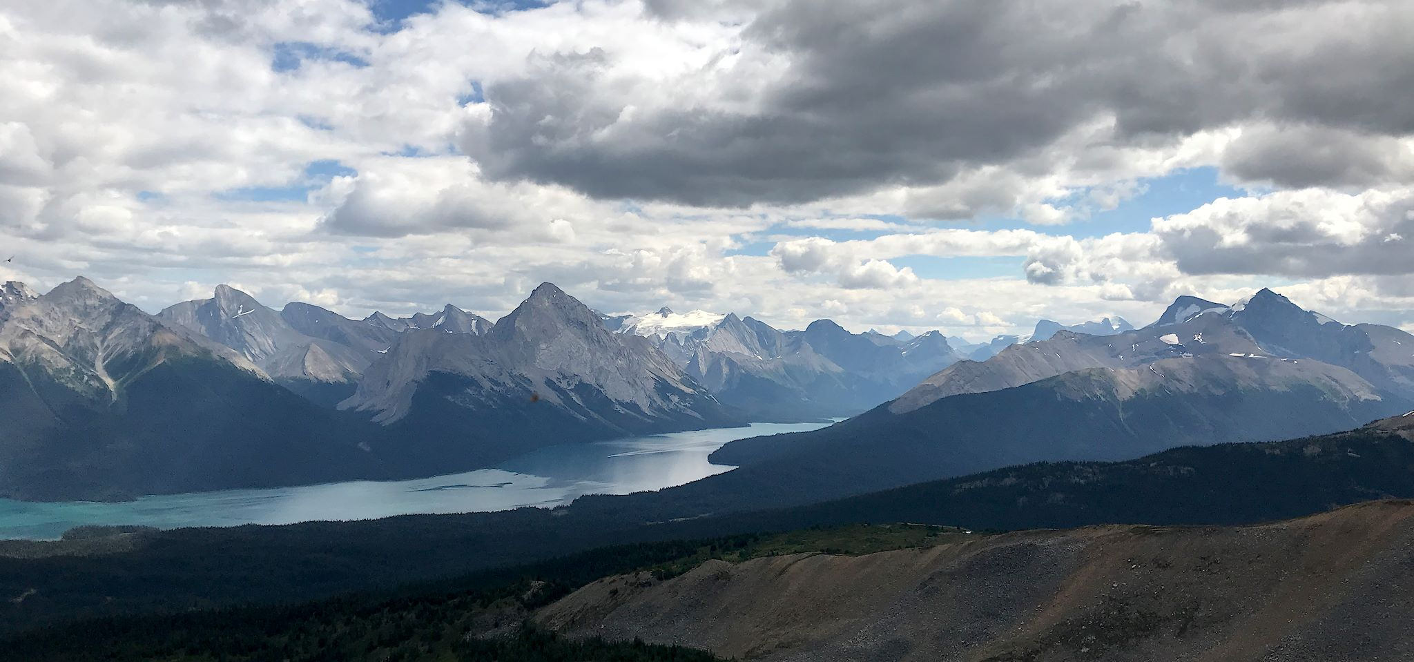
We’ve been on the Alaska Highway for 10 days. Several times a day, we pause and note – ‘Wow, that’s amazing!’ or ‘Look at that!’ Soon after we left Whitehorse, we started to see what appeared to be snow-covered peaks on the horizon. ‘Whoa, what’s that?’ As we approached Haines Junction, we realized the Kluane Range was in our faces. Our jaws dropped. We had to stop!
Literally. Ok, there was a crossroads in town where you had to bear left, turn right, or crash into the mountains that were in your face. According to the staff at the visitor center, these towering peaks were the foothills to the Kluane Mountains, among which are the 15 tallest peaks in Canada, #1 being Mount Logan at 5,959 m (19,551 feet). And although the Kluane National Park is ginormous, the only day hiking trails are right near Haines Junction. So we had to stop!
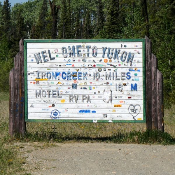
Along the Alaska Highway between Liard River, BC and Whitehorse, YT there are two small towns, a few service stops, and (as the highway crosses back and forth across the border) Welcome to British Columbia! and Welcome to Yukon! signs abound- making it no doubt the friendliest, least inhabited space we’ve ever visited. The Highway more or less follows the 60th parallel, crossing between BC and YT six times before definitively crossing into Yukon just south of Whitehorse.
We entered Yukon for the first time at Contact Creek. As with many major transportation projects – the Canadian Pacific Railroad, Transcontinental Railroad in the US, the Channel Tunnel – work crews on the Alaska Highway started at both ends and worked toward each other, connecting in September 1942 at a place known ever since as Contact Creek.
Driving north from Dawson Creek, the scenery quickly transforms from agricultural to boreal forest. The Highway ribbons through the forest in what appears to be the path of least resistance (as it likely is – they built it in a hurry…) until reaching Fort Nelson. Except for Fort St John (pop 21,500) and Fort Nelson (pop 3,500), there are few stops. Most are service stops (fuel, food, post office, maybe a motel and/or RV park) like Pink Mountain (pop 8), pull-outs with historical info, or dirt side roads heading to gas and oil camps. Oh, and lots and lots of animals – bears, moose, caribou, stone sheep (like big horn sheep only smaller and darker), and elk – everywhere.
Dawson Creek, BC, Mile 0, is the official start of the Alaska Highway (originally known as the Alcan). The history of the construction of the Highway is fascinating. Soon after the bombing of Pearl Harbor in 1942, the Japanese occupied two of the Aleutian Islands in Alaska, then a US territory. In order to enable movement of military personnel and equipment to defend the territory, the US government needed a land route to connect Dawson Creek, then the northern terminus of rail service in North America, to Alaska. Begun in March of 1942, the 1,520-mile crude road through a wild, unknown sub-arctic frontier was completed in 8 months.
If you haven’t seen it, we encourage you to watch Building the Alaska Highway, a PBS special, to learn more about the historical, political and sociological perspective of this epic undertaking. If you’d like to experience ‘Wow!’ or ‘OMG?!’ you’ll need to drive the Highway. That’s how the story comes to life.
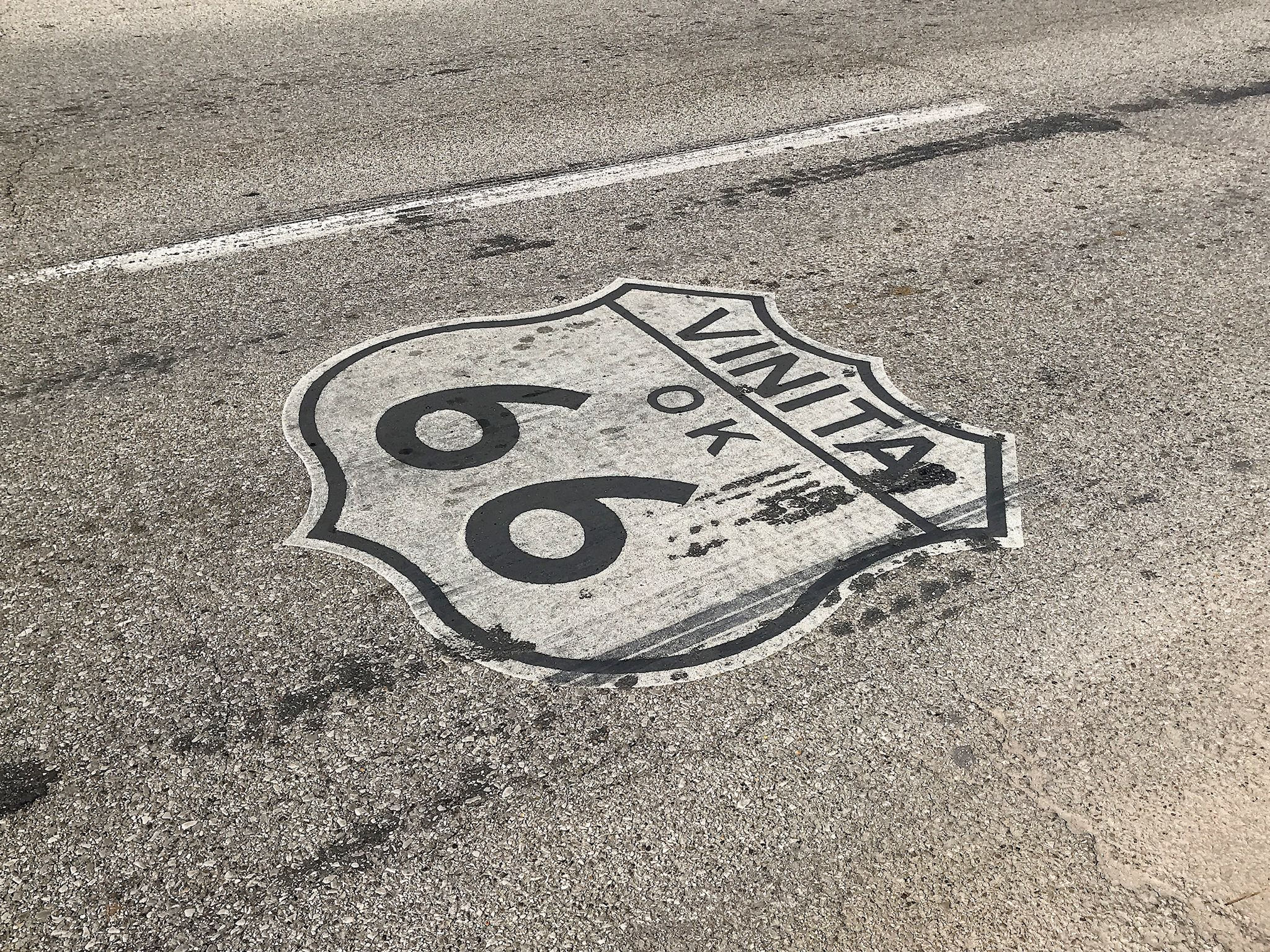
Less than 10 miles outside of Tulsa, we started seeing signs for Route 66. Our band back home does that classic song! With so much of our travel on back roads, we’ve crossed Route 66 at least a few times in Arizona and New Mexico. As we rolled out of Tulsa we recognized that for the first time we’d be traveling right along the storied route. And it goes through St Louis – like it says right in the song!
We do love mountains! Views, mountain air, hiking, mountains in your face with glimpses of remote river valleys and distant peaks; forests and critters big and small, tiny mountain communities and ski towns, (usually) cooler temps. We were on our way to see the Canadian Rockies and set a course for Jasper National Park, the northernmost of the parks there.
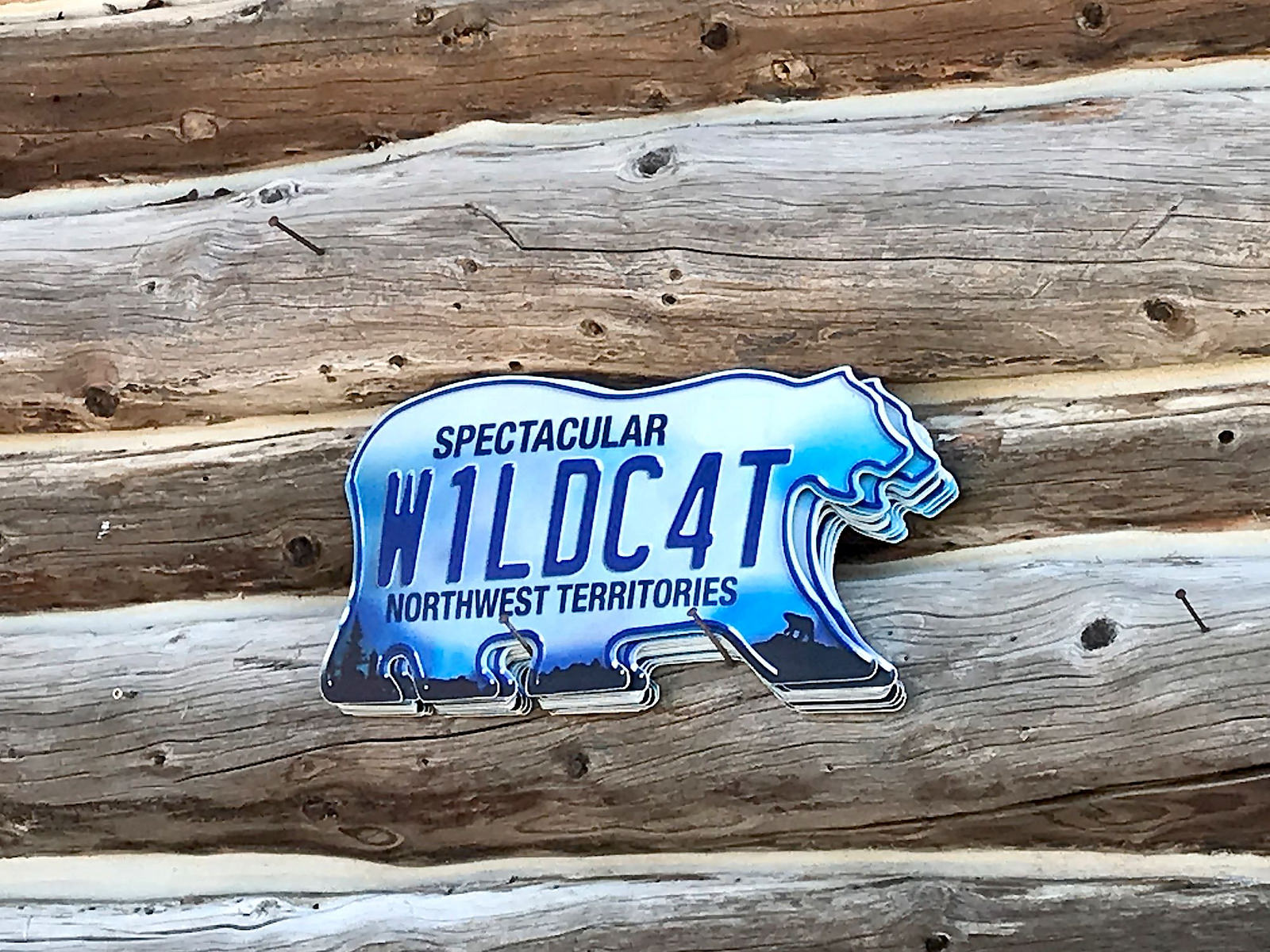
We love Northwest Territories and have thoroughly enjoyed our travels here, and we hope that sentiment has come through in our 3 prior posts. In those, we’ve included observations and thoughts about diversity, friendly people, great music, interesting small towns, and a unique city. This post includes a few more of our thoughts about the Northwest Territories and a few noteworthy things that didn’t make it into any of the other three. We did a post kind of like a year ago in Utah that we called “the space between.” This is in that same spirit.
To start with, as it says on their license plate – the only one in the world shaped like a polar bear – Northwest Territories is spectacular!