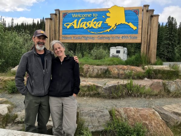
We’ve crossed the border into the interior of Alaska! We left Haines, re-entered Canada, then came back into Alaska (see photo) southeast of Tok, where we’ve still got a short way to go to the end of the Alaska Highway, then we’ll be poking around up here for awhile.
We’ll keep posting updates when we can get onto the internet.
When people think of Alaska, a lot of us think first of the Interior – that huge landmass that includes Fairbanks and Denali, just south of the polar bears. There’s also southeastern Alaska, also called the Inland Waterway or the Inside Passage or the Alaska panhandle. It’s a bunch of beautiful islands and peninsulas, featuring rain forests in close proximity to glaciated mountains. Our friend Gail who previously lived in Haines loved it and recommended a visit.
Fascinating and beautiful it is, but travel in southeast Alaska is primarily via the Alaska Marine Highway (aka ferries), cruise boats, and airplanes. It’s tough to visit southeast Alaska driving an RV! There are but two roads, for a total of 246 paved miles. One connects Whitehorse (which we’d just departed en route to Haines Junction, YT) with Skagway, AK, 100 miles to the south. The other 146 miles make up the Haines Highway which connects Haines Junction, YT (where we just happened to be) with Haines AK.
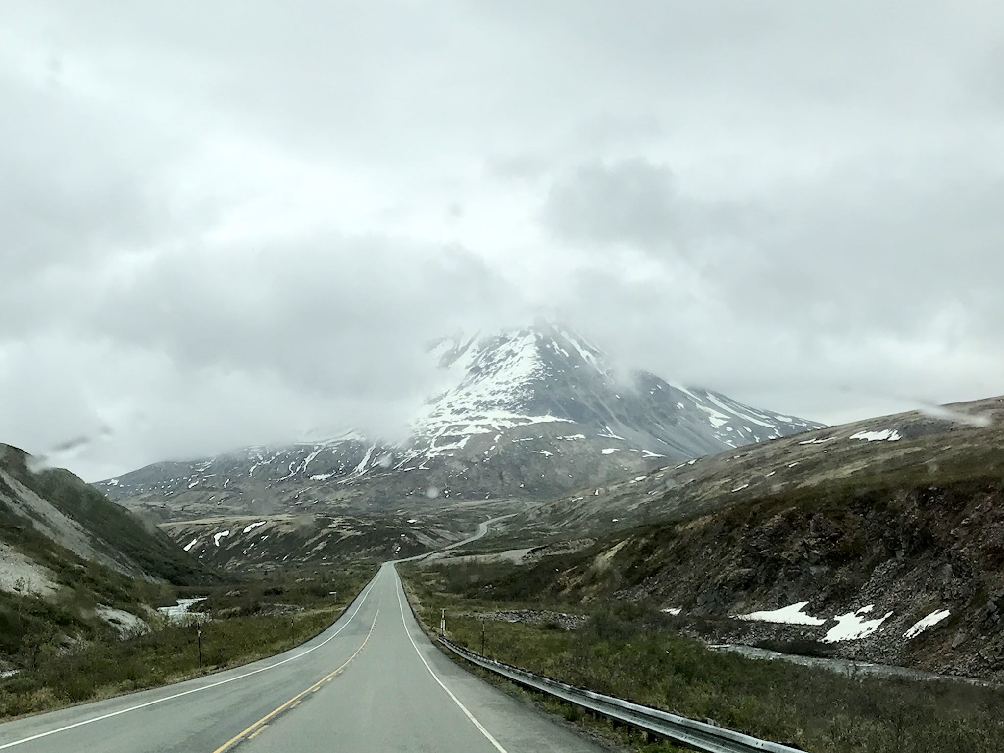
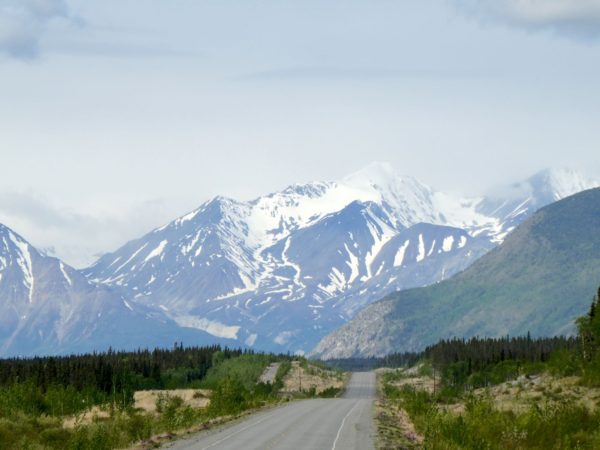
We’ve been on the Alaska Highway for 10 days. Several times a day, we pause and note – ‘Wow, that’s amazing!’ or ‘Look at that!’ Soon after we left Whitehorse, we started to see what appeared to be snow-covered peaks on the horizon. ‘Whoa, what’s that?’ As we approached Haines Junction, we realized the Kluane Range was in our faces. Our jaws dropped. We had to stop!
Literally. Ok, there was a crossroads in town where you had to bear left, turn right, or crash into the mountains that were in your face. According to the staff at the visitor center, these towering peaks were the foothills to the Kluane Mountains, among which are the 15 tallest peaks in Canada, #1 being Mount Logan at 5,959 m (19,551 feet). And although the Kluane National Park is ginormous, the only day hiking trails are right near Haines Junction. So we had to stop!
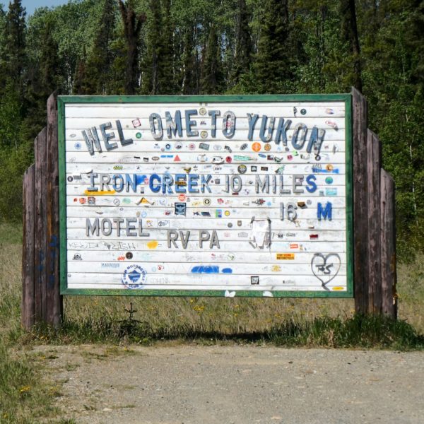
Along the Alaska Highway between Liard River, BC and Whitehorse, YT there are two small towns, a few service stops, and (as the highway crosses back and forth across the border) Welcome to British Columbia! and Welcome to Yukon! signs abound- making it no doubt the friendliest, least inhabited space we’ve ever visited. The Highway more or less follows the 60th parallel, crossing between BC and YT six times before definitively crossing into Yukon just south of Whitehorse.
We entered Yukon for the first time at Contact Creek. As with many major transportation projects – the Canadian Pacific Railroad, Transcontinental Railroad in the US, the Channel Tunnel – work crews on the Alaska Highway started at both ends and worked toward each other, connecting in September 1942 at a place known ever since as Contact Creek.
Driving north from Dawson Creek, the scenery quickly transforms from agricultural to boreal forest. The Highway ribbons through the forest in what appears to be the path of least resistance (as it likely is – they built it in a hurry…) until reaching Fort Nelson. Except for Fort St John (pop 21,500) and Fort Nelson (pop 3,500), there are few stops. Most are service stops (fuel, food, post office, maybe a motel and/or RV park) like Pink Mountain (pop 8), pull-outs with historical info, or dirt side roads heading to gas and oil camps. Oh, and lots and lots of animals – bears, moose, caribou, stone sheep (like big horn sheep only smaller and darker), and elk – everywhere.
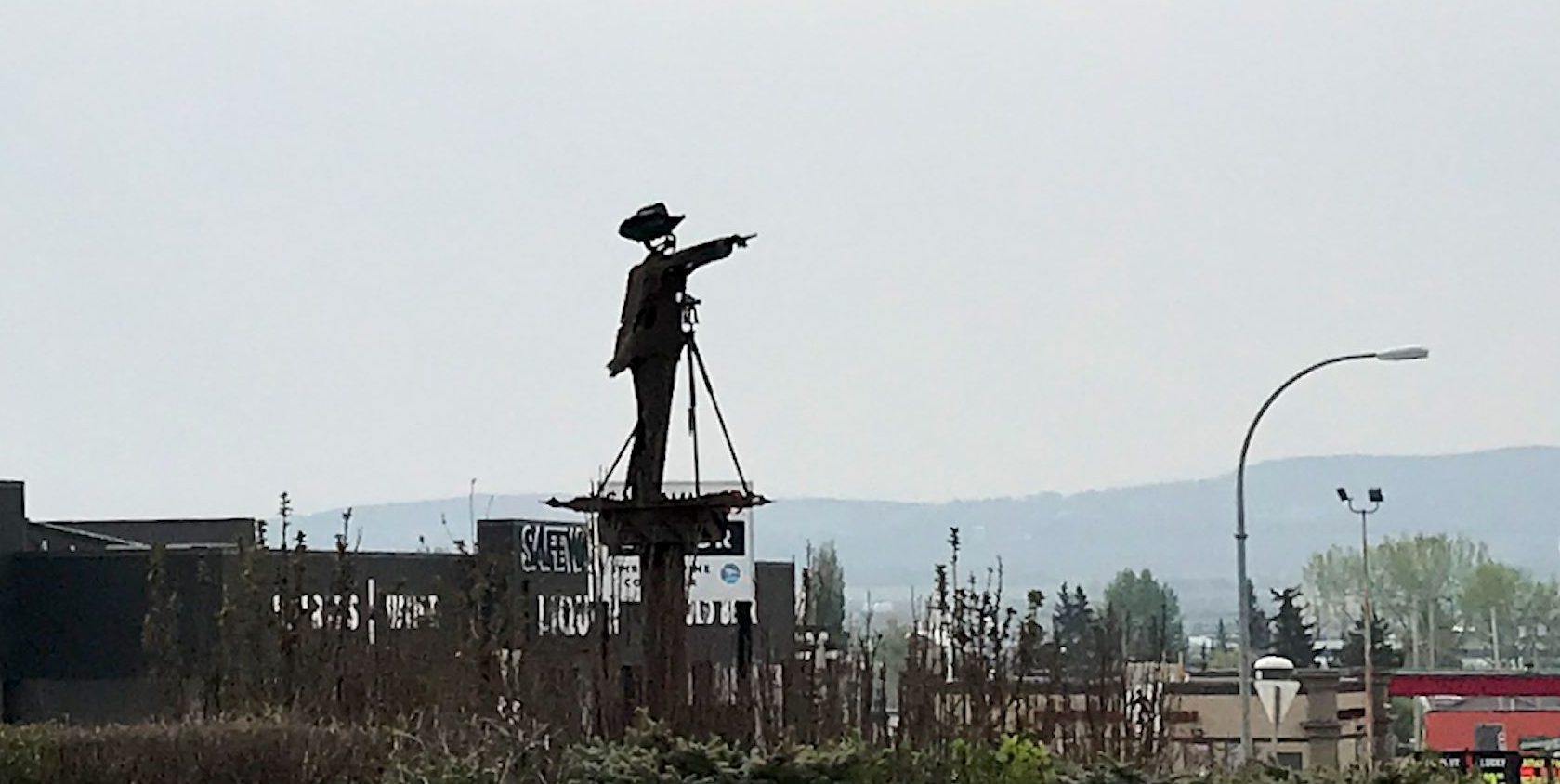
Dawson Creek, BC, Mile 0, is the official start of the Alaska Highway (originally known as the Alcan). The history of the construction of the Highway is fascinating. Soon after the bombing of Pearl Harbor in 1942, the Japanese occupied two of the Aleutian Islands in Alaska, then a US territory. In order to enable movement of military personnel and equipment to defend the territory, the US government needed a land route to connect Dawson Creek, then the northern terminus of rail service in North America, to Alaska. Begun in March of 1942, the 1,520-mile crude road through a wild, unknown sub-arctic frontier was completed in 8 months.
If you haven’t seen it, we encourage you to watch Building the Alaska Highway, a PBS special, to learn more about the historical, political and sociological perspective of this epic undertaking. If you’d like to experience ‘Wow!’ or ‘OMG?!’ you’ll need to drive the Highway. That’s how the story comes to life.
In an RV, hanging around somewhere is not really a big deal – we have everything we need to stay wherever we are, and it can be downright fun. Although we’d hoped to be closer to Alaska by now, we had to wait in Edmonton for at least another 2 days while our part made its way across Canada. Let’s check out the city!
Edmonton, North America’s northernmost city with a population over one million, is the capital of the Province of Alberta. Although it’s in the prairie and the surrounding areas are flat to slightly rolling, the North Saskatchewan River flows from southwest to northeast through the heart of the city in a tree-lined ravine. Two chains of 25 contiguous city parks link together to form the largest urban park in Canada, spanning both sides of the river. The epic walking, biking, roller blading, and x-c skiing paths go on for hundreds of kilometers throughout the city. People from Edmonton really know how to play outside!
We were about a 6-hour drive away from the end of our self-imposed sprint to the Alaska Highway when we decided we really did need to have our RV, built on a Sprinter chassis, checked out. We thought it maybe might possibly be intermittently losing power one day in Wyoming. Then it was fine. Then it was definitely probably intermittently losing power for two days in Alberta. We stopped at the Sprinter dealer in Edmonton to have it checked out. We’d had the rig serviced there last year and we liked their work. And it was the last Sprinter service center we’d see until Anchorage, 3,200 km (2,000 miles) away.
We arrived on a Friday and the initial diagnosis was a torque converter issue. Yes, they could fix it, but not until Tuesday. It was the May long weekend in Canada. We’d have to hover for four days. Hey, let’s go to Jasper National Park!
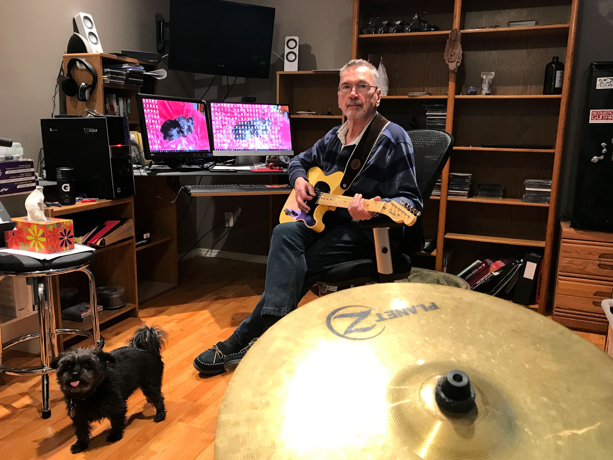
Last July we stopped on our way to Calgary for a visit in Linden, AB with my friend Larry and his wife Barb. Larry is a guitar-playing blues brother that I met through Blues Guitar Unleashed (BGU), as we’ve both been working our way through learning to play the blues. Well, we had a fine time and it seemed a great idea to see if we could stop by again as we head for Alaska. Answers: yes, we can stop by, and yes, it was great!
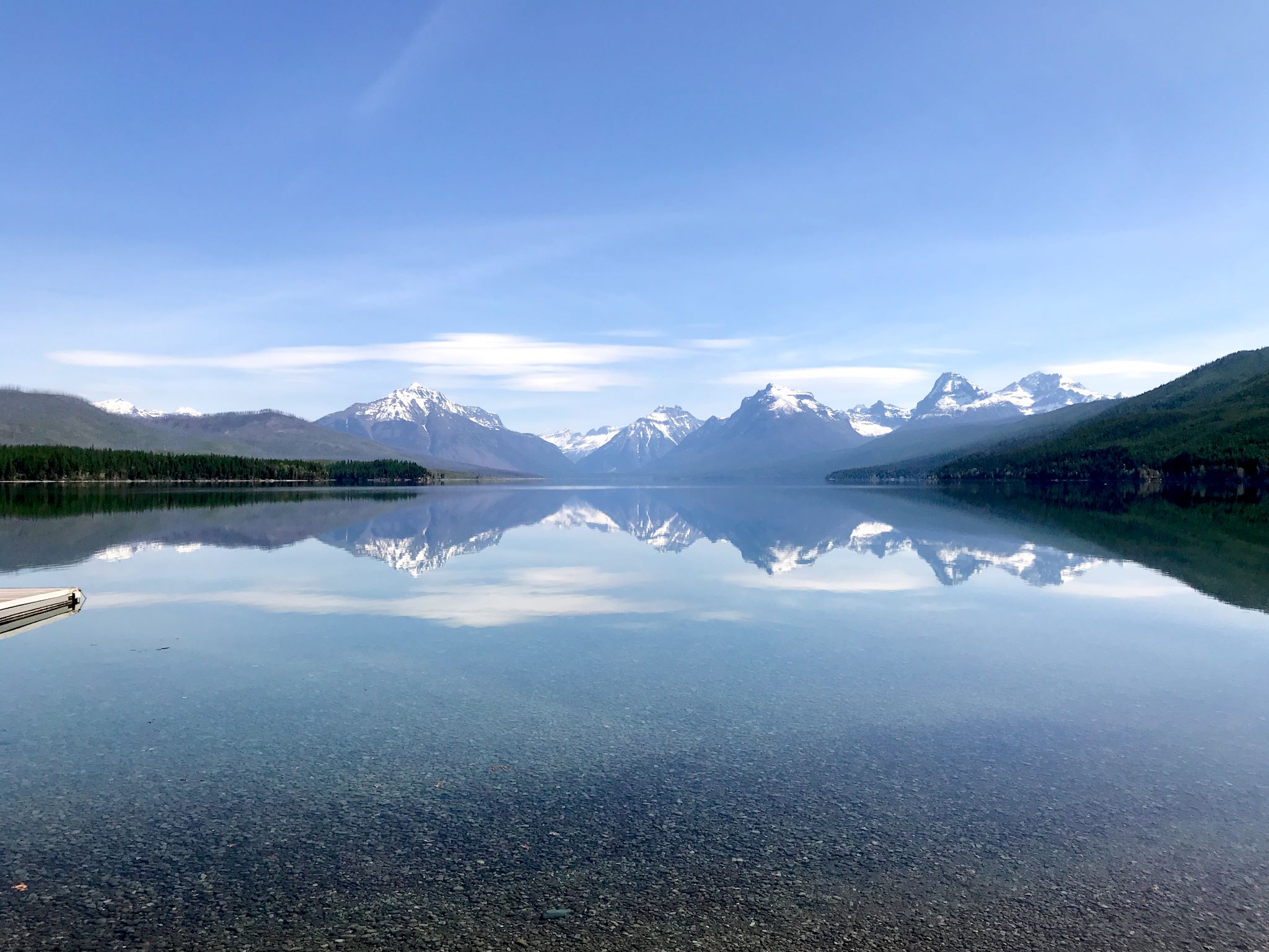
The most direct route between Vermont and Big Sky, Montana goes THROUGH Yellowstone National Park. The route includes the only road in Yellowstone that neither one of us had ever been on – Sylvan Pass, near the east entrance. That road opened early for the season, 3 days before our arrival. The next most direct route was an interstate. Hmmm, not much discussion needed. Let’s go through Yellowstone!
We do enjoy visiting National Parks early in the season, before the crowds arrive. Yes, some roads are closed, some services are unavailable, and many/most hiking trails are closed being either snow-, slush- or mud-covered late into the spring. Yet the majesty of the parks remains on display, colored in snow and early spring blossoms. Large critters are coming out from their winter routines. National Parks in the northern US are reawakening with spring.