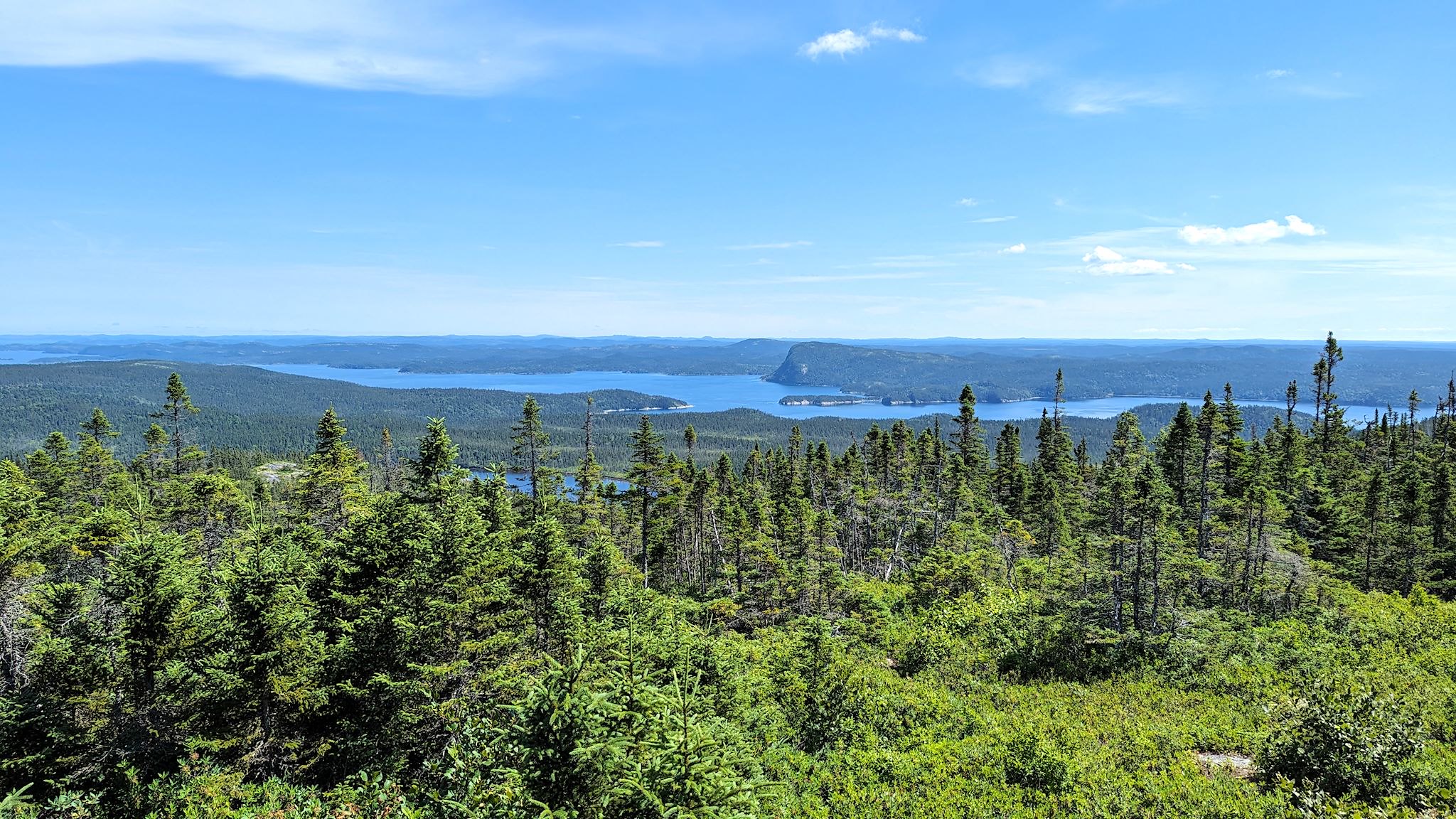
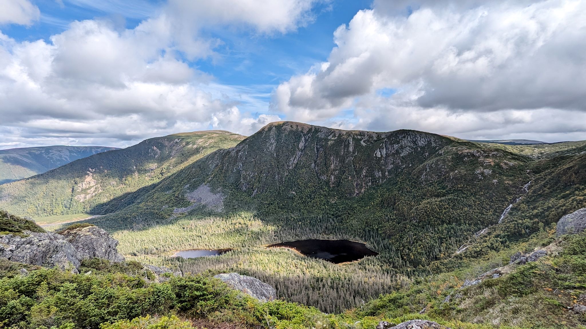
The Times, They Are A-Changin’

Vermont has not been hit hard (so far) by the coronavirus, though the impact of the shutdown on businesses and tourism has been huge. As in our previous post, we’re staying put until the pandemic is under control and spreading has stopped. The culture in our small state and small town is pretty much to look out for each other and, in general, people are following guidelines. As a result, the number of cases has been kept small and outbreaks have been quickly addressed. However, although it’s been a quiet spring, as businesses start to reopen and we begin to welcome some visitors, it’s clear that we’re not going right back to the way things used to be. The times, they are a-changin’, one might say…

Continue reading “The Times, They Are A-Changin’”

The I-5 – Friends and family

The view along I-5 near Yreka, CA

Alaskans and Canadians have it all over the lower 48 with highway names…

As we adjusted our route back to Vermont from BC to include a stop near San Francisco (more on that in an upcoming post), we had an opportunity for a few visits along the beautiful (but unimaginatively named) I-5 corridor.

Continue reading “The I-5 – Friends and family”

Vancouver Island, part 2 – west, interior, lower

Waves coming into Long Beach

Vancouver Island is about 1.5 times the size of Vermont in both area and population, with a comparable amount of geographic diversity. Remembering that we’ve chuckled about travelers planning to visit Vermont in 2 days (‘It’s so small!’), we allotted 10 days to explore Vancouver Island and found it wasn’t quite enough – there’s so much there!

The coasts, the ferries, the forests, the farms, orchards and vineyards… The small towns, the city of Victoria… The hiking, kayaking, biking, surfing… (Surfing?) The rainforest with giant cedars, Douglas firs, ferns and moss, the palm trees… (Palm trees?) Here’s more on the lower part of the island…

Continue reading “Vancouver Island, part 2 – west, interior, lower”

Vancouver Island, part 1 – north

Sunset over Queen Charlotte Strait

With a week or two left for exploring before we need to start heading toward Vermont, we decided to spend some of it on Vancouver Island. We got passage on the MV Coastal Renaissance, one of the largest double-ended ferries in the world and radically different from the 6- to 10-vehicle river ferries we boarded while in the Yukon and Northwest Territories. The height of our camper required that we board the truck deck – 6 lanes wide and seemingly a mile long, filled with trucks and other RVs. On an absolutely gorgeous day, we spent the 2-hour trip on the immense upper deck, trekking back and forth and all around as we took in the sights. From the departure dock at Horseshoe Bay, we could look back on the Sea to Sky Highway hanging off the mountain, splotchy with low clouds. Islands in all directions looked like mountains popping out of the ocean, many dotted with small communities along the shores. We looked back on the city of Vancouver, beautifully situated on the ocean, as more mountains came into sight on the horizon – Vancouver Island.

We debarked in Nanaimo, a pretty city on the east shore of the island. Without a plan, we headed north toward the most remote part of the island. Little did we know, the moon was soon to enter the seventh house, and Jupiter would align with Mars, and we were about to get a unique Vancouver Island experience…

Continue reading “Vancouver Island, part 1 – north”

Abbotsford, BC

Dave, Sue, Kyle

There’s no chance we’d miss a certain stop in Abbotsford as we came through southwest BC. Our loyal readers know I’m a drummer. Actually, I’m proud to say I’m now a professional drummer, having earned $108 so far this year (all before leaving for this trip in May)!

For the past few years, I’ve been a member of Drumeo, a drum education website and fabulous on-line drumming community with world headquarters in Abbotsford, BC. The team at Drumeo produces state-of-the-art, video-based drum education material featuring awesome in-house drummers, a distributed, international cast of world-renown drum educators, and a generous dose of bona fide rock stars in the drum world. They have programs in place to support the student members at all levels, in virtually any musical genre. And certainly for this drum student, it’s working.

I checked in to see if I could stop by to drop off a couple of hugs to a few of my online heroes, and perhaps get a quick tour. I got a resounding ‘Sure, c’mon over!’

Continue reading “Abbotsford, BC”

The Sea to Sky Highway

Welcome to Whistler!

South of Williams Lake, we needed to choose among four routes heading further south through the mountains of southern BC. Though all four promised amazing views and mountains and crazy roads and funky towns, we could explore only one. We’re at that time in this year’s trip where we need to think about weather and getting back to Vermont before it snows (too much…)

Based purely on sentimental reasons, we decided on the Sea to Sky Highway. We’d drive it just for the name! As hard core skiers, it would be enough that this highway passes by Whistler-Blackcomb, the largest ski resort in North America, rated one of the top ski areas consistently since the 1990’s. It was also the site of one of the infamous annual ski trips of our early adulthood with friends Pat, Geoff, Harry and Karen. That was in 1997…

Continue reading “The Sea to Sky Highway”

The Cassiar and Yellowhead Highways

Cassiar Highway south…

There are only two roads through British Columbia that will get you to or from Alaska – the Alaska Highway and the Cassiar/Yellowhead Highways. We came north on the first one, so we headed south on the Cassiar.

The Cassiar Highway is a relatively remote, 725-km (450-mile), paved, narrow, two-lane road through the Cassiar Mountains connecting Watson Lake (pop 1600) to Kitwanga (pop 400). The road mostly follows the river valleys and we were always within view of lakes and mountains of various shapes and sizes. Still, there were hints everywhere that there was more we weren’t seeing… occasional, brief glimpses between the trees of high, snow-covered peaks and avalanche signs everywhere. Also, heli-ski operations in settlements like Bell II (pop a handful plus seasonals) and a brochure for Provincial Parks with glorious mountain photos and instructions for how to access them, by air. Hmmmm…

Nonetheless, we found the drive to be quite pretty, imagined what we couldn’t see from where we were, and enjoyed a few remote campsites near lakes and rivers with great mountain views.

And then, there were the surprises…

Continue reading “The Cassiar and Yellowhead Highways”

The Klondike Highway

Bennett Lake, source of the Yukon River

Most people have heard of the Klondike and Klondike Gold Rush, even if only through watching Klondike Kat on Sunday mornings as kids. (Savoir-Faire is everywhere!) The Klondike was indeed a productive gold mining area in Western Canada near the Alaska border during 1896-1898. We suspect most people don’t know the Klondike Gold Rush was a group of about 100,000 prospective miners (aka prospectors) hoping to strike it rich, fueled by a recession in the lower 48 with high unemployment along with a spate of exaggerated claims and advertising fueled by the boom towns benefiting from the influx of outsiders buying passage, food and supplies. The prospectors bought passage on ships from Seattle and San Francisco to Skagway/Dyea (pop then 30,000), hiked over Wright Pass, then built boats to navigate down the Yukon River to Whitehorse where they boarded steamships to Dawson City (pop then 40,000). After their year of travel, they arrived to find no more gold claims were available. About 30,000 prospectors made it to Dawson City. Some turned around and went back home while others moved on to other gold fever boom towns in Alaska.

Although Alaska and western Canada share a rich (pun intended) gold mining history, the Klondike slice of it is fascinating and widely celebrated in this part of the world. We got to drive the overland part of the gold rush route in reverse, from Dawson City to Whitehorse to Skagway, on the Klondike Highway.

Continue reading “The Klondike Highway”

The Dempster and Inuvik-Tuktoyaktuk Highways

Sunset over the Arctic Ocean

You might be thinking by now that we have a perverse infatuation with dead-end roads to out-of-the-way places. Ok, maybe we do a little – and we’ve been to some outrageously cool end-of-the-road spots – and sometimes there’s more to it than that. While at the Folk on the Rocks Festival last year in Yellowknife, we chatted with some folks living there who came originally from Inuvik. They loved the town, and they also told us that the Mackenzie Delta was the most beautiful place on earth. That was certainly enough for us to put it on our list.

So, who’s ready to hear about another 1600-km (1000-mile) road trip on a mostly great dirt road that totally rocked? It’s actually quite different from the last one. True, Alaska’s Dalton Highway – which we drove in June – and the Yukon/Northwest Territories’ Dempster Highway both provide overland access north of the Arctic Circle. They both involve about 1600 km (1000 mi) of unpaved roads through the wilderness with spectacular wildlife, and they are both the northernmost roads in their respective countries as well as the first (Dalton) and second (Dempster) northernmost roads in North America. They’re both legendary for broken windshields, flat tires and, oh, yes, you could die. Other than that, everything was different.

Continue reading “The Dempster and Inuvik-Tuktoyaktuk Highways”

Taylor and Top of the World Highways

Top of the World Highway

If you are driving into or out of interior Alaska, you have go through the town of Tok. Ah, but there are two roads that head east from Tok. We came in on one of them, the Alaska Highway. We had the option of driving out on a road called the Top of the World Highway.

Any questions?

Continue reading “Taylor and Top of the World Highways”