As Doug mentioned in the previous post, we’re on our way to spend some time with my mom in Florida. We decided to treat ourselves to a little bit of normalcy. We made plans to visit a few OVFs (Old Vaccinated Friends) along the way. Doesn’t that sound, er, normal?
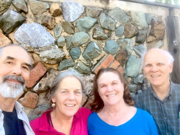
We last met up with Pete and Sue on the road two years ago in Salem, OR. They’re also RVers, so we’ve got a lot in common beyond Pete and I being related in some distant fashion (it’s not actually that obscure – his father and my mom’s father were 1st cousins). Also of interest is that Pete is the older brother of David, Pinky, and Katy.
Alaskans and Canadians have it all over the lower 48 with highway names…
As we adjusted our route back to Vermont from BC to include a stop near San Francisco (more on that in an upcoming post), we had an opportunity for a few visits along the beautiful (but unimaginatively named) I-5 corridor.
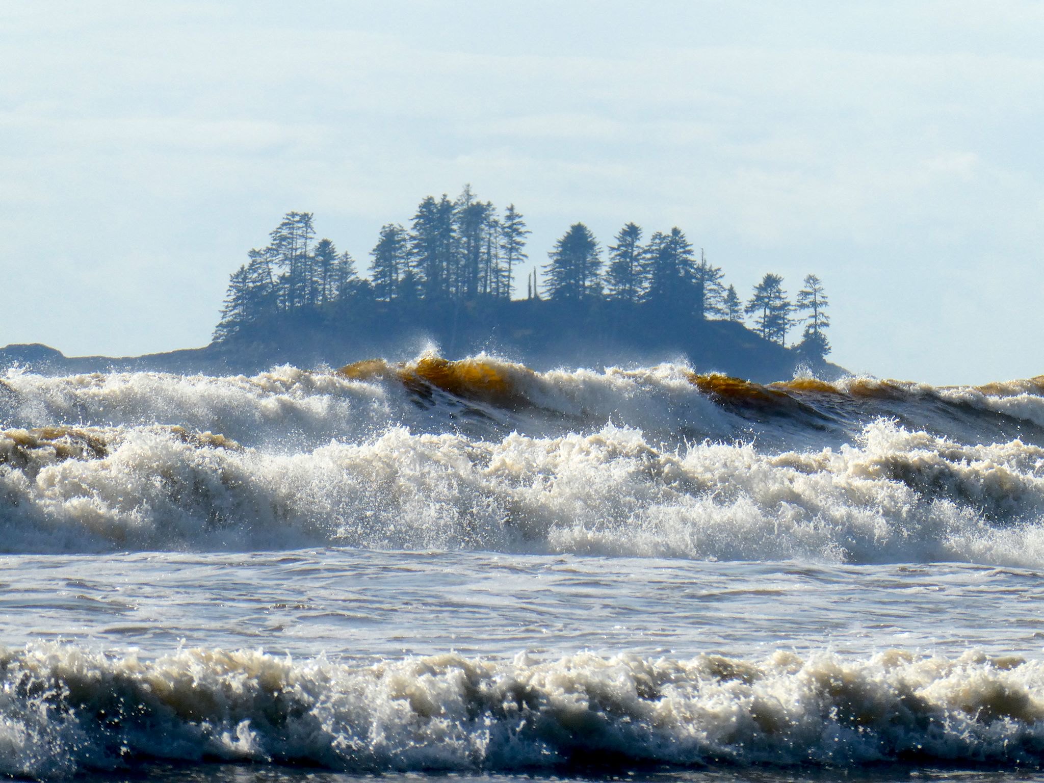
Vancouver Island is about 1.5 times the size of Vermont in both area and population, with a comparable amount of geographic diversity. Remembering that we’ve chuckled about travelers planning to visit Vermont in 2 days (‘It’s so small!’), we allotted 10 days to explore Vancouver Island and found it wasn’t quite enough – there’s so much there!
The coasts, the ferries, the forests, the farms, orchards and vineyards… The small towns, the city of Victoria… The hiking, kayaking, biking, surfing… (Surfing?) The rainforest with giant cedars, Douglas firs, ferns and moss, the palm trees… (Palm trees?) Here’s more on the lower part of the island…
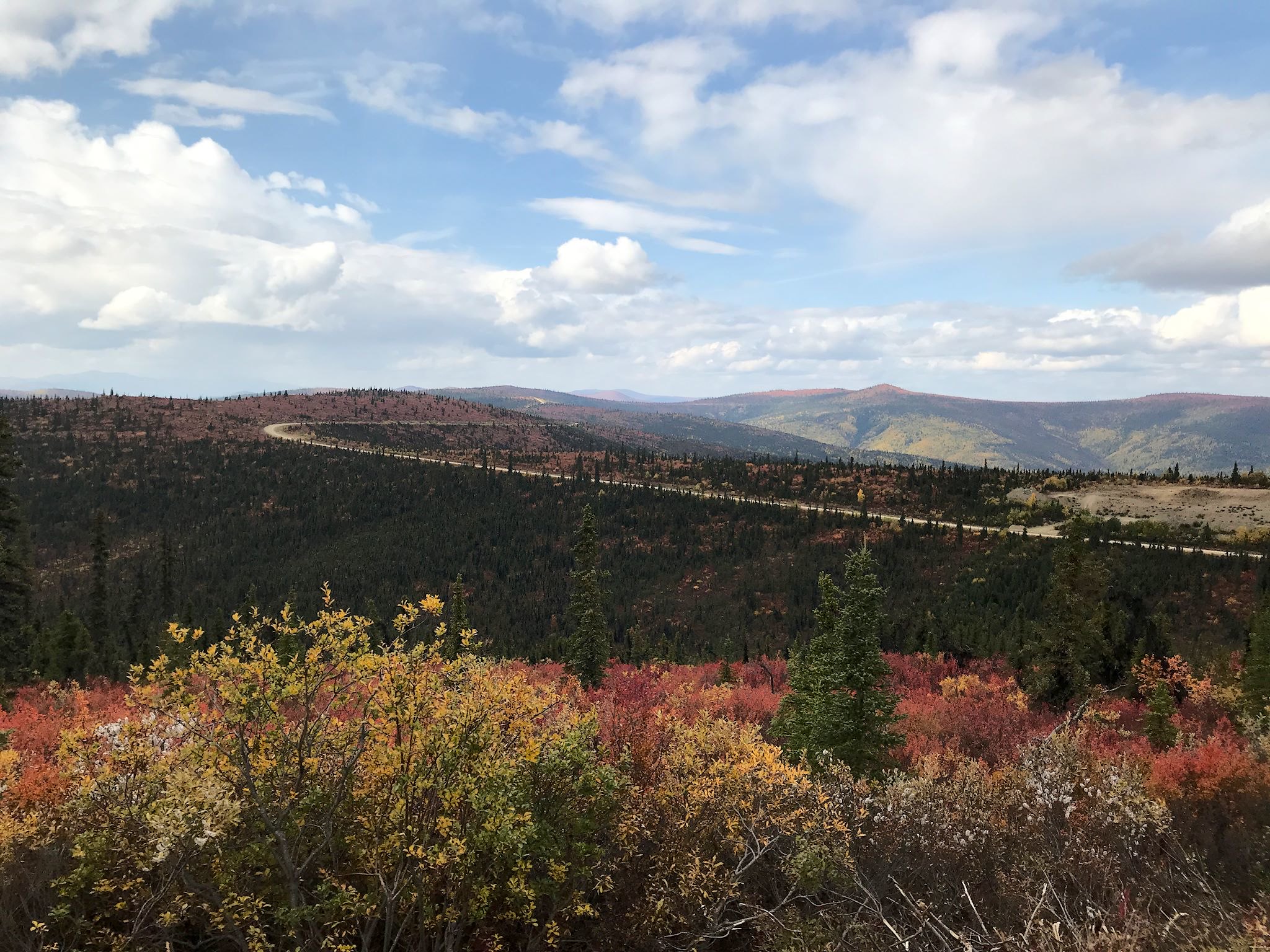
There are only two roads through British Columbia that will get you to or from Alaska – the Alaska Highway and the Cassiar/Yellowhead Highways. We came north on the first one, so we headed south on the Cassiar.
The Cassiar Highway is a relatively remote, 725-km (450-mile), paved, narrow, two-lane road through the Cassiar Mountains connecting Watson Lake (pop 1600) to Kitwanga (pop 400). The road mostly follows the river valleys and we were always within view of lakes and mountains of various shapes and sizes. Still, there were hints everywhere that there was more we weren’t seeing… occasional, brief glimpses between the trees of high, snow-covered peaks and avalanche signs everywhere. Also, heli-ski operations in settlements like Bell II (pop a handful plus seasonals) and a brochure for Provincial Parks with glorious mountain photos and instructions for how to access them, by air. Hmmmm…
Nonetheless, we found the drive to be quite pretty, imagined what we couldn’t see from where we were, and enjoyed a few remote campsites near lakes and rivers with great mountain views.
You might be thinking by now that we have a perverse infatuation with dead-end roads to out-of-the-way places. Ok, maybe we do a little – and we’ve been to some outrageously cool end-of-the-road spots – and sometimes there’s more to it than that. While at the Folk on the Rocks Festival last year in Yellowknife, we chatted with some folks living there who came originally from Inuvik. They loved the town, and they also told us that the Mackenzie Delta was the most beautiful place on earth. That was certainly enough for us to put it on our list.
So, who’s ready to hear about another 1600-km (1000-mile) road trip on a mostly great dirt road that totally rocked? It’s actually quite different from the last one. True, Alaska’s Dalton Highway – which we drove in June – and the Yukon/Northwest Territories’ Dempster Highway both provide overland access north of the Arctic Circle. They both involve about 1600 km (1000 mi) of unpaved roads through the wilderness with spectacular wildlife, and they are both the northernmost roads in their respective countries as well as the first (Dalton) and second (Dempster) northernmost roads in North America. They’re both legendary for broken windshields, flat tires and, oh, yes, you could die. Other than that, everything was different.
If you are driving into or out of interior Alaska, you have go through the town of Tok. Ah, but there are two roads that head east from Tok. We came in on one of them, the Alaska Highway. We had the option of driving out on a road called the Top of the World Highway.
Seward is a small, picturesque city on Resurrection Bay at the base of Marathon Mountain at yet another Alaskan road’s end. It’s totally surrounded by tall, steep mountains wearing a shawl of glaciers that make up Kenai Fjords National Park. Seward is predominantly a commercial fishing town, also a destination and embarkation point for tourists in the summer. It’s the northern terminus of many cruise ship lines as well as the southern terminus (aka Mile 0) of the Seward Highway to Anchorage, the Alaska Railroad to Fairbanks, and the original Iditarod dog sled trail to Nome. Heavily damaged by the 1964 earthquake, the rail yards and fish processing plants directly on the bay were not rebuilt where they’d stood; the land was instead converted to parks with hundreds of campsites, enabling travelers to soak in the views and get to the mountains.
D’oh! No, not that Homer – Homer, AK. It’s a small town in a stunning location at the road’s end on the west side of the Kenai Peninsula. It’s situated where the Kachemak Bay empties into Cook Inlet, feeling cozy and protected by the Kenai Mountains interspersed with glaciers to the south and east, and the Alaska Range with its four towering volcanoes to the west. A key geological feature of the town is the Homer Spit, a terminal moraine left by the glacier that filled and carved out the Kachemak Bay 15,000 years ago. The Spit is a long, narrow, natural gravel bar that sticks out 4.5 miles into bay, now dotted with campsites and shops and people fishing.
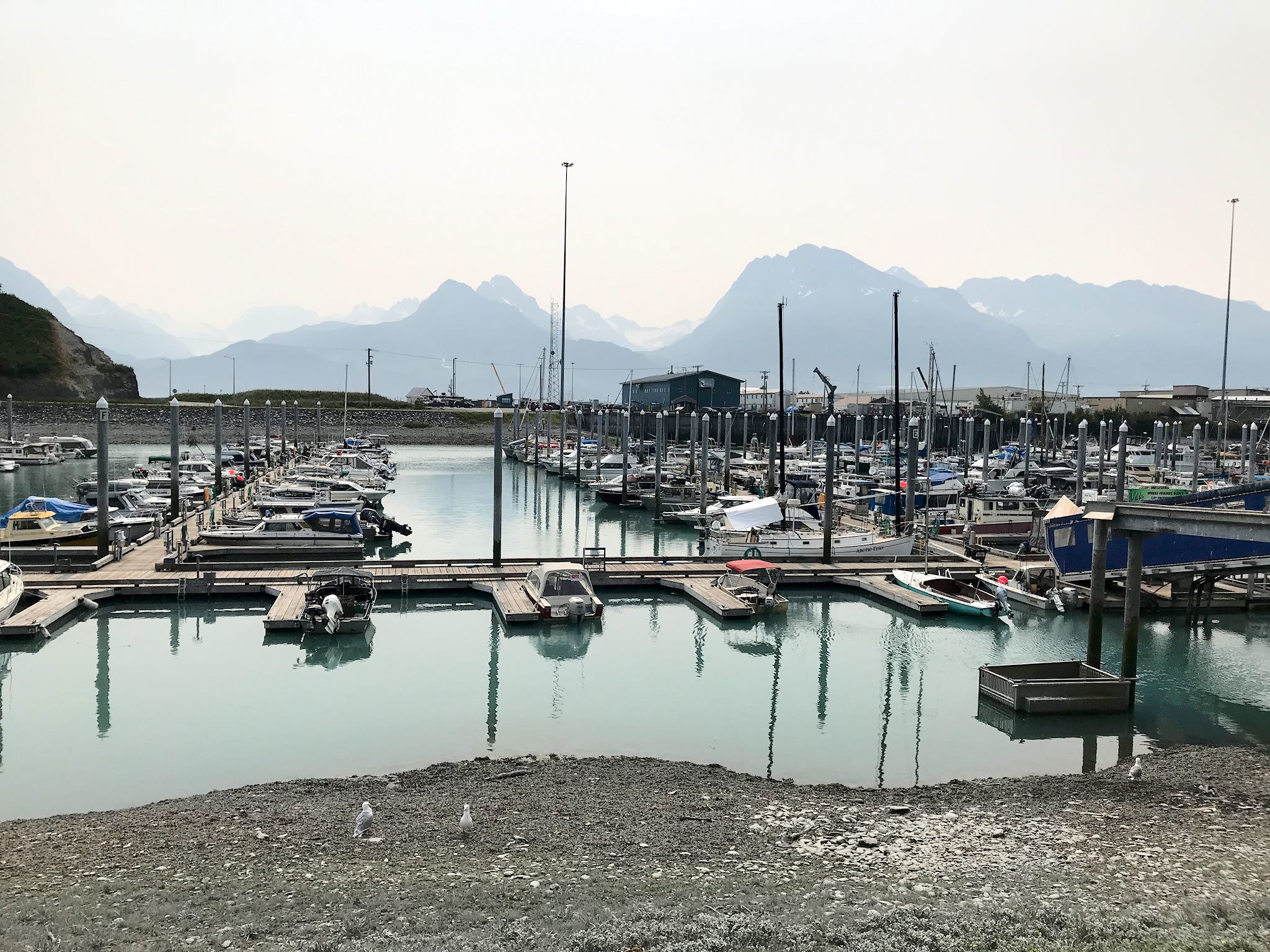
Valdez is a commercial fishing and shipping port with a history that is both colorful and tragic. It’s also a fun town to visit in a stunning location.
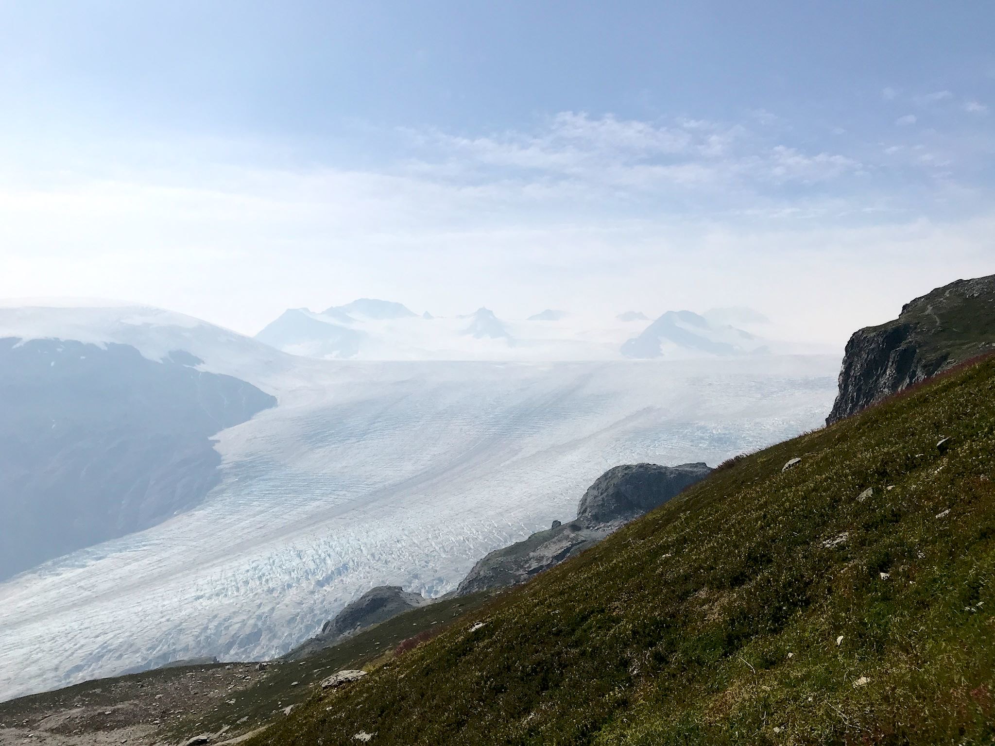
Recall that Mount Saint Elias, at 18,009 feet the second highest peak in the US, is only 10 miles from the ocean’s edge as the eagle flies (yes, we confirmed that this is the expression to use in Alaska). That means our relatively short drive to Valdez would cross yet another mountain range – the Chugach Mountains, the tallest, steepest mountains we’ve seen yet – before dropping into the city. Valdez is near the end of a narrow arm of the Prince William Sound where glacial rivers dropping down from tall, steep, glaciated mountains on 3-1/2 sides of the city turn the water a distinctive aquamarine color.